Introduction To ArcCatalog ArcCatalog. ArcCatalog is a data- centric GUI tool used for managing...
62
Introduction To ArcCatalog ArcCatal og
-
Upload
anissa-scott -
Category
Documents
-
view
233 -
download
2
Transcript of Introduction To ArcCatalog ArcCatalog. ArcCatalog is a data- centric GUI tool used for managing...

Introduction To
ArcCatalogArcCatalog
ArcCatalog is a data-centric GUI tool used for
managing spatial data

With ArcCatalog you can…….
• Inspect properties and attributes of data
• Preview and explore data contents
• Evaluate quality and suitability of data
• Create, move, copy, delete, organize, and rename
• Review, update and define metadata
• Import, export, convert
• Define rules and behavior

ArcCatalog Gives You….• Direct access to all your data ‘live.’
• Connections to any local or network disks.
• Connections to local or remote folders.
• Connections to relational databases via
– ArcSDE
• MS SQL Server, Oracle, DB2, Sybase, etc.
– OLE DB
• MS Access (jet), Oracle, MS SQL Server, etc.
• Typically OLE DB can retrieve only non-spatial data
– Personal geodatabases
• MS Access (jet)

ArcCatalog Is Better Equipped to Allow GIS Analysts To…
• Manage the GIS data explosion
• Control consistency and quality of data
• Maintain inventory of data holdings
• Expose incomplete metadata
• Identify redundant data

ArcCatalog Is the Principal User Interface Used to Define
and Manage the Geodatabase

What is a Geodatabase?
• A new type of geographic data format (GDF) for ArcInfo 8.
• Based on Object-Oriented Model
• Users can add behavior, properties, rules and relationships to data
• Implemented as extension to standard relational database technology
• Supports topologically integrated feature classes
• Extends the coverage model with support for complex networks, relationships among feature classes, and other object-oriented features
• Provides platform for development of custom data models using visual tools like CASE (Computer Aided Software Engineering) tools and UML (Unified Modeling Language) notation
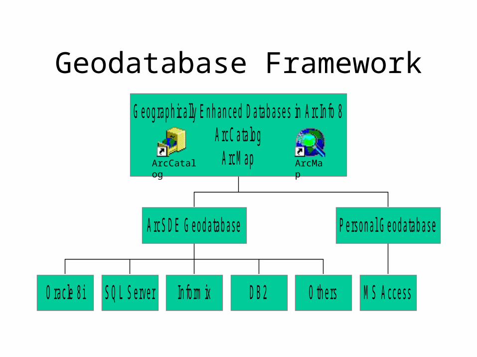
Geodatabase Framework
O rac le 8 i S Q L S erver In fo rm ix D B 2 O th ers
A rcS D E G eod atab ase
M S A ccess
P erson a l G eod atab ase
G eog rap h ica lly E n h an ced D atab ases in A rc In fo 8A rcC ata log
A rcM apArcCatalog
ArcMap
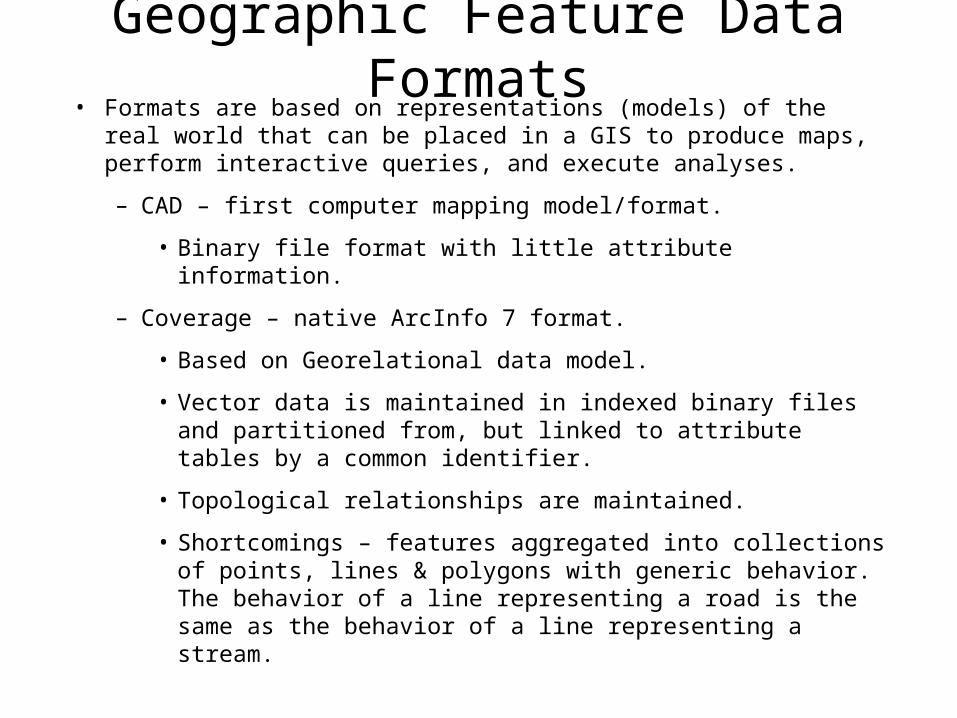
Geographic Feature Data Formats• Formats are based on representations (models) of the real world that can
be placed in a GIS to produce maps, perform interactive queries, and execute analyses.
– CAD – first computer mapping model/format.
• Binary file format with little attribute information.
– Coverage – native ArcInfo 7 format.
• Based on Georelational data model.
• Vector data is maintained in indexed binary files and partitioned from, but linked to attribute tables by a common identifier.
• Topological relationships are maintained.
• Shortcomings – features aggregated into collections of points, lines & polygons with generic behavior. The behavior of a line representing a road is the same as the behavior of a line representing a stream.

Geographic Feature Data Formats• Shapefile – introduced with ArcView
– Also georelational data model – nontopological vector data format.
– Very prolific format – much GIS data in Shapefile format.
– Simpler than coverages than because they do not store topological associations among different features and feature classes.
– Limited analysis capabilities due to lack of topology
• Geodatabase – introduced in ArcInfo 8.
– Object-oriented model – can characterize features more naturally by defining object types, topological, spatial and general relationships, and interactions.
– Geodatabase features can be stored in a single database.
– Create custom features in addition to points, lines, polygons
– Brings physical model closer to logical model.

Supported Data Types
• ArcInfo 8 supports four representations of geographic data.
– Vector data for representing features.
– Raster data for images, grids, and surfaces.
– Triangulated irregular networks (TINS) for surfaces.
– Tabular data.
• Locators and addresses for finding a geographic position from an address.
• Locators apply national postal conventions to convert an address to a position.
– Note: in AI8, geodatabases do NOT store TINS. They must be kept in coverage workspaces.

Three Ways to Create a Geodatabase• Create from scratch.
– Use tools in ArcCatalog to create schema for feature datasets, tables, geometric networks, etc.
• Migrate existing data.– Can convert by importing shapefiles, coverages, INFO
tables, dbase tables, ArcStorm, Map LIBRARIAN, and ArcSDE layers.
– Both spatial and non-spatial object component is translated.
• Use CASE (Computer Aided Software Engineering) tools.– Can use CASE tools to create new custom objects and
generate a geodatabase schema from UML (Unified Modeling Language).

Single-user Geodatabase• Personal Geodatabase.
– Implemented as a Microsoft Access database (*.mdb file) by using MS jet engine which is installed with AI8. MS access is not needed.
– Can be placed on local or network drives.
– Generally used for personal or small work-group use.
– Can handle small to moderately sized datasets.
– Personal geodatabase can yield decent performance for datasets of 250,000 objects or less.
– Full functionality of geodatabase served through ArcSDE except versioning.
• Versioning – allows many editors to work concurrently and includes framework to resolve edit conflicts.
– If a personal geodatabase is deleted its gone.
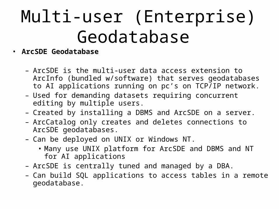
Multi-user (Enterprise) Geodatabase • ArcSDE Geodatabase
– ArcSDE is the multi-user data access extension to ArcInfo (bundled w/software) that serves geodatabases to AI applications running on pc’s on TCP/IP network.
– Used for demanding datasets requiring concurrent editing by multiple users.
– Created by installing a DBMS and ArcSDE on a server.– ArcCatalog only creates and deletes connections to ArcSDE geodatabases.– Can be deployed on UNIX or Windows NT.
• Many use UNIX platform for ArcSDE and DBMS and NT for AI applications
– ArcSDE is centrally tuned and managed by a DBA.– Can build SQL applications to access tables in a remote geodatabase.
Geodatabase Elements• Objects
• Object classes
• Features
• Feature classes
• Feature datasets
• Relationships
• Relationship classes
• Geometric networks
• Domains
• Subtypes
• Spatial references

Objects & Object Classes• Geodatabases organize geographic data into a hierarchy of data
objects.
• Objects are instances of an object class that have properties and behavior.
• Objects can be related to other objects via relationships
• Objects have unique system identifiers (OID)
• Object classes are tables in a geodatabase storing non-spatial data (e.g., Parcel owners)
• Objects in an object class have the same
– Properties - stored in the table as attributes
– Behavior - implemented as a component

Object Classes (tables)
A r
ow s
tore
s an
Obj
ect
Pump Table
OID Pump Type Inlet Size …….
175 Axial Flow 24” …….
… ………… ………… …….

Features and Feature Classes• Features are objects with required shape (Points, Multi-points,
Lines & Polygons) that represent a real world object in a layer on a map.
• Features classes are collections of features with same type of feature geometry and attributes.
• A feature class is also an object class which stores spatial objects (features)(e.g., Parcels).
• All the features in a feature class are in the same spatial reference.
• Feature classes which store topological features must be contained within a feature dataset to ensure a common spatial reference.

Feature ClassesA
row
sto
res
feat
ure
Feature Class Table
Lateral Water Lines
OID Shape Type …….
583 X,Y,Z,M Domestic …….
… ………… ………… …….

Feature Datasets
• Containers for feature classes
• Shared spatial reference
• Analogous to a coverage
– less restrictive
• May also contain
– relationship classes
– geometric networks
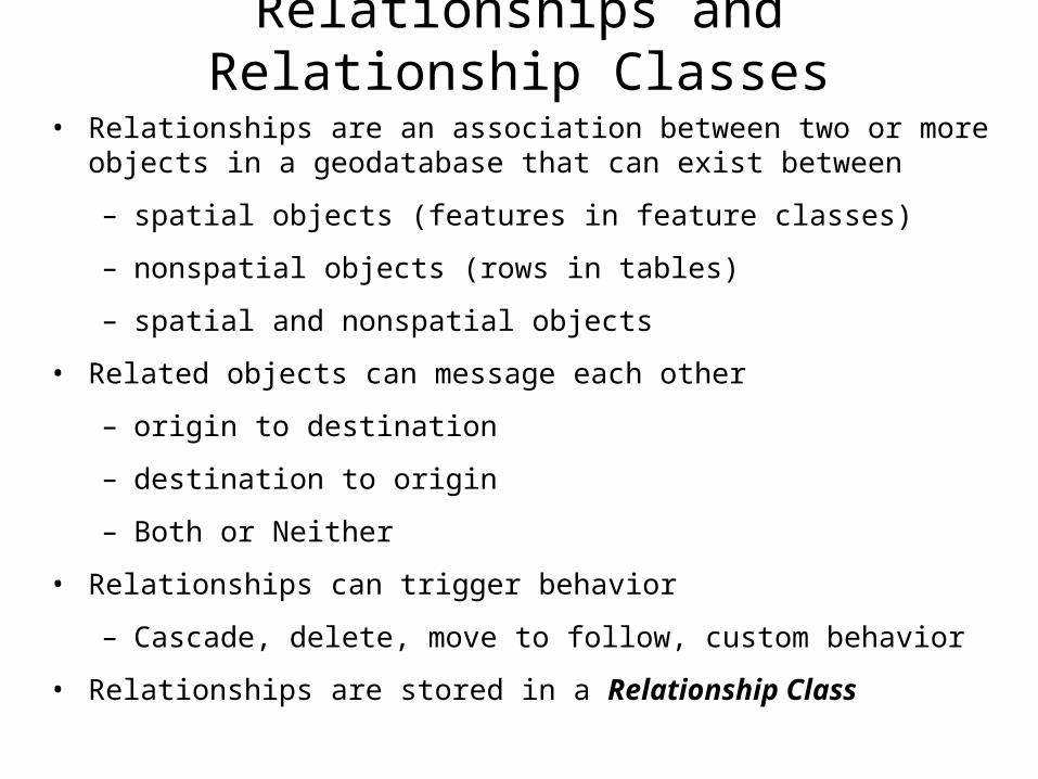
Relationships and Relationship Classes
• Relationships are an association between two or more objects in a geodatabase that can exist between
– spatial objects (features in feature classes)
– nonspatial objects (rows in tables)
– spatial and nonspatial objects
• Related objects can message each other
– origin to destination
– destination to origin
– Both or Neither
• Relationships can trigger behavior
– Cascade, delete, move to follow, custom behavior
• Relationships are stored in a Relationship Class

Relationships
Parcels(Spatial)
OwnersNon-Spatial

Relationship Behavior

Geometric Networks
• A topological relationship among a collection of feature classes in a feature dataset
• Used to model network systems
• Topology:
– Based upon geometric coincidence
– Always live
– Features are constrained to exist within the network

Geometric Networks
•Network features classes must reside in a geometric network•Directly support network analysis•Types of Network Features: Junction or Edge
•Junction and edge features can be Simple or Complex
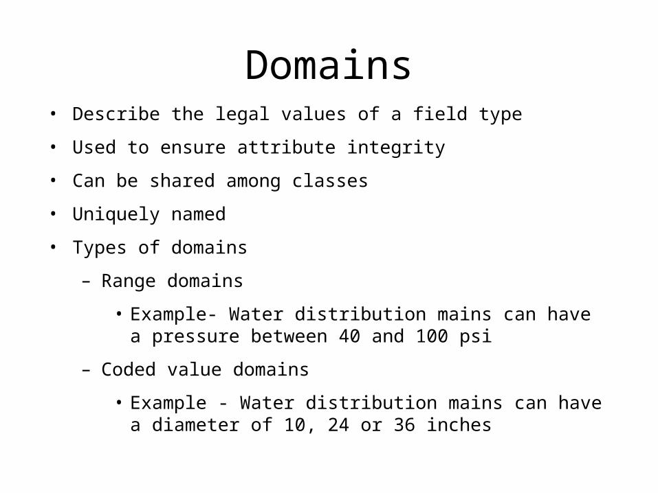
Domains• Describe the legal values of a field type
• Used to ensure attribute integrity
• Can be shared among classes
• Uniquely named
• Types of domains
– Range domains
• Example- Water distribution mains can have a pressure between 40 and 100 psi
– Coded value domains
• Example - Water distribution mains can have a diameter of 10, 24 or 36 inches

Subtypes
• Feature class “subclasses” that allow you to further distinguish objects without creating new feature classes
• Same attributes and behavior
• Can have different default values and domains for each field
• Example: in a feature class which stores Water Mains
– Steel mains can be 0 to 150 psi
– PVC mains can be 0 to 100 psi
– Both are subtypes of the Mains feature class
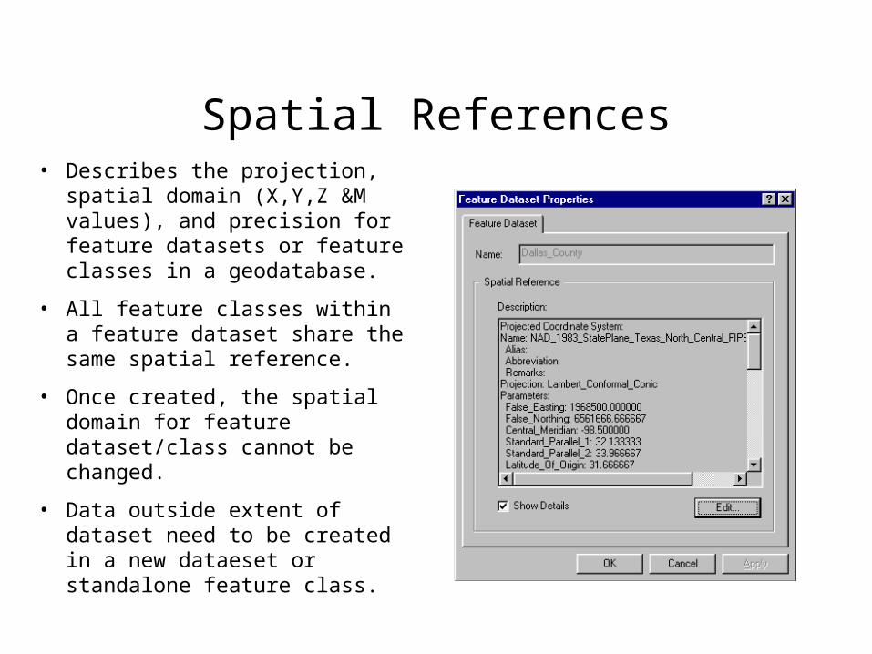
Spatial References• Describes the projection, spatial
domain (X,Y,Z &M values), and precision for feature datasets or feature classes in a geodatabase.
• All feature classes within a feature dataset share the same spatial reference.
• Once created, the spatial domain for feature dataset/class cannot be changed.
• Data outside extent of dataset need to be created in a new dataeset or standalone feature class.

For additional detail on the geodatabase see:geodatabase.ppt
ArcCatalog and Metadata
• Metadata is primarily viewed and edited in ArcCatalog.• ArcCatalog allows metadata to be easily created, stored,
and accessed for all data types supported by ArcInfo 8.0 using open, flexible, industry standard technology.
• AI8 has out-of-the-box support for the federal geographic data committee (FGDC) metadata content standard,
• ArcCatalog has a built-in and easily accessible full-featured metadata editor.
• AI8 automatically stores metadata with the data so that it also travels when the data is moved, distributed, exported, or renamed, including attached documents.
ArcCatalog and Metadata
• Bottom line: metadata editor is easy to use.
• Result = more organized and accurate data.
Underlying Metadata Technology = XML
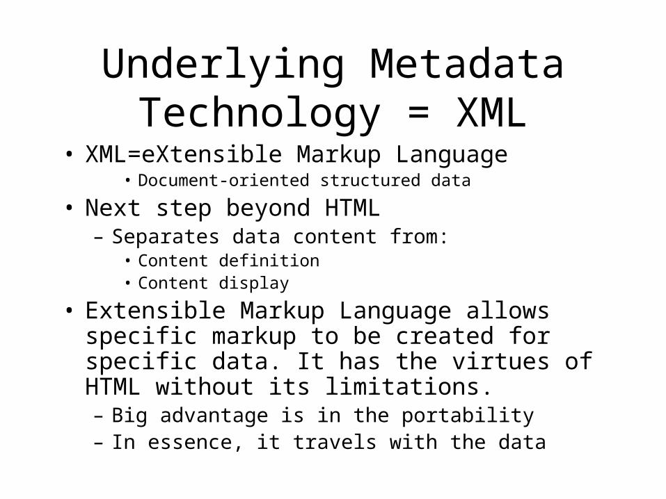
• XML=eXtensible Markup Language• Document-oriented structured data
• Next step beyond HTML– Separates data content from:
• Content definition• Content display
• Extensible Markup Language allows specific markup to be created for specific data. It has the virtues of HTML without its limitations. – Big advantage is in the portability– In essence, it travels with the data

Where Is Metadata Stored?
• All data types and containers have metadata
• Coverages: XML file stored in coverage folder
• Shapefiles & images: XML file in same location as shapefile or image.
– Example Cities.shp will have Cities.shp.xml file
• Folders & ArcInfo Workspaces can also have metadata: Metadata.xml file stored in folder
• Geodatabase data: XML stored in the database itself
– Example – If access database, XML is with *.mdb file
• Metadata can include attached documents and images, e.g., Word, *.Jpg.

Creating and Editing Metadata• Choose dataset and click the metadata tab…
• Metadata is automatically created if it doesn’t exist
– This can be turned on/off
• Some metadata is automatically obtained (“harvested”) from the data
• You can control frequency of metadata harvesting
– Automatic time interval
– Manually
• Any file type can be added as an attachment to the metadata to extend metadata information

ArcCatalog Metadata Editor

Extending and Customizing Metadata
• Metadata framework can be extended for various custom applications:
– Data inventory and management
– Quality control
– Identify and remove redundant data
– Custom metadata import / export
• Very easy to create Metadata for WWW
– Custom metadata publication / search

A Simple Right-click of the Mouse Yields Property Dialog Boxes for All
Data Types

Working with Coverages
• In ArcCatalog you can…….– Generate topology– Define coordinate systems– Modify coverage tics and extent– Set coverage tolerances– Create coverage realtionship classes– Maintain attributes– Create new coverages
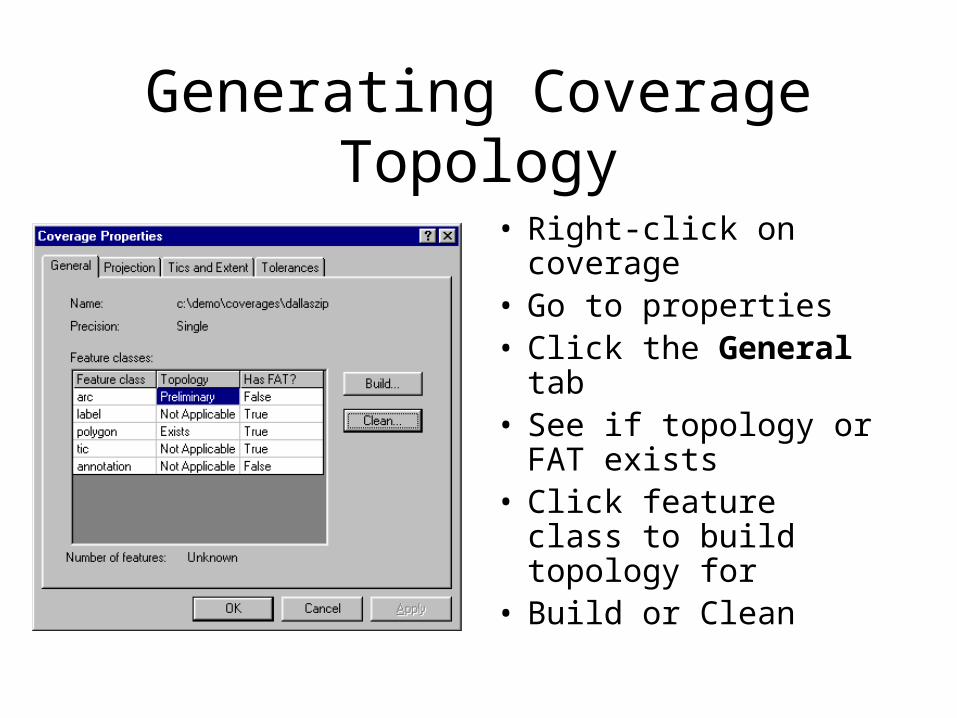
Generating Coverage Topology
• Right-click on coverage
• Go to properties• Click the General tab• See if topology or
FAT exists • Click feature class to
build topology for• Build or Clean

Define Coverage Coordinates
• Right-click and go to properties
• From file menu go to properties
• Can define interactively
• Can copy information from another grid, coverage, or TIN

Modifying Coverage Tics and Extent
• Right-click on coverage
• Go to properties• Click the Tics and
Extent tab• Click add• Click and add to X&Y• Fit button recalculates
extent

Creating New Coverages• Right click on ArcCatalog folder where you want
to create a coverage and go to “NEW” and “COVERAGE”
• Follow steps in create coverage wizard• Can create a new empty coverage or use a master
coverage for a template• The tics, extent, and coordinate system information
are all copied to from the template coverage to the new coverage
• If you do not use a template, you have to add tics before adding features

Maintaining Coverage Attributes• With attributes that reside in a feature attribute table or separate INFO
table ArcCatalog can….– Add new attributes.– Add redefined attributes.
• Used to combine or create subsets of existing attributes.– Modify.– Delete.– Add/remove indexes.
• Attribute indexes help to improve the performance of operations that access it.
• If an attribute containg feature geometry is indexed, a spatial index is created.
• Always recreate an index after modifying attribute values.
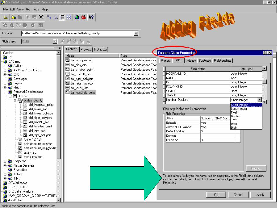
From ArcCatalog you can add and edit the properties of fields in tables, shapefiles and feature classes by right clicking on the object and going to properties.
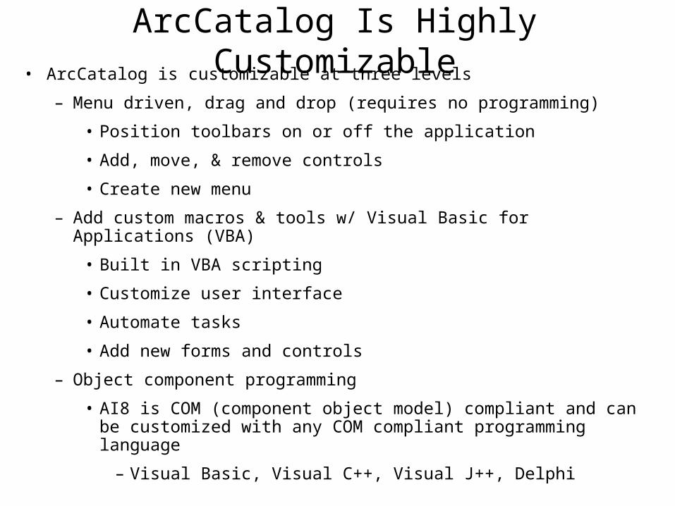
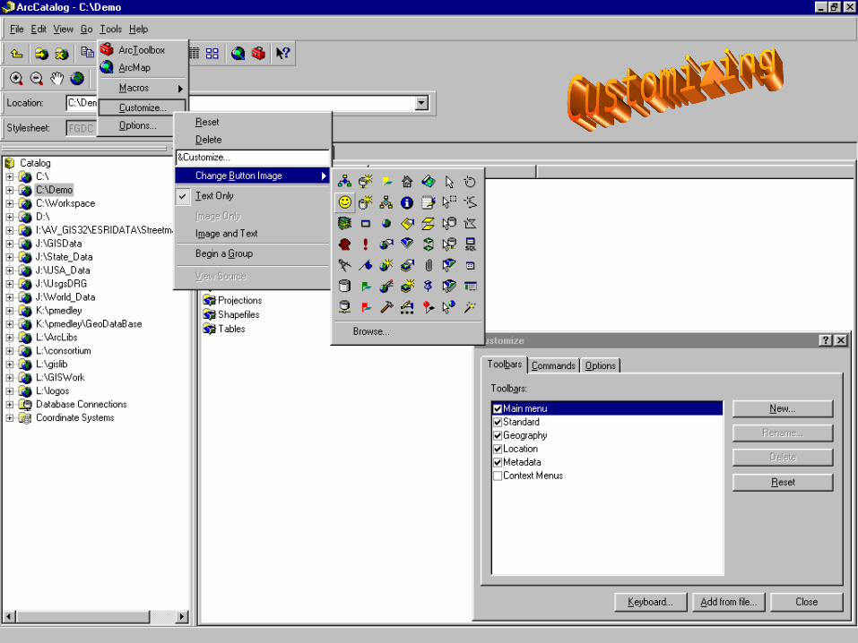
ArcCatalog Is Highly Customizable• ArcCatalog is customizable at three levels
– Menu driven, drag and drop (requires no programming)
• Position toolbars on or off the application
• Add, move, & remove controls
• Create new menu
– Add custom macros & tools w/ Visual Basic for Applications (VBA)
• Built in VBA scripting
• Customize user interface
• Automate tasks
• Add new forms and controls
– Object component programming
• AI8 is COM (component object model) compliant and can be customized with any COM compliant programming language
– Visual Basic, Visual C++, Visual J++, Delphi
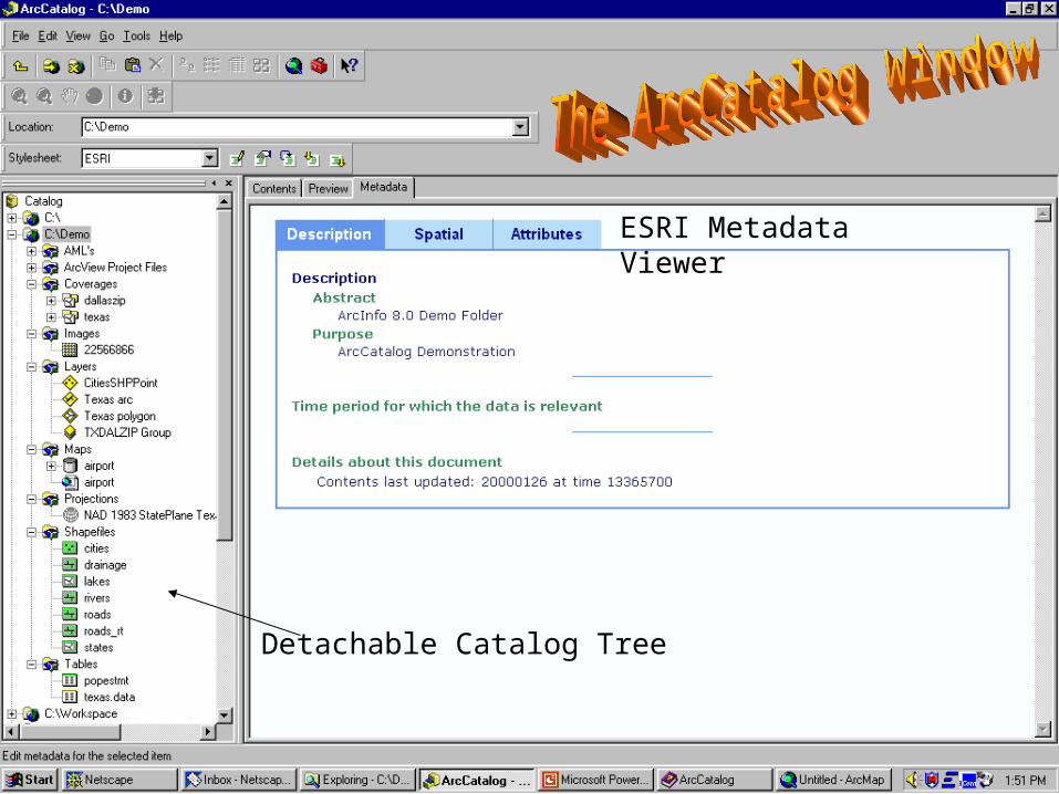
Detachable Catalog Tree
ESRI Metadata Viewer

CAD Dataset (Blue)
Coverages(Yellow)
Raster Datasets(Grid)
Layers(Bright Yellow)
Folder Connections
CAD Drawing File

Personal Geodatabase(Grey)
ArcMap Document(.mxd)
Projection(Globe)
Shapefiles(Green)
ArcView Dbase Table (Green)ArcInfo Info Table (Yellow)

T
IN D
ataset
Preview Tab
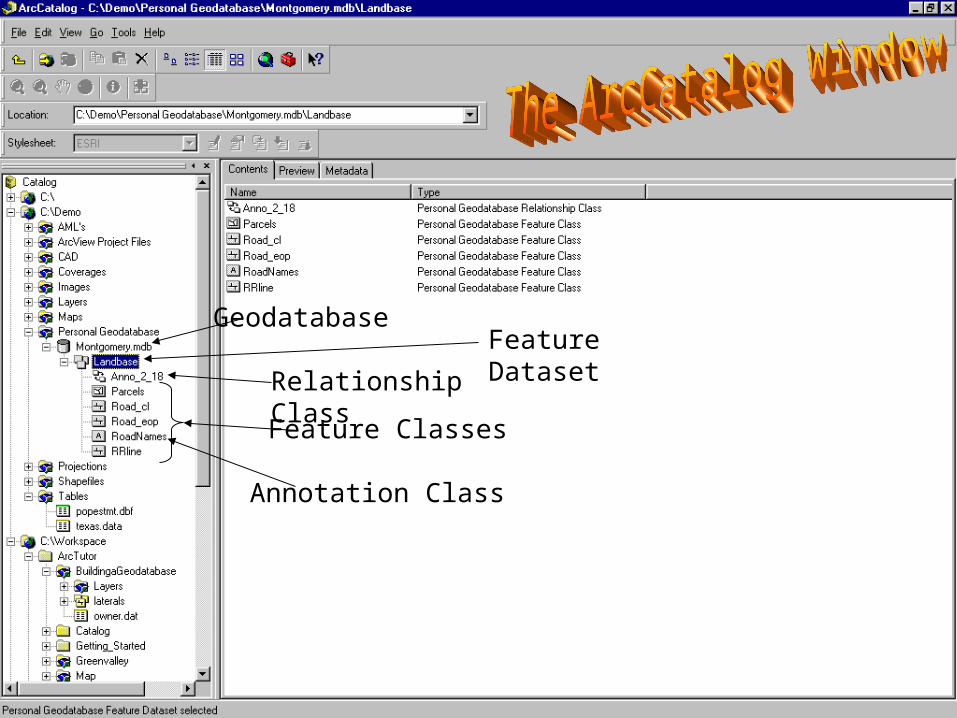
GeodatabaseFeature DatasetRelationship
ClassFeature Classes
Annotation Class

Projection Files*.prj


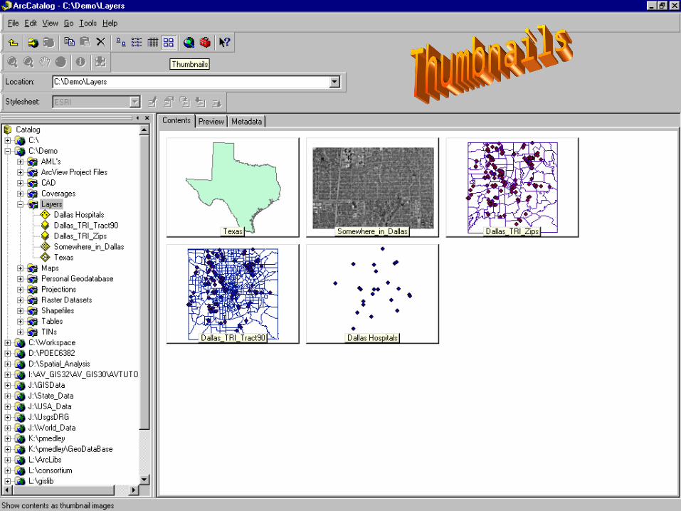
Creating Thumbnails
Database Table(Blue)
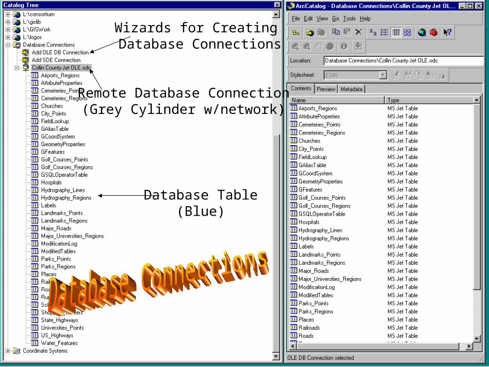
Remote Database Connection(Grey Cylinder w/network)
Wizards for Creating Database Connections