Introduction to the Geodatabase -...
52
Introduction to the Geodatabase Eric Rodenberg
Transcript of Introduction to the Geodatabase -...
Introduction to the Geodatabase
Eric Rodenberg

Environmental Systems Research Institute, IncCopyright © 1999–2009 ESRI All rights reserved. Printed in the United States of America.
The information contained in this document is the exclusive property of ESRI. This work is protected under United States copyright law and the copyright laws of the given countries of origin and applicable international laws, treaties, and/or conventions. No part of this work may be reproduced or transmitted in any form or by any means, electronic or mechanical, including photocopying or recording,
or by any information storage or retrieval system, except as expressly permitted in writing by ESRI. All requests should be sent to Attention: Contracts Manager, ESRI, 380 New York Street, Redlands, CA 92373-8100, USA.
The information contained in this document is subject to change without notice.
ESRI, ARC/INFO, ArcGIS, ArcView, BusinessMAP, MapObjects, PC ARC/INFO, SDE, and the ESRI globe logo are trademarks of Environmental Systems Research Institute, Inc., registered in the United States and certain other countries; registration is pending in
the European Community. 3D Analyst, ADF, ARC COGO, the ARC COGO logo, ARC GRID, the ARC GRID logo, the ARC/INFO logo, AML, ARC NETWORK, the ARC NETWORK logo, ArcNews, ARC TIN, the ARC TIN logo, ArcInfo, the ArcInfo logo, ArcInfo LIBRARIAN,
ArcInfo—Professional GIS, ArcInfo—The World's GIS, ArcAtlas, the ArcAtlas logo, the ArcCAD logo, the ArcCAD WorkBench logo, ArcCatalog, the ArcData logo, the ArcData Online logo, ArcDoc, ARCEDIT, the ARCEDIT logo, ArcEurope, the ArcEurope logo,
ArcEditor, ArcExplorer, the ArcExplorer logo, ArcExpress, the ArcExpress logo, ArcFM, the ArcFM logo, the ArcFM Viewer logo, ArcGIS, ArcIMS, the ArcIMS logo, ArcLogistics, the ArcLogistics Route logo, ArcMap, ArcObjects, ArcPad, the ArcPad logo,
ARCPLOT, the ARCPLOT logo, ArcPress, the ArcPress logo, the ArcPress for ArcView logo, ArcScan, the ArcScan logo, ArcScene, the ArcScene logo, ArcSchool, ArcSDE, the ArcSDE logo, the ArcSDE CAD Client logo, ArcSdl, ArcStorm, the ArcStorm logo,
ArcSurvey, ArcToolbox, ArcTools, the ArcTools logo, ArcUSA, the ArcUSA logo, ArcUser, the ArcView GIS logo, the ArcView 3D Analyst logo, the ArcView Business Analyst logo, the ArcView Data Publisher logo, the ArcView Image Analysis logo, the ArcView
Internet Map Server logo, the ArcView Network Analyst logo, the ArcView Spatial Analyst logo, the ArcView StreetMap logo, theArcView StreetMap 2000 logo, the ArcView Tracking Analyst logo, ArcVoyager, ArcWorld, the ArcWorld logo, Atlas GIS, the Atlas GIS logo, AtlasWare, Avenue, the Avenue logo, the BusinessMAP logo, DAK, the DAK logo, DATABASE INTEGRATOR, DBI Kit, the Digital
Chart of the World logo, the ESRI Data logo, the ESRI Press logo, ESRI—Team GIS, ESRI—The GIS People, FormEdit, Geographic Design System, Geography Matters, GIS by ESRI, GIS Day, the GIS Day logo, GIS for Everyone, GISData Server, InsiteMAP,
MapBeans, MapCafé, the MapCafé logo, the MapObjects logo, the MapObjects Internet Map Server logo, ModelBuilder, MOLE, the MOLE logo, NetEngine, the NetEngine logo, the PC ARC/INFO logo, PC ARCEDIT, PC ARCPLOT, PC ARCSHELL, PC DATA
CONVERSION, PC NETWORK, PC OVERLAY, PC STARTER KIT, PC TABLES, the Production Line Tool Set logo, RouteMAP, the RouteMAP logo, the RouteMAP IMS logo, Spatial Database Engine, the SDE logo, SML, StreetEditor, StreetMap, TABLES, The World's
Leading Desktop GIS, Water Writes, and Your Personal Geographic Information System are trademarks; and ArcData, ArcOpen, ArcQuest, ArcWatch, ArcWeb, Rent-a-Tech, Geography Network, the Geography Network logo, www.geographynetwork.com,
@esri.com, and www.esri.com are service marks of ESRI.
The names of other companies and products herein are trademarks or registered trademarks of their respective trademark owners. ArcView GIS uses Neuron Data’s Open Interface.

Workshop Agenda
• Welcome – 1:30• Geodatabase Overview 1:40 – 2:30• Hands on Tutorial 2:30 – 4:30• Wrap Up and Questions 4:30 – 5:00
• No Scheduled Breaks – Please take breaks as needed after 2:30

• The Geodatabase– What is it?– Why use it?– What types are there?
• Inside the Geodatabase
• Advanced Behavior
• Editing Geodatabases
• Geodatabase Potpourri
Geodatabase Overview

• Core ArcGIS data model–A comprehensive model for representing and managing GIS
data
• A physical store of geographic data –Scalable storage model supported on different platforms
• A transactional model for managing GIS workflows
• Set of COM components for accessing data
What is the Geodatabase?
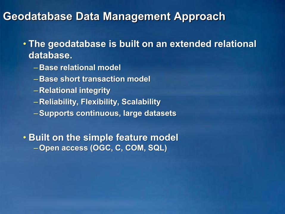
Geodatabase Data Management Approach
• The geodatabase is built on an extended relational database.
–Base relational model–Base short transaction model–Relational integrity–Reliability, Flexibility, Scalability–Supports continuous, large datasets
• Built on the simple feature model–Open access (OGC, C, COM, SQL)
Geodatabase Data Management Approach …
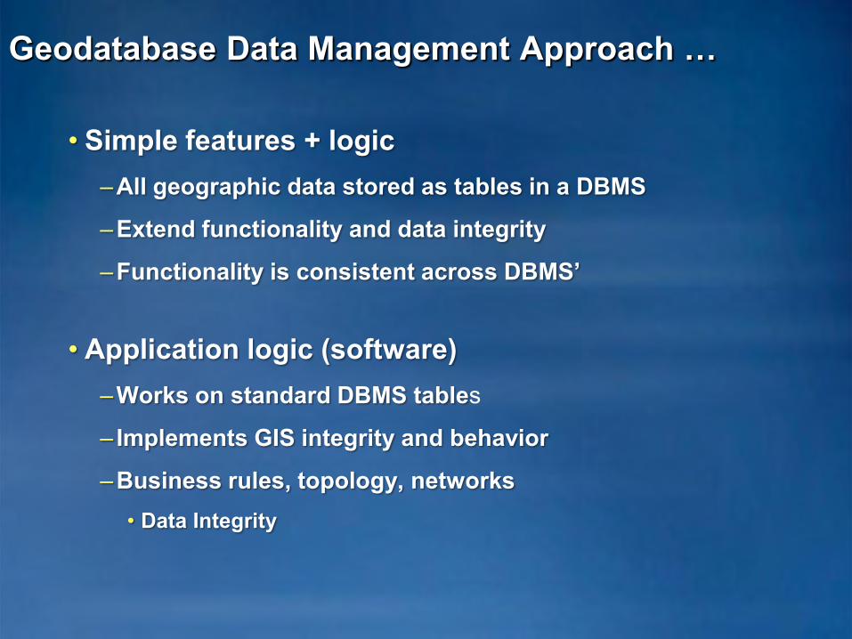
• Simple features + logic–All geographic data stored as tables in a DBMS
–Extend functionality and data integrity
–Functionality is consistent across DBMS’
• Application logic (software) –Works on standard DBMS tables
– Implements GIS integrity and behavior
–Business rules, topology, networks• Data Integrity
Geodatabase Data Management Approach …
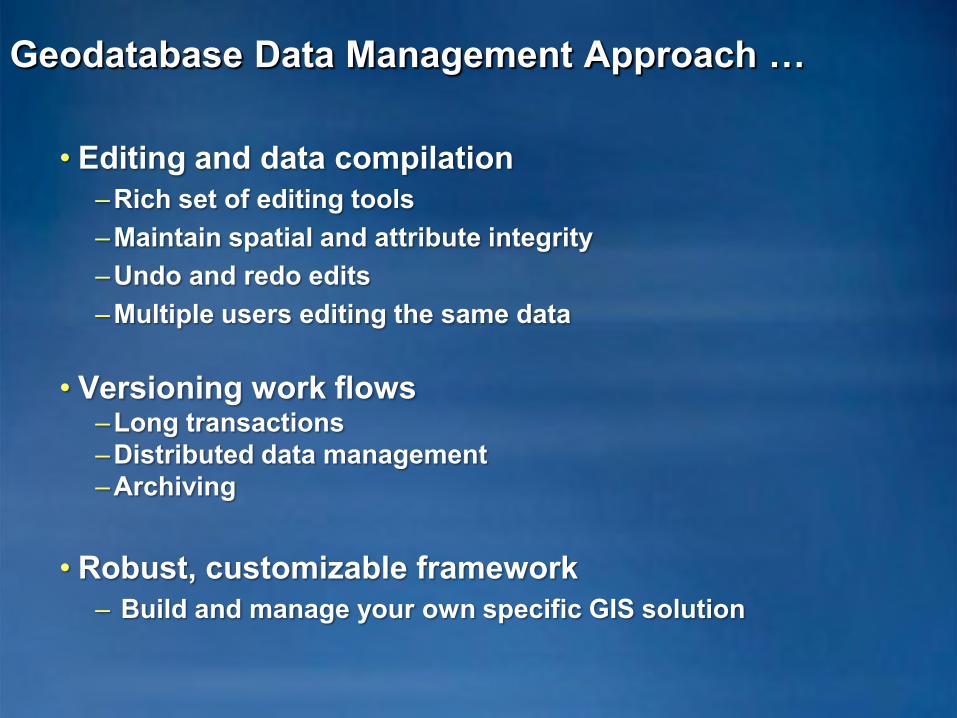
• Editing and data compilation–Rich set of editing tools –Maintain spatial and attribute integrity–Undo and redo edits–Multiple users editing the same data
• Versioning work flows–Long transactions–Distributed data management–Archiving
• Robust, customizable framework– Build and manage your own specific GIS solution

Geodatabase Data Management
• Schema is defined in ArcCatalog– Define feature classes, datasets, relationships, etc
• Import and convert data from other formats– Shapefile– Coverage– CAD– Raster
• Copy and Paste
• Geodatabase XML Export / Import
– For transferring Schema or Features and Schema
• Use an ESRI Data Model– Industry specific data models available– Copy geodatabase template
GDB
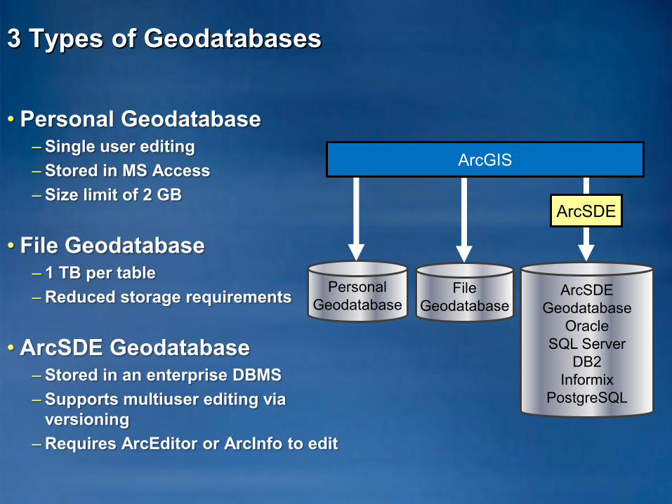
• Personal Geodatabase– Single user editing– Stored in MS Access– Size limit of 2 GB
• File Geodatabase– 1 TB per table– Reduced storage requirements
• ArcSDE Geodatabase– Stored in an enterprise DBMS– Supports multiuser editing via
versioning– Requires ArcEditor or ArcInfo to edit
3 Types of Geodatabases
PersonalGeodatabase
ArcSDEGeodatabase
OracleSQL Server
DB2Informix
PostgreSQL
ArcSDE
ArcGIS
FileGeodatabase
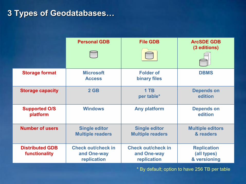
Personal GDB File GDB ArcSDE GDB(3 editions)
Storage format MicrosoftAccess
Folder ofbinary files
DBMS
Storage capacity 2 GB 1 TBper table*
Depends onedition
Supported O/S platform
Windows Any platform Depends onedition
Number of users Single editorMultiple readers
Single editorMultiple readers
Multiple editors& readers
Distributed GDB functionality
Check out/check inand One-way
replication
Check out/check inand One-way
replication
Replication(all types)
& versioning
* By default; option to have 256 TB per table
3 Types of Geodatabases…
• The Geodatabase
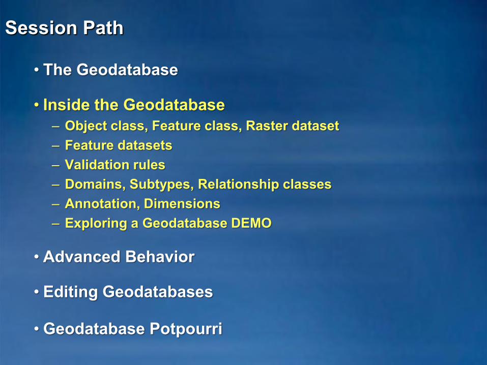
• Inside the Geodatabase– Object class, Feature class, Raster dataset– Feature datasets– Validation rules– Domains, Subtypes, Relationship classes– Annotation, Dimensions– Exploring a Geodatabase DEMO
• Advanced Behavior
• Editing Geodatabases
• Geodatabase Potpourri
Session Path

Inside the Geodatabase
• A geodatabase contains datasets
• Datasets represent collections of information with a real-world interpretation
• Types of geographic datasets:– Tables– Object classes, feature classes, relationship classes– Feature datasets– Networks, Topologies, Raster and cadastral datasets
• Datasets have associated information to help manage integrity, behavior, and interpretation
– Domains, Relational integrity, Topology, Metadata

Inside the Geodatabase…
GDB
Feature dataset
Terrain
Topology
Network dataset
Geometric network
Feature class
LinePolygon
PointDimensionAnnotation
Route
Relationship class
Table Raster dataset
Raster catalog
Survey dataset
Project folder Project
Toolbox
Tool Model Script
Schematic dataset
BehaviorRelationship rulesConnectivity rulesTopology rules
Attribute domainsAttribute defaultsSplit/merge policy
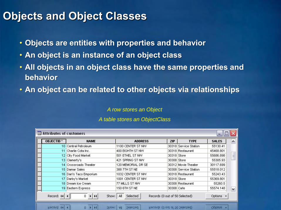
Objects and Object Classes
• Objects are entities with properties and behavior• An object is an instance of an object class• All objects in an object class have the same properties and
behavior• An object can be related to other objects via relationships
A row stores an Object
A table stores an ObjectClass
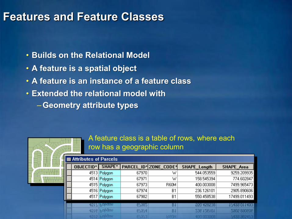
• Builds on the Relational Model• A feature is a spatial object• A feature is an instance of a feature class• Extended the relational model with
–Geometry attribute types
Features and Feature Classes
A feature class is a table of rows, where each row has a geographic column

Field data types
• The geodatabase supports eight field data types
• Supported field data types are generic– Data types specific to an RDBMS are not supported
Short IntegerLong IntegerFloatDoubleText
Data type Bytes2
DateBLOB
48
varies8
varies
4
Range / format / notes-32,768 to +32,767-2,147,483,648 to +2,147,483,647 About –3.4e38 to +1.2e38 (~7 significant digits) About –2.2e308 to +1.8e308 (~14 significant digits) Up to ~64,000 characters mm/dd/yyyy hh:mm:ss am/pm Store large binary content or other multimedia
Raster varies Store images
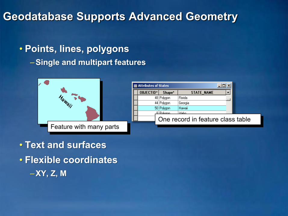
Geodatabase Supports Advanced Geometry
• Points, lines, polygons–Single and multipart features
• Text and surfaces• Flexible coordinates
–XY, Z, M
One record in feature class tableFeature with many parts
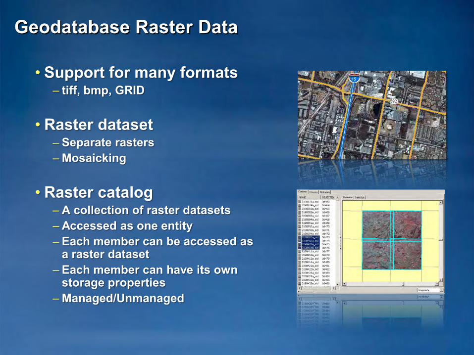
Geodatabase Raster Data
• Support for many formats– tiff, bmp, GRID
• Raster dataset– Separate rasters– Mosaicking
• Raster catalog– A collection of raster datasets – Accessed as one entity– Each member can be accessed as
a raster dataset– Each member can have its own
storage properties– Managed/Unmanaged
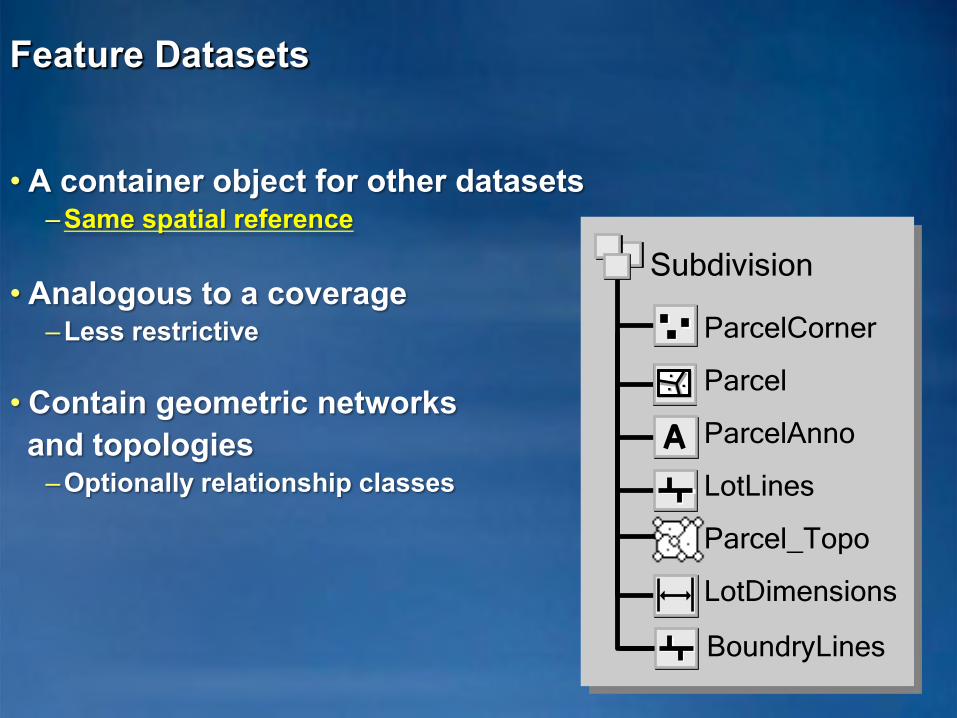
Feature Datasets
• A container object for other datasets –Same spatial reference
• Analogous to a coverage–Less restrictive
• Contain geometric networks and topologies
–Optionally relationship classes
ParcelCorner
Parcel
ParcelAnno
LotLines
Parcel_Topo
LotDimensions
Subdivision
BoundryLines
Validation Rules
• Store attribute, connectivity, and relationship rules on objects as part of the geodatabase
• Predefined, parameter driven–Attribute range rule–Attribute set rule–Connectivity rule
• On demand
• Perform custom validation by writing code
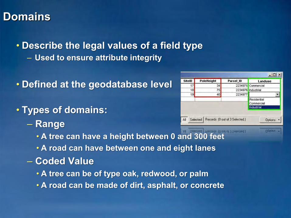
Domains
• Describe the legal values of a field type– Used to ensure attribute integrity
• Defined at the geodatabase level
• Types of domains:– Range
• A tree can have a height between 0 and 300 feet• A road can have between one and eight lanes
– Coded Value • A tree can be of type oak, redwood, or palm• A road can be made of dirt, asphalt, or concrete
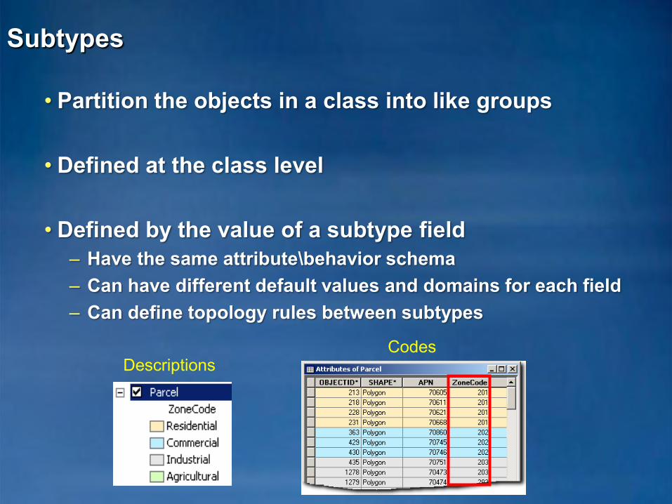
Subtypes
• Partition the objects in a class into like groups
• Defined at the class level
• Defined by the value of a subtype field– Have the same attribute\behavior schema– Can have different default values and domains for each field– Can define topology rules between subtypes
CodesDescriptions
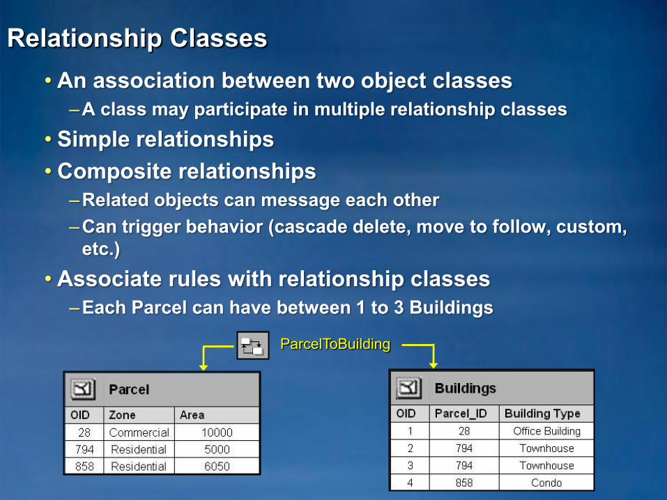
• An association between two object classes–A class may participate in multiple relationship classes
• Simple relationships• Composite relationships
–Related objects can message each other–Can trigger behavior (cascade delete, move to follow, custom,
etc.)• Associate rules with relationship classes
–Each Parcel can have between 1 to 3 Buildings
Relationship Classes
ParcelToBuilding
feature classannotation feature
classcomposite
relationship class
Topanga Canyon
Sacramento
Placerville
94 Sacramento
95 Topanga Canyon
92 Placerville41434749
929495
414347
212327
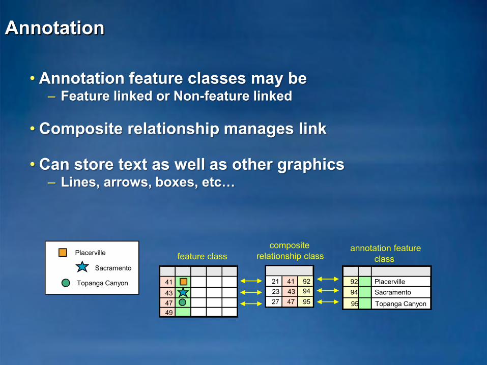
• Annotation feature classes may be – Feature linked or Non-feature linked
• Composite relationship manages link
• Can store text as well as other graphics– Lines, arrows, boxes, etc…
Annotation

• Type of annotation that displays specific distances on a map
• Graphic features stored in a dimension feature class
• ―Smart‖ feature
–Special drawing–Special editing
Dimension Features
1 3/8"

Object Behavior
• You can:– Instantiate classes with predefined behavior. (Dimensions and
Annotation)–Control the default value and acceptable values for any
attribute in a class. (Domains and Validation)–Partition the objects in a class into like groups. (Subtypes)–Control the general and network relationships in which an
object can participate. (Relationship Classes)
• Out of the Box in ArcGIS!–Configurable, no programming required

Exploring a Geodatabase Demo
• Explore a Geodatabase– Tables– Feature Classes– Subtypes– Domains– Relationship Classes

• The Geodatabase
• Inside the Geodatabase
• Advanced Behavior– Geometric Networks– Network Datasets– Geodatabase Topology– Advanced behavior DEMO
• Editing Geodatabases
• Geodatabase Potpourri
Session Path

• Used to model network systems
• Connectivity relationships between feature classes– Can associate connectivity rules with the network– Connectivity is based on geometric coincidence, always live
• Each feature class has a role in the network–A network may have multiple feature classes in the same role
Geometric Networks
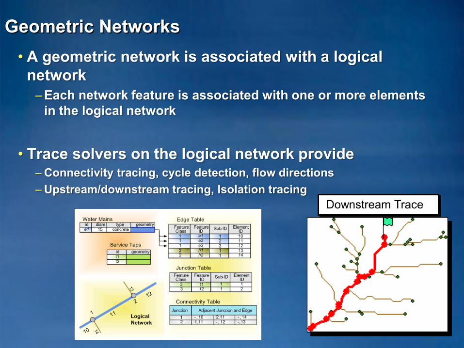
• A geometric network is associated with a logical network
–Each network feature is associated with one or more elements in the logical network
• Trace solvers on the logical network provide– Connectivity tracing, cycle detection, flow directions– Upstream/downstream tracing, Isolation tracing
Geometric Networks
Downstream Trace
Network Datasets
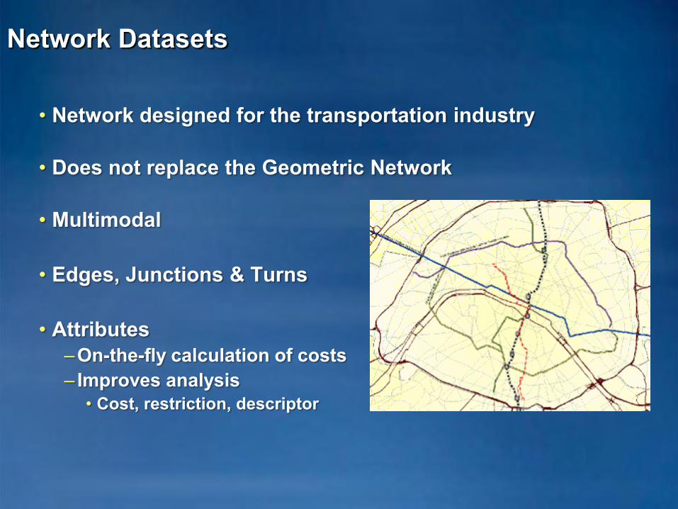
• Network designed for the transportation industry
• Does not replace the Geometric Network
• Multimodal
• Edges, Junctions & Turns
• Attributes –On-the-fly calculation of costs– Improves analysis
• Cost, restriction, descriptor
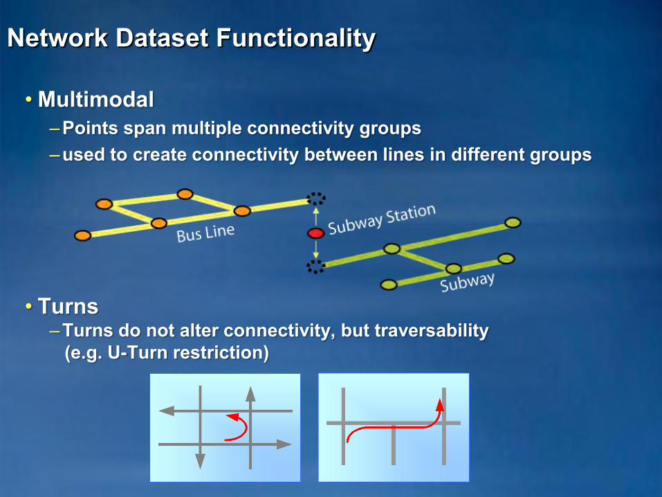
• Multimodal–Points span multiple connectivity groups–used to create connectivity between lines in different groups
• Turns–Turns do not alter connectivity, but traversability
(e.g. U-Turn restriction)
Network Dataset Functionality

Geodatabase Topology
• A topology manages a set of simple feature classes that share geometry
• Topology is used to– Integrate feature geometry– Validate features– Control editing tools– Define relationships between features– Ensure the quality of your data
Topological Integrity
• Topology defines integrity rules for associated feature classes
–Participating feature classes / subtypes–Cluster tolerance, ranks and rules
• Cluster Tolerance for XY and Z
• Rules are evaluated during Validation–Define rules when creating the Topology
• Violations of these rules are expressed as error features managed in the database as a part of the topology
–Error and Exceptions–Examine and Fix errors in ArcMap

Topology Error Examples
• Rules enforced to maintain topological integrity–25+ topology rules in ArcGIS
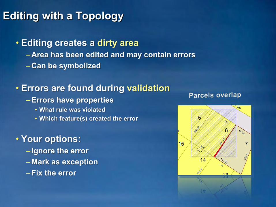
Editing with a Topology
• Editing creates a dirty area–Area has been edited and may contain errors–Can be symbolized
• Errors are found during validation–Errors have properties
• What rule was violated• Which feature(s) created the error
• Your options:– Ignore the error –Mark as exception –Fix the error

Geodatabase Behavior Demo
• Explore a Geodatabase– Topology– Geometric Network

• The Geodatabase
• Inside the Geodatabase
• Advanced Behavior
• Editing Geodatabases– Transaction model– Geodatabase editing solutions– Versioning
• Geodatabase Potpourri
Session Path

Editing Geodatabases
• ArcGIS datasets stored in the geodatabase are editable– Merge adjacent parcels in a topology– Add water mains to a network– Update land owners in a relationship class– Etc…
• There is a rich transaction model for editing in ArcGIS–Edits are performed in an edit session
• Open session – edit – save edits / don’t save edits
–A series of edit operations constitutes a transaction• Unit of work performed against the database• The transaction is either committed or rolled back
Editing Geodatabases…
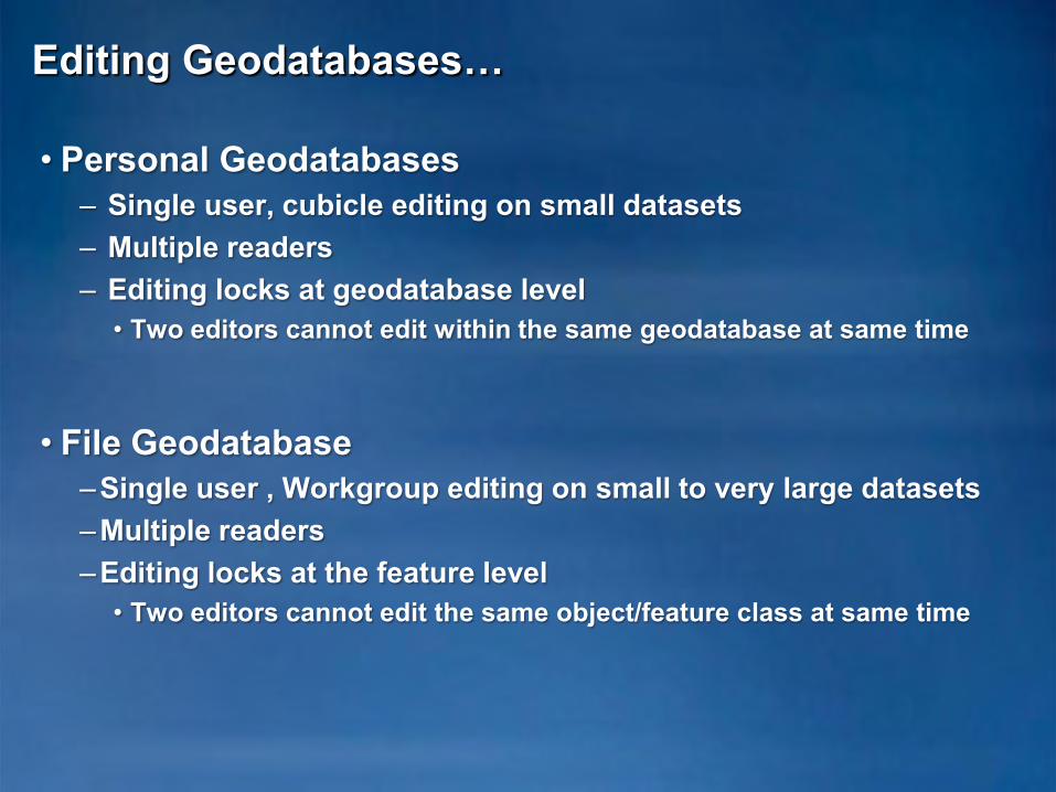
• Personal Geodatabases– Single user, cubicle editing on small datasets– Multiple readers– Editing locks at geodatabase level
• Two editors cannot edit within the same geodatabase at same time
• File Geodatabase–Single user , Workgroup editing on small to very large datasets–Multiple readers–Editing locks at the feature level
• Two editors cannot edit the same object/feature class at same time

Editing Geodatabases…
• ArcSDE Geodatabases –Extend the transaction model with Versions–Enterprise level editing–Multiuser editing without locking
• Unique isolated view of the geodatabase
• Benefits of versioned editing–Long Transactions–Undo / Redo–Archiving–Replication / mobile GIS

• The Geodatabase
• Inside the Geodatabase
• Editing Geodatabases
• Advanced Behavior
• Geodatabase Potpourri– Terrains– Cartographic representations– Cadastral
Session Path
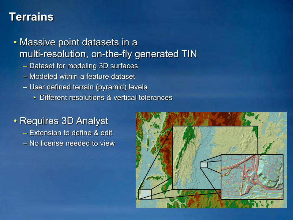
• Massive point datasets in amulti-resolution, on-the-fly generated TIN– Dataset for modeling 3D surfaces– Modeled within a feature dataset– User defined terrain (pyramid) levels
• Different resolutions & vertical tolerances
• Requires 3D Analyst – Extension to define & edit– No license needed to view
Terrains
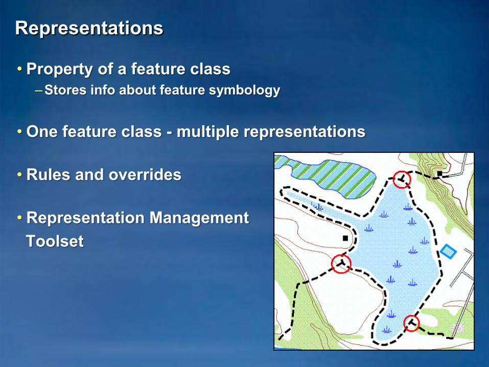
Representations
• Property of a feature class–Stores info about feature symbology
• One feature class - multiple representations
• Rules and overrides
• Representation Management Toolset

Cadastral Editor
• Solution for parcel data management–Survey Analyst extension
• Uses COGO attributes and survey control to improve spatial accuracy
• Cadastral editing–Cadastral editor toolbar–Cadastral fabrics
• Group layer with sublayers• Jobs
• The Geodatabase–Data model, Storage, Transaction model, COM components
• Inside the Geodatabase–Datasets, Validation rules, data behavior and integrity
• Advanced Behavior–Geometric Networks, Network Datasets, and Topology
• Editing Geodatabases–Transaction model, Editing solutions, Versions
• Geodatabase Potpourri–Terrains, Representations, Cadastral
Summary
Hands on Tutorial
• Work at your own pace• Take at least two breaks• Each exercise should take no more than 15 minutes• Please raise your hand if you have a question• Please remain quiet as your neighbors may still be
working

Hands On Tutorial
• Organizing your data in ArcCatalog • Importing data into your Geodatabase • Creating subtypes and attribute-domains• Creating relationships between objects • Building a geometric network• Creating annotation • Create Cartographic Representations• Creating a topology• Replicate and Synchronize the Geodatabase