Introducing the concept of Disaster Risk Reduction Through ...
63
Introducing the concept of Disaster Risk Reduction Through Environmental Design (DRRTED), and proposing a methodology for the creation of safer environments. Presented by: Theuns van der Linde Presentation prepared for: Conference in Disaster Risk Reduction Disaster Management Training and Education Centre for Africa (DiMTEC) 26 & 27 May 2009
Transcript of Introducing the concept of Disaster Risk Reduction Through ...

Introducing the concept of Disaster Risk Reduction Through Environmental Design
(DRRTED), and proposing a methodology for the creation of safer environments.
Presented by: Theuns van der Linde
Presentation prepared for: Conference in Disaster Risk Reduction
Disaster Management Training and Education Centre for Africa (DiMTEC)
26 & 27 May 2009
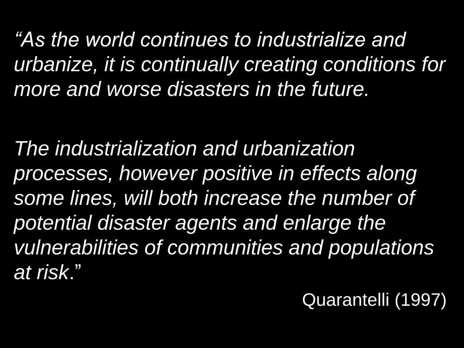
“As the world continues to industrialize and
urbanize, it is continually creating conditions for
more and worse disasters in the future.
The industrialization and urbanization
processes, however positive in effects along
some lines, will both increase the number of
potential disaster agents and enlarge the
vulnerabilities of communities and populations
at risk.”
Quarantelli (1997)

“natural and human-induced disasters are one
of the top three threats to the safety and
security of urban dwellers in the 21st century.”
The United Nations Global Report on
Human Settlements for 2007

“By 2050, the world population is expected to
grow by 3 billion people. Most of this growth
will take place in developing countries - and
within these countries, in cities and towns -
more than doubling urban populations.
Large numbers of people will be concentrated
in megacities and on fragile lands, making
reduction of vulnerability to disasters in
metropolitan areas a critical challenge facing
development.”
Editors’ Note – Building Safer Cities – The future of Disaster Risk
World Bank, 2003

What is Disaster Risk Reduction through
Environmental Design (DRRTED)
DRRTED aims to reduce disaster risk by utilizing
the built environment to influence components
that contribute to disaster risk, and in doing so,
reduces the overall disaster risk in (urban/built)
environments.
Federal Emergency Management Agency
(FEMA) Building Design for Homeland Security,
adapted for Disaster Management.
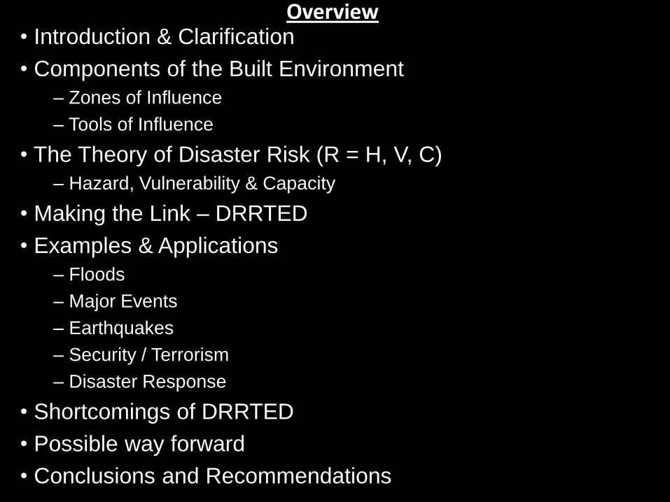
Overview • Introduction & Clarification
• Components of the Built Environment
– Zones of Influence
– Tools of Influence
• The Theory of Disaster Risk (R = H, V, C)
– Hazard, Vulnerability & Capacity
• Making the Link – DRRTED
• Examples & Applications
– Floods
– Major Events
– Earthquakes
– Security / Terrorism
– Disaster Response
• Shortcomings of DRRTED
• Possible way forward
• Conclusions and Recommendations

Disaster Risk Reduction through
Environmental Design (DRRTED)
Environmental Design:
Urban & Built Environment, not Natural Environment
Environmental Design:
Planning, Creation, Construction

Introduction Assuming that:
‘Uncontrolled’ Development / Urbanization can lead to the unsafe urban
environments.
Also be assumed that:
‘Controlled’ Development / Urbanization can lead to safer environments.
This is not a new concept – Architects, Engineers & Urban Planners:
• Building Regulations & Structural Design Guidelines
• Urban Planning Guidelines
• Zoning and Land-use restrictions
However, in order to create disaster ‘resistant’ urban environments, there is a need
for an Integrated approach (including specific guidelines) to incorporate disaster
risk reduction science into the urban planning, engineering and architectural
fields.
This is the aim of Disaster Risk Reduction Through Environmental Design
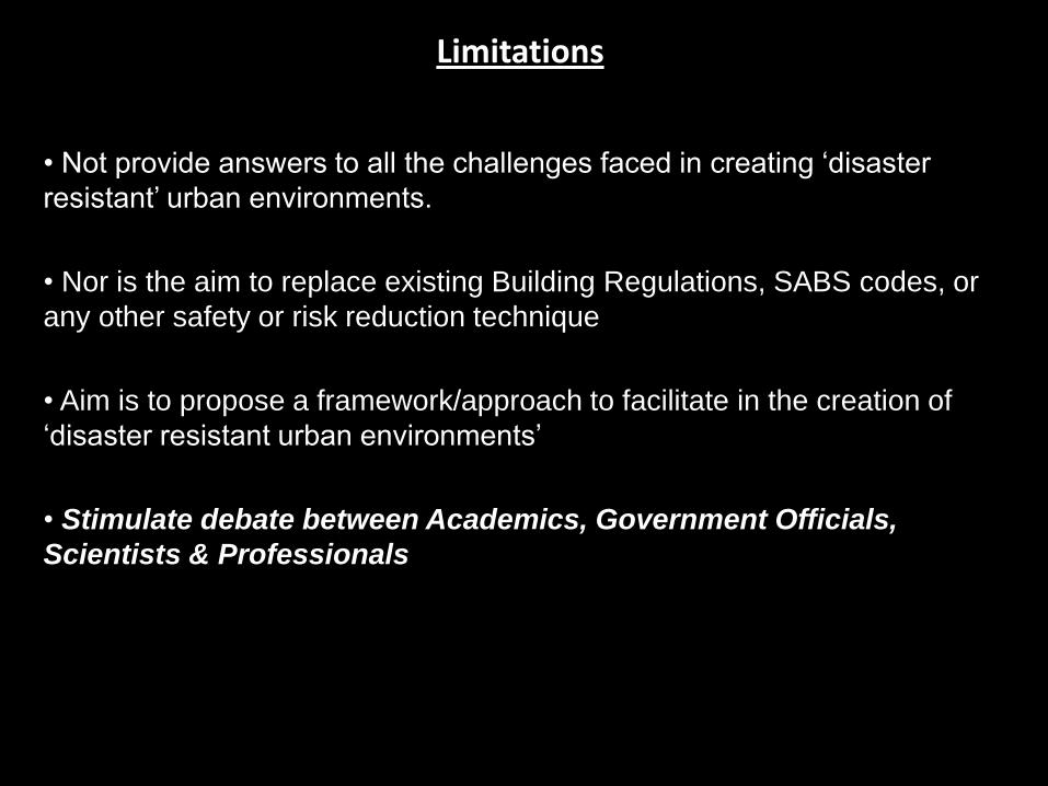
Limitations
• Not provide answers to all the challenges faced in creating ‘disaster
resistant’ urban environments.
• Nor is the aim to replace existing Building Regulations, SABS codes, or
any other safety or risk reduction technique
• Aim is to propose a framework/approach to facilitate in the creation of
‘disaster resistant urban environments’
• Stimulate debate between Academics, Government Officials,
Scientists & Professionals
Forget about Disaster Management – Focus on the Buildings

Components of Built Environment: Zones & Components
Image: TC van der Linde (2008) ©

Components of the Built Environment
Consider that the Built Environment can be characterised
in terms of two aspects:
Functions and Relationship of Zones within the Urban Context
(Where?)
Components of the Built Environment
(What, why, how?)

Components of Built Environment: Zones (Where?) & Components (What, why & how?)
Image: TC van der Linde (2008) ©

Components of the Built Environment Functions and Relationship of ‘Zones’
Image: TC van der Linde (2008) ©

Components of the Built Environment Functions and Relationship of ‘Zones’
Image: TC van der Linde (2008) ©

Components of the Built Environment Functions and Relationship of ‘Zones’
Image: TC van der Linde (2008) ©

Components of the Built Environment Functions and Relationship of ‘Zones’
ZONES OF INFLUENCE
Zone 1 – Up to External Boundary
Zone 2 – External Boundary to Building
‘Footprint’
Zone 3 – Building ‘Footprint’ and Building

Components of the Built Environment “ZONES OF INFLUENCE”

Components of the Built Environment
‘Tools of Influence’ (Why tools? – Use to form Environment)
• Tool 1 – Layout, Planning & Design
• Tool 2 – Terrain Components
• Tool 3 – Building Components

Tool 1 – Layout, Planning & Design
• Tool 1.2: Location, Placement,
Orientation and Sizing
(Practical/Quantitative).
• Tool 1.1: Land-, building- or
room-use planning
(Strategic/Qualitative)

Tool 1 – Layout, Planning & Design
• Tool 1.3: Access points and
transportation/movement routes.
• Tool 1.4: Location, routing and
connection points of services. (Electricity, water, sewerage, communication, etc)

Tool 2 – Terrain Components
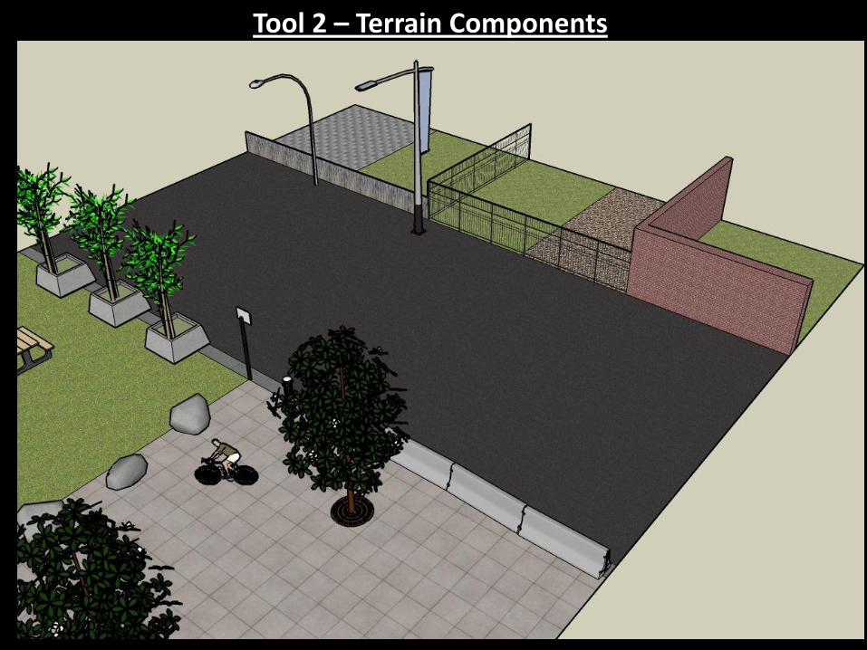
Tool 2 – Terrain Components

Tool 2 – Terrain Components
• Tool 2.1: Plants and Vegetation
• Tool 2.2: Landscaping and Artificial topography
• Tool 2.3: Land & Ground cover
• Tool 2.4: Walls, Fencing and Gates
• Tool 2.5: Barriers
• Tool 2.6: Furniture
• Tool 2.7: Signage
• Tool 2.8: Services, including
– Energy including Electrical Services and Gas;
– Water Reticulation Systems;
– Storm Water Services;
– Sanitation;
– Transportation;
– Communication & Information Technology;
– Mechanical Services (including HVAC, elevators and escalators);
– Ambiance (including Lighting & Sound); and
– Fire Safety and Security Systems
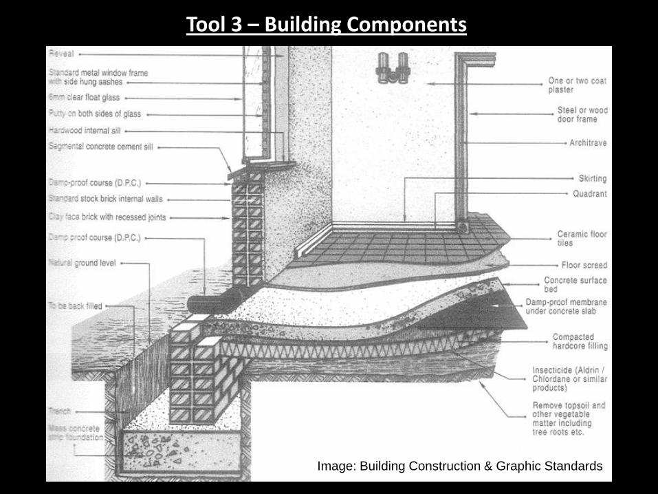
Tool 3 – Building Components
Image: Building Construction & Graphic Standards

Tool 3 – Building Components
Image: Building Construction & Graphic Standards

Tool 3 – Building Components • Tool 3.1: Foundations;
• Tool 3.2: Ground floor construction;
• Tool 3.3: Other floors (2nd, 3rd and other storeys);
• Tool 3.4: Structural frame;
• Tool 3.5: External envelope;
• Tool 3.6: External openings (Doors, Windows);
• Tool 3.7: External finishes;
• Tool 3.8: Roof Structure;
• Tool 3.9: Roof Finishes;
• Tool 3.10: Internal Divisions;
• Tool 3.11: Internal openings (Doors, Windows);
• Tool 3.12: Internal finishes (Wall, floor, ceiling);
• Tool 3.13: Internal fittings; and
• Tool 3.14: Services, including: –Energy including Electrical Services and Gas;
–Water Reticulation Systems;
–Storm Water goods;
–Sanitation & Plumbing;
–Transportation;
–Communication & Information Technology;
–Mechanical Services (including HVAC, elevators and escalators);
–Ambiance (including Lighting & Sound); and
–Fire Safety and Security Systems

Components of the Built Environment
Tools of Influence
• Tool 1 – Layout, Planning & Design
• Tool 2 – Terrain Components
• Tool 3 – Building Components
Zones of Influence
• Zone 1 – Up to External Boundary
• Zone 2 – External Boundary to Building ‘Footprint’
• Zone 3 – Building ‘Footprint’ and Building
Forget about Buildings – Focus on Disaster Management

Theory of Disaster Risk
Risk = Hazard x Vulnerability (PAR Model & NDMF) (1)
Risk = [Hazard x Vulnerability] / Capacity (2)
Risk = [Hazard x Vulnerability] / [Manageability x Capacity] (3)
Risk = [Hazard x Vulnerability] – Capacity (4)
Risk = [Hazard / Capacity1] x [Vulnerability / Capacity2] (5)
Hazard, Vulnerability, Capacity
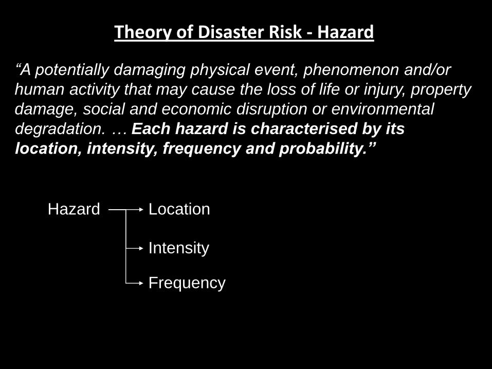
Theory of Disaster Risk - Hazard
Hazard
“A potentially damaging physical event, phenomenon and/or
human activity that may cause the loss of life or injury, property
damage, social and economic disruption or environmental
degradation. … Each hazard is characterised by its
location, intensity, frequency and probability.”
Location
Intensity
Frequency

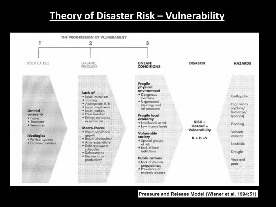
Theory of Disaster Risk – Vulnerability
“The degree to which an individual, a household, a community,
an area or a development may be adversely affected by the
impact of a hazard. Conditions of vulnerability and
susceptibility to the impact of hazards are determined by
physical, social, economic and environmental factors or
processes”
Theory of Disaster Risk – Vulnerability
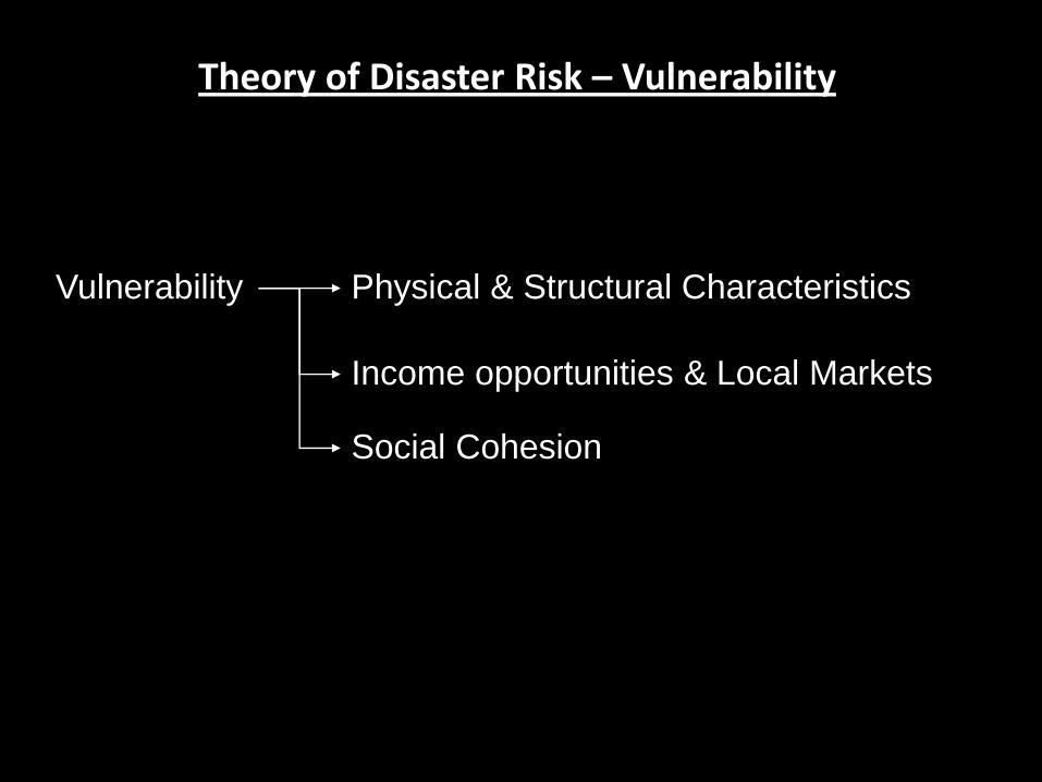
Theory of Disaster Risk – Vulnerability
Vulnerability Physical & Structural Characteristics
Income opportunities & Local Markets
Social Cohesion

Theory of Disaster Risk – Capacity
Capacity
“A combination of all the strengths and resources available
within a community, society or organisation that can reduce the
level of risk, or the effects of a disaster. Capacity may include
physical, institutional, social or economic means as well as
skilled personnel or collective attributes such as leadership
and management.”
Access
Resources
Environmental Factors
Communication & Information

Theory of Disaster Risk – Capacity
Hazard Vulnerability Capacity Risk
Hazard
Vulnerability Capacity
Risk
Risk = [Hazard x Vulnerability] / [Manageability x Capacity]
Risk = [Hazard x Vulnerability] - [Manageability x Capacity]

Making the Link - DRRTED
Hazard
Tool 2 Terrain Components
Tool 3 Building Components
Environmental
‘Components’ Disaster
Risk
Tool 1 Layout, Planning &Design
Vulnerability
Capacity
Disaster Risk
Reduction
through
Environmental
Design
DRRTED aims to reduce the risk of disaster (by influencing HVC levels),
by using various components of the Built Environment.
(Within 3 Zones)

Making the Link - DRRTED
HAZARD
Built Environment
(Zones 1 – 3)
Tool 1 – Layout,
Planning & Design
Tool 2 – Terrain
Components
Tool 3 – Building
Components
Hazard Characteristics
Location
Intensity
Frequency
Vulnerability Characteristics
Physical / Structural
Income Opportunities & Local
Markets
Social Cohesion
Capacity Characteristics
Access
Resources
Environmental Factors
Communication & Information

HAZARD Built Environment
Tool 1 – Layout,
Planning & Design
Tool 2 – Terrain
Components
Tool 3 – Building
Components
Hazard Characteristics
Location
Intensity
Frequency
Vulnerability Characteristics
Physical / Structural
Income Opportunities & Local Markets
Social Cohesion
Capacity Characteristics
Access
Resources
Environmental Factors
Communication & Information
1) How can Urban Planners (Zone 1) use land-use planning guidelines (Tool 1.1) to reduce the hazard level
caused by fires?
2) How can Engineers (Zone 3) use foundations (Tool 3.1) to reduce the vulnerability of buildings to the
effects of earthquakes?
3) How can Architects (Zone 2 & 3) use Landscaping (Tool 2.2 & 2.3) to facilitate the response (capacity) of
Fire Services to emergencies?
4) How can Urban Planners (Zone 1) use land-use planning guidelines (Tool 1.1) to increase income
opportunities in a specific area, thereby possibly reducing vulnerability?
1
2
3
4
Examples & Applications
• Examples of Existing Measures
• Taken from various sources
• Illustrate inclusion of existing guidelines within DRRTED framework

Examples & Applications (Floods)
Examples & Applications (Floods)
(Image: FEMA 2005:4-11)
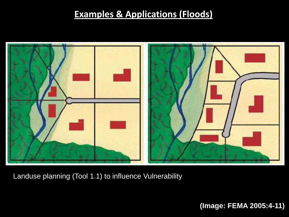
Landuse planning (Tool 1.1) to influence Vulnerability

Examples & Applications (Floods)
Landuse planning (Tool 1.1) to influence Vulnerability
(Image: FEMA 2005:9-8)

Examples & Applications (Floods)
Tool 2.2 (Landscaping and Artificial Topography) on a Zone 1 or 2 level to
influence Hazard Characteristics
(Image: FEMA 2005:8-11)

Examples & Applications (Floods)
Landscaping (Tool 2.2) and Walls (Tool 2.4) on a Zone 2 and 3 Level.
(Image: FEMA 2005:10-5)

Examples & Applications (Floods)
Land-cover is included in the DRRTED approach as Tool 2.3 (Land- and Ground
Cover) (Image: FEMA 2005:8-2)

Examples & Applications (Floods)
Flood walls, included in the DRRTED approach under Tool 2.4 (Walls, fencing &
Gates)
(Image: FEMA 2005:8-10 & FEMA 2005:10-4)

Examples & Applications (Floods)
This specific measure is included under Tool 3.2 (Ground-floor Construction) on a
Zone 3 level.
(Image: FEMA 2005:10-2)

Examples & Applications (Floods)
This is an example of using Tool 3.5 (External Envelope) and Tool 3.6 (External
Openings) in order to protect a building against flooding.
(Image: FEMA 2005:10-8)
Examples & Applications (Floods)
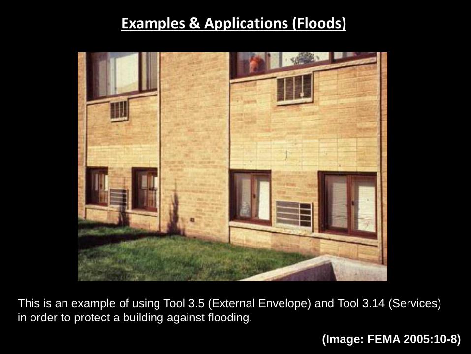
This is an example of using Tool 3.5 (External Envelope) and Tool 3.14 (Services)
in order to protect a building against flooding.
(Image: FEMA 2005:10-8)

Examples & Applications (Floods)
This is an example how services (Tool 3.14) can be used to reduce the
vulnerability of buildings against floods.
(Image: FEMA 2005:10-12)
Examples & Applications (Major Events)
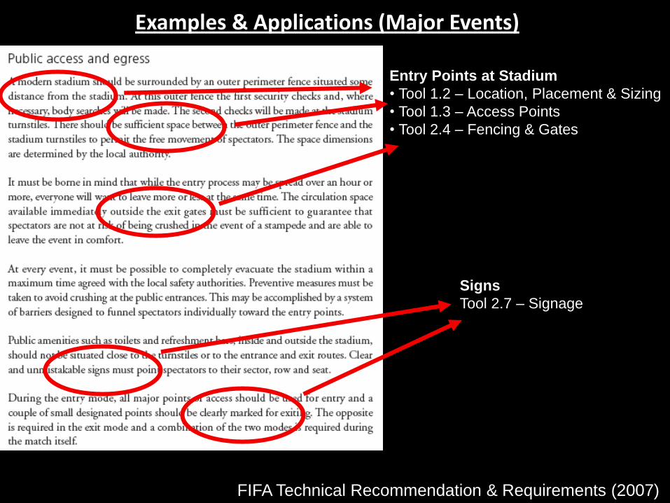
FIFA Technical Recommendation & Requirements (2007)
Entry Points at Stadium
• Tool 1.2 – Location, Placement & Sizing
• Tool 1.3 – Access Points
• Tool 2.4 – Fencing & Gates
Signs
Tool 2.7 – Signage
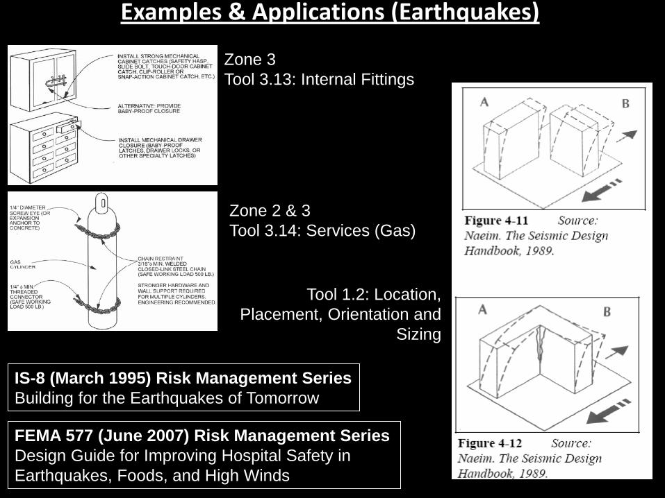
Examples & Applications (Earthquakes)
FEMA 577 (June 2007) Risk Management Series
Design Guide for Improving Hospital Safety in
Earthquakes, Foods, and High Winds
IS-8 (March 1995) Risk Management Series
Building for the Earthquakes of Tomorrow
Zone 2 & 3
Tool 3.14: Services (Gas)
Zone 3
Tool 3.13: Internal Fittings
Tool 1.2: Location,
Placement, Orientation and
Sizing
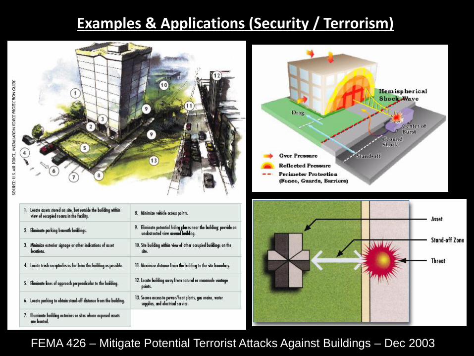
Examples & Applications (Security / Terrorism)
FEMA 426 – Mitigate Potential Terrorist Attacks Against Buildings – Dec 2003
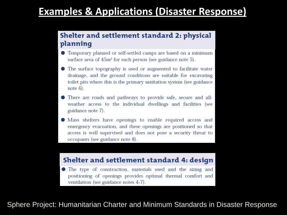
Examples & Applications (Disaster Response)
Sphere Project: Humanitarian Charter and Minimum Standards in Disaster Response
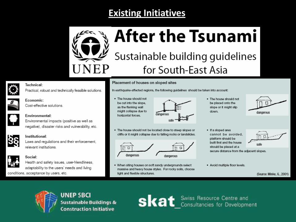
Existing Initiatives

Existing Initiatives
• Building Regulations, SABS Codes, etc.
• CSIR Guidelines for Human Settlement Planning & Design
• Crime Prevention through Environmental Design (CPTED)
• Safer City Initiatives

Sustainable Reconstruction (c) Skat 2006
Contracting
Start of Project
Planning
Construction
Handing Over
Phasing Out /
End of Project
Project Preparation
Site Selection
Project Definition
Sustainable House Design
Introduction to End-Users
Approval of Project
Build Model House(s)
Adjust Design
Construct Houses
Analyse Site Location
Site Plan
Indicate Buildings, Roads,
Green Areas
Select Adequate
Infrastructure
Select House Shape
Select Building Technologies
Design Building Components
Select Building Materials
Select Infrastructure Services
Incorporation of
DRRTED Principles Activities

Shortcomings & Challenges of DRRTED
Examples:
• Mostly focused on Physical / Structural Changes
• Need to Influence Socio-economic (& non-tangible aspects) to
influence vulnerability & community resilience
DRRTED in Practice:
• Limited to New buildings or Upgrading of Existing Buildings
• Require effective maintenance
• Will require additional plans/policies/monitoring for effective
DRR
Challenges:
• Challenge to get ‘buy-in’ from Developers/Professionals
• Capacity on Local-level
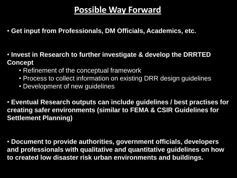
Possible Way Forward
• Get input from Professionals, DM Officials, Academics, etc.
• Invest in Research to further investigate & develop the DRRTED
Concept
• Refinement of the conceptual framework
• Process to collect information on existing DRR design guidelines
• Development of new guidelines
• Eventual Research outputs can include guidelines / best practises for
creating safer environments (similar to FEMA & CSIR Guidelines for
Settlement Planning)
• Document to provide authorities, government officials, developers
and professionals with qualitative and quantitative guidelines on how
to created low disaster risk urban environments and buildings.

Conclusions & Recommendations (1 of 2)
• Aimed to introduce the concept of Disaster Risk Reduction
Though Environmental Design (DRRTED)
• The DRRTED approach, aims to reduce disaster risk in the
urban or built environment by making use of the suggested
„tools of influence‟ and „zones of influence‟
• Tools & Zones can be used to influence the hazard,
vulnerability and capacity components that contribute to
disaster risk levels.
• DRRTED approach proposes to use a comprehensive
approach, and to consider all the factors that might lead to a
high disaster risk level in a community, by focusing on hazards,
but also vulnerability and capacity.
Conclusions & Recommendations (2 of 2)
• The DRRTED approach also aims to collect different existing guidelines
into a single framework / comprehensive planning approach.
• It is therefore recommended that additional research into DRRTED is
funded by a suitable organization (such as the UN, NDMC?) to enable
researchers to further investigate and refine the DRRTED concept.
• Results of this research might establishment set of guidelines for design
professionals to reduce disaster risk in South Africa.
• Additional research into DRRTED will require inputs from various experts
including, amongst others, engineers, architects, urban planners, and social
scientists.
• The DRRTED should, also, not just remain theory, but must lead to
practical solutions that can be implemented, while taking into account the
various challenges, in the South African and Southern African context.

Remarks, Questions & Comments
Theuns van der Linde
Pretoria, South Africa
Email: [email protected] or [email protected]
Tel: 012 361 9821
The fear of the LORD is the beginning of wisdom, and the knowledge of the Holy One is understanding.
Proverbs 9:10