Imagin presentation
18
Current Tools for Asset Collection and Inspection IMAGIN Annual Conference June 7-9, 2015
-
Upload
timothy-michael -
Category
Documents
-
view
36 -
download
5
Transcript of Imagin presentation

Current Tools for Asset
Collection and Inspection
IMAGIN Annual Conference
June 7-9, 2015

Current Tools for Asset
Collection and Inspection• Data Collection and Inspections
• Accessing Collected Data• Monitoring
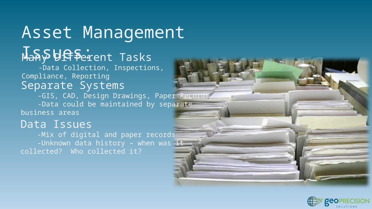
Asset Management Issues:Many Different Tasks -Data Collection, Inspections, Compliance, Reporting
Separate Systems -GIS, CAD, Design Drawings, Paper Records -Data could be maintained by separate business areas
Data Issues -Mix of digital and paper records -Unknown data history – when was it collected? Who collected it?

Solutions
• Common Data• Common Interfaces• Common Tools

Data Collection: Trimble Unity• Apps for data collection and inspection• Supports high accuracy data collection• Hosted solution – access anywhere• Uses Esri’s Local Government
Information Model

Demo: Data Collection with Trimble Unity

Review: Data Collection with Trimble Unity• Dispatch data collection work order from web• Synchronize work orders to Trimble GPS
devices• Collect data and synchronize changes• Review new features from web

Infrastructure Inspections: Trimble Unity• Assess the health and condition of assets and
infrastructure• Proactive vs reactive activities --> discover
potential issues Before a failure occurs• Maintain on-going history of asset condition

Demo: Asset Inspections with Trimble Unity

Review: Data Collection and Inspection• Work order-driven workflows to create, assign,
and complete work• High accuracy data collection with Trimble
GPS, low(er) accuracy with consumer devices• Common interface between field and office
devices

Activity Monitoring
• Allow managers and supervisors to monitor activities and progress
• View progress and receive alerts when certain conditions are met

ArcGIS Online and Operations Dashboard• ArcGIS Online – a collaborative, cloud-based
platform for creating, sharing, and using data, maps, and applications
• Operations Dashboard – application included with ArcGIS Online that provides a common operating picture for monitoring, tracking, and reporting events

Trimble Unity and ArcGIS OnlineWorking Together

Demo: ArcGIS Online and Operations Dashboard

Review: ArcGIS Online and OperationsDashboard • Access data from Trimble Unity within ArcGIS
Online• Use Unity data to create web maps• Use ArcGIS Online functionality to customize
web maps – scale range, visibility, pop-up configuration, etc.
• Create operational views with Operations Dashboard for ArcGIS
• Use widgets in Operations Dashboard to view data attributes, metrics, etc.

Summary
Board of DirectorsOperations Managers
ArcGIS OnlineOperations Dashboard for ArcGIS
Department SupervisorsField PersonnelTrimble Unity
Information TechnologyGIS Analysts & Managers
ArcGIS for DesktopArcGIS Online Administration

Summary• Common Tools• Trimble Unity• ArcGIS Online
• Common Data• Data from data collection and inspection activities
stored in single database
• Advanced Functionality• High accuracy data collection• Field-to-Office data synchronization• Dashboards and monitoring

Doug KotnikMGIS Sales and Support
[email protected]://www.linkedin.com/
pub/doug-kotnik/29/bb8/754
Timothy MichaelDirector of Solutions and
linkedin.com/in/timothyjmichael
Questions?