Image Indexing for Nearshore Restoration Morgan McKenzie and Dan Allen Geog 469.
13
Image Indexing for Nearshore Restoration Morgan McKenzie and Dan Allen Geog 469
-
date post
19-Dec-2015 -
Category
Documents
-
view
215 -
download
0
Transcript of Image Indexing for Nearshore Restoration Morgan McKenzie and Dan Allen Geog 469.
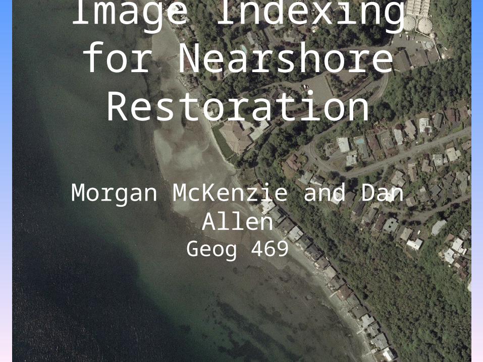
Image Indexing for Nearshore Restoration
Morgan McKenzie and Dan Allen
Geog 469
Project Goals
• Create an Image Data Index Model • For nearshore restoration ecologists– Provide search tool for research time
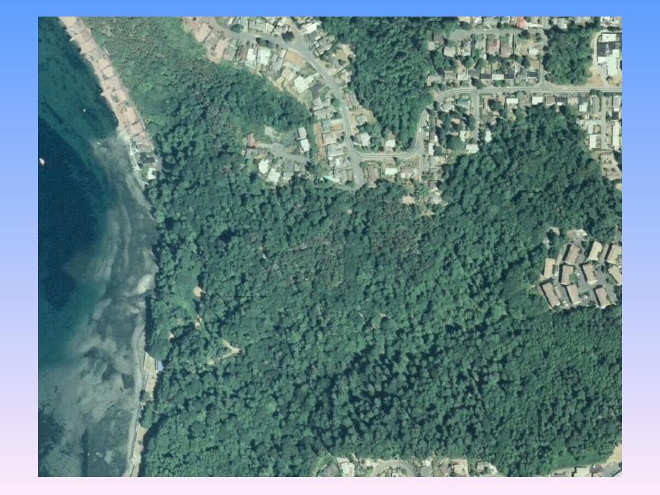
saving– Images show important landscape
attributes: shore forms, watersheds, vegetation, structures, etc
– Index provides way to find scientific research question desired attributes

Background
• Puget Sound Nearshore Restoration Project, Research group
• Client: Miles Logsdon, Restoration Ecologist– Also Matt Parsons of UW Libraries and WAGDA
• Implement restoration projects and monitor their success/failures to improve
• Examples of restoration projects: – Remove bulkheads, plant overhanging vegetation
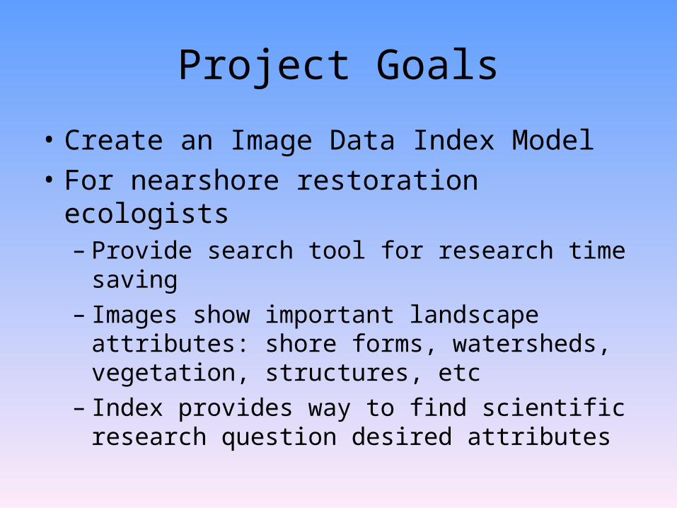
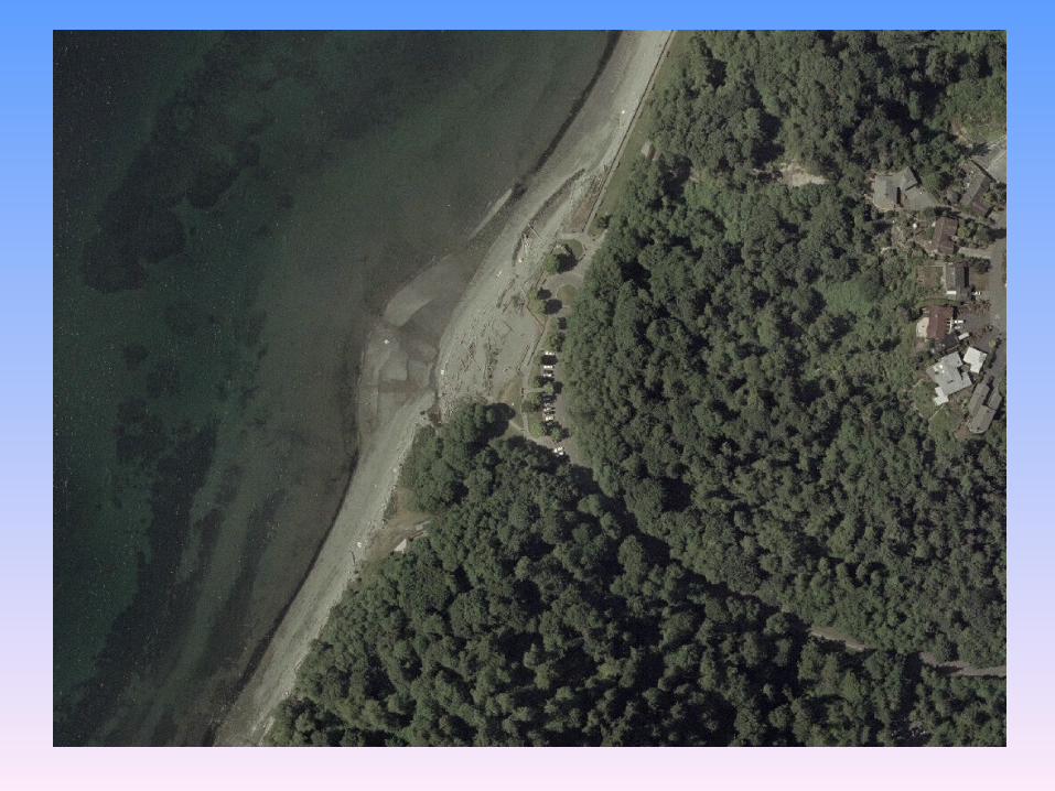
Index of Images for Restoration
• See potential areas of restoration• Monitor areas with implemented
restoration project• Potential Scientific Research
Questions include:–How much vegetation?– Depositional or erosional shoreline?– Shoreline before/after a structure
removal?– Shoreline before/after an event?

Data Process Diagram
Download image from
WAGDA
Process images
(manually or with image processing software)
Analyze Attributes (such as %
overhanging veg, aquatic, veg, shorline length, etc)
Data Entry
For PSNRP analyze
geomorphic objects, woody
debris, % of beach armored


Project Results
• Created a image data index model database
• Discovered which attributes were important and why
• Made database searchable by attributes

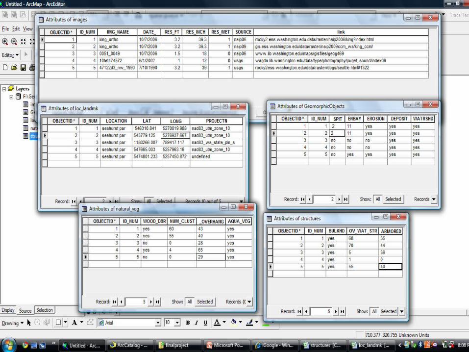
Image Database
Image database
ID#NameDate
ResolutionSource
ID#Bulkhead
Over water
structure%Armored
ID#Woody Debris# of Clusters
% overhanging Vegetation
Aquatic vegetation
ID#LocationLatitude
LongitudeProjection
ID#Spit
EmbaymentErosion
DepositsWatershed
ID#Beach Length
IMAGE Structures Vegetation
Bch LengthGeomorphicObjects
Location
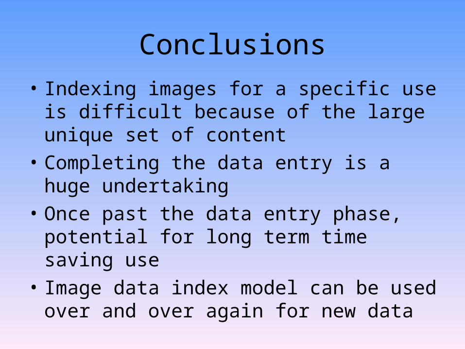
Conclusions• Indexing images for a specific use is
difficult because of the large unique set of content
• Completing the data entry is a huge undertaking
• Once past the data entry phase, potential for long term time saving use
• Image data index model can be used over and over again for new data