How to Use Land & Survey Spatial Information (LASSI) to ... · How to Use Land & Survey Spatial...
4
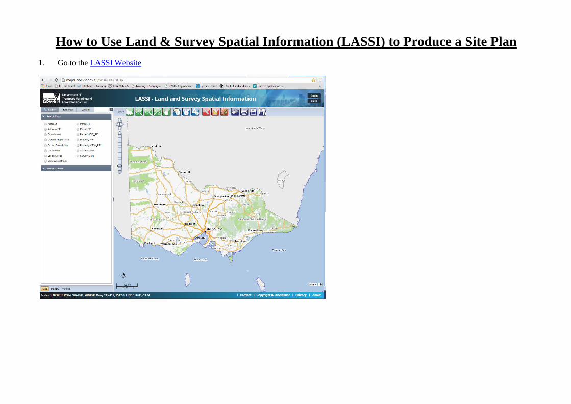
How to Use Land & Survey Spatial Information (LASSI) to Produce a Site Plan 1. Go to the LASSI Website
Transcript of How to Use Land & Survey Spatial Information (LASSI) to ... · How to Use Land & Survey Spatial...
How to Use Land & Survey Spatial Information (LASSI) to Produce a Site Plan
1. Go to the LASSI Website
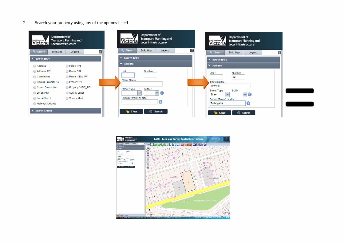
2. Search your property using any of the options listed
=
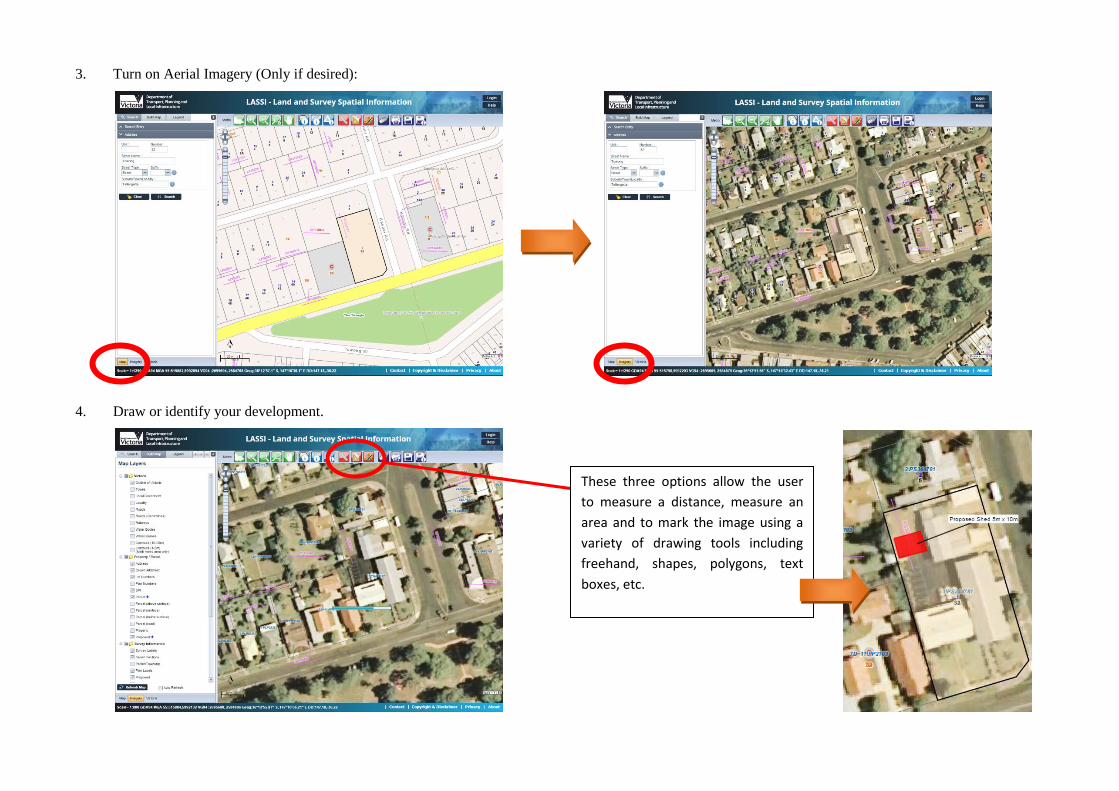
3. Turn on Aerial Imagery (Only if desired):
4. Draw or identify your development.
These three options allow the user
to measure a distance, measure an
area and to mark the image using a
variety of drawing tools including
freehand, shapes, polygons, text
boxes, etc.
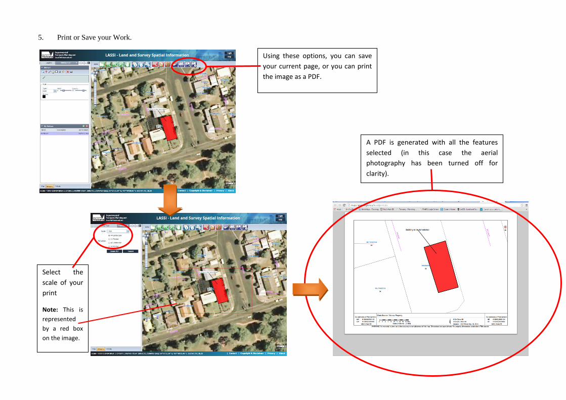
5. Print or Save your Work.
Using these options, you can save
your current page, or you can print
the image as a PDF.
Select the
scale of your
Note: This is
represented
by a red box
on the image.
A PDF is generated with all the features
selected (in this case the aerial
photography has been turned off for
clarity).

![Amul Lassi 2007[1]](https://static.fdocuments.us/doc/165x107/544bb22fb1af9f74678b4ea6/amul-lassi-20071-558448360c443.jpg)