Hagan-Lafitte Drainage Upgrades and Green Infrastructure ...
32
Hagan-Lafitte Drainage Upgrades and Green Infrastructure Project Design Review Committee June 30 th , 2016
Transcript of Hagan-Lafitte Drainage Upgrades and Green Infrastructure ...
Hagan-Lafitte Drainage Upgrades and Green Infrastructure Project
Design Review Committee June 30th, 2016
Presentation Agenda
• Project Overview • Grey Infrastructure • Green Infrastructure (GI) • Easton Park Underground Detention • Results • Questions

Project Overview
Project Background • Purpose – reduce flooding in Hagan-Lafitte
neighborhood during 10-year 24-hour rainfall event • HMGP funded $5.355 Million for construction
Project Status
• 10% submitted October 5, 2015 • 30% design documents submitted Jan 15, 2016 • BCA – 1.67 • Survey field work completed
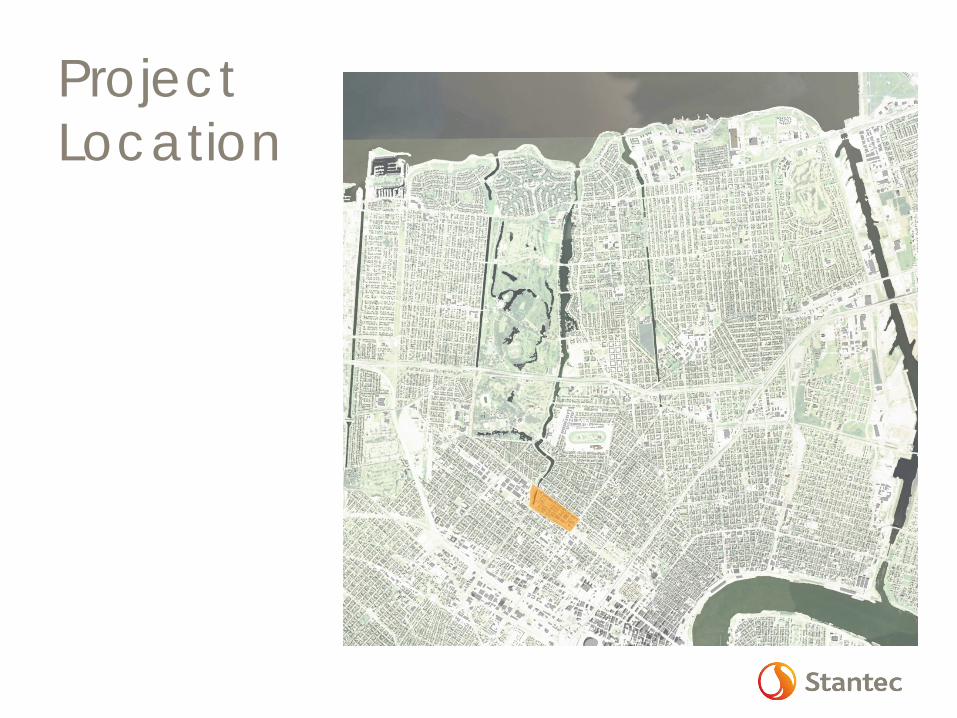
Project Location
Add overall city map and then zoomed in map
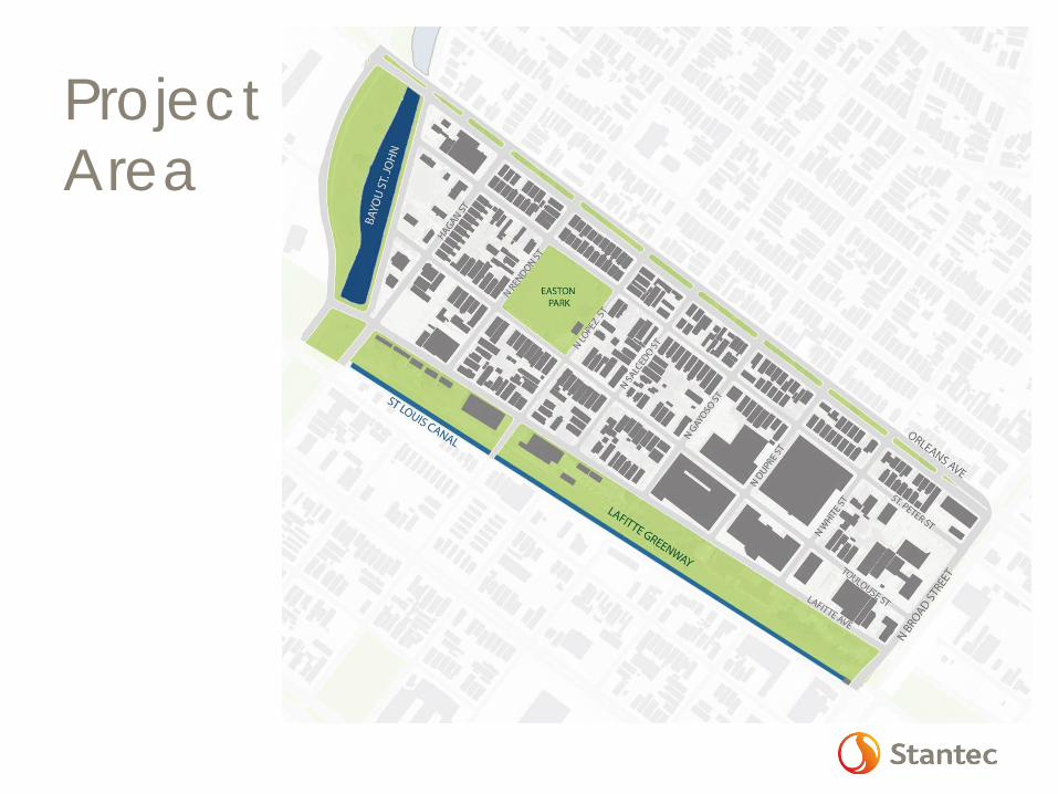
Project Area
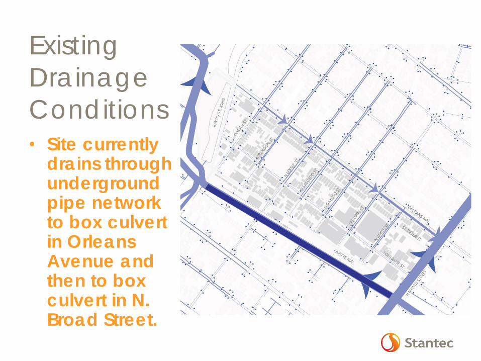
Existing Drainage Conditions • Site currently
drains through underground pipe network to box culvert in Orleans Avenue and then to box culvert in N. Broad Street.
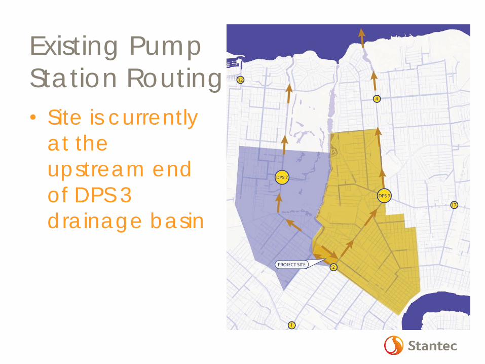
Existing Pump Station Routing • Site is currently
at the upstream end of DPS 3 drainage basin

Project Goals – Increase Neighborhood Resiliency • Increase capacity of collection system • Redirect storm flow away from Orleans Ave.
and toward St. Louis Canal • Increase capacity of final outfalls into Canal • Utilize GI to slow, retain, and absorb storm
water • Increase pervious area and connection with
groundwater with grid system to address subsidence / roadway settlement
• Introduce strategic on-site storage to reduce peak discharge and add storage volume.
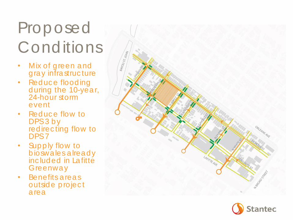
Proposed Conditions • Mix of green and
gray infrastructure • Reduce flooding
during the 10-year, 24-hour storm event
• Reduce flow to DPS 3 by redirecting flow to DPS 7
• Supply flow to bioswales already included in Lafitte Greenway
• Benefits areas outside project area
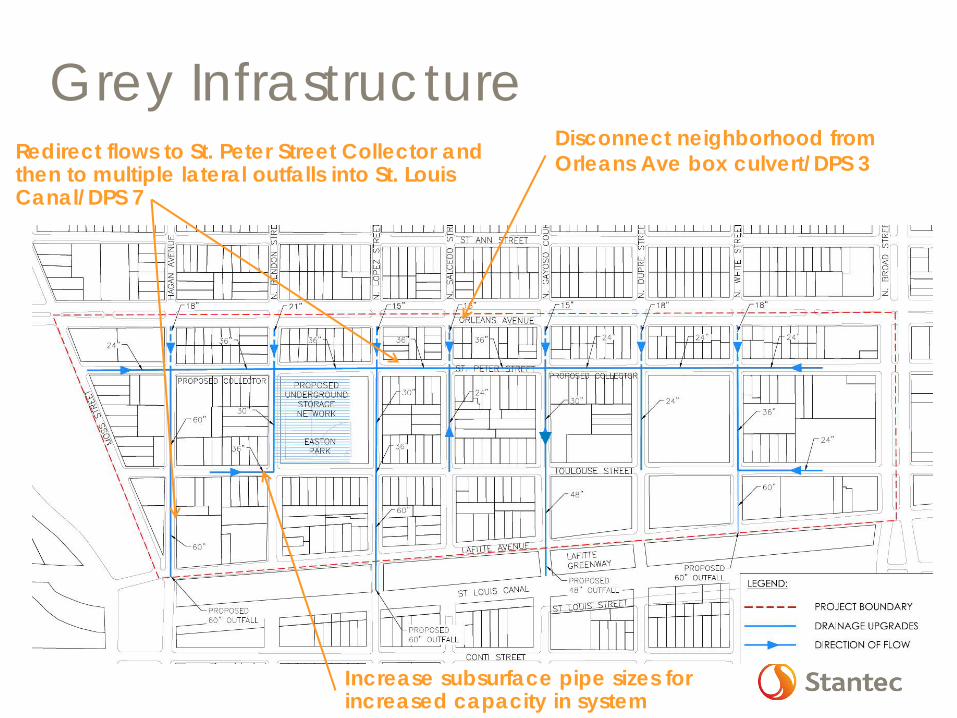
Grey Infrastructure Disconnect neighborhood from Orleans Ave box culvert/DPS 3 Redirect flows to St. Peter Street Collector and
then to multiple lateral outfalls into St. Louis Canal/DPS 7
Increase subsurface pipe sizes for increased capacity in system
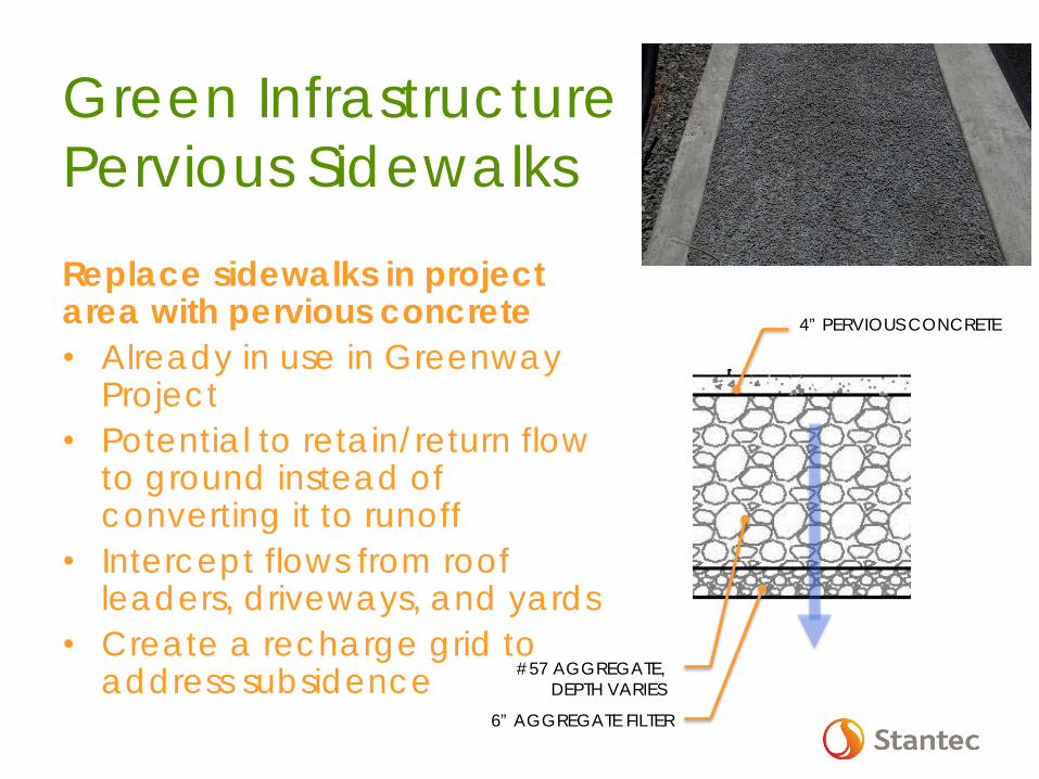
Green Infrastructure Pervious Sidewalks
Replace sidewalks in project area with pervious concrete • Already in use in Greenway
Project • Potential to retain/return flow
to ground instead of converting it to runoff
• Intercept flows from roof leaders, driveways, and yards
• Create a recharge grid to address subsidence 6” AGGREGATE FILTER
#57 AGGREGATE, DEPTH VARIES
4” PERVIOUS CONCRETE
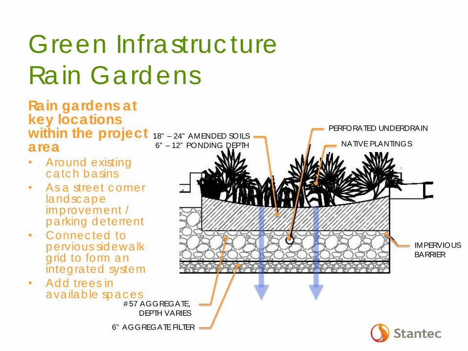
Green Infrastructure Rain Gardens Rain gardens at key locations within the project area • Around existing
catch basins • As a street corner
landscape improvement / parking deterrent
• Connected to pervious sidewalk grid to form an integrated system
• Add trees in available spaces
#57 AGGREGATE, DEPTH VARIES
6” AGGREGATE FILTER
NATIVE PLANTINGS
PERFORATED UNDERDRAIN
IMPERVIOUS BARRIER
18” – 24” AMENDED SOILS 6” – 12” PONDING DEPTH

• Performance • Evapotranspiration • Complex root
systems to aid infiltration
• Maintenance • Tolerant of standing
water & drought • Shade out weeds
• Public Acceptance • Not messy or reedy • Ideally flowering
GI – Plant List
Boxwood
Butterfly Iris
Agapanthus
Dwarf Palmetto
Bald Cypress
Lantana
Stokes’ aster
Sweet Bay Magnolia
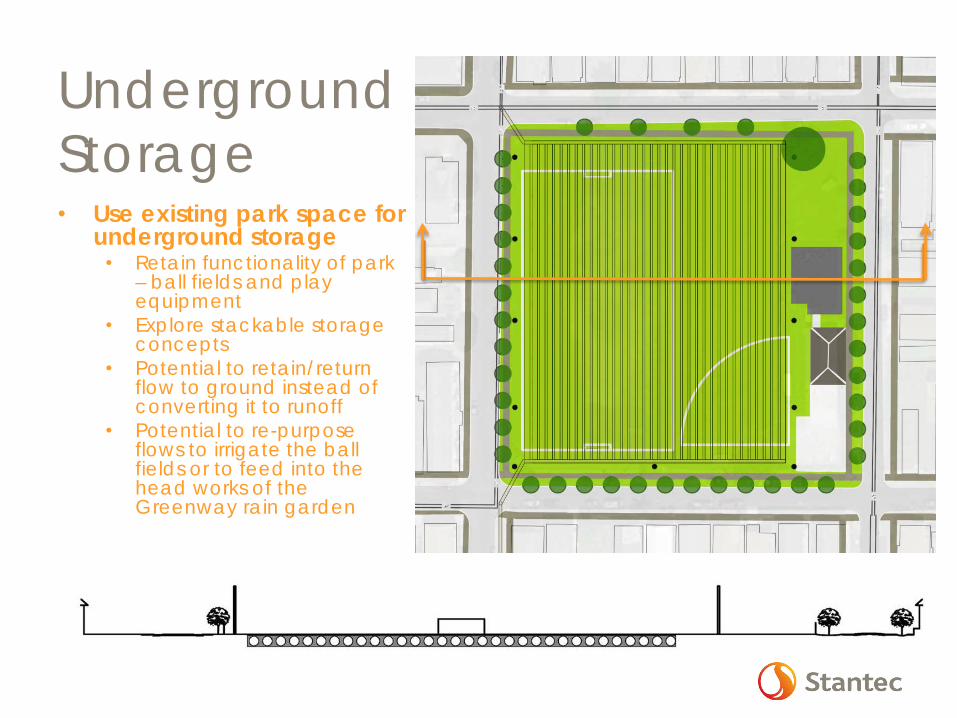
Underground Storage • Use existing park space for
underground storage • Retain functionality of park
– ball fields and play equipment
• Explore stackable storage concepts
• Potential to retain/return flow to ground instead of converting it to runoff
• Potential to re-purpose flows to irrigate the ball fields or to feed into the head works of the Greenway rain garden

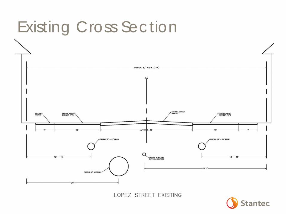
Existing Cross Section
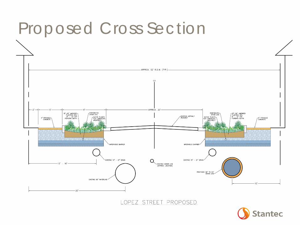
Proposed Cross Section

Existing Cross Section
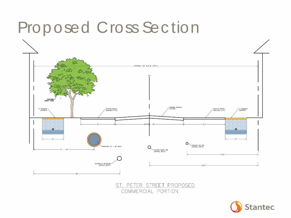
Proposed Cross Section

Hydraulic Results
Project Site Area – 32.9 Acres
2 Year / 24 Hour Storm Event – 6.0” • Volume 5.35 MG
10 Year / 24 Hour Storm Event -9.2” • Volume 8.21 MG
Proposed solution provides 1.0 MG Additional Storage

Existing Flood Map – 2 year
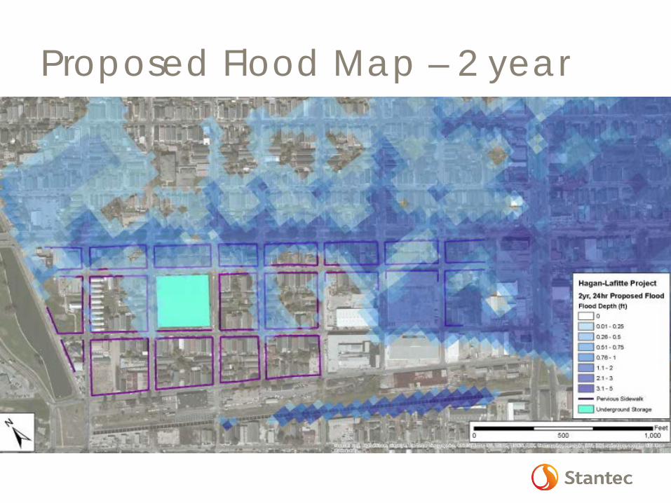
Proposed Flood Map – 2 year
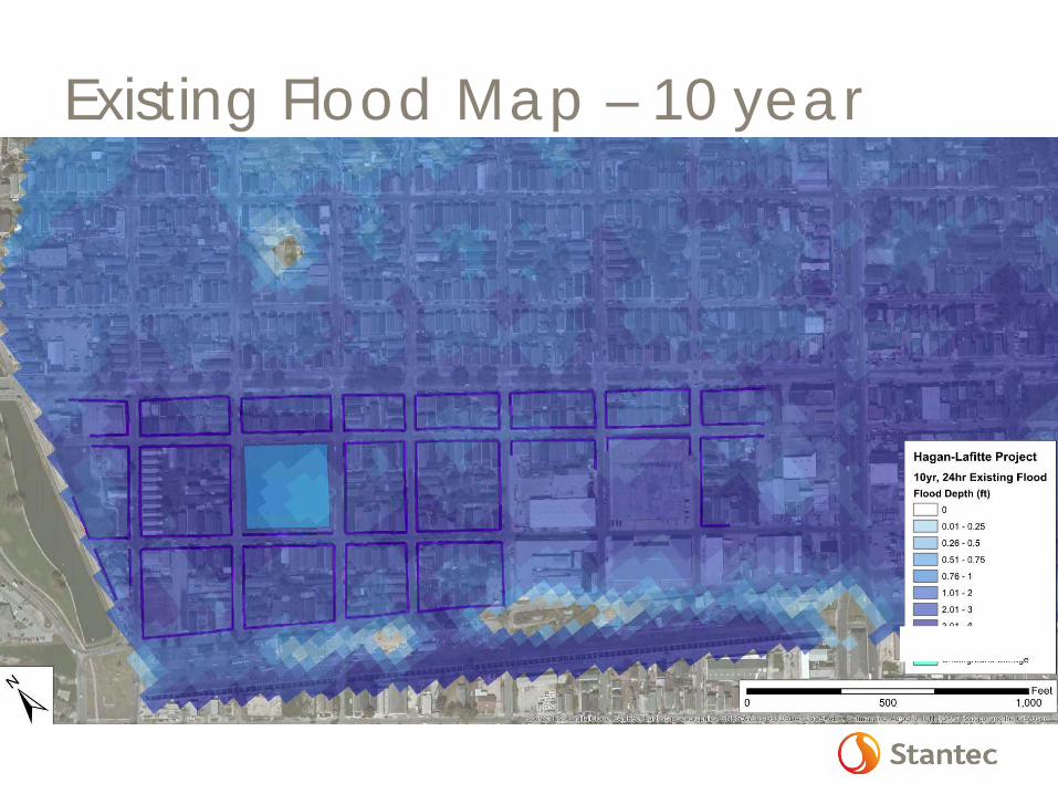
Existing Flood Map – 10 year
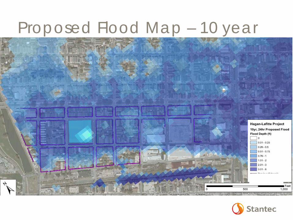
Proposed Flood Map – 10 year
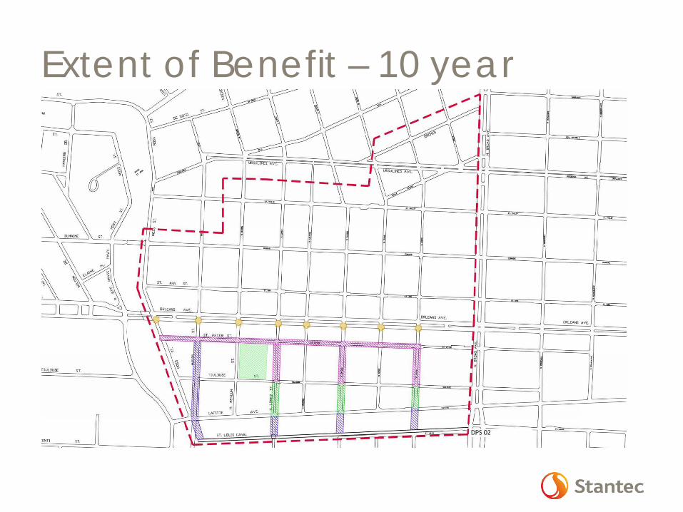
Extent of Benefit – 10 year
Community Benefits
• Neighborhood beautification • Opportunities for education and outreach • Reduced heat-island effect • Improved infrastructure • Reduced flooding, both elevation and
duration • Improved quality of life • Model for GI improvements that can be
replicated as funds become available
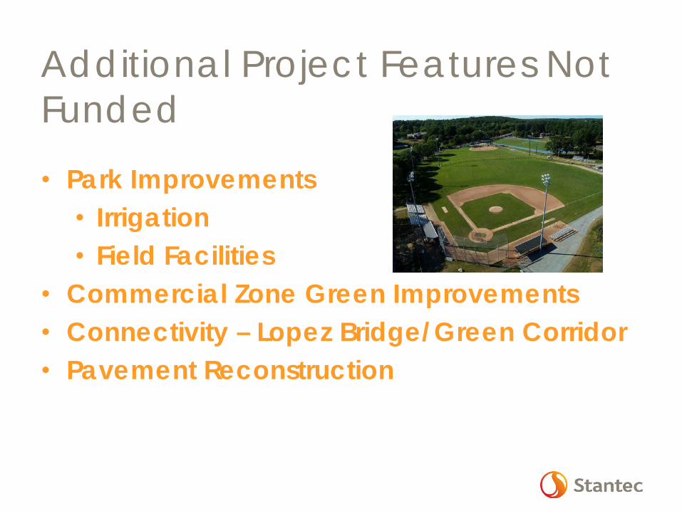
Additional Project Features Not Funded
• Park Improvements • Irrigation • Field Facilities
• Commercial Zone Green Improvements • Connectivity – Lopez Bridge/Green Corridor • Pavement Reconstruction
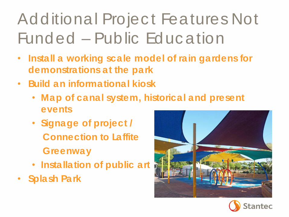
Additional Project Features Not Funded – Public Education • Install a working scale model of rain gardens for
demonstrations at the park • Build an informational kiosk
• Map of canal system, historical and present events
• Signage of project / Connection to Laffite Greenway • Installation of public art
• Splash Park
Project Challenges Budget
• Street patching/overlay requirements Pipe location in cross-section Condition of existing utilities Residential encroachments in ROW Public buy-in Maintain Existing Parking
Next Steps Finalize Survey Geotechnical investigation Coordination with S&WB Modeling and concept refinement Public involvement 60% Submittal Cost Estimating Constructability Reviews

Questions?
Project Manager Dan Grandal, PE, CFM, LEED AP 1615 Poydras Street Suite 850, New Orleans, LA 70112-1241
Phone: (504) 322-3050 Ext. 109 Cell: (305) 332-1379