GOOGLE EARTH & SoilWeb: Applications in Soil Survey...
33
GOOGLE EARTH & SoilWeb: Applications GOOGLE EARTH & SoilWeb: Applications in Soil Survey, Geomorphology VAPSS Profession Meeting, Fall 2013 October 18 - Dr. John Galbraith
Transcript of GOOGLE EARTH & SoilWeb: Applications in Soil Survey...
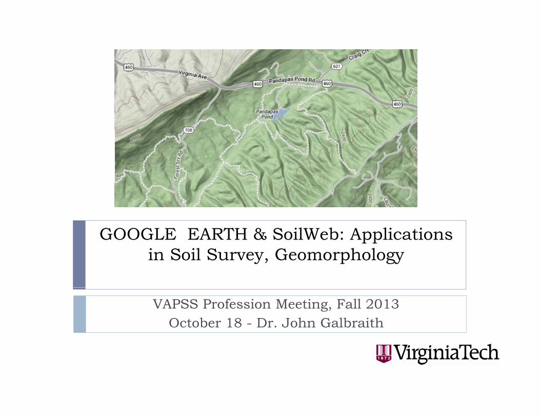
GOOGLE EARTH & SoilWeb: Applications GOOGLE EARTH & SoilWeb: Applications in Soil Survey, Geomorphology
VAPSS Profession Meeting, Fall 2013October 18 - Dr. John Galbraith

Online Sources of Soil Survey DataOnline Sources of Soil Survey Data1. Soil map unit and soil series data – SoilWeb
2. Soil map unit and soil series data with maps –SoilWeb gmap
3. Soil map unit and soil series data in 3D –Google Earth (new Google Maps?) Where Google Earth (new Google Maps?) Where add NWI, SSURGO, gSSURGO?
GIS d GIS lik d A GIS d 4. GIS and GIS-like products – ArcGIS and Google Earth Pro, new Google maps?

http://casoilresource.lawr.ucdavis.edu/soilweb/http://casoilresource.lawr.ucdavis.edu/soilweb/
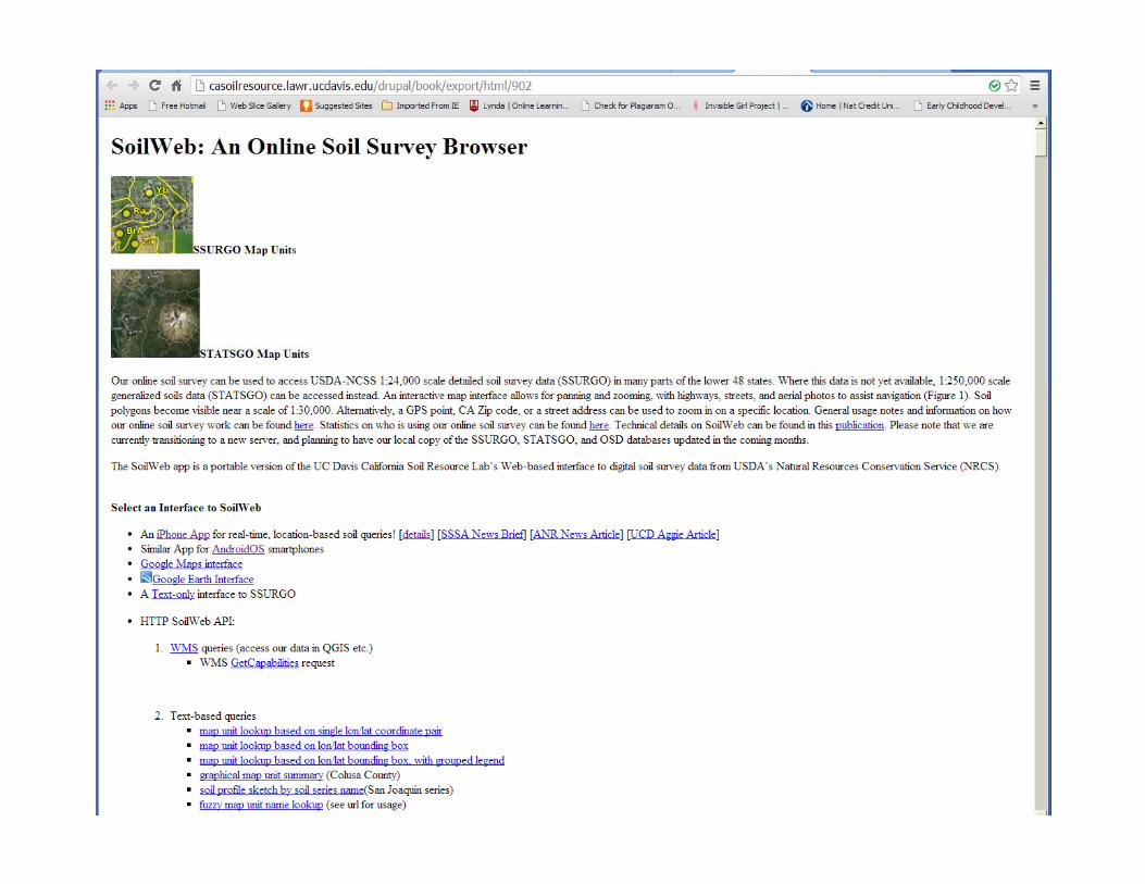
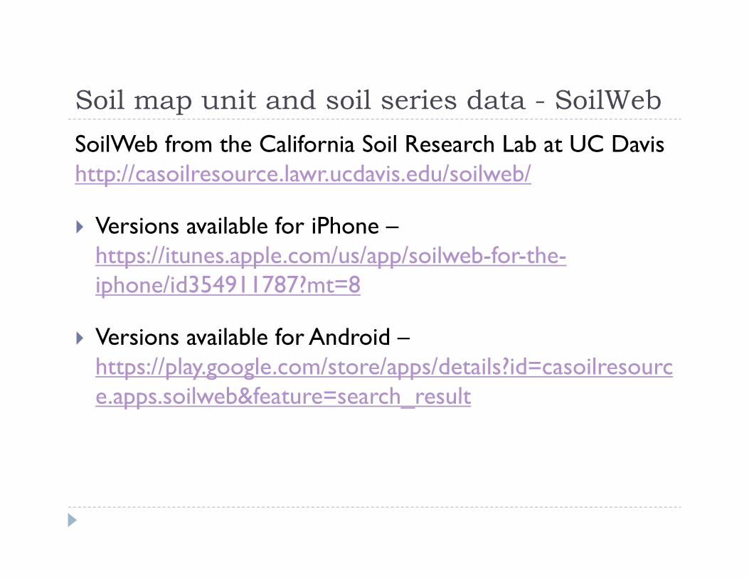
Soil map unit and soil series data - SoilWebSoil map unit and soil series data SoilWebSoilWeb from the California Soil Research Lab at UC Davis http://casoilresource.lawr.ucdavis.edu/soilweb/http://casoilresource.lawr.ucdavis.edu/soilweb/
Versions available for iPhone –https://itunes apple com/us/app/soilweb for thehttps://itunes.apple.com/us/app/soilweb-for-the-iphone/id354911787?mt=8
Versions available for Android –https://play.google.com/store/apps/details?id=casoilresource apps soilweb&feature=search resulte.apps.soilweb&feature=search_result

1. Soil map unit and soil series data –SoilWeb on a SmartPhoneSoilWeb on a SmartPhone
Lets look at this panel
Start by pushing the “Get my Location” button
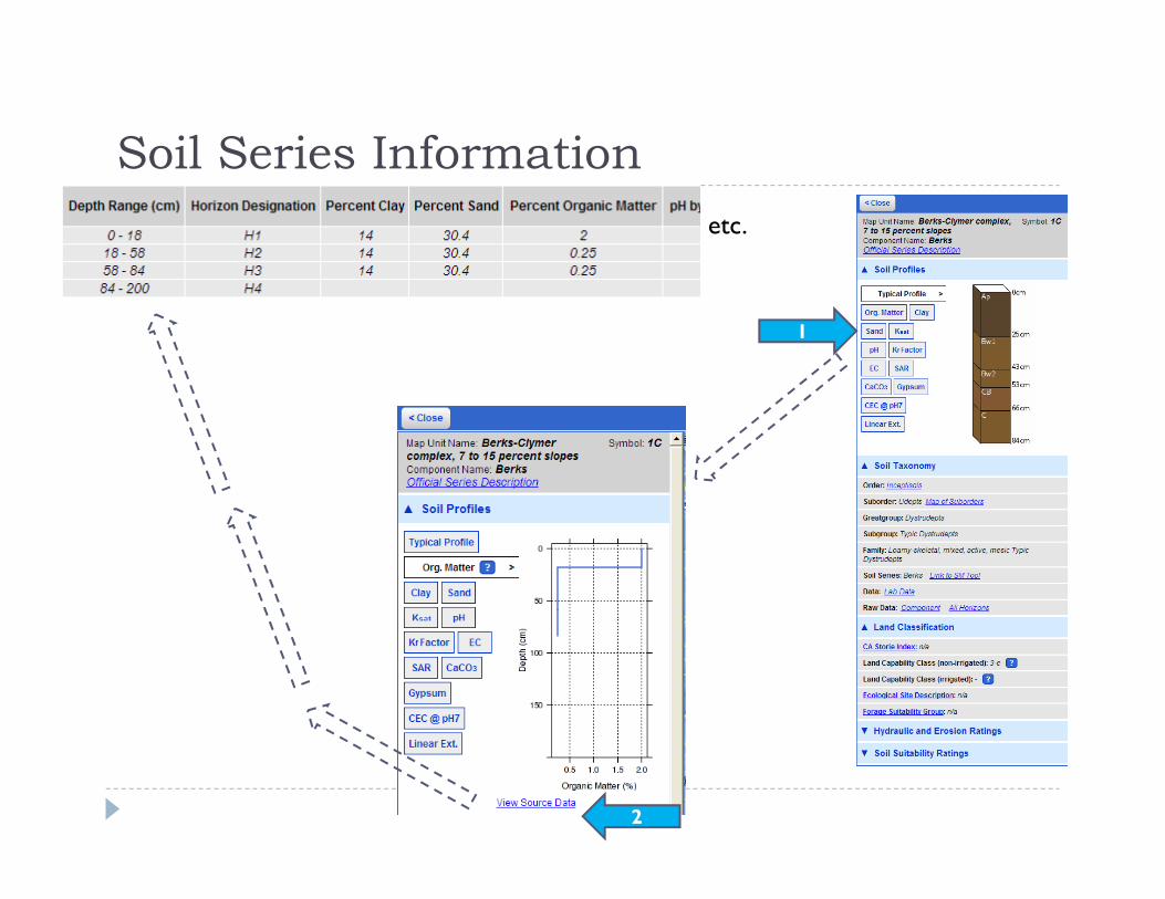
Soil Series InformationSoil Series Informationetc.
1
2
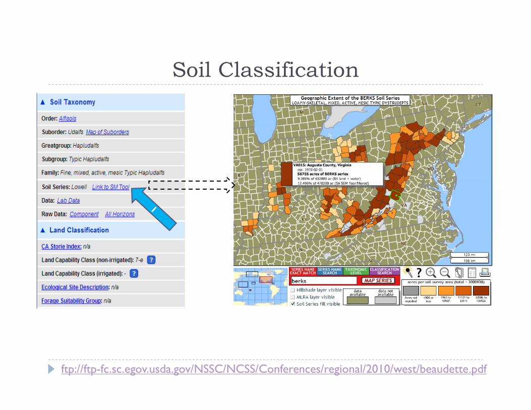
Soil ClassificationSoil Classification
ftp://ftp-fc.sc.egov.usda.gov/NSSC/NCSS/Conferences/regional/2010/west/beaudette.pdf

2. Soil map unit and soil series data with mapshttp://casoilresource.lawr.ucdavis.edu/gmap/http://casoilresource.lawr.ucdavis.edu/gmap/
Recently updated SoilWeb with maps (gmap). Recently updated SoilWeb with maps (gmap).
Overlays SSURGO/STATSGO on simulated 3-D shaded terrain maps through Google Chrome or Firefox terrain maps through Google Chrome or Firefox browsers.
No interpretive maps like Web Soil Survey but quicker to load, easy to use.

SoilWeb on a PC http://...../gmap/SoilWeb on a PC http://...../gmap/

Locating Yourself or the AreaLocating Yourself or the Area

Satellite ViewSatellite View

TerrainTerrain
Now zoom in
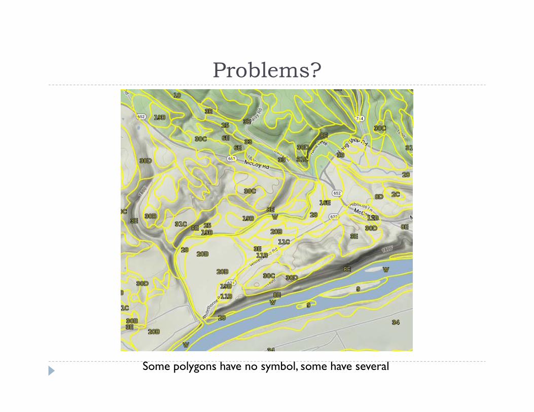
Problems?Problems?
Some polygons have no symbol, some have several
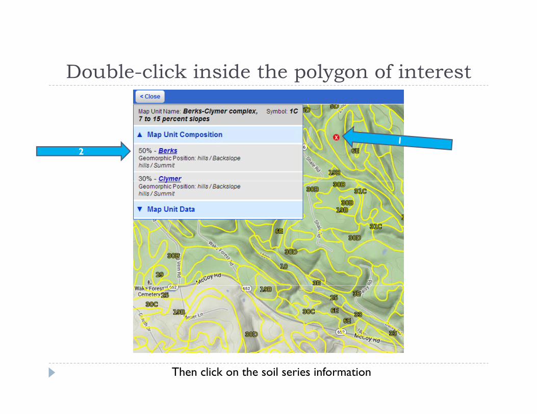
Double-click inside the polygon of interestDouble click inside the polygon of interest
2
Then click on the soil series information

Soil Series InformationSoil Series Informationetc.
1
2
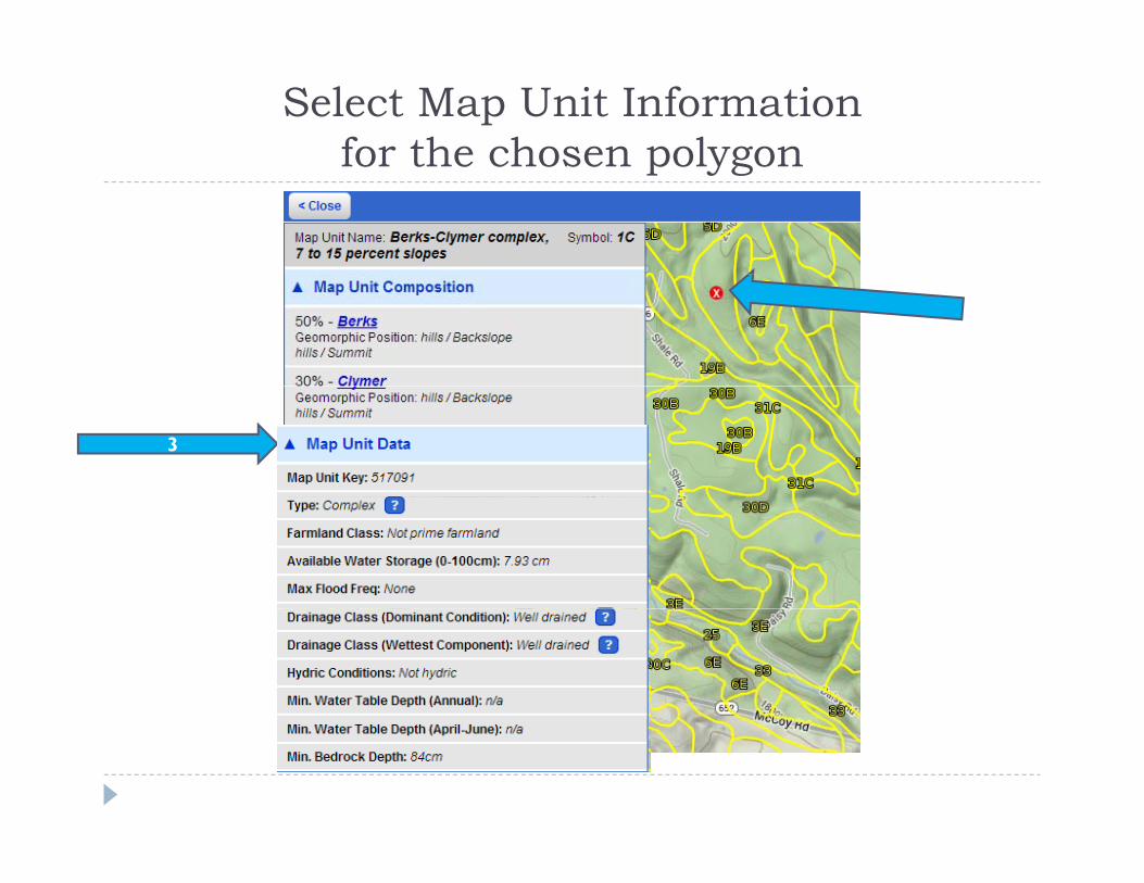
Select Map Unit Information for the chosen polygonfor the chosen polygon
3

Lat and Lon at cursor locationLat and Lon at cursor location
+
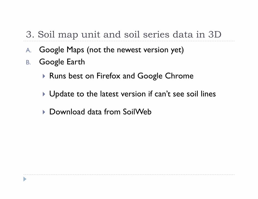
3. Soil map unit and soil series data in 3D3. Soil map unit and soil series data in 3DA. Google Maps (not the newest version yet)B Google Earth B. Google Earth
Runs best on Firefox and Google Chrome
Update to the latest version if can’t see soil lines
Download data from SoilWeb Download data from SoilWeb
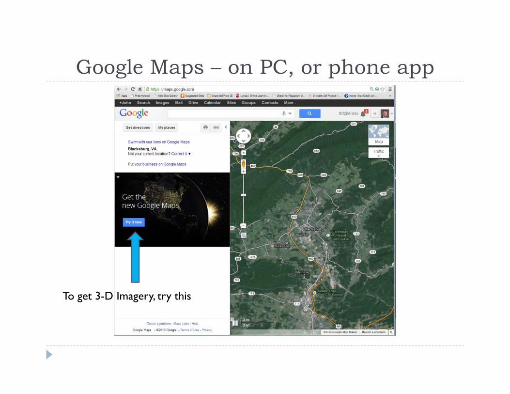
Google Maps – on PC, or phone appGoogle Maps on PC, or phone app
To get 3-D Imagery, try this
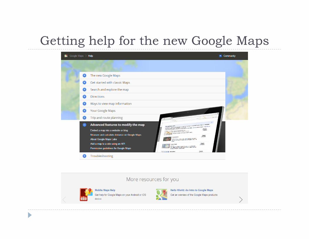
Getting help for the new Google MapsGetting help for the new Google Maps

Classic Map ViewClassic Map View
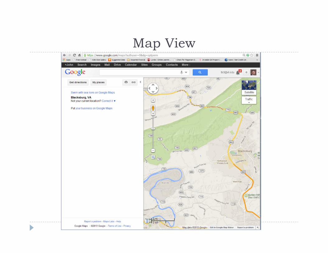
Map ViewMap View
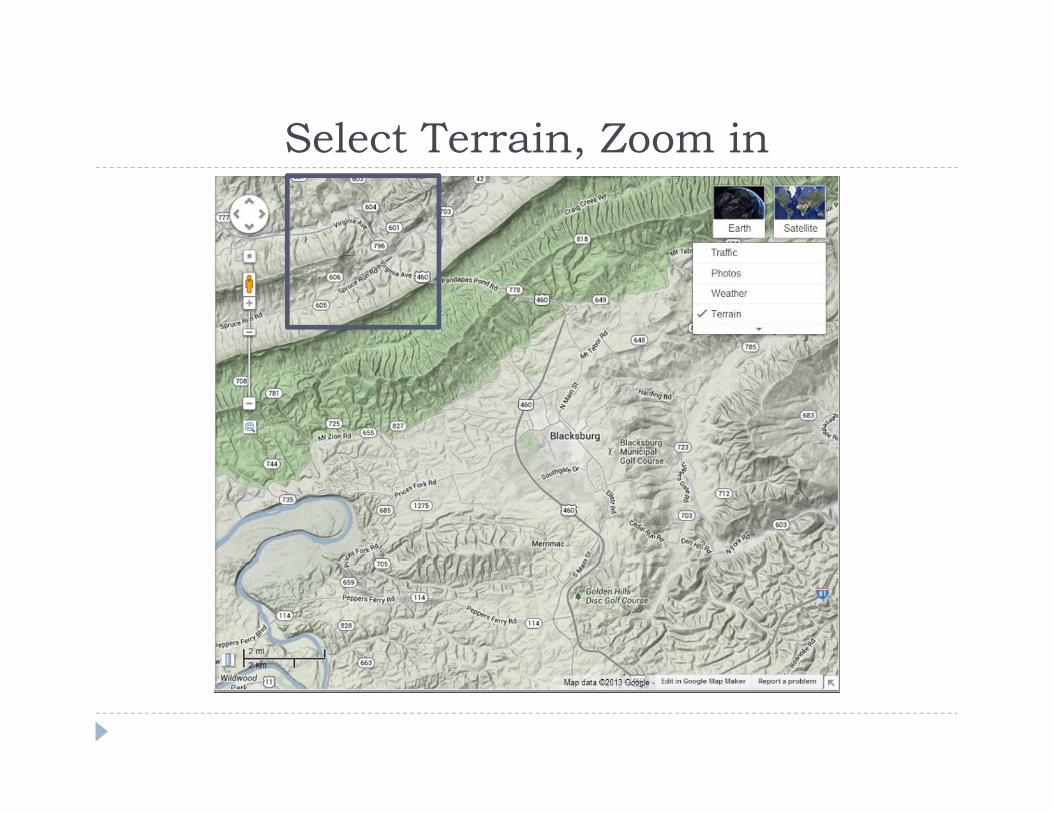
Select Terrain, Zoom inSelect Terrain, Zoom in
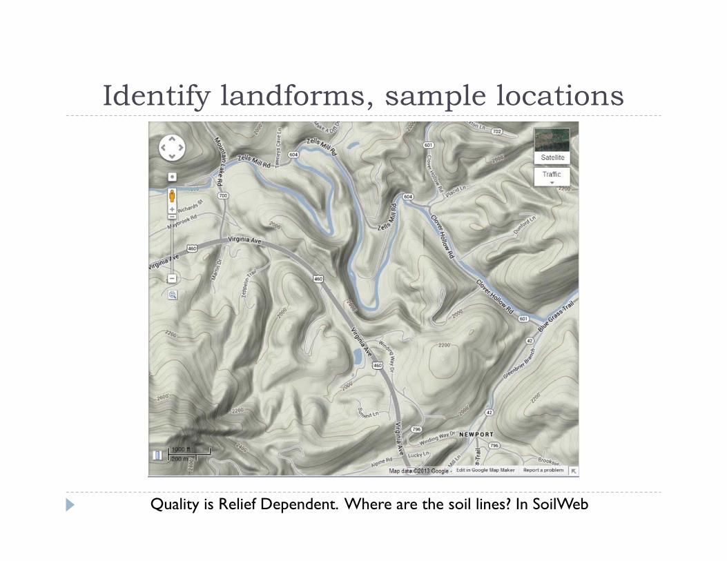
Identify landforms, sample locationsIdentify landforms, sample locations
Quality is Relief Dependent. Where are the soil lines? In SoilWeb

Satellite ViewSatellite View
Now switch to Google Earth View

3-D View in Google Earth – zoom in, around3 D View in Google Earth zoom in, around
Where are the soil lines? In SoilWeb
4. Soil map unit and soil series data in 3D4. Soil map unit and soil series data in 3DGoogle Earth + SoilWeb Runs best on Firefox and Google Chrome Runs best on Firefox and Google Chrome Update to the latest version Download data from SoilWeb at Download data from SoilWeb at
http://casoilresource.lawr.ucdavis.edu/node/538 Download NWI at this site Download NWI at this site
http://www.fws.gov/wetlands/Data/GoogleEarth.html and click on the kmz file and you will then have the option to turn on or off the NWI mapping.
Can draw polygons (on map), can measure distance.

http://casoilresource.lawr.ucdavis.edu/soilweb/http://casoilresource.lawr.ucdavis.edu/soilweb/
Or type in “download soilweb.kzm”

GIS-like products and GIS GIS like products and GIS GIS-like products Google Earth Pro cost $399/yr or a 7 day free trial Google Earth Pro – cost $399/yr, or a 7-day free trial Can overlay topo maps onto Google earth satellite
imagery and make the topo somewhat tranparent.g y p p
Show clips from web site advertp

And of Course, there is always …And of Course, there is always … GIS

Importing Geographic Information Systems (GIS) data in Google Earth (GIS) data in Google Earth
http://www.google.com/earth/outreach/tutorials/importgis.htmlp g g p g
Importing data with GISImporting data with GIS Import the gSSURGO 10-m raster product from
Geospatial Data Gateway (replacement for Soil Data Geospatial Data Gateway (replacement for Soil Data Mart), or
Import the gSSURGO product and hydric soils query, or Import SSURGO or STATSGO vector data using Soil data
Viewer to produce interpretative maps and layers