Google Earth: Improving Accessibility to Soil Survey Data
17
Transcript of Google Earth: Improving Accessibility to Soil Survey Data


“Google Earth lets you fly anywhere to view satellite imagery, maps, terrain, 3D buildings, galaxies in outer space, and the depths of the ocean.” –Google

• Biologists – Wetland delineations, Wildlife habitat, • Humanitarians – Emergency response, Mission trip planning
• Foresters – Monitoring forest fires, Deforestation• Teachers – Visual aid for history, geography, english, etc.
• Travelers and Hikers – Trip routes, places to visit• Urban Planners – Real Estate Agents, Homebuyers, Developers,
Contractors, etc. • Engineers – Historical use of the property, current landuse, where
to install drainage pipes, irrigation lines, etc.• Soil Scientists – Rapid Carbon Project, Updating Soil Survey, Educate
the public about soils • Military – Plan of attacks, escape routes, how to avoid terrain
obstacles, etc.• Hospitals – Epidemiological studies, improve access to hospitals


Tools available to Google Earth Users
• Ruler• Points, Lines, and Polygons• Historical Imagery• Turn on/off different layers (just like ArcMap)• Print/Save/E-mail• View current extent in Google Maps, Get driving directions,
Search for nearby businesses• Record a video• Flight Simulation• Import GPS points, tracks, or routes• Develop and/or Import existing KMZ files to view more
information. Example: Soil KMZ file, Fish and Wildlife Service’s Wetlands and Riparian KMZ file

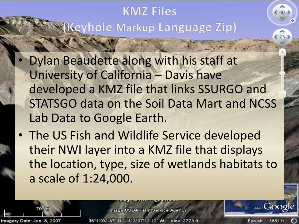
• Dylan Beaudette along with his staff at University of California – Davis have developed a KMZ file that links SSURGO and STATSGO data on the Soil Data Mart and NCSS Lab Data to Google Earth.
• The US Fish and Wildlife Service developed their NWI layer into a KMZ file that displays the location, type, size of wetlands habitats to a scale of 1:24,000.


Bored with Google Earth?How about Google Mars!


Credits
• http://casoilresource.lawr.ucdavis.edu/drupal/
• http://www.google.com/earth/download/ge/agree.html
• http://soildatamart.nrcs.usda.gov/
• http://www.fws.gov/wetlands/Data/GoogleEarth.html