East Route 66
118
East Route 66 Sector Development Plan 2020 Update Adopted by the Bernalillo County Board of County Commissioners August 11, 2020 Resolution No. AR 2020-71
Transcript of East Route 66

East Route 66Sector Development Plan2020 Update
Adopted by the Bernalillo CountyBoard of County CommissionersAugust 11, 2020Resolution No. AR 2020-71
2 East Route 66 Sector Development Plan - 2020 Update
This page is intentionally blank

3
4 East Route 66 Sector Development Plan - 2020 Update

5
AcknowledgmentsThe planning team is especially grateful to the guidance and contributions of Commissioner Charlene Pyskoty, County Planning Commissioner Joelle Hertel, and former County Planning Commissioner Linda Barbour.
Bernalillo County Board of CommissionersLonnie C. Talbert, Chair (District 4)Charlene E. Pyskoty, Vice Chair (District 5)Debbie O’Malley (District 1)Steven Michael Quezada (District 2)James M. Collie (District 3)Joe Noriega, Assistant to Commissioner Pyskoty
County ManagerJulie Morgas Baca, County ManagerEnrico Gradi, Deputy County Manager, Community Services
Division
Bernalillo County Planning CommissionJoe Chavez, Chair (District 2)Bret A. Blanchard, Vice Chair (District 1)Connie Chavez (District 1)Frederick Silva (District 2)Darcy Bushnell (District 3)Ivonne Nelson (District 4)Joelle Hertel (District 5)
Bernalillo County Planning and Development Services DepartmentLucas Tafoya, Interim DirectorCatherine VerEecke, Planning ManagerNick Hamm, Zoning AdministratorMartin Lewis, Technology ManagerDarrell Dady, Neighborhood Coordination Specialist Nathan Hendrix, GIS AnalystElvira Lopez, AICP, Program PlannerBen McIntosh, Impact Fee AdministratorRobert Pierson, Program PlannerMino Savoca, Program Planner, plan update project managerJoyous Valverde, Permit SpecialistKarl Redmon, Intern
Bernalillo County Parks and Recreation DepartmentJohn Barney, Parks & Open Space Planning ManagerMari Simbaña, Open Space SupervisorJames Wolfel, Los Vecinos Community Center Manager
Bernalillo County Economic Development Department Mayling Armijo, DirectorMarcos Gonzales, Assistant DirectorDaniel Beaman, Special Projects CoordinatorKristyn Fox, Economic Development Coordinator

6 East Route 66 Sector Development Plan - 2020 Update
Bernalillo County Public Works DivisionElias Archuleta, Director, Technical Services Department
Development Review SectionKevin Grovet, ManagerBlaine Carter, Engineer
Natural Resource Services SectionDan McGregor, ManagerKali Bronson, Stormwater Program Compliance ManagerMegan Marsee, Water Conservation and Resource ManagerPhillip Rust, County Hydrogeologist
Transportation Planning SectionRichard Meadows, Technical Planning Program ManagerJulie Luna, Transportation Planner
Bernalillo County Communication Services DepartmentTia Bland, Communication Services DirectorTerry Kelly, Web Content EditorTom Thorpe, Communication Services Administrator
Other Bernalillo County StaffRandy Baca, Inventory Control Administrator, General ServicesShaun Peña, Graphic Design Technician, General ServicesJerome “Jey” Starke, Human Resources Training Manager
New Mexico Department of TransportationNancy Perea, PE, Traffic Engineer, District 3Margaret Haynes, PE, Assistant Traffic Engineer, District 3Jim Hirsch, Environmental Analyst, District 4
New Mexico Department of Game and FishMark Watson, Terrestrial Habitat Specialist
Entranosa Water & Wastewater AssociationJack Crider, Chief Executive OfficerLinda Barbour, Board Chair
Village of TijerasJake Bruton, MayorMaxine Wilson, Councilor
The Town of EdgewoodTawnya Mortensen, Planning and ZoningKorrina Christensen, Parks and Recreation
Community ParticipantsDaniel Abram, West Juan Tomas Neighborhood AssociationDebbie Albrycht, Sedillo Road Greater Neighborhood
AssociationChristina Allday-BondyKim Audette

7
Alexis Bachicha, President, East Mountain Regional Chamber of Commerce
Genevieve Barrett, Talking Talons Youth LeadershipTamara Bicknell-Lambadi, The Edgewood IndependentNathanael Brown, Sierra Vista Estates Neighborhood
AssociationPaul Butler, East Mountain CoalitionThomas Campbell, The Edgewood IndependentMary CarsonGayle Castillo, Horseshoe Valley Landowners AssociationDoug Cleghorn, Piñon Ridge Estates Neighborhood AssociationPete Comstock, Piñon Ridge Estates Neighborhood AssociationDan & Brigid Conklin, Ciudad Soil & Water Conservation DistrictManny CrespinDr. David L. GearyLisa Davis, East Mountain Coalition / Sandia Mountain Ranch
AssociationRon DeLashmutt, Relive the Route (RETRO 66)Thomas Dittman, Paa-ko Ridge Communities Homeowners
AssociationDiane Donaghy, West Juan Tomas Neighborhood AssociationDale Dubbert, Sierra Vista West Neighborhood AssociationWill Duff, South Skyland Neighborhood AssociationSarah Duffield, Tablazon Neighborhood AssociationJennifer EdwardsMark Emery, Sandia Knolls Neighborhood AssociationDanis Frombach, Ramble Wood Neighborhood Association
John G. MarrBruce Gaither, Columbine Thompson Neighborhood
AssociationGregg Gardner, Hermosilla Estates Neighborhood AssociationSamette Gilbert, Sandia Mountain Ranch AssociationSteve Glass, Co-Chair, Tijeras Creek Watershed CollaborativeJoe Gober, Wildflower Neighborhood AssociationMoises Gonzales, Cañón de Carnué Land GrantBob Gore, East Mountain Conservative OutreachBrenda Gountis, Thunderbird Lane Neighborhood AssociationChristopher Green Jr., Rancho Verde Home Owners Association,
Inc.Chris Green Sr., Rancho Verde Home Owners Association, Inc.Alissa Hall, Thunderbird Lane Neighborhood AssociationMary Harris, Ventana del Sol Homeowners AssociationNathan Hawkins, Sedillo Self StorageChristopher HaycoxMario Hernandez, Neighbors of Nichols Road Neighborhood
AssociationRoger Holden, Relive the Route (RETRO 66)Rita Jennings, Vista Bonita Neighborhood AssociationDon Johnston, Titus HouseAlice JohnstonAndrew Knight, Forest Park Property Owners Cooperative
AssociationEmily KowalchukAlex Leonard, Nature Pointe

8 East Route 66 Sector Development Plan - 2020 Update
Morey Liebling, Sandia Trailer SalesAndrew Lipman, FHVASean Ludden, Ciudad Soil & Water Conservation DistrictMarie LuscombFrances Lusso, Los Suenos Neighborhood AssociationLynne M. Kramer, Neighbors of Nichols Road Neighborhood
AssociationMike Madden, East Mountain Regional Trails CouncilBetty Martin, Sedillo Road Greater Neighborhood AssociationJennifer Mastripolito, West Juan Tomas Neighborhood
AssociationPriscilla Matlack, Sierra Vista Estates Neighborhood AssociationNathaniel Matter, Ponderosa Ranch Estates Landowners Inc.Kathy McCoy, Sandia Knolls Neighborhood AssociationAnn McDanielDanny Mitchell, Mitchell Associates LLCDomonic Montaño, South Skyland Neighborhood AssociationAugustine MontoyaJames Morgans, West Juan Tomas Neighborhood AssociationBob Morrell, Horseshoe Valley Landowners AssociationBill Nelson, Rancho Verde Home Owners Association, Inc.Betsy Netts, Sedillo Self StorageBev Neville, East Mountain Historical SocietyJodi Newton, Savvy ShooterGary NewtonErin O’Neil, Wildflower Neighborhood AssociationAdrienne Pease, Sabino Canyon Neighborhood Association
Johnny Plath, New Mexico Sign AssociationFred Rael, Sedillo Hill Travel CenterJudith Rauschfuss, Vista Bonita Neighborhood AssociationEve Romero, Heatherland Hills Landowners AssociationEric Russell, Forest Park Property Owners Cooperative
AssociationBob Scofield, Sandia Mountain Lions ClubDavid ShellRuss Showers, Ventana del Sol Homeowners AssociationKris Shryock, Los Sueños Neighborhood AssociationJoshua Smith, Ponderosa Ranch Estates Landowners Inc.Jerret Snodgrass, Ramble Wood Neighborhood AssociationJulia Templin, Tablazon Neighborhood AssociationDenise Tessier, Hermosilla Estates Neighborhood AssociationNick Thompson, Paa-ko Ridge Communities Homeowners
AssociationDanette Townsend, East Mountain SubwayJennifer Trainer Searle, Columbine Thompson Neighborhood
AssociationStephen VerchinskiBeverly Wade, Sierra Vista West Neighborhood AssociationJane Watson, Heatherland Hills Landowners AssociationLinda Winterfeld, Sabino Canyon Neighborhood AssociationZach Withers, Polk’s Folly

9
Table of ContentsAcknowledgments .............................................................5
1. ExecutiveSummary .........................................................131.1 Executive Summary ....................................................14
2. Introduction 172.1 Project Background ....................................................182.2 Project History ............................................................182.3 Regulatory Framework ...............................................192.4 The Planning Process .................................................212.5 Community Contributions ........................................22
2.5.1 Community Contributions in the Original Plan ....................................................22
2.5.2 Community Contributions to the 2020 Update ....................................................23
3. PlanContext 253.1 Route 66 and the Nation ...........................................263.2 Route 66 in New Mexico ..........................................273.3 Route 66 in the East Mountain Corridor ...................28
4. RelevantPlanningDocuments .........................................314.1 Land Use Plans ...........................................................32
4.1.1 Albuquerque/Bernalillo County Comprehensive Plan (Updated 2013) ............32
4.1.2 East Mountain Area Plan (2006) ....................34
4.1.3 East Mountain Trails and Bikeways Master Plan (2004) .........................................36
4.1.4 Parks, Recreation & Open Space Facilities Master Plan 2015-2030 ....................38
4.2 Other Plans and Studies .............................................394.2.1 Historic Route 66 National Scenic Byway
Corridor Management Plan (2009) .................394.2.2 Salt Missions Trail Scenic Byway Corridor
Management Plan (Update 2012) ..................404.2.3 Interstate 40 Location Study - Sedillo to Moriarty
[NMDOT Project Number IM-040-3(191)181, CN CF834] (April 2010) .........................................42
4.2.4 Determining Wildlife-Vehicle Collision Mitigation Effectiveness Quarterly Report (September 2019) ...........................................43
5. ExistingConditions ..........................................................455.1 Current Characteristics of NM 333 in Plan Area ........465.2 Corridor Segments .....................................................47
5.2.1 Zuzax ................................................................485.2.2 Scenic Vista ......................................................505.2.3 Sedillo Hill ........................................................525.2.4 Mountain Valley ..............................................54
5.3 Zoning and Land Use in the Plan Area .......................565.3.1 Zoning in the Plan Area ...................................565.3.2 Land Use in the Plan Area ...............................58
5.4 Topography by segment .............................................59

10 East Route 66 Sector Development Plan - 2020 Update
5.5 Special Use Permits ....................................................605.6 Groundwater Assessment Summary .........................635.7 Economic Development ............................................635.8 Cultural and Historical Sites .......................................65
6. DevelopmentReviewConsiderations ..............................676.1 Development Review Considerations .......................686.2 Transportation Network and Access Management ...686.3 Drainage and Floodplain Management ....................73
6.3.1 Grading and Drainage Requirements for Development ...................................................73
6.3.2 Flood Zones .....................................................746.4 Water and Wastewater ..............................................766.5 Entranosa Water and Wastewater Association .........76
7. SectorDevelopmentZoning ............................................797.1 Introduction ...............................................................807.2 The Zoning Change Process .......................................807.3 Special Use Permits ....................................................817.4 Non-Conforming Uses ................................................817.5 The Sector Development Zone (SD-E66-CC) .............82
8. DesignStandardsandConsiderations .............................878.1 About These Standards ..............................................888.2 Site Design and Layout ...............................................888.3 Landscaping and Buffer Landscaping.........................898.4 Architecture ...............................................................908.5 Signs ...........................................................................92
8.6 Walls, Fences and Open Storage ...............................928.7 Lighting .......................................................................938.8 Utilities and Mechanical Equipment ..........................938.9 Other Design Considerations .....................................93
9. Appendices 959.1 References and Resources .........................................969.2 Sign Examples .............................................................989.3 Examples of Metal Building Facade Treatments ........999.4 Examples of Architectural Design in New Mexico .....1029.5 List of Low Water Use Plants .....................................1049.6 Groundwater Assessment Summary .........................105
9.6.1 Groundwater in the East Mountains ...............1059.6.2 Aquifers and Aquifer Chemistry ......................1059.6.3 Abo-Yeso Sandstone/Mudstone Aquifer: ........1069.6.4 Madera Limestone Aquifer: ............................1069.6.5 Tijeras Canyon Groundwater Area
(Route 66 Corridor only): ................................1069.6.6 Estancia Basin Groundwater Area
(Route 66 Corridor only): ................................1079.7 FEMA Guidance on Unmapped Areas on
Flood Hazard Maps ....................................................1079.7.1 Background ......................................................1079.7.2 Understanding Zone D ....................................108
9.8 List of Changes to the Document ..............................1099.9 Survey Results ............................................................111

11
List of FiguresFigure1. Plansegments .....................................................15
Figure2. MuraloutsideShelby’sAutoService ...................18
Figure3. Mapoforiginalplanboundariesshowing specialusepermits ..............................................19
Figure4. Publicmeetingsfromtheoriginalplan ................22
Figure5. CountystaffspeakatthepublickickoffonDecember12,2019 .............................................23
Figure6. Route66fromChicagotoLosAngeles ................26
Figure7. Route66alignmentovertime .............................29
Figure8. Albuquerque/BernalilloCounty ComprehensivePlan(updated2013) ..................32
Figure9. EastMountainAreaPlan .....................................34
Figure10. EastMountainTrails&BikewaysMasterPlan .....36
Figure11. PROSPlan2015-2030 ..........................................38
Figure12. HistoricRoute66NationalScenicByway CorridorManagementPlan .................................39
Figure13. SignidentifyingSaltMissionTrailonNM333intheEastRoute66SectorDevelopmentPlanArea .....40
Figure14. TrailmapfromtheSaltMissionsTrailScenic BywayCorridorManagementPlan ......................41
Figure15. Interstate40LocationStudy ................................42
Figure16. DeterminingWildlife-VehicleCollision MitigationEffectiveness.......................................43
Figure17. Wildlifecrossingsandinfrastructurein TijerasCanyon .....................................................44
Figure18. NM333lookingwesttowardthe SandiaMountains ................................................46
Figure19. Mapofcorridorsegments ..................................47
Figure20. Zuzaxcorridorsegment .......................................49
Figure21. ScenicVistacorridorsegment .............................51
Figure22. SedilloHillcorridorsegment ...............................53
Figure23. MountainValleycorridorsegment ......................55
Figure24. Acreageofzoningcategoriesbysegment ...........57
Figure25. Zoninganalysisinplanarea .................................57
Figure26. Landuseanalysisinplanarea .............................58
Figure27. Numberofparcelswithslopeover 11%bysegment ..................................................59

12 East Route 66 Sector Development Plan - 2020 Update
Figure28. Tableofspecialusesintheplanarea ..................61
Figure29. MapofexistingSpecialUsePermits ....................62
Figure30. NM333isamulti-modal transportationcorridor ........................................68
Figure31. AccessspacingtablefromStateAccessManagementManual(currentedition). .............69
Figure32. Exampleofdrivewayspacingforundeveloped,partially-developed,andfrontageroads .............70
Figure33. MapofaccesspointstoNM333 .........................72
Figure34. FEMAfloodhazardareas .....................................75
Figure35. Existingvegetationremainsonthissiteexceptforthebuildingpads,parkingareas, andaccessroads ..................................................89
Figure36. Thisdrivewayaccessservestwodevelopments ..89
Figure37. Exampleofwaterharvestingtechnique inparkingarea .....................................................90
Figure38. AfranchisethatincorporatesNorthern NewMexicoarchitecturaldesign ........................91
Figure39. Differentrooflines,windows,andanidentifiableentrancewayaddinteresttometalbuildings ......91
Figure40. Vehiclesonthislotarearranged inanorderlyway .................................................92
Figure41. Examplesofacceptablefencingtypes .................93
Figure42. Asolidfenceconcealsthetrashdumpster ..........94
Figure43. Exampleofa“semi-solid”coyotefence screeningatrashdumpster .................................94
Figure44. Signexamples ......................................................98
Figure45. Examplesofmetalbuildingfacadetreatments ...99
Figure46. Examplesofarchitecturaldesign inNewMexico .....................................................102
Figure47. Insurancepremiumcomparisonfor FEMAfloodzones ................................................109

13
1. ExecutiveSummary

14 East Route 66 Sector Development Plan - 2020 Update
1.1 Executive SummaryThe East Route 66 Sector Development Plan (SD-ER66) is a Rank Three Sector Plan, as defined by the County’s Plan Ranking Ordinance (#82-26), and provides zoning and design standards for land bordering an approximately 7.5-mile section of “Old Route 66” (NM 333), between the eastern limits of the Village of Tijeras and the Bernalillo County line. In the Plan area, NM 333 serves as a frontage road for Interstate 40 and is partially developed with a mix of residential, commercial and light industrial land uses.
Ongoing requests and approvals for Special Use Permits to allow various commercial and light-industrial land uses in this area indicated to Bernalillo County officials and staff that the existing residential zoning may no longer be appropriate and should be reconsidered through the sector development planning process, as provided in Section 20.5 of the County Zoning Code.
Property owners, business owners and residents sought to preserve and promote the conservation of special neighborhood characteristics. These stakeholders sought a greater degree of control and coordination of development than that allowed by available zones. Bernalillo County undertook this planning effort to insure the desired mix of uses.
The original plan, adopted in June 2018, focused on a two mile stretch of NM 333, between Dressage Road and the County line. The document created a special zoning category unique to the plan area – SD-E66-CC – to allow certain commercial and light industrial activities that community members deemed to be compatible with the rural and scenic characteristics of the area.
Since the adoption of the original document, the County has seen moderate success; two property owners have surrendered their Special Use Permits after adopting the new zoning, and no property owners have sought new Special Use Permits. The County, prompted by members of the public, has updated the plan and expanded its boundaries west to the limits of the Village of Tijeras to include more existing and potential commercial and industrial development and to more closely reflect the East Route 66 corridor as it is recognized and functions for area residents and businesses.
The multi-year and multi-phase planning process, which involved property owners, business owners, area residents, elected officials and County staff culminated in a document that contains the following elements:
• Land use regulations• Height and area regulations• Landscaping and buffer landscaping regulations• Off-street parking regulations

15Executive Summary
Figure 1. Plan segmentsFor more information about the characteristics of each segment, refer to the chapter “Existing Conditions” on page 45. Note that the “Scenic Vista” segment is ineligible to apply for SD-E66-CC zoning.
0 0.8 1.60.4Miles
Corridor Segments
Planning & Development Services DepartmentGIS Technology Section
This information is for reference only.Bernalillo County assumes no liability for errorsassociated with the use of these data. Users aresolely responsible for confirming data accuracywhen necessary. Source data fromBernalillo County and the City of Albuquerque.For current information visit http://www.bernco.gov/planning/gis.aspx.
LegendSector Plan Segments
ZuzaxScenic VistaSedillo HillMountain Valley
Road InventoryBC Maintained/PavementNot BC MaintainedState Roads
Property LinesCounty Special Use PermitsTijeras Village LimitsCounty Boundary
Bernalillo County Planning & Development Services:East Route 66 Sector Development Plan - 2020 Update
Zuzax
ScenicVista
SedilloHill
MountainValley

16 East Route 66 Sector Development Plan - 2020 Update
In addition, the plan:• Adds further planning detail to an important East
Mountain Area corridor, as recommended in the East Mountain Area Plan.
• Provides property owners additional land use options.• Allows for needed services in this area of the County
while protecting the rural character and natural environment.
• Provides an optional zone category for land within the Plan area that mirrors and expands on County C-1 and C-N zoning and addresses specific area characteristics and needs.
• Contains design standards to help preserve the rural and scenic character while promoting Old Route 66 and local businesses.
• Balances the need to visit commercial sites with safe and efficient traffic flow.
• Encourages improvements that increase safety for all transportation modes (vehicles, bicycles, pedestrians, transit) in the Plan area.
The plan update includes:• An expanded plan area with four segments (see Figure
1)• Revised land use regulations to reflect the varied
character of the expanded corridor and community input
• Updated data and planning guidance to reflect changes in the past two years
• Expanded and clarified development review considerations
• Updated language for drainage and hydrology• New information on economic development and
wildlife management

17
2. Introduction

18 East Route 66 Sector Development Plan - 2020 Update
2.1 Project BackgroundOld Route 66, decommissioned in 1985, has been experiencing a revival as local communities along the route respond to the nostalgia of the past and the potential for tourism in the future. This particular portion of Old Route 66 is the gateway to Bernalillo County from the east, and local residents have stated a desire to take advantage of its commercial potential while still retaining its rural flavor. Ongoing requests and approvals for Special Use Permits to allow various commercial and light-industrial land uses in this area indicated to Bernalillo County officials and staff that the existing residential zoning may no longer be appropriate. The County determined the sector development planning process to be the means by which to support commercial development while preserving the scenic rural character of the area.
2.2 Project HistoryThe process for creating the East Route 66 Sector Development Plan began in April 2013 at a public meeting of property owners, business owners, community residents, Bernalillo County elected officials and staff and a land use consultant.
The impetus for the meeting was a need to align the zoning with the land uses that the community needed and wanted in the area. In addition, the creation of design standards for new
development was considered essential to protect the natural beauty and rural character of the area, protect its status as a National Scenic Byway and to promote tourism along the route.
A driving factor in the plan was the prevalence of Special Use Permits in the area. This Special Use Permit process allows property owners to develop their land in a way that deviates from uses allowed in the underlying zoning, albeit with greater input from the surrounding community members and greater opportunity for enforcement from Bernalillo County staff where
Figure 2. Mural outside Shelby’s Auto ServiceLocal businesses are capitalizing on Route 66 nostalgia

19Introduction
that of this document. It identified a strip of parcels two miles long, on both the north and south sides of NM 333, running from the Bernalillo County line on the east to Dressage Road on the west. The Bernalillo County Commission adopted the plan in June of 2018.
In late 2019, East Mountain residents approached Bernalillo County staff about updating the plan and extending it to include more land. At a public kickoff in December 2019, community members made the case for extending the plan boundaries west to the Village of Tijeras. This total expanded area featured more diversity in terms of development patterns, zoning, and topography, and it also included an additional 11 parcels with Special Use Permits.
This document has a slightly different structure than the original plan. A summary of all changes appears in the Appendix.
2.3 Regulatory FrameworkThe County’s Plan Ranking Ordinance (#84-26) identifies three levels of planning documents. The first, and most general, is the County’s Comprehensive Plan, which is classified as a Rank One Plan and provides general, County-wide goals and policies. The second type of plan, which provides a greater level of detail for a specific yet large geographic area, is defined as a Rank Two Plan. In addition to furthering the goals and policies of a Rank
specific site plans and conditions of approval govern the site. However, this process can be cumbersome and lengthy, and requires substantial County resources to execute and enforce. Residents also recognize the trend away from residential toward commercial uses along most portions of the corridor.
In response to this issue, County staff sought to establish a unique, optional, sector-specific zoning for East Route 66 that would allow many of the existing uses permissively, encouraging property owners to relinquish their Special Use Permits.
The scope of the original East Route 66 plan was narrower than
Figure 3. Map of original plan boundaries showing special use permits

20 East Route 66 Sector Development Plan - 2020 Update
One Plan, Rank Two plans provide methods of goal and policy implementation. The third and most detailed type of plan is a Rank Three Plan. Examples of a Rank Three Plan are a Sector Development Plan, Corridor Plan or Facility Plan. These types of plans provide the most detailed information about a small geographic area or narrowly focused topic. This Plan is a Rank Three Plan.
The purpose of a Sector Development Plan is further described in Section 20.5 of the County’s Zoning Code. According to Section 20.5, a Sector Development Plan is a plan covering a specific portion of the unincorporated area of Bernalillo County that specifies standards for that area’s development. A sector development plan usually establishes zoning regulations for an area that differ from those normally allowed, based on unique neighborhood conditions, including allowable uses, densities, building heights, landscaping requirements, signs, parking or design elements. A sector development plan must be consistent with the policies of the Albuquerque/Bernalillo County Comprehensive Plan and any applicable area plan adopted for the portion of the County affected by the sector development plan.
The East Route 66 Sector Development Plan (SD-ER66) is a Rank Three Sector Plan, as defined by the County’s Plan Ranking Ordinance (#82-26), and provides zoning and design standards for land bordering a section of “Old Route 66” (NM 333), from
the eastern limits of the Village of Tijeras to the County line. NM 333 serves as a frontage road for Interstate 40 in this area and is partially developed with a mix of residential, commercial and light industrial land uses.
The process for plan preparation and adoption, as well as the required elements, of a Sector Development Plan is also outlined in Section 20.5. At a minimum, a Sector Development Plan is required to address the following:
1. Land use regulations2. Height and area regulations3. Landscaping and buffer landscaping regulations4. Off-street parking regulations
According to Section 20.5, the Sector Development or “SD” zone is appropriate where it is applied to an entire neighborhood, a major segment of a neighborhood, or a corridor, and if it is determined that the area proposed for the sector development plan meets at least one of the following criteria:
1. The area is developed such that the requirements of other available zones do not promote the conservation of special neighbored characteristics, which the County desires to preserve; or
2. The area has developed or should develop with a pattern of mixed land uses, which will need careful control and coordination of development at a sub-area scale in order to insure a desirable mixture of uses; or

21Introduction
3. There are factors that substantially impair or arrest the sound growth and economic health and well-being of the area, or the area constitutes an economic or social burden and is a menace to the public health, safety, or welfare in its present condition and use.
Accordingly, the purpose of the East Route 66 Sector Development Plan has been to:
1. Add further planning detail to an important East Mountain Area corridor, as recommended in the East Mountain Area Plan; and
2. Provide property owners additional land use options; and
3. Allow for needed services in this area of the County while protecting the rural character and natural environment; and
4. Develop an optional zone category for land within the Plan area; and
5. Identify requirements from other departments and agencies that will apply as the Plan area develops (such as transportation, drainage and/or open space).
2.4 The Planning ProcessPlanning is a participatory and iterative process that requires, among other activities, consideration of the history, geography and cultural context of a place.
Generally, planning involves the analysis of land uses, economics, infrastructure and social, cultural and historic elements that impact a specified geographical area.
At the beginning of a planning process, planners, residents, landowners, and others identify and discuss broad goals and a vision for the area. This exercise informs all future discussions of a wide range of factors such as preferred land uses and development density, natural resources, property ownership, traffic and roadway design, local history, community amenities and infrastructure needs and capacity.
Planners synthesize all this information and convert it to a planning document for use by local officials, agencies, business owners, landowners and residents to further the community’s goals.
A significant amount of planning has been done, and is continually ongoing, within Bernalillo County and, in particular, within the East Mountain Area. The East Route 66 Sector Development Plan builds on previous plans including the East Mountain Area Plan and the North Highway 14 Sector

22 East Route 66 Sector Development Plan - 2020 Update
Development Plan and further details the residents’ and property owners’ desires and needs for this area of the East Mountains.
2.5 Community Contributions
2.5.1CommunityContributionsintheOriginalPlanThe process for creating the East Route 66 Sector Development Plan began in April 2013 at a public meeting of property owners, business owners, community residents, Bernalillo County elected officials and staff and a land use consultant.
A second public meeting was held in May 2013 where residents and property owners discussed the types of desired uses. In general, the need was for smaller-scale commercial uses and light industrial (employment) uses. Meeting participants agreed that preserving the rural character and natural beauty of the area was a priority that new development should respect and enhance. There was support for minimum design standards that were reasonable for new development and would not overburden property and business owners.
By mid-2013, a rough document draft that included land uses and some design standards was posted on the County website for public comment. However, due to transitions in County staff, the document remained in draft form until August 2017 when County staff revisited the draft with renewed interest.
In October 2017, a public meeting was convened, which included over 22 area residents, property owners, business owners and County staff. The meeting revived the planning process and excitement for the work to be completed.
At the meeting, desired land uses were discussed and, based on the mix of commercial and light industrial uses that the community wanted in the area, a new zoning category that allowed for uses from both categories was determined to be
Figure 4. Public meetings from the original planEast Mountain residents gather at the Masonic Lodge to discuss the East Route 66 Sector Development Plan

23Introduction
the best option. As a result, the new optional East Route 66 Commercial Corridor Zone (SD-E66-CC) was developed.
In December 2017, another well-attended public meeting was held, this time to finalize land use preferences and discuss design standards for new development that would preserve and enhance the rural character and natural beauty of the area without being too costly for developers.
In February 2018, staff distributed a “final” draft to meeting participants, County staff, business owners, property owners and others for review and comment prior to County Planning Commission and Board of County Commission consideration.
In April 2018, the Plan was reviewed by the Bernalillo County Planning Commission and was adopted by the Bernalillo County Board of Commissioners at a public hearing on June 12, 2018 (AR-2018-42).
2.5.2CommunityContributionstothe2020UpdateIn October 2019, Bernalillo County staff met with East Mountain residents to discuss their desire to expand the plan boundaries. County staff held an internal technical kickoff meeting in November to bring together representatives from Planning & Development Services, Public Works, the New Mexico Department of Transportation, and others.
Planning & Development Services Department staff held a public kickoff at the Los Vecinos Cultural Center in Tijeras in December 2019, at which about 25 people attended. This meeting apprised the community of the update and sought to ascertain whether the land uses allowed in the original SD-E66-CC were appropriate for the expanded corridor. Participants also discussed how they characterize portions of the corridor and expressed concerns about future development as it related to water use, parking, and economic development.
County staff hosted a work session in mid-January to draft ideas for characterizing the corridor. This meeting established the four main corridor segments: Zuzax, Scenic Vista, Sedillo Hill, and Mountain Valley. The activities at this workshop informed a public workshop held in late January 2020, at which community
Figure 5. County staff speak at the public kickoff on December 12, 2019

24 East Route 66 Sector Development Plan - 2020 Update
members weighed in on specific zoning language. At this meeting, they determined that the central portion of the planning area, from approximately the Zuzax exit to the Sedillo Hill exit, should remain primarily residential and should not be permitted to adopt the new zoning. Around this same time the county distributed an online survey regarding potential changes to SD-E66-CC zoning. Results of that survey appear in the Appendix.
In late February, County staff held a final public workshop to review the draft language of the plan with community members. Over a subsequent two week period the community submitted changes, revisions, and suggestions, which County staff incorporated into the final document.
Planning & Development Services Department staff submitted a final draft to the County Planning Commission (CPC) in late March. The CPC reviewed the plan at a hearing on June 3, 2020, and voted to recommend to the Board of County Commissioners approval of amendments to the plan.
The Bernalillo County Board of County Commissioners (BCC) reviewed the plan at a hearing on August 11, 2020 and voted to adopt the amendments to the plan.

25
3. PlanContext
26 East Route 66 Sector Development Plan - 2020 Update
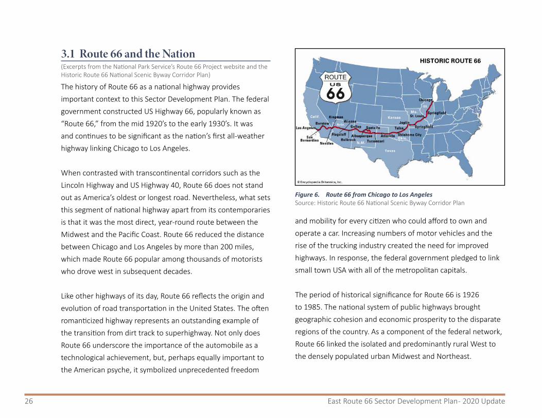
3.1 Route 66 and the Nation (Excerpts from the National Park Service’s Route 66 Project website and the Historic Route 66 National Scenic Byway Corridor Plan)
The history of Route 66 as a national highway provides important context to this Sector Development Plan. The federal government constructed US Highway 66, popularly known as “Route 66,” from the mid 1920’s to the early 1930’s. It was and continues to be significant as the nation’s first all-weather highway linking Chicago to Los Angeles.
When contrasted with transcontinental corridors such as the Lincoln Highway and US Highway 40, Route 66 does not stand out as America’s oldest or longest road. Nevertheless, what sets this segment of national highway apart from its contemporaries is that it was the most direct, year-round route between the Midwest and the Pacific Coast. Route 66 reduced the distance between Chicago and Los Angeles by more than 200 miles, which made Route 66 popular among thousands of motorists who drove west in subsequent decades.
Like other highways of its day, Route 66 reflects the origin and evolution of road transportation in the United States. The often romanticized highway represents an outstanding example of the transition from dirt track to superhighway. Not only does Route 66 underscore the importance of the automobile as a technological achievement, but, perhaps equally important to the American psyche, it symbolized unprecedented freedom
and mobility for every citizen who could afford to own and operate a car. Increasing numbers of motor vehicles and the rise of the trucking industry created the need for improved highways. In response, the federal government pledged to link small town USA with all of the metropolitan capitals.
The period of historical significance for Route 66 is 1926 to 1985. The national system of public highways brought geographic cohesion and economic prosperity to the disparate regions of the country. As a component of the federal network, Route 66 linked the isolated and predominantly rural West to the densely populated urban Midwest and Northeast.
Figure 6. Route 66 from Chicago to Los AngelesSource: Historic Route 66 National Scenic Byway Corridor Plan

27Plan Context
Chicago, the starting point of Route 66, had long served as a transshipment point for goods that were transported to the West. The creation of Route 66 ensured the continuation of this vital socioeconomic link. The construction of Route 66 came at a time of unparalleled social, economic, and political disruption and global conflict. It also enabled one of the most comprehensive movement of people in the history of the United States. One result was the irreversible transformation of the American west (primarily New Mexico, Arizona and California) from rural frontier to modernized, pace-setting, metropolitan regions.
Perhaps more than any other American highway, Route 66 symbolized the new optimism that pervaded the nation’s postwar economic recovery. For thousands of returning American servicemen and their families, Route 66 represented more than just another highway. “It became,” according to one contemporary admirer, “an icon of free-spirited independence linking the United States across the Rocky Mountain divide to the Pacific Ocean.” In recent years Route 66, imaginatively documented in prose, song, film, and television, has come to represent the essence of the American highway culture to countless motorists who traversed its course during the more than fifty years of its lifetime.
After the road was decommissioned in 1985, federal and state agencies, private organizations, and numerous members of
the public realized that remnants of the road were quickly disappearing, and that the remaining significant structures, features, and artifacts associated with the road should be preserved. In 1990, the US Congress passed PublicLaw101-400,theRoute66StudyActof1990. The act recognized that Route 66 “has become a symbol of the American people’s heritage of travel and their legacy of seeking a better life.” The legislation resulted in the National Park Service conducting the Route66SpecialResourceStudy to evaluate the significance of Route 66 in American history, and to identify options for its preservation, interpretation, and use. The document provides an in-depth account of significance and history of Route 66. This study led to enactment of PublicLaw106-45, and the creation of the Route 66 Corridor Preservation Program.
3.2 Route 66 in New Mexico (Excerpt from the Historic Route 66 National Scenic Byway Corridor Management Plan, Pg. 17)
In New Mexico, Route 66 also has an extensive history. When Route 66 was authorized by Congress in 1924, New Mexico had been a state for a mere twelve years. Construction of a federal highway commenced, with the opening of the original alignment in 1927 marking the beginning of a new era for this vast, rural region. However, there were already nascent tourism efforts underway by the 1920‘s, luring East Coast adventurers to the awesome landscape and exotic Native Americans of the

28 East Route 66 Sector Development Plan - 2020 Update
West. When the First World War broke out in Europe, driving out American expatriates, Santa Fe and Taos attracted artists and writers who formed communities and brought attention to the Southwest.
There were some 23 million automobiles in the United States in 1930. From 1921 to 1930, the number of miles of paved roads doubled and then doubled again from 1930 to 1940. Between 1933 and 1942 federal relief agencies poured some $4 billion (roughly 60 billion in 2017 dollars, according to the US Bureau of Labor Statistics Inflation Rate Calculator, www.bls.gov) into road and street construction projects. It was a huge investment at that time, and it would be an enormous infrastructure project today.
In 1934, the Public Works Administration embarked on roadside beautification projects and put up road signs and markers. By 1937, the state tourism bureau designated New Mexico as the “Land of Enchantment” on official highway maps.
There were several different ways the highway was constructed through the eight states that can claim its history. In New Mexico there were camps of workers that constructed and moved westward as they completed segment after segment. The camps included families and schools that were set up to educate the children. These camps were like a living creature, crawling steadily along, with hundreds of workers and families
living in them for months or years at a time.
3.3 Route 66 in the East Mountain CorridorThe Sandia and Manzano mountain ranges collectively stretch nearly fifty miles from north to south. The Tijeras Canyon, one of the few navigable passes through these mountains, has been a natural and obvious corridor since well before humans first traversed it for mule deer, mountain lions, and other wildlife. Over the course of at least a millennium of human history the East Mountains have been a source of food, natural resources, habitation, and wonder.
When first envisioned in the twentieth century, Route 66 bypassed these mountains altogether, running south from Santa Fe through what is now downtown Albuquerque to the Village of Los Lunas before veering west towards Gallup. This era saw substantial migration westward through New Mexico as travelers sought relief from the Dust Bowl and the Great Depression.

29Plan Context
In 1937, the alignment of Route 66 in the state shifted to its present configuration, a straight connection east-west across New Mexico – and directly through Tijeras Canyon and the East Mountains. This connection brought greater visibility to the East Mountain area just as the greater Albuquerque region was set to grow during a post-war boom, with an emphasis on automobile travel, longer commutes, interstate travel, and development patterns that evolved to serve this paradigm shift.
The introduction of the interstate highway system further cemented this corridor as key to the regional transportation system. With the introduction of Interstate 40 parallel to Route 66, the Mother Road diminished slightly in importance, as motorists were able to bypass the towns and businesses that grew to thrive on patrons passing through. While the freeway served as the death knell for many tourist-oriented businesses – such as the curio shop from which Zuzax derives its name – it allowed for an expansion of residential development. The interstate allowed people the freedom to work in Albuquerque during the day and flee to the scenic, rural quietude of the mountains for the evening.
Route 66 – or, officially NM 333 – still serves as a vital corridor for East Mountain residents, and it serves as a backup route if I-40 closes due to weather or traffic wrecks, but of late it has experienced a resurgence in global awareness. The past few decades have demonstrated an increased nostalgia for Route 66 and the mid-century car culture that made it famous. Tourists from all over the world drive along the Mother Road to relive the magic and nostalgia of a bygone era. The corridor through the East Mountains offers drivers a window into the past, but also stunning natural beauty and a unique local flair.
LOS LUNAS ROUTE 66 SCENIC BYWAY CORRIDOR MAN AGEMENT PLAN
PAGE 2
EXISTING CONDITIONS This section establishes an historic context for the corridor, identifies specific features that exemplify these qualities, and provides additional information pertaining to the existing condition of the byway within Los Lunas.
Historic Context
Much of the intrinsic qualities of the byway are related to the rich history of Route 66. As such, this historic summary is provided as a context for defining intrinsic qualities and features. Because Route 66 history has been covered in detail by Wallis (1990), Kammer (1992; 2003), Cassity (2004), and others, this literature review is intended to touch on only broad national developments with an increasing focus on the route through New Mexico and Los Lunas. (See the following figures for maps of the Route 66 alignments.)
Route 66 alignments in the United States and in New Mexico over time
Figure 7. Route 66 alignment over timeIn 1937 Route 66 straightened to resemble the present day I-40 alignment.
Source: Los Lunas Route 66 Scenic Byway Corridor Management Plan (Parsons Brinckerhoff, 2015)

30 East Route 66 Sector Development Plan - 2020 Update
This page is intentionally blank

31
4.RelevantPlanningDocuments

32 East Route 66 Sector Development Plan - 2020 Update
4.1 Land Use PlansLocal, state and federal agencies have completed or conducted a number of plans and studies for the East Mountain Area or along the Historic Route 66 Corridor. Some of these plans have been adopted by Bernalillo County Board of Commissioners and are regulatory in nature and serve to direct the process of plan-making or plan content. Other plans provide information about the area, plan for various facilities or amenities, or help to promote the attributes (historic, economic, scenic, etc.) of the area. These documents serve to inform elements of this Plan.
As previously alluded to, planning cannot take place in a vacuum. A good plan relies on those that have come before it. Since 1973, when Bernalillo County adopted its first Zoning Code, it has undergone extensive planning efforts, not only related to land uses but also related to transportation, parks, open space, trails and bicycle planning.
Figure 8. Albuquerque/Bernalillo County Comprehensive Plan (updated 2013)
4.1.1Albuquerque/BernalilloCountyComprehensivePlan(Updated2013)The Albuquerque/Bernalillo County Comprehensive Plan is a Rank One Plan and divides the county into “Development Areas” that reflect existing land use densities and guide future development. The East Route 66 Sector Development Plan area is located within the designated “Rural Area”.

33Relevant Planning Documents
The Comprehensive Plan goal for Rural Areas is to “maintain the separate identity of Rural Areas as alternatives to urbanization by guiding development compatible with their open character, natural resources, and traditional settlement patterns.” The following policies were adopted as part of the Comprehensive Plan in order to guide development in Rural Areas:
• Rural Areas as shown by the Plan map shall generally retain their rural character with development consisting primarily of ranches, farms and single-family homes on large lots; higher density development may occur at appropriate locations – within rural villages or planned communities. Overall gross densities shall not exceed one dwelling unit per acre. (Policy a)
• Development in rural areas shall be compatible with natural resource capacities, including water availability and soil capacity, community and regional goals, and shall include trail corridors where appropriate. (Policy b)
• Development shall be carefully controlled in floodplains and valley areas where flood danger, high water table, soils and air inversions inhibit extensive urbanization. (Policy c)
• Land which is suitable for agriculture shall be maintained to the extent feasible in agricultural production and discouraged from non-agricultural development. (Policy d)
• The following shall guide development of inhabited
rural settlements of a distinctive historic and cultural character:
○ Existing buildings and spaces determined to be of significant local, State, and/or national interest should be maintained and integrated as viable elements of the community.
○ New rural development shall be sensitive to existing historic, cultural and economic patterns. (Policy e)
• Development shall be carefully controlled in the East Mountain Area to prevent environmental deterioration, and to be compatible with the resource base and natural recreational and scenic assets. (Policy f)
• The following shall guide industrial and commercial development in the Rural Areas.
○ Small-scale, local industries, which employ few people and may sell products on the same premises, are the most desirable industrial use.
○ Neighborhood and/or community-scale rather than regional scale commercial centers are appropriate for rural areas. Strip commercial development should be discouraged and, instead, commercial development should be clustered at major intersections and within designated mountain and valley villages. (Policy g)
In summary, within Rural Areas, density should remain low and development should be compatible with the landscape, water supply and other natural, historic or cultural resources and

34 East Route 66 Sector Development Plan - 2020 Update
development patterns. Trails for hiking, biking and equestrians should be incorporated into new roadway design as well as into new or re-development. New uses should be small-scale, have a minimal impact on the surrounding area, employ few people and be clustered near roadway intersections or village centers. Mineral extraction, industrial uses and strip commercial development should be discouraged.
The Comprehensive Plan also includes the Centers and Corridors Plan that encourages future growth along designated corridors and in village centers. The goal is to “develop corridors, both street and adjacent land uses, that provide a balanced circulation system through efficient placement of employment and services, and encouragement of bicycling, walking, and use of transit/paratransit as alternatives to automobile travel, while providing sufficient capacity to meet mobility and access needs.”
In 2017, the City of Albuquerque adopted an updated version of the Comprehensive Plan, but the updated plan is still under review for consideration for adoption by Bernalillo County.
4.1.2EastMountainAreaPlan(2006)The East Mountain Area Plan is a Rank Two Plan. The key land use goal of the East Mountain Area Plan is “to promote appropriate development that retains the unique rural character of the East Mountain Area.” Elements of this rural character include wide-open spaces, scenic views, farms and houses spaced far apart from one another. This rural character is very important to residents and gives the area its unique identity and sense of place. The plan states that historical and cultural character shall be used to guide development of inhabited rural settlements. At the same time, residents respect and seek to protect the rights of property owners while also ensuring the health, safety and welfare of all inhabitants.
Figure 9. East Mountain Area Plan

35Relevant Planning Documents
The East Mountain Area Plan divides the region into five “Character Areas,” denoted A through E. The East Route 66 Sector Development Plan area transects three of these.
• Character Area B, listed as “Tijeras/North 14,” is per the plan “the most densely populated part of the East Mountain Area and serves as the main node of commercial activity in the East Mountain Area.”
• A small portion of Character Area E, “South Central,” crosses over Route 66 at the Zuzax exit. The plan states that “This area is made up of large lots, green-belts, open space, pastoral and scenic views, traditional dry land farming and small-scale livestock production.”
• From the Zuzax exit to the county line, the corridor falls within Character Area C, “Northeast Area.” The plan notes the “commercial enterprises concentrated along I-40.”
Historically, the East Route 66 corridor has been a hub of commercial activity in the East Mountain area. During the development of the East Mountain Area Plan, one of the public’s highest priorities was to limit the amount and intensity of commercial development in this area. The East Mountain Area Plan’s Economic Development goal is “to achieve steady and diversified economic development balanced with other important social, cultural, and environmental goals”. In support of this goal, several policies were adopted that are relevant to, and furthered by, the East Route 66 Sector Development Plan:
• Commercial development shall occur in commercial
corridors and nodes identified through an economic development study, sector plan or master plan approved by Bernalillo County. (Policy 9.1)
• Prohibit new Special Use Permits for commercial and manufacturing that would be equivalent to M-2 zoning. (Policy 9.2)
• New commercial development shall be of an appropriate scale to meet the needs of the area residents and not degrade the environment. (Policy 9.3)
• Encourage small-scale businesses to develop with the potential for providing local employment. (Policy 9.4)
The Plan recommends various techniques to carry out these policies such as:
• Establish commercial corridors and nodes to allow for the location of neighborhood-scale businesses that generate jobs and provide needed goods and services to East Mountain residents while maintaining the rural character of the area.
• Focus light industrial and commercial development in selected areas with adequate utilities and transportation access and set apart from any existing or future residential neighborhoods or other incompatible land uses.
• Reserve portions of the area strictly for commercial activity to accommodate a variety of wholesale, retail, service and office uses where the highest traffic volumes and greatest utility demands can be served

36 East Route 66 Sector Development Plan - 2020 Update
and more extensive signage and outdoor display of materials will be expected and permitted.
In furtherance of these goals and recommended techniques, the East Mountain Area Plan designates a commercial corridor in a portion of the East Route 66 Sector Development Plan area. The function of such a designation is to prioritize this area as a location for commercial activity and thereby encourage land owners and business owners to locate commercial uses within this area.
In addition to existing infrastructure and water limitations in the East Mountain area, there are two regulatory impediments to locating commercial uses in the Sector Plan area. The first is land use predictability and the second is the length of the development process.
Many current commercial uses within the Plan area are not carried out on commercially zoned property, but rather on land zoned for agricultural and residential uses by way of Special Use Permits. This adds an element of unpredictability not only for land and business owners but also for area residents. In addition to allowing uses that are oftentimes not anticipated, Special Use Permits can take several months to be processed and reviewed by County staff and other agencies. Also, Special Use Permits may be subject to strict terms and conditions, which may discourage business owners from locating needed services to the area.
In the East Mountain area, other than in the few village centers along Highway North 14 and NM 337, there are only a few isolated areas with commercial zoning where commercial activity is allowed to occur. This negatively impacts community residents who want and need goods and services in a timely manner.
4.1.3EastMountainTrailsandBikewaysMasterPlan(2004)The East Mountain Trails and Bikeways Master Plan (2004) identifies a trail and bikeway system for the area that was designed to link to existing and planned systems in Albuquerque, Santa Fe County and on nearby US Forest Service land.
Figure 10. East Mountain Trails & Bikeways Master Plan

37Relevant Planning Documents
Guided by a steering committee of local residents, hiking and bicycling enthusiasts and a technical team of government and public agency representatives, the planning team mapped existing and future trails and bikeways in the East Mountain area. The planned trails and bikeways are intended to enhance the experience of users at various skill levels.
This plan was meant to fulfill a recommendation set forth in the East Mountain Area Plan for more detailed and complete trail planning throughout the entire East Mountain area, which encompasses over 120,000 acres.
Consistent with other East Mountain area planning efforts, the Plan takes into account the desire of East Mountain residents to preserve what they consider a rural lifestyle and atmosphere, open spaces and dark skies.
Specifically, within the East Route 66 Sector Development Plan area, the following trail and bikeway improvements are recommended:
• On East NM 333/Old Route 66, the six-foot shoulders and paved multi-use trail should continue from Tijeras past the Santa Fe County Line to connect with the City of Edgewood system. A soft surface multi-use trail is recommended in limited areas from Kennedy Road to the Zuzax underpass and to the beginning of Sedillo Road.
• Mountain Valley Road (NM 217) north of NM 333, is an important north-south connection between Frost Road and NM 333/Old Route 66. Six-foot shoulders are recommended for the entire length of this segment.
• Mountain Valley Road (NM 217) south of NM 333, provides an important connection to many East Mountain Open Space areas, including the Cedro Peak area of the National Forest, Sedillo Ridge Open Space and Juan Tomas Open Space. Six-foot shoulders are recommended for this segment to the Bernalillo County Line.
The plan also contains several examples of multi-use roadway cross-sections suitable for rural roadways, including soft surface equestrian trails.

38 East Route 66 Sector Development Plan - 2020 Update
4.1.4Parks,Recreation&OpenSpaceFacilitiesMasterPlan2015-2030The Parks, Recreation & Open Space Facilities Master Plan 2015-2030 (PROS Plan), is a Rank 2 Facility Plan that was adopted by the Bernalillo County Commission in October 2015 (AR No. 2015-64).
The PROS Plan is an update to the Parks, Open Space and Trail (POST) Plan adopted by the County in 2003. The purpose of the PROS Plan is to “expand upon the work done in the POST Plan, to further integrate a network of parks, open spaces and trails that are managed by the County as well as other facilities owned and managed by other local, state and federal agencies”.
The East Route 66 Sector Development Plan area is located in the overlapping “North 14 Neighborhood Community Area” and the “Los Vecinos-Carnuel Neighborhood Community Area”, as designated in the Master Plan.
While there are no County Open Space properties within the East Route 66 Sector Development Plan area, NM 333 and NM 217 provide easy access to the County’s Sedillo Ridge Open Space and the Sabino Canyon Open Space, both located west of NM 217 off Juan Tomas Road. In addition, the City of Albuquerque’s Juan Tomas Open Space is located west of NM 217 and south of Juan Tomas Road. The amount of
undeveloped area contributes to the rural character of the area and future development along NM 333, within the Sector Plan area, could be designed to utilize and promote the nearby open space areas and recreational opportunities.
Figure 11. PROS Plan 2015-2030
39Relevant Planning Documents
4.2 Other Plans and StudiesA number of studies and plans have been completed by state and federal agencies that include the East Mountains, the East Route 66 Sector Development Plan area or Historic Route 66, in particular. These provide historical and contextual background for this Sector Plan.
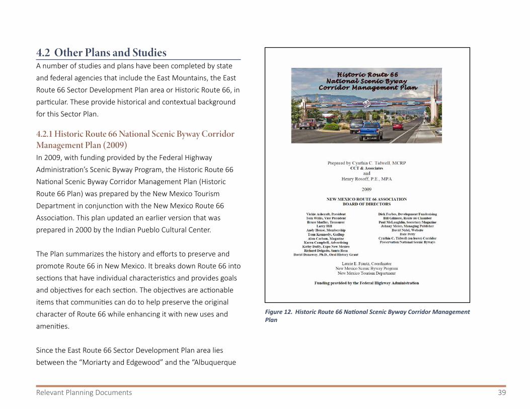
4.2.1HistoricRoute66NationalScenicBywayCorridorManagementPlan(2009)In 2009, with funding provided by the Federal Highway Administration’s Scenic Byway Program, the Historic Route 66 National Scenic Byway Corridor Management Plan (Historic Route 66 Plan) was prepared by the New Mexico Tourism Department in conjunction with the New Mexico Route 66 Association. This plan updated an earlier version that was prepared in 2000 by the Indian Pueblo Cultural Center.
The Plan summarizes the history and efforts to preserve and promote Route 66 in New Mexico. It breaks down Route 66 into sections that have individual characteristics and provides goals and objectives for each section. The objectives are actionable items that communities can do to help preserve the original character of Route 66 while enhancing it with new uses and amenities.
Since the East Route 66 Sector Development Plan area lies between the “Moriarty and Edgewood” and the “Albuquerque
Figure 12. Historic Route 66 National Scenic Byway Corridor Management Plan

40 East Route 66 Sector Development Plan - 2020 Update
and Bernalillo County” sections of the corridor management plan, the goals and objectives of both sections can be effectively applied. In fact, existing development in the East Route 66 Sector Development Plan area already reflects the architectural styles and signage elements of both sections.
One significant topic that the Historic Route 66 National Scenic Byway Corridor Management Plan addresses is outdoor advertising, specifically billboards. New billboards are discouraged and may be prohibited in certain areas along Route 66, as regulated by the State of New Mexico. The Historic Route 66 Plan encourages communities to develop sign regulations that serve to enhance the route and the natural beauty along it.
The plan acknowledges that, in some stretches of the corridor, “private property owners are largely unaware that they abut a national scenic byway, or, if they do know that Route 66 is a national scenic byway, they do not understand what their opportunities are for helping maintain and preserve the intrinsic qualities of the road” (Pg. 136). Fortunately, the Historic Route 66 Plan provides some idea of what these opportunities are and encourages local communities to adopt design standards that serve to preserve these intrinsic qualities.
4.2.2SaltMissionsTrailScenicBywayCorridorManagementPlan(Update2012)According to the Salt Missions Trail Scenic Byway Corridor Management Plan, “the 150-mile Salt Missions Trail Scenic Byway lies within three counties in the east central part of New Mexico. The Byway runs along an historic, winding wagon road from the Village of Tijeras in the mountain pass to Albuquerque, through the Spanish land grant towns of the Manzanita and Manzano Mountains, follows the prehistoric trade route of the Salinas Pueblo Missions, and skirts the abandoned railroad right-of-way along the edge of the Estancia Basin’s salt lakes and prairie. It closes the loop by following a 24-mile segment of the major transcontinental highway, Historic Route 66, back to the Village of Tijeras. A 25½ mile extension on the southern end connects the Gran Quivera National Park site to the loop portion of the Byway.” (Pg.1)
Figure 13. Sign identifying Salt Mission Trail on NM 333 in the East Route 66 Sector Development Plan Area

41Relevant Planning Documents
Furthermore, “the route of the Byway offers a variety of visual, educational, and recreational experiences as it loops through the open and expansive agricultural landscapes of the Estancia basin, passes by the remnant dunes that mark the edges of the Salt Lakes (Las Salinas); winds along the eastern slopes of the Manzano and Manzanita Mountains through the traditional mountain communities and the Cibola National Forest; provides access to the three Salt Missions as well as the Tijeras Pueblo Archaeological Site; and traverses one of the original Route 66 communities as well as a scenic mountainous portion of Old Route 66.” (Pg. 2)
Culturally, “traveling the Byway offers a unique opportunity to explore the relationships that diverse cultures have forged over hundreds of years with each other and the surrounding landscape. An interconnected web of visible artifacts, recorded histories, and living traditions reveal how people have adapted and worked together to meet the challenges of life in an environment where resources are limited. Current cultural events and educational opportunities provide an opportunity to participate in the protection and enhancement of authentic community histories and cultures.” (Pg. 3)
Figure 14. Trail map from the Salt Missions Trail Scenic Byway Corridor Management Plan

42 East Route 66 Sector Development Plan - 2020 Update
4.2.3Interstate40LocationStudy-SedillotoMoriarty[NMDOTProjectNumberIM-040-3(191)181,CNCF834](April2010)In 2010, the New Mexico Department of Transportation (NMDOT) completed a study that documented, reviewed and evaluated potential improvements to the I-40 corridor between Sedillo and Moriarty. The study recognized the national, regional and local importance of this corridor and identified NM 333 as a key component to its functionality. The key factors that were considered in this study included safety, travel demand/congestion, physical deficiencies, system connectivity and economic development.
The primary purpose for the I-40 Location Study was to improve the overall inter-connectivity between the Interstate,
NM 333 and the intermittent frontage road on the north side of I-40. The belief was that these improvements would facilitate economic development and planned growth along the corridor.
The East Route 66 corridor fell within the scope of this study and there were several roadway and intersection improvements recommended for the Plan area. For instance, the study analyzed the I-40 and NM 217 (Mountain Valley Road) interchange and the NM 333/NM217 intersection. It was determined that any corridor or intersection improvements in this area should facilitate economic growth, mitigate existing roadway deficiencies and be compatible with long-range local and regional planning goals. According to the study, consideration should be given to maintaining the agrarian heritage and rural setting of the corridor, including multi-modal opportunities that support community priorities, regional planning and corridor preservation.
The study identified needed improvements to the discontinuous pedestrian/bicycle/equestrian path that exists along the south side of NM 333. The study proposed a continuous multi-use trail along NM 333 based on the typical trail section identified in the East Mountain Trails & Bikeways Master Plan.
As with most, if not all, planning processes and plan development, there was public participation in the I-40
Figure 15. Interstate 40 Location Study

43Relevant Planning Documents
Location Study. The participants recommended improvements to the NM 217 and NM 333 intersection. While local residents favored a controlled intersection with a traffic light, the amount of traffic did not meet the warrants for that level of improvement. However, this intersection was improved in 2013 with dedicated turn lanes and new striping and, as a result, now functions at a higher level of service.
4.2.4DeterminingWildlife-VehicleCollisionMitigationEffectivenessQuarterlyReport(September2019)New Mexico Department of Transportation (NMDOT) currently has a research contract with Arizona Game and Fish Department to determine the effectiveness of wildlife-vehicle collision mitigation projects.
Per the report:
“New Mexico wildlife-vehicle collisions (WVC) can cause property loss, injury, and occasionally death to the traveling public. Animals involved in WVC typically die upon impact or as the result of injuries. Vehicular traffic also indirectly has a negative impact on animals and animal populations by reducing an animal’s ability to cross a roadway and fulfill daily, seasonal, and evolutionary (genetic interchange) needs.”
QUARTERLY REPORT PRELIMINARY DATA September 2019
Determining Wildlife-Vehicle Collision Mitigation Effectiveness
The Image Shows a Mule Deer Buck that Crossed NM 333 at the Wildlife Crosswalk
Presented to the New Mexico Department of Transportation Presented by the Arizona Game and Fish Department Wildlife Contracts Branch
Figure 16. Determining Wildlife-Vehicle Collision Mitigation Effectiveness

44 East Route 66 Sector Development Plan - 2020 Update
NMDOT has constructed 8-foot high woven wire fencing and other barriers that keep deer, bear and other wildlife from entering the roadway and directing them to safely cross under existing bridges. This report documents the effectiveness of those facilities. While these exist to the east and west of the study area, the data is relevant to efforts to reduce wildlife-vehicle collisions along this corridor.
At one location on Route 66, NMDOT constructed tall fencing that directs deer and other wildlife to cross at a specific location on the roadway. Electrified barriers prevent wildlife from wondering further into the roadway. An Animal Detection System was installed that warned motorists when wildlife was using this crossing. However, this Animal Detection System doesn’t work properly and efforts are underway to replace this system.
This research has been able to quantify the number of animals that approach and safely pass through crossing structures. Activity at the five crossings totaled nearly 2,500 animals. More than three out of four were mule deer, with coyotes accounting for the second greatest number of animal crossings.
Any plans to modify the roadway or to establish any major development in the area should consider the impact of those changes on wildlife travel through the area, and whether those plans could or should accommodate infrastructure to facilitate wildlife crossings or mitigate the risks of vehicle collisions with animals.
Figure 17. Wildlife crossings and infrastructure in Tijeras CanyonSource: Determining Wildlife-Vehicle Collision Mitigation Effectiveness (September 2019)
September 2019 Quarterly Report PRELIMINARY DATA 3
Determining the Design Effectiveness of Wildlife-Vehicle Collision Mitigation Projects
Figure 1. AGFD monitored Tijeras Canyon Safe Passage’s Wildlife Crosswalk (top left), which has electrified
concrete (top right), East Bridge (middle left), Middle Bridge (middle right), Public School Bridge (bottom left), and Juan Thomas Bridge (bottom right).
Raton Project No.: CN-4101090R I-25 MPs 450 - 455
Raton was identified as having the highest number of wildlife-vehicle collisions on I-25 within New Mexico. The project designed for this area uses 8-foot wildlife fencing, electrified concrete, and double cattle guards to primarily exclude mule deer and black bear from the I-25 right-of-way. Escape ramps were included in the design to allow animals that manage to enter the right-of-way to safely exit it (Figure 2). The fencing will also guide animals to existing structures (vehicular overpass, vehicular underpasses, and culverts; Figure 3). This project was completed in November 2017.

45
5. ExistingConditions

46 East Route 66 Sector Development Plan - 2020 Update
5.1 Current Characteristics of NM 333 in Plan AreaNM 333, known as “Old Route 66” within the East Mountain Area, is a two-lane, undivided highway classified by the Mid Region Council of Governments (MRCOG) as a Rural Major Collector. This portion of the highway is the “Gateway” from the east to Bernalillo County and the Albuquerque Metropolitan Region.
This portion of NM 333 was formerly part of US Highway 66, which spanned the distance from Chicago to Los Angeles, prior to construction of the interstate highway system. In New Mexico, Route 66 dips southward from the Bernalillo/Santa Fe County line on the east and moves northward again as it heads west. Route 66 in the Sector Plan area possesses the following characteristics:
• It is designated by the Federal Highway Administration (FHWA) as a National Scenic Byway.
• Portions of it are designated as part of the Salt Missions Trail Scenic Byway.
• A typical roadway cross-section is two, 12-foot lanes with narrow shoulders.
• The posted speed limit is 55 mph.• NM 217 (Mountain Valley Road) runs north and south
bisecting the eastern portion of the Plan area. The right-of-way of NM 333 is approximately 200 feet (200’) wide at most locations in the Plan area.
• Two interstate freeway exits provide access to and from Interstate 40: Zuzax and Sedillo.
• There is no traffic signal at the intersection of NM 333 and NM 217. A traffic study conducted by NMDOT in 2004 indicated that a traffic signal was not warranted.
• NM 333 is a proposed Bike Route.• MRCOG maintains traffic data along NM 333. Per its
2013-2018 data: ○ The greatest volume of traffic in the corridor for this
period was west of Sedillo Hill Road in 2018, with average weekday traffic (AWDT) of 8,100.
○ The lowest traffic volume was in 2015, west of the Sedillo exit, with an AWDT of 2,800.
○ Traffic counts have remained mostly steady since 2013.
Agencies are currently planning several transportation improvements in the area. Bernalillo County will reconstruct the intersection of NM 333 and Tablazon Road. NMDOT is reconstructing the Zuzax bridge over I-25, and plans to reconstruct the intersection with Dressage Road.
Figure 18. NM 333 looking west toward the Sandia Mountains

47Existing Conditions
5.2 Corridor SegmentsThis plan update expands the planning boundary for the East Route 66 Sector Development Plan, but also characterizes the corridor into four unique corridor segments: Zuzax, Scenic Vista, Sedillo Hill, and Mountain Valley.
0 0.8 1.60.4Miles
Corridor Segments
Planning & Development Services DepartmentGIS Technology Section
This information is for reference only.Bernalillo County assumes no liability for errorsassociated with the use of these data. Users aresolely responsible for confirming data accuracywhen necessary. Source data fromBernalillo County and the City of Albuquerque.For current information visit http://www.bernco.gov/planning/gis.aspx.
LegendSector Plan Segments
ZuzaxScenic VistaSedillo HillMountain Valley
Road InventoryBC Maintained/PavementNot BC MaintainedState Roads
Property LinesCounty Special Use PermitsTijeras Village LimitsCounty Boundary
Bernalillo County Planning & Development Services:East Route 66 Sector Development Plan - 2020 Update
Zuzax
ScenicVista
SedilloHill
MountainValley
Figure 19. Map of corridor segmentsThe planning boundary extends from the limits of the Village of Tijeras (light blue, far left) to the county line between Bernalillo and Santa Fe Counties. The four segments represent different development patterns in the area.
Each of these segments has specific characteristics that have impacted land development in the area, including: existing zoning, density of development, topography, or parcel size. Future development should be in keeping with the existing character of each segment.

48 East Route 66 Sector Development Plan - 2020 Update
5.2.1ZuzaxThe Zuzax area, taking its name from the I-40 freeway exit, extends from the eastern limits of the Village of Tijeras to Tablazon Road. This segment is a hub of commercial activity, including many parcels zoned C-1 (commercial) and O-1 (office), and it includes a number of non-residential special use permits. These parcels tend to be larger and flatter than many of those in the area, though they also tend to have peculiar shapes; the segment features many long, narrow, triangular parcels.
This segment features areas of right of way between I-40 and Route 66. NMDOT uses this land as a storage and maintenance yard and for reserve right of way. This land is not platted into parcels, but may present opportunities for future development.
The East Mountain Area Plan refers to this area as a commercial node. Some parcels are zoned for C-1 (commercial) and O-1 (office) and include business such as an aerospace research and manufacturing group. Other commercial activity — allowed via Special Use Permits — include mobile home parks and RV campgrounds, and furniture and fiber manufacturing.

49Existing Conditions
Figure 20. Zuzax corridor segment
RIN
CO
NLO
OP
RD
RIN
CO
NLO
OP
RD
FO
RESTRD (SM)
TABLA
Z
ONRD
NM 333
TA
BLAZON
RD
TECOLOTE RD
FOREST RD (SM) CAMPO RD
SHADE TREE LN
VICENTE LN
ZOPI
LOTERD
PUNT
IL
LADR
I40 RAMP
I40 WESTBOUND
I40 EASTBOUND
T
EJON DR
HAW
KS REST RD
NORTHZAMORA
RDI40 RAMP
A RDILLA RD
GUT
IER
RE
ZC
ANY
ONRD
MEADOWLN
LAGARTO
RD
LAGA
RTO
RD
EAGLEC
RE
STD
R
J UN
IPER
RIDGE
RD
SHA
DY
OAK
CIR
MELISSA LN
KING
FISH
ER
LN
KEN
NE
DY LN (SM)
FORE
STRD 462
H IDDENVALLEY RD
40
A-2
R-1
M-H
A-2
C-1
A-2
A-2
C-N
A-1
A-2
A-2
C-1
C-1
A-2
C-N
C-1
M-H
A-2
A-2
A-2A-2
A-2
A-2
A-2
A-2O-1
0 0.2 0.40.1Miles
Zuzax Corridor Segment
Planning & Development Services DepartmentGIS Technology Section
This information is for reference only.Bernalillo County assumes no liability for errorsassociated with the use of these data. Users aresolely responsible for confirming data accuracywhen necessary. Source data fromBernalillo County and the City of Albuquerque.For current information visit http://www.bernco.gov/planning/gis.aspx.
LegendSector Plan Segments
ZuzaxScenic VistaSedillo HillMountain Valley
Road InventoryBC Maintained/PavementNot BC MaintainedState Roads
Property LinesCounty Special Use PermitsTijeras Village LimitsCounty Boundary
Bernalillo County Planning & Development Services:East Route 66 Sector Development Plan - 2020 Update
Village of Tijeras
Segment
Boundary
Tablazon
ZuzaxExit
TransferStation
MobileHomePark
FurnitureMfrg.
IncenseMfrg.
NMDOTYard
Wetlands(Wastewater)
RV Park/Campground

50 East Route 66 Sector Development Plan - 2020 Update
5.2.2ScenicVistaThis segment, so named because of the views it affords of the natural landscape of the mountain foothills, extends from Tablazon Road to the eastern end of the large gravel pit just west of the Sedillo Hill exit. This segment features small, irregularly shaped parcels. While many of these parcels abut Route 66, few parcels have vehicular access to the highway; most are residential parcels with addresses along internal, residential roads.
This area also features some of the steepest terrain changes within the plan boundary. Hills rise above the highway and valleys and cliffs drop sharply from it. This challenging topography naturally restricts development, but provides breathtaking scenery. Piñon and juniper trees cover much of the area.
Residential land uses dominate the area. All parcels are zoned A-2 with the exception of a small portion of C-1, which appears to be a residential use.
While this segment’s residential and scenic characters differentiate it from the other three, it serves as a vital link between all segments. The natural beauty allows residents scenic relief from nearby developed areas. The rustic and rural character preserved in this segment adds value and character for nearby businesses.
Based on input from public meetings, parcels in the Scenic Vista segment will not be eligible to apply for SD-E66-CC zoning. Including this segment in the plan boundaries protects this area from development that would be incompatible with its character.

51Existing Conditions
Figure 21. Scenic Vista corridor segment
S EDILLO RD
TECOLOTE RD
CA
LLE
DE L
MEDIA
WOODLAND DR
AVENIDA
ALL
EGR
E
QUAILRUN RD
SEDILLOHILL
RD
VENADO RD
WOODLAND DR
SEDILLO RD
TABLAZ ONVA
LLEY
DR
RICHY PLPUN
TILLAD
R
TAYL
ORPL
TABLAZON
CT
PINON POINTTRO
MBL
EY
RD
MO NT
RA
EL
WRIGHTD
R
NM333
PUNT
ILLA
DR
T
EJON DR
SEDILLOHILL
RD
WILDERLAND RD
SEDILLO
RD
NORTHZAMORA
RD
I40 WESTBOUND
I40 EASTBOUND
TABL
AZON
RD
NA
TURE POINTEDR
LAGARTO
RD
LAGA
RTO
RD
CAMPO
RD
OSO
DR
GRIFFI N
RD
( SM
)
FIVEH
ILLSD
R
KI TSC
HRD
ESCENAD
R
COVEY CT
40
M-H
A-1
A-2
A-2
A-2
C-1
A-2
A-2
A-2
C-1
A-2
A-2
A-2 A-2
A-2
A-2A-2
A-2
A-2
O-1
0 0.2 0.40.1Miles
Scenic Vista Corridor Segment
Planning & Development Services DepartmentGIS Technology Section
This information is for reference only.Bernalillo County assumes no liability for errorsassociated with the use of these data. Users aresolely responsible for confirming data accuracywhen necessary. Source data fromBernalillo County and the City of Albuquerque.For current information visit http://www.bernco.gov/planning/gis.aspx.
LegendSector Plan Segments
ZuzaxScenic VistaSedillo HillMountain Valley
Road InventoryBC Maintained/PavementNot BC MaintainedState Roads
Property LinesCounty Special Use PermitsTijeras Village LimitsCounty Boundary
Bernalillo County Planning & Development Services:East Route 66 Sector Development Plan - 2020 Update
2 MobileHomes
Tablazon
GravelPit
Five Hills
Nature Pointe
Segment Boundary

52 East Route 66 Sector Development Plan - 2020 Update
5.2.3SedilloHillThis segment, taking its name from the I-40 freeway exit, extends from the eastern edge of the gravel pit to Dressage Road. This segment has potential to serve as a commercial hub in part due to the Sedillo exit granting access to and from Interstate 40. The area has several properties already zoned C-1 and has the benefit of an existing NMDOT Park and Ride facility which may draw users of that facility to nearby businesses.
Most of the parcels in that area have non-residential uses, such as a service station and natural gas utility infrastructure. The segment features many undeveloped parcels zoned for residential uses (namely M-H), though their proximity to Route 66 may suggest that residential uses are not appropriate for those properties; they may benefit from adopting SD-E66-CC zoning.
Many undeveloped parcels are large and relatively flat, facilitating future commercial development, though access to Route 66 would need to be coordinated with NMDOT.

53Existing Conditions
Figure 22. Sedillo Hill corridor segment
NM 333VI
ASE
DIL
LOR
DSEDILLO RD
I40 RAMP
WO
ODL
ANDSDR
DRESSAGE DR
MC
CALL
T
RL
I40 WESTBOUND
SEDILLOHILL
RD
BR
AD
CT
I40 RAMP
STEE
PLE C
HA
SEDR
I40 RAMP
I40 EASTBOUND
PIN
ON
RIDGE
RD
SEDILLORD
I40 RAMP
MO
NTE
VER
DE
RD
SEDILLO RD
40
M-H
A-1
A-2
C-1
A-2
A-2
C-1
M-H
A-2
C-1
A-2
C-1
C-1
A-2
A-2
A-2
A-2
A-2
A-2A-2
A-2
M-H
M-H
0 0.15 0.30.075Miles
Sedillo Hill Corridor Segment
Planning & Development Services DepartmentGIS Technology Section
This information is for reference only.Bernalillo County assumes no liability for errorsassociated with the use of these data. Users aresolely responsible for confirming data accuracywhen necessary. Source data fromBernalillo County and the City of Albuquerque.For current information visit http://www.bernco.gov/planning/gis.aspx.
LegendSector Plan Segments
ZuzaxScenic VistaSedillo HillMountain Valley
Road InventoryBC Maintained/PavementNot BC MaintainedState Roads
Property LinesCounty Special Use PermitsTijeras Village LimitsCounty Boundary
Bernalillo County Planning & Development Services:East Route 66 Sector Development Plan - 2020 Update
GravelPit
San YsidroChurch
Rt 66Travel Ctr
Park & Ride
NM Gas CoGas Sto.
Five Hills
SedilloHill Exit
Sedillo Sto.
Segment Boundary

54 East Route 66 Sector Development Plan - 2020 Update
on individual lots or within small commercial strip centers. Currently, there is a food pantry, two churches, a restaurant, a garage for auto repair, a local water service company, a private club lodge and a mini-warehouse and storage facility. Several of these uses are operating under Special Use Permits, though a number have adopted the new zoning category. Land in this area is especially appropriate for SD-E66-CC zoning.
5.2.4MountainValleyThis segment, taking its name from that of Highway 217, shares the same boundaries as the original plan area from 2018. It extends from Dressage Road east to the county line. The parcels in this area tend to be large, flat, and regularly shaped. This segment is unique in that Route 66 separates from Interstate 40, resulting in several parcels that lie between the two roadways. These are not conducive to residential or agricultural development, a contributing factor in the determination to establish the area as appropriate for a sector development plan.
North of Route 66Where development exists, it is intermittent with freestanding buildings that house commercial and light industrial uses such as contractor yards, trailer storage and sales, mini-storage units, instructional studios, propane storage and sales and a few residences. Buildings are generally simple frame or metal construction, set back from the road and fenced. The area has good access to I-40 from existing interchanges.
South of Route 66The portion of this segment south of Route 66 has a rural residential character with residences widely spaced and partially screened by trees and fences. Residences often include accessory uses such as stables and horse arenas. Some neighborhood-scale commercial uses exist but they are generally set far back from the roadway and located

55Existing Conditions
Figure 23. Mountain Valley corridor segment
CALLEALTA
NM 333
SEDILLO RD
STEEPLECHASE DR
JOE NESTOR RD
MCCA
LLT
RL
VISTA VALLE CT
BR
AD
CT
I40 RAMP EAST GATE RD
DINKLE RD
I40 EASTBOUNDI40 WESTBOUND
FUTURITY PL
BA
RTO
NR
D
BR
ENT
DR
ANNE
PICKARD CT
DINKLE RD
GU
EST
CT
KEVIN
DR
SCOTT RD
BRENDEN LN
NORTH VISTA VALLE DR
SEDILLO RD
MO
UN
TAIN
VALL
EYR
D
CO
UN
TYLI
NE
RD
SOUTH VISTAVALLE DR
ANNE PICKARDLOOP
AXT
ON
LN
MOUNTAIN
VALLEY LN
CA
BA
NA
DR
AN
NE
CT
ERIN
LN
AXTON LN
BRIDAL
LN
NM
217
MCCALL LOOP
MCCALL LOOP
40
A-2
A-2
O-1A-2
C-1A-2
A-2
A-2
C-1
SD-E66-CCA-2
SD-E66-CC
A-2
A-2
A-2
A-2A-2
A-2
A-2
A-2
A-2
A-2
A-2 A-20 0.25 0.50.125
Miles
Mountain Valley Corridor Segment
Planning & Development Services DepartmentGIS Technology Section
This information is for reference only.Bernalillo County assumes no liability for errorsassociated with the use of these data. Users aresolely responsible for confirming data accuracywhen necessary. Source data fromBernalillo County and the City of Albuquerque.For current information visit http://www.bernco.gov/planning/gis.aspx.
LegendSector Plan Segments
ZuzaxScenic VistaSedillo HillMountain Valley
Road InventoryBC Maintained/PavementNot BC MaintainedState Roads
Property LinesCounty Special Use PermitsTijeras Village LimitsCounty Boundary
Bernalillo County Planning & Development Services:East Route 66 Sector Development Plan - 2020 Update
PlannedDevt Area
PlannedDevt Area
ContractorYard/Nursery
Sedillo Sto.
Country Gas
Auto Repair
MedicalLab
HoundHaven
SandiaTrailer
Segment Boundary

56 East Route 66 Sector Development Plan - 2020 Update
5.3 Zoning and Land Use in the Plan AreaLand uses along East Route 66 in the East Mountains vary along the corridor. Commercial activity clusters around freeway exits and the denser development patterns of the Village of Tijeras to the west and the Town of Edgewood to the east, but this activity tends to be one parcel deep; removed from I-40 and Route 66, the land use reverts to low-density residential land and vacant property dominated by grasses, rocky outcroppings, and spruce and piñon forest. Many parcels that abut the highway are residential in nature, and while some have driveways onto Route 66 most face inward toward residential roads.
Commercial and light industrial uses, when necessary, have historically been accommodated through Special Use Permits issued by the County. Since 1976, approved Special Use Permits in the Plan area have been for a variety of commercial and light industrial uses. This suggests that property owners are more interested in developing their property for commercial or light industrial uses rather than residential uses. This is logical given the area’s close proximity to the two major roadways.
5.3.1ZoninginthePlanAreaZoning in the area is primarily A-2 (residential and agricultural), accounting for nearly three quarters of the acreage in the planning area. C-1 (commercial) accounts for barely ten percent of the land area, and M-H (mobile home residential) occupies slightly more than 8 percent. Various non-residential zoning makes up the remainder.
The Mountain Valley segment is the largest of the four by acreage, though the vast majority of the property is zoned A-2. The Sedillo Hill and Zuzax segments have the greatest share of non-residential zoned acreage. The only property in the Scenic Vista segment zoned for non-commercial uses is currently being used for residential
The prevalence of A-2 zoning in the corridor may be inappropriate for certain parcels given the existing commercial development in the area and the proximity to both I-40 and Route 66. The optional SD-E66-CC zoning provides an opportunity for these properties to be developed for commercial activity.

57Existing Conditions
Existing Conditions
1
113
36
814
2 20
20
40
60
80
100
120
A-1 A-2 C-1 C-N M-H O-1 SD-E66-CC
Zoning by Number of Parcels
Number of Parcels
Zoning byAcreage
A-1 A-2C-1 C-NM-H O-1SD-E66-CC
Figure 24. Acreage of zoning categories by segmentThis table illustrates the acreage devoted to each zoning category by planning segment in the plan area.
Figure 25. Zoning analysis in plan areaThe bar chart at far left shows the number of parcels in each zone. The pie chart illustrates the acreage devoted to each zoning category.
A-1 A-2 C-1 C-N M-H O-1SD-E66-CC
Total Acreage
Zuzax 247.4 3.7 0.8 3.5 255.4
Scenic Vista 31.2 56.4 6.8 94.4
Sedillo Hill 7.2 21.4 43.6 72.2
Mountain Valley 94.9 25.6 8.4 6.6 4.3 139.8
Total Acreage 31.2 405.9 57.5 8.4 50.2 5.1 3.5 561.8

58 East Route 66 Sector Development Plan - 2020 Update
5.3.2LandUseinthePlanAreaThe County Assessor assigns land use to each parcel. The Assessor maintains a separate parcel database than the platted parcels to which the County assigns zoning, resulting in some slight inconsistency in parcel size, count, and configuration. Per assessor data, residential and non-residential land use each comprises only about one quarter of the acreage in the plan area.
Existing Conditions
65
29
70
0
10
20
30
40
50
60
70
80
Residential Non-Residential Vacant
Land Use* by Number of Parcels
Number of Parcels
135
162
309
Land Use byAcreage
ResidentialNon-ResidentialVacant
* Land Use data is based on County Assessor parcels and classifications
Figure 26. Land use analysis in plan areaThe bar chart at far left shows the number of parcels in each land use category. The pie chart illustrates the acreage devoted to each land use category.
* Land Use data is based on County Assessor parcels and classifications
Vacant land accounts for more than half. This is likely due in part to the steep topography that exists in much of the plan area; steep hills and valleys spread from the foothills of the Sandia and Manzano mountains and complicate development efforts. Much of the vacant land in the area contributes to the scenic and rustic nature of the area, but some vacant parcels may present more opportunities for additional commercial development than is allowed under existing zoning.

59Existing Conditions
5.4 Topography by segmentThe East Mountains have challenging topography. A minor, dormant fault line runs approximately under Route 66 and Interstate 40, manifested in severe, steep slopes. More than half of the parcels in the plan area contain slopes in excess of eleven percent, with most of those found in the Zuzax and Scenic Vista area. This terrain can present challenges to developing and providing access to property, especially for commercial or public-facing land uses.
Slope over 11%? % of Total
Yes No
Zuzax 45 8 50.6%
Scenic Vista 28 1 31.5%
Sedillo Hill 10 16 11.2%Mountain Valley
6 62 6.7%
Total 89 87
Figure 27. Number of parcels with slope over 11% by segment

60 East Route 66 Sector Development Plan - 2020 Update
5.5 Special Use PermitsAccording to County records, a number of non-residential uses exist or have existed along the Route 66 corridor in the Sector Development Plan area, which suggest a preference for commercial and light industrial uses or that the area is not suitable for residential uses. These uses have been approved through County issued Special Use Permits and include:
• Commercial stable• Horse arena• Contractor’s yard• Feed store• Garage for auto repair• Mixed development with residential, retail and office
uses• Pet care business• Propane sales and service• Retail• Restaurant• Studio for instruction• Storage (mini-warehouse, storage units)• Truck, trailer storage and sales• Medical lab• Light industrial uses• Fire station• Fuel storage office• Gravel extraction and processing• Mobile home park• RV Park and campground
The limited residential development and continued requests for various commercial and light industrial uses, particularly on the parcels between I-40 and NM 333, suggests a trend toward an increasing number of these types of uses. Location along a major highway and easy access to I-40 render the area more suitable for commercial rather than residential uses and development.
The table in Figure 28 identifies the Special Use Permits referenced on the previous maps of each segment, indicated by a red line with blue hatching. Note that two of the special use permits have been withdrawn as land owners elected to adopt SD-E66-CC zoning:

61Existing Conditions
Figure 28. Table of special uses in the plan area
MAP # CASE FILE # PURPOSE1 CSU-89-7 HEALTH DEPARTMENT FIELD OFFICE SOLID WASTE TRANSFER FACILITY2 CSU-70-138 MOBILE HOME PARK3 CSU-94-17 FURNITURE MANUFACTURING4 CSU-40016 RETAIL, MANUFACTURE, PROCESSING & WAREHOUSING OF ITEMS MADE OF FIBRE (INCENSE), RETAIL
SALE OF ARTS & CRAFTS & OFFICE, & SINGLE FAMILY DWELLING5 CSU-20130006 RV PARK & CAMPGROUND6 CZ-87-61 2 MOBILE HOMES7 CSU-79-9 GRAVEL EXTRACTING, BATCH PLANTS & GRAVEL CRUSHER8 CSU-72-4 FUEL STORAGE OFFICE, EQUIPMENT, GARAGE, & SINGLE FAMILY DWELLING9 CSU-88-28 FIRE STATION
10 CSU2018-0009 SPECIFIC C-2 USES OF SELF STORAGE, MINIWAREHOUSES AND AUTO, TRAILER, RV, BOAT AND MOTORCYCLE STORAGE, SPECIFIC C-1 USE OF RETAIL SALES OF PACKING AND SHIPPING SUPPLIES AND THREE MOBILE HOMES
11 CSU2017-0023 SPECIFIC C-1 USE OF RETAIL SALES, DELIVERY AND SERVICE OF PROPANE AND A MOBILE HOME12 CZ-81-40 AUTOMOBILE AND MACHINERY REPAIR SHOP13 CSU-50014 PLANNED DEVELOPMENT AREA (SEDILLO NEIGHBORHOOD BUSINESS CENTER)14 CSU-88-12 PLANNED DEVELOPMENT AREA (SINGLE FAMILY DWELLING UNITS & WATER CO-OP OFFICE)15 CSU-20170012 SPECIFIC O-1 USES OF OFFICE AND MEDICAL LABORATORY AND THE SPECIFIC C-LI USES LISTED IN
SECTION 15.5.B.2.mm(5)16 CSU-20140007 CONTRACTOR’S YARD GREENHOUSE/NURSERY AND STORAGE YARD17 CSU-20120020 FEED STORE, BILLBOARD AND A COMMERCIAL ANIMAL ESTABLISHMENT18 CZ-99-5 TRUCK TRAILER SALES AND HORSE ARENA
CSU-20100022 C-1 USES OFFICE, SERVICE & RETAIL AND C-2 USES AUTO SALES, TAXIDERMY & OUTDOOR STORAGE & DISPLAY OF RETAIL ITEMS (Withdrawn)
CSU-20110007 CONTRACTOR’S YARD (Withdrawn)

62 East Route 66 Sector Development Plan - 2020 Update
Figure 29. Map of existing Special Use Permits
0 0.55 1.10.275Miles
Special Use Permits
Planning & Development Services DepartmentGIS Technology Section
This information is for reference only.Bernalillo County assumes no liability for errorsassociated with the use of these data. Users aresolely responsible for confirming data accuracywhen necessary. Source data fromBernalillo County and the City of Albuquerque.For current information visit http://www.bernco.gov/planning/gis.aspx.
LegendSector Plan Segments
ZuzaxScenic VistaSedillo HillMountain Valley
Road InventoryBC Maintained/PavementNot BC MaintainedState Roads
Property LinesCounty Special Use PermitsTijeras Village LimitsCounty Boundary
Bernalillo County Planning & Development Services:East Route 66 Sector Development Plan - 2020 Update
1
2
8 910
1112
1314
15
16
1718
34
5
6
78

63Existing Conditions
5.6 Groundwater Assessment SummaryThe East Mountain Area is complex, both geologically and hydrogeologically. Groundwater is typically available from fractured rock networks, which tend to be unpredictable in their capacity to store and provide groundwater.. Available data suggests that groundwater levels west of Sedillo Hill tend to fluctuate annually but are overall relatively stable, and that groundwater levels east of Sedillo Hill tend to be stable or declining.
Analysis suggests that groundwater sources along the corridor are recharged by localized surface infiltration and annual precipitation recharge events. This geologic setting places the near-surface groundwater resources at a greater risk of anthropogenic sources of contamination from the surface. Water quality data in the area reveals the presents of certain chemical constituents that may impact the taste, color, or odor of water, but do not present a risk to human health.
For additional information on the geology, hydrogeology, and water quality data, please see “9.6 Groundwater Assessment Summary” on page 105.
5.7 Economic Development The East Route 66 Sector Development Plan area lies between two centers of commercial activity, Albuquerque to the west and the smaller town of Edgewood to the east. The Plan area has a history of providing local residents with basic goods and services but, for the most part, residents drive to Edgewood or Albuquerque for shopping, entertainment and employment.
According to the East Mountain Area Plan (pg. 139), “Portions of the community shall be reserved strictly for commercial activity to accommodate a variety of wholesale, retail, service and office uses where the highest traffic volumes and greatest utility demands can be served and more extensive signage and outdoor display of materials will be expected and permitted. Business should be neighborhood-scale. Local business that can provide for the goods and service needs of the community also keep profits in the area, create jobs, and engender local decision-making for the future of the economy.” In addition, the East Mountain Area Plan identifies two primary corridors for commercial activity, the North Highway 14 corridor and Historic Route 66 corridor.
In addition to Bernalillo County’s Department of Economic Development, there are other organizations that promote development and economic opportunities along NM 333/Route 66. One such organization is the Retro 66 Organization, which is a not-for-profit that promotes the iconic “Mother Road” in

64 East Route 66 Sector Development Plan - 2020 Update
east-central New Mexico as an ideal place to locate your Route 66 themed business or activity. Most recently, Retro 66 was able to create a wall of vintage Route 66 license plates, located in Moriarty, NM (just east of the Plan area), as a reminder of all those who have traveled the Mother Road.
Residents have expressed a desire for business that cater to local needs, such as grocery stores, restaurants, banks, and medical offices. In public meetings and in the online survey they mentioned the need for job opportunities nearer to their homes. Additionally, respondents highlighted the need to cater to tourists who come to the area in search of Route 66 nostalgia. The corridor’s adjacency to Interstate 40 – with two freeway exits and its status as a backup route in the event of a freeway closure – serves as a driver for potential economic growth. Services catering to travelers and commuters and to patrons of the NMDOT Park and Ride station could include auto repair, food service, RV campgrounds, and lodging.
Bernalillo County has identified the following industries as being especially beneficial to the area:
• Food Service – Restaurants and food trucks can cater to residents, tourists, and Park and Ride users
• Outdoor Recreation – Many people flock to the mountains for hiking, mountain biking, birding, skiing, and other outdoor activities. They may require sales, rental or repair of equipment and gear, maps, guided
tours, or places to camp or keep a recreational vehicle.• Film Industry – New Mexico has attracted film and
television productions to the state, and many crews have sought the rustic and natural settings of the East Mountains as a backdrop for their projects.
• Route 66 Nostalgia – people the world over have shown an increased interest in the history of Route 66 in the United States. Tourism has increased along the Mother Road. Tourists seek not only businesses geared towards travelers but those who can transport visitors to the heyday of the Mother Road or demonstrate local significance of historic Route 66.

65Existing Conditions
In addition, one goal is to demonstrate how closing the gap in telecommunications infrastructure will lead to new job creation in this portion of the county from both local companies expanding and prospective companies locating to the area, as follows:
• Economic Development will work with Public Works to identify node(s) in the East Mountains where broadband can be added and would lead to new job creation;
• Economic Development will reach out to the local business community to understand their needs for broadband and if having this infrastructure would allow them to create additional jobs;
• Economic Development will work with Albuquerque Economic Development to market the East Mountains area to technology companies, defense contractors, film companies, or other companies that may want a remote location, but need to have access to broadband.
5.8 Cultural and Historical SitesThe East Mountains have been traversed by humans for at least the past thousand years, yielding a rich cultural and historical legacy. With a renewed worldwide interest in the Mother Road, the area has an opportunity to showcase its most memorable sites to travelers, and to instill pride in residents. Notable landmarks in the area include:
• The Fallen Officer Memorial Park in Tijeras• Los Vecinos Community Center in Tijeras• The San Ysidro Church• The Route 66 Building of Mountain Valley Road

66 East Route 66 Sector Development Plan - 2020 Update
This page is intentionally blank

67
6.DevelopmentReviewConsiderations

68 East Route 66 Sector Development Plan - 2020 Update
6.1 Development Review Considerations As with any development or re-development project, new development along East Route 66 must consider multiple factors such as site access and the transportation network, soil conditions, the area’s susceptibility to flooding, economic development potential and, particularly in the desert southwest, water availability and natural hazards such as wildfire, drought, and extreme weather conditions.
This Plan serves to provide some insight into the area’s natural and environmental challenges to development as well as regulatory challenges, such as agency requirements and standards, which may apply as this area develops.
6.2 Transportation Network and Access ManagementThe East Route 66 Sector Development Plan area lies along NM 333, which is a State highway under the jurisdiction of the New Mexico Department of Transportation (NMDOT). As such, the NMDOT reviews all requests for access along NM 333 to ensure that they comply with State requirements.
In order to effectively manage access to NM 333 and other State highways, the NMDOT utilizes the latest edition of the State Access Management Manual (SAMM). Access includes driveways on private property, intersections, medians, median
openings, traffic signal locations and interchanges throughout the State.
For safety and efficiency, the NMDOT encourages shared access between parcels whenever possible. If a parcel has “reasonable access” from a side road or an alternative location, the NMDOT may limit or deny access to the highway at the time of site development. For several of the parcels of land within the Plan area, there are multiple access options. For instance, if a property has frontage only on NM 333 and depending on the specifics of the site and the proposed development, then the NMDOT may require that they share access with an adjacent parcel. If a property has frontage on NM 333 and Sedillo Road, for instance, the NMDOT may require access from Sedillo Road rather than NM 333.
Figure 30. NM 333 is a multi-modal transportation corridor

69Development Review Considerations
Another tool utilized by the NMDOT when designing roadway improvements is the most current version of the NMDOT Design Manual. According to Section 510 of the manual, the control of access to and from New Mexico’s highways is only one of the traffic management strategies available to the NMDOT to get the most out of the State’s transportation system investment. Access management balances the need to provide safe and efficient traffic movement on state highways with the need to provide reasonable access to adjoining properties.
When reviewing development along State highways, the NMDOT not only ensures that the spacing of driveways and other access locations meets minimum standards, but also that clear sight lines are maintained for drivers and pedestrians by limiting signage and other obstructions in the right-of-way.
The NMDOT recently completed major improvements to the State highways within the East Mountains and more specifically, within the East Route 66 Sector Development Plan area. Turn
Figure 31. Access spacing table from State Access Management Manual (current edition). Speed limits vary across the plan area between 45 and 55 miles per hour. Depending on the speed limit of the proposed area, the highlighted RCOL distances apply.
State Access Management Manual Chapter 8
Section 18 Revision: September 2001 -84-
Table 18.C-1Access Spacing Standards for Intersections and Driveways
(centerline to centerline spacing in feet)
Driveway Spacing (feet) 2Intersection Spacing (feet) 1Non-Traversable Median
AccessCategory
PostedSpeed (mph) Signalized Unsignalized3 Full Access Partial
Access
TraversableMedian4
Controlled-Access,
Non-InterstateHighways
All Speeds 5,280 2,640 2,640 2,640 -NA-
UPA ≤ 30 mph 2,640 1,320 1,320 200 20035 to 40 mph 2,640 1,320 1,320 325 32545 to 50 mph 2,640 1,320 1,320 450 450
≥ 55 mph 5,280 1,320 1,320 625 625
UMA ≤ 30 mph 1,760 660 660 175 17535 to 40 mph 1,760 660 660 275 27545 to 50 mph 2,640 660 660 400 400
≥ 55 mph 5,280 1,320 1,320 600 600
UCOL ≤ 30 mph 1,100 330 330 150 15035 to 40 mph 1,320 330 330 225 22545 to 55 mph 1,760 660 660 350 350
RPA ≤ 30 mph 2,640 1,320 1,320 225 22535 to 40 mph 2,640 1,320 1,320 350 35045 to 50 mph 5,280 2,640 2,640 500 500
≥ 55 mph 5,280 2,640 2,640 775 775
RMA ≤ 30 mph 1,760 660 660 200 20035 to 40 mph 2,640 660 660 325 32545 to 50 mph 2,640 1,320 1,320 450 450
≥ 55 mph 5,280 2,640 2,640 725 725
RCOL ≤ 30 mph 1,320 330 330 200 20035 to 40 mph 1,760 660 660 300 30045 to 50 mph 2,640 1,320 1,320 425 425
≥ 55 mph 2,640 1,320 1,320 550 550
Notes: 1. Intersection - Public street or other access serving a large area or a major traffic generator(s) where fullaccess is typically provided.
2. Driveway - Public or private access serving a limited area where traffic signal control is not required.3. In urban areas, spacing should be consistent with the established street spacing along the state
highway facility.4. Includes highways with no median or a painted median. The type of access, full or partial, is
determined at the discretion of the Department. See Sub-Sections 7.AO and 7.BP.

70 East Route 66 Sector Development Plan - 2020 Update
R.O.W . R.O.W .
R.O.W .
STAGE 1 - ROADSIDE UNDEVELOPED
STAGE 2 - ROADSIDE PARTIALLY DEVELOPED
STAGE 3 - FRONTAGE ROAD PROVIDED
Limited Number of Driveways
Direct Driveway Connections Eliminated
Figure E7Example of an Access Development Scenario along a State Highway
Figure 32. Example of driveway spacing for undeveloped, partially-developed, and frontage roads
State Access Management Manual Chapter 8
Section 18 Revision: September 2001 -83-
(1) Direct Access: Direct access to a state highway may be considered whenadequate access to other roadway facilities is not available. When access isrequired along a state highway, the number of access points should be limited toone per site unless frontage is adequate and design hour traffic volumes indicatethat the operational level of service for a single access is expected to be belowthe minimum acceptable LOS standards defined in Table 15.C-1.
(2) Proximity to Speed-Change Lanes: Access should not be permitted within aspeed-change lane, or within 50 feet of either the leading or trailing limits of aspeed-change lane.
(3) Interchange Proximity: Access shall not be permitted within the access controllimits of an interchange, as established by the Department’s access controldetermination, or within 50 feet of the leading or trailing edge of the accesscontrol limits for the interchange.
(4) Corner Clearance: Driveway access should be controlled on both the approachand departure sides of an intersection to maintain corner clearances. Cornerclearances should be consistent with the access spacing standards defined inSection 18.C. These distances may require modification such as at locationswhere speed change lanes are provided or where vehicle queuing needs exist.Refer to Sub-Section 7.U for a definition and illustration of corner clearance.
(5) Edge Clearance: The location of access points relative to frontage property lines(Sub-Section 7.AN) should be based on local requirements. When propertyfrontage is not adequate to comply with local government’s edge clearancerequirements, shared access should be considered. Shared access drivewaysshould be provided across property lines of adjoining parcels. Refer to Sub-Section 7.AJ for a definition and illustration of edge clearance.
C. Access Spacing: Criteria for determining the required spacing of access points alongstate highways are described below. These criteria should be applied together with theaccess location factors discussed in Sub-Section 18.B and the median openingrequirements described in Sub-Section 18.D.
(1) Non-Developed and Developing Areas: Access spacing standards for newaccess points in non-developed and developing areas (i.e., highway segmentswith few existing access points) are defined in Table 18.C-1 by access categoryand posted speed. The spacing distances are measured from centerline tocenterline of adjacent access points. An applicant may request a variance to thespacing requirements when physical characteristics of a property preclude accessspacing based on the standards in Table 18.C-1.
(2) Developed Areas: In developed or redeveloping areas where existing drivewaylocations preclude access spacing based on the standards in Table 18.C-1, newaccess points should be located to minimize conflicts with existing access points.Access points should be consolidated where possible to provide shared propertyaccess. No more than one access per property should be allowed.

71Development Review Considerations
lanes and new markings were added to the intersection of NM 333 and NM 217, which serve to decrease wait times at this intersection. General pavement preservation that consisted of overlaying the roadway was completed along NM 333 and NM 217.
To increase safety and riding surface for bicyclists, paved shoulders were added and/or widened to six feet (6’), where possible, along both the north and south sides of NM 333, which is a proposed Bike Route. Bernalillo Public Works and the Mid-Region Council of Governments recommend that NMDOT formally recognize this as a bike lane, with appropriate signage, markings, and maintenance protocol. Bernalillo County Planning and Development concurs with this assessment.
Since the New Mexico Department of Transportation controls the number and spacing of access locations along NM 333, property owners must get a permit from the District 3 office in order to access the road and/or make any improvements to it. The NMDOT District 3 office is located in Albuquerque and encompasses Bernalillo, Valencia and portions of Sandoval counties.
In Bernalillo County, NMDOT regulations are usually enforced at the time of building permit, which is when NMDOT staff review applications and ensure that access permits are obtained and standards are met. Standards are shown in Figure 31 on page 69 and Figure 32 on page 70.
The NMDOT strives to make roads in New Mexico as safe and functional as possible. Locally, they work with Bernalillo County Public Works Department and landowners to do this. In particular, the County assists with articulating NMDOT street standards and transportation data to the public.
In addition to access management and relaying public information, the NMDOT and Bernalillo County work together to implement a multi-modal transportation system that intersects with the Plan area in the following ways:
• NM 333 is a proposed Bike Route.• NM 217 is a designated Bike Route.• NM 333 is a designated Commuter Transit Route (with a
daily bus from Moriarty to Albuquerque).• NM 14 contains bike lanes and a multi-use trail.
Finally, for NM 333, including the Plan area, the expectation is that as development occurs and improvements are made to the road, the need for multi-modal provisions will be addressed.
Figure 33 illustrates public roads that provide access to NM 333 and conceptual access locations. Actual access locations will be based on the specifics of future planning and land use development. Where possible, access to/from properties should be from an access road (or easement) rather than from NM 333.

72 East Route 66 Sector Development Plan - 2020 Update
Figure 33. Map of access points to NM 333
NM333
RIN
CO
NLO
OP
RD
S E DILLO R D
TECOLOTE RD
NO
RTH
HIG
HW
AY
14
FO
RESTRD (SM)
EXC HA
NG
E
LOOP
PRESTIGE DR
CALLEALTA
SEDILLOHILL
RD
WOODLAND DR
I40 RAMP
AVENIDA
AL L
EG
RE
QUAILRUN R D
GALLINGER LN
VALL
EC
ITO
SR
D
CRESTVIEW DR
WOODLANDS DR
JAKES
PL
CAM
I NO
D EL
SEN
ADO
R
CRESTVIEW LN
NM
217
VENADO RD
BERTADR
JOE NESTOR RD
VERA CRUZ AV E
DRESSAG E DR
FOREST RD (SM)
WOODLA ND DR
SED
ILLOR
D
GUT
IERREZ
CANYON
RD
PEACEFULDR
SEDILLO RD
WIL
DLI
FETR
L
MC
CALL
T
RLFALCON RIDGE RD
TR O XELLN
STONEBR OOK LN
BROKER AGE ST
CAMINO DE L SEN ADOR
VISTA VALLE CT
D-WAY
BAUGUS LN
TABL A Z ONVA
LLE
YDR
FIVE
HILLS DR
PAMEL
A
PL
CA
CT U
S
RANCHRD
CANONCITO VISTA RD
BR
AD
CT
RICHY PL
HAVE N DR
COILA CT
SANDIAMOUNTAIN
RANCH DR
PUNTILLAD
R
DIGBY LN
SIERRAVISTA
D R
SHADE TREE LN
ALT
AC
T
MUSTANG MESA TRL
EL REFUGIO RD
GRIGSBY LN
FALCON CT
EL GALLO R D
TAY L
O
RPL
NAOMI DR
CRAIG RD
HOBART RD
VICENTE LN
EAST GATE RD
ALTA
CT
TAB LAZON
CT
FUTU RITY PL
N EWKIRK C T
SNAFFELPL
TROYA CT
SA
GE
CT
LISKA RDPINON POINT
CABALLO TRL
VILLACITOS PL
TRO
MBL
EY
RD
CAMINO
VERD
E
WE S
TERN
SADDLE DR
PRIMERA
AG
UARD
SHIBA LN
CH
APE
LLN
NUGENT RD
CAMINO DEL ARRIBA
I40 RAMP
HOBART LN
PIONEER RD
BR
EN
TD
R
MO NT
RA
EL
SOL COR D PATH
BLU E G RAM AC
T
WRIGHT
D
R
DINKLE R D
HIGH COUNTRY
DR
CRESTA VISTA
CT
AM
Y
CT
MARKET
ST
I40 W
ESTBOU ND
I40 EASTBOUNDSADDLE SPUR TRL
ANN
EPICKA RD CT
EL RE FU
GIO
RD
CAMIN O ENCAN TADO
HIGH VIEWLN
GUILFORD RD
RIC
KR
OCK
LN
PUNT
ILLA
DR
DINKLE RD
GRAND VIEW CT
GU
EST
CT
FIRE LIZARD LN
JAR
AM
ILLO
DR
TIERRA
VISTA TRL
TORIES PINE RD
AUTUMNWOOD CT
QUIETVALLEY
LOOP
I40 RAMP
ASH
ER
LN
CA
ND
IDO
RD
CALAI
S DR
VIA POCO RD
CRESTVIEW LN
WO
OD
BR
IAR
LN
T
EJON DR
MANCHE STER L N
I40 RAMP
VALLE
CITO
SR
D
NO RTH ZAMORARD
CRY
STAL
GA
RD
ENS
LN
I40 RAMP
VIST
AA
LTA
DR
SA
ND
IA
VIEW CT
CA
NO
NC
ITO
VIST
ALN
HAWK
SR
E ST
RD
SAN
PED
RO
VIE
W
A RDILL A RD
RAN CH O
VER
DE
RD
MERCER LN
CAMIN O D EL PONIENTE
SADDLE SPUR TRL
KITSCH
RD
KIN
GS
RD
HOMESTEAD RD
SED
ILL OR
D
TRADE CT
WILDLIFE TRL
SUNRISE VIE
WCT
SCOTTS LN
GUILFORD RD
SUNSET VIEWDR
SADDLE SPUR TRL
M EADOWLN
KEVIN
DR
TH OMAS RD
SCOTT RD
BR ENDEN LN
VALLEY RD
SOUTH
ZAM
ORA
RD
FOREST
RD11
NO R TH VISTA VALLE DR
SEDILLO RD
N ATUR
EPO
INTE
DR
NA
TU
RE PO INTED
R
BA
RTO
NR
D
T AB
L AZO
NRD
SANGRE DE C RISTO CIR
SANGRE DE CRISTO CIR
SANG REDE C RISTO
DR
MO
UN
TAIN
VALL
EY
RD
LAGAR TO
RD
LAGA
R TO
RD
CA
LLE
DEL
MED
IA
CAMPORD
C AMPO
RD
CA
MIN
OD
EAV
ILA
MEADOW DR
MEA
DO
WD
R
TEYPANA DR
FIV
EH
ILLS
DR
FI VE
HI L LS
DR
KR
AM
ERR
D
VILLACITOS RD
OS
OD
R
VALL
ECIT
OS
L OO
P
RIN
CO
NLO
OP
RD
PIN
ON
R IDGE
RD
GRIFFI N
RD
(SM
)
RIC
HLAND
DR
RICH LAND DR
ELITE DR
E LITE DR
CA
BA
NA
DR
BOLIVAR LOOP
CO
UN
TYLI
NE
RD
SIERRA BLANCA RD
SOUTHVISTA
VALLE DR
VIASE
DIL
LORD
BR
UN
AC
INIR
D
COLBY CT (NM)
BA
BA
LOS
DR
BIRCH
RD
LOS
PE
COSLOOP
AN NE PICKARD LOOP
FOREST RD 462
FOR
E ST
RD
462
J
UN
IPER
RIDGE
RD
SEDI
LLO
CANYON
RD
AXT
ON
LN
SO
UTH
MO
UN
TAIN CT
MOUNTA IN
VALL EY LN
WESTERNTR
AI L
DR
CA
BA
NA
DR
CH
RIS
TYR
D
EAGLE C R E STDR
SH
AD
YO
AK
CIR
AN
NE
CT
ERIN
LN
MELISSA LN
HO
LIDA
YDR
I40 RAMP
JON
KI T
SCH
RD
PUNCHC
T
AXTON LN
BR IDAL
LN
BR
ENT
RD
VIST
AD E
LC
I EL O
VIST
ADE
LC
IELO
KIN
GF I
SHE
RLN
HO
LID
AY
LOOP
CRESTVIEW
DR
KIM
BERLY LN
ZOP
ILO
TE
RD
CA L
LE
LIBR
ACT
LON
GV IEW
DR
LON
GV IEW
DR
KE
NN
E
D Y LN (SM)
ARCHERY
RD ULTIMATE CT
GE
NEV
IEV
ED
R
STE
EPLE
CH
AS
ED
R
STEEP LECHASE DR
VISTA
DEL
CIE
LOP
L
SWE
ENH
AR
TD
R
MO
NTE
VER
DE
RD
PA S EO
DEP
AZRATT
LESNA
KERI
DG
E
ESCENAD
R
JACK RABBIT R UN
RED HAWK
RD
SEDILLO RD
COVEY CT
CAMINO DE AVILA
H IDDENVALLEY RD
MCCALL LOOP
MCCALL LOOP
CRES TVIEWRD
WILDERLAND RD
40
0 1 20.5Miles
Bernalillo County Planning & Development Services: East Route 66 Sector Development Plan - 2020 Update
Prepared By: N.Hendrix and B.W. SavocaDate: 2/27/2020
Planning & Development Services DepartmentGIS Technology Section
This information is for reference only.Bernalillo County assumes no liability for errorsassociated with the use of these data. Users aresolely responsible for confirming data accuracywhen necessary. Source data fromBernalillo County and the City of Albuquerque.For current information visit http://www.bernco.gov/planning/gis.aspx.
Legend
Tijeras Village LimitsCounty Boundary
Sector Plan SegmentsZuzaxScenic VistaSedillo HillMountain Valley
Access Points to East Rt 66
Road InventoryBC Maintained/PavementNot BC MaintainedState Roads

73Development Review Considerations
6.3 Drainage and Floodplain Management Chapter 38 “FLOODS” of the Bernalillo County Code regulates storm water runoff in the East Route 66 Sector Development Plan area. This ordinance seeks to maintain historic flow patterns and flow rates so downstream properties have a reasonable expectation of the future volume of storm water runoff upstream properties develop. In some cases, County ordinances permit an “allowable” amount of development before requiring developers to provide some type of infrastructure (such as drainage ponds) to mitigate excess runoff due to development. Specifically, within the Plan area, development must adhere to the special provisions for the East Mountain Area, as provided in Chapter 38. In addition to these provisions, all development that drains onto NM 333 must be reviewed and approved by the New Mexico Department of Transportation (District 3).
6.3.1GradingandDrainageRequirementsforDevelopmentFor the East Mountain Area, projects are required to prepare and submit a Grading and Drainage plan, prepared by a New Mexico Licensed engineer, unless the following exemption criteria are all met:
• The parcel is less than 5 acres in size; and• The developed area will be less than 15 percent of the
parcel; and• The disturbed area will be less than 1 acre;
For this purpose, the County defines “developed area” as the land area covered by impervious surface. This includes all areas not covered by grass or natural vegetation, including:
• Streets, drives, walks, and trails, whether dirt, gravel or paved
• Play areas and areas of human activity• Patios, porches, decks, and balconies• Roofs.
If the developed area exceeds the allowable 15 percent of the parcel, the grading & drainage plan must show how the development will mitigate excess storm water runoff.
Additionally, the plan should include water conservation and stormwater quality improvement measures. Developments that disturb over 1 acre must demonstrate compliance with Chapter 38, Article IV, the stormwater quality ordinance. This ordinance requires developers to follow water quality best management practices (BMPs) to manage the stormwater quality volume on-

74 East Route 66 Sector Development Plan - 2020 Update
6.3.2FloodZonesThe East Route 66 Sector Development Plan area lies within Federal Emergency Management Agency (FEMA) Flood Zones “X”, “A”, and “D” as reflected on the most recent Flood Insurance Rate Maps (See “Figure 34. FEMA flood hazard areas” on page 75).
Zone “X” is determined to be outside of the area inundated by the Base Flood, commonly called the 100-year storm. Zone “X” areas are not subject to further regulation for flood plain impacts.
FEMA defines Zone “D” areas as those in which possible but undetermined flood hazards may exist, as no analysis of flood hazards has been conducted. Development in Zone “D” is generally required to follow best practices, such as avoiding construction within known arroyos.
Zone “A” is within the regulated flood plain. Development in these areas requires elevation or flood proofing of structures to protect against flood damage. However, Zone “A” areas do not have a specific flood elevation identified. This means the mapped Zone “A” areas are approximate. Larger developments, such as subdivisions that exceed either 50 lots or 5 acres, must perform a detailed engineering analysis to determine the flood plain elevation.
site, for the purpose of mimicking pre-development hydrology and to protect stormwater quality. The use of BMPs and Green Stormwater Infrastructure and Low Impact Development (GSI/LID) techniques will reduce the amount of irrigation water needed for landscaping, improve stormwater quality, and can reduce the stormwater control volume. BMPs and GSI/LID techniques to manage the stormwater quality volume include, but are not limited to:
• Bioswales• Check dams• Stormwater ponds/rain gardens• Stormwater landscaping• Pervious/porous surfaces• Infiltration trench/basin

75Development Review Considerations
RIN
CO
NL
OO
PR
D NM333
S EDILLO R D
BA
RTO
NR
D
TECOLOTE RD
FO
RESTRD (SM)
HAVEN DR
SHADE TREE LN
EXCHA
NG
E
LOOP
PRESTIGEDR
CALLEALTA
SEDILLOHILL
RD
WOODLAND DR
I40 RAMP
AVENIDA
AL
LE
GR
E
QUAILR UN RD
VAL
LEC
ITO
SR
D
CRESTVIEW DR
WOODLANDS DR
JAKE
S
PL
CAM
INO
DE
LS
EN
AD
OR
VENADORD
SADDLE SPUR TRL
BERTADR
JOE NESTOR RD
VERA CRUZ AV E
DRESSAGE DR
FOREST RD (SM)
WOODLAN D DR
SEDILLOR
D
SEDILLO RD
WIL
DLI
FE
TRL
MC
CA
LL
T
RLFALCON RIDGE RD
TRO XELLN
STON
EBR OOK LN
BROKERAGE ST
CAMINO DE L S EN ADOR
VISTA VALLE CT
D-WA
Y
TABL A ZO
NVA
LLE
YD
R
FIVE
HILLS DR
PAM
ELA
PL
CANONCITO VISTA RD
BR
AD
CT
RICHY PL
COILA CT
SANDIA
MOUNTAIN RANCH DR
PUNTILLA
DR
DIGBY LN
I40 WESTBOUND
I40 EASTBOUND
SIERRAVISTA
DR
ALT
AC
T
MUSTANG MESA TRL
EL REFUGIO RD
FALCON CT
TAY
LO
RPL
NAOMI DR
HOBART RD
VILLACITOS PL
VICENTE LN
EAST GATE RD
ALT
AC
T
TAB LAZON
CT
FUTU RITY PL
SNAFFELPL
TROYA CT
SA
GE
CT
LISKA RDPINON POINT
CABALLO TRL
TRO
MB
LEY
RD
CA
MINO
VERD
E
WE
STE
RN
SADDLE
DR
SHIBA LN
I40 RAMP
HOBART LN
BR
EN
TD
R
MO NT
RA
EL
SOL CORD PATH
BLUE G RAMAC
T
WRIGHT
D
R
HIGH COUNTRY
DR
CRESTAVIS
TACT
AM
Y
CT
MAR KE
TS
T
AN
NEPICKARD CT
EL REFU
GI O
RD
GUILFORD RD
RIC
KR
OC
KL
N
PUN
TI
L LADR
DINKLE RD
GRAND VIEW CT
GU
ES
TC
T
FIRE LIZARD LN
JAR
AM
ILLO
DR
TIERRA
VISTA TRL
AUTUMNWOOD CT
I40 RAMP
AS
HE
RLN
VIA POCO RD
WO
OD
BR
IAR
LN
T
EJON DR
MANCHE STER L N
I40 RAMP
CA
CT
US
RA
NCHRD
NORTHZAMORA
RD
I40 RAMP
VIS
TAA
LTA
DR
SA
ND
IA
VIEW CT
CA
NO
NC
ITO
VIS
TAL
N
HAWK
SR
ES
TR
D
SA
NP
ED
RO
VIE
W
A RDILL A RD
GUTI
ERR
EZC
ANYO
NRD
RANCH O
VERD
ERD
MERCER LN
CAMINO DEL PONIENTE
SADDLE SPUR TRL
KITS
CHR
D
HOMESTEAD RD
SED
ILL OR
D
TRADE CT
WILDLIFE TRL
SUNRISE VIE
WCT
SCOTTS LN
RINC O N LOOP RD GUILFORD RD
SUNSET VIEWD
R
SADDLE SPUR TRL
M EADOW
LN
KE
V IND
R
THOMAS RD
SCOTT RD
BRENDEN LN
VALLEY RD
FOR
ESTRD
11
NO RTH VISTA VALLE DR
SEDILLO RD
FOREST RD 462
NM
217
N AT
UR
EP
OI N
TE
DR
NA
TU
REPOINTE
DR
TAB
LAZO
NRD
SANGRE DE CRISTO CIR
SANGRE DE CRISTO CIR
LAGARTO
RD
LAG
AR
TO
RD
CA
L LE
DEL
ME
DIA
CAMP ORD
CAMPO
RD
FORE
STR
D46
2
F OR
ES
TR
D462
MO
UN
TAIN
VALL
EY
RD
CA
MIN
OD
EA
VIL
A
ME
AD
OW
DR
TEYPA
NA DR
FIV
EH
ILL
SD
R
FI V
EH
ILLS
DR
OS
OD
R
PIN
ON
RIDGE
RD
GRIFFIN
RD
(SM
)
RIC
HLAND
DR
RICHLAND DR
ELITE DR
ELITE DR
CA
BA
NA
DR
BOLIVAR LOOP
CO
UN
TY
LIN
ER
D
SIERRA BLANCA RD
SOUT H
VISTAVALLE D
R
VIA
SE
DIL
LORD
COLBY CT (NM)
BA
BA
LO
SD
R
LO
SPE
COSLOOP
ANNE PICKARD LOOP
J
UN
IPER
RID
GE
RD
SED
ILLO
CANYON
RD
AX
T ON
LN
SO
UT
HM
OUN
TAIN CT
MOUNTAIN
VALLEYLN
WESTER N
TR
AIL
DR
CA
BA
NA
DR
EAGLE CRES TDR
EAGLEC
RE
ST
DR
CH
RIS
TYR
D
SH
AD
YO
AK
CIR
AN
NE
CT
ER
I NL
N
MELISSA LN
HOL
IDAY
DR
I40 RAMP
JON
KIT
SC
HR
D
PUNCHC
T
AXTON LN
BR IDAL
LN
BR
EN
TR
D
KIN
GF
ISH
ER
LN
HO
LID
AY
LOOP
CRES TVIE
WDR
KI M
B
ERLY LN
ZOP
ILO
TE RD
CA L
LELI
BRA
CT
LON
GV
IEW
DR
LO
NG
VIEWD
R
KE
NN
E
D Y LN (SM)
ARCHER
YR
D ULTIMATE CT
GE
NE
VIE
VE
DR
STE
EP
LE
CH
AS
ED
R
STEEPLECHASE DR
SW
EE
NH
AR
TD
R
MO
NT
EV
ER
DE
RD
PA S EO
DEP
AZ
RATT
LESN
AKE
RID
GE
ESCENAD
R
JACK RABBIT RUN
SEDILLO RD
COVEY CT
H IDDEN
VALLEY RD
MCCALL LOOP
MCCALL LOOP
WILDERLAND RD
40
X
A
X X
X
XD
X
D
0 0.7 1.40.35Miles
FEMA Flood Hazard Areas
Planning & Development Services DepartmentGIS Technology Section
This information is for reference only.Bernalillo County assumes no liability for errorsassociated with the use of these data. Users aresolely responsible for confirming data accuracywhen necessary. Source data fromBernalillo County and the City of Albuquerque.For current information visit http://www.bernco.gov/planning/gis.aspx.
LegendFEMA 2016 Flood Hazard Areas
ADX
Road InventoryBC Maintained/PavementNot BC MaintainedState Roads
Tijeras Village LimitsCounty Boundary
Bernalillo County Planning & Development Services:East Route 66 Sector Development Plan - 2020 Update
Figure 34. FEMA flood hazard areas

76 East Route 66 Sector Development Plan - 2020 Update
Flood insurance is available in through the National Flood Insurance Program (NFIP) for all of the included Zones, with premiums dependent upon the actual risk. For more information on flood zones and the National Flood Insurance Program, visit the FEMA website at www.fema.gov. (FEMA Fact Sheet for Stakeholders: “Unmapped Areas of Flood Hazard Maps” - August 2011). An excerpt of this fact sheet appears in Section 9.7 on page 107
6.4 Water and WastewaterWater and wastewater disposal is regulated by both Bernalillo County and State agencies to protect public health and ground/surface water supplies.
County staff review applications for new development for compliance with the County’s Subdivision Ordinance, Water Wells Ordinance, and Wastewater Systems Ordinance to ensure the proposed development has an adequate domestic water supply and method of wastewater disposal.
New wells must be permitted with the New Mexico Office of the State Engineer to ensure sufficient water is available, and with Bernalillo County to ensure the well is properly constructed. Drinking water quality is also regulated by the New Mexico Environment Department at public water systems that serve at least 15 connections or 25 people at least 60 days out of the year.
Bernalillo County permits on-site wastewater systems to ensure they meet minimum criteria for design, installation, and management. Wastewater systems with design flows over 5,000 gallons per day are permitted by the New Mexico Environment Department.
6.5 Entranosa Water and Wastewater AssociationEntranosa Water & Wastewater Association (EWWA) serves a 250 square mile area, including some of the properties in the Plan area, with water from the Estancia Basin. The Estancia Basin, which extends north into Santa Fe County and south into Torrance County, contains four aquifers that serve not only the Plan area but also most of the East Mountains.
Since 1993, the Estancia Basin Water Planning Committee has monitored the basin and coordinated water resource planning efforts to ensure that water resources in the basin are managed responsibly.
In November 2016, the Estancia Basin Regional Water Plan 2016, was completed. This plan is important because it provides decision makers with the information they need to make informed decisions about the Estancia Basin’s water resources.

77Development Review Considerations
According to the plan, “a primary water quality concern in the planning region is groundwater contamination due to septic tanks.” In response, the Estancia Basin Water Planning Committee identified the need for water quality monitoring and other system improvements to protect the water supply from contamination and water quality deterioration.
The Route 66 corridor is currently served from the Santa Fe county line on the east to the Sedillo exit on the west. The rest of the corridor in the plan area is served by a mix of private and shared wells and above-ground water storage.
Prior to the submittal of development plans to Bernalillo County for review, developers in the Plan area are encouraged to meet with EWWA staff at their offices located in Tijeras, NM to determine if EWWA can serve the proposed development.
After an application for subdivision or building permit, within the East Route 66 Sector Development Plan area, is received by Bernalillo County, EWWA staff are notified and will review and comment on the application, if applicable. County staff review the application for compliance with the County’s Wastewater Ordinance.

78 East Route 66 Sector Development Plan - 2020 Update
This page is intentionally blank

79
7. SectorDevelopmentZoning

80 East Route 66 Sector Development Plan - 2020 Update
7.1 IntroductionAccording to Bernalillo County Zoning Code, Section 20.5, effective Sector Development Plans or “Sector Development Zones” include not only Use Regulations but also Height and Area Regulations, Landscaping and Buffer Landscaping Regulations and Parking Regulations.
Recognizing the land use history and the needs expressed by area property owners and residents, this Sector Development Plan proposes an optional zoning category that property owners can apply for and receive. The optional zoning category allows a variety of uses as “permissive” meaning “by right” or as “conditional” meaning requiring a Conditional Use Permit. Due to their potential for negative impacts on the public or on the environment, uses that are listed as conditional require a higher level of scrutiny than those listed as permissive. Therefore, specific conditions may be attached to the approval of such uses.
The optional zoning category, “Sector Development Plan - East Route 66 - Commercial Corridor” zone (SD-E66-CC), allows, as permissive, uses such as limited retail sales, restaurants, commercial stables, propane sales, self-storage/mini-warehouses, trailer sales, limited light manufacturing or assembling, offices, concealed or building-mounted wireless telecommunication facilities and studios for photography, dance or exercise.
The SD-E66-CC Zone prohibits high water uses, such as car washes and laundromats; high traffic uses, such as drive-in/drive-thru restaurants, banks or drugstores; and also prohibits package liquor sales and restaurants serving liquor. For a complete list of prohibited uses, see Section 6.4.B.1 of this plan.
Property owners that request the SD-E66-CC zone will be able to develop the permissive uses on their property, provided they meet all applicable requirements OR they may apply for a Conditional Use Permit to develop one of the uses classified as conditional.
When developing either a permissive or conditional use, property owners are still required to comply with all applicable Federal, State and Local requirements, which may include those provided in this Sector Development Plan, the County’s Zoning Code or Building Codes, among others.
7.2 The Zoning Change ProcessThis Plan provides property owners, within the Plan area, three zoning options, as follows:
1. Keep the existing zoning for a property; or2. Request a Zone Change to the SD-E66-CC zone, as
specified in this Plan; or 3. Request a new Special Use Permit, as specified in this
Plan.

81Sector Development Zoning
Unlike typical zone change requests, the owners will have justification for the zone change since it is encouraged by this Plan. Property owners interested in a zone change should contact the Bernalillo County Planning & Development Services Department and request a pre-application meeting with a Planner to understand the application process and requirements. Note that properties within the “Scenic Vista” corridor segment (See “5.2.2 Scenic Vista” on page 50) are NOT eligible for a zone change to SD-E66-CC. These properties would still be eligible for conditional uses and zone changes to other zoning categories, as well as special use permits as outlined in this document.
7.3 Special Use PermitsIf a Special Use Permit (SUP) exists for a property or properties in the Plan area, the property owner may keep it and continue to operate as regulated by the Zoning Code and under the terms and conditions of the SUP.
New Special Use Permits may be requested within the Plan area ONLY for the following uses, as further regulated in Zoning Code Section 18:
1. Contractor’s yard, Contractor’s equipment storage.2. Overnight Campground, provided it complies with the
requirements as stated in Zoning Code Section 18.b.21.3. Public building, Public utility structure, power plant,
transformer yard or technical operations essential to the public health, safety and welfare, if utilized for uses
that are not otherwise permissive in the SD-R66-CC Zone.
4. School bus operation and school bus parking lot.5. Winery, provided it is associated with an on-site
vineyard.6. Specific use. Pursuant to Zoning Code Section 18.b.32.a,
in certain situations, and based on unique conditions, the owner may apply for any of the permissive uses set forth in Section 15 (C-2) of the Zoning Code, not otherwise listed as permissive in this zone and provided the use is not prohibited in this zone. The special use permit for a specific use may be granted if the owner/applicant proves by clear and convincing evidence that: (1) unique conditions exist that justify the request and (2) there is substantial support from property owners within 200 feet (200’) of the site for the proposed special use.
7.4 Non-Conforming UsesUses lawfully existing within the East Route 66 Sector Development Plan area, prior to the adoption of the Plan, shall be allowed to remain, in accordance with Section 23 of the Zoning Code.

82 East Route 66 Sector Development Plan - 2020 Update
7.5 The Sector Development Zone (SD-E66-CC)For properties within the East Route 66 Sector Development Plan area, the SD-E66-CC zone is OPTIONAL. Property owners MAY apply for it OR they may retain the existing zoning. Parcels in the Scenic Vista segment will not be eligible to apply for SD-E66-CC zoning. The SD-E66-CC zone is as follows:
A. The regulations set forth in this section, or set forth elsewhere in this Sector Development Plan, when referred to in this section, are the regulations in the East Route 66-Commercial Corridor Zone (SD-E66-CC). The purpose of this zone is to allow for retail, service and limited commercial and light industrial uses that primarily serve the daily needs of East Mountain residents while minimizing any adverse effects on adjacent residential development.
B. Use Regulations. A building or premises shall be used only for the following purposes. All uses customarily incidental to the building or premises shall be maintained on site.1. Prohibited Uses. The following uses are prohibited
in this zone:a. Any use not designated as a permissive use or
conditional use in this zone, unless otherwise authorized by this Sector Development Plan; or
b. Any use not recognized as customarily incidental to a permitted use in the zone.
c. Amateur radio antenna/tower greater than sixty-five feet (65’) in height.
d. Billboard.e. Car wash.f. Drive-thru or drive-in facilities.g. Laundromat.h. Mobile Home.i. Mortuary.j. Multiple single-family dwellings on one lot.k. Off-premise sign.l. Package liquor store.m. Parking lot.n. Restaurant serving liquor.o. Service station.
2. Permissive Uses. The following uses are permissive in this zone:a. Any permissive use allowed and as regulated
in the Zoning Code’s C-1 Neighborhood Commercial Zone — except those uses listed as prohibited in Section B.1 above — and the following:
b. Bank, without drive-thru.c. Drugstore, without drive-thru.d. Feed or fruit storage or sales (wholesale),
provided all outside storage is enclosed by a solid or semi-solid wall or fence six feet (6’) high on all sides abutting A-1, A-2, R-1, R-2, or M-H

83Sector Development Zoning
property. e. Hospital for animals, and kennel, provided it is in
a completely enclosed building. f. Machine shop, blacksmith shop, ornamental
iron shop or welding shop in a completely enclosed building or within an area enclosed on all sides by a wall or fence at least six feet high, which must be solid (not semi-solid) along the sides of the site facing or abutting land zoned A-1, A-2, R-1, R-2 or M-H and further provided, that products, items or materials stored on the site are not stacked to a height above the height of the required wall or fence.
g. Public building, including fire and police stations, if used only for a permissive use in this zone.
h. Retail sale of trailers, provided that any such area be surfaced with higher-type paving, and a solid or semi-solid wall or fence six feet (6’) high shall be maintained along any side of such area abutting or contiguous to any A-1, A-2, R-1, R-2 or M-H zone.
i. Roof-mounted wireless telecommunications facility, up to twenty feet (20’) above the parapet of the building on which it is placed, provided that it satisfies the requirements of section 22.5 of this ordinance.
j. Sale of liquefied petroleum gas (including
propane), but not for resale (wholesale). k. Sheet metal working (light), including the
making of heating or ventilating products or equipment, cornices, and eaves in a completely enclosed building or within an area enclosed on all sides by a wall or fence at least six feet (6’) high, which must be solid (not semi-solid) along the sides of the site facing or abutting land zoned A-1, A-2, R-1, R-2 or M-H and further provided, that products, items or materials stored on the site are not stacked to a height above the height of the required wall or fence.
l. Sign, on-premises. As regulated in Bernalillo County Zoning Code Section 14 (C-1 Neighborhood Commercial Zone).
m. School and related facilities. n. Stand for the sale of fruit, vegetables, or nursery
stock. o. Transfer or storage of household goods including
self-storage and mini-warehouses, provided: i. Ingress and egress is available from an
arterial or collector street shown on the adopted Long Range Roadway System Map.
ii. Parking and maneuvering of vehicles is permitted only off the street in a parking area approved by the Zoning Administrator.
iii. Outside lighting is so located, screened, or
84 East Route 66 Sector Development Plan - 2020 Update
shaded so as not to reflect off the premises.iv. All storage is within completely enclosed
one-story structures not to exceed twelve feet (12’) in height.
v. The site must be enclosed by a solid or semi-solid wall or fence on all sides facing or abutting A-1, A-2, R-1, R-2 or M-H zoning.
p. Warehouse.3. Conditional Uses. The following uses may be
permitted if approved by the Zoning Administrator, in accordance with the procedures and under the conditions set forth in the Administration Section of the Zoning Code, with additional requirements deemed necessary to safeguard the best interest of the adjoining property, neighborhood and the community:a. Apartments and townhouses as regulated in the
R-2 zone.b. Hospital for human beings or sanatorium
nursing home.c. Park Model Travel Trailer as a Watchman or
Caretaker Residence.d. Temporary storage building or yard for
equipment, material or activity incidental to a specific construction project but not to exceed one year, unless the time is extended by the
Zoning Administrator.e. The retail sale of beer or/and wine, without
a restaurant, with a Small Brewers Liquor License, including manufacturing of beer for on-site consumption or sale and a Winegrowers Liquor License, including manufacturing (excluding vineyard) of wine on site for on-site consumption or sale.
C. Height Regulations. Buildings and structures shall not exceed twenty-six (26’) feet in height, except as provided in the Supplementary Height and Area Regulation Section of the Bernalillo County Zoning Code. For purposes of this document, the term “height” or “building height” means “the vertical distance from the contiguous, natural grade to (a) the highest point of a flat roof, (b) the deckline of a mansard roof, or (c) the average height between eaves and ridge for gable, hip and gambrel roofs.”
D. Area Regulations. Except as provided in the Supplementary Height and Area Regulation Section of the Bernalillo County Zoning Code, area regulations shall be:1. Front Yard. There shall be a front yard having a
85Sector Development Zoning
depth of not less than twenty-five (25’) feet. 2. Side Yard. There shall be a side yard on both sides of
a building the width of which shall not be less than ten (10’) feet.
3. Rear Yard. a. For lots north of NM 333, there shall be a rear
yard having a depth of not less than fifteen (15’) feet.
b. For lots south of NM 333, there shall be a rear yard having a depth of not less than twenty-five (25’) feet.
E. Landscape and Buffer Landscaping. In order to further Bernalillo County goals and objectives related to water conservation, especially in the East Mountain area where water is a scarce resource, the provision of landscaping in the Plan area shall be provided in accordance with requirements set forth in Section 19, Landscaping and Buffer Landscaping Section of the Bernalillo County Zoning Code, and as further regulated in the Design Standards section of this Plan.
F. Off-Street Parking Spaces, Loading and Unloading Spaces. Off-street parking spaces and loading and unloading spaces shall be provided in accordance with requirements for specific uses set forth in Section 21, Off-Street Parking, Loading and Unloading Regulations Section of the Bernalillo County Zoning Code, and as further regulated in the Design Standards section of this Plan.

86 East Route 66 Sector Development Plan - 2020 Update
This page is intentionally blank

87
8.DesignStandardsandConsiderations

88 East Route 66 Sector Development Plan - 2020 Update
8.1 About These StandardsThis section was informed by public input, area development history and the goals of this Plan, as mentioned in previous sections of this document.
Throughout the planning process, participants recognized that this area is the “Gateway” from the east to Bernalillo County and the Albuquerque Metropolitan Region and discussed the need for a minimum level of design standards that improved site design, traffic flow and the overall appearance of area development, without adding an economic burden on property owners, business owners and developers.
This section details design standards that shall (meaning required) apply to all SD-R66-CC zoned property. This section also includes design guidelines that may be incorporated into any development, on any property within the Sector Plan Area, but are not required. The standards and guidelines are meant to improve site design, architectural design and/or offer flexibility in development.
It is important to reiterate that Route 66 is designated as a National Scenic Byway. As such, the East Route 66 Sector Development Plan area provides scenic views in all directions. These views should be protected and enhanced, if possible, by thoughtful site planning and building design. The design standards herein were developed with input from property
owners, business owners, residents and County planning staff to ensure that the area’s natural beauty will not be negatively impacted by new development.
The design standards address site planning, placement of buildings, structures, driveways and parking areas, landscaping, fencing and walls, lighting and signage. The design standards apply to new construction at the time of building permit application. Commercial site plans will demonstrate how the relevant standards are met.
8.2 Site Design and LayoutA. Buildings and parking areas shall be sited to preserve
and enhance the open views, natural features and rural character of the area while still being visible from NM 333.
B. Required setbacks shall remain free from obstructions. Loading docks, outside storage and service areas shall not be located within required setbacks.
C. Access to and from properties should be from an access road or easement, when possible.
D. Share driveway access from NM 333 with adjoining parcels when possible. The objective is one driveway per every two parcels.
E. Grade only the parts of a site that will be developed for a building, access road, or parking lot. Transition grades between old and new elevations should be rolling or terraced with engineered retaining walls rather than a

89Design Standards and Considerations
continuous straight slope or cut and fill.F. Retain existing healthy vegetation as much as possible.
Reseed disturbed areas as soon as practical with native plants/seeds.
8.3 Landscaping and Buffer LandscapingA. Landscaping shall be designed to maintain the rural
character of the area by retaining a maximum amount of natural vegetation on the developed site, keeping a consistent vegetated buffer between the building site and NM 333 and screening parking and storage areas.
B. In consideration of water limitations and in an effort to conserve water, native and drought-tolerant species should be planted, where required. Trees, shrubs, succulents, grasses, perennials and seeding should be from the Plant Materials List provided in this Plan. (See “9.5 List of Low Water Use Plants” on page 104)
C. Disruption of existing soils and groundcover during development or construction activities shall be minimized as much as practical. Cleared or graded areas shall not exceed the minimum required for driveways, buildings or structures, wastewater treatment and off-street parking areas.
D. Water harvesting techniques shall be incorporated into site design in order to reduce reliance on groundwater for landscape irrigation purposes. At a minimum, water from off-street parking areas and roof tops shall be
Figure 35. Existing vegetation remains on this site except for the building pads, parking areas, and access roads
Figure 36. This driveway access serves two developments

90 East Route 66 Sector Development Plan - 2020 Update
directed to landscaped areas. E. Where a wall or fence is required, it shall be solid
(textured and/or colored CMU, brick, wood or similar) or semi-solid (coyote fencing, chain link, pole fence, horse fence or similar). Semi-solid walls or fencing is encouraged in order to retain the open rural character of the area. Barbed wire is permitted only above 6’. Razor or concertina wire fencing is prohibited.
F. For sites of any size, where permeable or porous paving is utilized, as approved by County Public Works, to pave 50% or more of the off-street parking area, landscaping within the parking area is not required.
G. Detention ponds may be included in landscape coverage and contribute to the landscape requirement if located fully within the site and if it is landscaped with low-water use species.
8.4 ArchitectureBuilding materials, colors and treatments should reflect the Historic Route 66 theme for this portion of the route. This means combining the open scenic views and new commercial uses that are unique and visually interesting to motorists, while not detracting from the natural scenery.
A. Highly reflective materials such as bright aluminum or glossy metal shall not be used as a primary building material or as roofing material.
B. Plain metal buildings are prohibited. Metal buildings shall be modified with features and patterns that provide visual interest such as windows, trellises, wall articulation, variation in roof lines, arcades, material and color changes, portico and/or clerestory windows. (for examples see “9.3 Examples of Metal Building Facade Treatments” on page 99)
C. Non-shiny and non-reflective, brushed metal may be utilized as the primary roofing material.
D. Colors and textures of building materials shall be in harmony with the natural surroundings. Exterior building colors should be earth tones (beige, tan, browns, green, terra cotta, gray, etc.) with brighter colors (red, blue, turquoise, white, black, etc.) limited to roofs and accent colors.
E. Primary public entrances along major facades shall be clearly defined with façade variations, porticos, roof variations, recesses or projections, or other integrated building elements.
Figure 37. Example of water harvesting technique in parking areaPhoto by Travis Lewis

91Design Standards and Considerations
F. Primary building entrances shall be lighted and a minimum thirty-six inch (36”) pedestrian walkway shall extend from the parking area to the primary public entrance.
G. Architectural style of buildings and structures shall be based on contemporary interpretations of iconic Route 66 styles or southwest regional designs such as Modern Pueblo Revival, Northern New Mexico, Spanish Colonial, Territorial, Mountain Vernacular or Rustic Southwest Ranch Style. (for examples see Appendix D)
H. Break up the Mass. Major facades greater than one-hundred-thirty feet (130’) in length shall break up building mass by including one or more of the following:1. Vertical changes in color, material or texture every
50 linear feet; or2. An offset, pilaster, reveal or projecting element
every 50 linear feet; or3. Three dimensional cornice or base treatments; or4. A change in visible roof plane or parapet height.
I. All accessory buildings visible from a public street shall be similar in color and material to the primary/major building on a site.
Figure 38. A franchise that incorporates Northern New Mexico architectural design
Figure 39. Different roof lines, windows, and an identifiable entranceway add interest to metal buildings

92 East Route 66 Sector Development Plan - 2020 Update
8.5 SignsA. Sign color, material and lettering type should
complement buildings and structures on the site.B. Sign placement should be sensitive to natural features
and should not block or significantly detract from them. C. Any illumination of signs must comply with relevant
standards as identified in “8.7 Lighting” on page 93.
8.6 Walls, Fences and Open StorageA. The following fencing materials are prohibited:
1. Razor Wire.2. Concertina Wire.3. Barbed wire, except above 6’.4. Metal stakes along NM 333 frontage.5. Non-colored and/or non-textured CMU Block.
B. Solid walls and fencing, where not essential for security, are not required. Sites should remain as unobstructed as practical to maintain the open and rural character of the area.
C. Where a solid wall or fence is indicated as “required” in a regulation herein, it may be substituted with a semi-solid, “see-thru” wall or fence such as coyote fencing, wood panels, wrought iron, chain link, pole fence, horse fence or similar.
D. The use of colored and/or textured CMU block walls shall be limited to providing architectural variation to an otherwise open fence or wall along NM 333.
E. Open storage areas and trash enclosures shall be fully screened by a solid (not semi-solid) six foot (6’) high/tall wall or fence. Stored materials shall not be stacked or be visible above the wall height.
F. Perimeter fencing material should be sturdy and open. Examples include post and wire or horse pole fencing. Site walls, berms or a combination for screening parking shall be a maximum of four feet (4’) high.
G. Open storage of vehicles shall be arranged in an orderly way in designated parking spaces. Vehicles shall not be haphazardly parked.
Figure 40. Vehicles on this lot are arranged in an orderly way

93Design Standards and Considerations
8.7 LightingThe intent of this section is to ensure that lighting preserves dark skies while providing sufficient illumination of businesses and safety of the community. All lighting shall be consistent with the New Mexico Night Sky Protection Act (Chapter 74, Article 12 NMSA 1978) and the Bernalillo County Light Pollution Ordinance for the East Mountain Area (Chapter 30-Article VI- Div. 3- Sections 201-240 Bernalillo County Code of Ordinances). In addition, the following regulations apply:
A. Building-mounted lighting shall be shielded to project light downward.
B. Light poles shall be as short as practical to accomplish their purpose but no taller than twenty-five feet (25’) from ground surface to the top of the light fixture.
C. Flood lights or directional lights may be used to illuminate working areas but shall be shielded so as not to shine on adjacent properties or public rights-of-way.
8.8 Utilities and Mechanical EquipmentThe visual and noise impacts of utilities, mechanical equipment, transmission dishes, communication towers, antennas and similar types of equipment shall be mitigated by:
A. Locating them near the rear or sides of the building or property; and
B. Screening them from view from NM 333 and adjacent property with a semi-solid wall or fence, landscaping and/or architectural screening.
C. Renewable or alternative energy equipment such as solar panels and windmills, are exempt from mechanical equipment screening requirements.
8.9 Other Design ConsiderationsNatural Hazards exist everywhere people live. The East Mountain Community Fire Protection Plan (Updated 2015), utilized by the East Mountain Interagency Fire Protection Association (www.emifpa.org), is a resource for those interested in wildfire and fire related flooding hazards in the East Mountains and within the Plan area.
Figure 41. Examples of acceptable fencing types

94 East Route 66 Sector Development Plan - 2020 Update
A. Wildfires. Due to limited water resources and on-going, drought conditions, property owners should maintain defensible space by:1. Proper landscape irrigation and maintenance; and 2. Promptly clearing and replacing dead vegetation;
and3. Maintaining required setbacks and keeping them
free of obstructions. B. Flooding. All properties within the Plan area are in
FEMA’s FIRM Floodzone “D”, which means that flood hazards may exist but there has been no detailed study to determine risk. Prior to development or re-development, property owners are encouraged to contact Bernalillo County’s Floodplain Manager in the Public Works Department. (see Appendix F)
C. Wind. Springtime in New Mexico is notoriously windy. According to the National Oceanic and Atmospheric Administration (NOAA) website www.climate.gov, the average wind speed in the Plan area is 4.5 meters per second or 10 miles per hour but can be much higher during the spring. Stronger wind gusts are common in the Tijeras Canyon and may continue eastward to Clines Corners and beyond. Therefore, buildings, structures, fences and signs should be constructed to withstand sustained high wind and periodic wind gusts, as specified in applicable Building Codes.
Figure 42. A solid fence conceals the trash dumpster
Figure 43. Example of a “semi-solid” coyote fence screening a trash dumpster

95
9.Appendices

96 East Route 66 Sector Development Plan - 2020 Update
9.1 References and ResourcesAlbuquerque/Bernalillo County Comprehensive Plan. Amended 2003.
Albuquerque Bernalillo County Water Utility Authority (ABCWUA). www.abcwua.org
Arendt, Randall, et. al. Rural by Design: Maintaining Small Town Character. American Planning Association. May 1994.
Bernalillo County Strategic Plan - Fiscal Years 2017 & 2018
Best practices Standards for On Premise Signs. United States Sign Council (USSC) 2015. www.ussc.org
Context-Sensitive Signage Design. Marya Morris. American Planning Association. In progress (2013).
East Mountain Area Plan. Bernalillo County. Prepared by Mari Simbana, 2006.
The East Mountain Community Fire Protection Plan (Updated 2015). Prepared by Arid Land Innovation, LLC for the East Mountain Interagency Fire Protection Association (www.emifpa.org)
East Mountain Trails and Bikeways Master Plan. Bernalillo
County. Prepared by Sites Southwest, 2004.
Entranosa Water & Wastewater Association. www.entranosawater.com
Estancia Basin Regional Water Plan, November 2016. Prepared by State of New Mexico Interstate Stream Commission - Office of the State Engineer.
Historic Route 66 – A Handbook for New Mexico Communities. Prepared by Sites Southwest for New Mexico Mainstreet.
Historic Route 66 National Scenic By-way Corridor Management Plan. Prepared by Cynthia C. Tidwell and Henry Rosoff. 2009.
Interstate 40 Location Study - Sedillo to Moriarty (MP 181 to MP 199) NMDOT Project Number IM-040-3(191)181, CN CF834
Light Pollution Ordinance for the East Mountain Area. Bernalillo County Code of Ordinances, Chapter 30, Article VII, Division 3.
Mid Region Council of Governments (MRCOG). Traffic data. www.mrcog-nm.gov
National Oceanic and Atmospheric Administration (NOAA): www.climate.gov

97Appendices
National Park Service, Route 66 Corridor Preservation Program: https://www.ncptt.nps.gov/rt66/
NMDOT NM 333/NM 217 Intersection Improvement Options. Prepared by Vector Engineering. January 31, 2012.
NMDOT Traffic Signal Warrant Study, NM 333 and NM 217. Prepared by Tony S. Abbo, PE. April 20, 2004.
New Mexico Office of the State Engineer – Low Water Use Plant List. http://wuc.ose.state.nm.us/Plants/home.jsp
New Mexico Night Sky Protection Act – New Mexico State Statutes [Chapter 74, Article 12 NMSA 1978].
North Highway 14 Sector Development Plan. Prepared by Sites Southwest and adopted by Bernalillo County Board of Commissioners. April 24, 2012.
Parks, Recreation & Open Space Facilities Master Plan 2015-2030. Prepared by Sites Southwest and adopted by Bernalillo County Board of County Commissioners. October 27, 2015.
Research Route 66: https://www.ncptt.nps.gov/rt66archive/
Salt Missions Trail Scenic Byway Corridor Management Plan
Update. March 2012.
Sullivan, William C., and Lovell, Sarah T. Improving the Visual Quality of Commercial Development at the Rural-Urban Fringe. Landscape and Urban Planning, 2005. www.sciencedirect.com

98 East Route 66 Sector Development Plan - 2020 Update
9.2 Sign Examples
Pole-and-Panel Sign
Single Pole-Mounted on Pylon Sign
Monument Sign
Composite Monument Sign
Building-Mounted Sign
Composite Post-and-Panel Sign
Figure 44. Sign examples

99Appendices
9.3 Examples of Metal Building Facade Treatments
The red roof overhang and windows help break up the metal box effect of this building.
The double row of windows, side doors and entrance awning add interesting features to this metal building.
This design employs contrasting green awnings over the entranceways, a roof overhang, windows and a small amount of non-metal material on the facade to create a more inviting look.
Contrasting brick red stands out against this gray building.
Figure 45. Examples of metal building facade treatmentsThe photographs on these pages illustrate ways to modify the typical metal building to achieve a more interesting and less industrial look.

100 East Route 66 Sector Development Plan - 2020 Update
These buildings combine more traditional building materials with metal structure and colors.
Windows, a framed entrance, and different façade materials and colors gives this metal building more visual interest
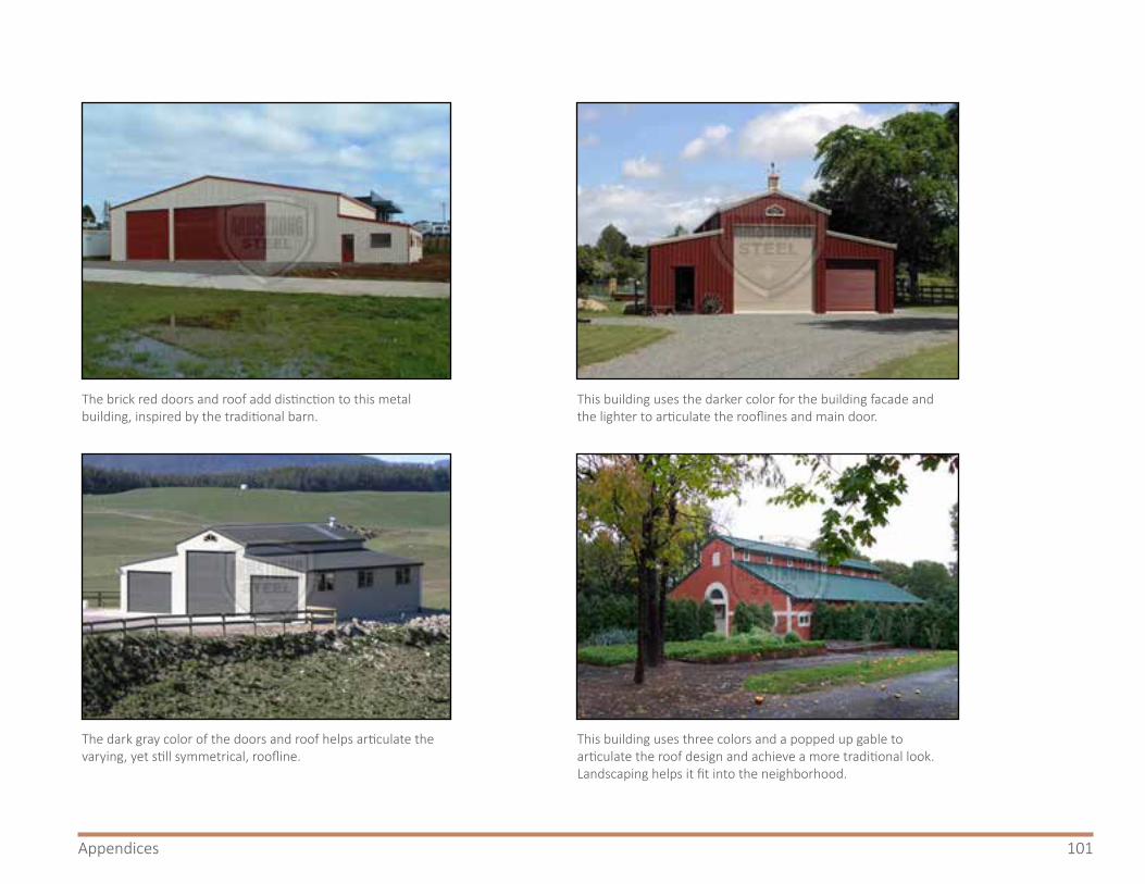
101Appendices
The brick red doors and roof add distinction to this metal building, inspired by the traditional barn.
The dark gray color of the doors and roof helps articulate the varying, yet still symmetrical, roofline.
This building uses the darker color for the building facade and the lighter to articulate the rooflines and main door.
This building uses three colors and a popped up gable to articulate the roof design and achieve a more traditional look. Landscaping helps it fit into the neighborhood.

102 East Route 66 Sector Development Plan - 2020 Update
9.4 Examples of Architectural Design in New Mexico
Mountain Vernacular Style (Photo from Hendricks Architecture, www.hendricksarch.com)
Northern New Mexico Style (Photo from Anthony Anella Architect AIA, http://www.anella.com/)
Territorial Style
Spanish Colonial Style
Figure 46. Examples of architectural design in New MexicoThe photographs on these pages illustrate architectural styles typical of New Mexico

103Appendices
Modern Pueblo Revival Style
Examples of Route 66 Themed Architecture

104 East Route 66 Sector Development Plan - 2020 Update
9.5 List of Low Water Use Plantsf

105Appendices
9.6 Groundwater Assessment SummaryBernalillo County Natural Resource Services provided the following summary of groundwater availability along the Route 66 corridor from Tijeras to the eastern Bernalillo County line.
9.6.1GroundwaterintheEastMountainsThe East Mountain Area is complex, both geologically and hydrogeologically. Groundwater is typically available from fractured rock networks, which tend to be unpredictable in their capacity to store and provide groundwater. The Route 66 Corridor from the Bernalillo County East Mountain Transfer Station to the East Bernalillo County Line passes through the Tijeras Canyon Groundwater Area and the Estancia Basin Groundwater Area. Sedillo Hill marks the pinnacle of a groundwater divide. Groundwater generally flows east from Sedillo Hill along the alignment, or groundwater flows west from Sedillo Hill.
Most wells along the alignment draw water from either the Abo-Yeso Sandstone/mudstone or the Madera Limestone aquifers. Groundwater quality data along the corridor is limited, or generalized. The groundwater areas and associated groundwater chemistries described here were previously delineated in the Scientific Investigations Report 2009-5204, produced by the USGS and titled “Groundwater Resources of the East Mountain Area, Bernalillo, Sandoval, Santa Fe, and Torrance Counties, New Mexico, 2005”, and are not specific to the Route 66 Corridor.
9.6.2AquifersandAquiferChemistry
Relevant Terms:MCL – Maximum Contaminant Levels are drinking water quality standards set by the United States Environmental Protection Agency (EPA). An MCL is the legal threshold limit on the amount of a substance that is allowed in public water systems under the Safe Drinking Water Act, measured in milligrams per liter (mg/L).
SMCL – Secondary Maximum Contaminant Levels established by the EPA to assist public water system in managing their drinking water for aesthetic considerations, such as taste, color, and odor. These contaminant levels are not considered to present a risk to human health.
TDS – Total Dissolved Solids is a measure of the total concentration of dissolved substances in water. TDS concentrations exceeding 1,000 mg/L are generally considered unsuitable for industrial uses.
ConstituentSMCL
(mg/L)MCL
(mg/L)Chloride 250 -Nitrate - 10TDS 500 -

106 East Route 66 Sector Development Plan - 2020 Update
9.6.3Abo-YesoSandstone/MudstoneAquifer:The USGS Report 2009-5204 found elevated levels of chloride and dissolved solids in wells placed in the Abo-Yeso aquifer along Interstate 40. Total dissolved solids exceeded the SMCL (Secondary Maximum Contaminant Level) in 11 of 32 samples, with calcium and bicarbonate being the dominant ions in most samples. Nitrate exceeded the MCL (Maximum Contaminant Level) in 1 of 35 samples tested. A common source of nitrate in groundwater is from septic tanks and leach fields. Chloride levels were above the SMCL in 4 of 37 water samples tested. If the source of the chlorides is primarily road salts, then this indicates that these wells are recharged by localized surface infiltration and annual precipitation recharge events. This geologic condition also makes this aquifer at a greater risk of anthropogenic sources of contamination from the surface.
9.6.4MaderaLimestoneAquifer:The USGS Report 2009-5204 found elevated levels of chloride and dissolved solids in wells placed in the Madera Limestone along Interstate 40. Total dissolved solids exceeded the SMCL in 38 of 81 samples, with calcium and bicarbonate being the dominant ions in most samples. The presence of these ions in limestone aquifers, like the Madera, is typical. Chloride levels were above the SMCL in 6 of 89 water samples tested. If the source of the chlorides is primarily road salts, then this indicates that these wells are recharged by localized surface infiltration and annual precipitation recharge events. This
geologic condition also makes this aquifer at a greater risk of anthropogenic sources of contamination from the surface.
9.6.5TijerasCanyonGroundwaterArea(Route66Corridoronly):The Route 66 corridor roughly from the Bernalillo County East Mountain Transfer Station east to Sedillo Hill, falls within the Tijeras Canyon Groundwater Area. Portions of this alignment, however, border the Tijeras Graben Groundwater Area, which possesses substantially different geologic and hydrogeologic properties. Wells within this narrow corridor draw upon either the Abo-Yeso or Madera aquifers. Well summaries were obtained from 45 well logs on file within the Office of the State Engineer Water Rights Database. Wells tend to be relatively shallow (up to 300 feet generally), and produce typically between 10-40 gallons per minute (gpm) groundwater. Water level readings tend to fluctuate by several feet, depending on the season and annual precipitation, but are overall relatively stable. Overall, groundwater flow direction is to the west from Sedillo Hill. Geologic and hydrogeologic conditions deviate substantially with distance from the alignment. In general, wells are deeper, and groundwater levels are declining outside of the Tijeras Arroyo.

107Appendices
9.6.6EstanciaBasinGroundwaterArea(Route66Corridoronly):The Route 66 corridor roughly from Sedillo Hill east to the Bernalillo County Line lies within the western edge of the Estancia Basin Groundwater Area. Well summaries were obtained from 18 well logs on file within the Office of the State Engineer Water Rights Database. Wells adjacent to the Route 66 alignment typically range from 300 to 1,000 feet in total depth and are placed within the Madera aquifer. The Madera limestone in this area generally produces groundwater flow volumes of 1-10 gpm. Current and relevant water level trends data from the Bernalillo County Domestic Well Program records, demonstrate that water levels are stable or declining. Overall, groundwater flow direction is to the east from Sedillo Hill.
9.7 FEMA Guidance on Unmapped Areas on Flood Hazard MapsThe following is excerpted from the Federal Emergency Management Agency (FEMA) Fact Sheet for Stakeholders “Unmapped Areas on Flood Hazard Maps” regarding Understanding Zone D, last updated in August 2011. It can be found online at https://www.fema.gov/media-library-data/20130726-1806-25045-7880/zone_d_fact_sheet.pdf
9.7.1BackgroundFlood hazard maps, also known as Flood Insurance Rate Maps (FIRMs), are important tools in the effort to protect lives and properties in communities across the nation. By showing the extent to which areas of a community and individual properties are at risk for flooding, these flood maps help residents and business owners make better financial decisions about protecting their property.
However, flood risks are dynamic and can change over time. Water flow and drainage patterns can be altered dramatically due to surface erosion, land use, and natural forces. As a result, flood maps for those areas may no longer accurately portray the current flood risks. Consequently, the Federal Emergency Management Agency (FEMA) has been updating the nation’s flood maps using the latest data gathering and mapping technology and new flood maps are being issued nationwide.

108 East Route 66 Sector Development Plan - 2020 Update
9.7.2UnderstandingZoneDThe level of flood risk is indicated on the flood map by a letter. For example, flood zones labeled with the letters B, C or X represent moderate- and low-risk areas. Flood zones identified by the letters A or V represent high-risk areas, known as Special Flood Hazard Areas (SFHAs). On some flood maps, there may also be a zone labeled with the letter D. The Zone D designation is used for areas where there are possible but undetermined flood hazards, as no analysis of flood hazards has been conducted. The designation of Zone D is also used when a community incorporates portions of another community’s area where no map has been prepared.
Flood insurance is available in Zone D and property owners should be encouraged to purchase it. However, flood insurance is not federally required by lenders for loans on properties in these zones. Although these areas are often undeveloped and sparsely populated when designated as Zone D, lenders may become aware that new development in such areas has increased the possibility of property damage from flooding. Consequently, they may require coverage as a condition of their loans, even though it is not federally required.
Flood insurance rates for properties in Zone D are commensurate with the uncertainty of the flood risk. Consequently, as seen in the table below, the Zone D premiums can be higher than a standard low-risk X zone premiums
and significantly higher than the Preferred Risk Policy (PRP) premiums. If an area is being remapped and properties are going from Zone B, C, or X to Zone D, the insurance agent should determine if grandfathering the existing low-risk zone for future rating will provide a lower premium than using the new Zone D premium. Also, since Zone D is not considered an SFHA, a property that was designated in Zone D on the previous map and is newly designated in an SFHA by a map revision effective may be insured under the PRP based on the 2-year PRP eligibility extension. More details on grandfathering and PRP Extension can be found at www.fema.gov/library/viewRecord.do?id=3745.
To learn more about flood insurance coverage and options, visit www.FloodSmart.gov. For more information about FEMA’s latest mapping initiatives, visit www.fema.gov/plan/prevent/fhm/index.shtm.

109Appendices
9.8 List of Changes to the DocumentThis section documents the changes to the document since its 2018 adoption.
1. Executive Summary ○ This section has been rewritten to reflect the
expansion and update to the plan.2. Introduction
○ The section markers “Part I – Background” and “Part II – The Plan: Zoning & Design” have been removed from the document. The document is just 10 chapters with no larger segmentation.
○ Introduction folds together three segments of the old document: “Introduction,” “1.0 Regulatory Framework,” and sections from “2.0 Plan Context.”
○ 2.1 Project Background — This section is adapted
from the “Introduction” section and includes updated language about the plan.
○ 2.2 Project History — This is a new section discussing the impetus for the original plan, adoption of the original plan, and the push for the update.
○ 2.3 Regulatory Framework — This section remains unchanged from section 1.0 of the original plan.
○ 2.4 The Planning Process — This section is largely unchanged from section 2.1 of the original plan.
○ 2.5 Community Contributions — This section has been updated from 2.2 of the original plan to reflect meetings, workshops, and other milestones of the update.
Unmapped Areas on Flood Hazard Maps
August 2011 PAGE 1
FACT SHEET FOR STAKEHOLDERS
Understanding Zone D BACKGROUND Flood hazard maps, also known as Flood Insurance Rate Maps (FIRMs), are important tools in the effort to protect lives and properties in communities across the nation. By showing the extent to which areas of a community and individual properties are at risk for flooding, these flood maps help residents and business owners make better financial decisions about protecting their property.
However, flood risks are dynamic and can change over time. Water flow and drainage patterns can be altered dramatically due to surface erosion, land use, and natural forces. As a result, flood maps for those areas may no longer accurately portray the current flood risks. Consequently, the Federal Emergency Management Agency (FEMA) has been updating the nation’s flood maps using the latest data gathering and mapping technology and new flood maps are being issued nationwide.
UNDERSTANDING ZONE D The level of flood risk is indicated on the flood map by a letter. For example, flood zones labeled with the letters B, C or X represent moderate- and low-risk areas. Flood zones identified by the letters A or V represent high-risk areas, known as Special Flood Hazard Areas (SFHAs). On some flood maps, there may also be a zone labeled with the letter D. The Zone D designation is used for areas where there are possible but undetermined flood hazards, as no analysis of flood hazards has been conducted. The designation of Zone D is also used when a community incorporates portions of another community’s area where no map has been prepared.
Flood insurance is available in Zone D and property owners should be encouraged to purchase it. However, flood insurance is not federally required by lenders for loans on properties in these zones. Although these areas are often undeveloped and sparsely populated when designated as Zone D, lenders may become aware that new development in such areas has increased the possibility of property damage from flooding. Consequently, they may require coverage as a condition of their loans, even though it is not federally required.
Flood insurance rates for properties in Zone D are commensurate with the uncertainty of the flood risk. Consequently, as seen in the table below, the Zone D premiums can be higher than a standard low-risk X zone premiums and significantly higher than the Preferred Risk Policy (PRP) premiums. If an area is being remapped and properties are going from Zone B, C, or X to Zone D, the insurance agent should determine if grandfathering the existing low-risk zone for future rating will provide a lower premium than using the new Zone D premium. Also, since Zone D is not considered an SFHA, a property that was designated in Zone D on the previous map and is newly designated in an SFHA by a map revision effective may be insured under the PRP based on the 2-year PRP eligibility extension. More details on grandfathering and PRP Extension can be found at www.fema.gov/library/viewRecord.do?id=3745.
Premium Comparison (October 1, 2011 Rates)
FIRM Date*/Building Type Preferred Risk Policy (Zone B, C, X)
Standard Rates (Zone B, C, X)
Standard Rates (Zone D)
Pre-FIRM Home** $211 $778 $575 Post-FIRM Home** $211 $778 $952 Pre-FIRM Manufactured Home*** $211 $778 $575 Post-FIRM Manufactured Home*** $211 $778 $1,197
*Pre-FIRM buildings are constructed prior to 12/31/74 or the effective date of the initial flood map; Post-FIRM buildings are constructed on or after the effective date of the initial flood map **Based on $50,000 in building and $20,000 in contents coverage; single family home on a slab with no garage; $1,000 deductible for building and for contents for Zone B, C, X and post-FIRM D; $2,000 deductible for pre-FIRM Zone D ***Based on $50,000 in building and $20,000 in contents coverage; permanently affixed to a lot with no enclosure; $1,000 deductible for building and for contents for Zone B, C, X and post-FIRM D; $2,000 deductible for pre-FIRM Zone D
To learn more about flood insurance coverage and options, visit www.FloodSmart.gov. For more information about FEMA’s latest mapping initiatives, visit www.fema.gov/plan/prevent/fhm/index.shtm. Figure 47. Insurance premium comparison for FEMA flood zones
As found in FEMA Fact Sheet for Stakeholders

110 East Route 66 Sector Development Plan - 2020 Update
3. Plan Context ○ This section uses language from sections 2.3 and 2.4
of the original plan (unchanged), with a new section about the East Mountain corridor.
4. Relevant Planning Documents ○ This section combines “3.0 Relevant Land Use Plans”
and “4.0 Other Plans and Studies” from the original plan. It includes one new plan regarding wildlife-vehicle collisions. Note that Economic Development (4.4) has been moved to section 5.5.
5. Existing Conditions ○ This is a new chapter. The first three sections
borrow from sections 2.5- 2.8 of the original plan. ○ 5.1 Current Characteristics of NM 333 in the Plan
Area — This includes language from section 2.5. Added paragraph about current and planned road improvements to and near NM 333.
○ “5.2 Corridor Segments” replaces 2.7 and 2.8 of the original plan. It explores the characteristics of each of the four corridor segments. Portions of 2.7 and 2.8 have been folded into section 5.2.4 and 5.3
○ “5.3 Zoning and Land Use in the Plan Area” is adapted from a portion of 2.6 of the original plan, with expanded language to discuss zoning and land use in the expanded corridor. It also breaks down zoning and land use by corridor segment.
○ Section 5.4 is a new section using GIS to analyze
topography in the corridor. ○ Section 5.5 draws language from section 2.6 and
lists the special use permits in the expanded corridor.
○ 5.6 is a new section summarizing groundwater quality and availability. The complete analysis, prepared by Bernalillo County Public Works at the request of the public, is available in the appendix.
○ 5.7 has been moved from 4.4 and includes expanded language to discuss economic opportunities.
○ 5.8 is a new section discussing the historical and cultural landmarks in the area.
6. Development Review Considerations ○ This was chapter 5 in the original plan. ○ Section 6.2 includes new language strengthening
the recommendation to NMDOT to establish a formal bicycle lane along NM 333.
○ Section 6.3 “Drainage and Floodplain Management” (formerly 5.2) has been expanded to clarify and update language about Public Works standards for drainage. It also includes additional language about flood zones to incorporate the differing features across the expanded plan area.
○ Section 6.5 is new.7. Sector Development Zoning
○ Based on public input, “Overnight Campground”

111Appendices
has been added to the list of uses eligible for Special Use permits.
8. Design Standards and Considerations ○ References to various appendices have been
updated to point to the appropriate section. ○ Section “8.4 Signs” removes allowances for neon
lighting and requires compliance with lighting requirements mentioned elsewhere in the document.
9. Appendices ○ This chapter includes three new sections: a list
of changes to the document, results of the online survey, and groundwater analysis prepared by Public Works
9.9 Survey ResultsAs part of the public involvement process, the planning team distributed an online survey via SurveyMonkey regarding land uses in the plan area. The survey received 34 responses.
The following pages include the survey questions and an analysis of the responses.
East Route 66 Sector Development Plan – Land Use Survey As you may know, Bernalillo County is in the process of updating the East Route 66 Sector Development Plan. This plan governs zoning and land use along Route 66 in the East Mountains. At present the plan applies to land from approximately the Sedillo Hill exit east to the County Line. This update will expand the plan area west to include all properties along the road from the edge of the Village of Tijeras east to the County Line. It will continue to allow property owners to adopt a special kind of (optional) commercial zoning unique to the East Route 66 corridor; with the update this opportunity will be extended to this expanded geographical area. The land uses allowed in this zoning category can be found here (LINK). We therefore need your help to reassess whether we should modify these uses to better reflect the character of the corridor. What kinds of future development you do or do not want in your community?
For more information about the plan, please refer to the project website (http://www.bernco.gov/planning/east-route-66-sector-development-plan.aspx) or contact Mino Savoca, Program Planner at Bernalillo County Planning & Development Services Department, at [email protected] or 505-314-0361.
1. The current plan PROHIBITS these uses in the area. Are there any of these that you want to ALLOW in the area? Please check any uses you would like to ALLOW. [check boxes]
Amateur radio antenna/tower greater than sixty-five feet (65’) in height
Billboard
Car wash
Drive-thru facilities
Drive-in facilities
Laundromat
Mobile Home
Mortuary
Multiple single-family dwellings on one lot
Off-premise sign

112 East Route 66 Sector Development Plan - 2020 Update
Package liquor store
Parking lot
Restaurant serving liquor (note: this does not include beer and wine)
2. The commercial zoning allowed in the East Route 66 Sector Development Plan permits many commercial uses. These include uses found in O-1 Office zoning, C-1 Commercial zoning, and a few uses unique to SD-E66CC. A full, detailed list of these uses can be found at this link (http://www.bernco.gov/uploads/files/Planning/E66-ZoningLanguage.pdf). Some of these uses include:
Single family housing, agricultural activity, automobile repair, banks, bed and breakfasts, places of worship, spas, drugstores, feed lots and fruit sales, dry cleaners, group homes, gyms, kennels and vet offices, libraries and museums, daycares and nursing homes, medical clinics and drugstores, office buildings, photo studios and radio/TV studios, restaurants, retail shops, trailer sales, liquefied petroleum gas and propane sales, sheet metal working studios, schools, self-storage and warehouses, and wireless telecommunications towers up to 65’ tall.
Should any of these uses be PROHIBITED? Please list them below [text box]
Should any uses NOT mentioned here be ALLOWED? Please list them below [text box]
3. The plan allows property owners to apply for special permission to develop specific uses through a process known as Special Use Permits. In most parts of the county, property owners may apply for any use listed under Section 18-B (link: https://library.municode.com/nm/bernalillo_county/codes/code_of_ordinances?nodeId=BECOCO_APXAZO_ZOBUPLDE_S18SPUSPERE). The plan only ALLOWS special use permits for the following uses: Contractor’s yard, contractor’s equipment storage, public building or utility structure, school bus operation and school bus parking lot, winery, or a specific use. At public meetings, members of the public expressed interest in allowing special use permits for the following uses. Should any of these uses be ALLOWED as a special use permit? [check boxes]
Park for mobile or manufactured homes
Truck Plaza
Overnight Campground for tents or RVs
A Planned Development Area (PDA) clustering housing and/or commercial uses
Other use from 18-B (check box with text box)
4. On a scale of 1-5, with 1 being the least and 5 being the most, how concerned are you about the following issues in the East Route 66 corridor? (Radio buttons 1-5, “least” -> “most”)
Jobs and economic development
Light and noise
Preserving wildlife habitats
Preserving the scenic and rural character of the area
Traffic
Water availability
5. Are there any other considerations the East Route 66 Sector Development Plan should make as it anticipates future development? Do you have any closing comments? Would you like to clarify any of your answers above? [text box]

113Appendices
Land Use
1 / 8
Q1 The current plan PROHIBITS these uses in the area. Are there any ofthese that you want to ALLOW in the area? Please check any uses you
would like to ALLOW.Answered: 21 Skipped: 17
Amateur radioantenna/towe...
Billboard
Car wash
Drive-thrufacilities
Drive-infacilities
Laundromat
Mobile Home
Mortuary
Multiplesingle-famil...
Off-premisesign
Package liquorstore
Parking lot
Restaurantserving liqu...
0% 10% 20% 30% 40% 50% 60% 70% 80% 90% 100%
Land Use
2 / 8
19.05% 4
14.29% 3
52.38% 11
38.10% 8
52.38% 11
19.05% 4
9.52% 2
4.76% 1
14.29% 3
9.52% 2
19.05% 4
23.81% 5
57.14% 12
Total Respondents: 21
ANSWER CHOICES RESPONSES
Amateur radio antenna/tower greater than sixty-five feet (65’) in height
Billboard
Car wash
Drive-thru facilities
Drive-in facilities
Laundromat
Mobile Home
Mortuary
Multiple single-family dwellings on one lot
Off-premise sign
Package liquor store
Parking lot
Restaurant serving liquor (note: this does not include beer and wine

114 East Route 66 Sector Development Plan - 2020 Update
Land Use
3 / 8
75.00% 12
43.75% 7
Q2 The commercial zoning allowed in the East Route 66 SectorDevelopment Plan permits many commercial uses. These include uses
found in O-1 Office zoning, C-1 Commercial zoning, and a few usesunique to SD-E66CC. A full, detailed list of these uses can be found at
this link (http://www.bernco.gov/uploads/files/Planning/E66-ZoningLanguage.pdf). Some of these uses include: Single family housing,agricultural activity, automobile repair, banks, bed and breakfasts, placesof worship, spas, drugstores, feed lots and fruit sales, dry cleaners, grouphomes, gyms, kennels and vet offices, libraries and museums, daycares
and nursing homes, medical clinics and drugstores, office buildings, photostudios and radio/TV studios, restaurants, retail shops, trailer sales,
liquefied petroleum gas and propane sales, sheet metal working studios,schools, self-storage and warehouses, and wireless telecommunications
towers up to 65’ tall.Answered: 16 Skipped: 22
# SHOULD ANY OF THESE USES BE PROHIBITED? PLEASE LIST THEM HERE DATE
1 Any business that has a high density use of water, such as group homes, kennels, nursinghomes, medical clinics, and high density office buildigs should be prohibited
2/15/2020 12:51 PM
2 trailer sales, self-storage and warehouses 2/12/2020 9:07 PM
3 Single family housing, automobile repair, banks, bed and breakfasts, places of worship, spas,drugstores, dry cleaners, group homes, gyms, kennels and vet offices, libraries and museums,daycares and nursing homes, medical clinics and drugstores, office buildings, photo studiosand radio/TV studios, restaurants, retail shops, trailer sales, liquefied petroleum gas andpropane sales, sheet metal working studios, schools, self-storage and warehouses, andwireless telecommunications towers up to 65’ tall
2/12/2020 2:31 PM
4 telecom towers without concealment 2/12/2020 11:17 AM
5 All of them 2/12/2020 11:01 AM
6 retail shops, banks, drugatores, dry cleaners, gyms, restaurants. radio/TV studios, trailer sales,w.t. towers, feed lots
2/10/2020 11:13 AM
7 Anything that uses water. And also anything higher than 20 feet. 2/8/2020 9:13 AM
8 No wireless towers 2/7/2020 12:25 PM
9 No 2/5/2020 2:03 PM
10 feed lots 2/4/2020 3:29 PM
11 Anything that uses water should be prohibited until the county can get some real projections forthe sustainability of the water in that area.
2/4/2020 1:40 PM
12 Self storage and warehouse 1/30/2020 5:22 PM
ANSWER CHOICES RESPONSES
Should any of these uses be PROHIBITED? Please list them Here
Should any uses NOT mentioned here be ALLOWED? Please list them Here
Land Use
4 / 8
# SHOULD ANY USES NOT MENTIONED HERE BE ALLOWED? PLEASE LIST THEM HERE DATE
1 agricultural activity, feed lots and fruit sales 2/12/2020 2:31 PM
2 brewery/restaurant 2/12/2020 11:31 AM
3 Drive in theater and restaurants in the 50s & 60 style 2/11/2020 12:46 PM
4 liquor sales 2/10/2020 9:37 AM
5 No 2/5/2020 2:03 PM
6 short term RV park 2/4/2020 3:59 PM
7 Trailer sales 1/30/2020 5:22 PM

115Appendices
Land Use
5 / 8
27.78% 5
22.22% 4
83.33% 15
33.33% 6
5.56% 1
Q3 The plan allows property owners to apply for special permission todevelop specific uses through a process known as Special Use Permits.In most parts of the county, property owners may apply for any use listed
under Section 18-B (link:https://library.municode.com/nm/bernalillo_county/codes/code_of_ordinances
nodeId=BECOCO_APXAZO_ZOBUPLDE_S18SPUSPERE). The planonly ALLOWS special use permits for the following uses: Contractor’s
yard, contractor’s equipment storage, public building or utility structure,school bus operation and school bus parking lot, winery, or a specific use.At public meetings, members of the public expressed interest in allowingspecial use permits for the following uses. Should any of these uses be
ALLOWED as a special use permit?Answered: 18 Skipped: 20
Total Respondents: 18
# OTHER USE FROM 18-B DATE
1 A nature preserve, a grocery store, or places to eat 1/30/2020 5:22 PM
Park formobile or...
Truck Plaza
OvernightCampground f...
A PlannedDevelopment...
Other use from18-B
0% 10% 20% 30% 40% 50% 60% 70% 80% 90% 100%
ANSWER CHOICES RESPONSES
Park for mobile or manufactured homes
Truck Plaza
Overnight Campground for tents or RVs
A Planned Development Area (PDA) clustering housing and/or commercial uses
Other use from 18-B
Land Use
6 / 8
Q4 On a scale of 1-5, with 1 being the least and 5 being the most, howconcerned are you about the following issues in the East Route 66
corridor?Answered: 38 Skipped: 0
Jobs andeconomic...
Light and noise
Preservingwildlife...
Preserving thescenic and...
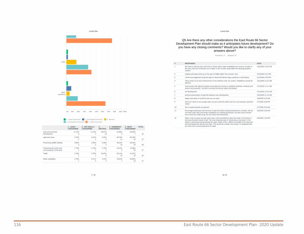
116 East Route 66 Sector Development Plan - 2020 Update
Land Use
7 / 8
17.14%6
11.43%4
28.57%10
22.86%8
20.00%7
35
2.70%1
5.41%2
5.41%2
29.73%11
56.76%21
37
0.00%0
5.26%2
5.26%2
26.32%10
63.16%24
38
2.70%1
2.70%1
2.70%1
16.22%6
75.68%28
37
2.78%1
2.78%1
16.67%6
36.11%13
41.67%15
36
2.70%1
8.11%3
5.41%2
18.92%7
64.86%24
37
1 - Least Concerned 2 - Not Really Concerned 3 - Neutral
4 - Somewhat Concerned 5 - Most Concerned
Traffic
Wateravailability
0% 10% 20% 30% 40% 50% 60% 70% 80% 90% 100%
1 - LEASTCONCERNED
2 - NOT REALLYCONCERNED
3 -NEUTRAL
4 - SOMEWHATCONCERNED
5 - MOSTCONCERNED
TOTAL
Jobs and economicdevelopment
Light and noise
Preserving wildlife habitats
Preserving the scenic andrural character of the area
Traffic
Water availability
Land Use
8 / 8
Q5 Are there any other considerations the East Route 66 SectorDevelopment Plan should make as it anticipates future development? Do
you have any closing comments? Would you like to clarify any of youranswers above?
Answered: 12 Skipped: 26
# RESPONSES DATE
1 We need to halt this plan until more is known about water availaibility and sources of water inthis area, and how increased use of water in this corridor would affect the abutting propertyowners.
2/15/2020 12:51 PM
2 Upkeep and signs back up on the part of Old66 called “the musical” road. 2/13/2020 5:21 PM
3 I think encouragement of period signs or Route 66 themed signs would be a neat feature 2/13/2020 4:34 PM
4 There needs to be strict enforcement on the esthetics side. No "junkie" installations should beallowed.
2/12/2020 11:31 AM
5 work closely with adjacent entities (municipal and county) to establish aesthetic continuity andavoid cross purposes - the EM is one big community, repect that please.
2/12/2020 11:17 AM
6 No development 2/12/2020 11:01 AM
7 priortize preservation of park-like features over development 2/10/2020 11:13 AM
8 Septic and water on small lot sizes are an issue. 2/8/2020 9:13 AM
9 Don't do it there is not enough water we don't need the traffic and the rural character would beruined
2/7/2020 9:26 PM
10 Don’t expand special use permits 2/7/2020 9:40 AM
11 Encourage businesses and services to open but allow existing businesses to continue. We donot need a plan that only brings competition for existing businesses, we want more servicesand a drive thru coffee shop, but not chains like McDonald's
2/5/2020 2:03 PM
12 Water. Until you guys can get some clear, current predictions about the water of the future inthat area this plan needs to halt. The most important part of "preserving a rural area" in thedesert is preserving and protecting the water. Water is life. It affects the health of the land andall living beings like wild life and trees. This should be number one priority. I'm disgusted thatyou have zero current projections for water.
2/4/2020 1:40 PM

117Appendices
This page is intentionally blank

Bernalillo CountyPlanning & Development Services