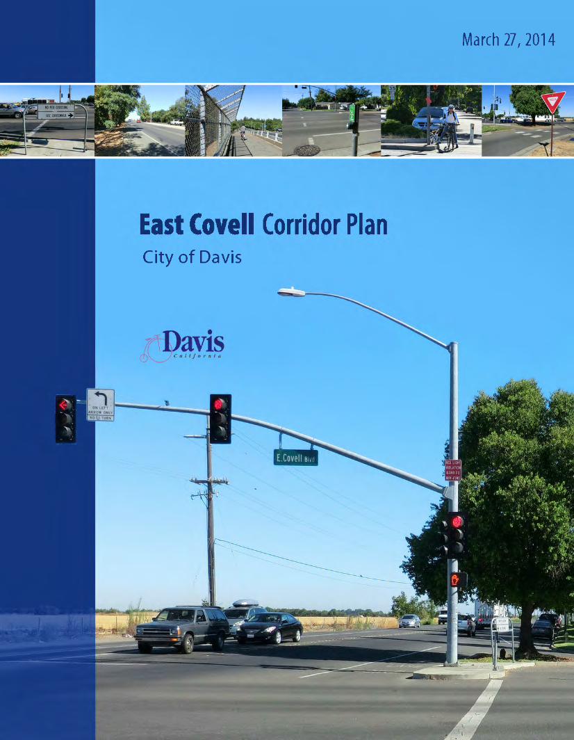
East Covell Corridor Plan - City of...
96
Transcript of East Covell Corridor Plan - City of...
East Covell Corridor Plan
Prepared for:
City of Davis
23 Russell Boulevard
Davis, CA 95616
For additional information contact:
Department of Community Development and Sustainability - (530) 757-5610Bob Wolcott, Principal Planner - [email protected]
Department of Public Works - (503) 757-5686Roxanne Namazi, Senior Civil Engineer - [email protected]
Prepared by:
Draft
March 27, 2014
ii
Executive Summary .................................................................................................................................1
Chapter 1: Corridor Plan Overview ....................................................................................................3
Chapter 2: Existing Conditions ............................................................................................................7
Chapter 3: Future Project ......................................................................................................................9
Chapter 4: Public Outreach ................................................................................................................ 13
Chapter 5: Circulation Study ............................................................................................................. 19
Chapter 6: Right Turn Analysis ......................................................................................................... 33
Chapter 7: Corridor Recommendations ....................................................................................... 37
Chapter 8: Pedestrian and Bicycle Grade Separation ............................................................. 47
Chapter 9: Place Making ..................................................................................................................... 51
Chapter 10: Implementation ............................................................................................................. 55
Appendices ............................................................................................................................................... 63
Project Map
Preliminary Cost Estimates
Public Workshop Summary
Contents
East Covell Corridor Plan
East Covell Corridor Plan iii
Executive Summary
East Covell Corridor PlanThe East Covell Corridor Plan (ECCP) is a taking a comprehensive look at the existing transportation systems and community assets on East Covell Boulevard between F Street and Birch Lane. The goal of the project is to identify realistic transportation improvements to the corridor that will enhance safety, circulation, identity, and access for all modes of transportation. The purpose of this document is to set a vision for the future development of East Covell Boulevard so that policy makers can make informed decisions about its future infrastructure development.
East Covell Boulevard is one of the corridors to be considered in the Transportatoin Element for a corridor plan with special needs related to future development in the region.
Covell Boulevard is a vital east-west corridor that connects residential neighborhoods to major destinations including SR113, I-80, many shopping centers, and numerous schools and parks.
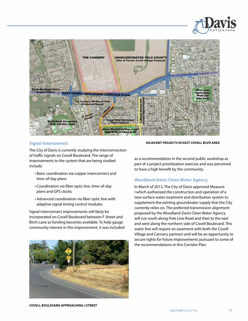
Currently, the former site of the Hunt-Wesson tomato cannery is being developed into a mixed use project with a blend of residential, business park, neighborhood center and urban farm referred to as The Cannery. The project’s main access is the intersection of Covell Boulevard and J Street with an additional off street bicycle path at the west edge along the Sacramento Northern railroad. Integrating The Cannery’s improvements with the recommendations of this Plan and a concurrent Safe Routes to School Project embodied a holistic approach to access and mobility for all modes of transportation.
Along with qualitative public input through stakeholder meetings and two public workshops, the corridor plan project included a circulation analysis that analyzed the existing roadway network, bicycle facilities, pedestrian facilities and transit routes. Key recommendations were made based on operations at the four main intersections with Covell Boulevard including F Street, J Street, L Street and Pole Line Road. Additionally, Low-Stress Bicycling and Network Connectivity methodology was used to determine the
Level of Traffic Stress (LTS) and possible enhancements for roadway segments and intersection approaches.
Key recommendations from the Corridor Plan include removal of the channelized right turns at the major intersections, buffered bicycle lanes, and a new traffic signal at L Street. These enhancements have the potential to increase safety at intersections for bicycles and pedestrians, calm traffic on Covell Boulevard, create better opportunities for side street and driveway access, and create opportunity areas for aesthetic enhancements.
One of the high priority desires of the users of the corridor is for a pedestrian and bicycle grade separated crossing between J Street and Pole Line Road. The Corridor Plan contains conceptual designs for four alternatives comparing probable right of way impacts, utility constraints and potential costs. All of the alternatives discussed have challenges that will require future exploration by the City.
Additional recommendations to the corridor include:
• Median Improvements along Covell Boulevard• Oak Tree Plaza Driveway Enhancements• Claremont Drive Cycle Track• East Covell Boulevard Shared Use Path• Pole Line Shared Use Path• Birch Lane Shared Use Path• H Street Tunnel Replacement• Signal Interconnect and Coordination
The East Covell Corridor Plan concludes with a discussion of the possible implementation strategies the City can explore for constructing the menu of corridor enhancements with a variety of possible funding sources.
1
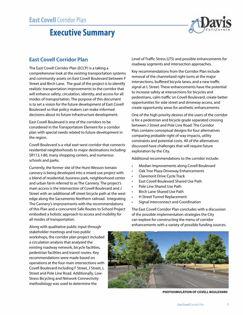
Photosimulation oF Covell Boulevard
2
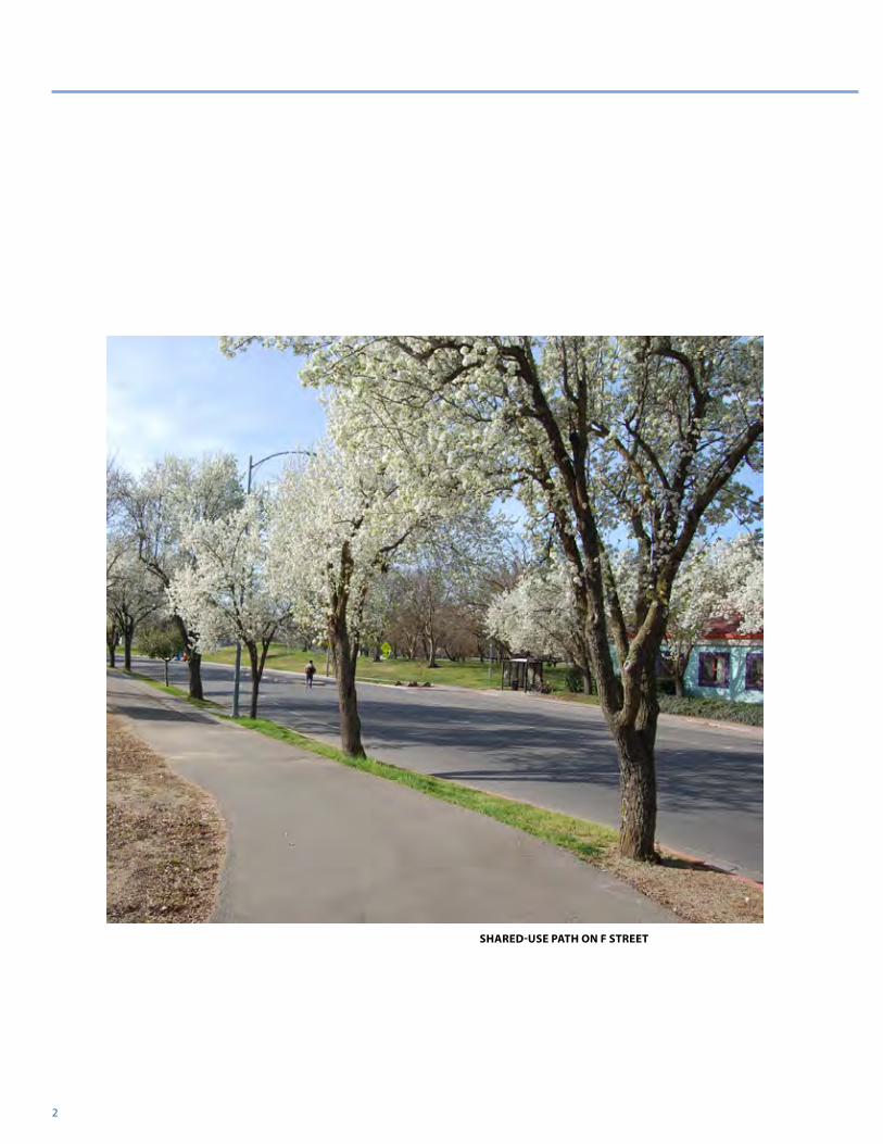
Shared-USe path on F Street
East Covell Corridor Plan
East Covell Corridor Plan 3
CHAPTER 1: Corridor Plan Overview
Purpose of Corridor PlanThe City of Davis General Plan Transportation Element (Policy TRANS 2.8) directs the City to “Improve the function, safety, and appearance of selected corridors.” To implement this policy, the General Plan calls for the City to develop “corridor plans” for selected streets which warrant special treatment because of existing impact problems or problems related to future projected conditions. Covell Boulevard is one of the streets identified in the General Plan as subject to the “corridor plan” process. The purpose of this document is to set a vision for the future development of East Covell Boulevard so that policy makers can make informed decisions about its future development.
General plan transportation elementpolicy tranS 2.8 (Goal: 2). Improve the function, safety, and appearance of selected corridors as illustrated. Corridor plan improvement concepts are shown in Figure 4 of the General Plan Transportation Element.
actions
a. Develop “corridor plans” for selected streets which warrant special treatment because of existing impact problems or operational issues. Corridor plans should take into consideration adjacent land uses and result in
streets that are both functional and aesthetic. The plans should utilize innovative means of slowing traffic, where appropriate, and provide safe access for pedestrians and bicyclists. Mitigation shall be incorporated to protect residences and sensitive receptors from noise, air pollution and other traffic related impacts. The corridor plans may deviate from the standards established in the General Plan, if deviations improve the livability of the area.
East Covell Boulevard is one of the corridors to be considered for a corridor plan with special needs related to future development in the region. These needs include:
• Improving safety for bicyclists and pedestrians on East Covell Boulevard and at intersections.
• Improving bicyclist and pedestrian access to major destinations, including the Oak Tree Plaza, nearby offices, schools, and parks.
• Completing the network of high-quality bikeways in Davis so that all destinations can easily be reached by bicycle.
• Providing safe crossings of East Covell Boulevard to key trip generators, including the Oak Tree Plaza.
• Improving streetscape aesthetic and amenities that add identity to the corridor.
• Providing improvements that maximize the ease and efficiency of using transit.
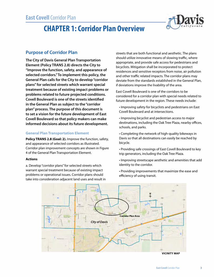
Vicinity Map
East Covell Corridor Plan
4 CHAPTER 1: Corridor Plan Overview
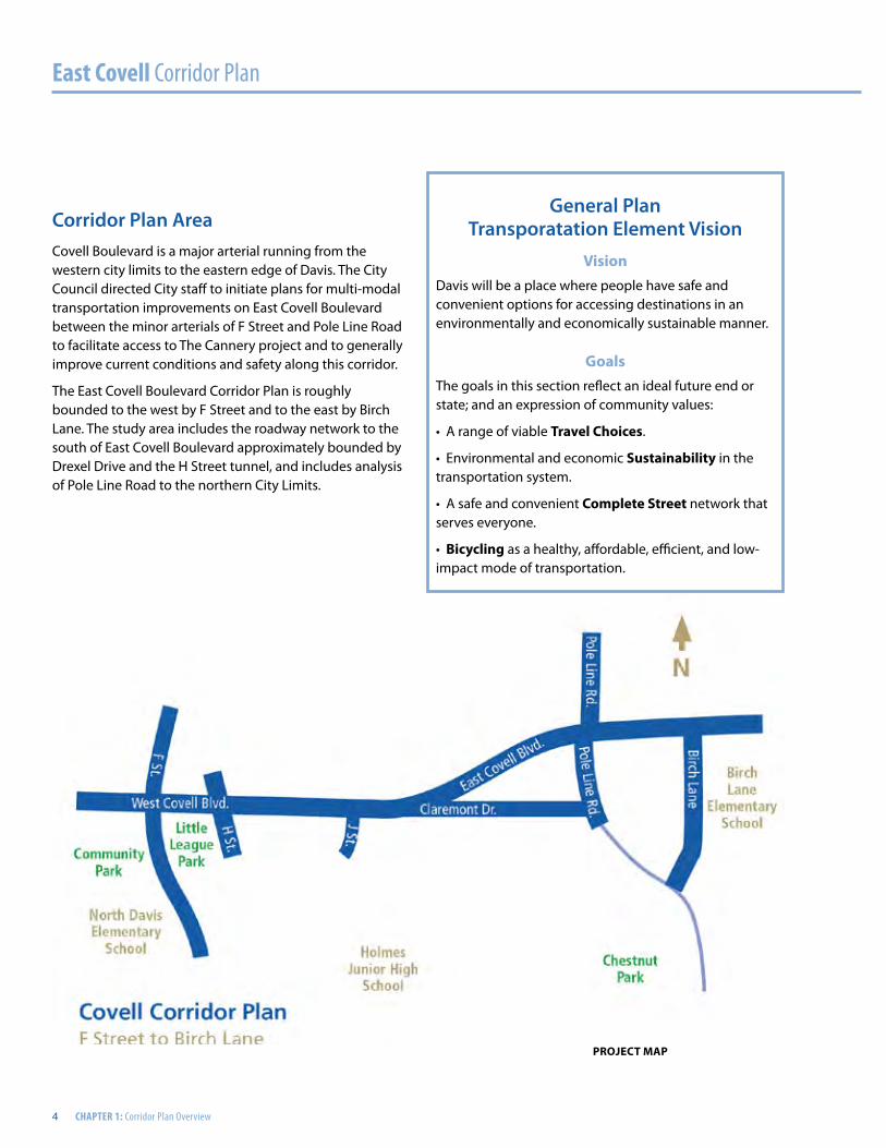
Corridor Plan AreaCovell Boulevard is a major arterial running from the western city limits to the eastern edge of Davis. The City Council directed City staff to initiate plans for multi-modal transportation improvements on East Covell Boulevard between the minor arterials of F Street and Pole Line Road to facilitate access to The Cannery project and to generally improve current conditions and safety along this corridor.
The East Covell Boulevard Corridor Plan is roughly bounded to the west by F Street and to the east by Birch Lane. The study area includes the roadway network to the south of East Covell Boulevard approximately bounded by Drexel Drive and the H Street tunnel, and includes analysis of Pole Line Road to the northern City Limits.
General Plan Transporatation Element Vision
VisionDavis will be a place where people have safe and convenient options for accessing destinations in an environmentally and economically sustainable manner.
GoalsThe goals in this section reflect an ideal future end or state; and an expression of community values:
• A range of viable travel choices.
• Environmental and economic Sustainability in the transportation system.
• A safe and convenient complete Street network that serves everyone.
• Bicycling as a healthy, affordable, efficient, and low-impact mode of transportation.
project Map
East Covell Corridor Plan 5
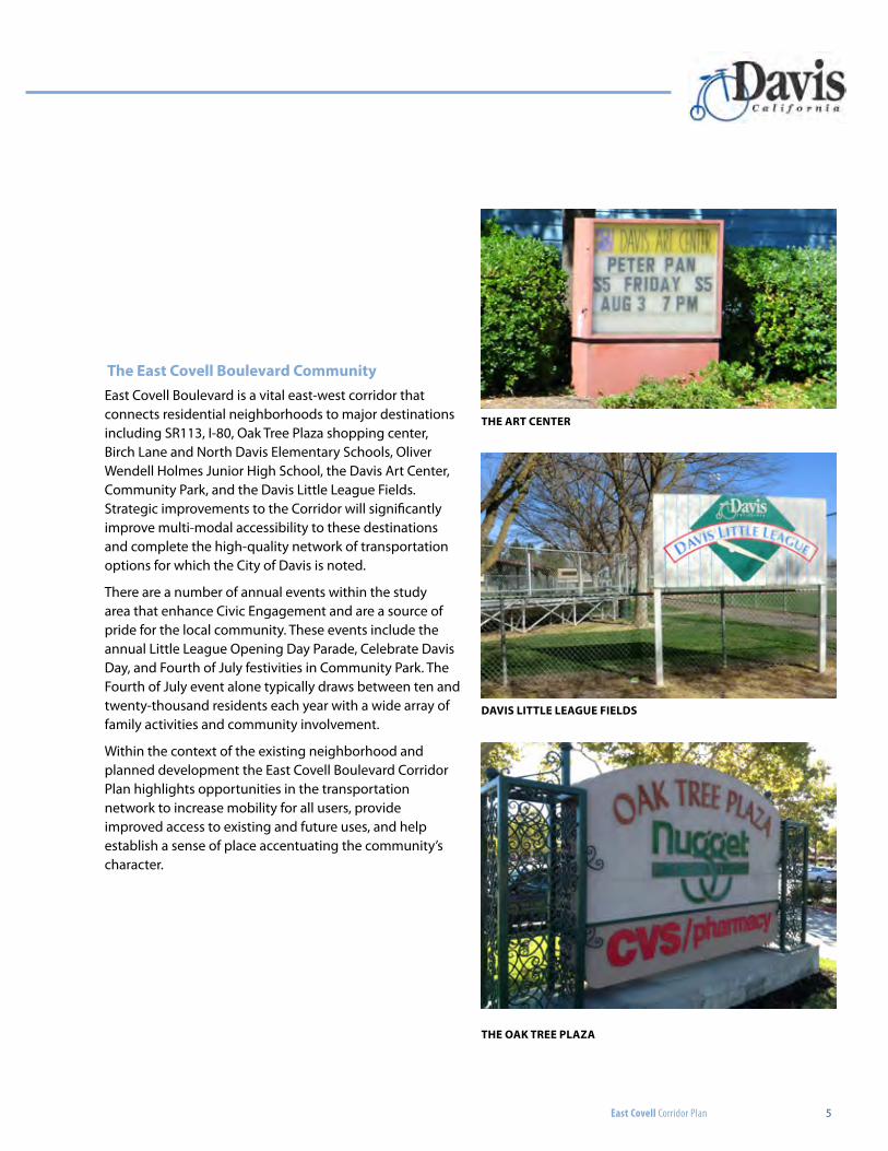
the east covell Boulevard communityEast Covell Boulevard is a vital east-west corridor that connects residential neighborhoods to major destinations including SR113, I-80, Oak Tree Plaza shopping center, Birch Lane and North Davis Elementary Schools, Oliver Wendell Holmes Junior High School, the Davis Art Center, Community Park, and the Davis Little League Fields. Strategic improvements to the Corridor will significantly improve multi-modal accessibility to these destinations and complete the high-quality network of transportation options for which the City of Davis is noted.
There are a number of annual events within the study area that enhance Civic Engagement and are a source of pride for the local community. These events include the annual Little League Opening Day Parade, Celebrate Davis Day, and Fourth of July festivities in Community Park. The Fourth of July event alone typically draws between ten and twenty-thousand residents each year with a wide array of family activities and community involvement.
Within the context of the existing neighborhood and planned development the East Covell Boulevard Corridor Plan highlights opportunities in the transportation network to increase mobility for all users, provide improved access to existing and future uses, and help establish a sense of place accentuating the community’s character.
the art center
daViS little leaGUe FieldS
the oak tree plaza
6
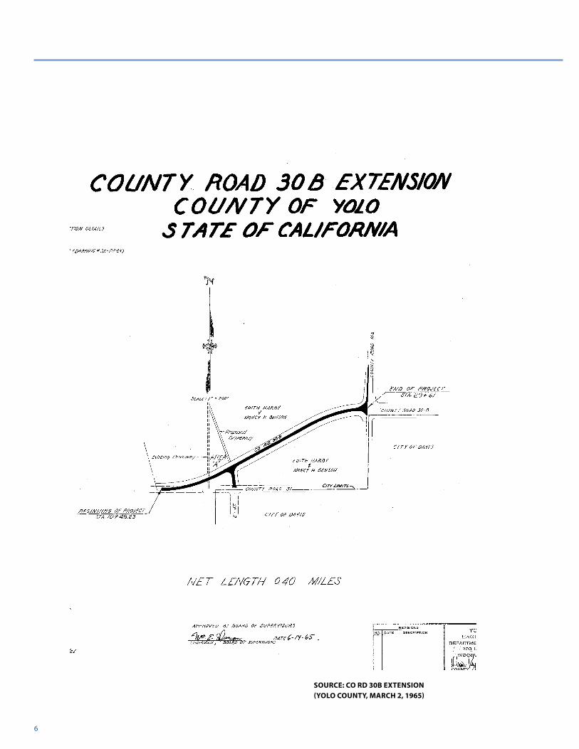
Source: co rd 30b extenSion (yolo county, March 2, 1965)
East Covell Corridor Plan
East Covell Corridor Plan 7
CHAPTER 2: Existing Conditions
Corridor HistoryThe Covell Boulevard corridor has been a historical arterial for automobile traffic in the City of Davis linking Highway 80 to State Route 113. Originally County Road 31, the development of the corridor can be seen with Yolo County’s County Road 30B extension project in the mid-1960’s which corrected an offset in the roadway at what is present-day Pole Line.
existing conditions
The County Road 30B extension project gave Covell Boulevard its distinctive reversing curve west of Pole Line and optimized the existing network of County Roads for automobiles and agricultural equipment. Remnants of the original County Road 31 became present-day Claremont Drive and the extension project lead to the unique configuration of the L Street/East Covell Boulevard intersection as it exists today. The triangular remnant from the County Road 30B extension has developed over the years to be Oak Tree Plaza which capitalizes on access to East Covell Boulevard and Pole Line Road. There are seven different parcels in the plaza that are served by three existing driveways on East Covell Boulevard and one on Pole Line Road.
The extension of County Road 30B set a precedent for the future development of East Covell Boulevard between F Street and Birch Lane that lead to the configuration of the road today. Within the study limits, East Covell Boulevard is a four-lane arterial with an average curb-to-curb distance of seventy-eight feet (78’). This currently accommodates four twelve foot travel lanes, a fourteen foot landscaped median and two eight foot bike lanes. Existing intersections within the study limits generally have channelized right turn lanes.
The old alignment of County Road 30 was the historic northern limit of the City and developed as a utility corridor. Existing utilities in East Covell Boulevard and Claremont Drive include storm drains, sanitary sewers, water, gas and overhead electric lines. These utilities converge at the intersection of L Street and East Covell Boulevard where they are routed to the south into the City.
The City of Davis has made significant improvements to the corridor to improve conditions for active modes of transportation. To accommodate bicyclists and pedestrians, a shared use path runs the length of the study area on the south side of Covell Boulevard. There is also an existing bicycle/pedestrian overcrossing of Covell Boulevard just outside the study area approximately 800 feet to the west of the F Street intersection. The closest undercrossing of Covell Boulevard is 4,500 feet to the east at the eastern boundary of the Wildhorse neighborhood.
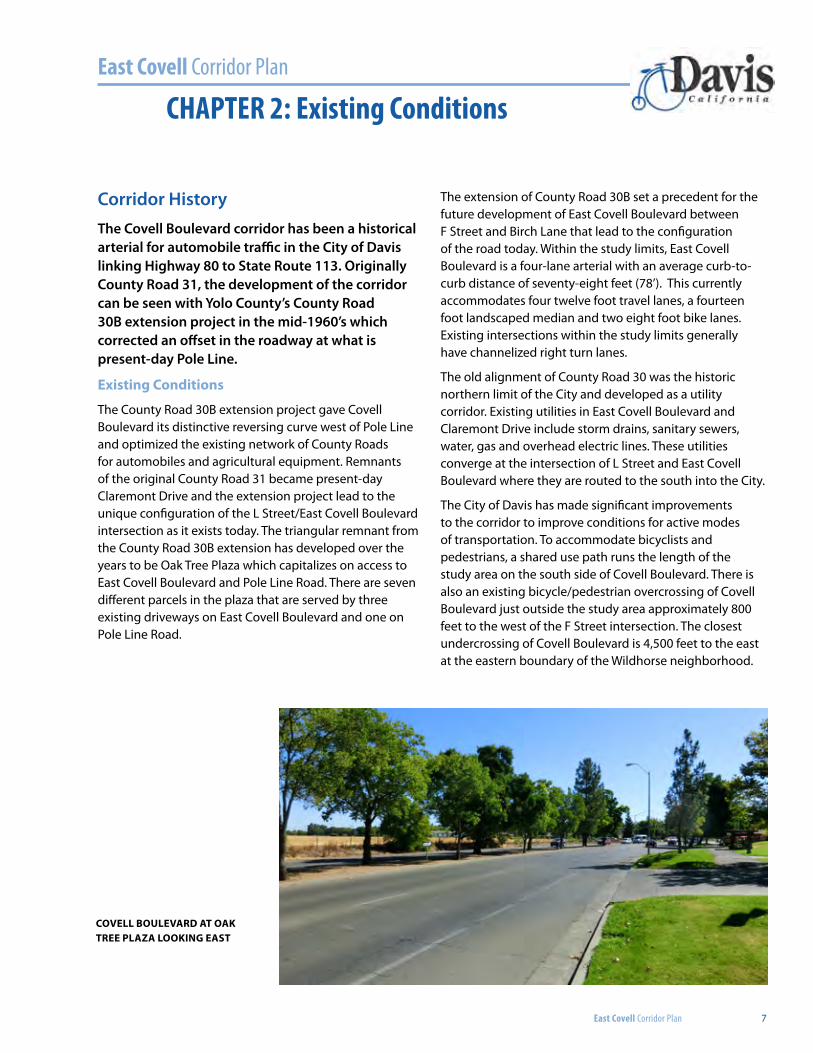
covell boulevard at oak tree plaza looking eaSt
8
Source: The cannery DevelopmenT
East Covell Boulevard
Sacramento N
orthern Railroad

East Covell Corridor Plan
East Covell Corridor Plan 9
CHAPTER 3: Future Projects
Future Development and Infrastructure ProjectsEast Covell Boulevard is a dynamic corridor with a number of adjacent development plans, planning documents and infrastructure projects within the Corridor Plan’s study limits. This chapter of the plan identifies these projects and their relationship to the Corridor Plan.
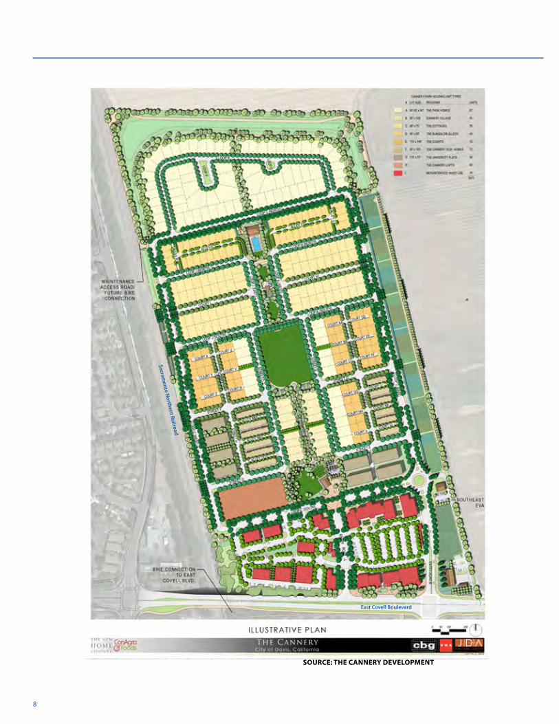
The canneryThe Cannery development on the former site of the Hunt-Wesson tomato cannery. The development, approved by City Council in December 2013, is bounded to the west by existing railroad tracks, to the south by Covell Boulevard, and to the north and east by the City/County Boundary. The project is approved for a mixed use of low, medium and high density residential units, a business park, a neighborhood center and an urban farm with an agricultural buffer. The residential component of the project includes 507 primary units and up to 40 accessory dwelling units (ADU’s) with an average density of 9.5 units per gross acre. The mixed-use component of the project will accommodate approximately 171,000 square feet with an employment potential of up to 850 jobs, plus potential for 24 dwelling units. The project includes 20.8 acres of open space including a detention basin on the west edge of the development, an agriculture buffer on the north
edge, an agricultural buffer and urban farm on the east edge, and two parks on the site.
Primary vehicular access to The Cannery will be provided at the intersection of East Covell Boulevard and J Street which has been incorporated in the East Covell Boulevard Corridor Plan. Bicycle and pedestrian access to The Cannery will be improved as agreed to in the Development Agreement approved by City Council on December 10th, 2013. Per the agreement, the Developer is responsible for J and L Street intersection improvements, the Covell Boulevard Transit Plaza at the Cannery site frontage, modifications to the Oak Tree Plaza Median (if needed), and a southwest grade-separated pathway across Covell Boulevard. The preferred route of this pathway is to connect to the H Street tunnel as studied in the project’s Environmental Impact Report (EIR). However, this route will require offsite easements and/or right-of-way acquisition. Should the City Council choose not to proceed with these acquisitions, the Developer will construct a new bicycle and pedestrian connection to the existing shared-use path on the south side of Covell Boulevard (Bike Path Option 1 in the EIR). The selection of either alternative will be resolved by the Developer and City Council and is outside the scope of recommendations for the East Covell Boulevard Corridor Plan. However, both options have been considered in the corridor plan and can be accommodated pending the ultimate direction from City Council.
looking norTh aT J STreeT anD covell BoulevarD
East Covell Corridor Plan
10 CHAPTER 3: Future Projects
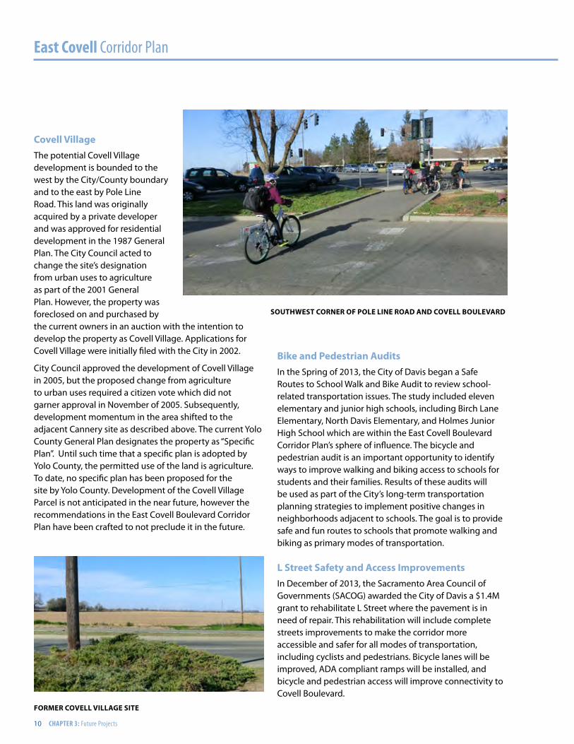
covell villageThe potential Covell Village development is bounded to the west by the City/County boundary and to the east by Pole Line Road. This land was originally acquired by a private developer and was approved for residential development in the 1987 General Plan. The City Council acted to change the site’s designation from urban uses to agriculture as part of the 2001 General Plan. However, the property was foreclosed on and purchased by the current owners in an auction with the intention to develop the property as Covell Village. Applications for Covell Village were initially filed with the City in 2002.
City Council approved the development of Covell Village in 2005, but the proposed change from agriculture to urban uses required a citizen vote which did not garner approval in November of 2005. Subsequently, development momentum in the area shifted to the adjacent Cannery site as described above. The current Yolo County General Plan designates the property as “Specific Plan”. Until such time that a specific plan is adopted by Yolo County, the permitted use of the land is agriculture. To date, no specific plan has been proposed for the site by Yolo County. Development of the Covell Village Parcel is not anticipated in the near future, however the recommendations in the East Covell Boulevard Corridor Plan have been crafted to not preclude it in the future.
Bike and pedestrian auditsIn the Spring of 2013, the City of Davis began a Safe Routes to School Walk and Bike Audit to review school-related transportation issues. The study included eleven elementary and junior high schools, including Birch Lane Elementary, North Davis Elementary, and Holmes Junior High School which are within the East Covell Boulevard Corridor Plan’s sphere of influence. The bicycle and pedestrian audit is an important opportunity to identify ways to improve walking and biking access to schools for students and their families. Results of these audits will be used as part of the City’s long-term transportation planning strategies to implement positive changes in neighborhoods adjacent to schools. The goal is to provide safe and fun routes to schools that promote walking and biking as primary modes of transportation.
l Street Safety and access improvementsIn December of 2013, the Sacramento Area Council of Governments (SACOG) awarded the City of Davis a $1.4M grant to rehabilitate L Street where the pavement is in need of repair. This rehabilitation will include complete streets improvements to make the corridor more accessible and safer for all modes of transportation, including cyclists and pedestrians. Bicycle lanes will be improved, ADA compliant ramps will be installed, and bicycle and pedestrian access will improve connectivity to Covell Boulevard.
SouThweST corner of pole line roaD anD covell BoulevarD
former covell village SiTe
East Covell Corridor Plan 11
Signal interconnectThe City of Davis is currently studying the interconnection of traffic signals on Covell Boulevard. The range of improvements to the system that are being studied include:
• Basic coordination via copper interconnect and time-of-day plans
• Coordination via fiber optic line, time-of-day plans and GPS clocks
• Advanced coordination via fiber optic line with adaptive signal timing control modules
Signal interconnect improvements will likely be incorporated on Covell Boulevard between F Street and Birch Lane as funding becomes available. To help gauge community interest in this improvement, it was included
as a recommendation in the second public workshop as part of a project prioritization exercise and was perceived to have a high benefit by the community.
woodland-Davis clean water agencyIn March of 2013, The City of Davis approved Measure I which authorized the construction and operation of a new surface water treatment and distribution system to supplement the existing groundwater supply that the City currently relies on. The preferred transmission alignment proposed by the Woodland-Davis Clean Water Agency will run south along Pole Line Road and then to the east and west along the northern side of Covell Boulevard. This water line will require an easement with both the Covell Village and Cannery partners and will be an opportunity to secure rights for future improvements pursuant to some of the recommendations in this Corridor Plan.
aDJacenT proJecTS in eaST covell BlvD area
covell BoulevarD approaching J STreeT
12
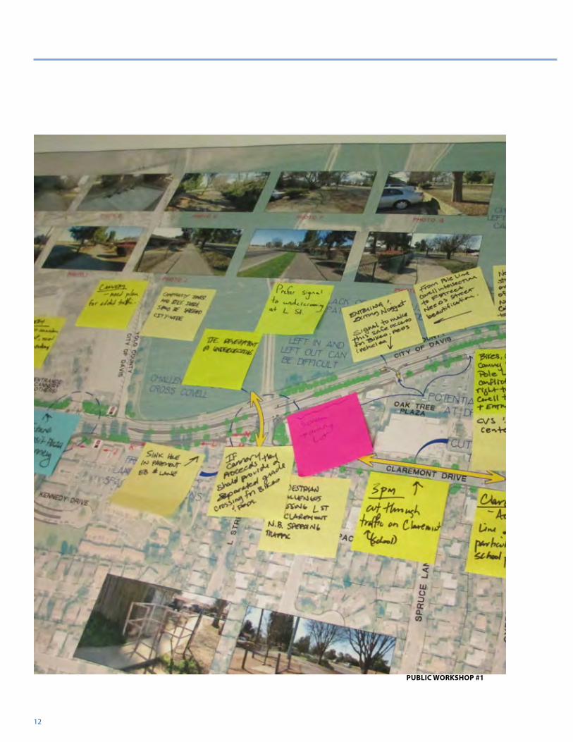
Public workShoP #1
East Covell Corridor Plan
East Covell Corridor Plan 13
CHAPTER 4: Public Outreach
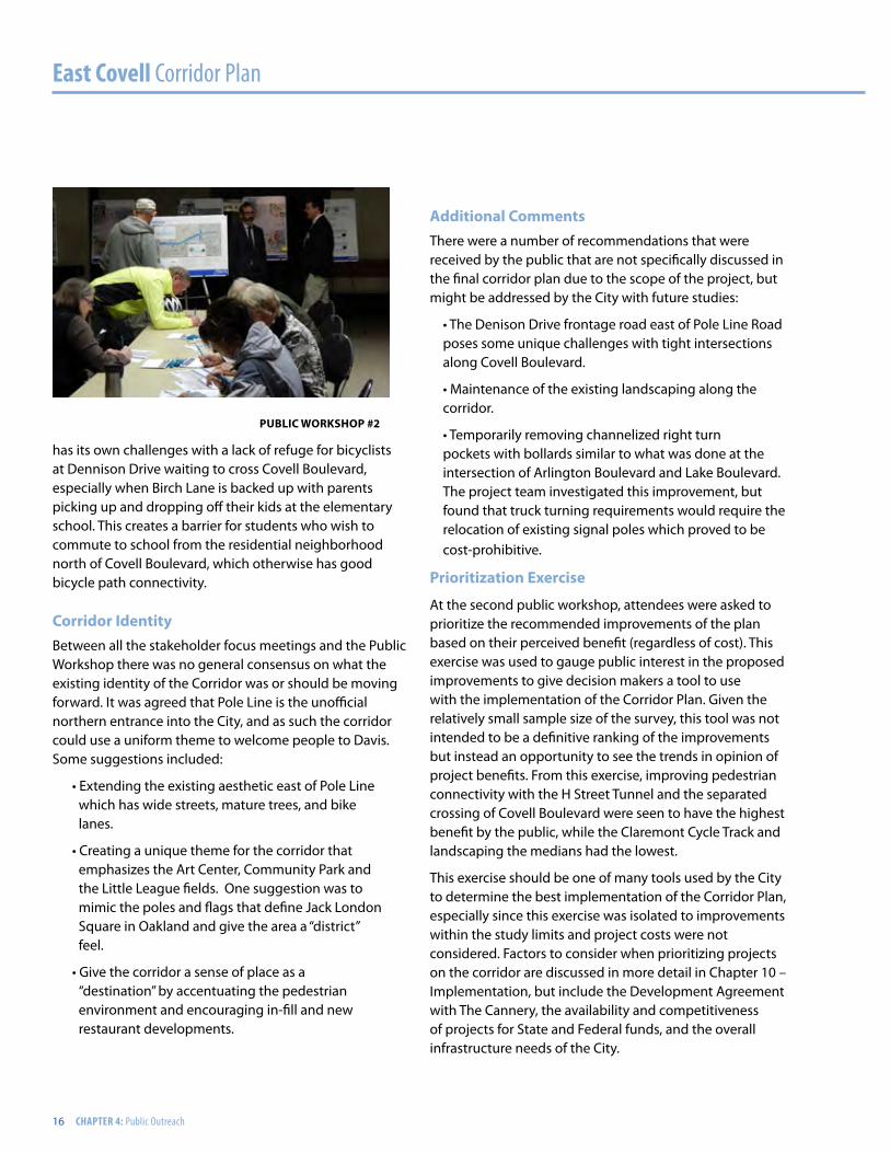
Community InvolvementIn order to better comprehend the mobility and access needs on the East Covell Boulevard Corridor, key stakeholder groups were identified early in the preparation of the Corridor Plan and invited to provide their input and observations about the study area in a series of focused meetings. These groups included local bicycle, transit, and advocacy groups, developers, property management companies, business owners, school officials, and law enforcement. These focused meetings were followed up with two community workshops where additional feedback about the corridor was collected. The information collected by both the focus groups and community workshop was organized by the project team and is summarized in this chapter.
Traffic challengesMany stakeholders commented that Covell Boulevard is a major automotive transportation corridor in their daily commute. There were no significant comments regarding traffic on the corridor itself, except for traffic backing up at F Street and Pole Line during peak traffic hours. At
F Street, the dual left-turn movement from westbound Covell Boulevard to southbound F Street creates a merge immediately to the south of the intersection where F Street drops from two receiving lanes to a single southbound lane. This is further complicated by a pedestrian crossing just south of the intersection that connects the Little League Fields to Community Park. This crossing was recently moved south from its existing location to improve bicycle and pedestrian safety, but it still has an adverse effect on traffic operations during peak school commuting hours.
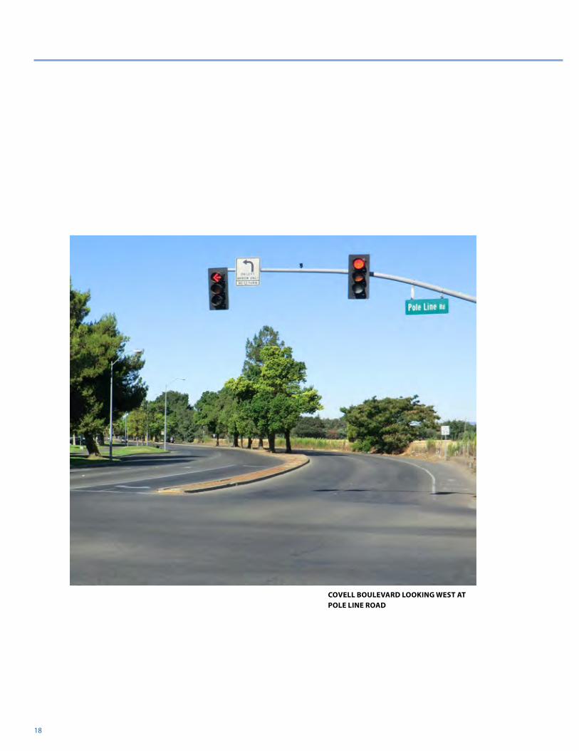
At Pole Line Road, eastbound traffic backs up during the peak hour which encourages some drivers to use Claremont Drive as a cut-through. Residents in the area noted this traffic movement makes the area challenging for bicycles and pedestrians crossing the northern leg of the L Street/Claremont Drive intersection. The other significant issue for stakeholders and the public at large was access to and from the existing parking lots adjacent to the project. It was noted that the Art Center only has a single driveway which is hard to get into and out of during special events and during rush hour traffic. It can also be difficult to make left turns out of the Oak Tree Plaza during peak hours.
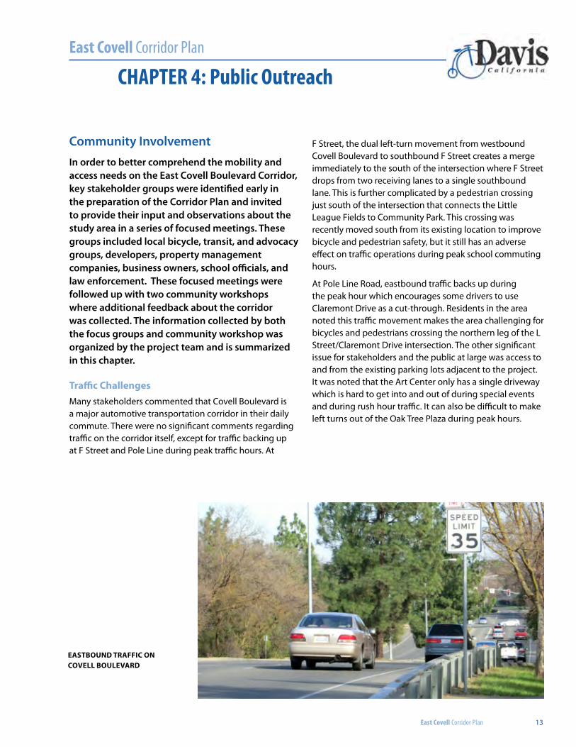
eaSTbound Traffic on covell boulevard
East Covell Corridor Plan
14 CHAPTER 4: Public Outreach
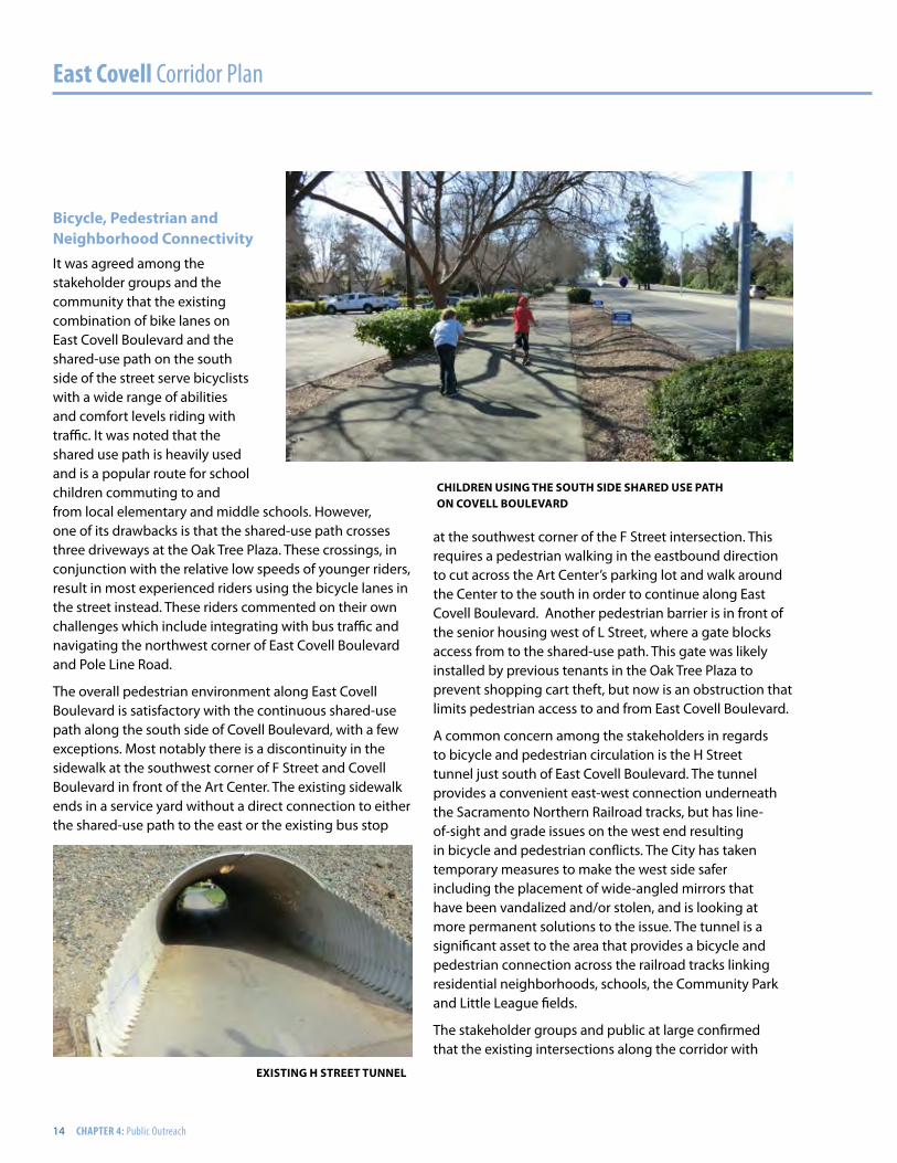
bicycle, Pedestrian and neighborhood connectivityIt was agreed among the stakeholder groups and the community that the existing combination of bike lanes on East Covell Boulevard and the shared-use path on the south side of the street serve bicyclists with a wide range of abilities and comfort levels riding with traffic. It was noted that the shared use path is heavily used and is a popular route for school children commuting to and from local elementary and middle schools. However, one of its drawbacks is that the shared-use path crosses three driveways at the Oak Tree Plaza. These crossings, in conjunction with the relative low speeds of younger riders, result in most experienced riders using the bicycle lanes in the street instead. These riders commented on their own challenges which include integrating with bus traffic and navigating the northwest corner of East Covell Boulevard and Pole Line Road.
The overall pedestrian environment along East Covell Boulevard is satisfactory with the continuous shared-use path along the south side of Covell Boulevard, with a few exceptions. Most notably there is a discontinuity in the sidewalk at the southwest corner of F Street and Covell Boulevard in front of the Art Center. The existing sidewalk ends in a service yard without a direct connection to either the shared-use path to the east or the existing bus stop
at the southwest corner of the F Street intersection. This requires a pedestrian walking in the eastbound direction to cut across the Art Center’s parking lot and walk around the Center to the south in order to continue along East Covell Boulevard. Another pedestrian barrier is in front of the senior housing west of L Street, where a gate blocks access from to the shared-use path. This gate was likely installed by previous tenants in the Oak Tree Plaza to prevent shopping cart theft, but now is an obstruction that limits pedestrian access to and from East Covell Boulevard.
A common concern among the stakeholders in regards to bicycle and pedestrian circulation is the H Street tunnel just south of East Covell Boulevard. The tunnel provides a convenient east-west connection underneath the Sacramento Northern Railroad tracks, but has line-of-sight and grade issues on the west end resulting in bicycle and pedestrian conflicts. The City has taken temporary measures to make the west side safer including the placement of wide-angled mirrors that have been vandalized and/or stolen, and is looking at more permanent solutions to the issue. The tunnel is a significant asset to the area that provides a bicycle and pedestrian connection across the railroad tracks linking residential neighborhoods, schools, the Community Park and Little League fields.
The stakeholder groups and public at large confirmed that the existing intersections along the corridor with
children uSing The SouTh Side Shared uSe PaTh on covell boulevard
exiSTing h STreeT Tunnel
East Covell Corridor Plan 15
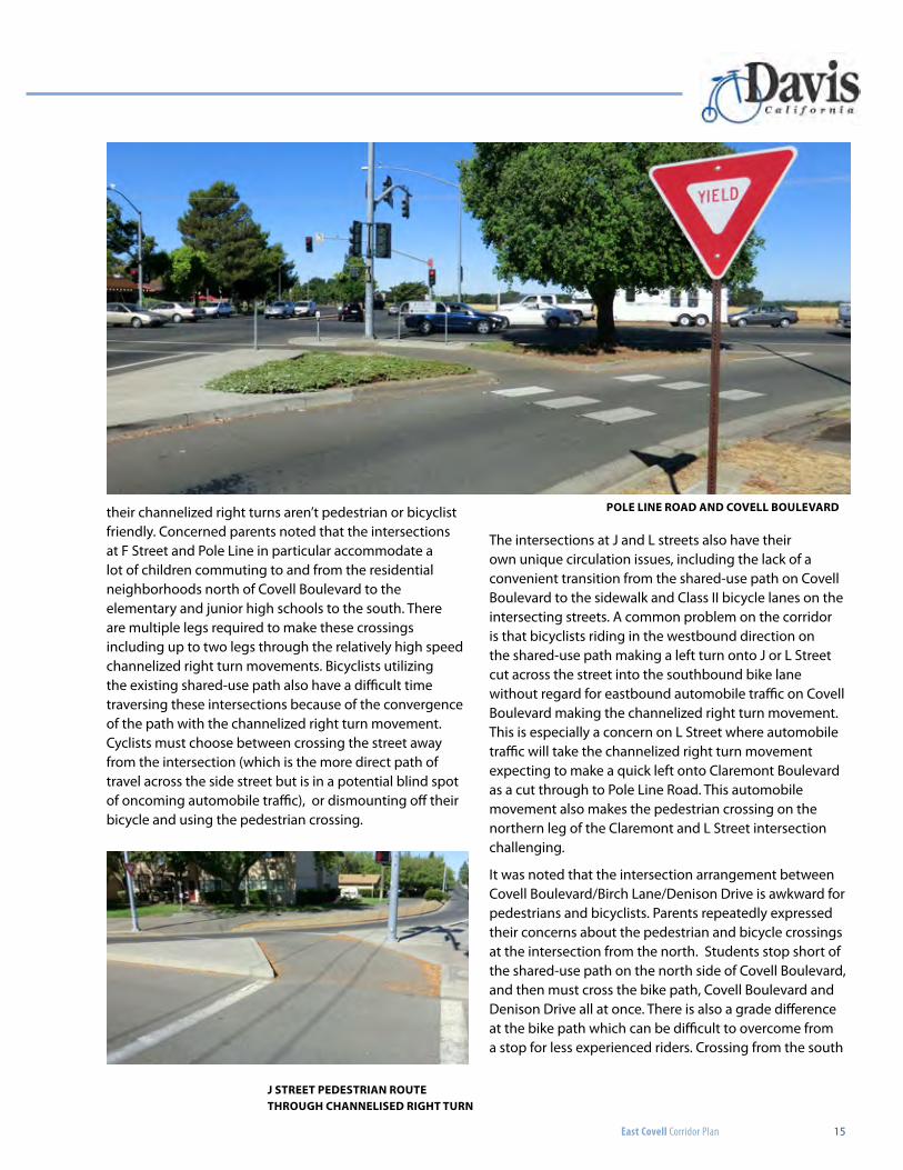
their channelized right turns aren’t pedestrian or bicyclist friendly. Concerned parents noted that the intersections at F Street and Pole Line in particular accommodate a lot of children commuting to and from the residential neighborhoods north of Covell Boulevard to the elementary and junior high schools to the south. There are multiple legs required to make these crossings including up to two legs through the relatively high speed channelized right turn movements. Bicyclists utilizing the existing shared-use path also have a difficult time traversing these intersections because of the convergence of the path with the channelized right turn movement. Cyclists must choose between crossing the street away from the intersection (which is the more direct path of travel across the side street but is in a potential blind spot of oncoming automobile traffic), or dismounting off their bicycle and using the pedestrian crossing.
The intersections at J and L streets also have their own unique circulation issues, including the lack of a convenient transition from the shared-use path on Covell Boulevard to the sidewalk and Class II bicycle lanes on the intersecting streets. A common problem on the corridor is that bicyclists riding in the westbound direction on the shared-use path making a left turn onto J or L Street cut across the street into the southbound bike lane without regard for eastbound automobile traffic on Covell Boulevard making the channelized right turn movement. This is especially a concern on L Street where automobile traffic will take the channelized right turn movement expecting to make a quick left onto Claremont Boulevard as a cut through to Pole Line Road. This automobile movement also makes the pedestrian crossing on the northern leg of the Claremont and L Street intersection challenging.
It was noted that the intersection arrangement between Covell Boulevard/Birch Lane/Denison Drive is awkward for pedestrians and bicyclists. Parents repeatedly expressed their concerns about the pedestrian and bicycle crossings at the intersection from the north. Students stop short of the shared-use path on the north side of Covell Boulevard, and then must cross the bike path, Covell Boulevard and Denison Drive all at once. There is also a grade difference at the bike path which can be difficult to overcome from a stop for less experienced riders. Crossing from the south
j STreeT PedeSTrian rouTe Through channeliSed righT Turn
Pole line road and covell boulevard
East Covell Corridor Plan
16 CHAPTER 4: Public Outreach
has its own challenges with a lack of refuge for bicyclists at Dennison Drive waiting to cross Covell Boulevard, especially when Birch Lane is backed up with parents picking up and dropping off their kids at the elementary school. This creates a barrier for students who wish to commute to school from the residential neighborhood north of Covell Boulevard, which otherwise has good bicycle path connectivity.
corridor identityBetween all the stakeholder focus meetings and the Public Workshop there was no general consensus on what the existing identity of the Corridor was or should be moving forward. It was agreed that Pole Line is the unofficial northern entrance into the City, and as such the corridor could use a uniform theme to welcome people to Davis. Some suggestions included:
• Extending the existing aesthetic east of Pole Line which has wide streets, mature trees, and bike lanes.
• Creating a unique theme for the corridor that emphasizes the Art Center, Community Park and the Little League fields. One suggestion was to mimic the poles and flags that define Jack London Square in Oakland and give the area a “district” feel.
• Give the corridor a sense of place as a “destination” by accentuating the pedestrian environment and encouraging in-fill and new restaurant developments.
additional commentsThere were a number of recommendations that were received by the public that are not specifically discussed in the final corridor plan due to the scope of the project, but might be addressed by the City with future studies:
• The Denison Drive frontage road east of Pole Line Road poses some unique challenges with tight intersections along Covell Boulevard.
• Maintenance of the existing landscaping along the corridor.
• Temporarily removing channelized right turn pockets with bollards similar to what was done at the intersection of Arlington Boulevard and Lake Boulevard. The project team investigated this improvement, but found that truck turning requirements would require the relocation of existing signal poles which proved to be cost-prohibitive.
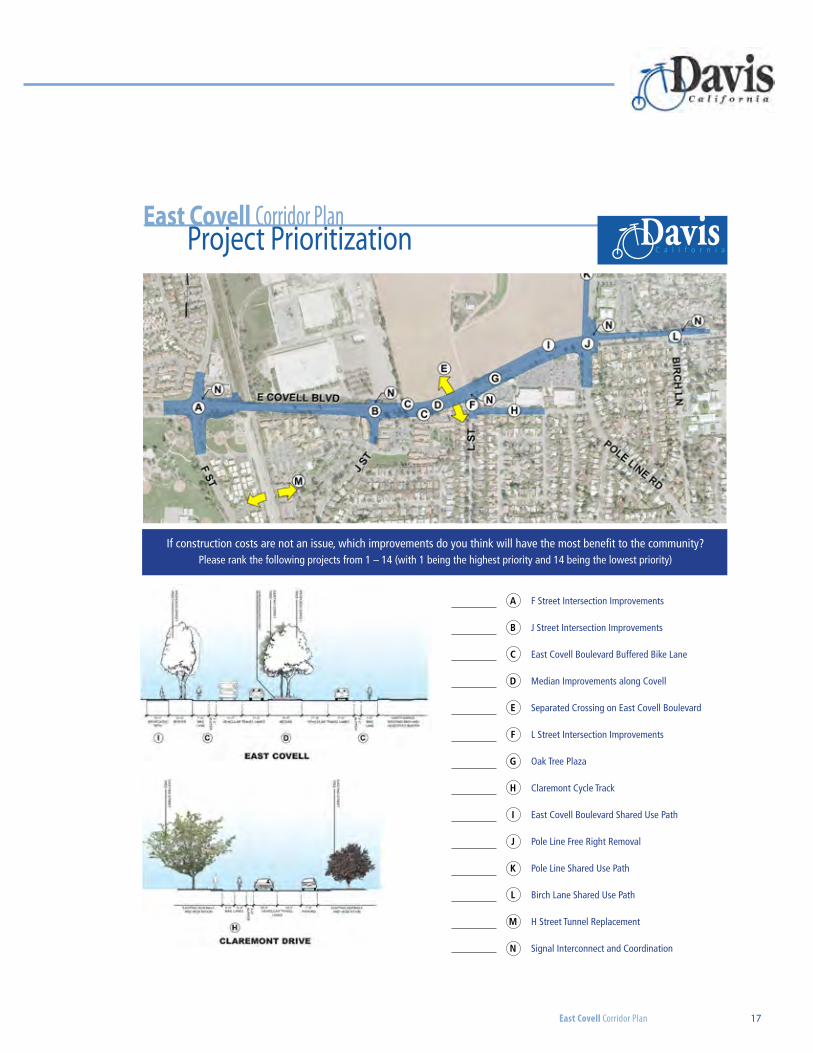
Prioritization exercise
At the second public workshop, attendees were asked to prioritize the recommended improvements of the plan based on their perceived benefit (regardless of cost). This exercise was used to gauge public interest in the proposed improvements to give decision makers a tool to use with the implementation of the Corridor Plan. Given the relatively small sample size of the survey, this tool was not intended to be a definitive ranking of the improvements but instead an opportunity to see the trends in opinion of project benefits. From this exercise, improving pedestrian connectivity with the H Street Tunnel and the separated crossing of Covell Boulevard were seen to have the highest benefit by the public, while the Claremont Cycle Track and landscaping the medians had the lowest.
This exercise should be one of many tools used by the City to determine the best implementation of the Corridor Plan, especially since this exercise was isolated to improvements within the study limits and project costs were not considered. Factors to consider when prioritizing projects on the corridor are discussed in more detail in Chapter 10 – Implementation, but include the Development Agreement with The Cannery, the availability and competitiveness of projects for State and Federal funds, and the overall infrastructure needs of the City.
Public workShoP #2
East Covell Corridor Plan 17
East Covell Corridor PlanProject Prioritization
DavisC a l i f o r n i a
If construction costs are not an issue, which improvements do you think will have the most benefit to the community? Please rank the following projects from 1 – 14 (with 1 being the highest priority and 14 being the lowest priority)
East Covell Corridor PlanProject Prioritization
DavisC a l i f o r n i a
A F Street Intersection Improvements
B J Street Intersection Improvements
C East Covell Boulevard Buffered Bike Lane
D Median Improvements along Covell
E Separated Crossing on East Covell Boulevard
F L Street Intersection Improvements
G Oak Tree Plaza
H Claremont Cycle Track
I East Covell Boulevard Shared Use Path
J Pole Line Free Right Removal
K Pole Line Shared Use Path
L Birch Lane Shared Use Path
M H Street Tunnel Replacement
N Signal Interconnect and Coordination
18
covell boulevard looking west at pole line road
East Covell Corridor Plan
East Covell Corridor Plan 19
CHAPTER 5: Circulation Study
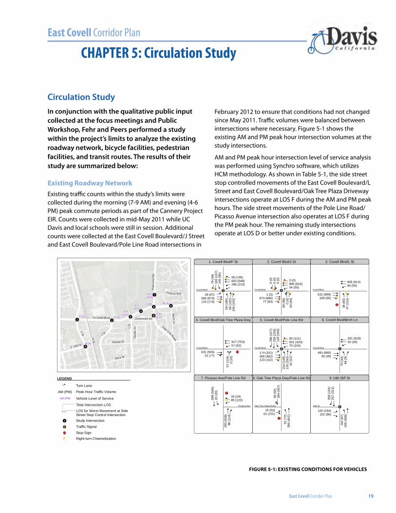
Circulation StudyIn conjunction with the qualitative public input collected at the focus meetings and Public Workshop, Fehr and Peers performed a study within the project’s limits to analyze the existing roadway network, bicycle facilities, pedestrian facilities, and transit routes. The results of their study are summarized below:
existing roadway networkExisting traffic counts within the study’s limits were collected during the morning (7-9 AM) and evening (4-6 PM) peak commute periods as part of the Cannery Project EIR. Counts were collected in mid-May 2011 while UC Davis and local schools were still in session. Additional counts were collected at the East Covell Boulevard/J Street and East Covell Boulevard/Pole Line Road intersections in
February 2012 to ensure that conditions had not changed since May 2011. Traffic volumes were balanced between intersections where necessary. Figure 5-1 shows the existing AM and PM peak hour intersection volumes at the study intersections.
AM and PM peak hour intersection level of service analysis was performed using Synchro software, which utilizes HCM methodology. As shown in Table 5-1, the side street stop controlled movements of the East Covell Boulevard/L Street and East Covell Boulevard/Oak Tree Plaza Driveway intersections operate at LOS F during the AM and PM peak hours. The side street movements of the Pole Line Road/Picasso Avenue intersection also operates at LOS F during the PM peak hour. The remaining study intersections operate at LOS D or better under existing conditions.
! !!
!
!
! !
!
!
FSt J St
L St
H St
E Covell Blvd
Drexel Dr
Pole
L ine
Rd
Alice St
Birch Ln
Grande Ave
Bayw
ood
Ln
Picas so AveAnza Ave
Paci
fic D
r
Claremont Dr
E 14th St
Balboa Ave
Pole Line Road
8
65
7
4
321
9B (A)
B (A)C (D)
A (A)C (C)A-B
(A-C)
A-C(A-F)
A-F(D-F)
A-F(A-F)
EXISTING CONDITIONS FOR VEHICLESFIGURE 5
acc
ccf
acf
bf
acf
ccf
aaccf
cfac
cf
g
accf
bf
acc
ac
acc
accfaccf af
af
af
accf
ce
acf
accf
af
acf
59 (1
80)
66 (1
62)
106
(192
)
34 (6
0)47
(114
)
70 (3
4)49
(9)
57 (1
19)
3 (2
0)
69 (9
6)0
(0)
53 (9
4)
110
(87)
108
(368
)
293
(558
)96
(114
)
154
(148
)12
5 (2
50)
42 (5
2)
79 (4
9)18
3 (1
07)
145
(95)
599
(506
)20
(20)
358
(164
)25
7 (3
21)
296
(227
)25
9 (2
36)
129
(166
)
0 (0
)0
(0)
0 (0
)
1 (0)673 (886)
77 (83)
174 (331)365 (482)123 (152)
631 (945)31 (77)
125 (184)102 (96)
29 (67)506 (674)124 (176)
491 (660)45 (35)
615 (899)109 (90)
16 (24)85 (123)
917 (753)57 (62)
90 (121)501 (433)70 (104)
0 (0)890 (816)54 (50)
905 (814)60 (55)
58 (146)603 (548)296 (210)
591 (628)53 (26)
e49 (9
2)39
4 (4
07)
g15 (53)61 (101) ac
51 (7
2)30
6 (4
01)
8. Oak Tree Plaza Dwy/Pole Line Rd
2. Covell Blvd/J St 3. Covell Blvd/L St1. Covell Blvd/F St
6. Covell Blvd/Birch Ln5. Covell Blvd/Pole Line Rd
7. Picasso Ave/Pole Line Rd
4. Covell Blvd/Oak Tree Plaza Dwy
9. 14th St/F St
14th St
Covell Blvd
Picasso Ave
Covell Blvd
Covell Blvd
Covell Blvd
Covell Blvd
Covell Blvd
Oak Tree Plaza Dvwy
Path: N:\2013Projects\3104_ECovellCorridorCompleteStreets\Graphics\Draft\GIS\MXD\fig05_autos_ex.mxd
èéëìí èéëìí
!"$
!"$èéëìí èéëìí
!"$
èéëìí
!"$
LEGEND
Turn Lane
a
Peak Hour Traffic Volume
Study Intersection
Traffic Signal
Stop Sign!"$
èéëìí
!1
AM (PM)
Vehicle Level of ServiceAM (PM)
LOS for Worst Movement at SideStreet Stop Control Intersection
X-X
Total Intersection LOS
Right-turn Channelization
Figure 5-1: existing conditions For vehicles
East Covell Corridor Plan
20 CHAPTER 5: Circulation Study
table 5-1. peak hour intersection level oF service – existing
Intersection ControlAM Peak Hour PM Peak Hour
Delay1 LOS Delay1 LOS
1. Covell Blvd/F St Traffic Signal 25 C 27 C
2. East Covell Blvd/J St Traffic Signal 8 A 7 A
3. East Covell Blvd/L St Side-Street Stop 3 (90) A (F) 4 (95) A (F)
4. East Covell Blvd/Oak Tree Plaza Dwy Side-Street Stop 6 (167) A (F) 32 (414)2 D (F)
5. East Covell Blvd/Pole Line Rd Traffic Signal 28 C 35 D
6. East Covell Blvd/Birch Ln Traffic Signal 17 B 7 A
7. Pole Line Rd/Picasso Ave Side-Street Stop 2 (24) A (C) 7 (61) A (F)
8. Pole Line Rd/Oak Tree Plaza Dwy Side-Street Stop 2 (14) A (B) 3 (18) A (C)
9. East 14th St/F St All-Way Stop 12 B 10 A
notes:
1.) For signalized and all-way stop controlled intersections, average intersection delay is reported in seconds per vehicle for the overall intersection. For side-street stop controlled intersections, the delay is reported is seconds per vehicle for the overall intersection (worst movement). All results are rounded to the nearest second.
2.) When side-street traffic volumes are near the boundary of the traffic software’s input range, delay estimates can become imprecise (e.g., intersection 4 has side-street LOS F, although it is unlikely that the average delay is 7 minutes per vehicle as estimated by the model).
Bold indicates unacceptable operations. Source: Cannery Park
Roadway LocationSpeed Limit
(mph)Surveyed Speed
(mph)Difference
F Street East 14th Street to Covell Boulevard 25 30.6 +5.6
F Street Covell Boulevard to Amapola Drive 30 32.3 +2.3
W. Covell Boulevard F Street to existing bicycle/pedestrian overpass 35 35.9 +0.9
East Covell Boulevard F Street to Pole Line Road 35 37.5 +2.5
East Covell Boulevard Pole Line Road to Baywood Lane 35 40.9 +5.9
J Street South of East Covell Boulevard 30 31.0 +1.0
Claremont Drive L Street to Pole Line Road 25 NA NA
L Street South of East Covell Boulevard 25 31.0 +6.0
Pole Line Road North of East Covell Boulevard 40 42.8 +2.8
Pole Line Road East Covell Boulevard to Birch Lane 25 30.4 +5.4
Birch Lane Pole Line Road to East Covell Boulevard 25 NA NA
Denison Drive Pole Line Road to Baywood Lane 251 NA NA
table 5-2. existing speed liMits and surveYed speeds
notes:
1.) Speed limits are not posted, however the character of the roadway indicates a 25 mph or less speed limit. Source: Fehr & Peers, 2013
East Covell Corridor Plan 21
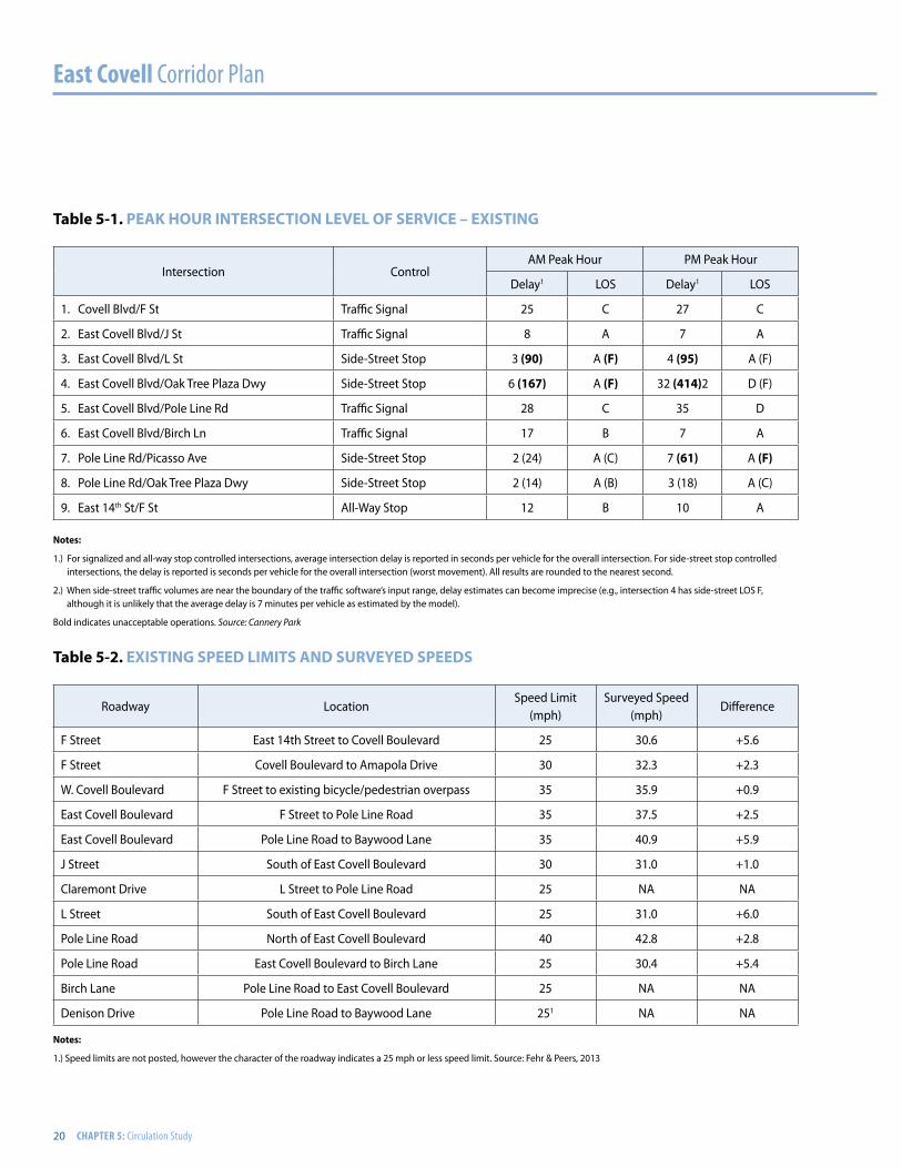
Table 5-2 shows the posted automobile speed limits and the measured speeds within the study’s limits. The difference between these surveyed speed and the speed limit range from +0.9 mph to +6.0 mph.
Bicycle, pedestrian and vehicular collision data for the five year period from 2007 to 2011 was obtained from the University of California, Berkeley (UC Berkeley) Transportation Injury Mapping System (TIMS) website. The
Collision SeverityNumber of Collisions
2007 2008 2009 2010 2011 Total
Injury - Severe 0 0 0 0 0 0
Injury – Other Visible 0 3 4 0 0 7
Injury – Complaint of Pain 6 5 9 8 4 32
Total 6 8 13 8 4 39
Sources: University of California, Berkley Transportation Injury Management System (TIMS); Fehr & Peers, 2013
table 5-3. 5 Year vehicle collision data
555
5
5
5
5 5
5
5
5
5
5
5
5
555
5
5
5
5
F St
J St
L St
H St
East Eighth St
E Covell Blvd
Ande
rson
Rd
B St
Oak
Ave
Pole
Lin
e Rd
Drexel Dr
Alice St
MooreBlvd
W Covell Blvd
Catalina Dr
Loyola Dr
Rockwell Dr
Alvarado Ave
Villanova Dr
Claremont Dr
East Fourteenth St
Pole Line Rd
35.9 37.5
40.9
31.0
42.8
30.430.6
32.3
31.0
EXISTING SPEED LIMITS AND SURVEYED SPEEDFIGURE 6Path: N:\2013Projects\3104_ECovellCorridorCompleteStreets\Graphics\Draft\GIS\MXD\fig06_autos_speed.mxd
Not to Scale
LEGEND
Speed Limit5
5 405
5 355
5 305
5 255
5 25 (No Measured Speed)
Average Surveyed SpeedXX.X
TIMS website obtains collision data from the Statewide Integrated Traffic Records System (SWITRS) and provides approximate coordinates of the collision locations. Table 5-3 provides a summary of all of the vehicle-vehicle collisions within the study area. The location of each collision is shown on Figure 5-3. During the five year period, 39 vehicle collisions occurred, all of which resulted in at least one injury but no fatalities. It can be inferred that the lack of accidents without injury can be attributed to the speeds on the corridor.
Figure 5-2: existing speed liMits and surveYed speed

East Covell Corridor Plan
22 CHAPTER 5: Circulation Study
!
!
!
!
!
!!
!
!
!
!
!
! !!!
!!
!
!
!
!
!!
!
!
!
!
!
!
!
!
!
!
!
!
!
!!
!
!
!
!
!
! !!!
!!
!
!
!
!
!!
!
!
!
!
!
!
!
!
!
!
!
!
!
!
!
!
!
!
!
!
! !! !
!!
!
!
!
!
!
!
!
!
!
!
!
!
!
!
!
!
!
!
!
!
!
!
!
!
!
!
!
!
!
!
!
!
!
!
!
F St
L S
t
J St
E Covell Blvd
H St
Drexel Dr
Denison Dr
Alice St
Loyola Dr
Pole
Lin
e R
d
Birch LnW Covell Blvd
Regis Dr
Cyp
ress
Ln
Whittier Dr
Ba yw
oodLn
Che
stnu
t Ln
Picasso AveBueno Dr R enoir Ave
Cat
alin
a D
r
Union Dr
Anza Ave
Paci
fic D
r
Auburn Dr
Claremont Dr
Spru
ceLnMenlo Dr
Temple Dr
Madrone Ln
Snyder Dr
East Fourteenth St
B St
Clemson Dr
Nutm
eg Ln
Bates Dr
Buckeye Ln
Baja Ave
C ortez Ave
Aurora Ave
West Fourteenth St
Cla ra
Lane
Hem
lock
Ln
Am
apola Dr Matisse St
Pole Line Rd
2007 - 2011COLLISION SUMMARY
FIGURE 2Path: N:\2013Projects\3104_ECovellCorridorCompleteStreets\Graphics\Draft\GIS\MXD\fig02_collisions.mxd
!!! !!!
!!!!!!!!!
!!!!!!
!!!
!!!
!!!
!!!
!!!
!!!
!!!!!!
!!!
!!!
F St
L S
t
J St
E Covell Blvd
H St
Drexel Dr
Denison Dr
Alice St
Loyola Dr
Pole
Lin
e R
d
Birch LnW Covell Blvd
Regis Dr
Cyp
ress
Ln
Whittier Dr
Ba yw
oodLn
Che
stnu
t Ln
Picasso AveBueno Dr R enoir Ave
Cat
alin
a D
r
Union Dr
Anza Ave
Paci
fic D
r
Auburn Dr
Claremont Dr
Spru
ceLnMenlo Dr
Temple Dr
Madrone Ln
Snyder Dr
East Fourteenth St
B St
Clemson Dr
Nutm
eg Ln
Bates Dr
Buckeye Ln
Baja Ave
C ortez Ave
Aurora Ave
West Fourteenth St
Cla ra
Lane
Hem
lock
Ln
Am
apola Dr Matisse St
Pole Line Rd
!!!!!!
!!!
!!! !!!
F St
L S
t
J St
E Covell BlvdH
St
Drexel Dr
Denison Dr
Alice St
Loyola Dr
Pole
Lin
e R
d
Birch LnW Covell Blvd
Regis Dr
Cyp
ress
Ln
Whittier Dr
Bayw
oodLn
Che
stnu
t Ln
Picasso AveBueno Dr R enoir Ave
Cat
alin
a D
r
Union Dr
Anza Ave
Paci
fic D
r
Auburn Dr
Claremont Dr
Spru
ceLnMenlo Dr
Temple Dr
Madrone Ln
Snyder Dr
East Fourteenth StB St
Clemson Dr
Nutm
eg Ln
Bates Dr
Buckeye Ln
Baja Ave
C ortez Ave
Aurora Ave
West Fourteenth St
Clara
Lane
Hem
lock
Ln
Am
apola Dr Matisse St
Pole Line Rd
Vehi
cle
-64%
Tota
l Col
lisio
ns
Bicy
cle -2
8%
Tota
l Col
lisio
ns
Pede
stria
n -8
%
Tota
l Col
lisio
ns
Not to Scale
Crash Severity
!!! Injury - Severe
!!! Injury - Other Visible
!!! Injury - Complaint of Pain
Figure 5-3: 2007-2011 collision suMMarY
VEH
ICLE
- 39
TO
TAL
PED
ESTR
IAN
- 5
TO
TAL
BICY
CLE
- 17
TOTA
L
East Covell Corridor Plan 23
F St
J St
L St
H St
E Covell Blvd
Drexel Dr
Pole
Li n
e Rd
Alice St
Denison Dr
Cypr
ess
Ln
W Covell Blvd
Birch Ln
Bueno Dr
Moore Blvd
Loyola Dr
Ches
tnut
Ln
Grande Ave
Bayw
ood
Ln
Picasso Ave
B St
CatalinaD
r
Renoir Ave
Anza Ave
Paci
fic D
r
Union Dr
Claremont Dr
Spru
ceLn
Auburn Dr
Snyder Dr
Rockwell Dr
Menlo Dr
Donner Ave
Bidwell St
Madron e Ln
E 14th St
Leonardo St
Balboa Ave
Baja Ave
Amapola D
r
Diablo Ave
Cortez Ave
Aurora Ave
Chapman Pl
Cranbrook Ct
Manet Pl
Cedar Pl
Aspen PlH
emlo
ck L
n
Sequoia Pl
Pole Line Road
10 (11) [90]
16 (23) [170]
19 (35) [230]
11 (23) [150]
12 (24) [150]
14 (26) [170]13 (18) [130]
18 (29) [200]
85 (147) [790]
EXISTING CONDITIONS FOR BICYCLESFIGURE 1Path: N:\2013Projects\3104_ECovellCorridorCompleteStreets\Graphics\Draft\GIS\MXD\fig01_bicycles_ex.mxd
Not to Scale
Bicycle Volumes
Class I Bike Path
Class II Bike Lane
Class III ConnectingBike Route
AM (PM) [ADT]
Legend
*
Class I Bike PathUnder E Covell Blvd
*
* PM and ADT estimated usingAM peak hour volume.
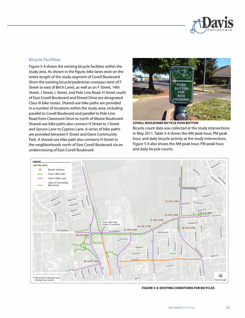
bicycle FacilitiesFigure 5-4 shows the existing bicycle facilities within the study area. As shown in the figure, bike lanes exist on the entire length of the study segment of Covell Boulevard (from the existing bicycle/pedestrian overpass west of F Street to east of Birch Lane), as well as on F Street, 14th Street, J Street, L Street, and Pole Line Road. H Street south of East Covell Boulevard and Drexel Drive are designated Class III bike routes. Shared-use bike paths are provided in a number of locations within the study area, including parallel to Covell Boulevard and parallel to Pole Line Road from Claremont Drive to north of Moore Boulevard. Shared-use bike paths also connect H Street to J Street and Spruce Lane to Cypress Lane. A series of bike paths are provided between F Street and Davis Community Park. A shared-use bike path also connects H Street to the neighborhoods north of East Covell Boulevard via an undercrossing of East Covell Boulevard.
Bicycle count data was collected at the study intersections in May 2011. Table 5-4 shows the AM peak hour, PM peak hour, and daily bicycle activity at the study intersections. Figure 5-4 also shows the AM peak hour, PM peak hour, and daily bicycle counts.
Figure 5-4: existing conditions For bicYcles
covell boulevard bicYcle push button
East Covell Corridor Plan
24 CHAPTER 5: Circulation Study
table 5-4. existing bicYcle voluMes
Intersection AM Peak Hour PM Peak Hour Daily
1. Covell Blvd/F St 18 29 200
2. East Covell Blvd/J St 13 18 130
3. East Covell Blvd/L St 14 26 170
4. East Covell Blvd/Oak Tree Plaza Dwy 12 24 150
5. East Covell Blvd/Pole Line Rd 19 35 230
6. East Covell Blvd/Birch Ln 10 11 90
7. Pole Line Rd/Picasso Ave 11 23 150
8. Pole Line Rd/Oak Tree Plaza Dwy 16 23 170
9. 14th St/F St 85 1471 7901
notes:
1.) PM peak hour and daily counts at the 14th Street/F Street intersection were estimated using the AM peak hour volume. Source: Fehr & Peers, 2013
Collision SeverityNumber of Collisions
2007 2008 2009 2010 2011 Total
Injury - Severe 0 0 1 0 0 1
Injury – Other Visible 2 5 1 1 1 10
Injury – Complaint of Pain 0 2 1 1 2 6
Total 2 7 3 2 3 17
Sources: University of California, Berkley Transportation Injury Management System (TIMS); Fehr & Peers, 2013
table 5-5. 5 Year bicYcle collision data
Bicycle collision data for the five year period from 2007 to 2011 is summarized in Table 5-5. Based on the data, there were no fatal or property damage only collisions. During the five year period, there were 17 bicycle collisions, all of
which resulted in at least one injury. The most significant intersection for bicycle accidents was the F Street intersection.
East Covell Corridor Plan 25
Level of Traffic Stress
(LTS) Definition
LTS 1Presenting little traffic stress and demanding little attention from cyclists, and attractive enough for a relaxing bike ride. Suitable for all cyclists, including children trained to safely cross intersections.
LTS 2Presenting little traffic stress and therefore suitable to most adult cyclists but demanding more attention than might be expected from children.
LTS 3More traffic stress than LTS 2, yet markedly less than the stress of integrating with multilane traffic, and therefore welcome to many people currently riding bikes in American cities.
LTS 4 A level of stress beyond LTS 3.
Source: Low-Stress Bicycling and Network Connectivity
table 5-6. level oF traFFic stress deFinitions
Fehr & Peers analyzed existing bikeways using the methodology presented in Low-Stress Bicycling and Network Connectivity (Furth, Mekuria, and Nixon, 2012). The Low-Stress Bicycling and Network Connectivity methodology determines the Level of Traffic Stress (LTS) for roadway segments and intersection approaches. For roadway segments, LTS is primarily affected by the number of vehicle lanes, presence of a bike lane, vehicle speed limit, presence of a parking lane, and presence of a raised median. For intersection approaches, LTS is primarily affected by right-turn lane configurations. The four classifications of LTS are summarized in Table 5-6.
The Low-Stress Bicycling and Network Connectivity methodology corresponds LTS to the Four Types of Transportations Cyclists in Portland, a chart developed by Portland’s Bicycle Program Manager, Roger Geller:
East Covell Corridor Plan Circulation Report
October 2013
10
TABLE 3 LEVEL OF TRAFFIC STRESS DEFINITIONS
Level of Traffic Stress (LTS)
Definition
LTS 1 Presenting little traffic stress and demanding little attention from cyclists, and attractive enough for a relaxing bike ride. Suitable for all cyclists, including children trained to safely cross intersections.
LTS 2 Presenting little traffic stress and therefore suitable to most adult cyclists but demanding more attention than might be expected from children.
LTS 3 More traffic stress than LTS 2, yet markedly less than the stress of integrating with multilane traffic, and therefore welcome to many people currently riding bikes in American cities.
LTS 4 A level of stress beyond LTS 3.
Source: Low-Stress Bicycling and Network Connectivity
The Low-Stress Bicycling and Network Connectivity methodology corresponds LTS to the Four Types of
Transportations Cyclists in Portland, a chart developed by Portland’s Bicycle Program Manager, Roger
Geller.
Source: Roger Geller
The above chart shows that “Interested but Concerned” bicyclists comprise the majority of adults. The
Low-Stress Bicycling and Network Connectivity methodology concludes that “Interested but Concerned”
bicyclists will not tolerate a LTS greater than two. Traffic stress criteria for roadway segments and
intersection approaches are provided in Appendix A.
Roadway Segments
The LTS for the study roadway segments was analyzed based on the criteria provided in Appendix A.
Figure 3 shows the LTS for off-street bikeways and on-street bikeways in the study area. Table 4 shows
the LTS for on-street bikeways in the study area. Although all Class I bike paths are LTS 1, the LOS
methodology is not sensitive enough to account for bike path crossings at channelized right-turn lanes.
In general, channelized right-turn lanes have a high level of traffic stress.
The chart below shows that “Interested but Concerned” bicyclists comprise the majority of adults. The Low-Stress Bicycling and Network Connectivity methodology concludes that “Interested but Concerned” bicyclists will not tolerate a LTS greater than two. Figure 5-5 shows the LTS for off-street bikeways and on-street bikeways in the study area. Table 5-7 summarizes the LTS for on-street bikeways in the study area and Table 5-8 summarizes the LTS at intersection approaches. Although all shared-use bike paths are LTS 1, the LOS methodology is not sensitive enough to account for bike path crossings at channelized right-turn lanes. In general, channelized right-turn lanes have a high level of traffic stress. In summary, the majority of on-street bikeways in the study area have an LTS greater than 2.
East Covell Corridor Plan
26 CHAPTER 5: Circulation Study
table 5-7. existing level oF traFFic stress – roadwaY segMents
Roadway Location1 Direction LTS
F Street East 14th Street to Covell Boulevard NB/SB 2
F Street Covell Boulevard to Amapola Drive NB/SB 1
West Covell Boulevard F Street to existing bicycle/pedestrian overpass EB/WB 3
East Covell Boulevard F Street to Pole Line Road EB/WB 4
East Covell Boulevard Pole Line Road to Baywood Lane EB/WB 4
J Street South of East Covell BoulevardNB 3
SB 2
Claremont Drive L Street to Pole Line Road EB/WB 1
L Street South of East Covell Boulevard NB/SB 3
Pole Line Road North of East Covell Boulevard NB/SB 4
Pole Line Road East Covell Boulevard to Birch Lane NB/SB 2
Birch Lane Pole Line Road to East Covell Boulevard NB/SB 1
notes:
1.) Locations include facilities within the roadway right-of-way. Class I paths adjacent to the study roadway segments are not included in this table. Class I paths are LTS 1.
Source: Fehr & Peers, 2013
== == = = ==
=
=
=
=
=
=
=
=
=
=
=
=
F St
J StL
St
H St
E Covell Blvd
Drexel Dr
Pole
Lin
e R d
Alice St
Denison Dr
Cypr
essL
n
W Covell Blvd
Birch Ln
Bueno Dr
Moore Blvd
Loyola DrChes
tnu t
Ln
Grande Ave
Bayw
ood
Ln
Picasso Ave
B St
Faro Ave
Cata linaD
r
Paci
f ic D
r
Union Dr
Solito St
Claremont Dr
Spru
ceLn
Auburn Dr
Snyder Dr
Rockwell Dr
Menlo Dr
Donner Ave
Bidwell St
Madro ne Ln
E 14th St
Leonardo St
Baja Ave
Amapola D
r
Cortez Ave
Aurora Ave
Chapman Pl
Cranbrook Ct
Manet Pl
Cedar Pl
Aspen Pl
Hem
lock
Ln
Sequoia Pl
PoleLine
Road
Class I is under E. Covell Blvd
!
EXISTING LEVEL OF TRAFFIC STRESSFIGURE 3Path: N:\2013Projects\3104_ECovellCorridorCompleteStreets\Graphics\Draft\GIS\MXD\fig03_LTS_ex.mxd
Not to Scale
Approach LTS
=1
=2
=3
=4
Segment LTS
1
2
3
4
1 = Best, 4 = WorstLevel of Traffic Stress (LTS)LEGEND
Note: Approach LTS only calculated forintersection approaches with right turns.
Figure 5-5: existing level oF traFFic stress
East Covell Corridor Plan 27
table 5-8. existing level oF traFFic stress – intersection approaches
Intersection Approach Right-Turn Configuration LTS
1. Covell Blvd/F St
NB Single channelized RT <75 feet 3
SB Single channelized RT <75 feet 3
EB Single channelized RT <75 feet 3
WB Single channelized RT <75 feet 3
2. East Covell Blvd/J StNB Single channelized RT <75 feet 3
EB Single channelized RT <150 feet 3
3. East Covell Blvd/L StNB Single channelized RT with turn radius >90 degrees 4
EB Single channelized RT <150 feet 3
4. East Covell Blvd/Oak Tree Plaza Dwy EB Shared Through/RT lane 2
5. East Covell Blvd/Pole Line Rd
NB RT pocket <75 feet 2
SB RT pocket <150 feet 2
EB Single channelized RT <75 feet 3
WB Single channelized RT <75 feet 3
6. East Covell Blvd/Birch LnNB RT pocket <75 feet 2
EB Shared Through/RT lane 2
7. Pole Line Rd/Picasso AveNB Shared Through/RT lane 2
WB RT pocket <150 feet 2
8. Pole Line Rd/Oak Tree Plaza Dwy SB Shared Through/RT lane 2
9. East 14th St/F StSB Shared Through/RT lane 2
EB Shared Through/RT lane 2
Source: Fehr & Peers, 2013
East Covell Corridor Plan
28 CHAPTER 5: Circulation Study
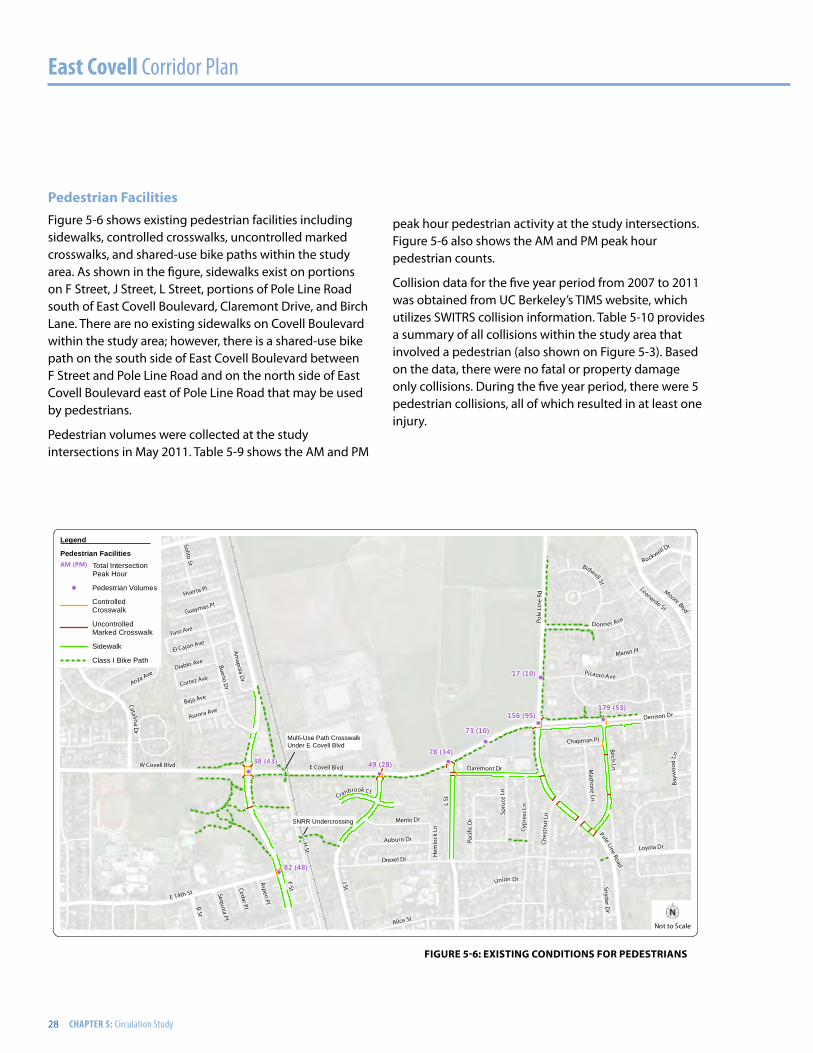
pedestrian FacilitiesFigure 5-6 shows existing pedestrian facilities including sidewalks, controlled crosswalks, uncontrolled marked crosswalks, and shared-use bike paths within the study area. As shown in the figure, sidewalks exist on portions on F Street, J Street, L Street, portions of Pole Line Road south of East Covell Boulevard, Claremont Drive, and Birch Lane. There are no existing sidewalks on Covell Boulevard within the study area; however, there is a shared-use bike path on the south side of East Covell Boulevard between F Street and Pole Line Road and on the north side of East Covell Boulevard east of Pole Line Road that may be used by pedestrians.
Pedestrian volumes were collected at the study intersections in May 2011. Table 5-9 shows the AM and PM
! !
!
!
!
!!
!
F St
J St
L St
H St
E Covell Blvd
Drexel Dr
Pole
Lin
e Rd
Alice St
Denison Dr
Cypr
ess
Ln
W Covell Blvd
Birch Ln
Bueno Dr
Moore Blvd
Loyola DrChes
tnu t
Ln
Grande Ave
Bayw
ood
LnPicasso Ave
B St
Faro Ave
CatalinaD
rAnza Ave
Paci
fic D
r
Union Dr
Solito St
Claremont Dr
Spru
ceLn
Auburn Dr
Snyder Dr
Rockwell Dr
Menlo Dr
Donner Ave
Bidwell St
Madrone Ln
E 14th St
Leonardo St
Huerta Pl
Baja Ave
El Cajon Ave
Amapola D
r
Guaymas Pl
Diablo Ave
Cortez Ave
Aurora Ave
Chapman Pl
Cranbrook Ct
Manet Pl
Cedar Pl
Aspen Pl
Hem
lock
Ln
Sequoia Pl
PoleLine
Road
17 (10)
73 (10)
78 (34)
49 (28)38 (43)
156 (95)179 (53)
82 (48)
EXISTING CONDITIONS FOR PEDESTRIANSFIGURE 4Path: N:\2013Projects\3104_ECovellCorridorCompleteStreets\Graphics\Draft\GIS\MXD\fig04_pedestrians_ex.mxd
Not to Scale
Multi-Use Path CrosswalkUnder E Covell Blvd
SNRR Undercrossing
! Pedestrian Volumes
ControlledCrosswalk
UncontrolledMarked Crosswalk
Sidewalk
Class I Bike Path
Legend
Pedestrian Facilities AM (PM) Total Intersection
Peak Hour
Figure 5-6: existing conditions For pedestrians
peak hour pedestrian activity at the study intersections. Figure 5-6 also shows the AM and PM peak hour pedestrian counts.
Collision data for the five year period from 2007 to 2011 was obtained from UC Berkeley’s TIMS website, which utilizes SWITRS collision information. Table 5-10 provides a summary of all collisions within the study area that involved a pedestrian (also shown on Figure 5-3). Based on the data, there were no fatal or property damage only collisions. During the five year period, there were 5 pedestrian collisions, all of which resulted in at least one injury.
East Covell Corridor Plan 29
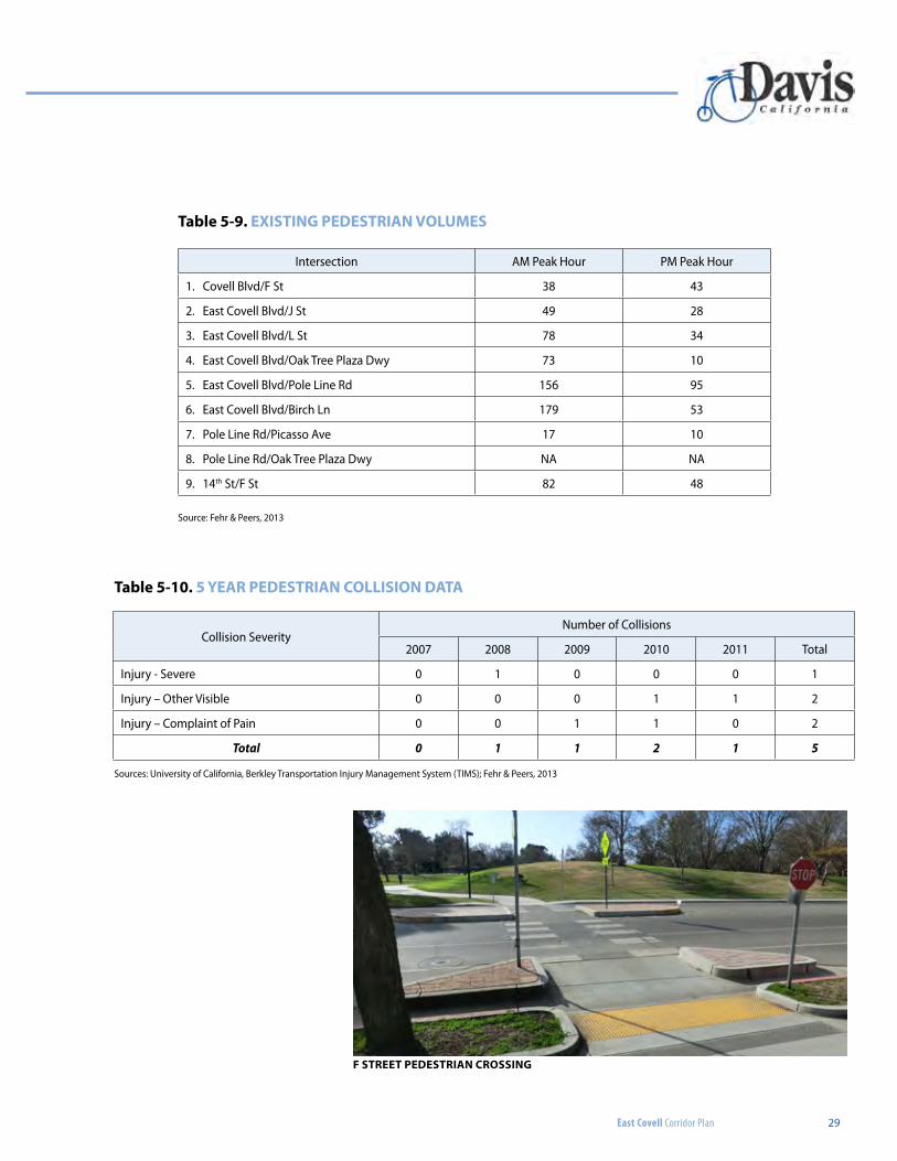
table 5-9. existing pedestrian voluMes
Intersection AM Peak Hour PM Peak Hour
1. Covell Blvd/F St 38 43
2. East Covell Blvd/J St 49 28
3. East Covell Blvd/L St 78 34
4. East Covell Blvd/Oak Tree Plaza Dwy 73 10
5. East Covell Blvd/Pole Line Rd 156 95
6. East Covell Blvd/Birch Ln 179 53
7. Pole Line Rd/Picasso Ave 17 10
8. Pole Line Rd/Oak Tree Plaza Dwy NA NA
9. 14th St/F St 82 48
Source: Fehr & Peers, 2013
Collision SeverityNumber of Collisions
2007 2008 2009 2010 2011 Total
Injury - Severe 0 1 0 0 0 1
Injury – Other Visible 0 0 0 1 1 2
Injury – Complaint of Pain 0 0 1 1 0 2
Total 0 1 1 2 1 5
Sources: University of California, Berkley Transportation Injury Management System (TIMS); Fehr & Peers, 2013
table 5-10. 5 Year pedestrian collision data
F street pedestrian crossing
East Covell Corridor Plan
30 CHAPTER 5: Circulation Study
transitTransit service in the City of Davis is provided by Unitrans (local) and Yolobus (regional).
YolobusYolobus provides regional transit service between Davis, Sacramento, West Sacramento, Winters, Vacaville, Knights Landing, Dunnigan, Cache Creek Casino Resort, and Woodland.
The following routes provide service on Covell Boulevard within the study area:
•route 42a (Intercity Loop Clockwise) – Route 42A starts in downtown Sacramento and runs through West Sacramento, Davis, Woodland, and the Sacramento International Airport. Hourly service is provided Monday through Friday from 4:37 AM to 11:48 PM, and on Saturdays, Sundays, and holidays from 6:35 AM to 10:45 PM. Within the study area, Route 42A provides service on East Covell Boulevard from Alhambra Drive to F Street, and on F Street between Covell Boulevard and 5th Street.
• route 42b (Intercity Loop Counter Clockwise) – Route 42B provides the same hourly service as Route 42A with buses travelling in the opposite direction.
• route 43 (Davis/Sacramento Express) – Route 43 provides five morning trips from Davis to downtown Sacramento between 6:08 AM and 8:32 AM, and four afternoon trips from Sacramento to Davis between 4:03 PM and 6:03 PM. Service is only provided Monday through Friday. Weekend and holiday service is not provided.
• route 220 (Davis/Winters/Vacaville) – Route 220 provides one morning, one midday, and one afternoon round trip between Davis, Winters, and Vacaville, Monday through Saturday.
• route 220c (Winters/Davis Commute) – Route 220C provides one morning and one afternoon trip Monday through Friday between Winters and UC Davis. The morning trip leaves Winters at 7:04 AM and arrives in Davis at 7:43 AM. The afternoon trip leaves Davis at 5:06 PM and arrives in Winters at 5:52 PM. Weekend
service is not provided.
• route 242 (Woodland/Davis Commute) – Route 242 provides one morning and one afternoon trip Monday through Friday between Woodland, UC Davis, and South Davis. The morning trip leaves Woodland at 6:54 AM and ends in Davis at 7:40 AM. The afternoon trip leaves Davis at 5:10 PM and ends in Woodland at 5:55 PM. Weekend service is not provided.
unitransUnitrans is a student-run public transportation bus system that serves the City of Davis. Daily bus service is provided Monday through Friday from 7:00 a.m. to 7:10 p.m., and on weekends from 9:00 a.m. to 5:00 p.m. Night service is provided Monday through Thursday from 7:30 p.m. to 11:10 p.m. Buses run more frequently during the UC Davis academic year when ridership is higher, and less frequently during the summer and other school breaks.
The following routes provide service on Covell Boulevard within the study area:
• p line (Davis Perimeter Counter Clockwise) – The P Line provides fixed route service around the perimeter of Davis with 25-60 minute headways Monday through Friday. Weekend service is provided with one hour headways. Within the study area, the P Line provides service on East Covell Boulevard east of F Street, F Street between Covell Boulevard and East 14th Street, and East 14th Street west of F Street.
table 5-11. unitrans dailY ridership bY line
Transit Line
Average Daily Riders
Weekday (Monday-Thursday)
Weekend
P/Q 2,113 566
E 953 NA1
L 1,022 NA1
total 4,087 566
notes:
1.) Weekend service is not provided on these routes. Source: Fehr & Peers, 2013
East Covell Corridor Plan 31
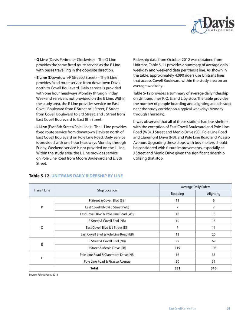
table 5-12. unitrans dailY ridership bY line
Transit Line Stop LocationAverage Daily Riders
Boarding Alighting
P
F Street & Covell Blvd (SB) 13 6
East Covell Blvd & J Street (WB) 7 7
East Covell Blvd & Pole Line Road (WB) 18 13
Q
F Street & Covell Blvd (NB) 10 13
East Covell Blvd & J Street (EB) 7 11
East Covell Blvd & Pole Line Road (EB) 12 20
EF Street & Covell Blvd (NB) 99 69
J Street & Menlo Drive (SB) 119 105
LPole Line Road & Claremont Drive (NB) 16 35
Pole Line Road & Picasso Avenue 30 31
total 331 310
Source: Fehr & Peers, 2013
• Q line (Davis Perimeter Clockwise) – The Q Line provides the same fixed route service as the P Line with buses travelling in the opposite direction.
• e line (Downtown/F Street/J Street) – The E Line provides fixed route service from downtown Davis north to Covell Boulevard. Daily service is provided with one hour headways Monday through Friday. Weekend service is not provided on the E Line. Within the study area, the E Line provides service on East Covell Boulevard from F Street to J Street, F Street from Covell Boulevard to 3rd Street, and J Street from East Covell Boulevard to East 8th Street.
• l line (East 8th Street/Pole Line) – The L Line provides fixed route service from downtown Davis to north of East Covell Boulevard on Pole Line Road. Daily service is provided with one hour headways Monday through Friday. Weekend service is not provided on the L Line. Within the study area, the L Line provides service on Pole Line Road from Moore Boulevard and E. 8th Street.
Ridership data from October 2012 was obtained from Unitrans. Table 5-11 provides a summary of average daily weekday and weekend data per transit line. As shown in the table, approximately 4,090 riders use Unitrans lines that access Covell Boulevard within the study area on an average weekday.
Table 5-12 provides a summary of average daily ridership on Unitrans lines P, Q, E, and L by stop. The table provides the number of people boarding and alighting at each stop near the study corridor on a typical weekday (Monday through Thursday).
It was observed that all of these stations had bus shelters with the exception of East Covell Boulevard and Pole Line Road (WB), J Street and Menlo Drive (SB), Pole Line Road and Claremont Drive (NB), and Pole Line Road and Picasso Avenue. Upgrading these stops with bus shelters should be considered with future improvements, especially at J Street and Menlo Drive given the significant ridership utilizing that stop.
32
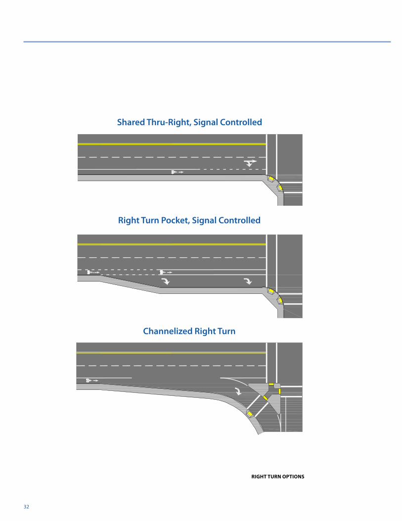
right turn options
Shared Thru-Right, Signal Controlled
Right Turn Pocket, Signal Controlled
Channelized Right Turn
East Covell Corridor Plan
East Covell Corridor Plan 33
CHAPTER 6: Right Turn Analysis
Right Turn Traffic AnalysisEarly on in the study it became apparent that one of the most effective solutions to meet the objectives of the corridor plan would be to remove the channelized right turns at each of the intersections. This improvement would increase the safety of bicyclists and pedestrians crossing each of the intersections, act as a traffic calming measure for automobile traffic on East Covell Boulevard, and create significant opportunity areas to enhance the corridor’s identity with streetscape amenities, landscaping, and monumentation. However, this improvement comes at the expense of traffic circulation on East Covell Boulevard.
For the purpose of establishing acceptable circulation on East Covell Boulevard, Fehr and Peers referred to the City
of Davis General Plan which provides the following level of service standards:
• LOS E for automobiles is sufficient for arterials and collectors during peak traffic hours. LOS D for automobiles is sufficient for arterials, collectors and major intersection during non-peak hours.
• Neighborhood plans or corridor plans can allow for a LOS F at peak times if approved by the City Council. LOS F is acceptable during peak hours in the Core Area.
LOS E was used as the threshold for this study (i.e. LOS A, B, C, D, and E are considered acceptable operations, and LOS F is considered unacceptable). Two alternatives were studied with this analysis: Alternative A which assumed existing lane configurations and right turn treatments at the study intersections, and Alternative B which looked at the possibility of removing all channelized right-turn lanes and replacing them with either right-turn pockets
table 6-1. pEAK hour intErsECtion LEVEL oF sErViCE – CuMuLAtiVE ConDitions (ALtErnAtiVE A)
Intersection ControlAM Peak Hour PM Peak Hour
Delay1 LOS Delay1 LOS
1. Covell Blvd/F St Traffic Signal 32 C 45 D
2. East Covell Blvd/J St Traffic Signal 47 D 49 D
3. East Covell Blvd/L St/Covell Village Driveway Traffic Signal 56 E 74 E
4. East Covell Blvd/Oak Tree Plaza Dwy Side-Street Stop 31 (947) 2 D (F) 650 (>1000)2
F (F)
5. East Covell Blvd/Pole Line Rd Traffic Signal 58 E 53 D
6. East Covell Blvd/Birch Ln Traffic Signal 21 C 8 A
7. Pole Line Rd/Picasso Ave Traffic Signal 24 C 28 C
8. Pole Line Rd/Oak Tree Plaza Dwy Side-Street Stop 2 (24) A (C) 4 (24) A (C)
9. East 14th St/F St Traffic Signal 15 B 12 B
notes:
1) For signalized and all-way stop controlled intersections, average intersection delay is reported in seconds per vehicle for the overall intersection. For side-street stop controlled intersections, the delay is reported is seconds per vehicle for the overall intersection (worst movement). All results are rounded to the nearest second.
2.) When side-street traffic volumes are near the boundary of the traffic software’s input range, delay estimates can become imprecise (e.g., intersection 4 has side-street LOS F, although it is unlikely that the average delay is 16+ minutes per vehicle as estimated by the model).
Bold indicates unacceptable operations.
Source: Cannery Park EIR, Fehr & Peers, 2013
East Covell Corridor Plan
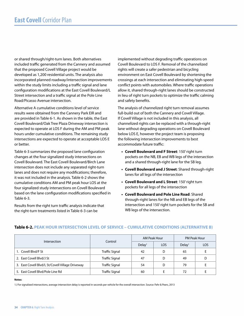
34 CHAPTER 6: Right Turn Analysis
or shared through/right-turn lanes. Both alternatives included traffic generated from the Cannery and assumed that the proposed Covell Village project would be developed as 1,200 residential units. The analysis also incorporated planned roadway/intersection improvements within the study limits including a traffic signal and lane configuration modifications at the East Covell Boulevard/L Street intersection and a traffic signal at the Pole Line Road/Picasso Avenue intersection.
Alternative A cumulative conditions level of service results were obtained from the Cannery Park EIR and are provided in Table 6-1. As shown in the table, the East Covell Boulevard/Oak Tree Plaza Driveway intersection is expected to operate at LOS F during the AM and PM peak hours under cumulative conditions. The remaining study intersections are expected to operate at acceptable LOS E or better.
Table 6-3 summarizes the proposed lane configuration changes at the four signalized study intersections on Covell Boulevard. The East Covell Boulevard/Birch Lane intersection does not include any separated right-turn lanes and does not require any modifications; therefore, it was not included in the analysis. Table 6-2 shows the cumulative conditions AM and PM peak hour LOS at the four signalized study intersections on Covell Boulevard based on the lane configuration modifications specified in Table 6-3.
Results from the right turn traffic analysis indicate that the right-turn treatments listed in Table 6-3 can be
implemented without degrading traffic operations on Covell Boulevard to LOS F. Removal of the channelized rights will create a safer pedestrian and bicycling environment on East Covell Boulevard by shortening the crossings at each intersection and eliminating high-speed conflict points with automobiles. Where traffic operations allow it, shared through-right lanes should be constructed in lieu of right turn pockets to optimize the traffic calming and safety benefits.
The analysis of channelized right turn removal assumes full-build out of both the Cannery and Covell Village. If Covell Village is not included in this analysis, all channelized rights can be replaced with a through-right lane without degrading operations on Covell Boulevard below LOS E, however the project team is proposing the following intersection improvements to best accommodate future traffic:
• Covell Boulevard and F street: 150’ right turn pockets on the NB, EB and WB legs of the intersection and a shared through-right lane for the SB leg.
• Covell Boulevard and J street: Shared through-right lanes for all legs of the intersection
• Covell Boulevard and L street: 150’ right turn pockets for all legs of the intersection
• Covell Boulevard and pole Line road: Shared through-right lanes for the NB and EB legs of the intersection and 150’ right turn pockets for the SB and WB legs of the intersection.
table 6-2. pEAK hour intErsECtion LEVEL oF sErViCE – CuMuLAtiVE ConDitions (ALtErnAtiVE B)
Intersection ControlAM Peak Hour PM Peak Hour
Delay1 LOS Delay1 LOS
1. Covell Blvd/F St Traffic Signal 42 D 65 E
2. East Covell Blvd/J St Traffic Signal 47 D 49 D
3. East Covell Blvd/L St/Covell Village Driveway Traffic Signal 54 D 79 E
5. East Covell Blvd/Pole Line Rd Traffic Signal 60 E 72 E
notes:
1.) For signalized intersections, average intersection delay is reported in seconds per vehicle for the overall intersection. Source: Fehr & Peers, 2013
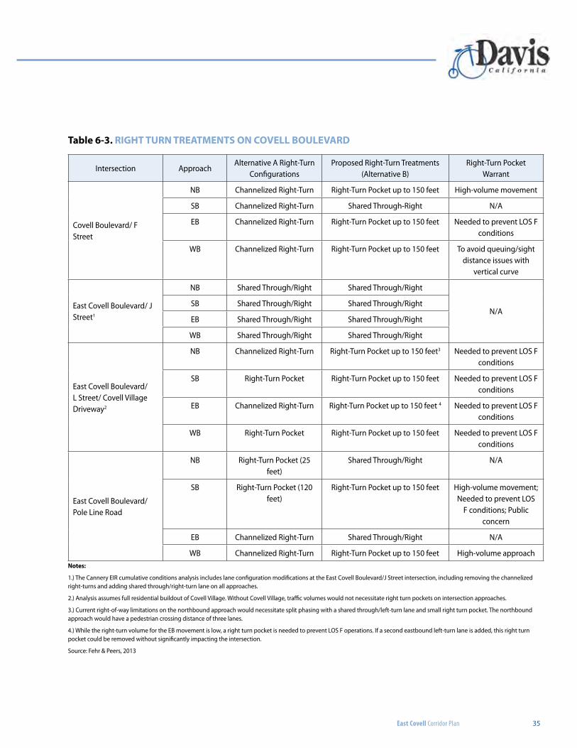
East Covell Corridor Plan 35
Intersection ApproachAlternative A Right-Turn
ConfigurationsProposed Right-Turn Treatments
(Alternative B)Right-Turn Pocket
Warrant
Covell Boulevard/ F Street
NB Channelized Right-Turn Right-Turn Pocket up to 150 feet High-volume movement
SB Channelized Right-Turn Shared Through-Right N/A
EB Channelized Right-Turn Right-Turn Pocket up to 150 feet Needed to prevent LOS F conditions
WB Channelized Right-Turn Right-Turn Pocket up to 150 feet To avoid queuing/sight distance issues with
vertical curve
East Covell Boulevard/ J Street1
NB Shared Through/Right Shared Through/Right
N/ASB Shared Through/Right Shared Through/Right
EB Shared Through/Right Shared Through/Right
WB Shared Through/Right Shared Through/Right
East Covell Boulevard/ L Street/ Covell Village Driveway2
NB Channelized Right-Turn Right-Turn Pocket up to 150 feet3 Needed to prevent LOS F conditions
SB Right-Turn Pocket Right-Turn Pocket up to 150 feet Needed to prevent LOS F conditions
EB Channelized Right-Turn Right-Turn Pocket up to 150 feet 4 Needed to prevent LOS F conditions
WB Right-Turn Pocket Right-Turn Pocket up to 150 feet Needed to prevent LOS F conditions
East Covell Boulevard/ Pole Line Road
NB Right-Turn Pocket (25 feet)
Shared Through/Right N/A
SB Right-Turn Pocket (120 feet)
Right-Turn Pocket up to 150 feet High-volume movement; Needed to prevent LOS
F conditions; Public concern
EB Channelized Right-Turn Shared Through/Right N/A
WB Channelized Right-Turn Right-Turn Pocket up to 150 feet High-volume approach
table 6-3. right turn trEAtMEnts on CoVELL BouLEVArD
notes:
1.) The Cannery EIR cumulative conditions analysis includes lane configuration modifications at the East Covell Boulevard/J Street intersection, including removing the channelized right-turns and adding shared through/right-turn lane on all approaches.
2.) Analysis assumes full residential buildout of Covell Village. Without Covell Village, traffic volumes would not necessitate right turn pockets on intersection approaches.
3.) Current right-of-way limitations on the northbound approach would necessitate split phasing with a shared through/left-turn lane and small right turn pocket. The northbound approach would have a pedestrian crossing distance of three lanes.
4.) While the right-turn volume for the EB movement is low, a right turn pocket is needed to prevent LOS F operations. If a second eastbound left-turn lane is added, this right turn pocket could be removed without significantly impacting the intersection.
Source: Fehr & Peers, 2013
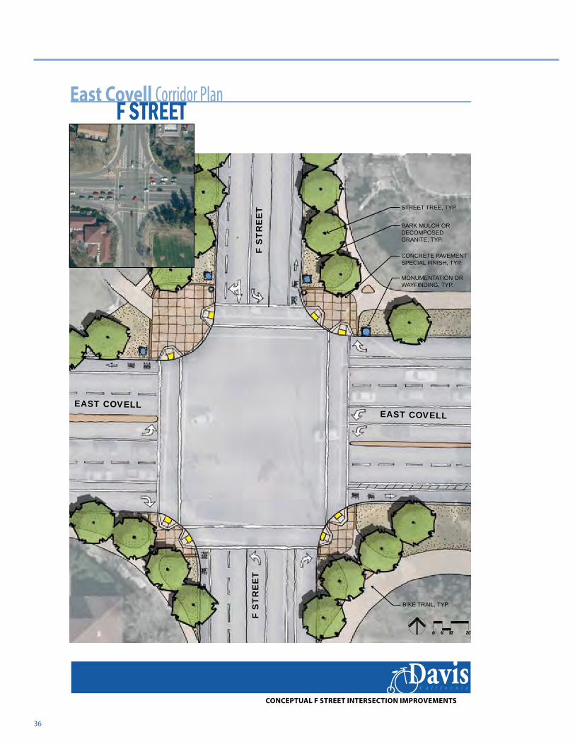
36
F S
TR
EE
TF
ST
RE
ET
EAST COVELLEAST COVELL
East Covell Corridor Plan
DavisC a l i f o r n i a
F STREET
MONUMENTATION OR WAYFINDING, TYP.
CONCRETE PAVEMENT SPECIAL FINISH, TYP.
BIKE TRAIL, TYP.
STREET TREE, TYP.
BARK MULCH OR DECOMPOSED GRANITE, TYP.
CONCEPTUAL F STREET INTERSECTION IMPROVEMENTS
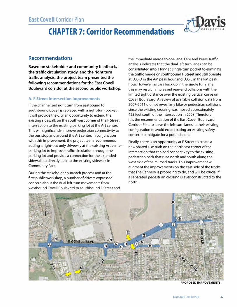
East Covell Corridor Plan
East Covell Corridor Plan 37
CHAPTER 7: Corridor Recommendations
RecommendationsBased on stakeholder and community feedback, the traffic circulation study, and the right turn traffic analysis, the project team presented the following recommendations for the East Covell Boulevard corridor at the second public workshop:
A. F Street Intersection ImprovementsIf the channelized right turn from eastbound to southbound Covell is replaced with a right-turn pocket, it will provide the City an opportunity to extend the existing sidewalk on the southwest corner of the F Street intersection to the existing parking lot at the Art center. This will significantly improve pedestrian connectivity to the bus stop and around the Art center. In conjunction with this improvement, the project team recommends adding a right-out only driveway at the existing Art center parking lot to improve traffic circulation through the parking lot and provide a connection for the extended sidewalk to directly tie into the existing sidewalk in Community Park.
During the stakeholder outreach process and at the first public workshop, a number of drivers expressed concern about the dual left-turn movements from westbound Covell Boulevard to southbound F Street and
the immediate merge to one lane. Fehr and Peers’ traffic analysis indicates that the dual left turn lanes can be consolidated into a longer, single turn pocket to eliminate the traffic merge on southbound F Street and still operate at LOS D in the AM peak hour and LOS E in the PM peak hour. However, as cars back up in the single turn lane this may result in increased rear-end collisions with the limited sight distance over the existing vertical curve on Covell Boulevard. A review of available collision data from 2007-2011 did not reveal any bike or pedestrian collisions since the existing crossing was moved approximately 425 feet south of the intersection in 2008. Therefore, it is the recommendation of the East Covell Boulevard Corridor Plan to leave the left-turn lanes in their existing configuration to avoid exacerbating an existing safety concern to mitigate for a potential one.
Finally, there is an opportunity at F Street to create a new shared-use path on the northeast corner of the intersection that can add connectivity to the existing pedestrian path that runs north and south along the west side of the railroad tracks. This improvement will augment the improvements on the east side of the tracks that The Cannery is proposing to do, and will be crucial if a separated pedestrian crossing is ever constructed to the north.
PROPOSEd IMPROVEMENTS
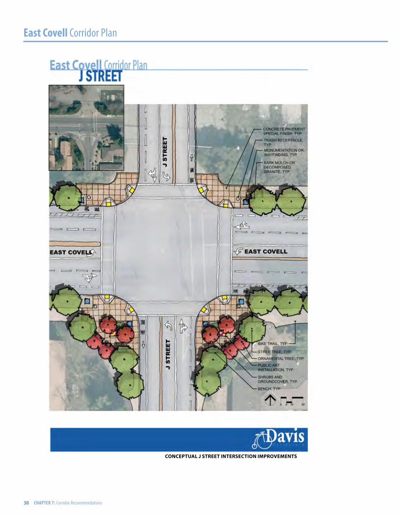
East Covell Corridor Plan
38 CHAPTER 7: Corridor Recommendations
CONCEPTUAL J STREET INTERSECTION IMPROVEMENTS
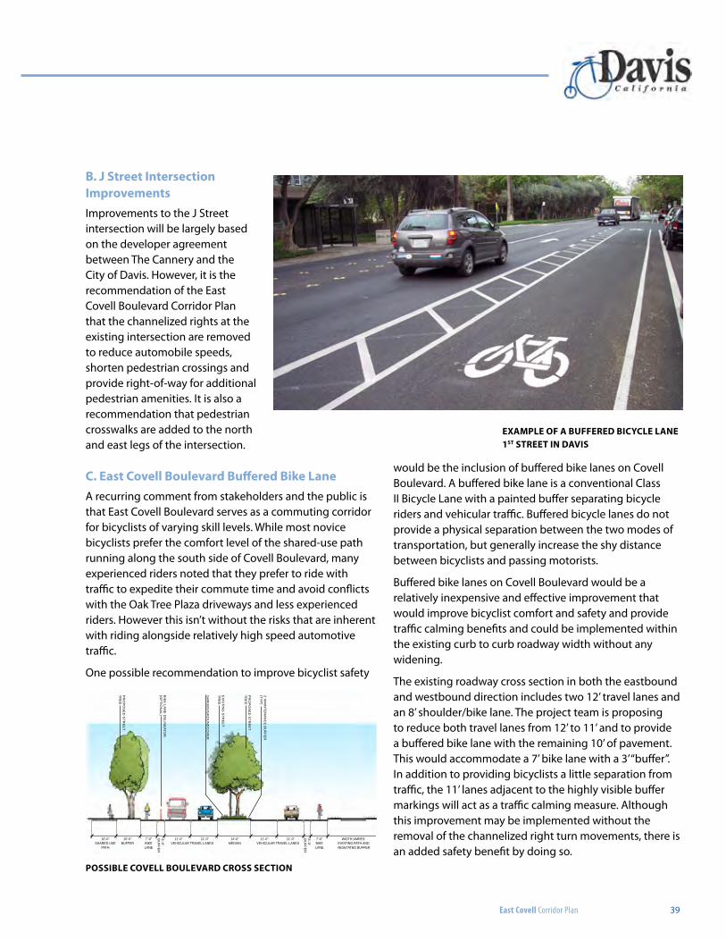
East Covell Corridor Plan 39
B. J Street Intersection ImprovementsImprovements to the J Street intersection will be largely based on the developer agreement between The Cannery and the City of Davis. However, it is the recommendation of the East Covell Boulevard Corridor Plan that the channelized rights at the existing intersection are removed to reduce automobile speeds, shorten pedestrian crossings and provide right-of-way for additional pedestrian amenities. It is also a recommendation that pedestrian crosswalks are added to the north and east legs of the intersection.
C. East Covell Boulevard Buffered Bike LaneA recurring comment from stakeholders and the public is that East Covell Boulevard serves as a commuting corridor for bicyclists of varying skill levels. While most novice bicyclists prefer the comfort level of the shared-use path running along the south side of Covell Boulevard, many experienced riders noted that they prefer to ride with traffic to expedite their commute time and avoid conflicts with the Oak Tree Plaza driveways and less experienced riders. However this isn’t without the risks that are inherent with riding alongside relatively high speed automotive traffic.
One possible recommendation to improve bicyclist safety
would be the inclusion of buffered bike lanes on Covell Boulevard. A buffered bike lane is a conventional Class II Bicycle Lane with a painted buffer separating bicycle riders and vehicular traffic. Buffered bicycle lanes do not provide a physical separation between the two modes of transportation, but generally increase the shy distance between bicyclists and passing motorists.
Buffered bike lanes on Covell Boulevard would be a relatively inexpensive and effective improvement that would improve bicyclist comfort and safety and provide traffic calming benefits and could be implemented within the existing curb to curb roadway width without any widening.
The existing roadway cross section in both the eastbound and westbound direction includes two 12’ travel lanes and an 8’ shoulder/bike lane. The project team is proposing to reduce both travel lanes from 12’ to 11’ and to provide a buffered bike lane with the remaining 10’ of pavement. This would accommodate a 7’ bike lane with a 3’ “buffer”. In addition to providing bicyclists a little separation from traffic, the 11’ lanes adjacent to the highly visible buffer markings will act as a traffic calming measure. Although this improvement may be implemented without the removal of the channelized right turn movements, there is an added safety benefit by doing so.
ExAMPLE OF A BUFFEREd BICyCLE LANE 1ST STREET IN dAVIS
10’-0” SHARED USE
PATH
5’-0” PATH
10’-0” BUFFER
8’-0” BUFFER
6’-0” S
HO
ULD
ER
13’-0” CYCLE TRACK
7’-0” BIKELANE
7’-0” PARKING
40’-0” OVERALL: VEHICULAR TRAVEL LANES AND ON-STREET PARKING
3’-0” B
UF
FE
R
3’-0” B
UF
FE
R
3’-0” B
UF
FE
R
EX
IST
ING
ST
RE
ET
TR
EE
EX
IST
ING
ST
RE
ET
TR
EE
EX
IST
ING
ST
RE
ET
TR
EE
BIK
E LA
NE
DE
LINE
ATOR
EX
IST
ING
ST
RE
ET
TR
EE
EX
IST
ING
ST
RE
ET
TR
EE
SH
RU
BS
/GR
OU
ND
CO
VE
R
2’ MA
INT
EN
AN
CE
BU
FF
ER
(TY
P)
PR
OP
OS
ED
ST
RE
ET
TR
EE
PR
OP
OS
ED
ST
RE
ET
TR
EE
PR
OP
OS
ED
ST
RE
ET
TR
EE
BIK
E LA
NE
DE
LINE
ATOR
(OP
TIO
NA
L)
3’-0” B
UF
FE
R
14’-0” MEDIAN
7’-0” BIKELANE
WIDTH VARIES: EXISTING PATH AND VEGETATED BUFFER
VEHICULAR TRAVEL LANES
VEHICULAR TRAVEL LANES
VEHICULAR TRAVEL LANES11’-0”
11’-0”
11’-0” 11’-0”
11’-0”
11’-0”
EXISTING SIDEWALKAND VEGETATION
SIDEWALKAND VEGETATION
EXISTING SIDEWALKAND VEGETATION
SIDEWALKAND VEGETATION
5’-0” 10’-0” 10’-0”5’-0”PROTECTEDBIKE LANES
VEHICULAR TRAVELLANES
40’-0” OVERALL
East Covell Corridor Plan
DavisC a l i f o r n i a
Street Sections
EAST
COVE
LL BO
ULEV
ARD
OPTIO
N BPR
OPOS
EDEX
ISIN
GOP
TION A
CLAR
EMON
T DRI
VE
POSSIBLE COVELL BOULEVARd CROSS SECTION
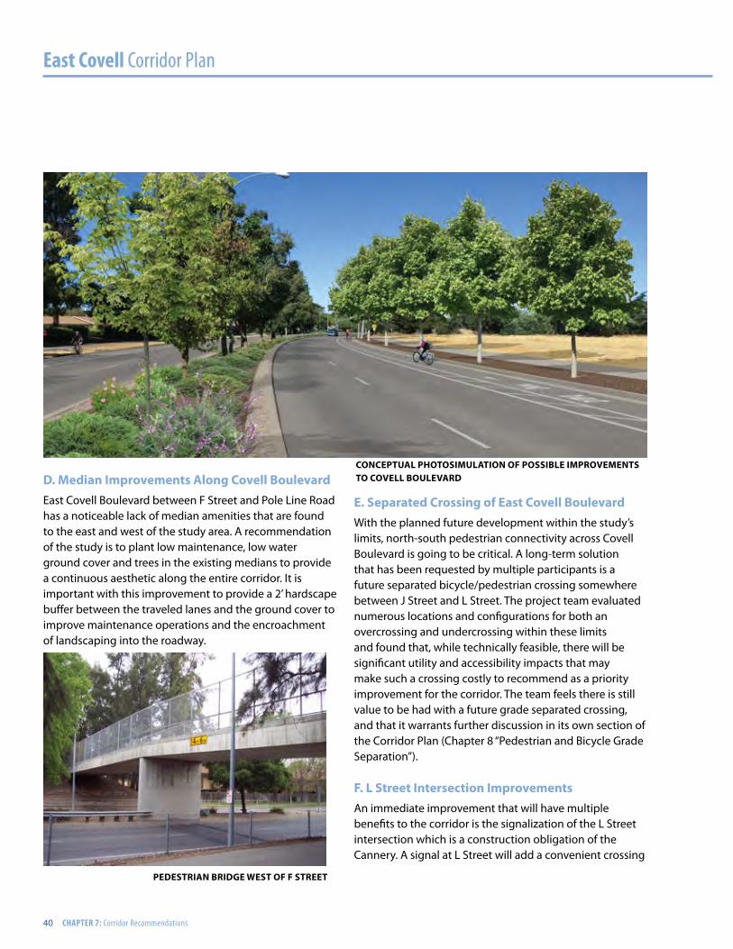
East Covell Corridor Plan
40 CHAPTER 7: Corridor Recommendations
d. Median Improvements Along Covell BoulevardEast Covell Boulevard between F Street and Pole Line Road has a noticeable lack of median amenities that are found to the east and west of the study area. A recommendation of the study is to plant low maintenance, low water ground cover and trees in the existing medians to provide a continuous aesthetic along the entire corridor. It is important with this improvement to provide a 2’ hardscape buffer between the traveled lanes and the ground cover to improve maintenance operations and the encroachment of landscaping into the roadway.
E. Separated Crossing of East Covell BoulevardWith the planned future development within the study’s limits, north-south pedestrian connectivity across Covell Boulevard is going to be critical. A long-term solution that has been requested by multiple participants is a future separated bicycle/pedestrian crossing somewhere between J Street and L Street. The project team evaluated numerous locations and configurations for both an overcrossing and undercrossing within these limits and found that, while technically feasible, there will be significant utility and accessibility impacts that may make such a crossing costly to recommend as a priority improvement for the corridor. The team feels there is still value to be had with a future grade separated crossing, and that it warrants further discussion in its own section of the Corridor Plan (Chapter 8 “Pedestrian and Bicycle Grade Separation”).
F. L Street Intersection ImprovementsAn immediate improvement that will have multiple benefits to the corridor is the signalization of the L Street intersection which is a construction obligation of the Cannery. A signal at L Street will add a convenient crossing
CONCEPTUAL PhOTOSIMULATION OF POSSIBLE IMPROVEMENTS TO COVELL BOULEVARd
PEdESTRIAN BRIdGE WEST OF F STREET
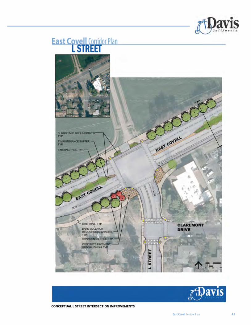
East Covell Corridor Plan 41
CONCEPTUAL L STREET INTERSECTION IMPROVEMENTS
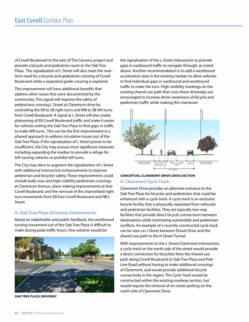
East Covell Corridor Plan
42 CHAPTER 7: Corridor Recommendations
of Covell Boulevard to the east of The Cannery project and provide a bicycle and pedestrian route to the Oak Tree Plaza. The signalization of L Street will also meet the near-term need for a bicycle and pedestrian crossing of Covell Boulevard while a separated grade crossing is explored.
This improvement will have additional benefits that address other issues that were documented by the community. This signal will improve the safety of pedestrians crossing L Street at Claremont drive by controlling the EB to SB right turns and WB to SB left turns from Covell Boulevard. A signal at L Street will also create platooning of EB Covell Boulevard traffic and make it easier for vehicles exiting the Oak Tree Plaza to find gaps in traffic to make WB turns. This can be the first improvement in a phased approach to address circulation issues out of the Oak Tree Plaza. If the signalization of L Street proves to be insufficient, the City may pursue more significant measures including expanding the median to provide a refuge for left-turning vehicles or prohibit left turns.
The City may elect to augment the signalization of L Street with additional intersection enhancements to improve pedestrian and bicyclist safety. These improvements could include bulb-outs and high visibility pedestrian crossings at Claremont Avenue, place making improvements at East Covell Boulevard, and the removal of the channelized right turn movements from EB East Covell Boulevard and NB L Street.
G. Oak Tree Plaza driveway EnhancmentsBased on stakeholder and public feedback, the westbound turning movement out of the Oak Tree Plaza is difficult to make during peak traffic hours. One solution would be
the signalization of the L Street intersection to provide gaps in eastbound traffic to navigate through, as noted above. Another recommendation is to add a westbound acceleration lane in the existing median to allow vehicles to find individual gaps in eastbound and westbound traffic to make the turn. High-visibility markings on the existing shared-use path that cross these driveways are encouraged to increase driver awareness of bicycle and pedestrian traffic while making this maneuver.
h. Claremont Cycle TrackClaremont Drive provides an alternate entrance to the Oak Tree Plaza for bicycles and pedestrians that could be enhanced with a cycle track. A cycle track is an exclusive bicycle facility that is physically separated from vehicular and pedestrian facilities. They are typically two-way facilities that provide direct bicycle connections between destinations while minimizing automobile and pedestrian conflicts. An example of a recently constructed cycle track can be seen on J Street between Drexel Drive and the shared-use path to the H Street Tunnel.
With improvements to the L Street/Claremont intersection, a cycle track on the north side of the street would provide a direct connection for bicyclists from the shared-use path along Covell Boulevard to Oak Tree Plaza and Pole Line Road without having to make additional crossings of Claremont, and would provide additional bicycle connectivity in the region. The Cycle Track would be constructed within the existing roadway section, but would require the removal of on-street parking on the north side of Claremont Drive.
10’-0” SHARED USE
PATH
5’-0” PATH
10’-0” BUFFER
8’-0” BUFFER
6’-0” S
HO
ULD
ER
13’-0” CYCLE TRACK
7’-0” BIKELANE
7’-0” PARKING
40’-0” OVERALL: VEHICULAR TRAVEL LANES AND ON-STREET PARKING
3’-0” B
UFFE
R
3’-0” B
UFFE
R
3’-0” B
UFFE
R
EX
ISTIN
G S
TRE
ET
TRE
E
EX
ISTIN
G S
TRE
ET
TRE
EE
XIS
TING
STR
EE
T TR
EE
BIK
E LA
NE
DE
LINE
ATOR
EX
ISTIN
G S
TRE
ET
TRE
EE
XIS
TING
STR
EE
T TR
EE
SH
RU
BS
/GR
OU
ND
CO
VE
R
2’ MA
INTE
NA
NC
E B
UFFE
R(TY
P)
PR
OP
OS
ED
STR
EE
T TR
EE
PR
OP
OS
ED
STR
EE
T TR
EE
PR
OP
OS
ED
STR
EE
T TR
EE
BIK
E LA
NE
DE
LINE
ATOR
(OP
TION
AL)
3’-0” B
UFFE
R
14’-0” MEDIAN
7’-0” BIKELANE
WIDTH VARIES: EXISTING PATH AND VEGETATED BUFFER
VEHICULAR TRAVEL LANES
VEHICULAR TRAVEL LANES
VEHICULAR TRAVEL LANES11’-0”
11’-0”
11’-0” 11’-0”
11’-0”
11’-0”
EXISTING SIDEWALKAND VEGETATION
SIDEWALKAND VEGETATION
EXISTING SIDEWALKAND VEGETATION
SIDEWALKAND VEGETATION
5’-0” 10’-0” 10’-0”5’-0”PROTECTEDBIKE LANES
VEHICULAR TRAVELLANES
40’-0” OVERALL
East Covell Corridor Plan
DavisC a l i f o r n i a
Street Sections
EAST
COVE
LL BO
ULEV
ARD
OPTIO
N BPR
OPOS
EDEX
ISING
OPTIO
N ACL
AREM
ONT D
RIVE
CONCEPTUAL CLAREMONT dRIVE CROSS SECTION
OAK TREE PLAZA dRIVEWAy
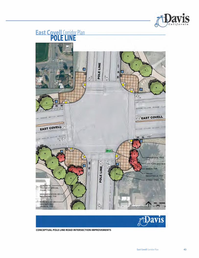
East Covell Corridor Plan 43
CONCEPTUAL POLE LINE ROAd INTERSECTION IMPROVEMENTS
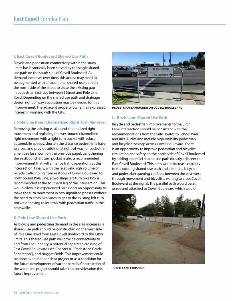
East Covell Corridor Plan
44 CHAPTER 7: Corridor Recommendations
I. East Covell Boulevard Shared Use PathBicycle and pedestrian connectivity within the study limits has historically been served by the single shared-use path on the south side of Covell Boulevard. As demand increases over time, this access may need to be augmented with an additional shared-use path on the north side of the street to close the existing gap in pedestrian facilities between J Street and Pole Line Road. Depending on the shared use path and drainage design right of way acquisition may be needed for this improvement. The adjacent property owner has expressed interest in working with the City.
J. Pole Line Road Channelized Right Turn RemovalRemoving the existing eastbound channelized right movement and replacing the westbound channelized right movement with a right turn pocket will reduce automobile speeds, shorten the distance pedestrians have to cross, and provide additional right-of-way for pedestrian amenities (as shown on the previous page). Lengthening the eastbound left turn pocket is also a recommended improvement that will enhance traffic operations at this intersection. Finally, with the relatively high volume of bicycle traffic going from eastbound Covell Boulevard to northbound Pole Line, a two stage left-turn bike box is recommended at the southern leg of the intersection. This would allow less experienced bike riders an opportunity to make the turn movement in two signalized phases without the need to cross two lanes to get to the existing left turn pocket or having to intermix with pedestrian traffic in the crosswalks.
K. Pole Line Shared Use PathAs bicycle and pedestrian demand in the area increases, a shared-use path should be constructed on the west side of Pole Line Road from East Covell Boulevard to the City’s limits. This shared-use path will provide connectivity to and from The Cannery, a potential separated crossing of East Covell Boulevard (see Chapter 8 - “Pedestrian Grade Separation”), and Nugget Fields. This improvement could be done as an independent project or as a condition for the future development of vacant parcels. Construction of the water line project should take into consideration this future improvement.
L. Birch Lane Shared Use PathBicycle and pedestrian improvements to the Birch Lane intersection should be consistent with the recommendations from the Safe Routes to School Walk and Bike Audits and include high-visibility pedestrian and bicycle crossings across Covell Boulevard. There is an opportunity to improve pedestrian and bicyclist circulation and safety on the north side of Covell Boulevard by adding a parallel shared-use path directly adjacent to East Covell Boulevard. This path would increase capacity to the existing shared-use path and eliminate bicycle and pedestrian queuing conflicts between the east-west through movement and bicyclists waiting to cross Covell Boulevard at the signal. The parallel path would be at grade and attached to Covell Boulevard which would
PEdESTRIAN BARRACAdE ON COVELL BOULEVARd
BIRCh LANE CROSSING
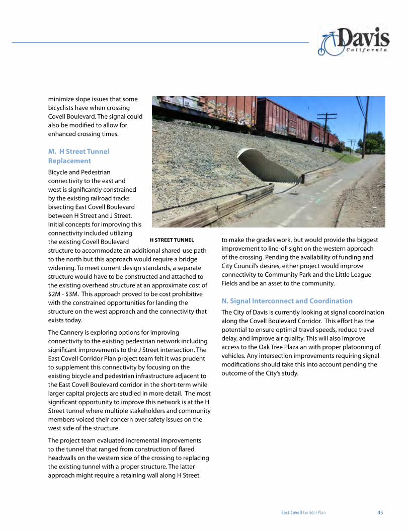
East Covell Corridor Plan 45
to make the grades work, but would provide the biggest improvement to line-of-sight on the western approach of the crossing. Pending the availability of funding and City Council’s desires, either project would improve connectivity to Community Park and the Little League Fields and be an asset to the community.
N. Signal Interconnect and CoordinationThe City of Davis is currently looking at signal coordination along the Covell Boulevard Corridor. This effort has the potential to ensure optimal travel speeds, reduce travel delay, and improve air quality. This will also improve access to the Oak Tree Plaza an with proper platooning of vehicles. Any intersection improvements requiring signal modifications should take this into account pending the outcome of the City’s study.
minimize slope issues that some bicyclists have when crossing Covell Boulevard. The signal could also be modified to allow for enhanced crossing times.
M. h Street Tunnel ReplacementBicycle and Pedestrian connectivity to the east and west is significantly constrained by the existing railroad tracks bisecting East Covell Boulevard between H Street and J Street. Initial concepts for improving this connectivity included utilizing the existing Covell Boulevard structure to accommodate an additional shared-use path to the north but this approach would require a bridge widening. To meet current design standards, a separate structure would have to be constructed and attached to the existing overhead structure at an approximate cost of $2M - $3M. This approach proved to be cost prohibitive with the constrained opportunities for landing the structure on the west approach and the connectivity that exists today.
The Cannery is exploring options for improving connectivity to the existing pedestrian network including significant improvements to the J Street intersection. The East Covell Corridor Plan project team felt it was prudent to supplement this connectivity by focusing on the existing bicycle and pedestrian infrastructure adjacent to the East Covell Boulevard corridor in the short-term while larger capital projects are studied in more detail. The most significant opportunity to improve this network is at the H Street tunnel where multiple stakeholders and community members voiced their concern over safety issues on the west side of the structure.
The project team evaluated incremental improvements to the tunnel that ranged from construction of flared headwalls on the western side of the crossing to replacing the existing tunnel with a proper structure. The latter approach might require a retaining wall along H Street
h STREET TUNNEL
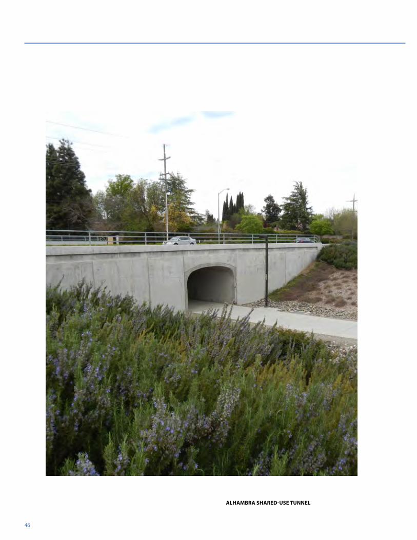
46
ALHAMBRA SHARED-USE TUNNEL
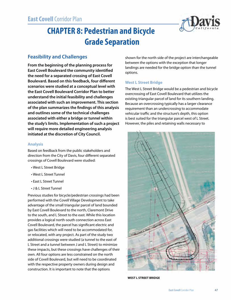
East Covell Corridor Plan
East Covell Corridor Plan 47
CHAPTER 8: Pedestrian and BicycleGrade Separation
Feasibility and ChallengesFrom the beginning of the planning process for East Covell Boulevard the community identified the need for a separated crossing of East Covell Boulevard. Based on this feedback, four different scenarios were studied at a conceptual level with the East Covell Boulevard Corridor Plan to better understand the initial feasibility and challenges associated with such an improvement. This section of the plan summarizes the findings of this analysis and outlines some of the technical challenges associated with either a bridge or tunnel within the study’s limits. Implementation of such a project will require more detailed engineering analysis initiated at the discretion of City Council.
AnalysisBased on feedback from the public stakeholders and direction from the City of Davis, four different separated crossings of Covell Boulevard were studied:
• West L Street Bridge
• West L Street Tunnel
• East L Street Tunnel
• J & L Street Tunnel
Previous studies for bicycle/pedestrian crossings had been performed with the Covell Village Development to take advantage of the small triangular parcel of land bounded by East Covell Boulevard to the north, Claremont Drive to the south, and L Street to the east. While this location provides a logical north-south connection across East Covell Boulevard, the parcel has significant electric and gas facilities which will need to be accommodated for, or relocated, with any project. As part of the study two additional crossings were studied (a tunnel to the east of L Street and a tunnel between J and L Street) to minimize these impacts, but these crossings have challenges of their own. All four options are less constrained on the north side of Covell Boulevard, but will need to be coordinated with the respective property owners during design and construction. It is important to note that the options
shown for the north side of the project are interchangeable between the options with the exception that longer landings are needed for the bridge option than the tunnel options.
West L Street BridgeThe West L Street Bridge would be a pedestrian and bicycle overcrossing of East Covell Boulevard that utilizes the existing triangular parcel of land for its southern landing. Because an overcrossing typically has a larger clearance requirement than an undercrossing to accommodate vehicular traffic and the structure’s depth, this option is best suited for the triangular parcel west of L Street. However, the piles and retaining walls necessary to
WEST L STREET BRIDGE
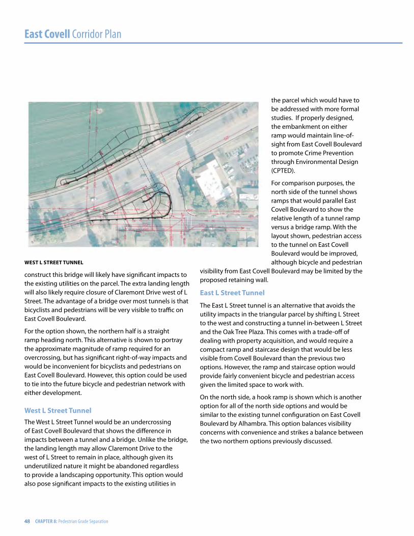
East Covell Corridor Plan
48 CHAPTER 8: Pedestrian Grade Separation
construct this bridge will likely have significant impacts to the existing utilities on the parcel. The extra landing length will also likely require closure of Claremont Drive west of L Street. The advantage of a bridge over most tunnels is that bicyclists and pedestrians will be very visible to traffic on East Covell Boulevard.
For the option shown, the northern half is a straight ramp heading north. This alternative is shown to portray the approximate magnitude of ramp required for an overcrossing, but has significant right-of-way impacts and would be inconvenient for bicyclists and pedestrians on East Covell Boulevard. However, this option could be used to tie into the future bicycle and pedestrian network with either development.
West L Street TunnelThe West L Street Tunnel would be an undercrossing of East Covell Boulevard that shows the difference in impacts between a tunnel and a bridge. Unlike the bridge, the landing length may allow Claremont Drive to the west of L Street to remain in place, although given its underutilized nature it might be abandoned regardless to provide a landscaping opportunity. This option would also pose significant impacts to the existing utilities in
the parcel which would have to be addressed with more formal studies. If properly designed, the embankment on either ramp would maintain line-of-sight from East Covell Boulevard to promote Crime Prevention through Environmental Design (CPTED).
For comparison purposes, the north side of the tunnel shows ramps that would parallel East Covell Boulevard to show the relative length of a tunnel ramp versus a bridge ramp. With the layout shown, pedestrian access to the tunnel on East Covell Boulevard would be improved, although bicycle and pedestrian
visibility from East Covell Boulevard may be limited by the proposed retaining wall.
East L Street Tunnel
The East L Street tunnel is an alternative that avoids the utility impacts in the triangular parcel by shifting L Street to the west and constructing a tunnel in-between L Street and the Oak Tree Plaza. This comes with a trade-off of dealing with property acquisition, and would require a compact ramp and staircase design that would be less visible from Covell Boulevard than the previous two options. However, the ramp and staircase option would provide fairly convenient bicycle and pedestrian access given the limited space to work with.
On the north side, a hook ramp is shown which is another option for all of the north side options and would be similar to the existing tunnel configuration on East Covell Boulevard by Alhambra. This option balances visibility concerns with convenience and strikes a balance between the two northern options previously discussed.
WEST L STREET TUNNEL
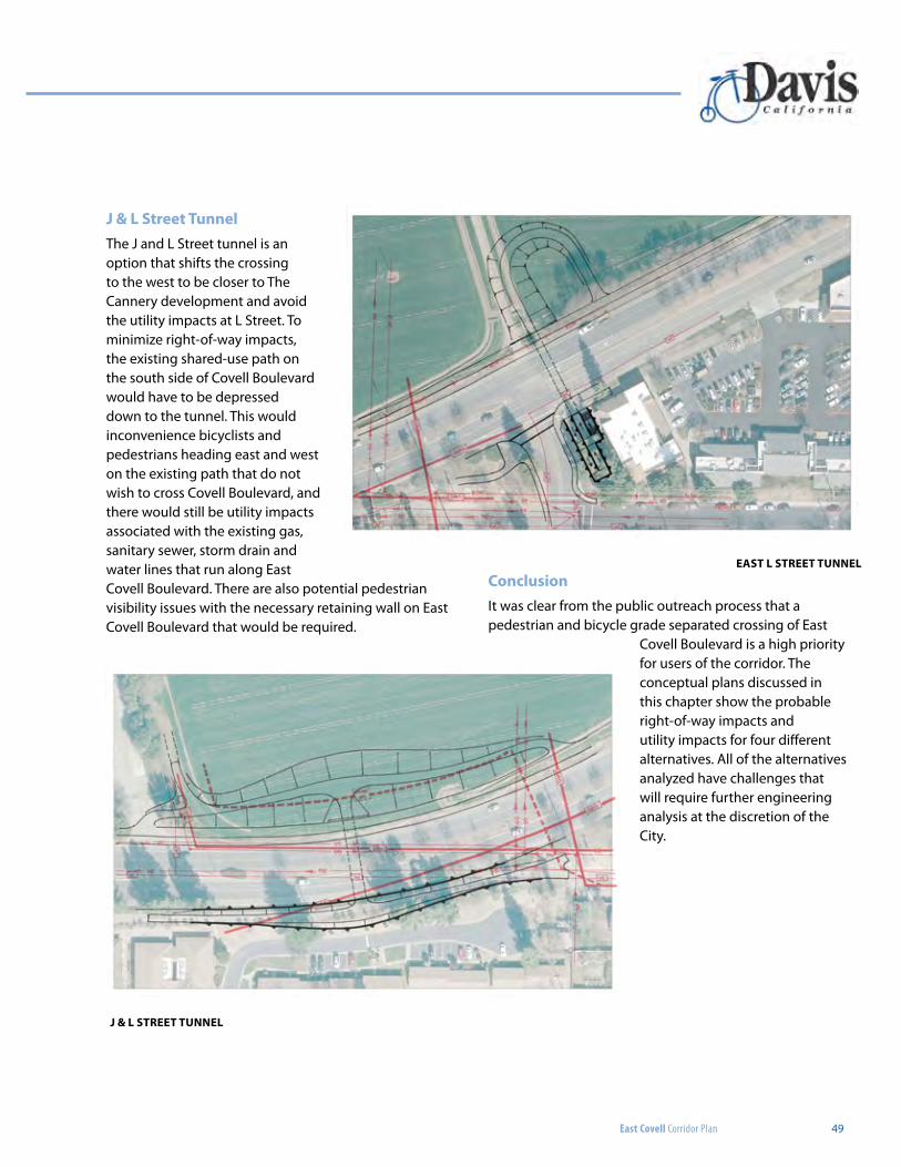
East Covell Corridor Plan 49
J & L Street TunnelThe J and L Street tunnel is an option that shifts the crossing to the west to be closer to The Cannery development and avoid the utility impacts at L Street. To minimize right-of-way impacts, the existing shared-use path on the south side of Covell Boulevard would have to be depressed down to the tunnel. This would inconvenience bicyclists and pedestrians heading east and west on the existing path that do not wish to cross Covell Boulevard, and there would still be utility impacts associated with the existing gas, sanitary sewer, storm drain and water lines that run along East Covell Boulevard. There are also potential pedestrian visibility issues with the necessary retaining wall on East Covell Boulevard that would be required.
ConclusionIt was clear from the public outreach process that a pedestrian and bicycle grade separated crossing of East
Covell Boulevard is a high priority for users of the corridor. The conceptual plans discussed in this chapter show the probable right-of-way impacts and utility impacts for four different alternatives. All of the alternatives analyzed have challenges that will require further engineering analysis at the discretion of the City.
EAST L STREET TUNNEL
J & L STREET TUNNEL
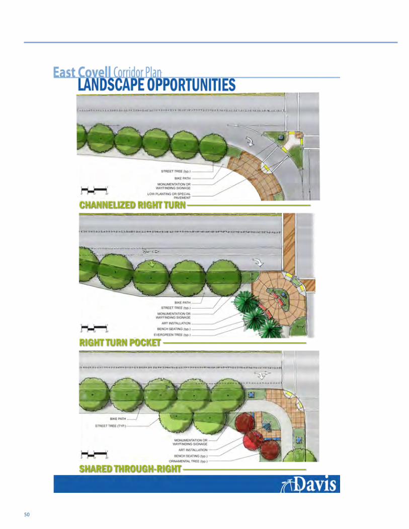
50
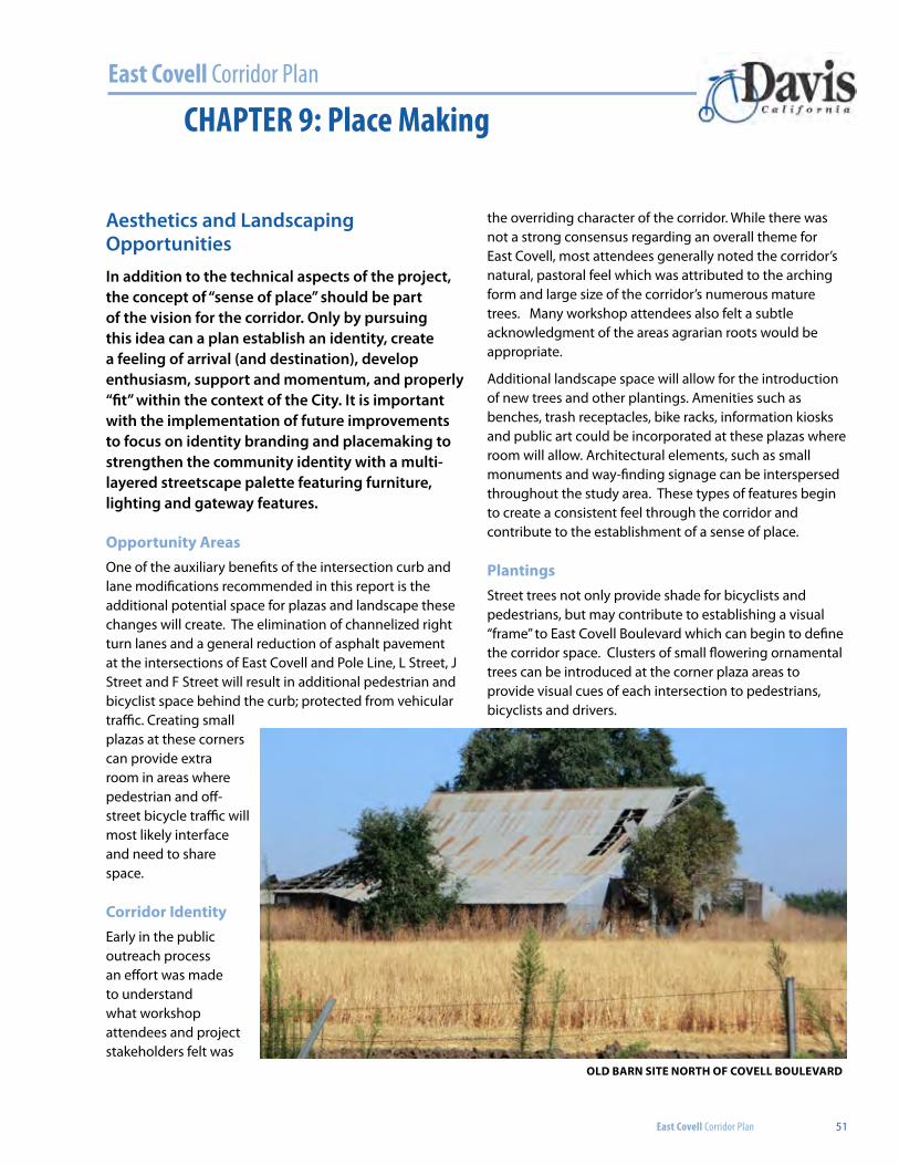
East Covell Corridor Plan
East Covell Corridor Plan 51
CHAPTER 9: Place Making
Aesthetics and Landscaping OpportunitiesIn addition to the technical aspects of the project, the concept of “sense of place” should be part of the vision for the corridor. Only by pursuing this idea can a plan establish an identity, create a feeling of arrival (and destination), develop enthusiasm, support and momentum, and properly “fit” within the context of the City. It is important with the implementation of future improvements to focus on identity branding and placemaking to strengthen the community identity with a multi-layered streetscape palette featuring furniture, lighting and gateway features.
Opportunity AreasOne of the auxiliary benefits of the intersection curb and lane modifications recommended in this report is the additional potential space for plazas and landscape these changes will create. The elimination of channelized right turn lanes and a general reduction of asphalt pavement at the intersections of East Covell and Pole Line, L Street, J Street and F Street will result in additional pedestrian and bicyclist space behind the curb; protected from vehicular traffic. Creating small plazas at these corners can provide extra room in areas where pedestrian and off-street bicycle traffic will most likely interface and need to share space.
Corridor IdentityEarly in the public outreach process an effort was made to understand what workshop attendees and project stakeholders felt was
the overriding character of the corridor. While there was not a strong consensus regarding an overall theme for East Covell, most attendees generally noted the corridor’s natural, pastoral feel which was attributed to the arching form and large size of the corridor’s numerous mature trees. Many workshop attendees also felt a subtle acknowledgment of the areas agrarian roots would be appropriate.
Additional landscape space will allow for the introduction of new trees and other plantings. Amenities such as benches, trash receptacles, bike racks, information kiosks and public art could be incorporated at these plazas where room will allow. Architectural elements, such as small monuments and way-finding signage can be interspersed throughout the study area. These types of features begin to create a consistent feel through the corridor and contribute to the establishment of a sense of place.
PlantingsStreet trees not only provide shade for bicyclists and pedestrians, but may contribute to establishing a visual “frame” to East Covell Boulevard which can begin to define the corridor space. Clusters of small flowering ornamental trees can be introduced at the corner plaza areas to provide visual cues of each intersection to pedestrians, bicyclists and drivers.
Old bArn sIte nOrth Of COvell bOulevArd
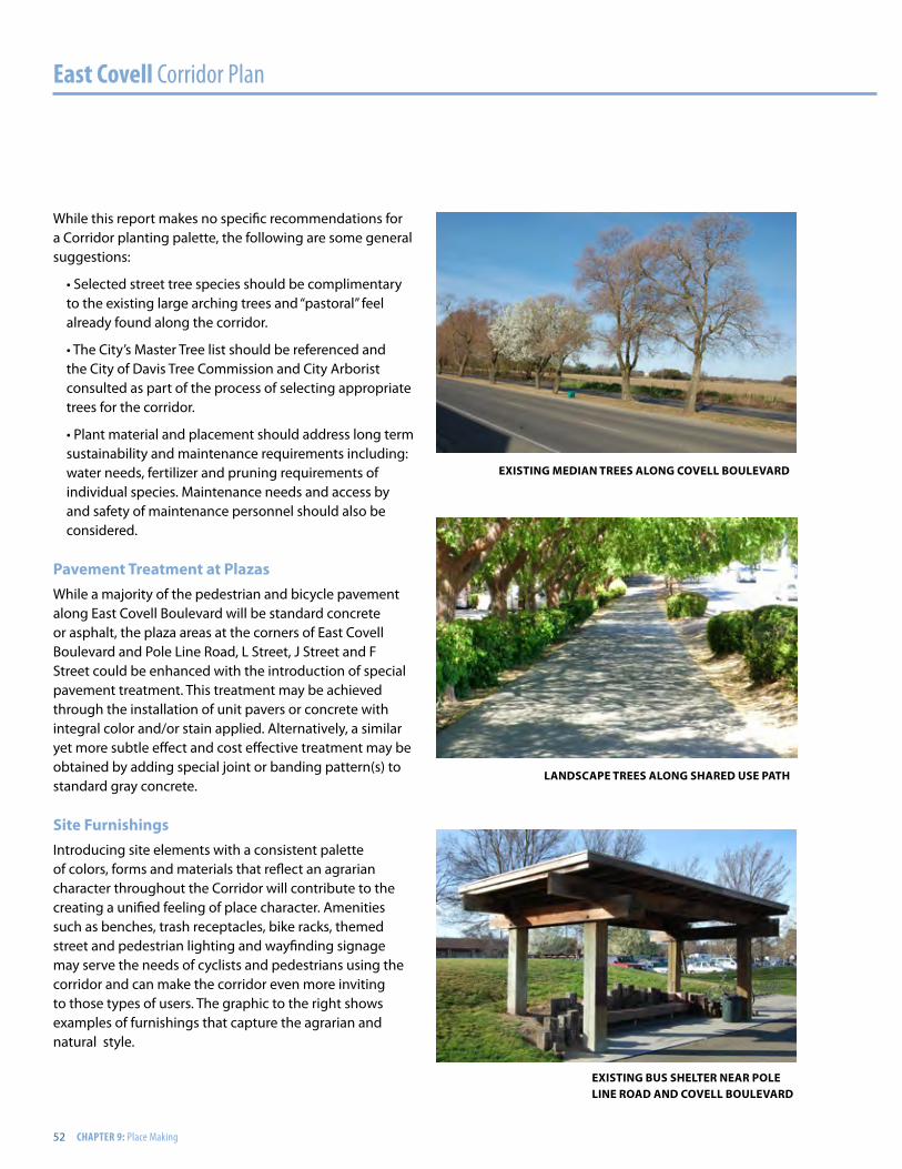
East Covell Corridor Plan
52 CHAPTER 9: Place Making
While this report makes no specific recommendations for a Corridor planting palette, the following are some general suggestions:
• Selected street tree species should be complimentary to the existing large arching trees and “pastoral” feel already found along the corridor.
• The City’s Master Tree list should be referenced and the City of Davis Tree Commission and City Arborist consulted as part of the process of selecting appropriate trees for the corridor.
• Plant material and placement should address long term sustainability and maintenance requirements including: water needs, fertilizer and pruning requirements of individual species. Maintenance needs and access by and safety of maintenance personnel should also be considered.
Pavement treatment at PlazasWhile a majority of the pedestrian and bicycle pavement along East Covell Boulevard will be standard concrete or asphalt, the plaza areas at the corners of East Covell Boulevard and Pole Line Road, L Street, J Street and F Street could be enhanced with the introduction of special pavement treatment. This treatment may be achieved through the installation of unit pavers or concrete with integral color and/or stain applied. Alternatively, a similar yet more subtle effect and cost effective treatment may be obtained by adding special joint or banding pattern(s) to standard gray concrete.
site furnishingsIntroducing site elements with a consistent palette of colors, forms and materials that reflect an agrarian character throughout the Corridor will contribute to the creating a unified feeling of place character. Amenities such as benches, trash receptacles, bike racks, themed street and pedestrian lighting and wayfinding signage may serve the needs of cyclists and pedestrians using the corridor and can make the corridor even more inviting to those types of users. The graphic to the right shows examples of furnishings that capture the agrarian and natural style.
exIstIng medIAn trees AlOng COvell bOulevArd
lAndsCAPe trees AlOng shAred use PAth
exIstIng bus shelter neAr POle lIne rOAd And COvell bOulevArd

East Covell Corridor Plan 53
Natural
Agrarian
East Covell Corridor Plan
DavisC a l i f o r n i a
CORRIDOR IDENTITY
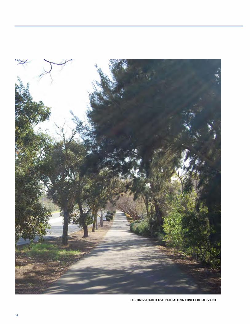
54
existing sHAReD-Use PAtH Along covell boUlevARD
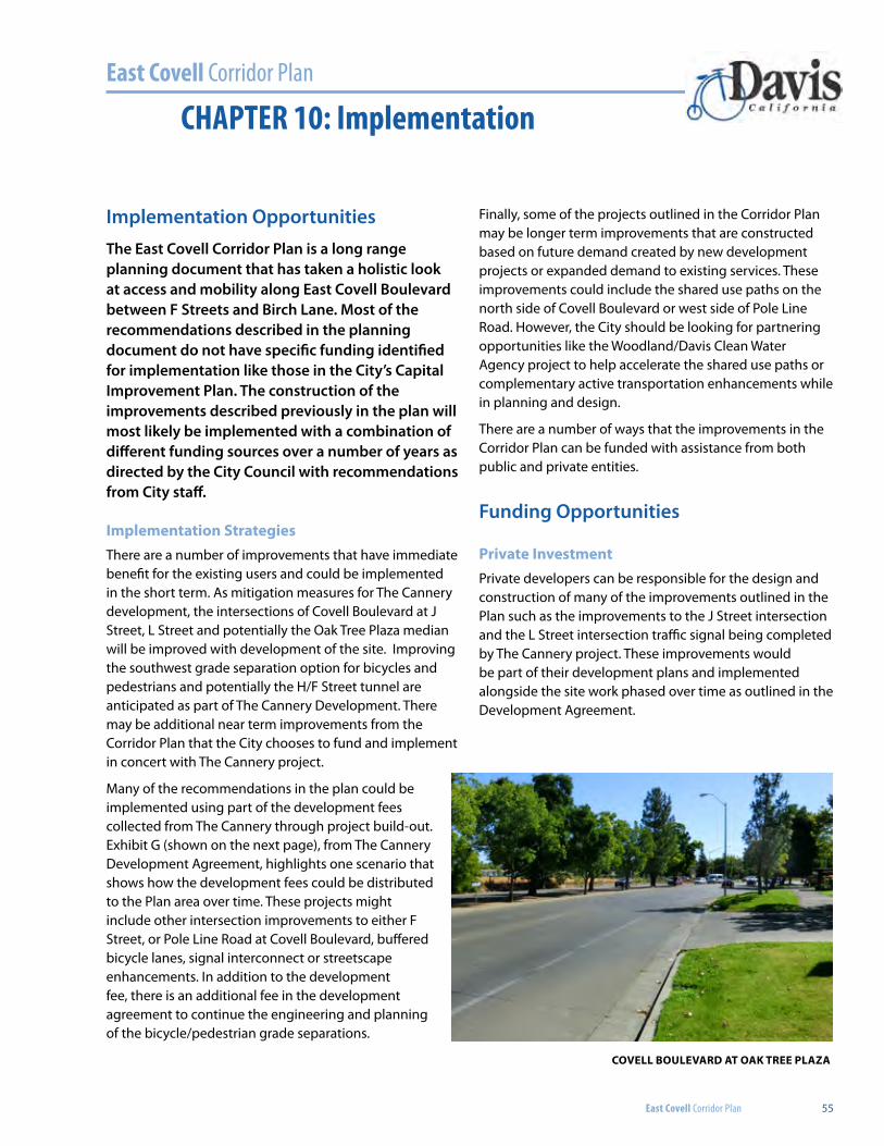
East Covell Corridor Plan
East Covell Corridor Plan 55
CHAPTER 10: Implementation
Implementation OpportunitiesThe East Covell Corridor Plan is a long range planning document that has taken a holistic look at access and mobility along East Covell Boulevard between F Streets and Birch Lane. Most of the recommendations described in the planning document do not have specific funding identified for implementation like those in the City’s Capital Improvement Plan. The construction of the improvements described previously in the plan will most likely be implemented with a combination of different funding sources over a number of years as directed by the City Council with recommendations from City staff.
implementation strategiesThere are a number of improvements that have immediate benefit for the existing users and could be implemented in the short term. As mitigation measures for The Cannery development, the intersections of Covell Boulevard at J Street, L Street and potentially the Oak Tree Plaza median will be improved with development of the site. Improving the southwest grade separation option for bicycles and pedestrians and potentially the H/F Street tunnel are anticipated as part of The Cannery Development. There may be additional near term improvements from the Corridor Plan that the City chooses to fund and implement in concert with The Cannery project.
Many of the recommendations in the plan could be implemented using part of the development fees collected from The Cannery through project build-out. Exhibit G (shown on the next page), from The Cannery Development Agreement, highlights one scenario that shows how the development fees could be distributed to the Plan area over time. These projects might include other intersection improvements to either F Street, or Pole Line Road at Covell Boulevard, buffered bicycle lanes, signal interconnect or streetscape enhancements. In addition to the development fee, there is an additional fee in the development agreement to continue the engineering and planning of the bicycle/pedestrian grade separations.
Finally, some of the projects outlined in the Corridor Plan may be longer term improvements that are constructed based on future demand created by new development projects or expanded demand to existing services. These improvements could include the shared use paths on the north side of Covell Boulevard or west side of Pole Line Road. However, the City should be looking for partnering opportunities like the Woodland/Davis Clean Water Agency project to help accelerate the shared use paths or complementary active transportation enhancements while in planning and design.
There are a number of ways that the improvements in the Corridor Plan can be funded with assistance from both public and private entities.
Funding Opportunities
Private investmentPrivate developers can be responsible for the design and construction of many of the improvements outlined in the Plan such as the improvements to the J Street intersection and the L Street intersection traffic signal being completed by The Cannery project. These improvements would be part of their development plans and implemented alongside the site work phased over time as outlined in the Development Agreement.
covell boUlevARD At oAK tRee PlAZA
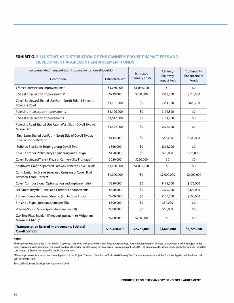
56
Recommended Transportation Improvements - Covell CorridorEstimated
Cannery Costs
Cannery Roadway
Impact Fees
Community Enhancement
FundsDescription Estimated Cost
J Street Intersection Improvements* $1,066,000 $1,066,000 $0 $0
L Street Intersection Improvements* $739,000 $250,000 $369,500 $119,500
Covell Boulevard Shared Use Path - North Side - J Street to Pole Line Road
$1,181,000 $0 $351,300 $829,700
Pole Line Intersection Improvements $1,125,000 $0 $112,500 $0
F Street Intersection Improvements $1,617,000 $0 $161,700 $0
Pole Line Road Shared Use Path - West Side - Covell Blvd to Moore Blvd
$1,422,000 $0 $426,600 $0
Birch Lane Shared Use Path - North Side of Covell Blvd at Intersection of Birch Ln
$144,000 $0 $43,200 $100,800
Buffered Bike Lane Striping along Covell Blvd $366,000 $0 $366,000 $0
Covell Corridor Preliminary Engineering and Design $150,000 $0 $75,000 $75,000
Covell Boulevard Transit Plaza at Cannery Site Frontage* $250,000 $250,000 $0 $0
Southwest Grade Separated Pathway beneath Covell Blvd* $1,000,000 $1,000,000 $0 $0
Contribution to Grade Separated Crossing of Covell Blvd between J and L Streets
$4,000,000 $0 $2,000,000 $2,000,000
Covell Corridor Signal Optimization and Implementation $350,000 $0 $175,000 $175,000
H/F Street Bicycle Tunnel and Corridor Enhancements $650,000 $0 $325,000 $325,000
J Street Complete Street Striping (8th to Covell Blvd) $200,000 $0 $100,000 $100,000
8th and J Signal (pro rata share per EIR) $500,000 $0 $50,000 $0
Poleline/Picaso Signal (pro rata share per EIR) $500,000 $0 $50,000 $0
Oak Tree Plaza Median (if needed, pursuant to Mitigation Measure 3.14-1E)*
$200,000 $200,000 $0 $0
transportation Related improvements subtotal - covell corridor
$15,460,000 $2,766,000 $4,605,800 $3,725,000
exHibit g. eillUstRAtive DistRibUtion oF tHe cAnneRY PRoJect iMPAct Fees AnD DeveloPMent AggReMent enHAnceMent FUnDs
notes:
The improvements identified in this Exhibit G (except as denoted with an asterix) are for illustrative purposes. Future implementation of these improvements will be subject to the City’s review and consideration of the Covell Boulevard Corridor Plan, following environmental review pursuant to CEQA. The City retains the discretion to apply the funds ($3,725,000) contributed by Developer to specific public improvements.
*These improvements are construction obligations of the Project. The costs identified as “Estimated Cannery Costs” are estimates only, and the Project obligation will be the actual cost of construction.
Source: The Cannery Development Agreement, 2013
exHibit g FRoM tHe cAnneRY DeveloPeR AgReeMent
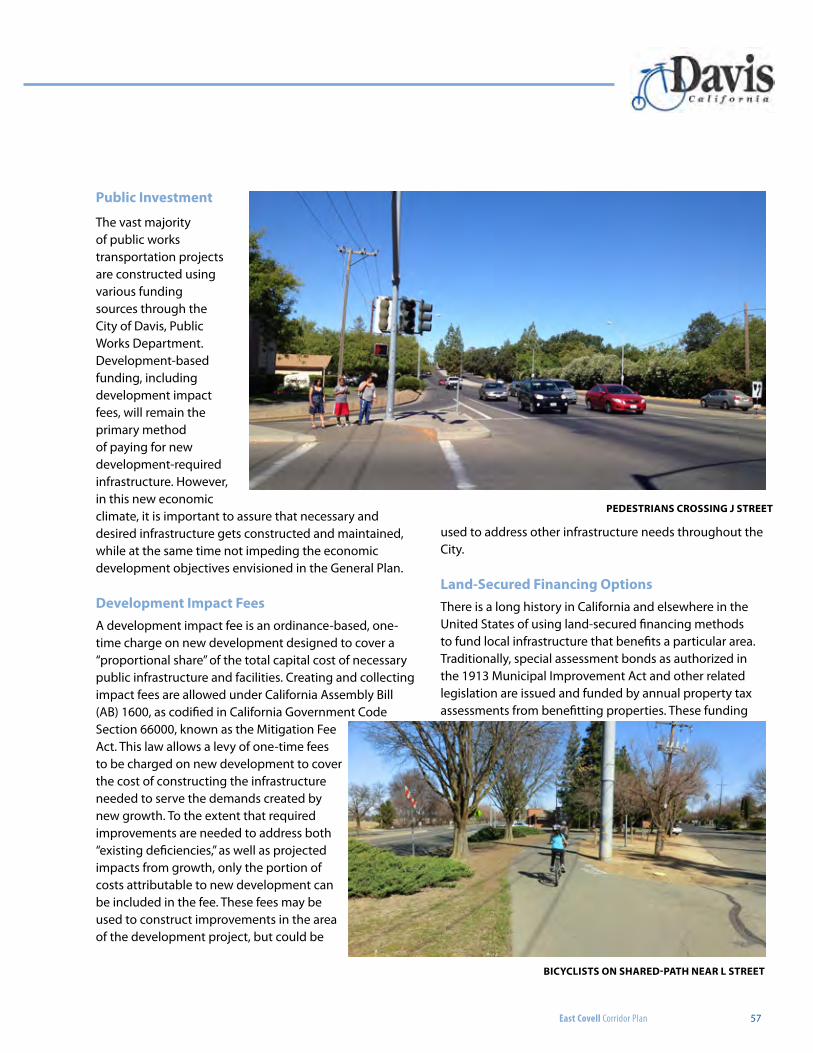
East Covell Corridor Plan 57
Public investment
The vast majority of public works transportation projects are constructed using various funding sources through the City of Davis, Public Works Department. Development-based funding, including development impact fees, will remain the primary method of paying for new development-required infrastructure. However, in this new economic climate, it is important to assure that necessary and desired infrastructure gets constructed and maintained, while at the same time not impeding the economic development objectives envisioned in the General Plan.
Development impact FeesA development impact fee is an ordinance-based, one-time charge on new development designed to cover a “proportional share” of the total capital cost of necessary public infrastructure and facilities. Creating and collecting impact fees are allowed under California Assembly Bill (AB) 1600, as codified in California Government Code Section 66000, known as the Mitigation Fee Act. This law allows a levy of one-time fees to be charged on new development to cover the cost of constructing the infrastructure needed to serve the demands created by new growth. To the extent that required improvements are needed to address both “existing deficiencies,” as well as projected impacts from growth, only the portion of costs attributable to new development can be included in the fee. These fees may be used to construct improvements in the area of the development project, but could be
used to address other infrastructure needs throughout the City.
land-secured Financing optionsThere is a long history in California and elsewhere in the United States of using land-secured financing methods to fund local infrastructure that benefits a particular area. Traditionally, special assessment bonds as authorized in the 1913 Municipal Improvement Act and other related legislation are issued and funded by annual property tax assessments from benefitting properties. These funding
PeDestRiAns cRossing J stReet
bicYclists on sHAReD-PAtH neAR l stReet
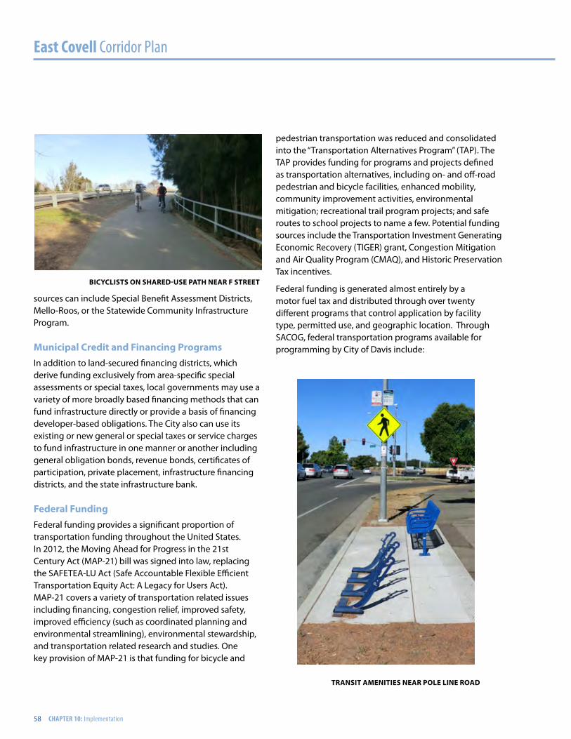
East Covell Corridor Plan
58 CHAPTER 10: Implementation
sources can include Special Benefit Assessment Districts, Mello-Roos, or the Statewide Community Infrastructure Program.
Municipal credit and Financing ProgramsIn addition to land-secured financing districts, which derive funding exclusively from area-specific special assessments or special taxes, local governments may use a variety of more broadly based financing methods that can fund infrastructure directly or provide a basis of financing developer-based obligations. The City also can use its existing or new general or special taxes or service charges to fund infrastructure in one manner or another including general obligation bonds, revenue bonds, certificates of participation, private placement, infrastructure financing districts, and the state infrastructure bank.
Federal FundingFederal funding provides a significant proportion of transportation funding throughout the United States. In 2012, the Moving Ahead for Progress in the 21st Century Act (MAP-21) bill was signed into law, replacing the SAFETEA-LU Act (Safe Accountable Flexible Efficient Transportation Equity Act: A Legacy for Users Act). MAP-21 covers a variety of transportation related issues including financing, congestion relief, improved safety, improved efficiency (such as coordinated planning and environmental streamlining), environmental stewardship, and transportation related research and studies. One key provision of MAP-21 is that funding for bicycle and
pedestrian transportation was reduced and consolidated into the “Transportation Alternatives Program” (TAP). The TAP provides funding for programs and projects defined as transportation alternatives, including on- and off-road pedestrian and bicycle facilities, enhanced mobility, community improvement activities, environmental mitigation; recreational trail program projects; and safe routes to school projects to name a few. Potential funding sources include the Transportation Investment Generating Economic Recovery (TIGER) grant, Congestion Mitigation and Air Quality Program (CMAQ), and Historic Preservation Tax incentives.
Federal funding is generated almost entirely by a motor fuel tax and distributed through over twenty different programs that control application by facility type, permitted use, and geographic location. Through SACOG, federal transportation programs available for programming by City of Davis include:
bicYclists on sHAReD-Use PAtH neAR F stReet
tRAnsit AMenities neAR Pole line RoAD
East Covell Corridor Plan 59
congestion Mitigation and Air Quality Program (cMAQ)The CMAQ Program was established by the 1991 Federal Intermodal Surface Transportation Efficiency Act (ISTEA) and was re-authorized with the passage of TEA-21, SAFETEA-LU, and MAP-21. Funds are directed to transportation projects and programs which contribute to the attainment of maintenance of National Ambient Air Quality Standards in non-attainment or air quality maintenance areas for ozone, carbon monoxide, or particulate matter under provisions in the federal Clean Air Act. As part of the Sacramento Valley air basin, which is in non-attainment for ozone, the City of Davis is eligible for CMAQ funds.
Eligible CMAQ projects include public transit improvements; high occupancy vehicle lanes; Intelligent Transportation System Infrastructure; traffic management and traveler information systems (i.e., electric toll collection systems); employer-based transportation management plans and incentives; traffic flow improvement programs (signal coordination); fringe parking facilities serving multiple occupancy vehicles; shared ride services; bicycle and pedestrian facilities; flexible work-hour programs; outreach activities establishing Transportation Management Associations; fare/fee subsidy programs; and under certain conditions, Particulate Matter improvement projects.
Regional surface transportation Program (RstP)RSTP was established by the 1991 Federal Intermodal
Surface Transportation Efficiency Act (ISTEA) and continued with the passage of TEA 21 in 1997, SAFETEA-LU in 2005, and MAP-21 in 2012. Of all the funding programs in MAP-21, RSTP is most flexible. A broad variety of transportation projects and modes, including streets and roads, are eligible.
Examples of projects eligible for RSTP include highway projects; bridges (including construction, reconstruction, seismic retrofit, and painting); transit capital improvements; carpool, parking, bicycle, and pedestrian facilities; safety improvements and hazard elimination; research; traffic management systems; surface transportation planning; transportation enhancement activities and control measures; and wetland and other environmental mitigation.
Eighty percent of the apportionment is distributed among the urbanized and non-urbanized areas of the State through Metropolitan Planning Organizations and Regional Transportation Planning Agencies. The remainder goes directly to counties in a formula equal to 110% of the Federal Aid Urban/Federal Aid Secondary funding in place prior to 1991.
state FundingState funding also comes largely from the fuel tax, though recent changes in law now provide for some contribution from the state sales tax on motor fuel. State funds are combined with funding from various federal programs through the biennial State Transportation Improvement Program programming process and apportioned to
bicYclist on J stReet
existing RAilRoAD tRAcKs neAR F stReet
East Covell Corridor Plan
60 CHAPTER 10: Implementation
the state highway system projects, and other projects throughout the state formulaically based on the geographic distribution of population and lane miles.
Prior to the passage of MAP-21, non-motorized transportation was funded in the state through a suite of programs that included State Safe Routes to School, Bicycle Transportation Account, and the Recreational Trails Program. MAP-21 collapsed those programs into single funding program called the Transportation Alternatives Program or TAP. Federal TAP funding was allocated through MAP-21 to individual states, and on September 26, 2013, Governor Brown signed legislation creating the Active Transportation Program (ATP) in the Department of Transportation (Senate Bill 99, Chapter 359 and Assembly Bill 101, Chapter 354). The ATP consolidates existing federal and state transportation programs, including
the Transportation Alternatives Program (TAP), Bicycle Transportation Account (BTA), and State Safe Routes to School (SR2S), into a single program with a focus to make California a national leader in active transportation. The ATP is administered by the Division of Local Assistance, Office of Active Transportation and Special Programs.
The advantage of the publicly funded projects is that they can be built on a set timeline based on available funding and span multiple property or jurisdictions. A project along Covell Boulevard that included improvements to the five major intersections at F Street, J Street, L Street, Pole Line Road, and Birch Lane and general corridor improvements such as buffered bicycle lanes, signal interconnect, pedestrian and bicycle gap closures, and streetscape elements are all of the types of elements that would best be tackled by one of the public agencies.
The challenge with public funding projects is that they are dependent on the project competing well for local, regional, State, or Federal grants or qualifying for some sort of financing district, tax or bond program. As listed above, there are many funding sources currently geared towards the implementation of active transportation projects that support the livability goals outlined in the plan. Most of these funding sources are administered through the Sacramento Area Council of Governments (SACOG). The East Covell Corridor Plan is a critical piece in being competitive for these various regional funding sources through their Community Design Grant, Bicycle and Pedestrian Grant, and Local and Regional Funding program.
biRcH lAne cRossing
biKe lAne cRossing sign
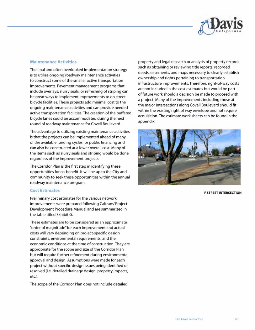
East Covell Corridor Plan 61
Maintenance Activities
The final and often overlooked implementation strategy is to utilize ongoing roadway maintenance activities to construct some of the smaller active transportation improvements. Pavement management programs that include overlays, slurry seals, or refreshing of striping can be great ways to implement improvements to on street bicycle facilities. These projects add minimal cost to the ongoing maintenance activities and can provide needed active transportation facilities. The creation of the buffered bicycle lanes could be accommodated during the next round of roadway maintenance for Covell Boulevard.
The advantage to utilizing existing maintenance activities is that the projects can be implemented ahead of many of the available funding cycles for public financing and can also be constructed at a lower overall cost. Many of the items such as slurry seals and striping would be done regardless of the improvement projects.
The Corridor Plan is the first step in identifying these opportunities for co-benefit. It will be up to the City and community to seek these opportunities within the annual roadway maintenance program.
cost estimates
Preliminary cost estimates for the various network improvements were prepared following Caltrans’ Project Development Procedure Manual and are summarized in the table titled Exhibit G.
These estimates are to be considered as an approximate “order of magnitude” for each improvement and actual costs will vary depending on project-specific design constraints, environmental requirements, and the economic conditions at the time of construction. They are appropriate for the scope and size of the Corridor Plan but will require further refinement during environmental approval and design. Assumptions were made for each project without specific design issues being identified or resolved (i.e. detailed drainage design, property impacts, etc.).
The scope of the Corridor Plan does not include detailed
property and legal research or analysis of property records such as obtaining or reviewing title reports, recorded deeds, easements, and maps necessary to clearly establish ownership and rights pertaining to transportation infrastructure improvements. Therefore, right-of-way costs are not included in the cost estimates but would be part of future work should a decision be made to proceed with a project. Many of the improvements including those at the major intersections along Covell Boulevard should fit within the existing right of way envelope and not require acquisition. The estimate work sheets can be found in the appendix.
F stReet inteRsection
East Covell Corridor Plan
62 CHAPTER 10: Implementation
This Page Intentionally Left Blank
East Covell Corridor Plan
East Covell Corridor Plan 63
APPENDICES
APPENDIX A: PROJECT AREA MAP
APPENDIX B: PUBLIC WORKSHOP SUMMARIES
APPENDIX C: PRELIMINARY PLANNING LEVEL COST ESTIMATES

APPENDIX A: PROJECT AREA MAP
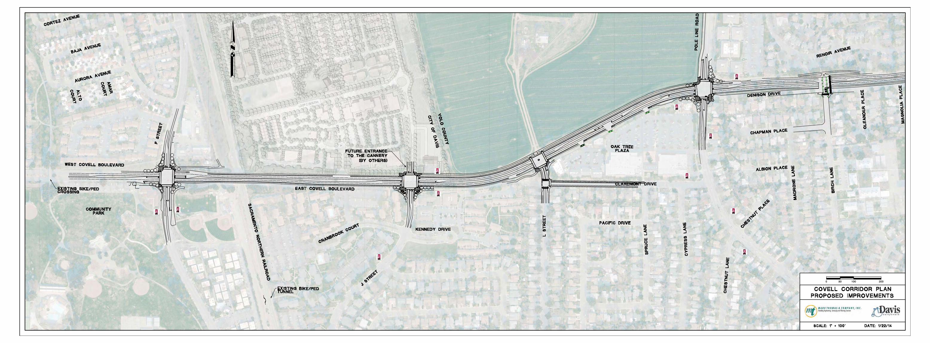
APPENDIX B: PUBLIC WORKSHOP SUMMARIES
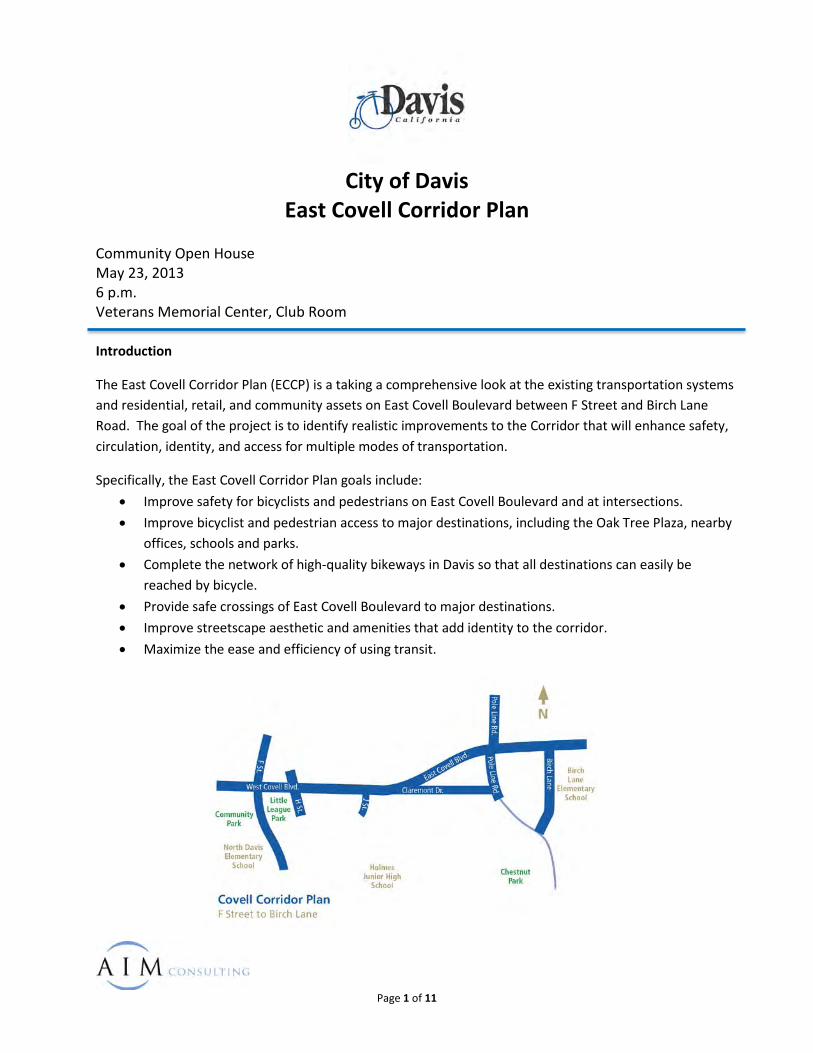
City of Davis
East Covell Corridor Plan
Page 1 of 11
Community Open House May 23, 2013 6 p.m. Veterans Memorial Center, Club Room Introduction
The East Covell Corridor Plan (ECCP) is a taking a comprehensive look at the existing transportation systems and residential, retail, and community assets on East Covell Boulevard between F Street and Birch Lane Road. The goal of the project is to identify realistic improvements to the Corridor that will enhance safety, circulation, identity, and access for multiple modes of transportation.
Specifically, the East Covell Corridor Plan goals include: • Improve safety for bicyclists and pedestrians on East Covell Boulevard and at intersections. • Improve bicyclist and pedestrian access to major destinations, including the Oak Tree Plaza, nearby
offices, schools and parks. • Complete the network of high-quality bikeways in Davis so that all destinations can easily be
reached by bicycle. • Provide safe crossings of East Covell Boulevard to major destinations. • Improve streetscape aesthetic and amenities that add identity to the corridor. • Maximize the ease and efficiency of using transit.
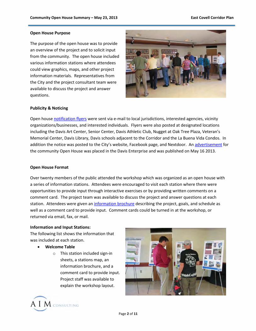
Community Open House Summary – May 23, 2013 East Covell Corridor Plan
Page 2 of 11
Open House Purpose
The purpose of the open house was to provide an overview of the project and to solicit input from the community. The open house included various information stations where attendees could view graphics, maps, and other project information materials. Representatives from the City and the project consultant team were available to discuss the project and answer questions. Publicity & Noticing
Open house notification flyers were sent via e-mail to local jurisdictions, interested agencies, vicinity organizations/businesses, and interested individuals. Flyers were also posted at designated locations including the Davis Art Center, Senior Center, Davis Athletic Club, Nugget at Oak Tree Plaza, Veteran’s Memorial Center, Davis Library, Davis schools adjacent to the Corridor and the La Buena Vida Condos. In addition the notice was posted to the City’s website, Facebook page, and Nextdoor. An advertisement for the community Open House was placed in the Davis Enterprise and was published on May 16 2013.
Open House Format
Over twenty members of the public attended the workshop which was organized as an open house with a series of information stations. Attendees were encouraged to visit each station where there were opportunities to provide input through interactive exercises or by providing written comments on a comment card. The project team was available to discuss the project and answer questions at each station. Attendees were given an information brochure describing the project, goals, and schedule as well as a comment card to provide input. Comment cards could be turned in at the workshop, or returned via email, fax, or mail.
Information and Input Stations: The following list shows the information that was included at each station.
• Welcome Table o This station included sign-in
sheets, a stations map, an information brochure, and a comment card to provide input. Project staff was available to explain the workshop layout.
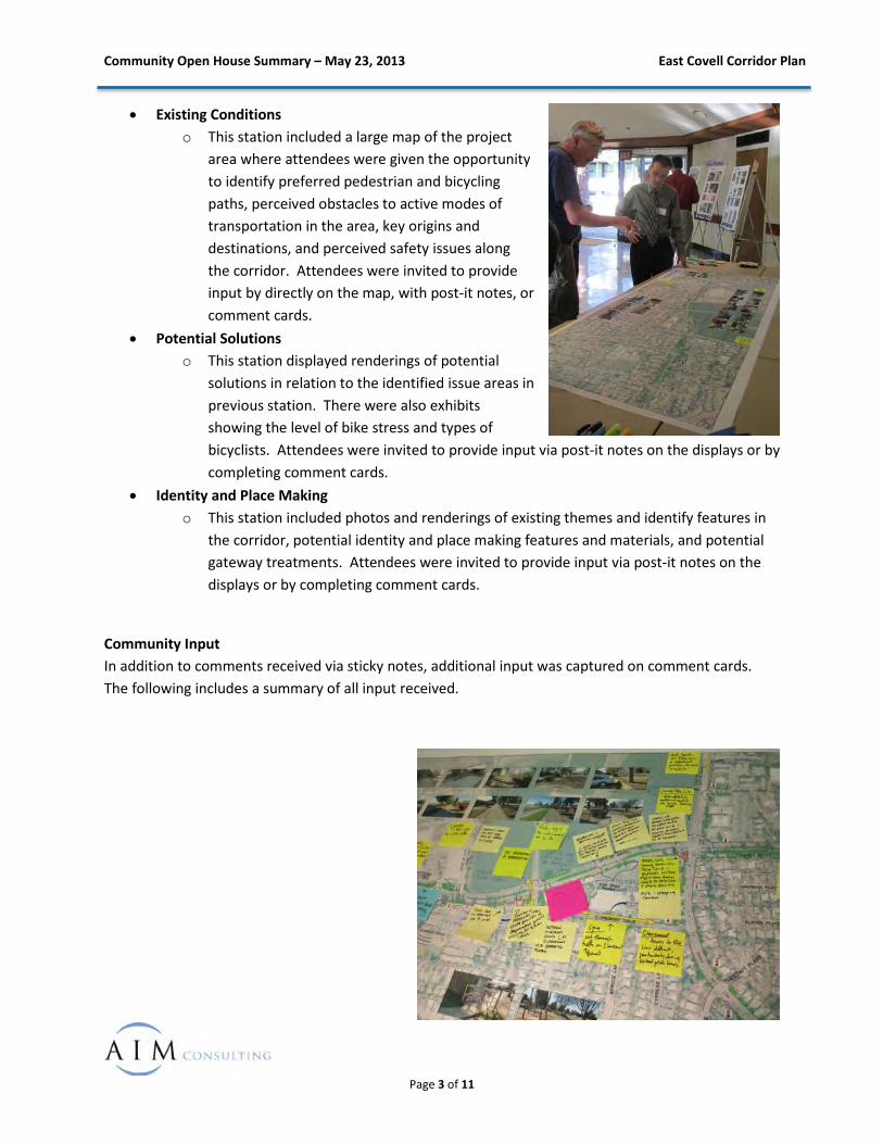
Community Open House Summary – May 23, 2013 East Covell Corridor Plan
Page 3 of 11
• Existing Conditions o This station included a large map of the project
area where attendees were given the opportunity to identify preferred pedestrian and bicycling paths, perceived obstacles to active modes of transportation in the area, key origins and destinations, and perceived safety issues along the corridor. Attendees were invited to provide input by directly on the map, with post-it notes, or comment cards.
• Potential Solutions o This station displayed renderings of potential
solutions in relation to the identified issue areas in previous station. There were also exhibits showing the level of bike stress and types of bicyclists. Attendees were invited to provide input via post-it notes on the displays or by completing comment cards.
• Identity and Place Making o This station included photos and renderings of existing themes and identify features in
the corridor, potential identity and place making features and materials, and potential gateway treatments. Attendees were invited to provide input via post-it notes on the displays or by completing comment cards.
Community Input In addition to comments received via sticky notes, additional input was captured on comment cards. The following includes a summary of all input received.
Community Open House Summary – May 23, 2013 East Covell Corridor Plan
Page 4 of 11
East Covell Corridor Plan Public Comments – Existing Conditions Station Key: Stakeholder Comment <MTCo Clarification> Comments: F Street
• Tall utility box blocks pedestrian views <References the tall utility box at southwest corner of F Street and Covell Boulevard that blocks the view of pedestrians crossing the free-right turn lane adjacent to the Art Center>
Bike Tunnel and Trail • Need to connect Covell Boulevard to bike trail <References connecting Covell Boulevard to the
existing bike path that goes underneath Covell Boulevard on the west side of the tracks> • Cycling: Biggest problem with corridor is H Street tunnel. The tunnel approaches and width are
equally problematic The Cannery
• Cannery: Consider school bus to reduce traffic • Cannery needs Bike/Ped overcrossing to F Street • Cannery: Design project to reduce driving/more walking and biking • 500 houses and people taking kids to work <This was posted by a stakeholder who was
concerned that The Cannery has not properly accounted for the increase in traffic on Covell Boulevard>
• Cannery: If no connection to F Street, need multiple connections to Covell • Cannery: Need plan for added traffic • Future transit plaza at Cannery <References the northern leg of the J Street/Covell Boulevard
intersection> • Community investments and bike infrastructure should be spread Citywide <This was posted by
a stakeholder who was concerned with the localized bike and pedestrian improvements around The Cannery development when there are gaps in the existing bike and pedestrian infrastructure in other parts of the City>
• Tie development to undercrossing <This was posted by a stakeholder that wanted an undercrossing of Covell Boulevard to be a mitigation measure for The Cannery>
• Prefer signal to undercrossing at L Street • If cannery proceeds they should provide a separated grade crossing for bikes and peds.
Cranbrook Apartments • Screen parking lot <References the parking lot between Covell Boulevard and Cranbrook Court>
Oak Tree Plaza • Sink hole in pavement EB lane <References the EB lanes in front of the Oak Tree Plaza> • Screen parking lot <References the Oak Tree Plaza parking lot> • Pedestrian challenges crossing L Street at Claremont. NB speeding traffic.
Community Open House Summary – May 23, 2013 East Covell Corridor Plan
Page 5 of 11
• 3 PM: Cut through school traffic on Claremont • Entering and exiting Nugget – Signal to make this safe access for bikes, pedestrians and vehicles • Claremont: Access to Pole Line difficult, particularly during school peak hours
Pole Line • From Pole Line/Covell intersection to F Street needs street beautification • Bikes, cars coming south on Pole Line – conflicts with free right turn from Covell to Pole Line and
entry into CVS Shopping center • Covell/Pole Line: Bike fatality southbound cyclist SB truck turning right • High Speeds on Pole Line a significant problem for auto and cyclists
Birch Lane • Bicyclists using Denison don’t stop at intersection <References intersection of Birch Lane/Covell
Boulevard/Denison Avenue> • EB movement concurrent on Denison and Covell <References intersection of Birch Lane/Covell
Boulevard/Denison Avenue> • Need to reduce auto traffic to/from schools (buses) • Landscape buffer needs addressing <References intersection of Birch Lane/Covell
Boulevard/Denison Avenue> • Matisse: AT&T control box. Trucks create ditch. Break curb. Recent addition of DG not working.
Need path/pad reinforced. Baywood Lane
• No crosswalk <References intersection of Baywood Lane / Covell Boulevard> • Need a bus stop here <References intersection of Baywood Lane / Covell Boulevard> • Dangerous for Bicycles

Community Open House Summary – May 23, 2013 East Covell Corridor Plan
Page 6 of 11
East Covell Corridor Plan Public Comments – Potential Solutions Station Right Turn Treatments
• Either Right Turn Pocket or Through-Right is better than existing conditions • Consider removing bike lanes and enhancing bike path further. Remove green strip between
path and road. • Channelized RT scary, especially for kids. • Consider raised cycletrack (one-way) instead of on-street bike lanes. • Prefer shared through-right to limit conflict zone. • Shared through right is preference, if capacity can handle it.
Level of Traffic Stress • May only need bike path on south side of Covell • Path between H St. tunnel and Cannery east of Railroad • H St. Tunnel – need to address both tunnel and approach. Consider separate one-way tunnels. • Plan needs to address existing conditions and Cannery Park • Pole Line Road – improve transition from bike path to bike lane, and vice versa • Pole Line bike signal at Clara Lane is confusing for northbound vehicles. Need another signal
head on NB approach. • Underpass at L St. for bikes and peds? • Southbound right turning vehicles at pole line / covell is stressful for bikes and peds. • Disagree with LTS 1 on Drexel Rd. South side path in front of Nugget is also a problem. • Cycle length is long at Birch Ln / Covell. No bike detection at signal. • Facilities that are not low-stress (contrary to graphic):
o Undercrossing along railroad o Drexel o Class I on Covell not LTS 1 due to roots, uneven surface, sun.
• Dual westbound lefts at Covell / F St. creates safety concern at Class I crosswalk south of Covell. Sight distance and speed differential.
• H St. Tunnel – low clearance, visibility issues, drainage grate. • Birch crossing – southbound slope is steep for bicyclists, conflicts with peds • Need consistent paving on Class I facilities • Use land currently taken by channelization as a landing area for over or undercrossing. • E 14th Street to Drexel Road – need better connection.
Bike Lane Enhancements • Like buffered with separation • Trucks could degrade green paint / thermal? • Secure bike parking needed for intermodal connections. • Prefer buffer with vertical device (one-way cycletrack)
Left-Turn Treatments • 2 Stage Left Turn Queue box could be useful at Covell & Pole Line.
Community Open House Summary – May 23, 2013 East Covell Corridor Plan
Page 7 of 11
• Not sure we get the massing of bikes on Covell that would justify bike boxes; perhaps northbound on Pole Line at Covell.
• Would pole line intercity traffic be comfortable with bike boxes and other enhancements? • Education on bike detection – and bike detection stencils • Check safety studies of TSTQB and BB for left turns. • TSTQB and compliance concerns.
Pedestrian Crossing Enhancements • Southbound left at Covell / J St – use T/L bike lanes and green between LT and bike path. • Check – can we get bright colored green asphalt? • Green paint needs to be reflective. • Prefer high vis crosswalks at signalized locations. • Consider arced crosswalks for peds cutting corners. • Consider pedestrian scramble. Scramble striping can also slow vehicles? • Heavy vehicle traffic at Pole Line – what are the best pedestrian treatments? • West leg at Pole Line has no crosswalk because of right hook conflict with southbound vehicles.
The crosswalk once existed but was removed due to safety concerns. • Raised crosswalks? • ID other key areas for RRFB • Need more bus stop shelters / benches • Need bus shelter / bench at Covell / Pole Line and other stations. • Consider improvements at F St. crosswalk near Art Center. • Lots of vehicle congestion at Covell / Pole Line. • Focus on off-street bike paths instead of on-street bike lanes. • No bike lanes on Covell because it’s an expressway for cars. May be unsafe. • Existing median refuge islands on Pole line are useful. • Potential bike lane conflicts with bulbouts. • There is an existing RRFB at California and Russel. • Crossing Covell is most important. • Reduce travel lane width where possible. • Bike paths maintenance. Who is responsible, how will we improve maintenance along the
corridor? Shade in summer needed on bike paths, but be careful for thorns and flat-tire risk.
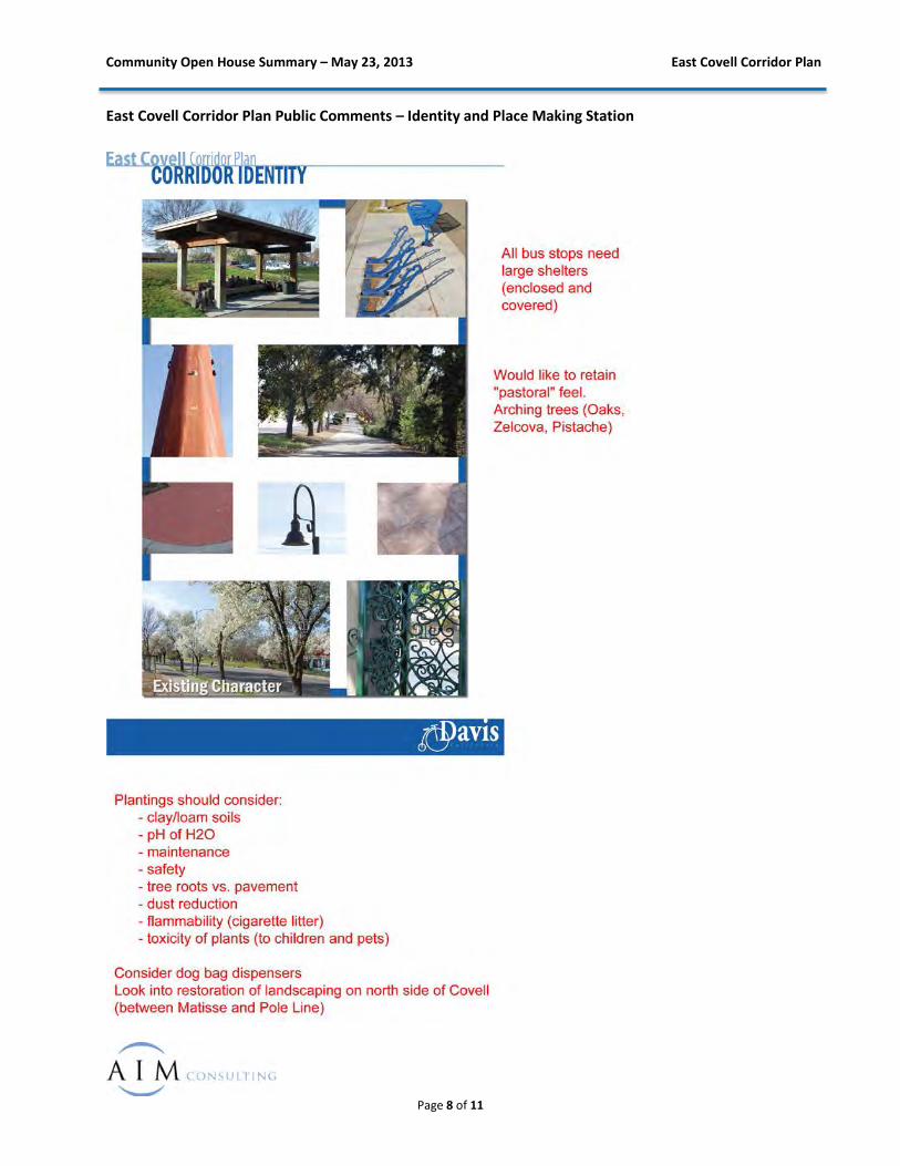
Community Open House Summary – May 23, 2013 East Covell Corridor Plan
Page 8 of 11
East Covell Corridor Plan Public Comments – Identity and Place Making Station
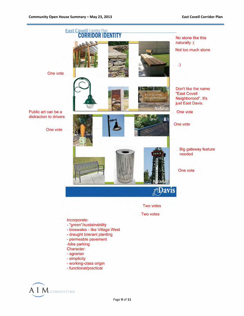
Community Open House Summary – May 23, 2013 East Covell Corridor Plan
Page 9 of 11
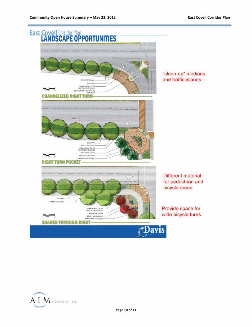
Community Open House Summary – May 23, 2013 East Covell Corridor Plan
Page 10 of 11
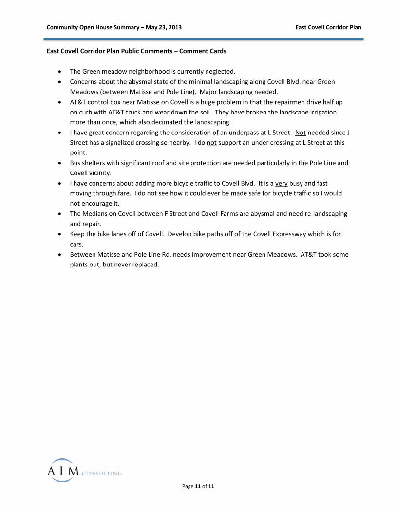
Community Open House Summary – May 23, 2013 East Covell Corridor Plan
Page 11 of 11
East Covell Corridor Plan Public Comments – Comment Cards
• The Green meadow neighborhood is currently neglected. • Concerns about the abysmal state of the minimal landscaping along Covell Blvd. near Green
Meadows (between Matisse and Pole Line). Major landscaping needed. • AT&T control box near Matisse on Covell is a huge problem in that the repairmen drive half up
on curb with AT&T truck and wear down the soil. They have broken the landscape irrigation more than once, which also decimated the landscaping.
• I have great concern regarding the consideration of an underpass at L Street. Not needed since J Street has a signalized crossing so nearby. I do not support an under crossing at L Street at this point.
• Bus shelters with significant roof and site protection are needed particularly in the Pole Line and Covell vicinity.
• I have concerns about adding more bicycle traffic to Covell Blvd. It is a very busy and fast moving through fare. I do not see how it could ever be made safe for bicycle traffic so I would not encourage it.
• The Medians on Covell between F Street and Covell Farms are abysmal and need re-landscaping and repair.
• Keep the bike lanes off of Covell. Develop bike paths off of the Covell Expressway which is for cars.
• Between Matisse and Pole Line Rd. needs improvement near Green Meadows. AT&T took some plants out, but never replaced.
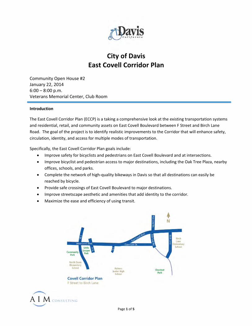
City of Davis
East Covell Corridor Plan Community Open House #2 January 22, 2014 6:00 – 8:00 p.m. Veterans Memorial Center, Club Room Introduction
The East Covell Corridor Plan (ECCP) is a taking a comprehensive look at the existing transportation systems and residential, retail, and community assets on East Covell Boulevard between F Street and Birch Lane Road. The goal of the project is to identify realistic improvements to the Corridor that will enhance safety, circulation, identity, and access for multiple modes of transportation.
Specifically, the East Covell Corridor Plan goals include: • Improve safety for bicyclists and pedestrians on East Covell Boulevard and at intersections. • Improve bicyclist and pedestrian access to major destinations, including the Oak Tree Plaza, nearby
offices, schools, and parks. • Complete the network of high-quality bikeways in Davis so that all destinations can easily be
reached by bicycle. • Provide safe crossings of East Covell Boulevard to major destinations. • Improve streetscape aesthetic and amenities that add identity to the corridor. • Maximize the ease and efficiency of using transit.
Page 1 of 5
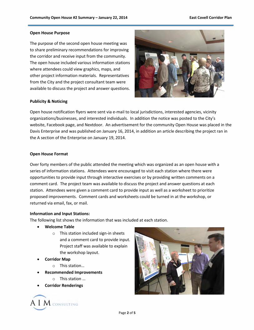
Community Open House #2 Summary – January 22, 2014 East Covell Corridor Plan
Open House Purpose
The purpose of the second open house meeting was to share preliminary recommendations for improving the corridor and receive input from the community. The open house included various information stations where attendees could view graphics, maps, and other project information materials. Representatives from the City and the project consultant team were available to discuss the project and answer questions. Publicity & Noticing
Open house notification flyers were sent via e-mail to local jurisdictions, interested agencies, vicinity organizations/businesses, and interested individuals. In addition the notice was posted to the City’s website, Facebook page, and Nextdoor. An advertisement for the community Open House was placed in the Davis Enterprise and was published on January 16, 2014, in addition an article describing the project ran in the A section of the Enterprise on January 19, 2014.
Open House Format
Over forty members of the public attended the meeting which was organized as an open house with a series of information stations. Attendees were encouraged to visit each station where there were opportunities to provide input through interactive exercises or by providing written comments on a comment card. The project team was available to discuss the project and answer questions at each station. Attendees were given a comment card to provide input as well as a worksheet to prioritize proposed improvements. Comment cards and worksheets could be turned in at the workshop, or returned via email, fax, or mail.
Information and Input Stations: The following list shows the information that was included at each station.
• Welcome Table o This station included sign-in sheets
and a comment card to provide input. Project staff was available to explain the workshop layout.
• Corridor Map o This station…
• Recommended Improvements o This station …
• Corridor Renderings
Page 2 of 5
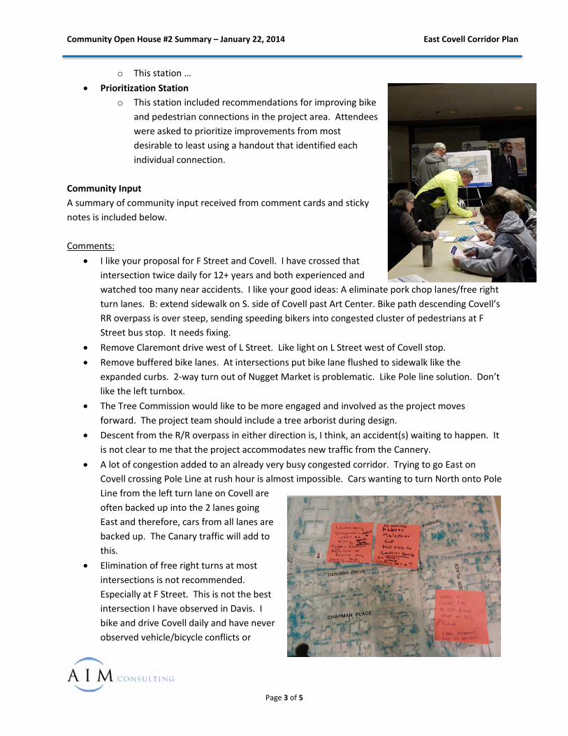
Community Open House #2 Summary – January 22, 2014 East Covell Corridor Plan
o This station … • Prioritization Station
o This station included recommendations for improving bike and pedestrian connections in the project area. Attendees were asked to prioritize improvements from most desirable to least using a handout that identified each individual connection.
Community Input A summary of community input received from comment cards and sticky notes is included below. Comments:
• I like your proposal for F Street and Covell. I have crossed that intersection twice daily for 12+ years and both experienced and watched too many near accidents. I like your good ideas: A eliminate pork chop lanes/free right turn lanes. B: extend sidewalk on S. side of Covell past Art Center. Bike path descending Covell’s RR overpass is over steep, sending speeding bikers into congested cluster of pedestrians at F Street bus stop. It needs fixing.
• Remove Claremont drive west of L Street. Like light on L Street west of Covell stop. • Remove buffered bike lanes. At intersections put bike lane flushed to sidewalk like the
expanded curbs. 2-way turn out of Nugget Market is problematic. Like Pole line solution. Don’t like the left turnbox.
• The Tree Commission would like to be more engaged and involved as the project moves forward. The project team should include a tree arborist during design.
• Descent from the R/R overpass in either direction is, I think, an accident(s) waiting to happen. It is not clear to me that the project accommodates new traffic from the Cannery.
• A lot of congestion added to an already very busy congested corridor. Trying to go East on Covell crossing Pole Line at rush hour is almost impossible. Cars wanting to turn North onto Pole Line from the left turn lane on Covell are often backed up into the 2 lanes going East and therefore, cars from all lanes are backed up. The Canary traffic will add to this.
• Elimination of free right turns at most intersections is not recommended. Especially at F Street. This is not the best intersection I have observed in Davis. I bike and drive Covell daily and have never observed vehicle/bicycle conflicts or
Page 3 of 5
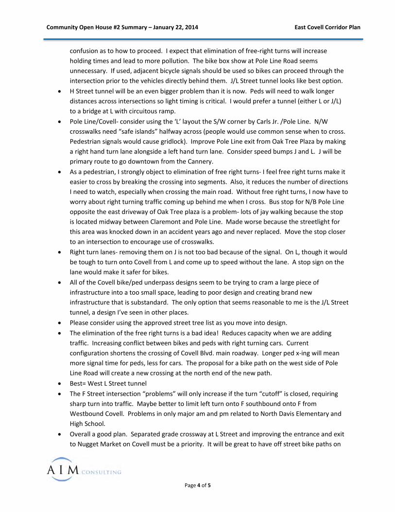
Community Open House #2 Summary – January 22, 2014 East Covell Corridor Plan
confusion as to how to proceed. I expect that elimination of free-right turns will increase holding times and lead to more pollution. The bike box show at Pole Line Road seems unnecessary. If used, adjacent bicycle signals should be used so bikes can proceed through the intersection prior to the vehicles directly behind them. J/L Street tunnel looks like best option.
• H Street tunnel will be an even bigger problem than it is now. Peds will need to walk longer distances across intersections so light timing is critical. I would prefer a tunnel (either L or J/L) to a bridge at L with circuitous ramp.
• Pole Line/Covell- consider using the ‘L’ layout the S/W corner by Carls Jr. /Pole Line. N/W crosswalks need “safe islands” halfway across (people would use common sense when to cross. Pedestrian signals would cause gridlock). Improve Pole Line exit from Oak Tree Plaza by making a right hand turn lane alongside a left hand turn lane. Consider speed bumps J and L. J will be primary route to go downtown from the Cannery.
• As a pedestrian, I strongly object to elimination of free right turns- I feel free right turns make it easier to cross by breaking the crossing into segments. Also, it reduces the number of directions I need to watch, especially when crossing the main road. Without free right turns, I now have to worry about right turning traffic coming up behind me when I cross. Bus stop for N/B Pole Line opposite the east driveway of Oak Tree plaza is a problem- lots of jay walking because the stop is located midway between Claremont and Pole Line. Made worse because the streetlight for this area was knocked down in an accident years ago and never replaced. Move the stop closer to an intersection to encourage use of crosswalks.
• Right turn lanes- removing them on J is not too bad because of the signal. On L, though it would be tough to turn onto Covell from L and come up to speed without the lane. A stop sign on the lane would make it safer for bikes.
• All of the Covell bike/ped underpass designs seem to be trying to cram a large piece of infrastructure into a too small space, leading to poor design and creating brand new infrastructure that is substandard. The only option that seems reasonable to me is the J/L Street tunnel, a design I’ve seen in other places.
• Please consider using the approved street tree list as you move into design. • The elimination of the free right turns is a bad idea! Reduces capacity when we are adding
traffic. Increasing conflict between bikes and peds with right turning cars. Current configuration shortens the crossing of Covell Blvd. main roadway. Longer ped x-ing will mean more signal time for peds, less for cars. The proposal for a bike path on the west side of Pole Line Road will create a new crossing at the north end of the new path.
• Best= West L Street tunnel • The F Street intersection “problems” will only increase if the turn “cutoff” is closed, requiring
sharp turn into traffic. Maybe better to limit left turn onto F southbound onto F from Westbound Covell. Problems in only major am and pm related to North Davis Elementary and High School.
• Overall a good plan. Separated grade crossway at L Street and improving the entrance and exit to Nugget Market on Covell must be a priority. It will be great to have off street bike paths on
Page 4 of 5
Community Open House #2 Summary – January 22, 2014 East Covell Corridor Plan
the North side of Covell and the west side of Pole Line. Signal synchronization will be key to managing traffic when Cannery is built. Please address lights triggering when only cyclist is at a traffic light. Currently none of them work.
Prioritization Exercise
In addition to comment cards, attendees were asked to prioritize improvements from most to least desirable, assuming construction costs were not an issue. The list below represents the improvements as they were prioritized. The improvements are shown on the maps on the following pages.
1. H Street Tunnel Replacement 2. Separated Crossing on East Covell Blvd. 3. L Street Intersection Improvements 4. J Street Intersection Improvements 5. Signal Innterconnect and Coordination 6. Oak Tree Plaza 7. East Covell Blvd. Shared Use Path 8. East Covell Blvd. Buffered Bike Lane 9. F Street Intersection Improvements 10. Birch Lane Shared Use Path 11. Pole Line Shared Use Path 12. Pole Line Free Right Removal 13. Median Improvements Along Covell 14. Claremont Cycle Track
Page 5 of 5
APPENDIX C: PRELIMINARY PLANNING LEVEL COST ESTIMATES
Davis - East Covell BoulevardRoadway Estimate Summary
1 F Street Intersection Improvements $1,617,000
2 J Street Intersection Improvements $1,066,000
3 L Street Intersection Improvements $739,000
4 Pole Line Intersection Improvements $1,125,000
5 Covell Boulevard Shared Use Path - North Side - J Street to Pole Line Road $1,181,000
6 Pole Line Road Shared Use Path - West Side - Covell Boulevard to City Limits $2,130,000
7 Birch Lane Shared Use Path - North Side of Covell Boulevard at Intersection of Birch Lane $144,000
8 Buffered Bike Lane Striping along Covell Boulevard $366,000
9 H/F Street Bicycle Tunnel and Corridor Enhancements (lump sum) $650,000
10 H Street Tunnel Replacement (lump sum) $2,000,000
11 Covell Corridor Signal Optimization and Implementation (lump sum) $350,000
12 Contribution to Grade Separated Crossing of Covell Boulevard between J and L Streets (lump sum) $4,000,000
Total $15,368,000
Page 1 of 9

Davis - East Covell BoulevardF Street Intersection Improvements
Item
No.Item Description Unit Quantity Item Price Total
ROADWAY ITEMS
1 Roadway Excavation CY 1800 $40 $72,000
2 Asphalt Concrete TON 160 $110 $17,600
3 Aggregate Base CY 300 $80 $24,000
4 Slurry Seal SY 11300 $3 $33,900
5 Shared Use Path SF 15700 $5 $78,500
6 Decorative Concrete SF 2700 $15 $40,500
7 Concrete Curb and Gutter LF 2400 $25 $60,000
8 Median Curb LF 1400 $20 $28,000
9 Median Paving SF 5900 $10 $59,000
10 Curb Ramps EA 8 $5,000 $40,000
11 Pavement Striping LF 2300 $2 $4,600
12 Pavement Markings SF 1100 $5 $5,500
13 Drainage Improvements LS 1 $40,000 $40,000
LANDSCAPING ITEMS
14 Groundcover SF 13,200 $4 $52,800
15 Trees EA 25 $325 $8,125
16 Benches EA 4 $2,200 $8,800
17 Place Making Signage LS 1 $4,000 $4,000
18 Irrigation LS 1 $15,000 $15,000
19 Plant Establishment Period MO 3 $3,000 $9,000
ELECTRICAL ITEMS
20 Signal Modifications LS 1 $200,000 $200,000
21 Pedestrian Lighting LS 1 $195,000 $195,000
$997,000
$50,000
$100,000
$200,000
$1,347,000
$135,000
$135,000
$1,617,000
Construction Administration (10%)
PROJECT TOTAL
Miscellaneous Items (5%)
Contingency (20%)
Mobilization (10%)
CONSTRUCTION SUBTOTAL
CONSTRUCTION TOTAL
Engineering Design (10%)
Page 2 of 9

Davis - East Covell BoulevardJ Street Intersection Improvements
Item
No.Item Description Unit Quantity Item Price Total
ROADWAY ITEMS
1 Roadway Excavation CY 770 $40 $30,800
2 Asphalt Concrete TON 105 $110 $11,550
3 Aggregate Base CY 200 $80 $16,000
4 Slurry Seal SY 6200 $3 $18,600
5 Shared Use Path SF 2200 $5 $11,000
6 Decorative Concrete SF 6000 $15 $90,000
7 Concrete Curb and Gutter LF 1250 $25 $31,250
8 Median Curb LF 700 $20 $14,000
9 Median Paving SF 2500 $10 $25,000
10 Curb Ramps EA 8 $5,000 $40,000
11 Pavement Striping LF 1200 $2 $2,400
12 Pavement Markings SF 1000 $5 $5,000
13 Drainage Improvements LS 1 $40,000 $40,000
LANDSCAPING ITEMS
14 Groundcover SF 4,500 $4 $18,000
15 Trees EA 20 $325 $6,500
16 Benches EA 4 $2,200 $8,800
17 Place Making Signage LS 1 $4,000 $4,000
18 Irrigation LS 1 $15,000 $15,000
19 Plant Establishment Period MO 3 $3,000 $9,000
ELECTRICAL ITEMS
20 Signal Modifications LS 1 $200,000 $200,000
21 Pedestrian Lighting LS 1 $60,000 $60,000
$657,000
$33,000
$66,000
$132,000
$888,000
$89,000
$89,000
$1,066,000
Construction Administration (10%)
PROJECT TOTAL
CONSTRUCTION SUBTOTAL
Miscellaneous Items (5%)
Mobilization (10%)
Contingency (20%)
CONSTRUCTION TOTAL
Engineering Design (10%)
Page 3 of 9
Davis - East Covell BoulevardL Street Intersection Improvements
Item
No.Item Description Unit Quantity Item Price Total
ROADWAY ITEMS
1 Roadway Excavation CY 400 $40 $16,000
2 Asphalt Concrete TON 65 $110 $7,150
3 Aggregate Base CY 120 $80 $9,600
4 Slurry Seal SY 3600 $3 $10,800
5 Shared Use Path SF 1500 $5 $7,500
6 Decorative Concrete SF 1500 $15 $22,500
7 Concrete Curb and Gutter LF 700 $25 $17,500
8 Median Curb LF 0 $20 $0
9 Median Paving SF 0 $10 $0
10 Curb Ramps EA 4 $5,000 $20,000
11 Pavement Striping LF 600 $2 $1,200
12 Pavement Markings SF 450 $5 $2,250
13 Drainage Improvements LS 1 $20,000 $20,000
LANDSCAPING ITEMS
14 Groundcover SF 1,900 $4 $7,600
15 Trees EA 0 $325 $0
16 Benches EA 2 $2,200 $4,400
17 Place Making Signage LS 1 $4,000 $4,000
18 Irrigation LS 1 $15,000 $15,000
19 Plant Establishment Period MO 3 $3,000 $9,000
ELECTRICAL ITEMS
20 Signalized Intersection LS 1 $250,000 $250,000
21 Pedestrian Lighting LS 1 $30,000 $30,000
$455,000
$23,000
$46,000
$91,000
$615,000
$62,000
$62,000
$739,000
Construction Administration (10%)
PROJECT TOTAL
CONSTRUCTION SUBTOTAL
Miscellaneous Items (5%)
Mobilization (10%)
Contingency (20%)
CONSTRUCTION TOTAL
Engineering Design (10%)
Page 4 of 9
Davis - East Covell BoulevardPole Line Intersection Improvements
Item
No.Item Description Unit Quantity Item Price Total
ROADWAY ITEMS
1 Roadway Excavation CY 1100 $40 $44,000
2 Asphalt Concrete TON 130 $110 $14,300
3 Aggregate Base CY 240 $80 $19,200
4 Slurry Seal SY 9000 $3 $27,000
5 Shared Use Path SF 1600 $5 $8,000
6 Decorative Concrete SF 3000 $15 $45,000
7 Concrete Curb and Gutter LF 1600 $25 $40,000
8 Median Curb LF 0 $20 $0
9 Median Paving SF 0 $10 $0
10 Curb Ramps EA 4 $5,000 $20,000
11 Pavement Striping LF 2800 $2 $5,600
12 Pavement Markings SF 1000 $5 $5,000
13 Drainage Improvements LS 1 $30,000 $30,000
LANDSCAPING ITEMS
14 Groundcover SF 10,500 $4 $42,000
15 Trees EA 23 $325 $7,475
16 Benches EA 3 $2,200 $6,600
17 Place Making Signage LS 1 $4,000 $4,000
18 Irrigation LS 1 $15,000 $15,000
19 Plant Establishment Period MO 3 $3,000 $9,000
ELECTRICAL ITEMS
20 Signal Modifications LS 1 $200,000 $200,000
21 Pedestrian Lighting LS 1 $150,000 $150,000
$693,000
$35,000
$70,000
$139,000
$937,000
$94,000
$94,000
$1,125,000
Construction Administration (10%)
PROJECT TOTAL
CONSTRUCTION SUBTOTAL
Miscellaneous Items (5%)
Mobilization (10%)
Contingency (20%)
CONSTRUCTION TOTAL
Engineering Design (10%)
Page 5 of 9

Davis - East Covell BoulevardCovell Boulevard Shared Use Path - North Side - J Street to Pole Line Road
Item
No.Item Description Unit Quantity Item Price Total
ROADWAY ITEMS
1 Roadway Excavation CY 2300 $40 $92,000
2 Asphalt Concrete TON 130 $110 $14,300
3 Aggregate Base CY 240 $80 $19,200
4 Slurry Seal SY 0 $3 $0
5 Shared Use Path SF 21800 $5 $109,000
6 Decorative Concrete SF 1400 $15 $21,000
7 Concrete Curb and Gutter LF 2500 $25 $62,500
8 Median Curb LF 0 $20 $0
9 Median Paving SF 0 $10 $0
10 Curb Ramps EA 6 $5,000 $30,000
11 Pavement Striping LF 0 $2 $0
12 Pavement Markings SF 600 $5 $3,000
13 Drainage Improvements LS 1 $40,000 $40,000
LANDSCAPING ITEMS
14 Groundcover SF 21,100 $4 $84,400
15 Trees EA 100 $325 $32,500
16 Benches EA 0 $2,200 $0
17 Place Making Signage LS 0 $4,000 $0
18 Irrigation LS 1 $15,000 $15,000
19 Plant Establishment Period MO 3 $3,000 $9,000
ELECTRICAL ITEMS
20 Signal Modifications LS 0 $200,000 $0
21 Pedestrian Lighting LS 1 $195,000 $195,000
$727,000
$37,000
$73,000
$146,000
$983,000
$99,000
$99,000
$1,181,000
Construction Administration (10%)
PROJECT TOTAL
CONSTRUCTION SUBTOTAL
Miscellaneous Items (5%)
Mobilization (10%)
Contingency (20%)
CONSTRUCTION TOTAL
Engineering Design (10%)
Page 6 of 9
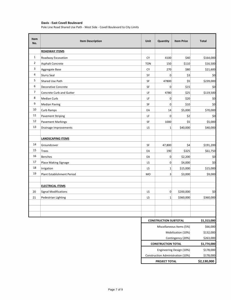
Davis - East Covell BoulevardPole Line Road Shared Use Path - West Side - Covell Boulevard to City Limits
Item
No.Item Description Unit Quantity Item Price Total
ROADWAY ITEMS
1 Roadway Excavation CY 4100 $40 $164,000
2 Asphalt Concrete TON 150 $110 $16,500
3 Aggregate Base CY 270 $80 $21,600
4 Slurry Seal SY 0 $3 $0
5 Shared Use Path SF 47800 $5 $239,000
6 Decorative Concrete SF 0 $15 $0
7 Concrete Curb and Gutter LF 4780 $25 $119,500
8 Median Curb LF 0 $20 $0
9 Median Paving SF 0 $10 $0
10 Curb Ramps EA 14 $5,000 $70,000
11 Pavement Striping LF 0 $2 $0
12 Pavement Markings SF 1000 $5 $5,000
13 Drainage Improvements LS 1 $40,000 $40,000
LANDSCAPING ITEMS
14 Groundcover SF 47,800 $4 $191,200
15 Trees EA 190 $325 $61,750
16 Benches EA 0 $2,200 $0
17 Place Making Signage LS 0 $4,000 $0
18 Irrigation LS 1 $15,000 $15,000
19 Plant Establishment Period MO 3 $3,000 $9,000
ELECTRICAL ITEMS
20 Signal Modifications LS 0 $200,000 $0
21 Pedestrian Lighting LS 1 $360,000 $360,000
$1,313,000
$66,000
$132,000
$263,000
$1,774,000
$178,000
$178,000
$2,130,000
Construction Administration (10%)
PROJECT TOTAL
CONSTRUCTION SUBTOTAL
Miscellaneous Items (5%)
Mobilization (10%)
Contingency (20%)
CONSTRUCTION TOTAL
Engineering Design (10%)
Page 7 of 9

Davis - East Covell BoulevardBirch Lane Shared Use Path - North Side of Covell Boulevard at Intersection of Birch Lane
Item
No.Item Description Unit Quantity Item Price Total
ROADWAY ITEMS
1 Roadway Excavation CY 140 $40 $5,600
2 Asphalt Concrete TON 15 $110 $1,650
3 Aggregate Base CY 20 $80 $1,600
4 Slurry Seal SY 0 $3 $0
5 Shared Use Path SF 5700 $5 $28,500
6 Decorative Concrete SF 0 $15 $0
7 Concrete Curb and Gutter LF 200 $25 $5,000
8 Median Curb LF 0 $20 $0
9 Median Paving SF 0 $10 $0
10 Curb Ramps EA 0 $5,000 $0
11 Pavement Striping LF 0 $2 $0
12 Pavement Markings SF 0 $5 $0
13 Drainage Improvements LS 0 $40,000 $0
LANDSCAPING ITEMS
14 Groundcover SF 5,300 $4 $21,200
15 Trees EA 0 $325 $0
16 Benches EA 0 $2,200 $0
17 Place Making Signage LS 0 $4,000 $0
18 Irrigation LS 1 $15,000 $15,000
19 Plant Establishment Period MO 3 $3,000 $9,000
ELECTRICAL ITEMS
20 Signal Modifications LS 0 $200,000 $0
21 Pedestrian Lighting LS 0 $195,000 $0
$88,000
$5,000
$9,000
$18,000
$120,000
$12,000
$12,000
$144,000
Construction Administration (10%)
PROJECT TOTAL
CONSTRUCTION SUBTOTAL
Miscellaneous Items (5%)
Mobilization (10%)
Contingency (20%)
CONSTRUCTION TOTAL
Engineering Design (10%)
Page 8 of 9
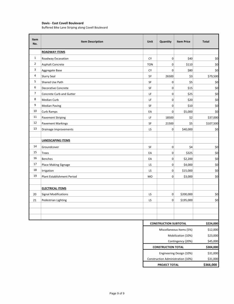
Davis - East Covell BoulevardBuffered Bike Lane Striping along Covell Boulevard
Item
No.Item Description Unit Quantity Item Price Total
ROADWAY ITEMS
1 Roadway Excavation CY 0 $40 $0
2 Asphalt Concrete TON 0 $110 $0
3 Aggregate Base CY 0 $80 $0
4 Slurry Seal SY 26500 $3 $79,500
5 Shared Use Path SF 0 $5 $0
6 Decorative Concrete SF 0 $15 $0
7 Concrete Curb and Gutter LF 0 $25 $0
8 Median Curb LF 0 $20 $0
9 Median Paving SF 0 $10 $0
10 Curb Ramps EA 0 $5,000 $0
11 Pavement Striping LF 18500 $2 $37,000
12 Pavement Markings SF 21500 $5 $107,500
13 Drainage Improvements LS 0 $40,000 $0
LANDSCAPING ITEMS
14 Groundcover SF 0 $4 $0
15 Trees EA 0 $325 $0
16 Benches EA 0 $2,200 $0
17 Place Making Signage LS 0 $4,000 $0
18 Irrigation LS 0 $15,000 $0
19 Plant Establishment Period MO 0 $3,000 $0
ELECTRICAL ITEMS
20 Signal Modifications LS 0 $200,000 $0
21 Pedestrian Lighting LS 0 $195,000 $0
$224,000
$12,000
$23,000
$45,000
$304,000
$31,000
$31,000
$366,000
Construction Administration (10%)
PROJECT TOTAL
CONSTRUCTION SUBTOTAL
Miscellaneous Items (5%)
Mobilization (10%)
Contingency (20%)
CONSTRUCTION TOTAL
Engineering Design (10%)
Page 9 of 9