Earth Science Explorations Using Airborne and Ground-Based ...
50
Earth Science Explorations Using Airborne and Ground-Based Sensors Training the next generation of scientists, engineers, and other professionals to observe and understand our planet Earth through experiential learning using NASA technology and data in real-world settings. http://www.globe.gov/web/aren-project
Transcript of Earth Science Explorations Using Airborne and Ground-Based ...

Earth Science Explorations Using Airborne and Ground-Based Sensors
Training the next generation of scientists, engineers, and other professionals to observe and understand our planet Earth through experiential learning
using NASA technology and data in real-world settings.
http://www.globe.gov/web/aren-project

• The AEROKATS and ROVER Education Network (AREN) introduces NASA technologies and practices in authentic, experiential learning environments.
• Low-cost instrumented systems for in-situ and remotely sensed Earth observations include kite-based “AEROKATS”, and remotely controlled aquatic and land-based “ROVERS”.

Observing or measuring phenomena without direct physical contact, often
from a distance.
How Do We Make Scientific Observations of the Earth and its Systems?
Observing or measuring phenomena in place, often with direct physical contact.
IN-SITU MEASUREMENT REMOTE SENSING

Orbital Platforms - Satellites (platform and sensors)
• Earth Observing Systems
Sub-orbital Platforms - Aircraft, Drones, Balloons and Kites
• High altitude aircraft
• High altitude balloons
• Low altitude aircraft
• Drones/RC Planes
• Low altitude tethered systems (balloons and kites)
T Y P E S O F R E M O T E S E N S I N GS Y S T E M S

Spatial Resolution (Scale): How large of an area is captured in each pixel and how large of an area is imaged in each frame or sweep.
THE ROLE OF RESOLUTION IN REMOTE SENSING
LandSat 30 m
Google Earth ~1ft - 1m
(varies)
AEROKATS TwinCam
< 1 ft (varies)
MODIS250 m - 1000m

Spectral Resolution - How finely does the sensor slice the EM spectrum, and how many bands does it detect (e.g., Landsat TM - 7 broad bands,
AVIRIS - 224 narrow bands, TwinCam Aeropod - 4 broad bands)
Landsat ETM+ (Multispectral)
Landsat ETM + band mixing
AVRIS Hyperspectral Data Cube - 255 Narrow
Bands
Landsat TM: Seven Broad Bands TwinCam: 4 Broad Bands

Temporal Resolution - How often does the sensor capture an image of the same location - (continuous, daily, monthly, etc.)

REMOTE SENSING:What Can We Observe from Space?

The Atmosphere
Cloud Fraction
Cloud Reflectivity
Aerosol Particle Size Aerosol Optical Depth
Reflected SW Radiation
Cloud Optical Thickness
ATMOSPHERIC GASESCLOUDS AND AEROSOLS
Atmospheric CO2 - NASA OCO2

Landcover types and extentLandcover changes - Deforestation
Invasive species - Phragmites Vegetation extent and health /
biomass / productivity Soil moisture / ground water /
drought and fire risk
Landcover changes - Impervious surface
The Biosphere

Land Surface Temperature
Earthquake land displacement - Copernicus Sentinel-1A(SAR) instrument
Mapping gravity - GRACE
Catastrophic Change - QuickBird
Volcanic activity - Modis
The Geosphere

Arctic Sea Ice Concentration July 2011-Jan 2012
Snow cover Arctic region Sept 2011 - Feb 2012
Glacial retreat - Alaska
Rate of continental glacier melt - Antarctica
The Cryosphere

MY NASA DATA https://mynasadata.larc.nasa.gov/

LOCAL SCALE REMOTE SENSING:What Can We Observe from Kite-borne Sensor Systems?

Using NASA’s kite based Aeropod systems to capture remotely sensed imagery and in-situ atmospheric data for use in the classroom
A E R O K A T S
Geoff Bland - NASA Aero-Engineer
Geoff Bland and NASA Technician, Ted Miles
Advancing Earth Research Observations with Kites and Atmospheric/Terrestrial Sensors

AEROKATS MonoCam Aeropod AEROKATS TwinCam Aeropod AEROKATS AirColumn Profiler
Aeropods Used in the ICCARS Project
Using kite-based Aeropods, students can: • collect real data about their environment,• learn image processing and data analysis skills,• validate the remote sensing process• develop teamwork skills • learn operations skills.
s,,,s,,,,,,,,,,,,,,,,,,,,,,,,,,,,,,,,,,,

MonoCam Examples - Aerial Imagery
UMES/CBEC

TwinCam Examples - Classified Imagery
Knabusch Center for Science and Mathematics

TwinCam - Visible Light Image TwinCam - Near-Infrared Image
Example using TwinCam Visible and Near-Infrared Imagery
T i C N I f d IT i C Vi ibl Li h I
I M A G E P R O C E S S I N GWorking with TwinCam Image data

Spectral characteristics of healthy green vegetationWhat Can the Data Show Us?


Combine and re-map the bands from the two cameras into a new image

U s e M u l t i S p e c * S o f t w a r e t o P r o d u c e C l a s s i f i e d I m a g e s a n d V e g e t a t i o n I n d i c e s
*MultiSpec was created by David Landgreb and Larry Biehl at Purdue University

CLASS DISTRIBUTION FOR SELECTED AREA Number Class Samples Percent 1 Grass(Lawn)Green 5,300 1.8 2 Roof 3,479 1.2 3 Grass(Lawn) G Shdw 8,360 2.8 4 Drain (Water) 6,310 2.1 5 Green Plot 4,241 1.4 6 Grass Lawn (Mixed) 36,889 12.4 7 Tree (bare) 26,951 9.1 8 Tree Greening 19,617 6.6 9 Conifer 21,020 7.1 10 Mixed Shrubs 29,286 9.8 11 Bare Soil 14,946 5.0 12 Soil-veg_rows 16,959 5.7 13 ShdSoil and Grasses 23,493 7.9 14 Shrubs bare 27,718 9.3 15 Tall grasses (Mixed) 12,176 4.1 16 GrassLawn(Mix)Shd 40,903 13.7
Total 297,648 100.0
The numbers behind the imagery - quantifying the data

Air Column Profiler (Why is this in-situ?)
I m a ge C o u r t e s y o f G e o f f B l a n d
IN-SITU OBSERVATIONS FROM KITE-BORNE SENSORS

A E R O K A T S I N T H E F I E L DUsing Measurement Tools and Protocols

Calculate Sensor Altitude and Position
sin A = a /cc = 820 ft. and A = 57º
sin 57 = a / 820
sin 57 x 820 = a0.839 x 820 = a
∴ a = 688 ft.
57º
33º
Use Clinometer app on iPad for angle A and the length of kite string for side c (hypotenuse):
(Remember a2 + b2 = c2 and opposite angles are A, B,and C)
To determine nodal point, use azimuth angle b for ground-angle,
and use results of altitude calculation to derive length of side b:
b = √(c2 - a 2)

Aerodynamics - How do k i te s f l y ?
R E S O U R C EKite Launch and Flight
Control Line
Aerodynamic Forces
NASA’s Glen Research Center Online tutorials and modeling tools!www.grc.nasa.gov/WWW/k-12/airplane/kite1.html

I m a ge C o u r t e s y o f f C h e s a p e a ke B a y E nv i r o n m e n t a l C e n t e r
IN-SITU Observations from Remotely Controlled Watercraft
R O V E RRemotely Operated Vehicle for Environmental Research

ROVER in Use at the Chesapeake Bay Environmental Center

ROVER - LabQuest II Data Display

ROVER - Plotting data with ArcGIS Online

ROVER - Table Data Display (ArcGIS Online)

Engineering focus: Prototyping New Systems and Re-designing Existing Systems
Engineering is a systematic and often iterative approach to designing objects, processes, and systems to meet human
needs and wants.

• MonoCam HD and TwinCam HD• New Air-Column Profiler (w/ Kestrel)• New Arduino based Air-Column Profiler• HoboPod - Using Hobo Data Loggers• ThermoPod-TC • Aerosol Sampler
Engineering focus: New Aeropods

Air-Column Profiler Arduino
Engineering focus: New Aeropods
• Arduino Uno rev3 • Sparkfun weather shield • GPS chip • WeatherFlow Anemometer
Data Capture: • Wind speed • Temperature • Humidity • Barometric Pressure • Light sensor • Position (Longitude/Latitude)

HoboPod - Using Hobo Data Loggers
Engineering focus: New Aeropods

TwinCam ThermalPod
Engineering focus: New Aeropods
• Raspberry Pi based• Includes Raspberry Pi Camera (5mp) • Flir Lepton thermal imager • and other stuff to make it work…
(Thermal-guy)

Engineering focus: Student Designed Systems

Students At University Prep MS
R E S O U R C E S
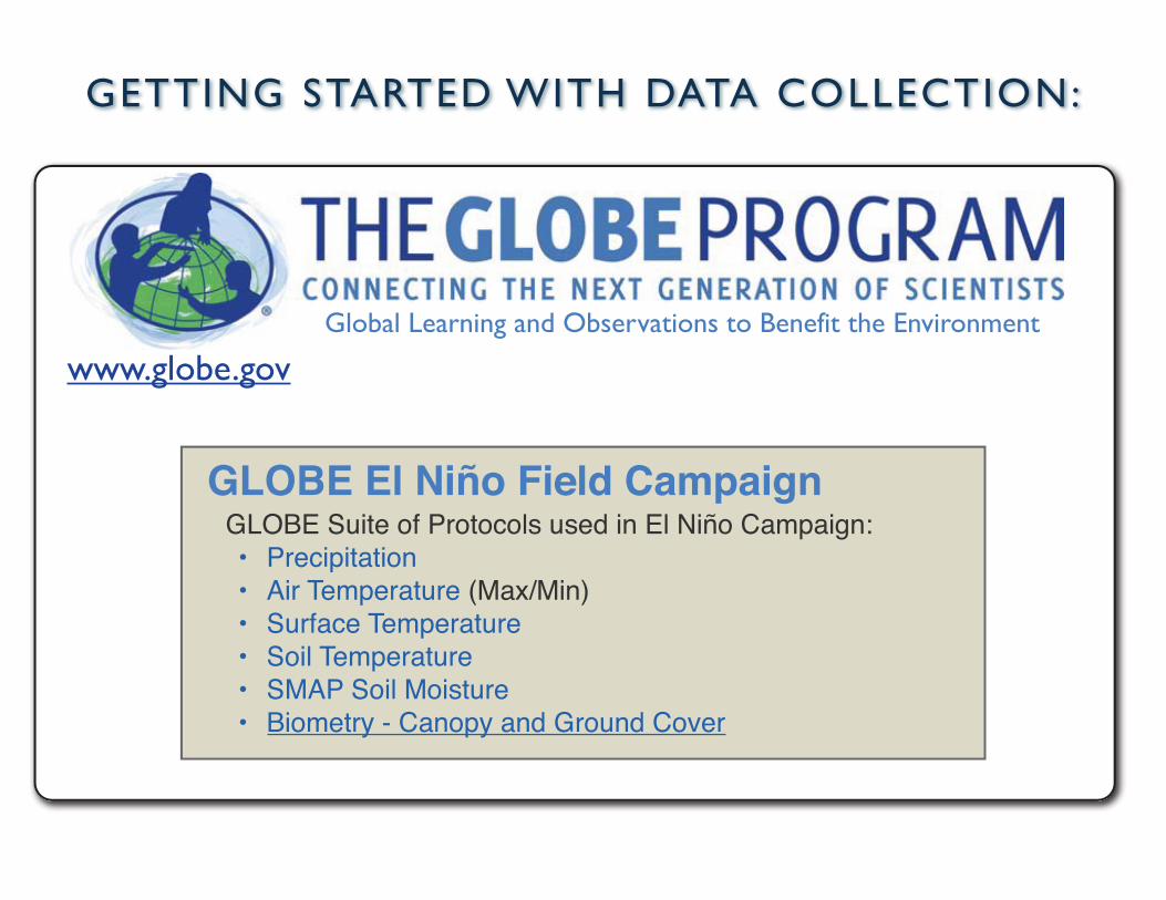
GETTING STARTED WITH DATA COLLECTION:
www.globe.gov
GLOBE El Niño Field CampaignGLOBE Suite of Protocols used in El Niño Campaign:• Precipitation• Air Temperature (Max/Min)• Surface Temperature• Soil Temperature• SMAP Soil Moisture • Biometry - Canopy and Ground Cover
Global Learning and Observations to Benefit the Environment

https://publiclab.org
Open Source Citizen Science Community
THE PUBLIC LAB

https://spectralworkbench.org/
THE PUBLIC LAB

ARDUINO AND RASPBERRY PI
GETTING STARTED WITH SENSORS: Open Source and DIY

• Software runs on Mac, PC, or Linux
• Create “Sketches” and upload them to board
• Lots of examples included!!
Arduino

• Standalone Linux computer • Open source applications • Physical computing - IoT• GPIO pins allow it to read
sensors and control devices
• Designed for education • Free online training • Uses are limitless!!
The Raspberry Pi FoundationRaspberry Pi

The Raspberry Pi Foundationhttps://www.raspberrypi.org
Arduinohttps://www.arduino.cc
Adafruit (Ladyada)https://www.adafruit.com
Sparkfunhttps://www.sparkfun.com
GETTING STARTED WITH SENSORS:Raspberry Pie and Arduino Resources
Instructableshttp://www.instructables.com/

(AEROKATS AND ROVER EDUCATION NETWORK)
THE AREN PROJECT
Applicable GLOBE Protocols
AEROKATS
Green Up - Green Down
Land Cover Classification
Fire Fuel Classification
Phenological Gardens Barometric Pressure Albedo Air Temperature Surface Temperature Air Temperature Relative Humidity Clouds Water Vapor Soil Moisture - SMAP Block Pattern Soil Moisture -Gravimetric
Soil Moisture Sensors Soil Temperature
ROVER
Conductivity Dissolved Oxygen
Nitrates
Salinity
Water Temperature Water Transparency pH GPS
NASA’s Global View from Space
We will begin the AEROKATS and ROVER Education Network (AREN) Project in 2016, with a combination of activities that will compliment and augment NASA’s established
Global Learning and Observations to Benefit the Environment (GLOBE) program
NASA’s Airborne Science Missions
www.globe.gov/web/aren-project

Please visit: http://www.globe.gov/web/aren-project
ADDITIONAL RESOURCES:
The AEROKATS program was developed by Geoff Bland at the NASA/GSFC Wallops Flight Facility. Aeropods and the Aeropod concept are the Intellectual Property of NASA and are considered competition sensitive. Aeropods or other aerodynamically stabilized tethered remote sensing systems based on the Aeropod concept may not be produced without the express consent of NASA through a formalized Space Act Agreement. Please contact Andy
Henry at Wayne RESA [email protected] with questions.

MonoCam Production Team
T H A N K Y O U !
The AEROKATS program was developed by Geoff Bland at the NASA/GSFC Wallops Flight Facility. Aeropods and the Aeropod concept are the Intellectual Property of NASA and are considered competition sensitive. Aeropods or other aerodynamically stabilized tethered remote sensing systems based on the Aeropod concept may not be produced without the express consent of NASA through a formalized Space Act Agreement. Please contact Andy
Henry at Wayne RESA [email protected] with questions.