Inside Earth Chapter 3: Volcanoes. Section 3-1 Volcanoes and Plate Tectonics.
Upload
pamela-parkerCategory
view
220download
3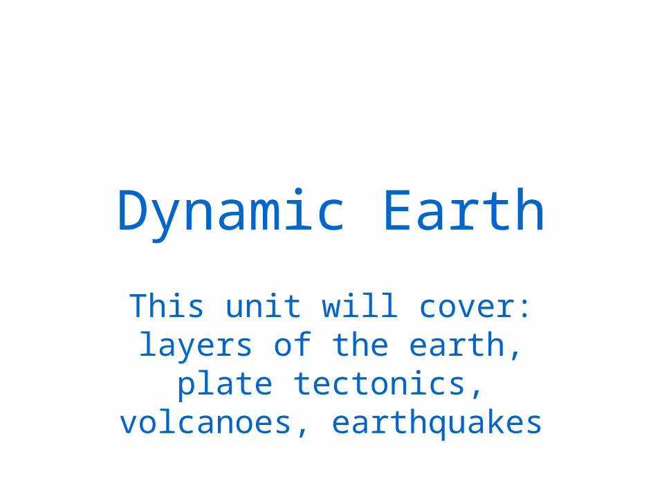
Dynamic Earth
This unit will cover: layers of the earth, plate tectonics, volcanoes, earthquakes
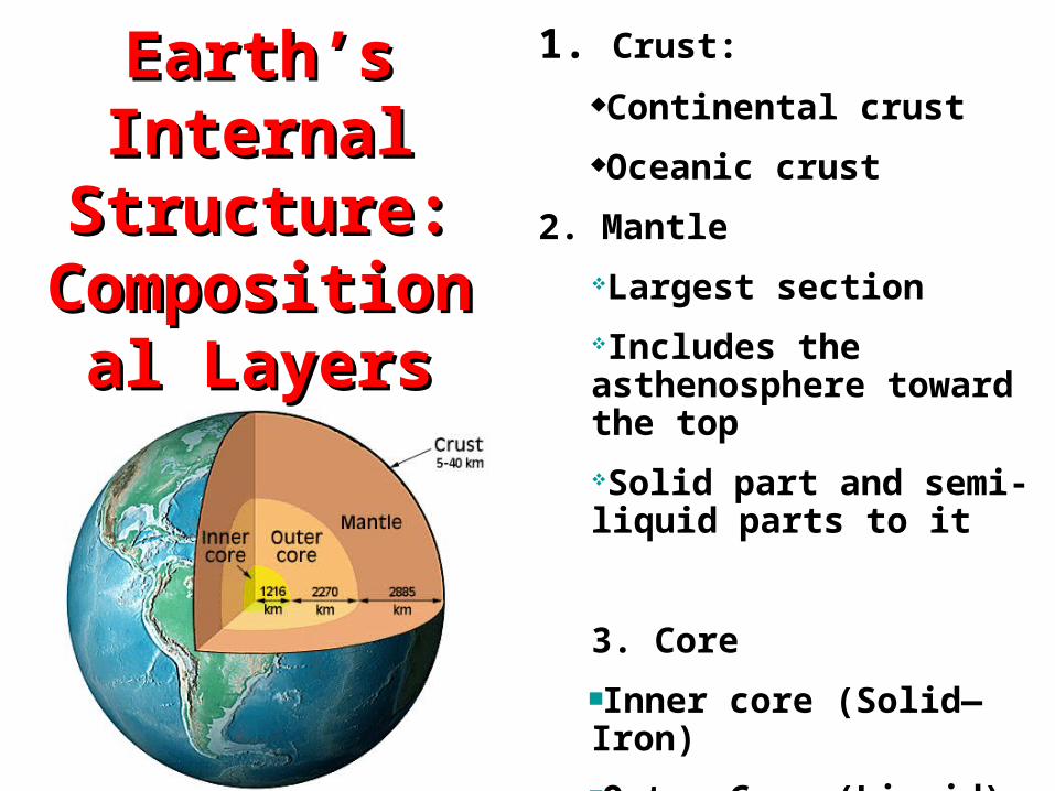
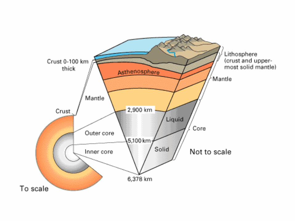
Earth’s Internal Earth’s Internal Structure: Structure:
Compositional Compositional LayersLayers
1. Crust:
Continental crust
Oceanic crust
2. Mantle
Largest section
Includes the asthenosphere toward the top
Solid part and semi-liquid parts to it
3. Core
Inner core (Solid—Iron)
Outer Core (Liquid)
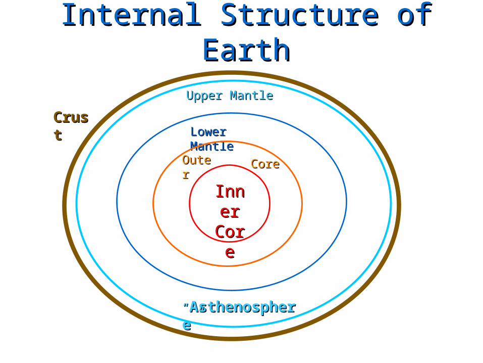
Internal Structure of EarthInternal Structure of Earth
Inner Inner CoreCore
Lower MantleLower Mantle
““AsthenosphereAsthenosphere””
OuterOuter CoreCore
Upper MantleUpper Mantle
CrustCrust

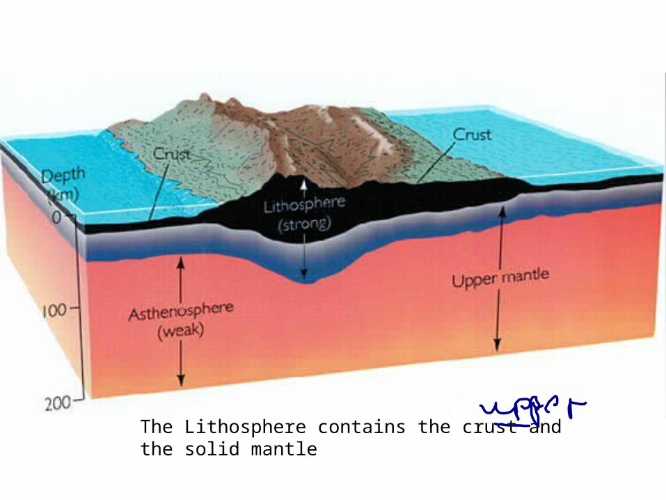
The Lithosphere contains the crust and the solid mantle
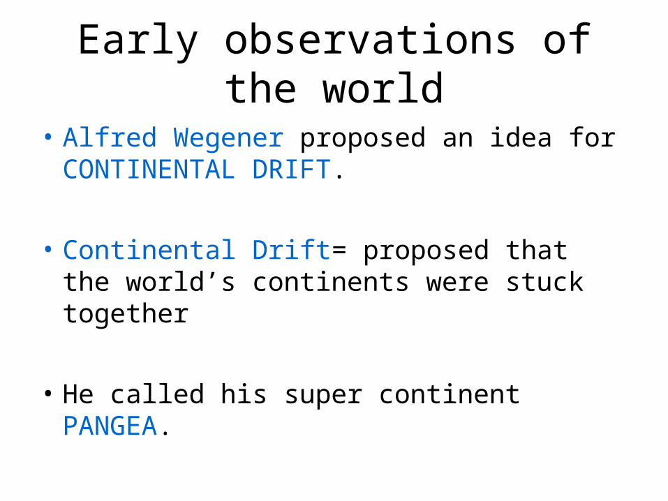
Early observations of the world
• Alfred Wegener proposed an idea for CONTINENTAL DRIFT.
• Continental Drift= proposed that the world’s continents were stuck together
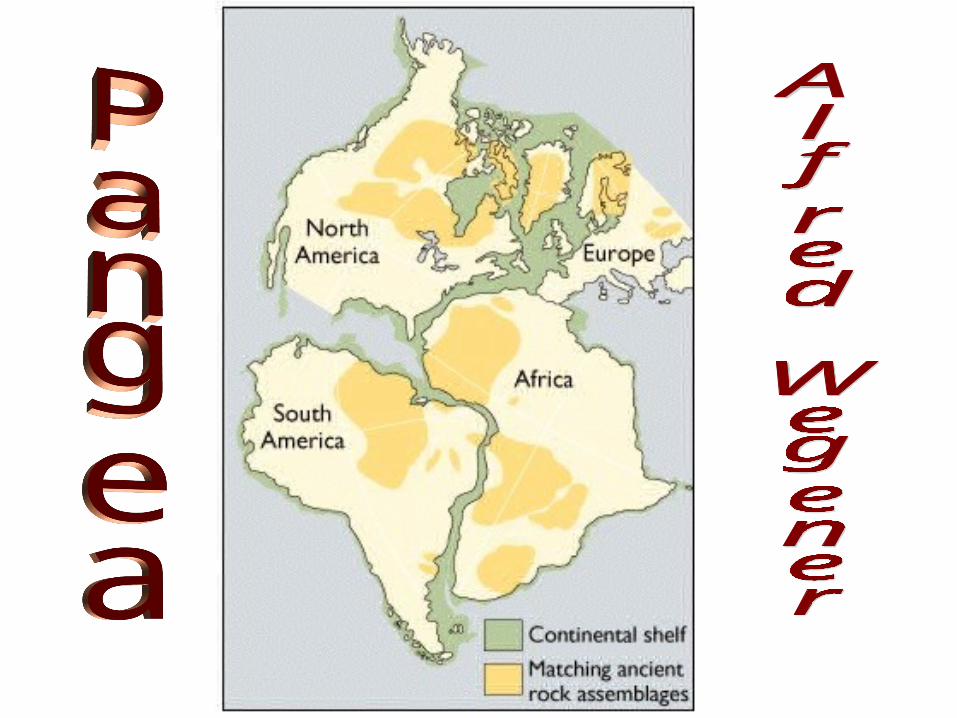
• He called his super continent PANGEA.

Rejected…..
• Alfred Wegener idea of Pangea was rejected after his death in 1930.
• The use of Seafloor spreading was a new idea that was promoted.
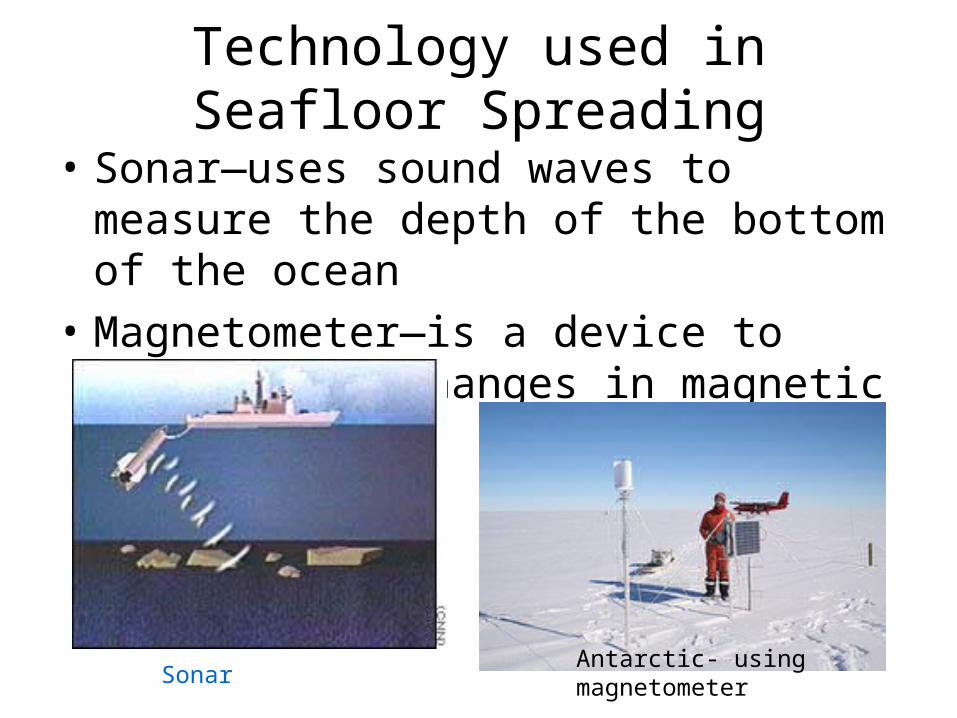
Technology used in Seafloor Spreading
• Sonar—uses sound waves to measure the depth of the bottom of the ocean
• Magnetometer—is a device to measure the changes in magnetic fields.
Antarctic- using magnetometerSonar
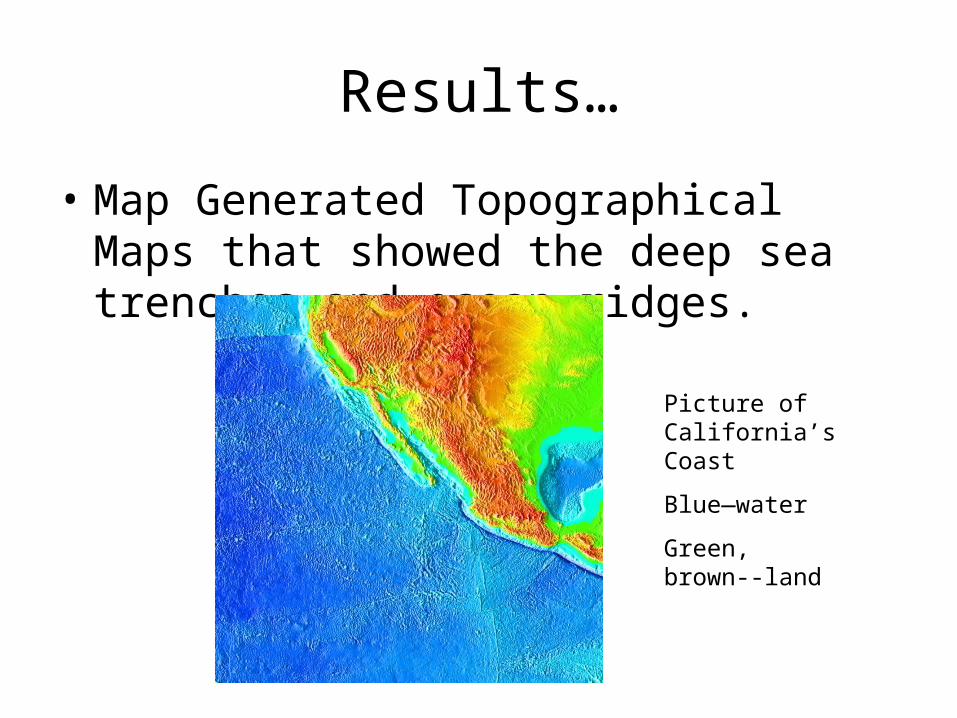
Results…
• Map Generated Topographical Maps that showed the deep sea trenches and ocean ridges.
Picture of California’s Coast
Blue—water
Green, brown--land
Theory of Plate Tectonics
• Which states that the Earth’s crust and rigid upper mantle is broken into plates
• The plates move in different directions and different rates over time.
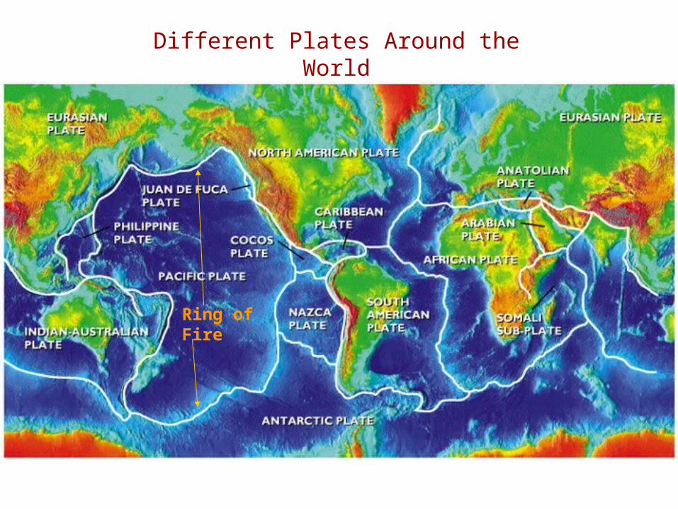
Different Plates Around the World
Ring of Fire
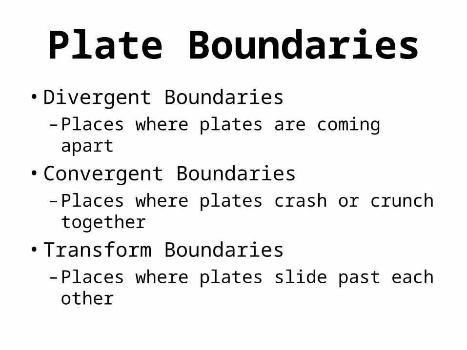
Plate Boundaries• Divergent Boundaries
– Places where plates are coming apart
• Convergent Boundaries– Places where plates crash or crunch
together
• Transform Boundaries– Places where plates slide past each
other
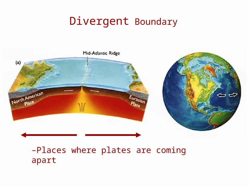
Divergent Boundary
–Places where plates are coming apart
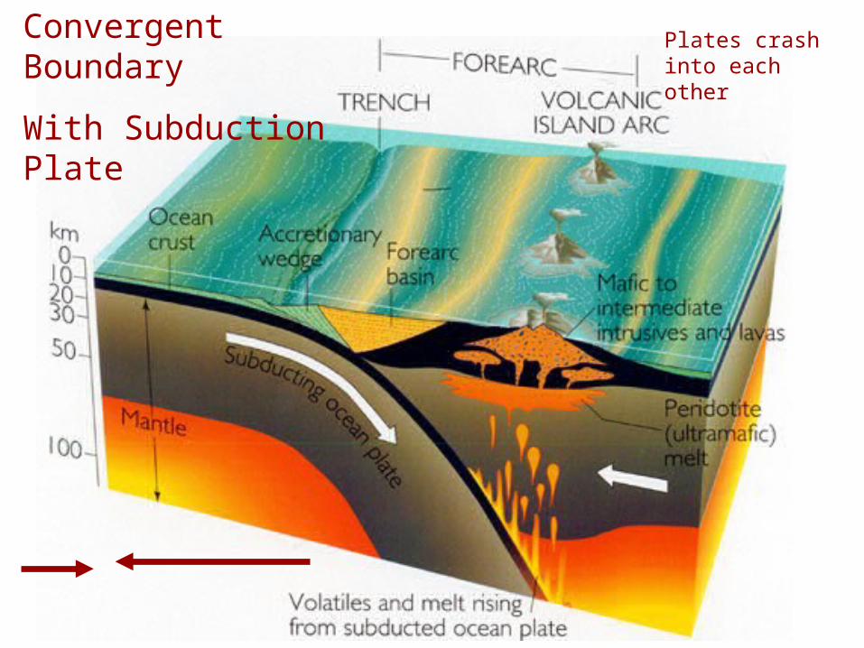
Convergent Boundary
With Subduction Plate
Plates crash into each other
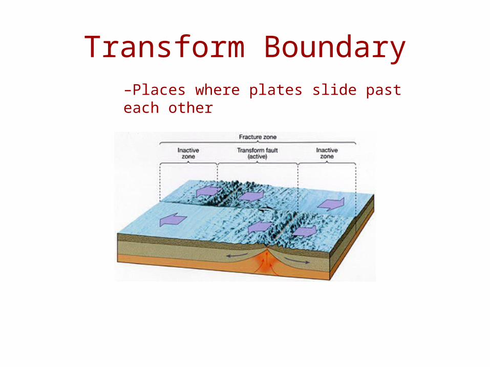
Transform Boundary–Places where plates slide past each other
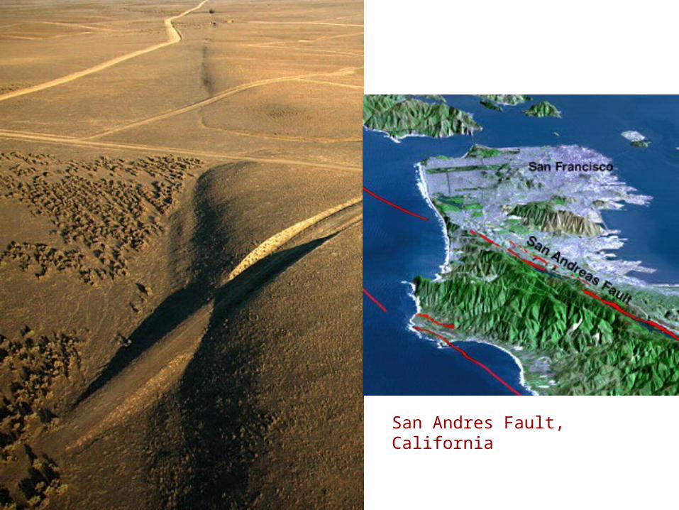
San Andres Fault, California

Plate Motions• Assume plates are rigid (no internal
deformation: bending or flexing)
• Obtain plate motion:– Directions
– Rates of movement
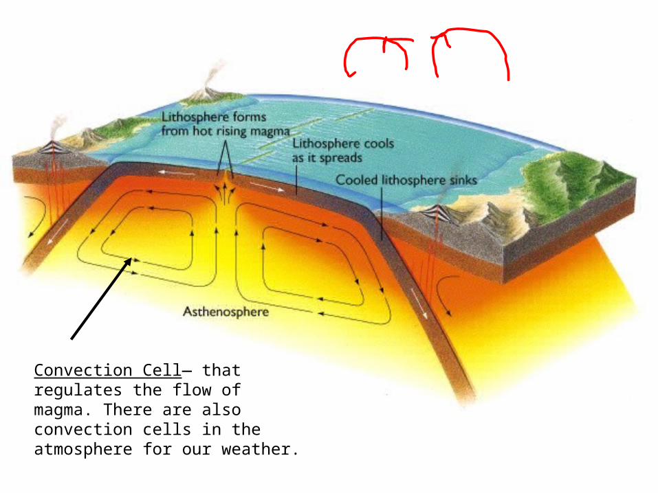
Convection Cell— that regulates the flow of magma. There are also convection cells in the atmosphere for our weather.
What do plate tectonics form?
• Earthquakes
• Hotspots
• Volcanoes
Earthquakes
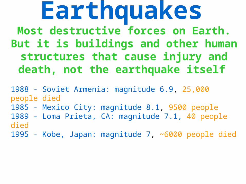
EarthquakesMost destructive forces on Earth. But
it is buildings and other human structures that cause injury and death, not the earthquake itself
1988 - Soviet Armenia: magnitude 6.9, 25,000 people died 1985 - Mexico City: magnitude 8.1, 9500 people 1989 - Loma Prieta, CA: magnitude 7.1, 40 people died 1995 - Kobe, Japan: magnitude 7, ~6000 people died
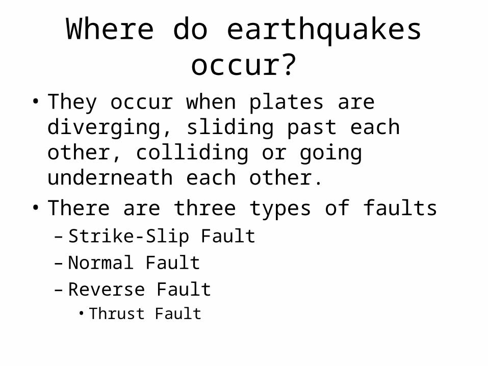
Where do earthquakes occur?
• They occur when plates are diverging, sliding past each other, colliding or going underneath each other.
• There are three types of faults– Strike-Slip Fault– Normal Fault– Reverse Fault
• Thrust Fault
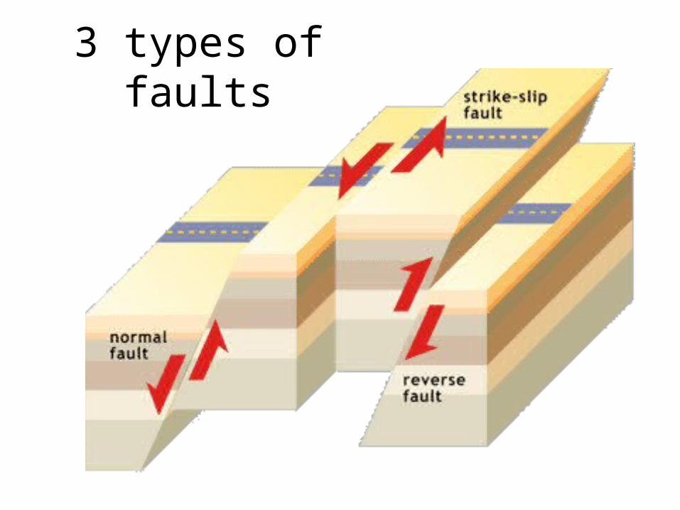
3 types of faults
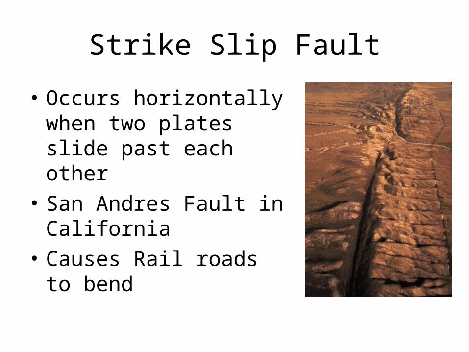
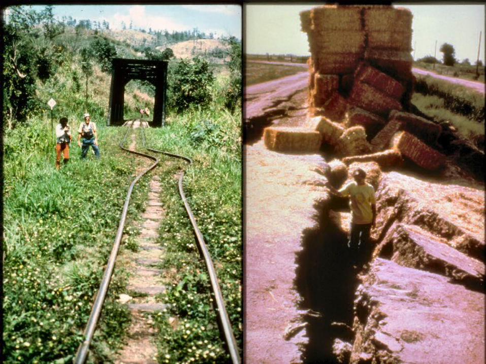
Strike Slip Fault
• Occurs horizontally when two plates slide past each other
• San Andres Fault in California
• Causes Rail roads to bend
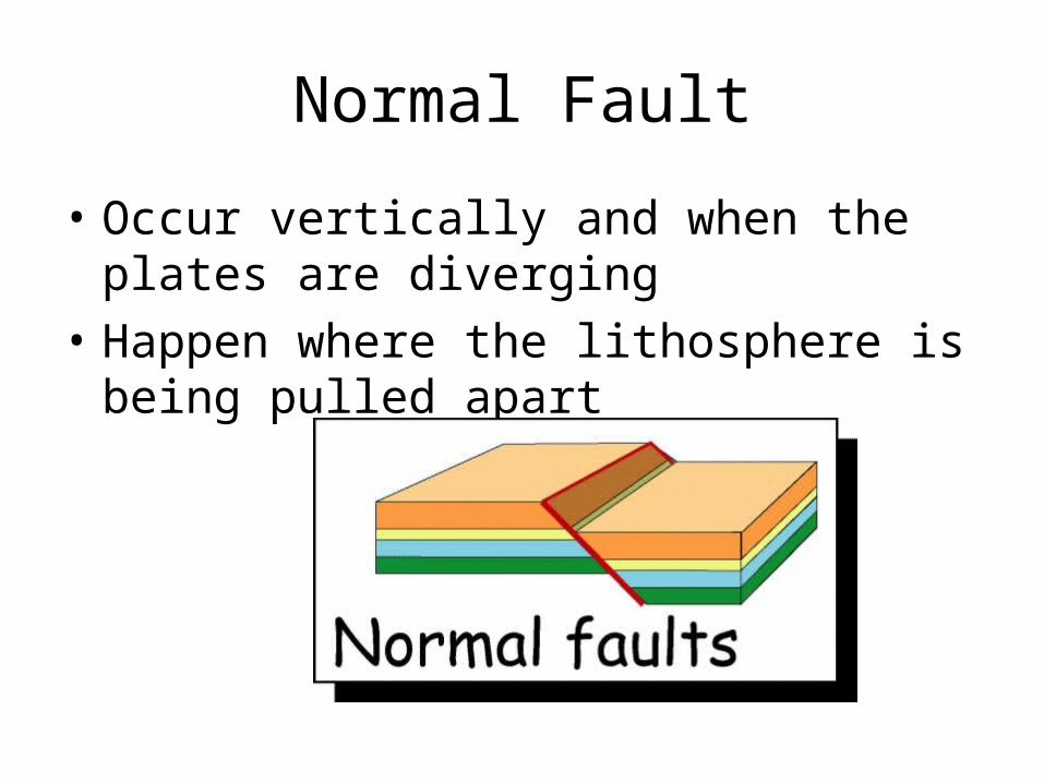
Normal Fault
• Occur vertically and when the plates are diverging
• Happen where the lithosphere is being pulled apart
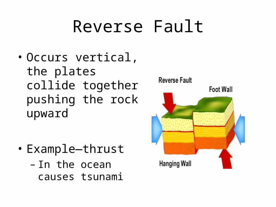
Reverse Fault
• Occurs vertical, the plates collide together pushing the rock upward
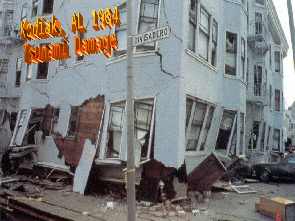
• Example—thrust– In the ocean causes
tsunami

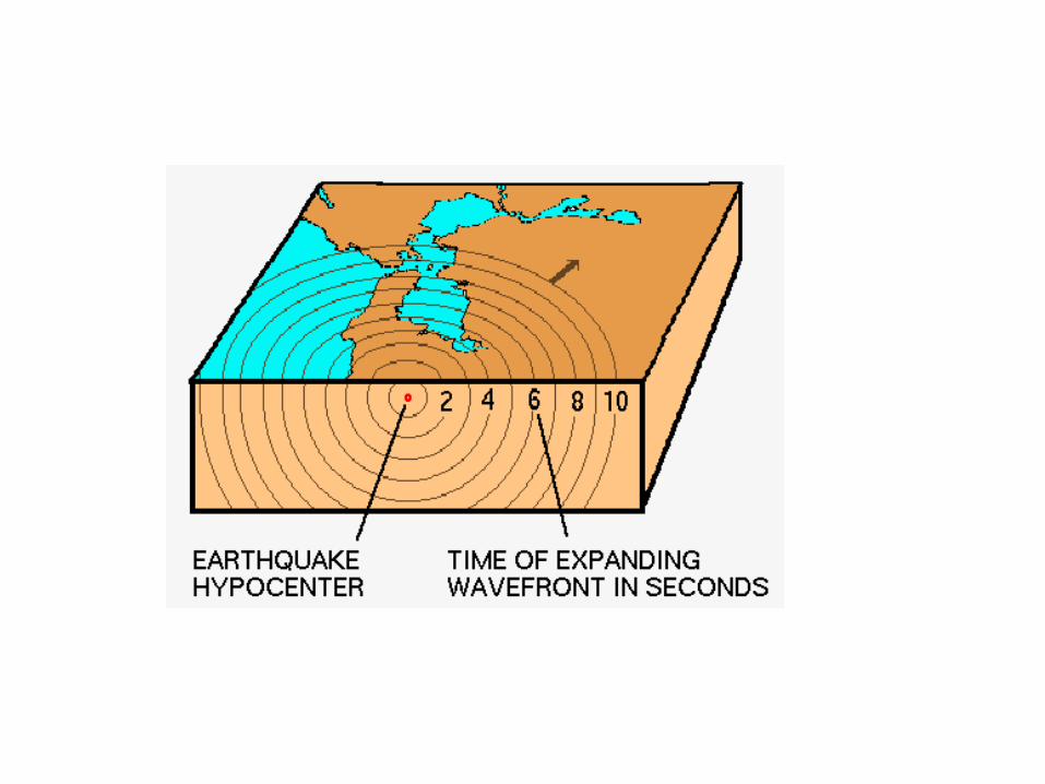
PARTS OF EARTHQUAKES
• HYPOCENTER—LOCATIONS OF EARTHQUAKE UNDERNEATH THE GROUND.
• EPICENTER—LOCATION OF EARTHQUAKE ON THE SURFACE
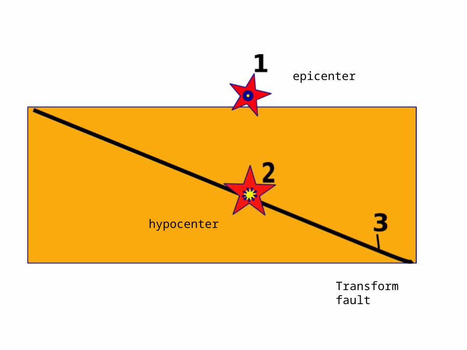
epicenter
hypocenter
Transform fault

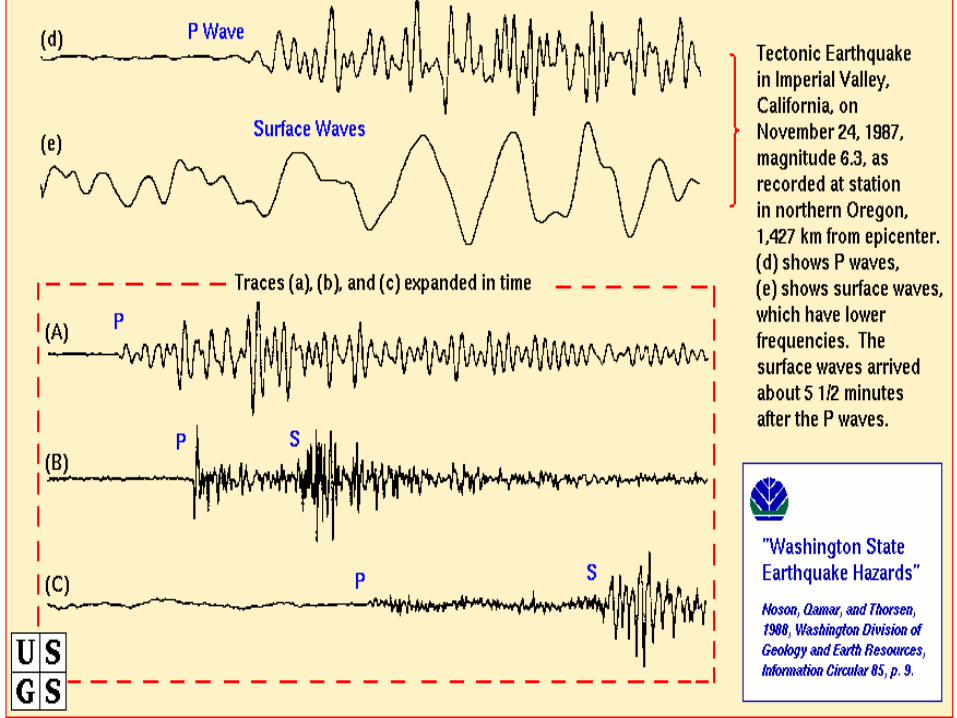
P and S Wave
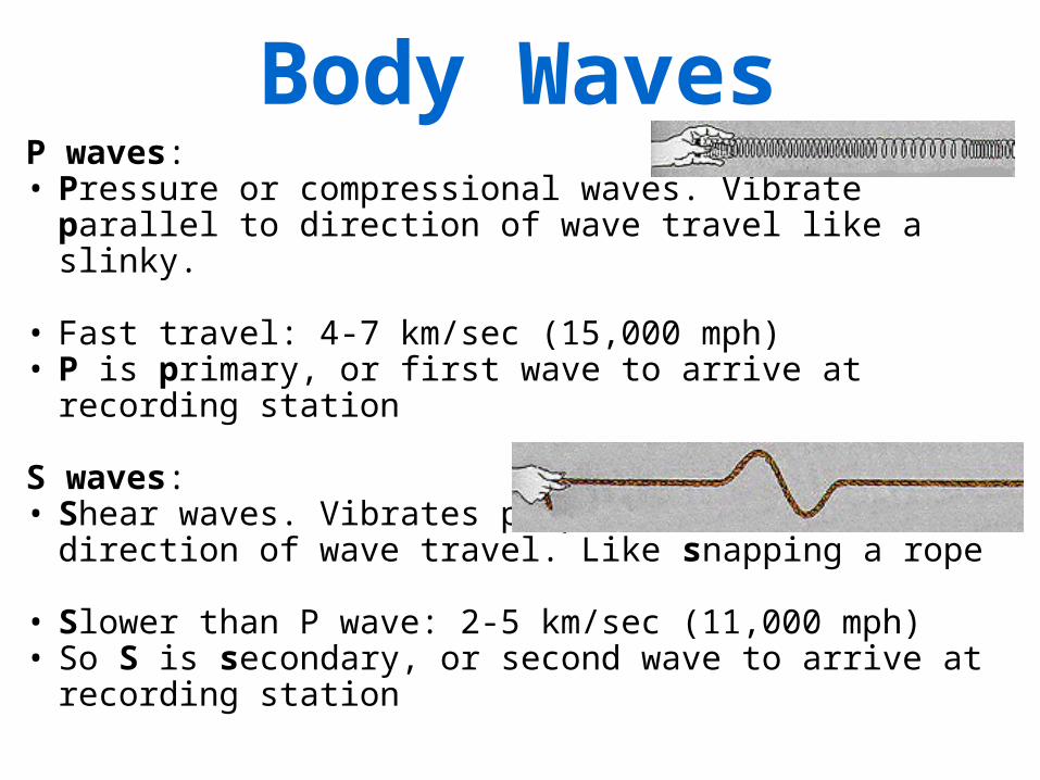
Body WavesP waves: • Pressure or compressional waves. Vibrate parallel to
direction of wave travel like a slinky.
• Fast travel: 4-7 km/sec (15,000 mph) • P is primary, or first wave to arrive at recording station
S waves: • Shear waves. Vibrates perpendicular to direction of
wave travel. Like snapping a rope
• Slower than P wave: 2-5 km/sec (11,000 mph)• So S is secondary, or second wave to arrive at
recording station
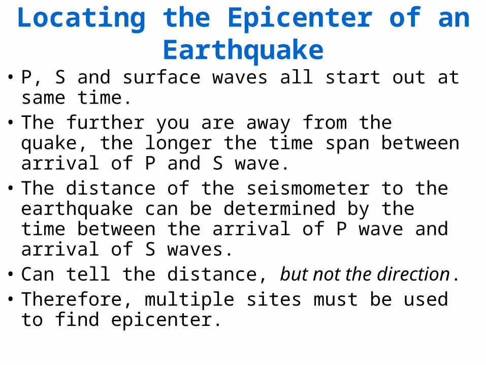
Locating the Epicenter of an Earthquake
• P, S and surface waves all start out at same time. • The further you are away from the quake, the
longer the time span between arrival of P and S wave.
• The distance of the seismometer to the earthquake can be determined by the time between the arrival of P wave and arrival of S waves.
• Can tell the distance, but not the direction. • Therefore, multiple sites must be used to find
epicenter.

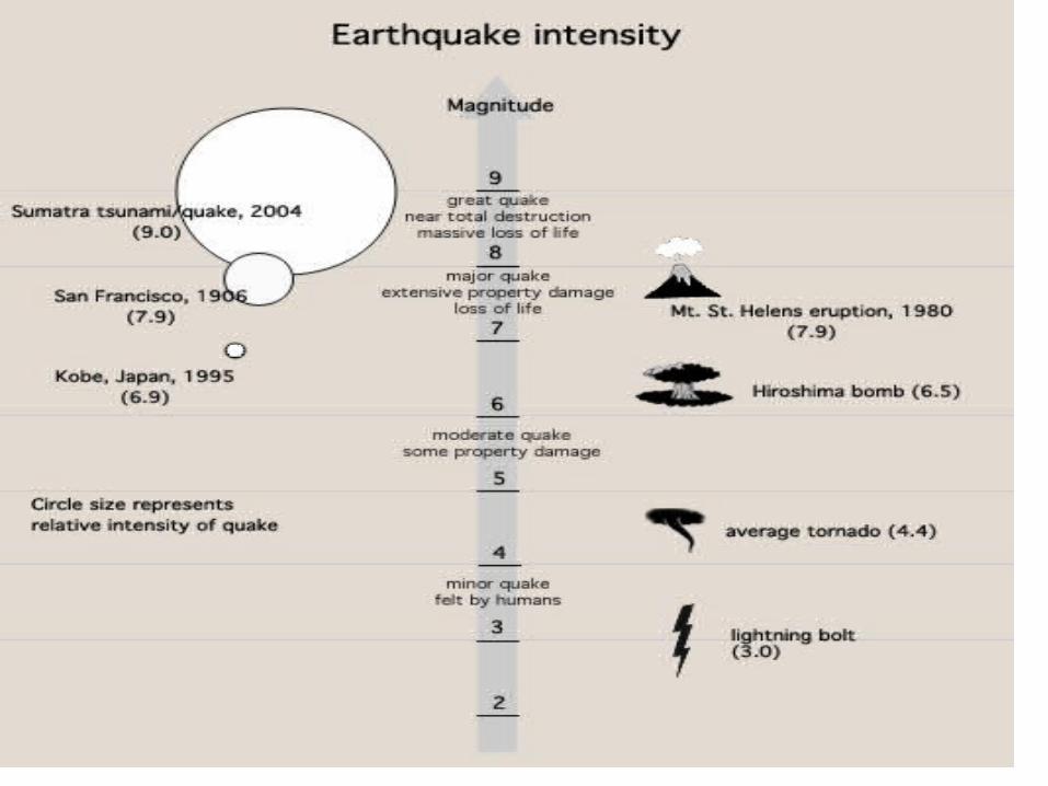
Richter Scale
• Measures the magnitude of an earthquake from 1-10
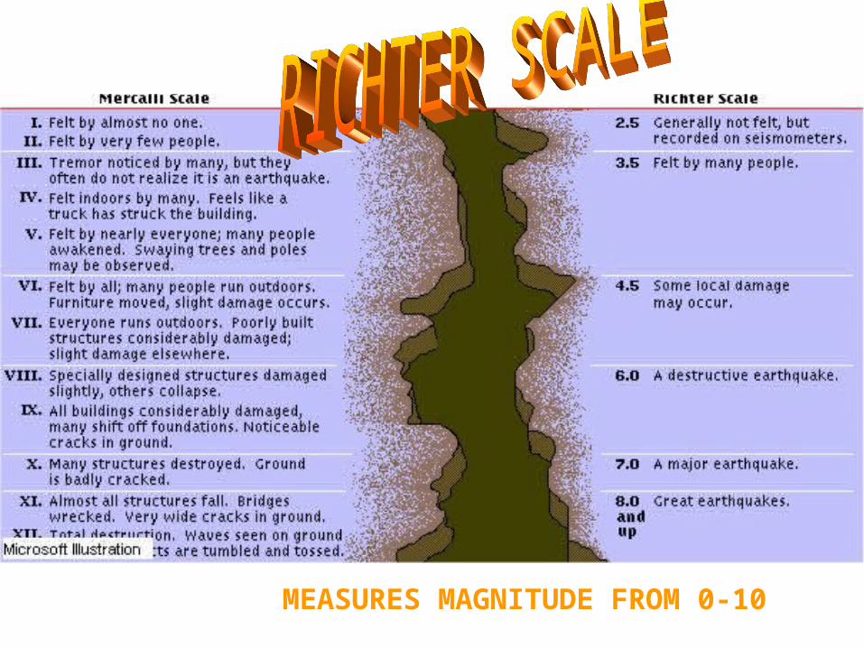
MEASURES MAGNITUDE FROM 0-10

Hotspots
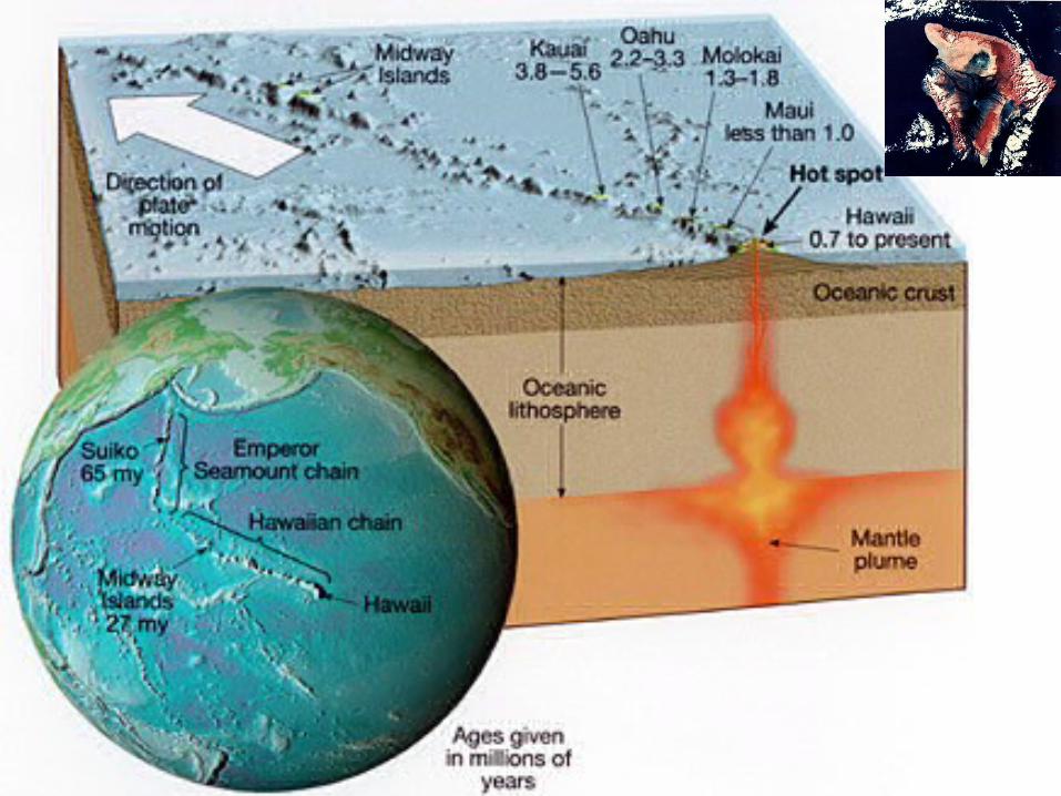
Hot Spots• Islands associated with hot spots (island chains,
mid-ocean ridges, triple junctions). • Iceland (mid-ocean ridge). • Galapagos Islands (triple junction). • Island of Hawaii (mid-plate volcanic chain; hot
spot trace). • Linear island chains form as plate moves over
hot spot. • Hawaiian islands get older in direction of plate
movement (older away from mid-ocean ridge).
http://georoc.mpch-mainz.gwdg.de/volcano.gif
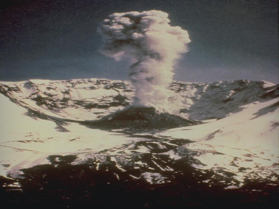
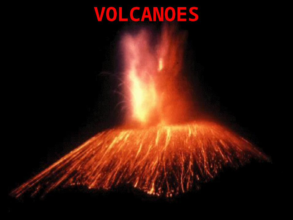
VOLCANOES
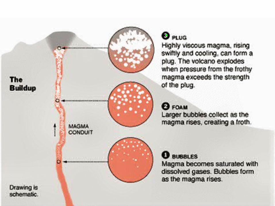
Volcanoes• Basic parts of a volcano
• Crater (depression at the summit of a volcano, connected by a vent or pipe to the magma chamber below)
• Caldera (crater more than 1 km in diameter, formed at the summit of a volcano when lava is drained from an underground magma chamber, causing the summit of the volcano to be unsupported, and to collapse)
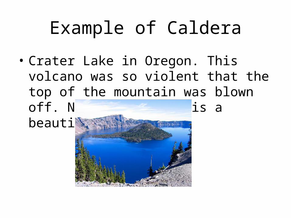
Example of Caldera
• Crater Lake in Oregon. This volcano was so violent that the top of the mountain was blown off. Now all is left is a beautiful lake.
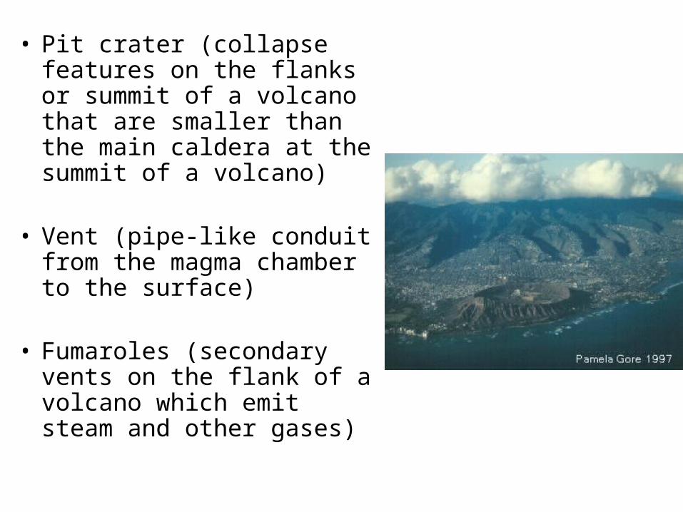
• Pit crater (collapse features on the flanks or summit of a volcano that are smaller than the main caldera at the summit of a volcano)
• Vent (pipe-like conduit from
the magma chamber to the surface)
• Fumaroles (secondary vents on the flank of a volcano which emit steam and other gases)
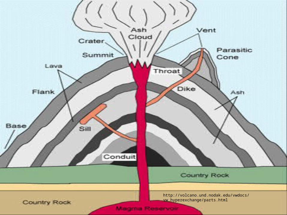
http://volcano.und.nodak.edu/vwdocs/vw_hyperexchange/parts.html

Types of Volcanoes
1. Shield volcanoes - Hawaii• Docile lava outpouring. Only minor pyroclastic
material • Lava forms broad dome with central crater • Slope is 2-10 degrees, like flattened shield • Very long lived, very large, massive amounts of
lava (pahoehoe and aa) Example: Kilauea
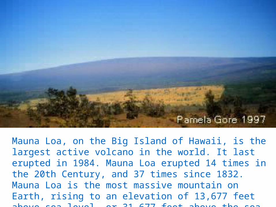
Mauna Loa, on the Big Island of Hawaii, is the largest active volcano in the world. It last erupted in 1984. Mauna Loa erupted 14 times in the 20th Century, and 37 times since 1832. Mauna Loa is the most massive mountain on Earth, rising to an elevation of 13,677 feet above sea level, or 31,677 feet above the sea floor. Its volume is 10,000 miles3.
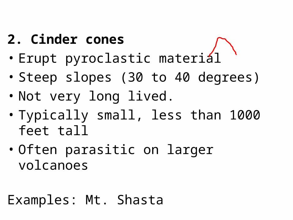
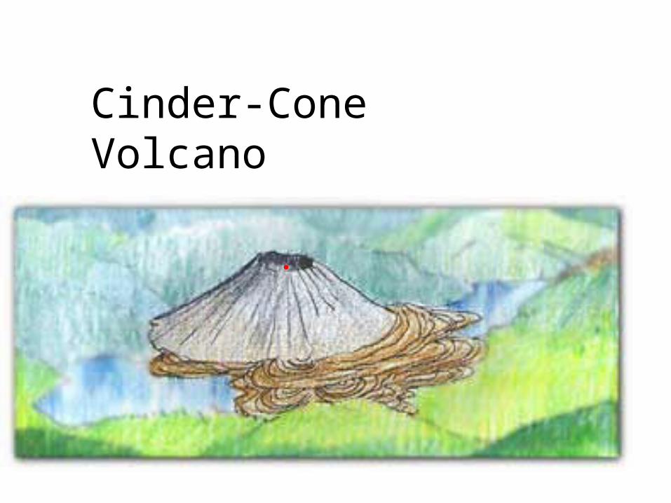
2. Cinder cones
• Erupt pyroclastic material
• Steep slopes (30 to 40 degrees)
• Not very long lived.
• Typically small, less than 1000 feet tall
• Often parasitic on larger volcanoes
Examples: Mt. Shasta
Cinder-Cone Volcano
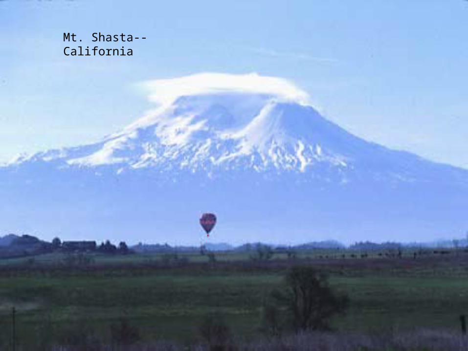
Mt. Shasta--California

3. Composite volcanoes
• Erupt lava and pyroclastic material
• Intermediate slopes because lava acts like protective coating on pyroclastic layers
• Built up over long periods of time
• Most picturesque, but most violent
Examples: Mt. Vesuvius, Mt. Fuji, Yellowstone
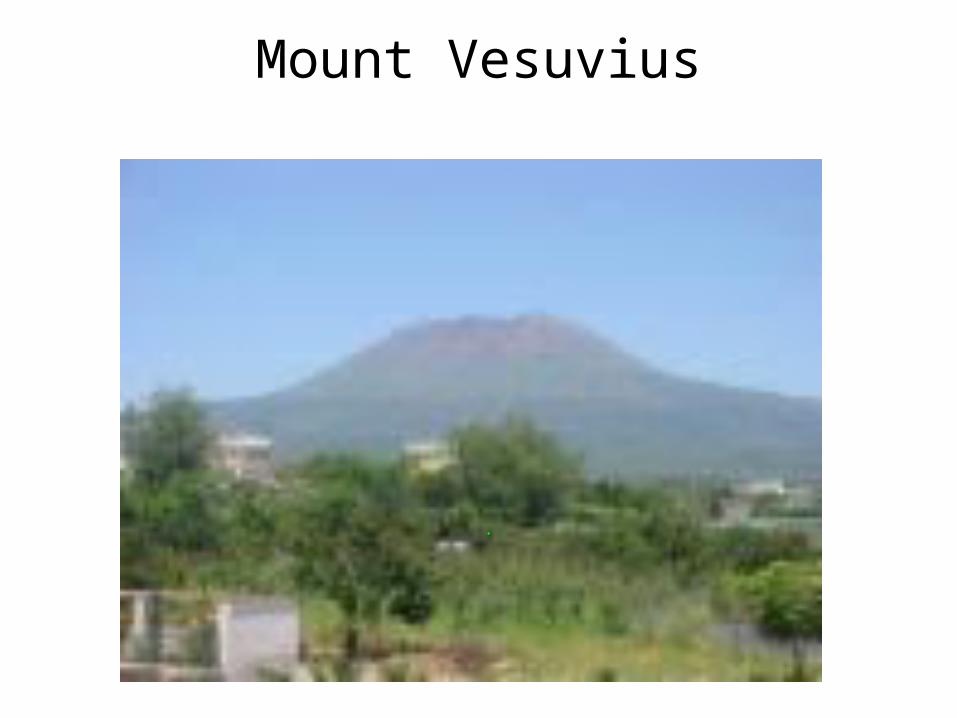
Mount Vesuvius
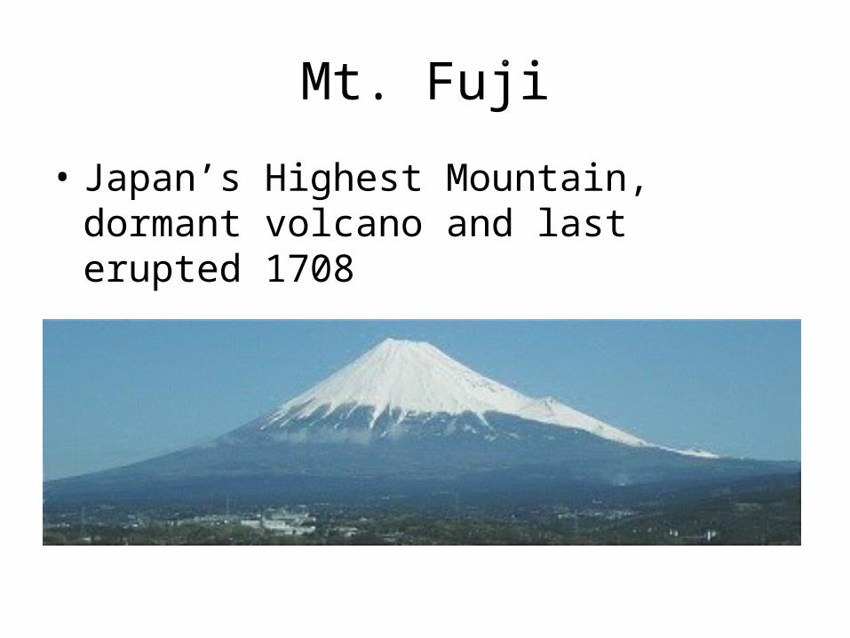
Mt. Fuji
• Japan’s Highest Mountain, dormant volcano and last erupted 1708
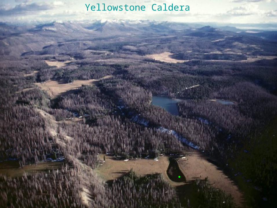
Yellowstone Caldera
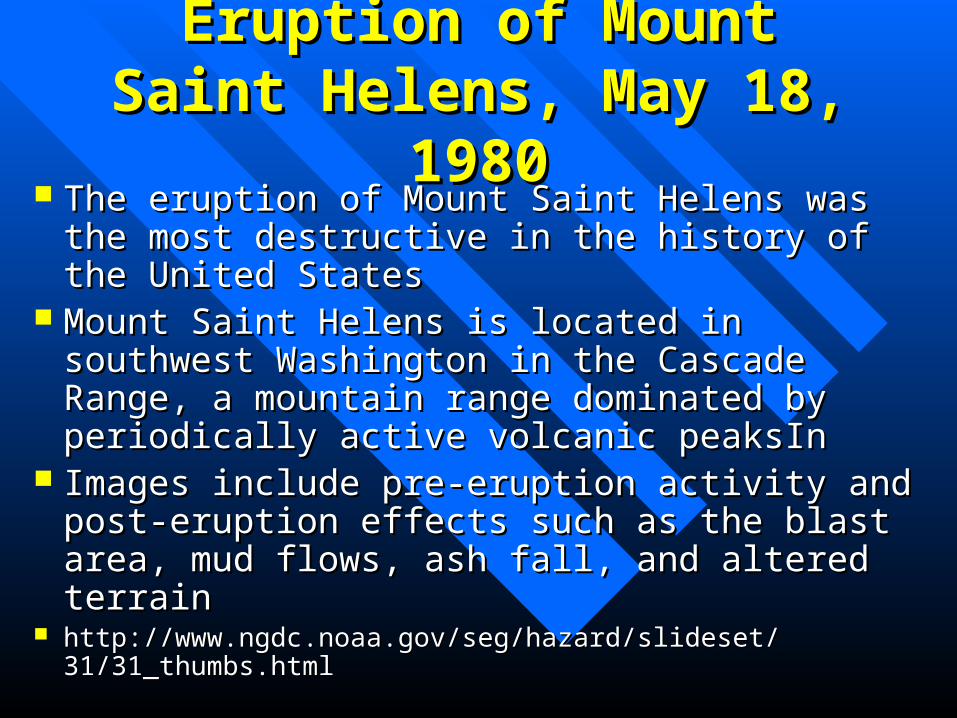
Eruption of Mount Saint Eruption of Mount Saint Helens, May 18, 1980Helens, May 18, 1980
The eruption of Mount Saint Helens was the most The eruption of Mount Saint Helens was the most destructive in the history of the United Statesdestructive in the history of the United States
Mount Saint Helens is located in southwest Mount Saint Helens is located in southwest Washington in the Cascade Range, a mountain Washington in the Cascade Range, a mountain range dominated by periodically active volcanic range dominated by periodically active volcanic peaksIn peaksIn
Images include pre-eruption activity and post-Images include pre-eruption activity and post-eruption effects such as the blast area, mud flows, eruption effects such as the blast area, mud flows, ash fall, and altered terrainash fall, and altered terrain
http://www.ngdc.noaa.gov/seg/hazard/slideset/31/31_thumbs.htmlhttp://www.ngdc.noaa.gov/seg/hazard/slideset/31/31_thumbs.html