Data-Driven Civic Innovation
26
© 2016, Amazon Web Services, Inc. or its Affiliates. All rights reserved. Steve Sofian, Solutions Architect WWPS ASEAN Data-Driven Civic Innovation
-
Upload
amazon-web-services -
Category
Technology
-
view
265 -
download
0
Transcript of Data-Driven Civic Innovation

© 2016, Amazon Web Services, Inc. or its Affiliates. All rights reserved.
Steve Sofian, Solutions Architect WWPS ASEAN
Data-Driven Civic Innovation
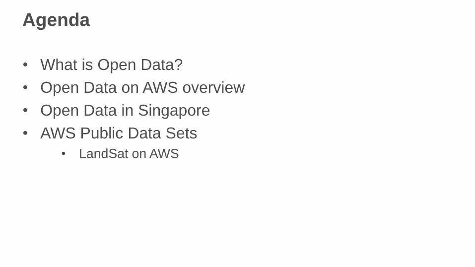
Agenda
• What is Open Data?
• Open Data on AWS overview
• Open Data in Singapore
• AWS Public Data Sets
• LandSat on AWS

What does Open Data look like?

What is Open Data?
Open data is data that can be used by anyone for any purpose for free.
Many of our customers, such as Esri, the Weather Company, and the
Climate Corporation, rely on quality open data as much as they rely on our
computing, storage, and other web services.
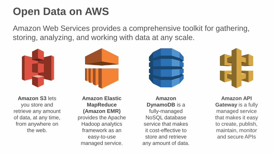
Open Data on AWS
Amazon S3 lets
you store and
retrieve any amount
of data, at any time,
from anywhere on
the web.
Amazon Elastic
MapReduce
(Amazon EMR)
provides the Apache
Hadoop analytics
framework as an
easy-to-use
managed service.
Amazon
DynamoDB is a
fully-managed
NoSQL database
service that makes
it cost-effective to
store and retrieve
any amount of data.
Amazon API
Gateway is a fully
managed service
that makes it easy
to create, publish,
maintain, monitor
and secure APIs
Amazon Web Services provides a comprehensive toolkit for gathering,
storing, analyzing, and working with data at any scale.

The power of open data on AWS
Making data open on AWS enables more innovation by making data
available for rapid access to our flexible and low-cost computing
resources.
Amazon
EC2
Amazon
EMR
Amazon
Redshift
Amazon
DynamoDB
AWS
Lambda
Amazon
S3

The Weather Company saves $1 million per year running its
forecasting application on AWS
The Weather Company provides millions of people
with the world’s best weather forecasts,
content and data, every day.
Using AWS, TWC can scale as
necessary to handle constantly
changing workloads and maintain
our 11-millisecond response time.
Bryson Koehler
EVP, CTO, CIO, The Weather Company
”
“ • Needed a cost-effective, scalable
alternative to operating 13 data centers
with legacy systems.
• TWC ingests, stores, and analyzes
ingests 4 GB of weather data per
second from over 800 sources.
• Designed to handle more than 15 billion
API calls each day, at a rate of 150,000
per second.
• Reduced its on-premises IT
environment form 13 to 6 data centers.

Data Enrichment
Sen
sem
akin
g
Data at Rest(Object storage)
Basic APIs
Complex APIs
Consumerapplications
Algorithmicpolicy
Data-drivenjournalism
Data Catalogs
Focused datadashboards
Predictivemodeling
Visualizations
Lower cost of knowledge(Efficiency)
Open data as a platform

Data Creation Data Enrichment
Sen
sem
akin
g
Data at Rest(Object storage)
Basic APIs
Complex APIs
Consumerapplications
Algorithmicpolicy
Data-drivenjournalism
Data Catalogs
Focused datadashboards
Predictivemodeling
Visualizations
Efficiency
Open data as a platform

Data Enrichment
Sen
sem
akin
g
AmazonKinesis
AmazonEC2
AmazonEC2
AWS DataPipeline
AmazonS3
AmazonRDS
AmazonEMR
AmazonRedshift
AmazonDynamoDB
AWSLambda
Open data as a platform

Open Data in Singapore

Singapore Open Data platform

OneMap
First government-wide national intelligent map portal • Integrated map system for government agencies to deliver location-based
services and information to government agencies and citizens
• Powers over 100 government GIS websites and applications
• Reduced costs by 60%
“AWS has helped my organization
to provide better service availability
and handle higher traffic load at a
lower cost.” —Chan Chin Wai, Chief Information Officer
Singapore Land Authority

Participating Agencies

Open Data Applications
Ministry of Social & Family Development SG Cares – Volunteering Opportunities
OneMotoring – traffic.smart Surround Network – Location Based Commerce

AWS Public Data Sets

Public datasets on AWS
To enable more innovation, AWS hosts a selection of datasets that anyone
can access for free. Data in our public datasets is available for rapid
access to our flexible and low-cost computing resources.
Earth Science
NASA Earth Exchange
(NASA NEX)
Life Sciences
1000 Genomes Project
Internet Science
Common Crawl Corpus

Landsat
The Landsat program is a joint effort
of the U.S. Geological Survey and
NASA. It is the longest running
program to gather Earth imagery
from space and is considered the
gold standard for natural resources
satellite imagery.

Landsat is big open data
The Landsat program is a joint effort
of the U.S. Geological Survey and
NASA. It is the longest running
program to gather Earth imagery
from space and is considered the
gold standard for natural resources
satellite imagery.
It has traditionally been time-
consuming and expensive to
acquire, store, and analyze Landsat
data.

Landsat on AWS
We have committed to making up to
1 petabyte of Landsat imagery
readily available as objects on
Amazon S3.
Now, anyone can analyze Landsat
data at web scale with no significant
up-front investment of time or capital
expense.

Esri—Unlock Earth’s Secrets
Esri has created a tool to show how
ArcGIS Online can quickly visualize
Landsat data for live visualization and
analysis within the browser.
“These are not pre-generated cache
services limited to just visualization—
they are dynamic, high-performance
image services that perform on-the-
fly processing and dynamic
mosaicking of Landsat’s multi-
spectral and multi-temporal imagery.”
http://www.esri.com/landsatonaws
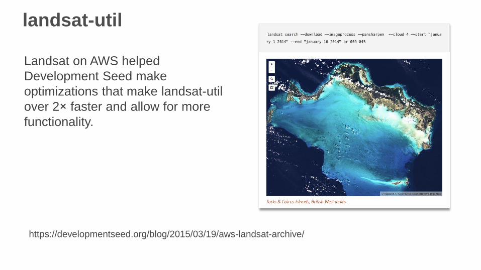
landsat-util
Landsat on AWS helped
Development Seed make
optimizations that make landsat-util
over 2× faster and allow for more
functionality.
https://developmentseed.org/blog/2015/03/19/aws-landsat-archive/

Landsat-live
Mapbox created Landsat-live, a map
that is constantly refreshed with the
latest satellite imagery from NASA’s
Landsat 8 satellite.
Creating a live Earth imagery
pipeline is possible because Landsat
imagery is available on Amazon S3
within hours of creation.
https://www.mapbox.com/blog/landsat-live-live/
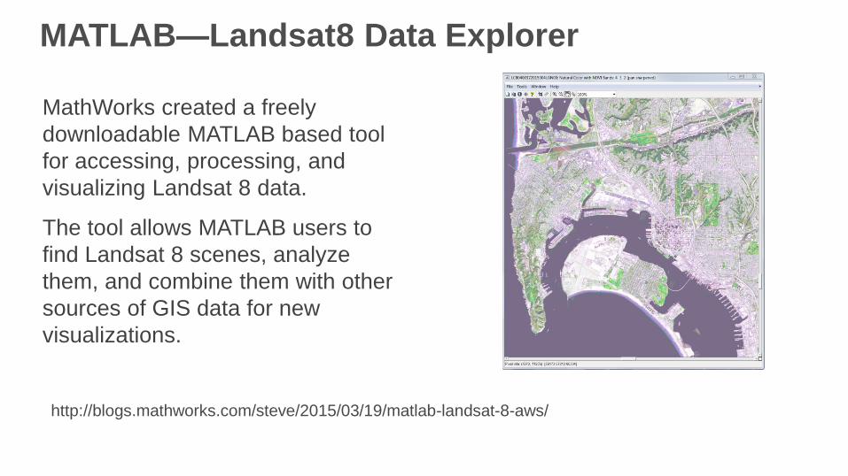
MATLAB—Landsat8 Data Explorer
MathWorks created a freely
downloadable MATLAB based tool
for accessing, processing, and
visualizing Landsat 8 data.
The tool allows MATLAB users to
find Landsat 8 scenes, analyze
them, and combine them with other
sources of GIS data for new
visualizations.
http://blogs.mathworks.com/steve/2015/03/19/matlab-landsat-8-aws/
Summary
• Publicly available resources have reached critical mass
• Governments
• Citizens
• Businesses
• Consumers
• Seize upon open data to improve products and services
• Businesses begin leverage on open innovation