DANE COUNTY BOARD OF SUPERVISORS
84
ZLR Committee Work Meeting Agenda Page 1 of 3 April 12, 2011 DANE COUNTY BOARD OF SUPERVISORS ZONING & LAND REGULATION COMMITTEE WORK MEETING AGENDA Date: Tuesday, April 12, 2011 Time: 7:30 P.M. Location: ROOM 351, CITY-COUNTY BUILDING NOTE: If you need an interpreter, translator, materials in alternate formats or other accommodations to access this service, activity or program, please call the phone number below at least three business days prior to the meeting. NOTA: Si necesita un intérprete, un traductor, materiales en formatos alternativos u otros arreglos para acceder a este servicio, actividad o programa, comuníquese al número de teléfono que figura a continuación tres días hábiles como mínimo antes de la reunión. LUS CIM: Yog hais tias koj xav tau ib tug neeg txhais lus, ib tug neeg txhais ntawv, cov ntawv ua lwm hom ntawv los sis lwm cov kev pab kom siv tau cov kev pab, cov kev ua ub no (activity) los sis qhov kev pab cuam, thov hu rau tus xov tooj hauv qab yam tsawg peb hnub ua hauj lwm ua ntej yuav tuaj sib tham. Contact Information: Zoning Office, Planning & Development Department, 266-4266, or 266-9138 (TDD) ITEMS TO BE CONSIDERED I. CALL TO ORDER II. APPROVAL OF MINUTES Minutes of the 03/08/11 and 03/22/11 meetings of the Zoning & Land Regulation Committee. III. PUBLIC COMMENT IV. ZONING MAP AMENDMENTS AND CONDITIONAL USE PERMIT APPLICATIONS FROM THE MARCH 22, 2011 PUBLIC HEARING 1. PETITION # 10291 by JEFFREY ZIMMERMAN to change the zoning from A-1EX Exclusive Agricultural to R-1 Residential to allow the SEPARATION OF THE EXISTING RESIDENCE FROM THE FARM on the property located at 4973 RIDGE ROAD in Section 36, Town of Sun Prairie. 2. PETITION # 10296 by PROPERTIES ON FISH LAKE LLC to change the zoning from RH-3 Rural Homes to RH-2 Rural Homes to allow the DIVISION OF AN EXISTING PARCEL INTO THREE RESIDENTIAL LOTS on the property located WEST OF 8623 SCHOEPP ROAD in Section 03, Town of Roxbury. 3. PETITION # 10297 by 2121 FISH HATCHERY ROAD LLC to change the zoning from C-1 Commercial to C-2 Commercial to allow ZONING COMPLIANCE FOR AN EXISTING BUSINESS on the property located at 2121 FISH HATCHERY ROAD in Section 35, Town of Madison.
Transcript of DANE COUNTY BOARD OF SUPERVISORS
ZLR Committee Work Meeting Agenda Page 1 of 3 April 12, 2011
DANE COUNTY BOARD OF SUPERVISORS
ZONING & LAND REGULATION COMMITTEE
WORK MEETING AGENDA Date: Tuesday, April 12, 2011 Time: 7:30 P.M. Location: ROOM 351, CITY-COUNTY BUILDING
NOTE: If you need an interpreter, translator, materials in alternate formats or other accommodations to access this service, activity or program, please call the phone number below at least three business days prior to the meeting. NOTA: Si necesita un intérprete, un traductor, materiales en formatos alternativos u otros arreglos para acceder a este servicio, actividad o programa, comuníquese al número de teléfono que figura a continuación tres días hábiles como mínimo antes de la reunión. LUS CIM: Yog hais tias koj xav tau ib tug neeg txhais lus, ib tug neeg txhais ntawv, cov ntawv ua lwm hom ntawv los sis lwm cov kev pab kom siv tau cov kev pab, cov kev ua ub no (activity) los sis qhov kev pab cuam, thov hu rau tus xov tooj hauv qab yam tsawg peb hnub ua hauj lwm ua ntej yuav tuaj sib tham. Contact Information: Zoning Office, Planning & Development Department, 266-4266, or 266-9138 (TDD)
ITEMS TO BE CONSIDERED I. CALL TO ORDER II. APPROVAL OF MINUTES
Minutes of the 03/08/11 and 03/22/11 meetings of the Zoning & Land Regulation Committee. III. PUBLIC COMMENT IV. ZONING MAP AMENDMENTS AND CONDITIONAL USE PERMIT APPLICATIONS FROM THE
MARCH 22, 2011 PUBLIC HEARING 1. PETITION # 10291 by JEFFREY ZIMMERMAN to change the zoning from A-1EX Exclusive
Agricultural to R-1 Residential to allow the SEPARATION OF THE EXISTING RESIDENCE FROM THE FARM on the property located at 4973 RIDGE ROAD in Section 36, Town of Sun Prairie.
2. PETITION # 10296 by PROPERTIES ON FISH LAKE LLC to change the zoning from RH-3 Rural
Homes to RH-2 Rural Homes to allow the DIVISION OF AN EXISTING PARCEL INTO THREE RESIDENTIAL LOTS on the property located WEST OF 8623 SCHOEPP ROAD in Section 03, Town of Roxbury.
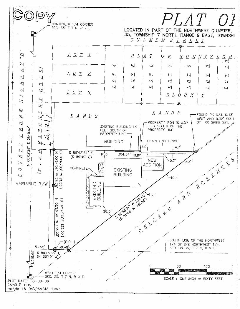
3. PETITION # 10297 by 2121 FISH HATCHERY ROAD LLC to change the zoning from C-1
Commercial to C-2 Commercial to allow ZONING COMPLIANCE FOR AN EXISTING BUSINESS on the property located at 2121 FISH HATCHERY ROAD in Section 35, Town of Madison.
ZLR Committee Work Meeting Agenda Page 2 of 3 April 12, 2011
4. CONDITIONAL USE PERMIT # 2165 by JEFFREY MRKVICKA to allow a DAY CAMP SCHOOL
on the property located at 2418 DAHLK CIRCLE in Section 25, Town of Springdale. V. ZONING MAP AMENDMENTS AND CONDITIONAL USE PERMIT APPLICATIONS FROM
PREVIOUS MEETINGS 1. PETITION # 10170 by FJD FARM LLC to change the zoning from A-1EX Exclusive Agricultural to
R-1 Residential to allow the REALIGNMENT OF THREE EXISTING LOTS FOR RESIDENTIAL DEVELOPMENT on the property located NORTH OF 502 NORTH MAIN STREET in Section 21, Town of Deerfield.
2. CONDITIONAL USE PERMIT # 2159 by STANLEY LIEN to allow the RENEWAL OF NON-
METALLIC MINERAL EXTRACTION CONDITIONAL USE PERMIT on the property located at 372 KOSHKONONG RD in Section 14, Town of Christiana.
VI. PLATS AND CERTIFIED SURVEY MAPS
1. PRELIMINARY PLATS: None. 2. FINAL PLATS: None. 3. PRELIMINARY CERTIFIED SURVEY MAPS: a. Variance request for Todd Nelson, Town of Dunn, Section 8, to allow a proposed 1-lot Certified
Survey Map to maintain less than the minimum frontage of 66-feet to facilitate the possible development of a public right-of-way that could service additional lots. Lot 1 is proposing 28.02 feet of road frontage along Jordan Drive.
b. APPLICATION # 9276, Mark Wagner, Town of Middleton, Section 7 (1 lot, 1.8 acres) c. APPLICATION # 9277, Crazy Acres, Town of Albion, Section 23 (1 lot, 4.9 acres) d. APPLICATION # 9281, David Roark, Town of Cross Plains, Section 24 (3 lots, 20 acres) 4. CERTIFIED SURVEY MAPS: a. APPLICATION # 9233, Gary Paulman, Town of Windsor, Section 12 (3 lots, 29.5 acres) b. APPLICATION # 9258, Ronald Dorshorst, Town of Sun Prairie, Section 36 (2 lots, 20.8 acres) c. APPLICATION # 9264, Ted White, Town of Primrose, Section 27 (1 lot, 4.2 acres) d. APPLICATION # 9270, Don Tierney, Town of Windsor, Section 25 (1 lot, 1.4 acres)
ZLR Committee Work Meeting Agenda Page 3 of 3 April 12, 2011 VII. RESOLUTIONS
1. RESOLUTION 312, 2010-2011, Authorizing acceptance of Dane County’s Share of US EPA Climate Showcase Communities Grant Funding
2. RESOLUTION 322, 2010-2011, Approving Natural Path Sanctuary Cemetery Plat, Section 24, Town
of Springdale VIII. ORDINANCE AMENDMENTS
1. None.
IX. OTHER BUSINESS
1. Update Zoning and Land Regulation Committee’s Rules and Procedures 2. Delegate authority of Certified Survey Map review and approval to Planning and Development
Staff
X. ADJOURN Supervisor Patrick Miles, Chair, Zoning & Land Regulation Committee AGENDA POSTED: April 7, 2011
ZLR Committee Work Meeting Minutes Page 1 of 9 March 8, 2011
NOTE: These minutes reflect the notes of the recorder and are subject to correction and approval at a subsequent meeting of the Committee.
ZONING & LAND REGULATION COMMITTEE
Dane County Board of Supervisors
MINUTES OF THE MARCH 8, 2011 MEETING MEMBERS PRESENT: Bruskewitz (arrived 7:47 pm), Eicher, Jensen, Matano, and Miles. OTHERS PRESENT: Allan, Everson, and Violante I. CALL TO ORDER
Chair Miles called the meeting to order at 7:34 pm in Room 351 of the City-County Building. II. APPROVAL OF MINUTES
Motion by Eicher / Matano to approve the minutes of the 02/08/11 and 02/22/11 meetings of the Zoning & Land Regulation Committee; motion carried, 4-0.
III. PUBLIC COMMENT
There was no public comment. IV. PUBLIC HEARING FOR ZONING MAP AMENDMENTS, CONDITIONAL USE PERMIT
APPLICATIONS, RESOLUTIONS, AND ORDINANCE AMENDMENTS
1. PETITION # 10275 AND CONDITIONAL USE PERMIT # 2157 by STOUGHTON FARMS INC to change the zoning from A-1EX Exclusive Agricultural to A-2(8) Agricultural to allow a 488-FOOT TALL FM RADIO TOWER IN THE A-2(8) ZONING DISTRICT on the property located at 3768 OLD STAGE ROAD in Section 34, Town of Rutland
IN FAVOR: Dave Magnum, Steve Ritt, David Lyshek, Richard Rogers Registrants / speakers in favor of the proposed FM radio tower stated that the tower is being proposed at the subject property and at a height of 488’ based on FCC requirements that the Class A FM station maximize its facilities and service to the community of license (Stoughton). Other statements addressed the energy efficiencies achieved by building a tower at the proposed height, willingness of the station to assist law enforcement in emergency situations, and support from various community officials. OPPOSED: Jessica Polakowski, Margaret Shea, Charles Burch, Leslie Burch, James McMillan, Jan Krenz, Henry Royer, Cathy Royer, James Danky, Christine Schelshorn, Erin Furrer, Chris Beebe, Andrew Laundrie. Registrants / speakers in opposition to the proposed FM radio tower expressed numerous concerns, including the following: Proposal is inconsistent with the town / county comprehensive plan policies. Proposed conditional use does not satisfy applicable county ordinance standards in s. 10.255(2)(h). Proposal will result in loss of property values / enjoyment of property. Proposal will have a negative aesthetic impact and cause light pollution at night. Proposal will negatively impact rural character of the area.
ZLR Committee Work Meeting Minutes Page 2 of 9 March 8, 2011
Proposal would negatively impact nearby wildlife areas. Proposal would negatively impact migratory bird species. Proposal could result in hazardous “ice fall” from the tower or guyed lines. Inadequate rationale presented for needing an FM tower at the proposed height in the proposed area. STAFF: P&D, Evans Associates Allan briefly noted that it is the county, not the applicant, that contracts with Evans Associates for the technical review of proposed towers. An audio recording of the entire 3/8/11 ZLR Committee public hearing, will be made available online at: http://www.countyofdane.com/plandev/zoning/recording/meeting.aspx TOWN ACTION: Pending
Motion by Jensen / Eicher to postpone until the 4/12/11 ZLR work meeting, or next available work session following receipt of the town board action report; motion carried, 5-0.
IV. ZONING MAP AMENDMENTS AND CONDITIONAL USE PERMIT APPLICATIONS FROM THE FEBRUARY 22, 2011 PUBLIC HEARING
1. PETITION # 10284 by GULDSTEEN FARM LLC to change the zoning from A-1EX Exclusive
Agricultural to A-2(2) Agricultural to allow zoning compliance for an existing residence on the property located at 2255 TOWER DRIVE in Section 23, Town of Pleasant Springs.
TOWN: Approved with amendment and conditions
Motion by Bruskewitz / Jensen to recommend approval with amendment and conditions; motion carried, 4-1 (Nay: Matano). 1. The zoning district boundary shall be amended to create an approximate 6-acre lot. The Zoning
District shall be amended to A-2(4) to agree with the amended boundary. The A-2(4) parcel shall include the barn/residence, but will not include the stone house.
2. The A-2(4) parcel will be a flag lot with a minimum of 66 feet of frontage on Tower Drive. 3. A CSM shall be recorded with the Dane County Register of Deeds showing the boundaries of the
A-2(4) parcel, acreage, driveway easement, and all structures. 4. Additional land shall be acquired from the adjacent property owner, Tom Sayre, to keep the
remaining A-1 Exclusive land acreage above aggregate 35 acres. Evidence of this purchase shall be recorded with the Dane County Register of Deeds within 90 days of the A-2(4) zoning becoming effective. The zoning shall be rendered null and void if the transaction is not accomplished.
5. Deed restrict parent parcel number 0611-231-9125-0 to prohibit residential development on the remaining A-1 Exclusive land. The housing density rights have been exhausted for the original farm.
6. There shall be a 6-month delayed effective date to record the Certified Survey Map.
2. CONDITIONAL USE PERMIT # 2158 by RESURRECTION LUTHERAN CHURCH INC to allow a
PRESCHOOL on the property located at 6705 WESNER RD, in Section 26, Town of Verona.
TOWN: Approved with conditions
Motion by Jensen / Bruskewitz to approval Conditional Use Permit # 2158 with conditions; motion carried, 5-0. 1. Adequate off-street parking shall be installed on site to accommodate vehicle parking as required
under Dane County Code of Ordinance section 10.18. 2. Capacity of the preschool shall be limited to 50 children.
ZLR Committee Work Meeting Minutes Page 3 of 9 March 8, 2011
3. Hours of operation of the preschool shall be limited to 7:00am to 6:00pm, Monday through Friday. 4. The well and septic system shall have proper capacity to accommodate the additional persons. 5. The Church shall participate on the improvements to Wesner Road, if required.
3. CONDITIONAL USE PERMIT # 2161 by PRAIRIE HOME LOT 26 LLC to allow a SCHOOL on the
property located at the corner of AIRPORT ROAD and ELLINGTON WAY in Section 05, Town of Middleton.
Motion by Jensen / Bruskewitz to approval Conditional Use Permit # 2161 with conditions; motion carried, 5-0. 1. The parking lot layout shall conform to Dane County Code of Ordinances and be approved by the
Town Engineer (Vierbicher Associates). 2. The exterior lighting shall be approved by the Town Board. 3. The building height to be a maximum of 32 feet. 4. The playground shall be fenced. The fencing shall be approved by the Town Board. 5. Signs on the property shall not be illuminated. 6. The applicants, if needed as determined by the Town Engineer, shall pay for the Ellington and
Airport Road intersection to be upgraded to a “Class A” intersection. 7. The school’s driveway shall be located as far to the north as practical. 8. The septic drain-fields, both primary and secondary, to be located within Lot 26, if feasible. 9. The site improvements shall meet both Town of Middleton and Dane County Stormwater
management ordinances for detention and infiltration on site. 10. The plan, for handling storm water drainage entering and leaving lot 26, to be acceptable to Town
Engineer and approved by Dane County Land Conservation. 11. Screening and landscaping to be compatible with the neighboring prairie and be acceptable to the
Town Board. 12. The enrollment shall be limited to a maximum 160 students. 13. Hours of operation shall be limited to 6:30 A.M. to 9:30 P.M., Monday through Friday.
4. REVOCATION of CONDITIONAL USE PERMIT #2118 for failure to comply with stipulated conditions
of the conditional use permit on the property owned by Robert Johnson located at 275 US HIGHWAY 12/18 in Section 02, Town of Christiana.
Motion by Bruskewitz / Jensen to postpone to allow time for Zoning Staff to work with the landowner; motion carried, 5-0.
VI. ZONING MAP AMENDMENTS AND CONDITIONAL USE PERMIT APPLICATIONS FROM
PREVIOUS MEETINGS 1. PETITION # 10271 by JAMIE BECKER to change the zoning from RH-2 Rural Homes to LC-1
Limited Commercial to allow a CONTRACTOR BUSINESS on the property located at 156 EDGERTON RD in Section 34, Town of Albion. TOWN: Approved
Motion by Jensen / Eicher to recommend approval; motion carried, 5-0.
VII. PLATS AND CERTIFIED SURVEY MAPS
1. PRELIMINARY PLATS:
ZLR Committee Work Meeting Minutes Page 4 of 9 March 8, 2011
a. None. 2. FINAL PLATS: a. First Addition to Nature Valley Conservation Neighborhood, Town of Vienna, Section 36
(15 lots) (15.3 acres) (Application deadline 3/19/2011) Staff recommends approval.
Motion by Bruskewitz / Jensen to approve, subject to the following conditions; motion carried, 5-0 Compliance with the Dane County Comprehensive Plan is to be established. Memo provided by Curt Kodl, Senior Planner dated December 1, 2010. Rezone Petition #10246 is to become effective (one day following publication in the Wisconsin State Journal) and all conditions established with Zoning Petition #10246 are to be timely satisfied. Recording of an approved Subdivision Plat. Payment of Rezone Conversion Fees. The public park land appropriation requirement is to be satisfied (private park land does not satisfy this requirement). Street names (Nature Cove) with respect to Ch. 76 of the Dane County Code of Ordinances are to be assigned. Dane County Surveyor approval is to be obtained. Approximate location of the wetlands shall be shown. The creek shall be labeled as Unnamed Perennial Stream. Compliance with Ch. 14.45 DCCO, Erosion Control Plans is to be established. Compliance with Ch. 14.46 DCCO, Stormwater Control Permits is to be established. Utility easements are to be provided. Town of Vienna approvals are to be obtained. Village of DeForest approvals are to be obtained (extraterritorial jurisdiction). All lots and outlots are to meet the minimum area and width requirements of the zoning districts that are applicable. The final plat must be submitted within thirty-six (36) months from the approval date of the preliminary plat and in the case of preliminary plats given conditional approval, all conditions must be met. 3. PRELIMINARY CERTIFIED SURVEY MAPS: Motion by Jensen / Eicher to approve the preliminary Certified Survey Maps listed as a thru e, subject to the following conditions; motion carried, 5-0. a. APPLICATION # 9256, Larry Skaar, Town of Cottage Grove, Section 31 (1 lot, 2.2 acres) 1. Rezone Petition #10281 is to become effective (one day following publication in the Wisconsin State Journal) and all conditions established with Zoning Petition #10281 are to be timely satisfied. 2. The document is to be completed in accordance with S.236.34, Wisconsin State Statutes. 3. Lot 1 is to be a minimum of 2.0 net acres, excluding the road right-of-way.

ZLR Committee Work Meeting Minutes Page 5 of 9 March 8, 2011
4. The net lot area calculation is to be specified in square feet. 5. Comments and conditions from the County Highway Department are to be recognized: No new accesses will be permitted. 6. An owners certificate in accordance with S. 236.21(2), Wisconsin State Statutes is to be included. 7. The owners certificate is to include “we also certify that this certified survey map is required by 75.17(1)(a), Dane County Code of Ordinances to be submitted to the Dane County Zoning and Land Regulation Committee for approval. 8. All owners of record are to be included in the owner’s certificate. (County records indicate that Larry G. Skaar is the owner). Middle initials are required to provide valid certificates. 9. The Town of Cottage Grove approval certificate is to be included. 10. The City of Madison approval certificate is to be included. 11. The required certificates are to be executed. 12. “Approved for recording per Dane County Zoning & Land Regulation Committee action of ______________, by ______________, Authorized Representative” is to be included. 13. A notation is to be affixed to the document “refer to building site information contained in the Dane County Soil Survey.” 14. All references to zoning are to be removed from the final document. 15. Dane County Surveyor approval is to be obtained. 16. The recordable document is to be submitted for review and approval. b. APPLICATION # 9257, Don Viney, Town of Cottage Grove, Section 35 (1 lot, 3.9 acres) 1. Rezone Petition #10280 is to become effective (one day following publication in the Wisconsin State Journal) and all conditions established with Zoning Petition #10280 are to be timely satisfied. 2. The document is to be completed in accordance with S.236.34, Wisconsin State Statutes. 3. The net lot area calculation is to be specified in square feet. 4. Existing buildings shall be dimensioned to the nearest 0.1-foot in relation to proposed property boundaries. 5. The approximate location of the on-site septic system is to be shown. 6. An owners certificate in accordance with S. 236.21(2), Wisconsin State Statutes is to be included. 7. The owners certificate is to include “we also certify that this certified survey map is required by 75.17(1)(a), Dane County Code of Ordinances to be submitted to the Dane County Zoning and Land Regulation Committee for approval. 8. All owners of record are to be included in the owner’s certificate. (County records indicate that DONALD P VINEY & MARILYN R VINEY is the owner). Spouse’s signature and middle initials are required to provide valid certificates. 9. The Town of Cottage Grove approval certificate is to be included.

ZLR Committee Work Meeting Minutes Page 6 of 9 March 8, 2011
10. The required certificates are to be executed. 11. “Approved for recording per Dane County Zoning & Land Regulation Committee action of ______________, by ______________, Authorized Representative” is to be included. 12. A notation is to be affixed to the document “refer to building site information contained in the Dane County Soil Survey.” 13. All references to zoning are to be removed from the final document. 14. Dane County Surveyor approvals are to be obtained. When all revisions are complete, submit a copy to the Dane County Surveyor for technical review and approval. 15. The recordable document is to be submitted for review and approval. c. APPLICATION # 9258, Ronald Dorshorst, Town of Sun Prairie, Section 36 (2 lots, 21.1 acres) 1. Rezone Petition #10279 is to become effective (one day following publication in the Wisconsin State Journal) and all conditions established with Zoning Petition #10279 are to be timely satisfied. 2. The document is to be completed in accordance with S.236.34, Wisconsin State Statutes. 3. The net lot area calculations are to be specified in square feet. 4. The County Highway Register shows WEST MEDINA ROAD right-of-way to be three rods. All street rights-of-way shall be of the width specified on applicable official plans and official maps or, if not specified therein, they shall not be less than the width specified in section 75.19(1)(o). Minimum right-of-way for local access is 66 feet. Thirty-three feet southerly of the West Medina Road right-of-way centerline is to be clearly designated to the public. 5. An owners certificate in accordance with S. 236.21(2), Wisconsin State Statutes is to be included. 6. The owners certificate is to include “we also certify that this certified survey map is required by 75.17(1)(a), Dane County Code of Ordinances to be submitted to the Dane County Zoning and Land Regulation Committee for approval. The Owners Certificate is to include the word “dedicated”. 7. All owners of record are to be included in the owner’s certificate. (County records indicate that RONALD J DORSHORST is the owner). Middle initials are required to provide valid certificates. 8. A Town of Sun Prairie approval certificate is to be included. Town of Primrose approval shall include language that identifies the public highway right of way dedication and is hereby acknowledged and accepted by the Town Board. 9. The required certificates are to be executed. 10. The notation “refer to building site information contained in the Dane County Soil Survey” is to be included on the document. 11. “Approved for recording per Dane County Zoning & Land Regulation Committee action of ______________, by ______________, Authorized Representative” is to be included. 12. Dane County Surveyor approvals are to be obtained. When all revisions are complete, please submit a copy to the Dane County Surveyor for technical review and approval. 13. The recordable document is to be submitted for review and approval.
ZLR Committee Work Meeting Minutes Page 7 of 9 March 8, 2011
d. APPLICATION # 9265, Lund, Town of Christiana, Section 14 (1 lot, 2.9 acres) 1. Rezone Petition #10294 is to become effective (one day following publication in the Wisconsin State Journal) and all conditions established with Zoning Petition #10294 are to be timely satisfied. 2. The document is to be completed in accordance with S.236.34, Wisconsin State Statutes. 3. The net lot area calculations are to be specified in square feet. 4. The town road is currently an un-named road per county records. Street names with respect to Ch. 76 of the Dane County Code of Ordinances are to be assigned. Dane County Surveyor approval is to be obtained. 5. Dead end streets shall not be permitted without suitable turn-around. A cul-de-sac will be required and shall not exceed 1000 feet in length and shall provide a turn-around with a minimum right-of-way radius of 60 feet. The traveled way within the cul-de-sac shall provide a minimum radius of 40 feet. 6. The cul-de-sac is to be clearly designated “dedicated to the public.” 7. The distance to the centerline of the un-named town road right-of-way is to be shown. 8. Existing buildings shall be dimensioned to the nearest 0.1-foot in relation to proposed property boundaries. 9. The approximate location of the on-site septic system is to be shown including the absorption system. 10. An owners certificate in accordance with S. 236.21(2), Wisconsin State Statutes is to be included. 11. The owners certificate is to include “we also certify that this certified survey map is required by 75.17(1)(a), Dane County Code of Ordinances to be submitted to the Dane County Zoning and Land Regulation Committee for approval. The Owners Certificate is to include the word “dedicated”. 12. All owners of record are to be included in the owner’s certificate. (County records indicate that DALE E LUND & JAMES E LUND is the owner). Middle initials are required to provide valid certificates. 13. A Town of Christiana approval certificate is to be included. Town of Christiana approval shall include language that identifies the public highway right of way dedication and is hereby acknowledged and accepted by the Town Board. 14. A Village of Cambridge approval certificate is to be included with respect to the extraterritorial jurisdiction. 15. The required certificates are to be executed. 16. “Approved for recording per Dane County Zoning & Land Regulation Committee action of ______________, by ______________, Authorized Representative” is to be included. 17. The notation “refer to building site information contained in the Dane County Soil Survey” is to be included on the document. 18. Dane County Surveyor approvals are to be obtained. When all revisions are complete, please submit a copy to the Dane County Surveyor for technical review and approval. 19. The recordable document is to be submitted for review and approval.
ZLR Committee Work Meeting Minutes Page 8 of 9 March 8, 2011
e. APPLICATION # 9267, Mark Halverson, Town of Christiana, Section 4 (1 lot, 2.5 acres) 1. Rezone Petition #10282 is to become effective (one day following publication in the Wisconsin State Journal) and all conditions established with Zoning Petition #10282 are to be timely satisfied. 2. The document is to be completed in accordance with S.236.34, Wisconsin State Statutes. 3. The net lot area calculations are to be specified in square feet. 4. The County Highway Register shows HILLCREST ROAD right-of-way to be three rods. All street rights-of-way shall be of the width specified on applicable official plans and official maps or, if not specified therein, they shall not be less than the width specified in section 75.19(1)(o). Minimum right-of-way for local access is 66 feet. Thirty-three feet southerly of the Hillcrest Road right-of-way centerline is to be clearly designated to the public. 5. An owners certificate in accordance with S. 236.21(2), Wisconsin State Statutes is to be included. 6. The owners certificate is to include “we also certify that this certified survey map is required by 75.17(1)(a), Dane County Code of Ordinances to be submitted to the Dane County Zoning and Land Regulation Committee for approval. The Owners Certificate is to include the word “dedicated”. 7. All owners of record are to be included in the owner’s certificate. (County records indicate that MARK A HALVERSON & JOANN M HALVERSON is the owner). Spouse’s signature and middle initials are required to provide valid certificates. 8. A Town of Christiana approval certificate is to be included. Town of Christiana approval shall include language that identifies the public highway right of way dedication and is hereby acknowledged and accepted by the Town Board. 9. The required certificates are to be executed. 10. “Approved for recording per Dane County Zoning & Land Regulation Committee action of ______________, by ______________, Authorized Representative” is to be included. 11. The notation “refer to building site information contained in the Dane County Soil Survey” is to be included on the document. 12. Dane County Surveyor approvals are to be obtained. When all revisions are complete, please submit a copy to the Dane County Surveyor for technical review and approval. 13. The recordable document is to be submitted for review and approval. 4. CERTIFIED SURVEY MAPS: Motion by Jensen / Eicher to approve final Certified Survey Maps listed a thru e; motion carried, 5-0. Chair Miles signed the Certified Survey Maps. a. APPLICATION # 9237, Gary Berge, Town of Primrose, Section 29 (2 lots, 35.8 acres) b. APPLICATION # 9239, Tim Duerst, Town of Springdale, Section 28/33 (2 lots, 78 acres) c. APPLICATION # 9240, Schlueter Living Tr., Town of Cottage Grove, Section 19

ZLR Committee Work Meeting Minutes Page 9 of 9 March 8, 2011
(4 lots, 56.7 acres) d. APPLICATION # 9250, Daniel Atkins, Town of Blue Mounds, Section 31 (1 lot, 5.1 acres) e. APPLICATION # 9252, Welton Properties, Town of Burke, Section 5 (1 lot, 6.9 acres)
VIII. RESOLUTIONS
1. None. IX. ORDINANCE AMENDMENTS
1. ORDINANCE AMENDMENT 13, 2010-2011: Amending Chapter 82 of the Dane County Code
Of Ordinances, Incorporating the Town of Middleton Comprehensive Plan into the Dane County Comprehensive Plan.
Motion by Matano / Eicher to postpone, motion carried, 5-0.
X. OTHER BUSINESS
1. Status of pending zoning petitions
a. PETITION # 10157 by HEIDI RICHARDSON in Section 01, Town of Blue Mounds (2/23/10) b. PETITION # 10170 by FJD FARM LLC in Section 21, Town of Deerfield (3/23/10) c. PETITION # 10172 by DALBY FARM LLC in Section 27, Town of Deerfield (3/23/10) d. PETITION # 10179 AND CUP # 2131 by POOCH in Section 33, Town of Medina (3/23/10) e. PETITION # 10208 by DANIEL GOFF in Section 07, Town of Cottage Grove (5/25/10) f. PETITION # 10214 by SKAAR LIVING TR in Section 22, Town of Cottage Grove (7/27/10) g. PETITION # 10238 by KALSCHEUR in Section 34, Town of Cross Plains (9/28/10)
Allan provided the committee with a brief update on the status of pending zoning petitions a through g.
XI. ADJOURN
Motion by Bruskewitz / Matano to adjourn the meeting at 9:23 pm; motion carried, 5-0.
ZLR Committee Public Hearing Agenda Page 1 of 12 March 22, 2011
ZONING & LAND REGULATION COMMITTEE Dane County Board of Supervisors
MINUTES OF THE MARCH 22, 2011 PUBLIC HEARING MEMBERS PRESENT: Eicher, Jensen, Miles, and Matano. Excused: Bruskewitz OTHERS PRESENT: Everson, Lane, Violante, and Members of the Public.
I. CALL TO ORDER
Chair Miles called the meeting to order at 7:35pm in Room 201 of the City-County Building. II. PUBLIC COMMENT
No comments made by the public. III. PUBLIC HEARING FOR REZONE AND CONDITIONAL USE PERMIT APPLICATIONS AND
RESOLUTIONS AND ORDINANCE AMENDMENTS 1. PETITION # 10285 by ROBERT JOHNSON to change the zoning from A-1EX Exclusive Agricultural to A-
2(1) Agricultural to allow the CREATION OF ONE RESIDENTIAL LOT on the property located at 282 RODNEY ROAD in Section 02, Town of Christiana.
IN FAVOR: Steven Johnson OPPOSED: None STAFF: P&D, HWY TOWN: Approved with no conditions Motion by Jensen / Eicher to recommend approval; motion carried, 4-0.
2. PETITION # 10286 by STOKSTAD REV TR, HARLEY & BARBARA to change the zoning from R-1A
Residential and A-1EX Exclusive Agricultural to RH-1 Rural Homes to ADD LAND TO AN EXISTING LOT on the property located at 1201 SUNRISE ROAD in Section 08, Town of Rutland.
IN FAVOR: Petitioner OPPOSED: None STAFF: P&D, HWY TOWN: Approved with no conditions Motion by Matano / Eicher to recommend approval; motion carried, 4-0.
3. PETITION # 10287 AND CONDITIONAL USE PERMIT # 2162 by JOHN LEONHARDT to change the
zoning from RH-2 Rural Homes to A-2(4) Agricultural to allow ZONING COMPLIANCE FOR A LIMITED FAMILY BUSINESS on the property located at 3479 NATVIG ROAD, in Section 28, Town of Cottage Grove.
IN FAVOR: Petitioner OPPOSED: None STAFF: P&D, HWY TOWN: Approved with condition Motion by Jensen / Eicher to recommend approval of Zoning Petition #10287 with condition; motion carried, 4-0. 1. Road right-of-way along Natvig Road shall be dedicated to the public (Town).
ZLR Committee Public Hearing Agenda Page 2 of 12 March 22, 2011
Motion Jensen / Eicher to approve Conditional Use Permit #2162 with 5 conditions as listed, contingent upon zoning petition #10287 becoming effective; motion carried, 4-0. 1. The retail sales operation shall be limited to the existing residence on the property. Trees sales will be
conducted in and around the accessory building. 2. The business operation is limited to the sales of evergreen trees and related holiday products. 3. Hours of Operation shall be from 8:00am to 8:00pm. 4. Adequate on-site parking shall be provided. There shall be no parking along Natvig Road. 5. All employees, except one or one full-time equivalent, shall be a member of the family residing on the
property.
4. PETITION # 10288 AND CONDITIONAL USE PERMIT # 2163 by JOSEPH TAYLOR to change the zoning from A-1EX Exclusive Agricultural to LC-1 Limited Commercial to allow ZONING COMPLIANCE FOR AN EXISTING BUSINESS and allow A RESIDENCE FOR A CARETAKER on the property located at 6379 RIVER ROAD, Town of Westport.
IN FAVOR: Petitioner OPPOSED: None STAFF: P&D, HWY TOWN: Approved with condition Motion by Matano / Eicher to recommend approval of Zoning Petition #10288 with condition; motion carried, 4-0. 1. The LC-1 Zoning District shall be deed restricted to limit the land uses on the property to
landscaping/yard maintenance/snow plowing business, and single-family residence for a caretaker or owner of the business.
Motion by Matano / Eicher to approve Conditional Use Permit #2163 with 5 conditions as listed, contingent upon zoning petition #10288 becoming effective; motion carried, 4-0. 1. There shall be an active commercial business present during residency of the existing dwelling on the
property. The dwelling may only be used by the owner or caretaker of the business that is being conducted on the property.
2. The uses shall be limited to a residence for the owner and a landscaping, yard maintenance, and landscape business.
3. Any outdoor lighting or signage must comply with County and Town regulations. 4. Any building additions or exterior improvements will require compliance with the Town Design Review
Code. 5. Outdoor storage shall be limited to 12 vehicles or construction equipment.
5. PETITION # 10289 by ROBERT EVERSON to change the zoning from A-1EX Exclusive Agricultural to RH-
3 Rural Homes to allow the SEPARATION OF EXISTING RESIDENCE AND FARM BUILDINGS FROM THE FARM on the property located at 3835 RUTLAND DUNN TOWNLINE ROAD in Section 03, Town of Rutland.
IN FAVOR: Dan Everson OPPOSED: None STAFF: P&D, HWY TOWN: Approved with no conditions Motion by Matano / Eicher to recommend approval with condition; motion carried, 4-0. 1. The 100-year floodplain elevation of 908 feet shall be delineated on the Certified Survey Map.
ZLR Committee Public Hearing Agenda Page 3 of 12 March 22, 2011
6. PETITION # 10290 by GRENIER REV TR, DOUGLAS W & SHANNON K to change the zoning from RH-3
Rural Homes to LC-1 Limited Commercial to allow ZONING COMPLIANCE FOR AN EXISTING BUSINESS on property located at 5584 COUNTY HIGHWAY N in Section 16, Town of Sun Prairie.
IN FAVOR: Petitioner OPPOSED: None STAFF: P&D, HWY TOWN: Approved with no conditions Motion by Jensen / Matano to recommend approval; motion carried, 4-0.
7. PETITION # 10291 by JEFFREY ZIMMERMAN to change the zoning from A-1EX Exclusive Agricultural to
R-1 Residential to allow the SEPARATION OF THE EXISTING RESIDENCE FROM THE FARM on the property located at 4973 RIDGE ROAD in Section 36, Town of Sun Prairie.
IN FAVOR: Petitioner OPPOSED: None STAFF: P&D, HWY TOWN: Pending Motion by Matano / Eicher to postpone; motion carried, 4-0.
8. PETITION # 10292 by MICHAEL PEPER to change the zoning from RH-3 Rural Homes and RH-1 Rural
Homes to RH-3 and RH-1 to allow the RECONFIGURATION THE SHAPE OF TWO EXISTING LOTS on the property located at 4411 and 4413 LIBBY ROAD in Section 32, Town of Blooming Grove.
IN FAVOR: Alice Peper OPPOSED: None STAFF: P&D, HWY TOWN: Pending Motion by Eicher / Matano to postpone; motion carried, 4-0.
9. PETITION # 10295 by JAD LAND DEVELOPMENT LLC to change the zoning from A-1 Agricultural and A-
B Agricultural Business to C-2 Commercial to allow UNSPECIFIED COMMERCIAL USES on the property located at and around 3370 BURKE ROAD in Section 24, Town of Burke.
IN FAVOR: Dan Birrenkott of Birrenkott Surveying presented a contour plan, concept plan, and wetland plan to the Committee for review. Attorney Michael Lawton representing JAD Development informed the Committee that the City of Madison is receptive of the development, the Town Plan Commission has approved the development, the landowner is willing to vacate the condominium plat, and the wetland issue is being addressed. OPPOSED: Randall Wautlet was concerned with the types of land uses and the lack of information that is being provided on the project. Elka Brendel was concerned with the development’s affects on property values, the overall aesthetics of the project, and the domino effect of development. Rick Franz was concerned with the type of land uses that were proposed for the property. STAFF: P&D, HWY TOWN: Pending Motion by Matano / Eicher to postpone; motion carried, 4-0.
ZLR Committee Public Hearing Agenda Page 4 of 12 March 22, 2011
10. PETITION # 10296 by PROPERTIES ON FISH LAKE LLC to change the zoning from RH-3 Rural Homes to RH-2 Rural Homes to allow the DIVISION OF AN EXISTING PARCEL INTO THREE RESIDENTIAL LOTS on the property located WEST OF 8623 SCHOEPP ROAD in Section 03, Town of Roxbury.
IN FAVOR: David Lyshere of Edge Consulting explained the development proposal to the Committee OPPOSED: None STAFF: P&D, HWY TOWN: Approved with conditions Supervisor Matano expressed concerns regarding development of areas around Fish Lake given the unusual flooding events the area has been having. Motion by Matano / Jensen to postpone the petition and requested that staff provide additional information regarding topography of the site and information on the flooding and lake levels; motion carried, 4-0.
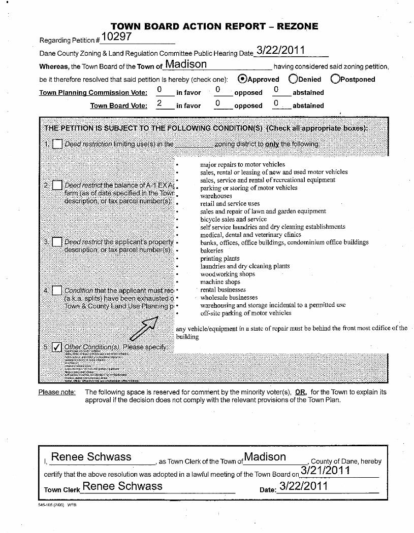
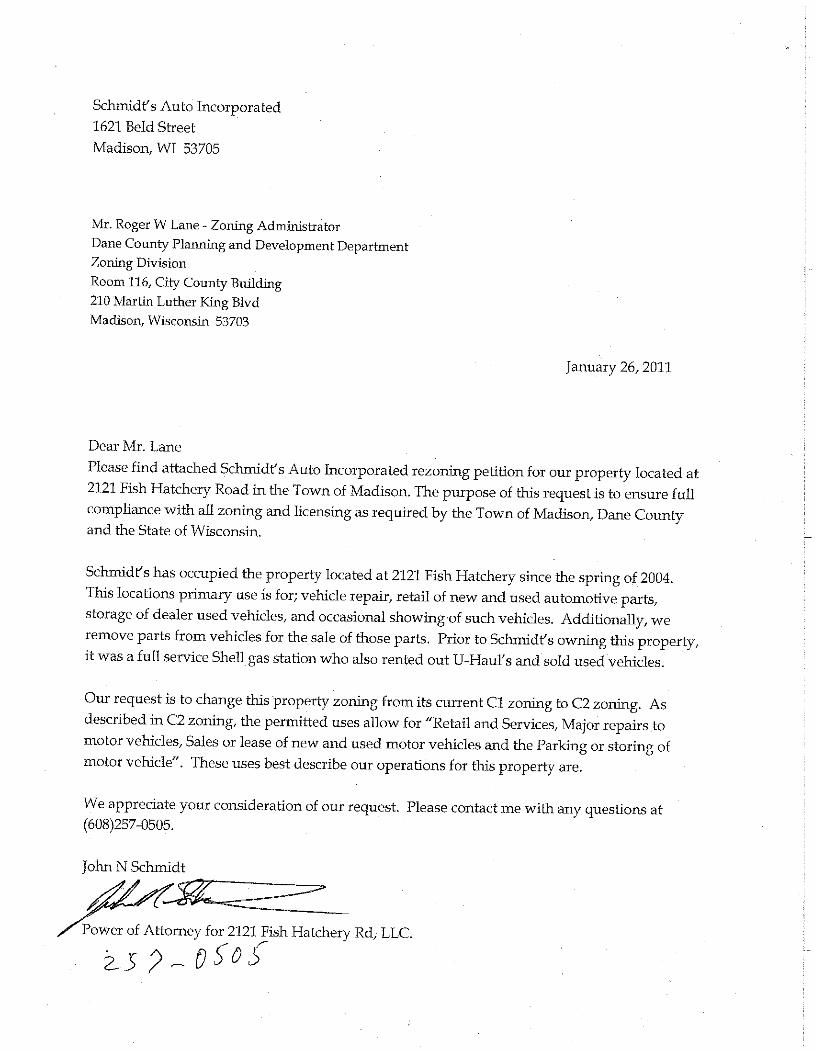
11. PETITION # 10297 by 2121 FISH HATCHERY ROAD LLC to change the zoning from C-1 Commercial to
C-2 Commercial to allow ZONING COMPLIANCE FOR AN EXISTING BUSINESS on the property located at 2121 FISH HATCHERY ROAD in Section 35, Town of Madison.
IN FAVOR: John Schmidt OPPOSED: None STAFF: P&D, HWY TOWN: Pending Motion by Eicher / Matano to postpone; motion carried, 4-0.
12. CONDITIONAL USE PERMIT # 2165 by JEFFREY MRKVICKA to allow a DAY CAMP SCHOOL on the
property located at 2418 DAHLK CIRCLE in Section 25, Town of Springdale.
IN FAVOR: Joan Mrkvicka OPPOSED: None STAFF: P&D, HWY TOWN: Pending Motion by Eicher / Matano to postpone; motion carried, 4-0.
13. ORD. AMEND. NO. 39, 2010-2011: AMENDING CHAPTER 82 OF THE DANE COUNTY CODE OF
ORDINANCES, INCORPORATING THE CITY OF FITCHBURG FARMLAND PRESERVATION PLAN INTO THE DANE COUNTY COMPREHENSIVE PLAN.
IN FAVOR: Jason Schmidt, planner for the City of Fitchburg, explained the high points of the Fitchburg plan. OPPOSED: None Motion by Jensen / Matano to recommend approval; motion carried, 4-0.
14. ORD. AMEND. NO. 37, 2010-2011: Amending Chapter 10, Defining Small Scale Electric Generating
Stations and Requiring a Conditional Use Permit for Such Uses in the A-1 Exclusive Agriculture District. Submitted by Supervisors Downing, and Jensen. Referred to ZONING/LAND REGULATION.
IN FAVOR: None OPPOSED: None Motion by Jensen / Matano to postpone to allow time for Town input; motion carried, 4-0.
ZLR Committee Public Hearing Agenda Page 5 of 12 March 22, 2011 IV. REZONE AND CONDITIONAL USE PERMIT APPLICATIONS FROM PREVIOUS MEETINGS
1. PETITION # 10277 by J & A LLC to change the zoning from RH-2 Rural Homes and RH-3 Rural Homes to RH-1 Rural Homes and RH-2 Rural Homes to allow RECONFIGURATION OF EXISTING LOT LINES on the property located at 3919 AND 3913 TIMBER LANE in Section 24, Town of Cross Plains.
TOWN: Approved with no conditions. Motion by Jensen / Matano to recommend approval; motion carried, 4-0.
V. PLATS AND CERTIFIED SURVEY MAPS
1. PRELIMINARY PLATS: None. 2. FINAL PLATS: a. Replat of East Metro Business Park, Town of Burke, Section 5
(8 lots) (49 acres) (Application deadline 4/16/2011) Staff recommends approval. Motion by Matano / Eicher to approve, subject to the following conditions; motion carried, 4-0 1. Compliance with the Dane County Comprehensive Plan is to be established.
2. Evidence of required zoning is to be established (publication in the official newspaper). Said
publication is to include a specific legal description.
3. All lots and outlots are to meet the minimum area and width requirements of the zoning districts that are applicable.
4. Lot boundaries and zoning district boundaries are to be coterminous.
5. Compliance with Ch. 14.45 DCCO, Erosion Control Plans is to be established.
6. Compliance with Ch. 14.46 DCCO, Stormwater Control Permits is to be established.
7. Utility easements are to be provided.
8. Town of Burke approval is to be obtained prior to execution of final plat.
9. Village of DeForest approval is to be obtained with respect to extraterritorial jurisdiction prior to
execution of final plat.
10. Wisconsin Department of Transportation certification of non-objection is to be obtained.
11. A notation is to be affixed to the document “Lands covered by this subdivision plat are within an area subject to height limitations owing to the operation of aircraft and equipment from a nearby airport. Owners of lands within the area covered by this subdivision plat are required by law to restrict trees, other vegetation and man made structures to less than the height limitations set forth in that certain map dated April 24, 2008, entitled “height limitation zoning map, Dane County Regional Truax Field, Madison, Wisconsin”, said map being on file in the Dane County Clerks office.”
12. The final plat must be submitted within thirty-six (36) months from the approval date of the preliminary
plat and in the case of preliminary plats given conditional approval, all conditions must be met. 3. PRELIMINARY CERTIFIED SURVEY MAPS:
ZLR Committee Public Hearing Agenda Page 6 of 12 March 22, 2011
Motion by Matano / Eicher to separate item d due to the rezone application being denied; motion carried, 4-0. Motion by Eicher / Matano to approve the preliminary Certified Survey Maps listed as a thru c and e thru j subject to the following conditions; motion carried, 4-0. a. APPLICATION # 9254, Robert Johnson, Town of Christiana, Section 2 (1 lot, 1.5 acres) 1. Rezone Petition #10285 is to become effective (one day following publication in the Wisconsin State Journal) and all conditions established with Zoning Petition #10285 are to be timely satisfied. 2. The document is to be completed in accordance with S.236.34, Wisconsin State Statutes. 3. The net lot area calculation is to be specified in square feet. 4. The distance to the centerline of Rodney Road right-of-way is to be shown. 5. An owners certificate in accordance with S. 236.21(2), Wisconsin State Statutes is to be included. 6. The owners certificate is to include “we also certify that this certified survey map is required by 75.17(1)(a), Dane County Code of Ordinances to be submitted to the Dane County Zoning and Land Regulation Committee for approval. 7. All owners of record are to be included in the owner’s certificate. (County records indicate that ROBERT H JOHNSON is the owner). Middle initials are required to provide valid certificates. 8. A Town of Christiana approval certificate is to be included. 9. A Village of Cambridge approval certificate is to be included with respect to the extraterritorial jurisdiction. 10. The required certificates are to be executed. 11. “Approved for recording per Dane County Zoning & Land Regulation Committee action of ______________, by ______________, Authorized Representative” is to be included. 12. The notation “refer to building site information contained in the Dane County Soil Survey” is to be included on the document. 13. Dane County Surveyor approvals are to be obtained. When all revisions are complete, please submit a copy to the Dane County Surveyor for technical review and approval. 14. The recordable document is to be submitted for review and approval. b. APPLICATION # 9259, Harley Stokstad, Town of Rutland, Section 8 (1 lot, 2.4 acres) 1. Rezone Petition #10286 is to become effective (one day following publication in the Wisconsin State Journal) and all conditions, if any established with Zoning Petition #10286 are to be timely satisfied. Recording of a Certified Survey Map. 2. The document is to be completed in accordance with S.236.34, Wisconsin State Statutes. 3. The net lot area calculations are to be specified in square feet. 4. Lot 1 is to have a minimum lot size of 2.0 net acres, excluding the road right-of-way.
ZLR Committee Public Hearing Agenda Page 7 of 12 March 22, 2011
5. The distance to the centerline of Sunrise Road right-of-way is to be dimensioned. 6. Existing buildings are to be identified and dimensioned to the nearest 0.1 foot in relation to proposed property boundaries. 7. The approximate location of the on-site septic system is to be shown. 8. An owners certificate in accordance with S. 236.21(2), Wisconsin State Statutes is to be included. 9. The owners certificate is to include “we also certify that this certified survey map is required by 75.17(1)(a), Dane County Code of Ordinances to be submitted to the Dane County Zoning and Land Regulation Committee for approval. 10. All owners of record are to be included in the owner’s certificate. (County records indicate that STOKSTAD REV TR, HARLEY & BARBARA is the owner. Spouse’s signatures and middle initials are required to provide valid certificates. 11. Town of Rutland approval certificate is to be included. 12. The required certificates are to be executed prior to final submittal. 13. “Approved for recording per Dane County Zoning & Land Regulation Committee action of ______________, by ______________, Authorized Representative” is to be included. Please include an area for the authorized name to be printed underneath. 14. A notation is to be affixed to the document “refer to building site information contained in the Dane County Soil Survey.” 15. Dane County Surveyor approvals are to be obtained. When all revisions are complete, you will need to submit a copy to the Dane County Surveyor for technical review and approval. 16. The recordable document is to be submitted for review and approval. c. APPLICATION # 9262, Robert Everson, Town of Rutland, Section 3 (1 lot, 9.3 acres) 1. Rezone Petition #10289 is to become effective (one day following publication in the Wisconsin State Journal) and all conditions, if any established with Zoning Petition #10289 are to be timely satisfied. 2. The document is to be completed in accordance with S.236.34, Wisconsin State Statutes. 3. The net lot area calculations are to be specified in square feet. 4. Lot 1 is to have a minimum lot size of 8.0 net acres, excluding the road right-of-way. 5. Existing buildings are to be identified and dimensioned to the nearest 0.1 foot in relation to proposed property boundaries. 6. The approximate location of the on-site septic system is to be shown. 7. The final document shall show contour 906’ NAD 1983, vertical datum. The eastern and southern portion of proposed lot 1 is within a floodzone district. The floodzone follows contour elevation 906’. 8. A notation shall be included on the final document that references the floodzone as zone A, panel # 55025C0620G. 9. An owners certificate in accordance with S. 236.21(2), Wisconsin State Statutes is to be included. 10. The owners certificate is to include “we also certify that this certified survey map is required by 75.17(1)(a), Dane County Code of Ordinances to be submitted to the Dane County Zoning and Land Regulation Committee for approval.
ZLR Committee Public Hearing Agenda Page 8 of 12 March 22, 2011
11. All owners of record are to be included in the owner’s certificate. (County records indicate that ROBERT W EVERSON JR & KATHRYN C EVERSON is the owner. Spouse’s signatures and middle initials are required to provide valid certificates. 12. Town of Rutland approval certificate is to be included. 13. The required certificates are to be executed prior to final submittal. 14. “Approved for recording per Dane County Zoning & Land Regulation Committee action of ______________, by ______________, Authorized Representative” is to be included. Please include an area for the authorized name to be printed underneath. 15. A notation is to be affixed to the document “refer to building site information contained in the Dane County Soil Survey.” 16. Dane County Surveyor approvals are to be obtained. When all revisions are complete, you will need to submit a copy to the Dane County Surveyor for technical review and approval. 17. The recordable document is to be submitted for review and approval. e. APPLICATION # 9270, Don Tierney, Town of Windsor, Section 25 (1 lot, 1.4 acres) 1. The document is to be completed in accordance with S.236.34, Wisconsin State Statutes. Name and address of the individual dividing lands is to be included. 2. The recorded document number is to be shown in regards to the 12-foot utility easement. 3. Building setbacks are to be removed. 4. All owners of record are to be included in the owner’s certificate. (County records indicate that DONALD C TIERNEY & JOANNE K TIERNEY is the owner). Spouse’s signature and middle initials are required to provide valid certificates. 5. The required certificates are to be executed. 6. A notation is to be affixed to the document “refer to building site information contained in the Dane County Soil Survey.” 7. Comments from the Dane County Surveyor are to be satisfied: Setbacks are subject to change and should not be included on the recorded document. 8. The recordable document is to be submitted for review and approval. f. APPLICATION # 9271, Steve Williams, Town of Rutland, Section 7 (3 lots, 19.6 acres) 1. Rezone Petition #10267 is to become effective (one day following publication in the Wisconsin State Journal) and all conditions established with Zoning Petition #10267 are to be timely satisfied. Recording of an approved Certified Survey Map. Recording of a Deed Restriction Joint driveway to be recorded. Payment of Rezone Conversion Fees. 2. The document is to be completed in accordance with S.236.34, Wisconsin State Statutes. 3. The net lot area calculations are to be specified in square feet.
ZLR Committee Public Hearing Agenda Page 9 of 12 March 22, 2011
4. Existing buildings shall be dimensioned to the nearest 0.1-foot in relation to proposed property boundaries. 5. The approximate location of the on-site septic system is to be shown. 6. Comments from Wisconsin Department of Transportation are to be recognized. No additional access points will be granted. Trans 233 notes regarding access restriction, setback restriction and noise are to be included. 7. Comments from Public Health Department are to be recognized. A septic easement is to be shown on the final document allowing for the septic system to be located on proposed lot 3 that serves the residence on proposed lot 2. 8. All owners of record are to be included in the owner’s certificate. (County records indicate that STEVEN A WILLIAMS & DONNA M WILLIAMS is the owner. Spouse’s signatures and middle initials are required to provide valid certificates. 9. The required certificates are to be executed prior to final submittal. 10. A notation is to be affixed to the document “refer to building site information contained in the Dane County Soil Survey.” 11. Dane County Surveyor approvals are to be obtained. When all revisions are complete, submit a copy to the Dane County Surveyor for technical review and approval. 12. The recordable document is to be submitted for review and approval. 13. Remove City of Middleton form the Surveyor’s Certificate. g. APPLICATION # 9272, DL Evans, Town of Middleton, Section 25 (2 lots, 2.2 acres) 1. The document is to be completed in accordance with S.236.34, Wisconsin State Statutes. 2. The net lot area calculations are to be specified in square feet. 3. Existing buildings shall be dimensioned to the nearest 0.1-foot in relation to proposed property boundaries. 4. Compliance with respect to DCCO 10.14(4)(b) is to be established. Any building together with its accessory building shall not cover more than sixty percent (60%) of the lot area. Proposed lot 1 - building covers 61 % of lot area. Proposed lot 2 - building covers 53 % of lot area. 5. The Corporate Owner’s certificate is to include “we also certify that this certified survey map is required by S. 75.17 (1)(a), Dane County Code of Ordinances to be submitted to the Dane County Zoning and Land Regulation Committee for approval.” 6. All owners of record are to be included in the owner’s certificate. (County records indicate that REYNOLDS PROPERTIES INC. is the owner. Middle initials are required to provide valid certificates. 7. Prior to final approval of the CSM, a Town of Middleton document vacating the roadway is to be recorded with the Register of Deeds. 8. The required certificates are to be executed prior to final submittal. 9. “Approved for recording per Dane County Zoning & Land Regulation Committee action of ______________, by ______________, Authorized Representative” is to be included.
ZLR Committee Public Hearing Agenda Page 10 of 12 March 22, 2011
10. Dane County Surveyor approvals are to be obtained. When all revisions are complete, submit a copy to the Dane County Surveyor for technical review and approval. 11. The recordable document is to be submitted for review and approval. h. APPLICATION # 9273, Patrick Coffey, Town of Cottage Grove, Section 12 (3 lots, 30 acres) 1. Rezone Petition #10263 is to become effective (one day following publication in the Wisconsin State Journal) and all conditions established with Zoning Petition #10234 are to be timely satisfied. A shared driveway agreement shall be recorded. An approved Certified Survey Map shall be recorded. Payment of Rezone Conversion Fees. Deed Restriction is to be recorded. 2. The document is to be completed in accordance with S.236.34, Wisconsin State Statutes. 3. The net lot area calculations are to be specified in square feet. 4. Lot’s 1 and 2 are to be 2.0 net acres, excluding the road right-of-way. 5. A portion of proposed lot 2 and lot 3 are within a floodplain district. A notation shall be included on the final document that references the floodplain as zone AE, panel # 55025CO459G. 6. Please include the recorded document # regarding the access easement. 7. An owners certificate in accordance with S. 236.21(2), Wisconsin State Statutes is to be included. 8. The owners certificate is to include “we also certify that this certified survey map is required by 75.17(1)(a), Dane County Code of Ordinances to be submitted to the Dane County Zoning and Land Regulation Committee for approval. 9. All owners of record are to be included in the owner’s certificate. County records indicate that PATRICK W COFFEY & PEGGY J COFFEY is the owner. Spouse’s signature and middle initials are required to provide valid certificates. 10. A Town of Cottage Grove approval certificate is to be included and satisfied. 11. The required certificates are to be executed prior to final submittal. 12. The notation “refer to building site information contained in the Dane County Soil Survey” is to be included on the document. 13. “Approved for recording per Dane County Zoning & Land Regulation Committee action of ______________, by ______________, Authorized Representative” is to be included. 14. Dane County Surveyor approvals are to be obtained. When all revisions are complete, submit a copy to the Dane County Surveyor for technical review and approval. 15. The recordable document is to be submitted for review and approval. i. APPLICATION # 9274, Kevin Uphoff, Town of Cottage Grove, Section 14 (3 lots, 6.0 acres) 1. Rezone Petition #10261 is to become effective (one day following publication in the Wisconsin State Journal) and all conditions established with Zoning Petition #10261 are to be timely satisfied. An approved Certified Survey Map shall be recorded. A joint driveway agreement shall be recorded. Payment of Rezone Conversion Fees.
ZLR Committee Public Hearing Agenda Page 11 of 12 March 22, 2011
Deed Notice is to be recorded. 2. The document is to be completed in accordance with S.236.34, Wisconsin State Statutes. 3. The net lot area calculations are to be specified in square feet. 4. Lot’s 1, 2 and 3 are to be 2.0 net acres, excluding the road right-of-way. 5. The distance to the centerline of Ridge Road right-of-way is to be shown. 6. An owners certificate in accordance with S. 236.21(2), Wisconsin State Statutes is to be included. 7. The owners certificate is to include “we also certify that this certified survey map is required by 75.17(1)(a), Dane County Code of Ordinances to be submitted to the Dane County Zoning and Land Regulation Committee for approval. 8. All owners of record are to be included in the owner’s certificate. (County records indicate that KENDAL UPHOFF & DONNA UPHOFF is the owner). Spouse’s signature and middle initials are required to provide valid certificates. 9. The Town of Cottage Grove approval certificate is to be included. 10. The Village of Cottage Grove approval certificate is to be included with respect to extraterritorial jurisdiction. 11. The required certificates are to be executed. 12. “Approved for recording per Dane County Zoning & Land Regulation Committee action of ______________, by ______________, Authorized Representative” is to be included. 13. A notation is to be affixed to the document “refer to building site information contained in the Dane County Soil Survey.” 14. All references to zoning are to be removed from the final document. 15. Dane County Surveyor approvals are to be obtained. When all revisions are complete, submit a copy to the Dane County Surveyor for technical review and approval. 16. The recordable document is to be submitted for review and approval. j. APPLICATION # 9275, PC Farm Holdings II, Town of Windsor, Section 28/33 (2 lots, 6.2 acres)
1. The document is to be completed in accordance with S.236.34, Wisconsin State Statutes. 2. The net lot area calculations are to be specified in square feet. 3. The distance to the centerline of Reardon Road right-of-way is to be shown. 4. Proposed street names with respect to Ch. 76 of the Dane County Code of Ordinances are to be assigned. Dane County Surveyor approval of Pederson Crossing is to be obtained. 5. All owners of record are to be included in the owner’s certificate. (County records indicate that PC FARM HOLDINGS II LLC is the owner. Middle initials are required to provide valid certificates. 6. The required certificates are to be executed prior to final submittal. 7. Dane County Surveyor approvals are to be obtained. When all revisions are complete, submit a copy to the Dane County Surveyor for technical review and approval.
ZLR Committee Public Hearing Agenda Page 12 of 12 March 22, 2011
8. The recordable document is to be submitted for review and approval. d. APPLICATION # 9263, Properties on Fish Lake, Town of Roxbury, Section 18 (3 lots, 16 acres) Motion by Matano / Eicher to postpone the preliminary Certified Survey Maps listed as item d; motion carried, 4-0. 4. CERTIFIED SURVEY MAPS: Motion by Jensen / Matano to approve final Certified Survey Maps listed a thru d; motion carried, 5-0. Chair Miles signed the Certified Survey Maps. a. APPLICATION # 9242, Jean Bjorenson, Town of Sun Prairie, Section 19 (2 lots, 9.5 acres) b. APPLICATION # 9244, Meinholz Family Trust, Town of Springfield, Section 29 (1 lot, 6.0 acres) c. APPLICATION # 9260, Wayne Reamer, Town of Medina, Section 29 (2 lots, 34.7 acres) d. APPLICATION # 9261, Fox Bluff LLC, Town of Westport, Section 5
(2 lots, 5.8 acres) VI. RESOLUTIONS
1. None. VII. ORDINANCE AMENDMENTS
1. ORDINANCE AMENDMENT NO. 39, 2010-2011: Amending Chapter 82 of the Dane County Code of Ordinances, Incorporation of the City of Fitchburg Farmland Preservation Plan into the Dane County Comprehensive Plan.
See action above.
2. ORDINANCE AMENDMENT NO. 37, 2010-2011: Amending Chapter 10, Defining Small Scale Electric
Generating Stations and Requiring a Conditional Use Permit for Such Uses in the A-1 Exclusive Agriculture District. Submitted by Supervisors Downing, and Jensen. Referred to ZONING/LAND REGULATION.
See action above.
VIII. OTHER BUSINESS
1. Review and discuss proposed policies regarding Land Division Review, specifically, Certified Survey Map applications.
The committee reviewed proposed policies regarding the CSM process and a land division flowchart.
IX. ADJOURN
Motion by Matano / Eicher to adjourn the meeting at 9:03pm; motion carried, 4-0.
Roger Lane, Recording Secretary Minutes filed with the County Clerk 03/23/11 Note: These minutes are the notes of the recorder and are subject to change at a subsequent meeting of the committee.
TOWN ACTION RECOMMENDATION
ZLR COMMITTEE ACTION - REZONING ZLR CUP APPROVAL
Approved ______________________________ Postponed _____________________________________ Appoved As Specified by Town Approve Cond/Amnd Town Cond/Amnd Comm Con by ZLR DENY
Denied ______________________________ As Ccnditioned _____________________________ Date________________ ___________________________________________ COUNTY BOARD ACTION Subject To: Amended Changed Zone Dist. _______________ REZONING Conditions Amendments Changed Boundary Description Referred Date________________ Approved Amended on Floor IF CUP: DENY DENY County Board Agenda Item Conditions None Vote Action Date ________________________ _____-_____
STAFF REPORT DANE COUNTY ZONING & LAND REGULATION COMMITTEE
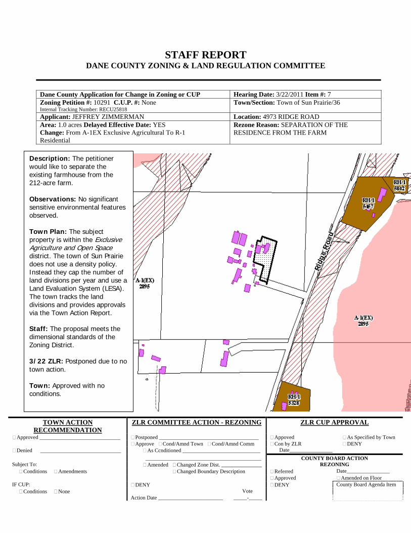
Dane County Application for Change in Zoning or CUP Hearing Date: 3/22/2011 Item #: 7 Zoning Petition #: 10291 C.U.P. #: None Internal Tracking Number: RECU25818
Town/Section: Town of Sun Prairie/36
Applicant: JEFFREY ZIMMERMAN Location: 4973 RIDGE ROAD Area: 1.0 acres Delayed Effective Date: YES Change: From A-1EX Exclusive Agricultural To R-1 Residential
Rezone Reason: SEPARATION OF THE RESIDENCE FROM THE FARM
Description: The petitioner would like to separate the existing farmhouse from the 212-acre farm. Observations: No significant sensitive environmental features observed. Town Plan: The subject property is within the Exclusive Agriculture and Open Space district. The town of Sun Prairie does not use a density policy. Instead they cap the number of land divisions per year and use a Land Evaluation System (LESA). The town tracks the land divisions and provides approvals via the Town Action Report. Staff: The proposal meets the dimensional standards of the Zoning District. 3/22 ZLR: Postponed due to no town action. Town: Approved with no conditions.
545-105 (2/06) WEB
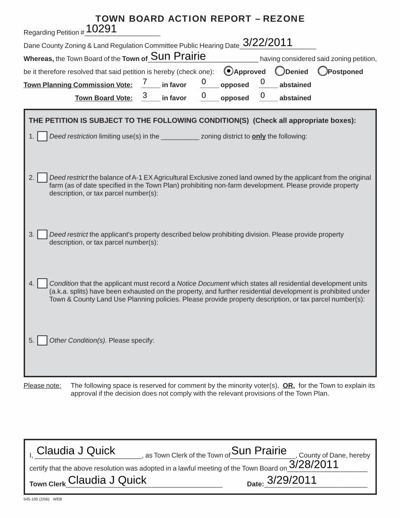
TOWN BOARD ACTION REPORT – REZONERegarding Petition #____________________
Dane County Zoning & Land Regulation Committee Public Hearing Date____________________
Whereas, the Town Board of the Town of_____________________________ having considered said zoning petition,
be it therefore resolved that said petition is hereby (check one): ❑ Approved ❑ Denied ❑ Postponed
Town Planning Commission Vote: _____ in favor _____ opposed _____ abstained
Town Board Vote: _____ in favor _____ opposed _____ abstained
Please note: The following space is reserved for comment by the minority voter(s), OR, for the Town to explain itsapproval if the decision does not comply with the relevant provisions of the Town Plan.
THE PETITION IS SUBJECT TO THE FOLLOWING CONDITION(S) (Check all appropriate boxes):
1. ❑ Deed restriction limiting use(s) in the __________ zoning district to only the following:
2. ❑ Deed restrict the balance of A-1 EX Agricultural Exclusive zoned land owned by the applicant from the originalfarm (as of date specified in the Town Plan) prohibiting non-farm development. Please provide propertydescription, or tax parcel number(s):
3. ❑ Deed restrict the applicant's property described below prohibiting division. Please provide propertydescription, or tax parcel number(s):
4. ❑ Condition that the applicant must record a Notice Document which states all residential development units(a.k.a. splits) have been exhausted on the property, and further residential development is prohibited underTown & County Land Use Planning policies. Please provide property description, or tax parcel number(s):
5. ❑ Other Condition(s). Please specify:
I, ____________________________, as Town Clerk of the Town of_________________, County of Dane, hereby
certify that the above resolution was adopted in a lawful meeting of the Town Board on_____________________
Town Clerk_________________________________________ Date:___________________________
102913/22/2011
Sun Prairie
Claudia J Quick Sun Prairie3/28/2011
Claudia J Quick 3/29/2011
7 0 0
3 0 0


TOWN ACTION RECOMMENDATION
ZLR COMMITTEE ACTION - REZONING ZLR CUP APPROVAL
Approved ______________________________ Postponed _____________________________________ Appoved As Specified by Town Approve Cond/Amnd Town Cond/Amnd Comm Con by ZLR DENY
Denied ______________________________ As Ccnditioned _____________________________ Date________________ ___________________________________________ COUNTY BOARD ACTION Subject To: Amended Changed Zone Dist. _______________ REZONING Conditions Amendments Changed Boundary Description Referred Date________________ Approved Amended on Floor IF CUP: DENY DENY County Board Agenda Item Conditions None Vote Action Date ________________________ _____-_____
STAFF REPORT DANE COUNTY ZONING & LAND REGULATION COMMITTEE
Dane County Application for Change in Zoning or CUP Hearing Date: 3/22/2011 Item #: 10 Zoning Petition #: 10296 C.U.P. #: None Internal Tracking Number: RECU25823
Town/Section: Town of Roxbury/03
Applicant: PROPERTIES ON FISH LAKE LLC Location: WEST OF 8623 SCHOEPP ROAD Area: 16 acres Delayed Effective Date: YES Change: From RH-3 Rural Homes To RH-2 Rural Homes
Rezone Reason: DIVISION OF AN EXISTING PARCEL INTO THREE RESIDENTIAL LOTS
Description: The petitioner would like to create 3 residential lots on the shores of Fish Lake. Observations: Fish Lake has been experiencing fluctuations in the lake elevation. It has been identified that the lake level has been increasing 2/10th of a foot a year for over the past 50 years. In 2009, the lake elevation was recorded at 862 feet. Given the changes in elevation, it is difficult to determine a reasonably safe elevation for which development can occur without being flooded. The northerly portion of the property that is currently being cropped has Class II soils. Town Plan: The Town Plan designates this area as a Residential Development Area. Lots shall be 1.5 to 5 acres is size. Staff: Staff is concerned with the future flooding potential of these sites. To offer a reasonable solution, staff suggests placing a deed restriction on the property and a note on the CSM that restricts dwelling construction below 867 feet ASL until such time as a base flood elevation is established by the DNR for Fish Lake. The proposal meets the dimensional standards of the zoning district. Town: Approved with conditions.
Page 1 of 2
Room 116, City-County Building, Madison, Wisconsin 53703 Fax (608) 267-1540
TO: Zoning and Land Regulation Committee FROM: Roger Lane, Dane County Zoning Administrator SUBJECT: Requested information regarding Fish Lake (Zoning Petition #10296) DATE: March 30, 2011 CC: Agent for Zoning Petition 310296
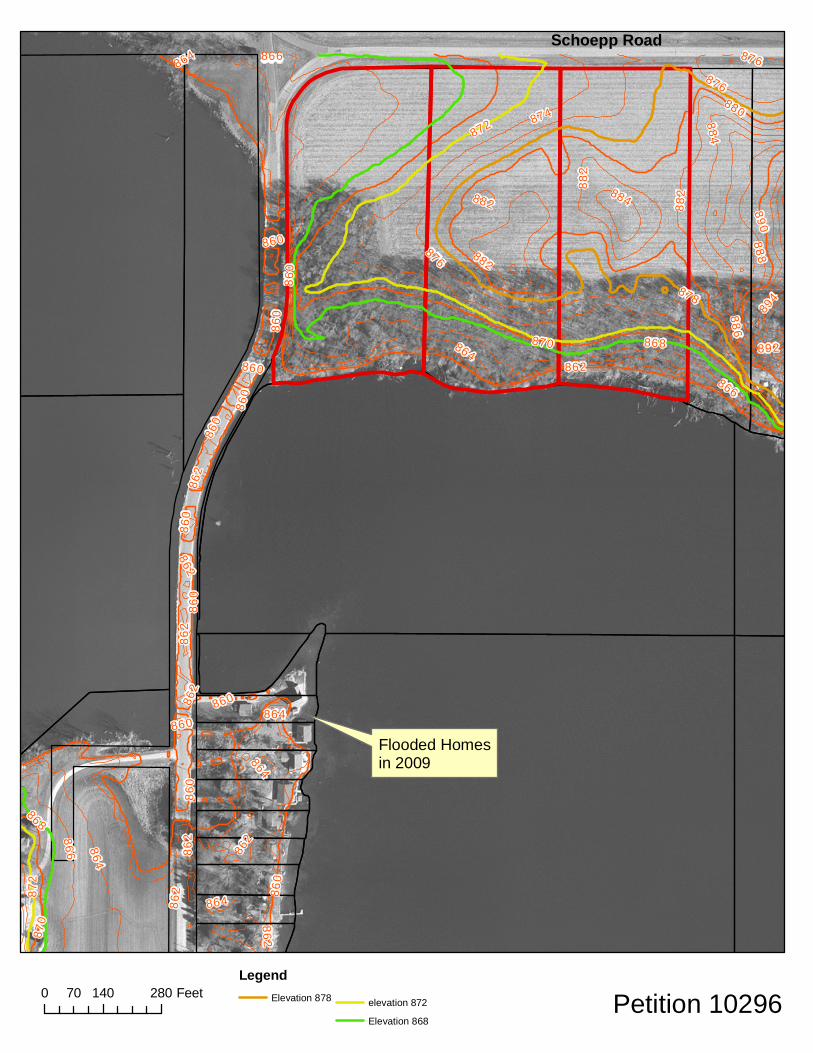
At the March 22, 2011 Zoning and Land Regulation Committee meeting, the Committee postponed Zoning Petition #10296 due to concerns of the possible flooding potential of the proposed residential lots abutting Fish Lake. Additional information was requested regarding the fluctuating lake levels of Fish Lake and the topography of the area. Fish Lake is located in Section 3 and 4 in the Town of Roxbury. It is a seepage lake, meaning that it does not have a surface-water inlet or outlet. The northwest basin of Fish Lake is known as Mud Lake. Although Fish Lake and Mud Lake are separated by Fish Lake Road, both water bodies are connected by a series of culverts located under Fish Lake Road. Both lakes cover approximately 350 acres with Fish Lake having a maximum depth of 50 feet and Mud Lake having an average depth of 10 feet. The lake is identified on FEMA Flood Insurance Rate Maps as a “Zone A” Flood Hazard Area. This designation identifies that this area has an undetermined base flood elevation. Given the unique characteristics of the lake levels, Fish Lake has been studied intermittently since 1966. The Zoning Division found lake level data recorded by the WDNR from 1975 to 1986 (see attached). This data shows the lake level increasing on the average of 2/10th’s of a foot per year over a 10-year period. In 1993, WDNR studied the lake to set a “guesstimate” base flood elevation (BFE) for Fish Lake. The BFE was set at 959.6 feet. Due to recent flooding events, this “guesstimate” BFE is no longer valid due to the lake levels exceeding this anticipated flood elevation. In 2002, USGS conducted a study on the lake to analyze the hydrology of the lake and what effect, if any, would result in the dewatering (pumping) the of lake. Their conclusion was that the lake level of Fish Lake would be reduced approximately 1.4 feet after pumping 500 gallons/minute for a period of one year. However, the study also concludes that the lake level would recover to its original level due to the lake being hydraulically connected to the ground-water-flow system. In March of 2009, a flood event occurred at Fish Lake that affected 6 residential dwellings along the western edge of the lake, Fish Lake Road. The lake level rose to 861.8 feet and damaged five of these residences in excess of 50% of their assessed value. In conjunction with grants from FEMA and the State of Wisconsin, Dane County was able to “buyout” these properties and remove the damaged structures. Currently, there are 7 homes remaining along this stretch of land that may become damaged if the lake level rises above its current elevation, which is at 861.2 feet. Since the 2009 flood event, Dane County Zoning Division has been corresponding with Wisconsin DNR Flood Management personnel to establish a base flood elevation for Fish Lake to reasonably assure future development would not be affected by a flood event or fluctuations in the lake level. After several months of evaluating data, the DNR was in agreement with suggested elevations noted in the November
Page 2 of 2
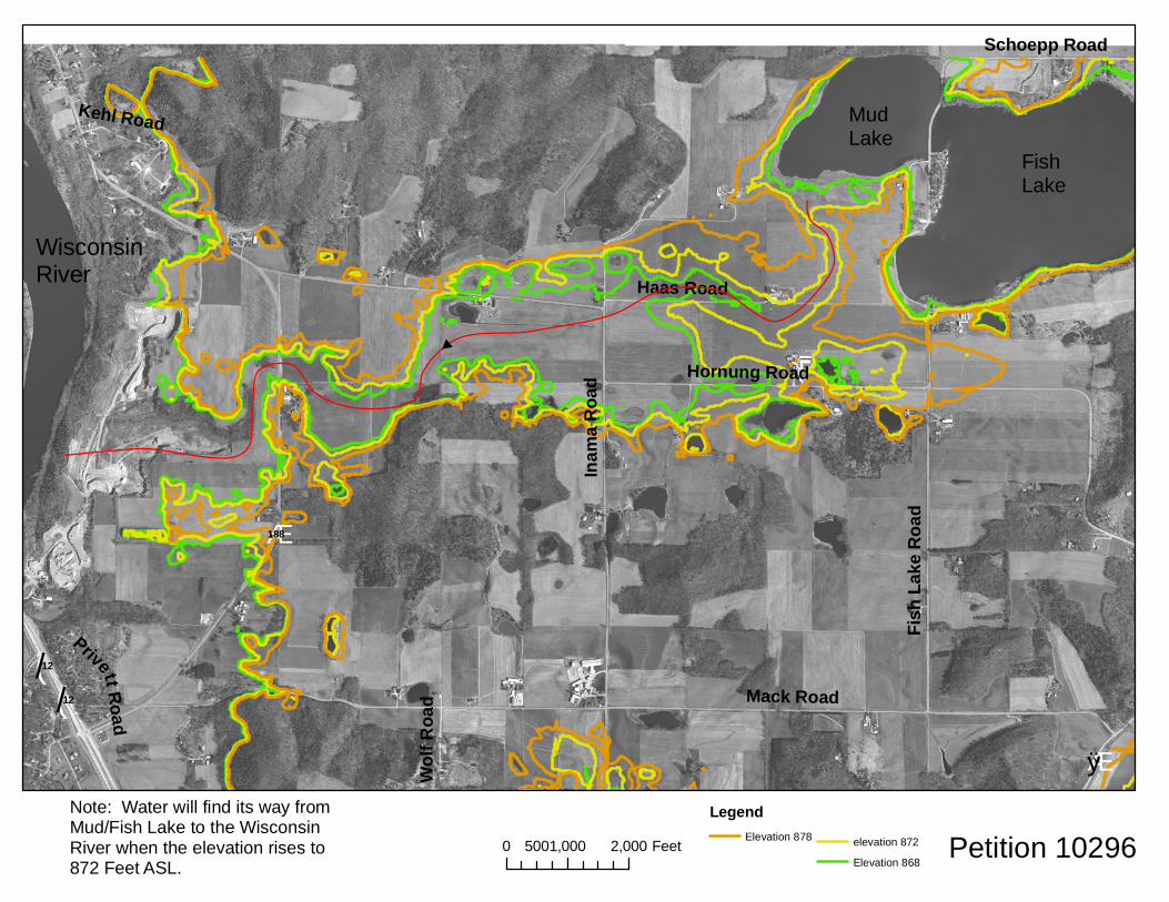
16, 2009 letter from Zoning Administrator Lane to Konny Margovsky of the DNR. See attached letter. The Base Flood Elevation proposed for Fish Lake was to be set at 867.4 feet. However, the acceptance of the determination was placed on hold due to opposition expressed by the residents along Fish Lake. Given that the Base Flood Elevation was not established, any development (new construction) proposed will need to have an independent flood study performed in order to establish a Base Flood Elevation in this Flood Hazard Zone around Fish Lake. With the pending Zoning Petition #10296, Staff has reviewed the topography around Fish Lake. In a worst-case scenario, the Fish Lake seepage basin would need to fill to an elevation of 872 feet before the lake waters would begin to flow west, journeying to the shores of the Wisconsin River. See attached elevation map depicting elevations 868, 872, and 878. The map shows the pathway to the Wisconsin River. Conclusion The land identified under Zoning Petition #10296 rises to an elevation of 884 feet. There are areas within this petition boundary that could be developed with reasonably assurance that flooding would not occur.


Room 116, City-County Building, Madison, Wisconsin 53703 Fax (608) 267-1540
Housing & Economic Development (608)266-4270, Rm. 362 Planning (608)266-4251, Rm. 116 Records & Support (608)266-4251, Rm. 116 Zoning (608)266-4266, Rm. 116
November 16, 2009
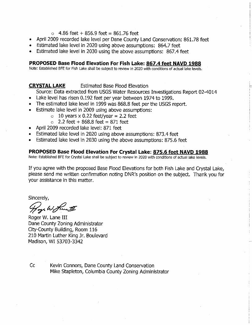
Konny Margovsky WDNR Service Center 1500 N Johns Street Dodgeville, WI 53533 RE: Updating Estimated 100-year Flood Elevations for Fish and Crystal Lake Dear Mr. Margovsky, Dane County Zoning Division is in the process of revising our public summary list of the Base Flood Elevations for various lakes in Dane County. For most lakes, the stillwater elevation information found in the FEMA Flood Insurance Study, page 24, is disseminated to the public. However, Dane County has two lakes that are not listed in the Study and occasionally have development occurring around them. These lakes are Fish Lake and Crystal Lake. They are located in the Town of Roxbury. The FEMA FIRM designates these two lakes as Flood Hazard Zone A with an undetermined flood elevation. In 1998, the DNR made a determination of the estimated flood elevations for these lakes. Unfortunately, these flood elevations have now become the standard lake elevation given the rising waters of these seepage lakes. The current estimated flood elevations give no leeway for water level fluctuations in a high storm event. I would like to revise the estimated base flood elevations to minimize the potential for flood damage of future construction projects around these lakes. Below is Dane County’s proposal for setting the Base Flood Elevations for Fish Lake and Crystal Lake. We are seeking DNR’s concurrence with the proposed elevations to establish the Base Flood Elevation for a Zone A Flood Hazard Area per National Flood Insurance Program protocol. Once the elevations are established, Dane County will formally adopt this data as part of our floodplain management regulations. FISH LAKE Estimated Base Flood Elevation Source: Data extracted from USGS Water Resources Investigations Report 02-4014 • Lake level has risen 0.27 feet per year between 1974 and 1991. • The estimated lake level in 1991 was 856.9 feet per the USGS report. • Estimated lake level in 2009 using above assumptions:
o 18 years x 0.27 feet/year = 4.86 feet
(/12
(/12
Æ·188
ÆÿY
Mack Road
Inama
Roa
d
Fish L
ake R
oad
Hornung Road
Haas Road
Schoepp Road
Kehl Road
Wolf R
oad
Privett Road
0 1,000 2,000500 Feet
LegendElevation 878 elevation 872
Elevation 868Petition 10296
WisconsinRiver
MudLake
FishLake
Note: Water will find its way fromMud/Fish Lake to the WisconsinRiver when the elevation rises to 872 Feet ASL.
860
870
880
89087
0
860
860
860
860
860
860
860
860860
860
860
862864
866
868
872 874
876
878
882
884886
888
892
894
864
866
862
866
862
862
884
882
862
864
864
862
862
864
862
872
882
868
864
876
882
876
862
Schoepp Road
0 140 28070 FeetLegend
Elevation 878 elevation 872
Elevation 868Petition 10296
Flooded Homesin 2009

TOWN ACTION RECOMMENDATION
ZLR COMMITTEE ACTION - REZONING ZLR CUP APPROVAL
Approved ______________________________ Postponed _____________________________________ Appoved As Specified by Town Approve Cond/Amnd Town Cond/Amnd Comm Con by ZLR DENY
Denied ______________________________ As Ccnditioned _____________________________ Date________________ ___________________________________________ COUNTY BOARD ACTION Subject To: Amended Changed Zone Dist. _______________ REZONING Conditions Amendments Changed Boundary Description Referred Date________________ Approved Amended on Floor IF CUP: DENY DENY County Board Agenda Item Conditions None Vote Action Date ________________________ _____-_____
STAFF REPORT DANE COUNTY ZONING & LAND REGULATION COMMITTEE
Dane County Application for Change in Zoning or CUP Hearing Date: 3/22/2011 Item #: 11 Zoning Petition #: 10297 C.U.P. #: None Internal Tracking Number: RECU25824
Town/Section: Town of Madison/35
Applicant: 2121 FISH HATCHERY ROAD LLC Location: 2121 FISH HATCHERY ROAD Area: 0.73 acres Delayed Effective Date: NO Change: From C-1 Commercial To C-2 Commercial
Rezone Reason: ZONING COMPLIANCE FOR AN EXISTING BUSINESS
Description: The petitioner would like to license this property to be able to sell used cars from the lot. Currently, the property is used for auto repairs and sales of automotive parts. Observations: The property is part of a developed commercial area. This property in particular has been used for various auto-related activities for over 50 years. Town Plan: The 1978 Town plan does not reference this area. The proposal appears to be consistent with the activities in the general area. Staff: Staff suggests that the land uses be limited to the attached list. 3/22 ZLR: Postponed due to no town action. Town: Approved with limits on uses and the location of repair vehicles.

TOWN ACTION RECOMMENDATION
ZLR COMMITTEE ACTION - REZONING ZLR CUP APPROVAL
Approved ______________________________ Postponed _____________________________________ Appoved As Specified by Town Approve Cond/Amnd Town Cond/Amnd Comm Con by ZLR DENY
Denied ______________________________ As Ccnditioned _____________________________ Date________________ ___________________________________________ COUNTY BOARD ACTION Subject To: Amended Changed Zone Dist. _______________ REZONING Conditions Amendments Changed Boundary Description Referred Date________________ Approved Amended on Floor IF CUP: DENY DENY County Board Agenda Item Conditions None Vote Action Date ________________________ _____-_____
STAFF REPORT DANE COUNTY ZONING & LAND REGULATION COMMITTEE
Dane County Application for Change in Zoning or CUP Hearing Date: 3/22/2011 Item #: 12 Zoning Petition #: None C.U.P. #: 2165 Internal Tracking Number: RECU25825
Town/Section: Town of Springdale/25
Applicant: JEFFREY MRKVICKA Location: 2418 DAHLK CIRCLE Area: 5.1 acres Delayed Effective Date: NO
Proposed Use: DAY CAMP SCHOOL
Description: The petitioner would like to run a small day camp this summer. It is anticipated that a maximum of 20 children will attend the camp. Observations: There is an existing single-family home and barn on the property. The neighboring residence is approximately 250 feet from the barn. No sensitive environmental features observed. Town Plan: The Town Plan designates this area as Residential. The proposal appears to be consistent with land use and economic development policies of the plan. Staff: Staff is suggesting that limits be placed on the number of children, parking, and hours of operation. See attached suggested conditions. 3/22 ZLR: Postponed due to no town action. Town: Approved with 5 conditions.

545-105 (2/06) WEB
TOWN BOARD ACTION REPORT – REZONERegarding Petition #____________________
Dane County Zoning & Land Regulation Committee Public Hearing Date____________________
Whereas, the Town Board of the Town of_____________________________ having considered said zoning petition,
be it therefore resolved that said petition is hereby (check one): ❑ Approved ❑ Denied ❑ Postponed
Town Planning Commission Vote: _____ in favor _____ opposed _____ abstained
Town Board Vote: _____ in favor _____ opposed _____ abstained
Please note: The following space is reserved for comment by the minority voter(s), OR, for the Town to explain itsapproval if the decision does not comply with the relevant provisions of the Town Plan.
THE PETITION IS SUBJECT TO THE FOLLOWING CONDITION(S) (Check all appropriate boxes):
1. ❑ Deed restriction limiting use(s) in the __________ zoning district to only the following:
2. ❑ Deed restrict the balance of A-1 EX Agricultural Exclusive zoned land owned by the applicant from the originalfarm (as of date specified in the Town Plan) prohibiting non-farm development. Please provide propertydescription, or tax parcel number(s):
3. ❑ Deed restrict the applicant's property described below prohibiting division. Please provide propertydescription, or tax parcel number(s):
4. ❑ Condition that the applicant must record a Notice Document which states all residential development units(a.k.a. splits) have been exhausted on the property, and further residential development is prohibited underTown & County Land Use Planning policies. Please provide property description, or tax parcel number(s):
5. ❑ Other Condition(s). Please specify:
I, ____________________________, as Town Clerk of the Town of_________________, County of Dane, hereby
certify that the above resolution was adopted in a lawful meeting of the Town Board on_____________________
Town Clerk_________________________________________ Date:___________________________
C.U.P. 21653/22/2011
Springdale
✔1. The hours of operation of the day camp school shall be limited to 7 a.m. to 6 p.m., Monday through Friday.2. Dates of the operation of the day camp school shall be limited to June 1 through Sept. 15.3. Capacity of the day camp school shall be limited to 15 children.4. Signage shall conform to all pertinent ordinances in the Town of Springdale, Dane County and the State of Wisconsin.5. Adequate off-street parking shall be installed on site to accomodate vehicle parking as required under Dane County Code of Ordinance section 10.18.
Vicki Anderson Springdale3/21/2011
Vicki Anderson 3/21/2011
7 0 0
2 0 0
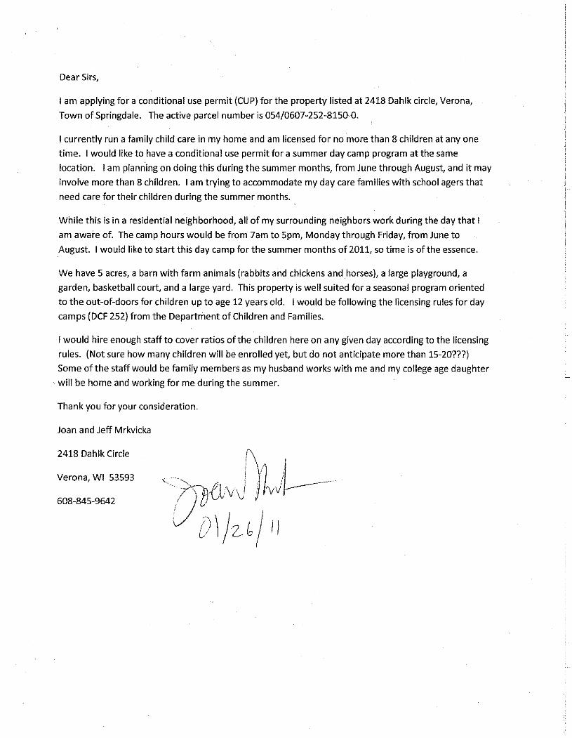
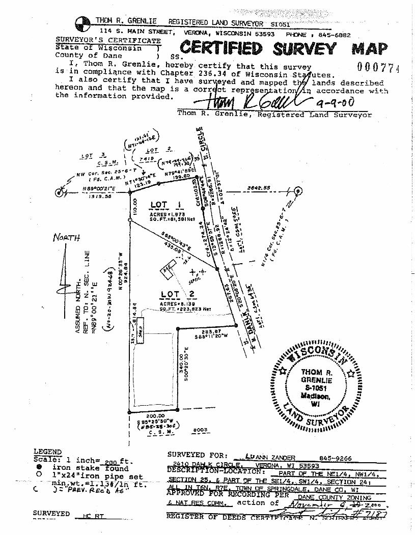
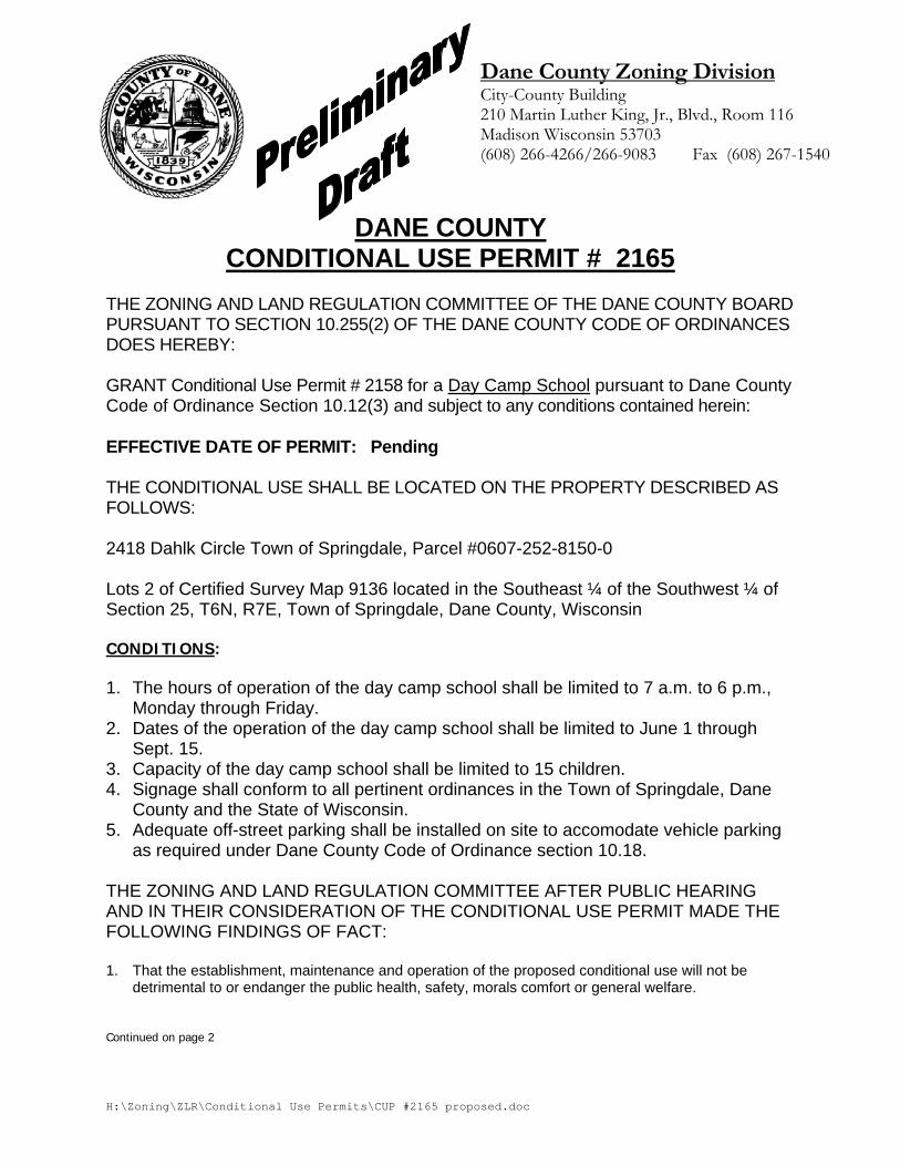
H:\Zoning\ZLR\Conditional Use Permits\CUP #2165 proposed.doc
Dane County Zoning Division City-County Building 210 Martin Luther King, Jr., Blvd., Room 116 Madison Wisconsin 53703 (608) 266-4266/266-9083 Fax (608) 267-1540
DANE COUNTY
CONDITIONAL USE PERMIT # 2165 THE ZONING AND LAND REGULATION COMMITTEE OF THE DANE COUNTY BOARD PURSUANT TO SECTION 10.255(2) OF THE DANE COUNTY CODE OF ORDINANCES DOES HEREBY: GRANT Conditional Use Permit # 2158 for a Day Camp School pursuant to Dane County Code of Ordinance Section 10.12(3) and subject to any conditions contained herein: EFFECTIVE DATE OF PERMIT: Pending THE CONDITIONAL USE SHALL BE LOCATED ON THE PROPERTY DESCRIBED AS FOLLOWS: 2418 Dahlk Circle Town of Springdale, Parcel #0607-252-8150-0 Lots 2 of Certified Survey Map 9136 located in the Southeast ¼ of the Southwest ¼ of Section 25, T6N, R7E, Town of Springdale, Dane County, Wisconsin CONDITIONS: 1. The hours of operation of the day camp school shall be limited to 7 a.m. to 6 p.m.,
Monday through Friday. 2. Dates of the operation of the day camp school shall be limited to June 1 through
Sept. 15. 3. Capacity of the day camp school shall be limited to 15 children. 4. Signage shall conform to all pertinent ordinances in the Town of Springdale, Dane
County and the State of Wisconsin. 5. Adequate off-street parking shall be installed on site to accomodate vehicle parking
as required under Dane County Code of Ordinance section 10.18. THE ZONING AND LAND REGULATION COMMITTEE AFTER PUBLIC HEARING AND IN THEIR CONSIDERATION OF THE CONDITIONAL USE PERMIT MADE THE FOLLOWING FINDINGS OF FACT: 1. That the establishment, maintenance and operation of the proposed conditional use will not be
detrimental to or endanger the public health, safety, morals comfort or general welfare. Continued on page 2
H:\Zoning\ZLR\Conditional Use Permits\CUP #2165 proposed.doc
2. That the uses, values, and enjoyment of other property in the neighborhood for purposes already permitted will not be substantially impaired or diminished by the establishment, maintenance, and operation of the proposed conditional use.
3. That the establishment of the proposed conditional use will not impede the normal and orderly
development and improvement of the surrounding property for uses permitted in the district. 4. That adequate utilities, access roads, drainage and other necessary site improvements will be made. 5. That adequate measures will be taken to provide ingress and egress so designed as to minimize
traffic congestion in the public streets. 6. That the proposed conditional use does conform to all applicable regulations of the district in which it
is proposed to be located.
EXPIRATION OF PERMIT In addition to any time limit established as a condition in granting this CUP, Section 10.25(2)(n) of the Dane County Code of Ordinances provides that any use for which a conditional use permit has been issued, upon its cessation or abandonment for a period of one year, will be deemed to have been terminated and any future use shall be in conformity with the ordinance.
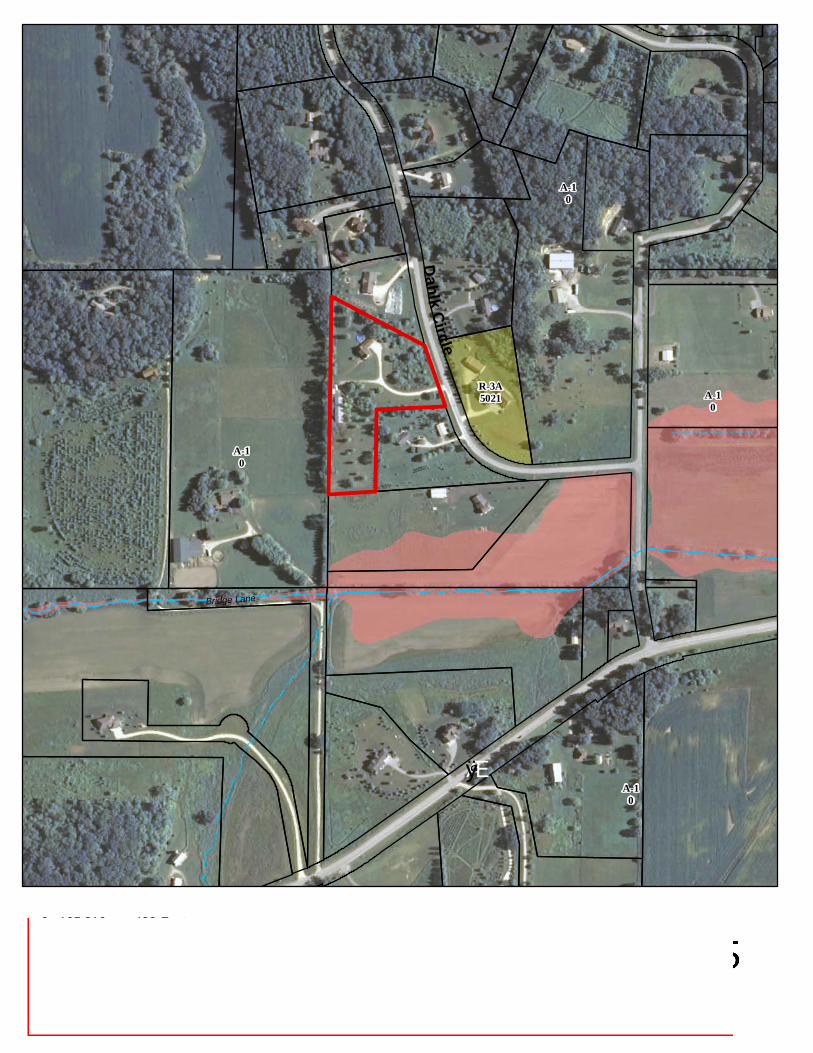
A-10
A-10
A-10
A-10
R-3A5021
ÆÿG
Dahlk Circle
Bridge Lane
²0 210 420105 Feet
LegendWetlands > 2 acres 100-year floodplainCUP 2165
rwl1
Rectangle
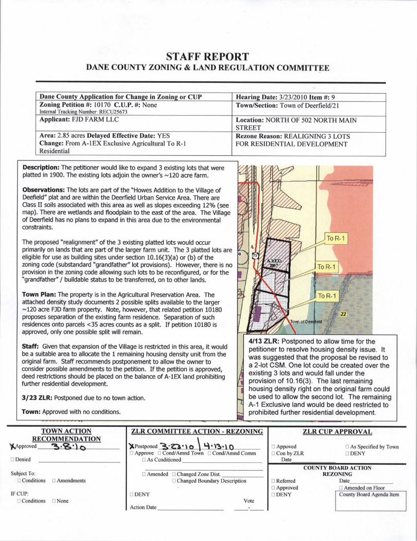
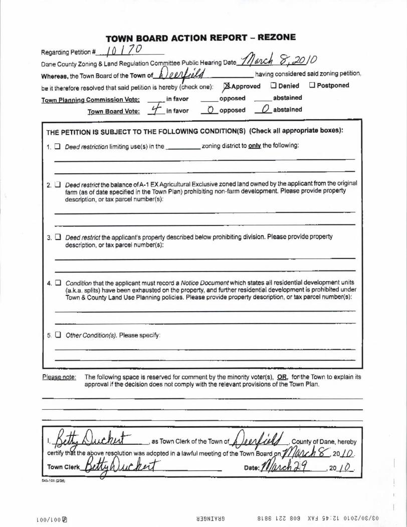
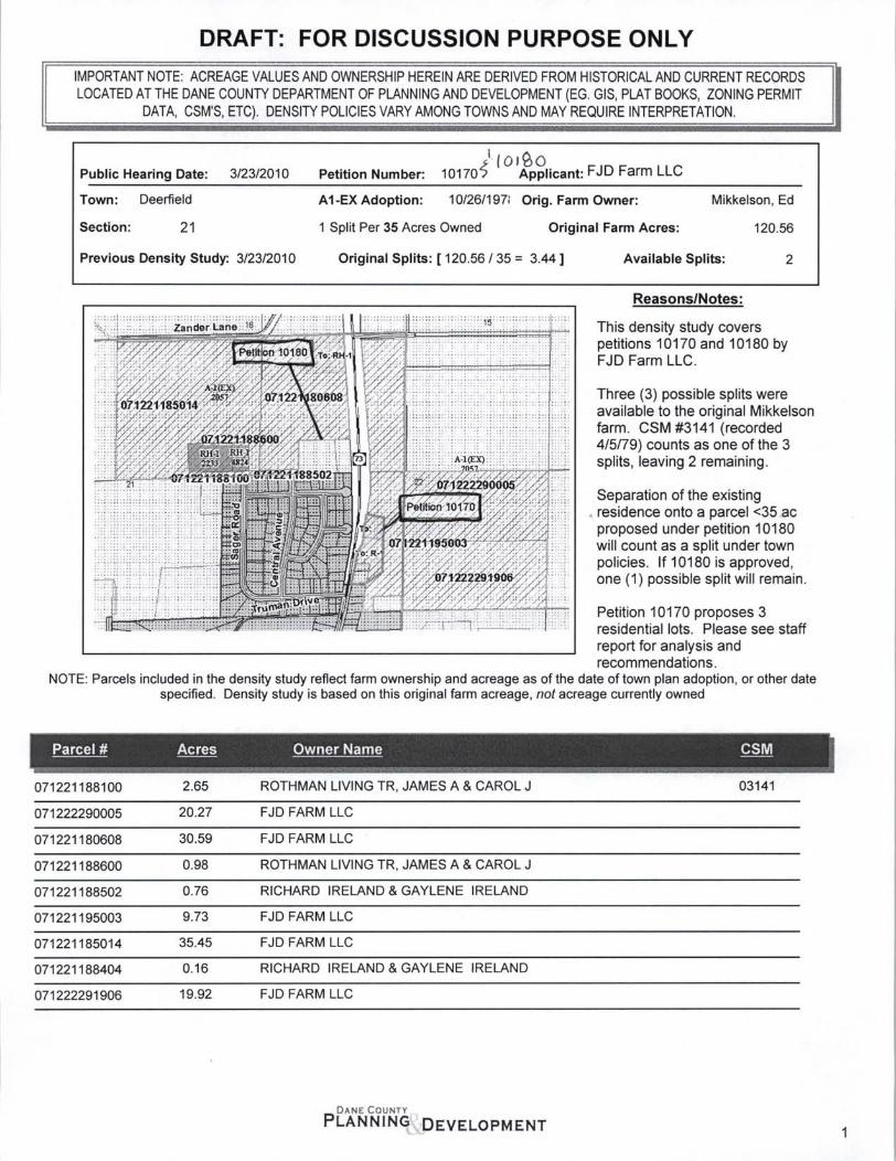
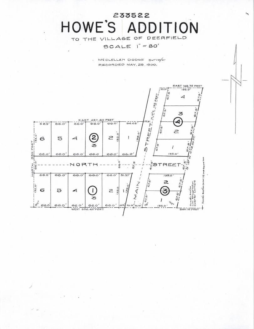
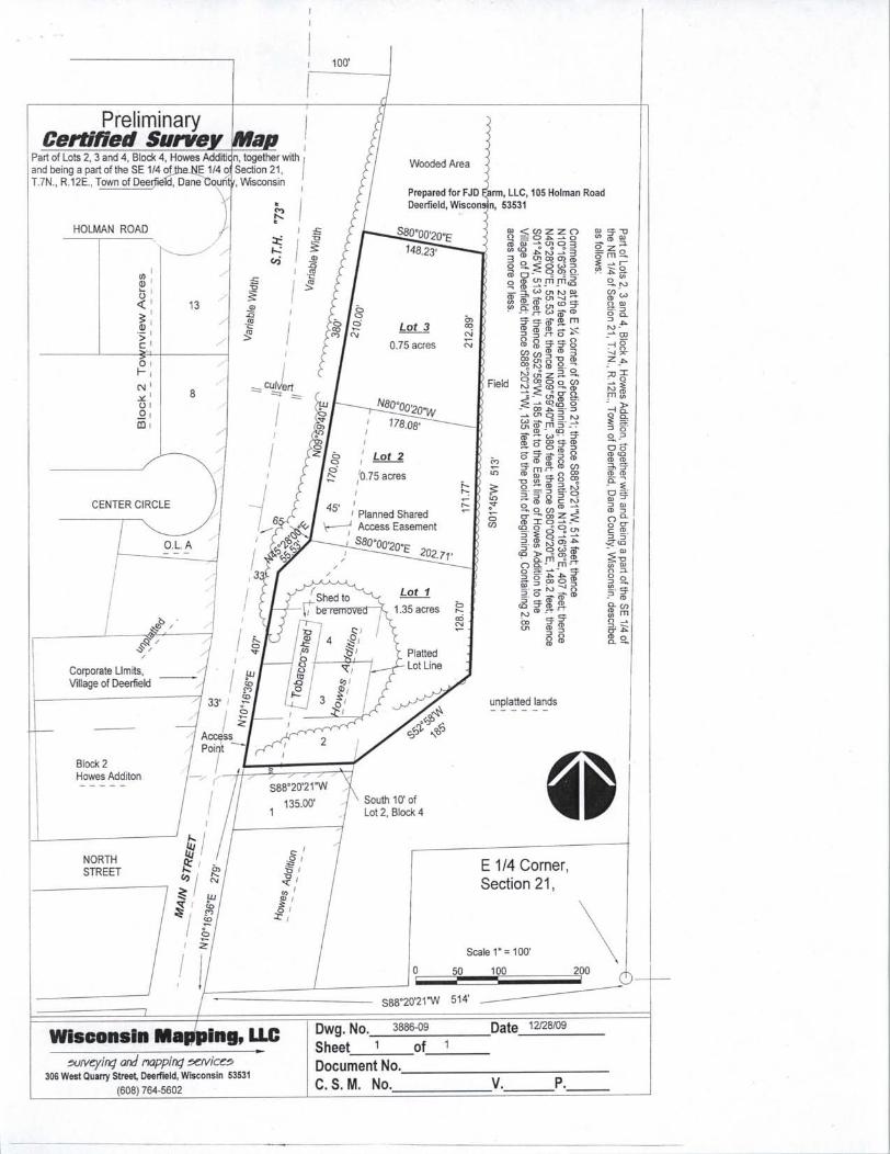
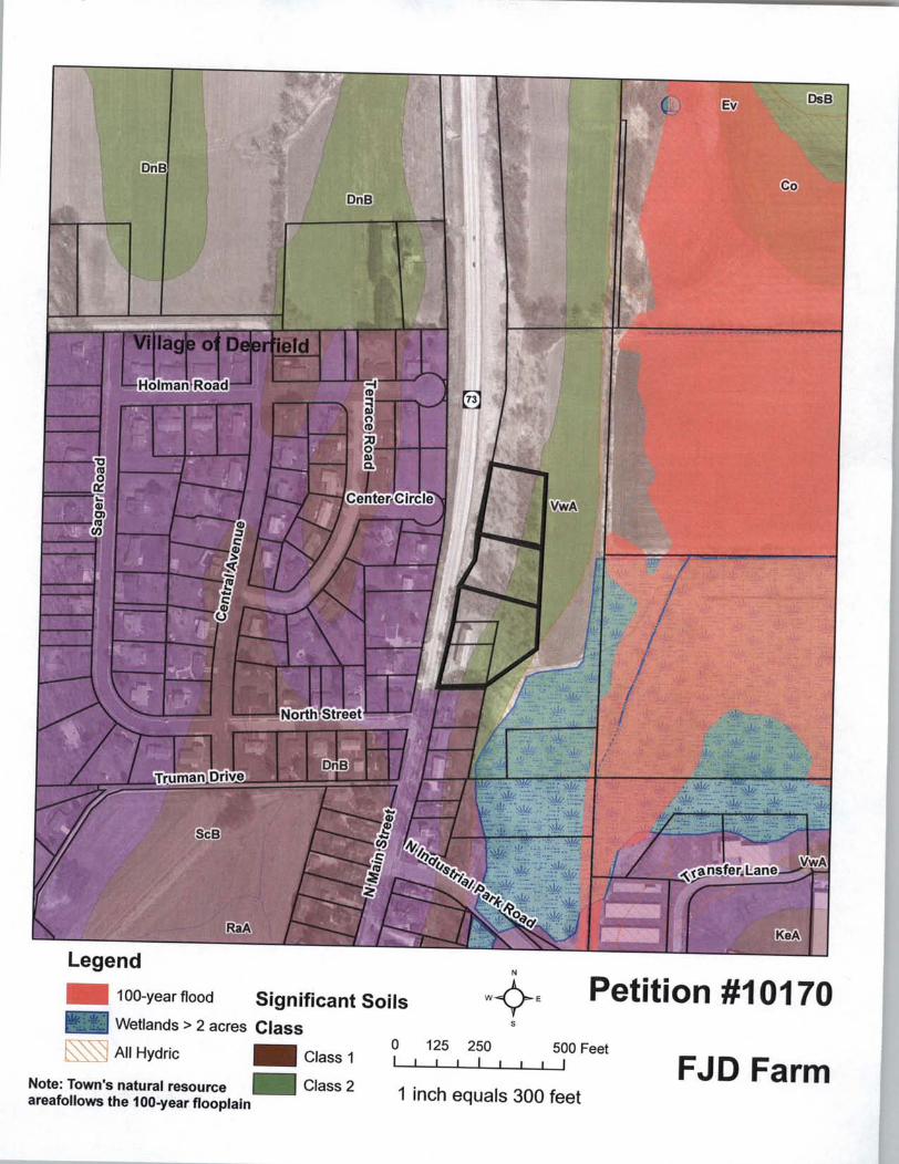
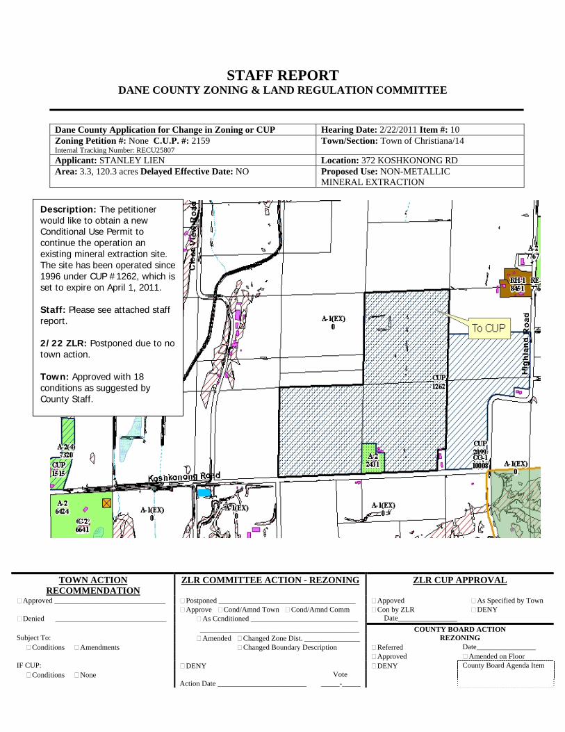
TOWN ACTION RECOMMENDATION
ZLR COMMITTEE ACTION - REZONING ZLR CUP APPROVAL
Approved ______________________________ Postponed _____________________________________ Appoved As Specified by Town Approve Cond/Amnd Town Cond/Amnd Comm Con by ZLR DENY
Denied ______________________________ As Ccnditioned _____________________________ Date________________ ___________________________________________ COUNTY BOARD ACTION Subject To: Amended Changed Zone Dist. _______________ REZONING Conditions Amendments Changed Boundary Description Referred Date________________ Approved Amended on Floor IF CUP: DENY DENY County Board Agenda Item Conditions None Vote Action Date ________________________ _____-_____
STAFF REPORT DANE COUNTY ZONING & LAND REGULATION COMMITTEE
Dane County Application for Change in Zoning or CUP Hearing Date: 2/22/2011 Item #: 10 Zoning Petition #: None C.U.P. #: 2159 Internal Tracking Number: RECU25807
Town/Section: Town of Christiana/14
Applicant: STANLEY LIEN Location: 372 KOSHKONONG RD Area: 3.3, 120.3 acres Delayed Effective Date: NO
Proposed Use: NON-METALLIC MINERAL EXTRACTION
Description: The petitioner would like to obtain a new Conditional Use Permit to continue the operation an existing mineral extraction site. The site has been operated since 1996 under CUP #1262, which is set to expire on April 1, 2011. Staff: Please see attached staff report. 2/22 ZLR: Postponed due to no town action. Town: Approved with 18 conditions as suggested by County Staff.
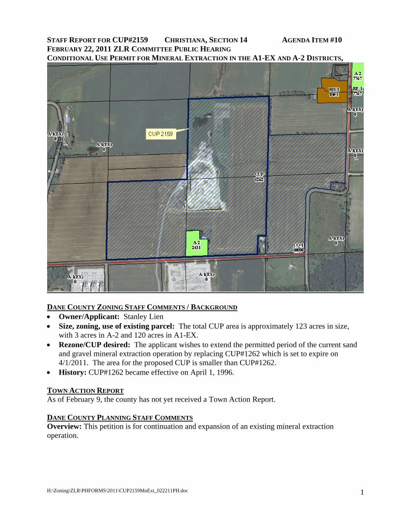
H:\Zoning\ZLR\PHFORMS\2011\CUP2159MnExt_022211PH.doc 1
STAFF REPORT FOR CUP#2159 CHRISTIANA, SECTION 14 AGENDA ITEM #10 FEBRUARY 22, 2011 ZLR COMMITTEE PUBLIC HEARING CONDITIONAL USE PERMIT FOR MINERAL EXTRACTION IN THE A1-EX AND A-2 DISTRICTS,
DANE COUNTY ZONING STAFF COMMENTS / BACKGROUND • Owner/Applicant: Stanley Lien • Size, zoning, use of existing parcel: The total CUP area is approximately 123 acres in size,
with 3 acres in A-2 and 120 acres in A1-EX. • Rezone/CUP desired: The applicant wishes to extend the permitted period of the current sand
and gravel mineral extraction operation by replacing CUP#1262 which is set to expire on 4/1/2011. The area for the proposed CUP is smaller than CUP#1262.
• History: CUP#1262 became effective on April 1, 1996. TOWN ACTION REPORT As of February 9, the county has not yet received a Town Action Report. DANE COUNTY PLANNING STAFF COMMENTS Overview: This petition is for continuation and expansion of an existing mineral extraction operation.
H:\Zoning\ZLR\PHFORMS\2011\CUP2159MnExt_022211PH.doc 2
Surrounding Area Characteristics: The surrounding area is a mixture of mostly agricultural use and scattered residential uses. The subject property is located at the intersection of Highland Rd. and Koshkonong Rd.
Reclamation Plan: A reclamation plan and reclamation permit (permit #74-98) already exist for this operation. This permit is based upon a reclamation plan that identifies agriculture as its future land use.
Town Plan: The Town of Christiana Comprehensive Plan identifies the subject property in the Agricultural Preservation land use district. The plan explains that Mineral Extraction is allowed as a conditional use in the district. It also states that the town will discourage non-farm residential development near existing mineral extraction sites.
Compliance with County Ordinances: Mineral extraction operations must meet requirements found in Chapters 10, 14 and 74 of the Dane County Code of Ordinances. The applicant has submitted an erosion control plan/storm water management plan as required by Chapter 14 of the Dane County Code of Ordinances (DCCO) a reclamation plan as required by Chapter 74. Chapter 10 provides six standards for granting a CUP in Section 10.255(2)(h) of the zoning ordinance are as follows:
1. That the establishment, maintenance, or operation of the conditional use will not be detrimental to or endanger the public health, safety, comfort or welfare.
2. That the uses, values and enjoyment of other property in the neighborhood for purposes already permitted shall be in no foreseeable manner substantially impaired or diminished by establishment, maintenance or operation of the conditional use.
3. That the establishment of the conditional use will not impede the normal and orderly development and improvement of the surrounding property for uses permitted in the district.
4. That adequate utilities, access roads, drainage and other necessary site improvements have been or are being made.
5. That adequate measures have been or will be being taken to provide ingress and egress so designed as to minimize traffic congestion in the public streets; and
6. That the conditional use shall conform to all applicable regulations of the district in which it is located.
According to S. 10.123(3)(a) of the zoning ordinance, the ZLR Committee must also consider the following factors when approving CUPs in the A-1 Exclusive District:
The statement of purpose of the zoning ordinance and the A-1 Exclusive Agriculture District.
The potential for conflict with agricultural use
The need of the proposed use for a location in an agricultural area.
The availability of alternative locations
Compatibility with existing or permitted use on adjacent lands.
The productivity of lands involved
The location of the proposed use so as to reduce to a minimum the amount of productive agricultural lands converted.
H:\Zoning\ZLR\PHFORMS\2011\CUP2159MnExt_022211PH.doc 3
The need for public services created by the proposed use.
The availability of adequate public services and the ability of affected local units of government to provide them without an unreasonable burden.
The effect of the proposed use on water or air pollution, soil erosion and rare or irreplaceable natural resources.
RECOMMENDED CONDITIONS • Conditions: Please see the following list of potential conditions for CUP #2159.
POTENTIAL CONDITIONS OF APPROVAL FOR CUP 2159: 1. The applicant shall submit an erosion control plan covering the entire CUP area for the duration
of operations, and receive approval of an erosion control permit prior to commencing extraction operations.
2. The applicant shall apply for and receive all other required local, state, and federal permits.
3. The operator shall develop and operate the site according to the submitted site and operations plan.
4. Operations shall cease no later than fifteen (15) years from the date of issuance of the conditional use permit.
5. Reclamation shall be completed within one year after operations have ceased, and shall be phased according to the revised operations and reclamation plan.
6. Reclamation shall meet requirements of Chapter 74 of the Dane County Code of Ordinances.
7. All drive aisles shall be either graveled or paved according to revised operations plans, and shall be maintained in a dust free manner in accordance with local, state, and federal regulations.
8. Open excavation area shall not exceed eight (8) acres.
9. Hours of operations shall be limited to 6:00 a.m. to 9:00 p.m. Monday through Friday and 7:00 a.m. to 12:00 p.m. on Saturday. There shall be no Sunday operations. Crushing of stone shall be limited to 6:00 a.m. to 9:00 p.m., Monday through Friday. Crushing shall not be permitted on Saturday, Sunday or legal holidays.
10. There shall be a minimum of an 80 foot setback from all Township roadway right of way lines, and a minimum of a 200 foot setback from all property lines of other owners.
11. There shall be a safety fence around portions of the extraction area that contains high walls and/or steep slopes. That safety fence shall be a minimum of 5 feet in height with a single strand of barbed wire on the top. For areas that are not high walls or steep slopes, during operations, the edges of the extraction area shall be maintained at a slope no greater than 1:1. The site shall be signed “no trespassing”.
12. All blasting shall be performed in strict accordance with State of Wisconsin rules and regulations. No explosives shall be stored on the quarry site.
13. The owner/operator shall notify, in writing, the Town of Christiana Clerk, local utility (Wisconsin Power and Light), and residents living within one-quarter mile of the open excavation area of the quarrying activity, the dates of blasting at the quarry. Said notification shall be provided more than 72 hours prior to blasting.
14. The operator shall use spray bars (water) in the crushing process to reduce dust. Use of spray
H:\Zoning\ZLR\PHFORMS\2011\CUP2159MnExt_022211PH.doc 4
bars is not required when the temperature is below freezing. The operator shall spray the site with water if and when needed to control dust.
15. The operator shall require all trucks, excavation, crushing, screening and washing equipment to have muffler systems which meet or exceed then current industry standards for noise abatement.
16. The applicant shall meet DNR standards for particulate emissions as described in NR 415.075, Wisconsin Administrative Code.
17. Owner/operator shall maintain liability insurance coverage in the amount of $5,000,000 and maintained at that level or greater until the quarry is closed or CUP 2159 expires. Proof of insurance shall be submitted annually to the Township and the insurance Township shall be named as an additional insured.
18. The Dane County zoning administrator or designee may enter the premises of the operation to inspect those premises and to ascertain compliance with these conditions or to investigate an alleged violation. If the operation is not in reasonable compliance with the terms of this approval, such approval is subject to amendment or revocation.
(Questions? Contact Pam Andros – 261-9780)

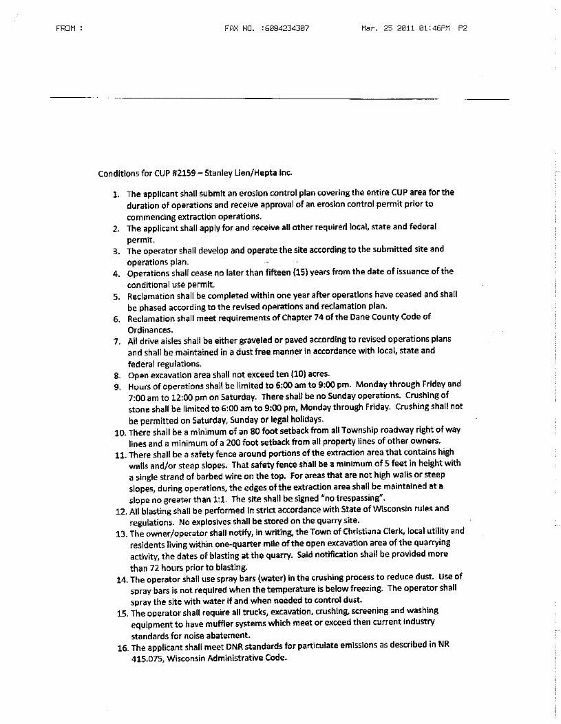

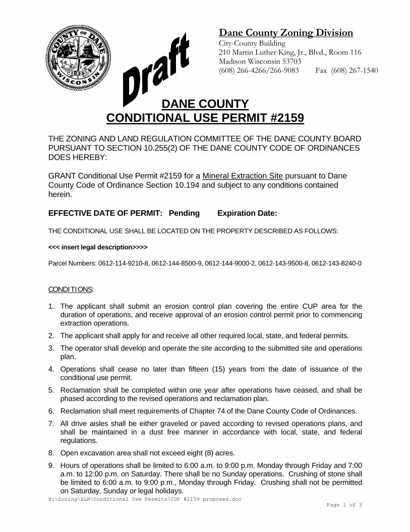
H:\Zoning\ZLR\Conditional Use Permits\CUP #2159 proposed.doc Page 1 of 3
Dane County Zoning Division City-County Building 210 Martin Luther King, Jr., Blvd., Room 116 Madison Wisconsin 53703 (608) 266-4266/266-9083 Fax (608) 267-1540
DANE COUNTY
CONDITIONAL USE PERMIT #2159 THE ZONING AND LAND REGULATION COMMITTEE OF THE DANE COUNTY BOARD PURSUANT TO SECTION 10.255(2) OF THE DANE COUNTY CODE OF ORDINANCES DOES HEREBY: GRANT Conditional Use Permit #2159 for a Mineral Extraction Site pursuant to Dane County Code of Ordinance Section 10.194 and subject to any conditions contained herein. EFFECTIVE DATE OF PERMIT: Pending Expiration Date: THE CONDITIONAL USE SHALL BE LOCATED ON THE PROPERTY DESCRIBED AS FOLLOWS: <<< insert legal description>>>> Parcel Numbers: 0612-114-9210-8, 0612-144-8500-9, 0612-144-9000-2, 0612-143-9500-8, 0612-143-8240-0 CONDITIONS: 1. The applicant shall submit an erosion control plan covering the entire CUP area for the
duration of operations, and receive approval of an erosion control permit prior to commencing extraction operations.
2. The applicant shall apply for and receive all other required local, state, and federal permits.
3. The operator shall develop and operate the site according to the submitted site and operations plan.
4. Operations shall cease no later than fifteen (15) years from the date of issuance of the conditional use permit.
5. Reclamation shall be completed within one year after operations have ceased, and shall be phased according to the revised operations and reclamation plan.
6. Reclamation shall meet requirements of Chapter 74 of the Dane County Code of Ordinances.
7. All drive aisles shall be either graveled or paved according to revised operations plans, and shall be maintained in a dust free manner in accordance with local, state, and federal regulations.
8. Open excavation area shall not exceed eight (8) acres.
9. Hours of operations shall be limited to 6:00 a.m. to 9:00 p.m. Monday through Friday and 7:00 a.m. to 12:00 p.m. on Saturday. There shall be no Sunday operations. Crushing of stone shall be limited to 6:00 a.m. to 9:00 p.m., Monday through Friday. Crushing shall not be permitted on Saturday, Sunday or legal holidays.
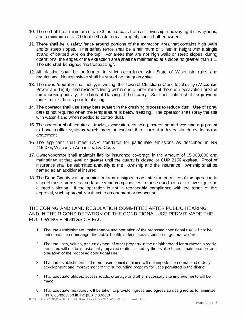
H:\Zoning\ZLR\Conditional Use Permits\CUP #2159 proposed.doc Page 2 of 3
10. There shall be a minimum of an 80 foot setback from all Township roadway right of way lines, and a minimum of a 200 foot setback from all property lines of other owners.
11. There shall be a safety fence around portions of the extraction area that contains high walls and/or steep slopes. That safety fence shall be a minimum of 5 feet in height with a single strand of barbed wire on the top. For areas that are not high walls or steep slopes, during operations, the edges of the extraction area shall be maintained at a slope no greater than 1:1. The site shall be signed “no trespassing”.
12. All blasting shall be performed in strict accordance with State of Wisconsin rules and regulations. No explosives shall be stored on the quarry site.
13. The owner/operator shall notify, in writing, the Town of Christiana Clerk, local utility (Wisconsin Power and Light), and residents living within one-quarter mile of the open excavation area of the quarrying activity, the dates of blasting at the quarry. Said notification shall be provided more than 72 hours prior to blasting.
14. The operator shall use spray bars (water) in the crushing process to reduce dust. Use of spray bars is not required when the temperature is below freezing. The operator shall spray the site with water if and when needed to control dust.
15. The operator shall require all trucks, excavation, crushing, screening and washing equipment to have muffler systems which meet or exceed then current industry standards for noise abatement.
16. The applicant shall meet DNR standards for particulate emissions as described in NR 415.075, Wisconsin Administrative Code.
17. Owner/operator shall maintain liability insurance coverage in the amount of $5,000,000 and maintained at that level or greater until the quarry is closed or CUP 2159 expires. Proof of insurance shall be submitted annually to the Township and the insurance Township shall be named as an additional insured.
18. The Dane County zoning administrator or designee may enter the premises of the operation to inspect those premises and to ascertain compliance with these conditions or to investigate an alleged violation. If the operation is not in reasonable compliance with the terms of this approval, such approval is subject to amendment or revocation.
THE ZONING AND LAND REGULATION COMMITTEE AFTER PUBLIC HEARING AND IN THEIR CONSIDERATION OF THE CONDITIONAL USE PERMIT MADE THE FOLLOWING FINDINGS OF FACT:
1. That the establishment, maintenance and operation of the proposed conditional use will not be detrimental to or endanger the public health, safety, morals comfort or general welfare.
2. That the uses, values, and enjoyment of other property in the neighborhood for purposes already
permitted will not be substantially impaired or diminished by the establishment, maintenance, and operation of the proposed conditional use.
3. That the establishment of the proposed conditional use will not impede the normal and orderly
development and improvement of the surrounding property for uses permitted in the district.
4. That adequate utilities, access roads, drainage and other necessary site improvements will be made.
5. That adequate measures will be taken to provide ingress and egress so designed as to minimize
traffic congestion in the public streets.
H:\Zoning\ZLR\Conditional Use Permits\CUP #2159 proposed.doc Page 3 of 3
6. That the proposed conditional use does conform to all applicable regulations of the district in
which it is proposed to be located.
EXPIRATION OF PERMIT In addition to any time limit established as a condition in granting this CUP, Section 10.25(2)(n) of the Dane County Code of Ordinances provides that any use for which a conditional use permit has been issued, upon its cessation or abandonment for a period of one year, will be deemed to have been terminated and any future use shall be in conformity with the ordinance.
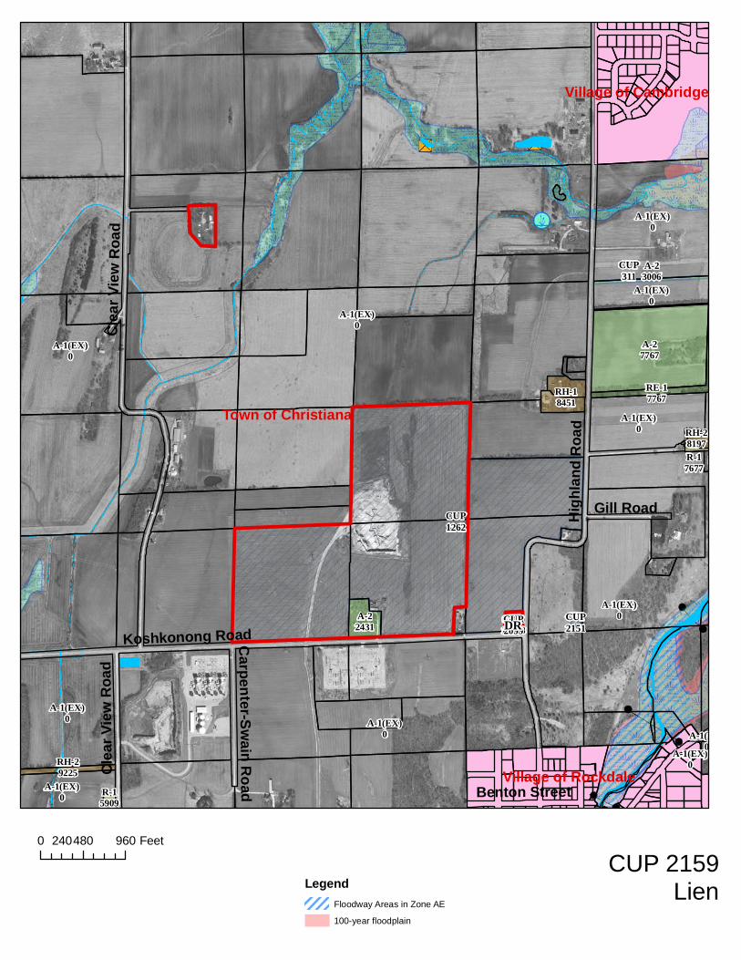
A-1(EX)0
A-1(EX)0
A-1(EX)0
A-1(EX)0
A-27767
A-1(EX)0
A-1(EX)0
A-1(EX)0
A-1(EX)0
RH-18451
A-1(EX)0
A-22431
RE-17767
RH-29225
A-23006
RH-28197
R-15909
R-17677
A-1(EX)0
CO-110008
CUP1262
CUP311
CUP2151
Town of Christiana
Village of Rockdale
Village of Cambridge
High
land R
oad
Clea
r View
Roa
d
Koshkonong Road
Gill Road
Benton Street
Car pe nte r-S wai n Roa d
Clea
r View
Roa
d
A-1(EX)0
CUP2099DR
0 480 960240 Feet
LegendFloodway Areas in Zone AE
100-year floodplain
CUP 2159Lien
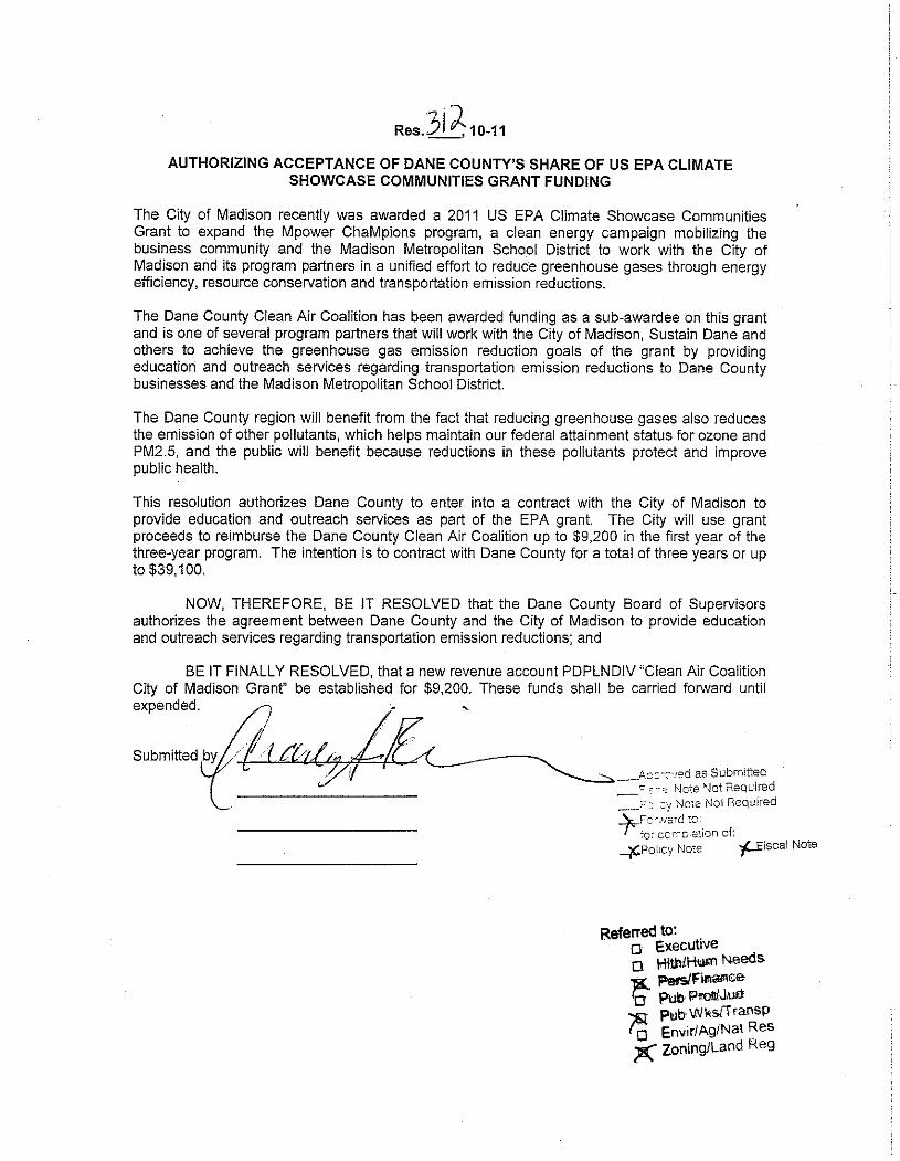
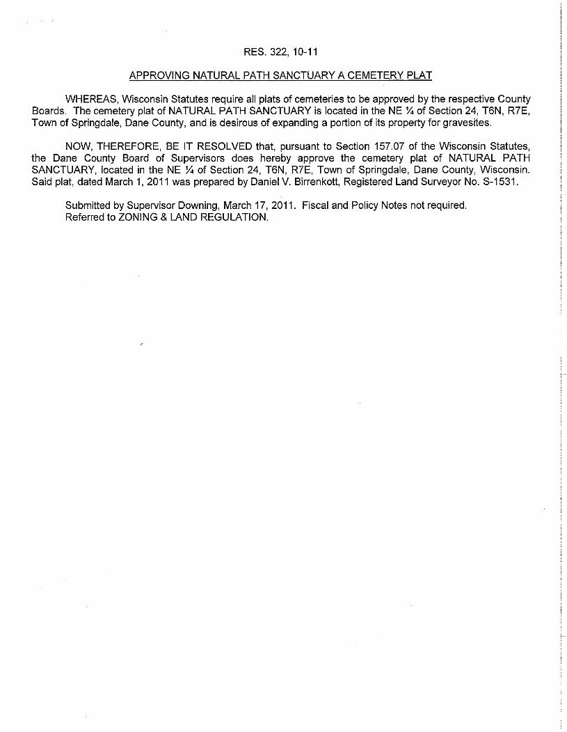
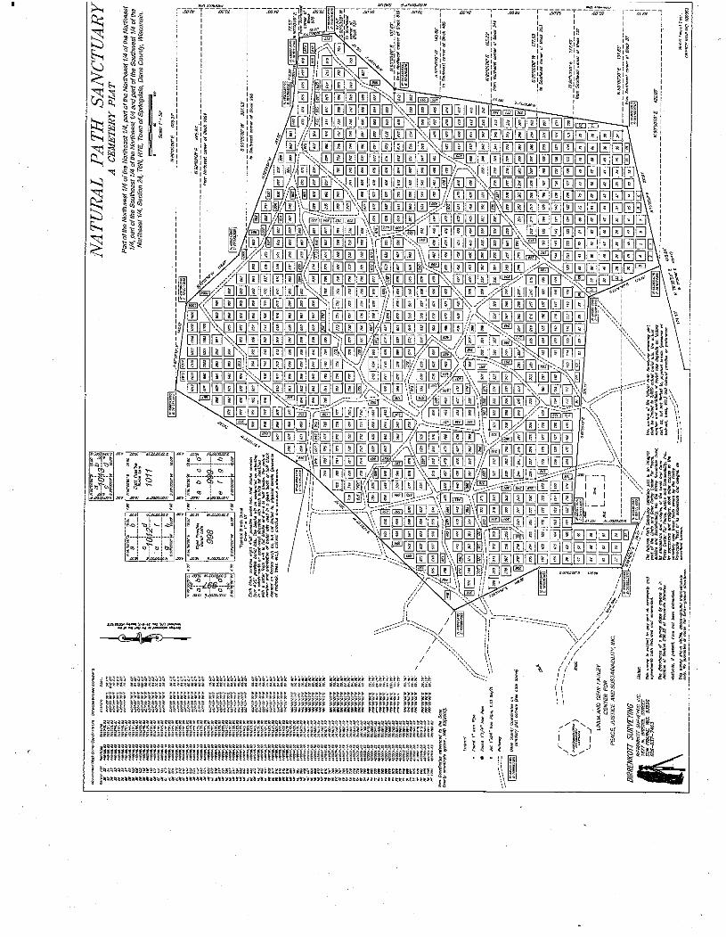

Room 116, City-County Building, Madison, Wisconsin 53703 Fax (608) 267-1540
Housing & Economic Development (608)266-4270, Rm. 362 Planning (608)266-4251, Rm. 116 Records & Support (608)266-4251, Rm. 116 Zoning (608)266-4266, Rm. 116
TO: ZLR Committee FROM: Majid Allan DATE: April 7, 2011 RE: Recommended changes to ZLR Rules & Procedures (Rezoning / Land
Division application procedures and updated references) In a memo dated 3/22/11, staff outlined a number of recommendations regarding land division / subdivision review procedures and approval of Certified Survey Maps. Enclosed is a revised draft of the committee’s Rules & Procedures document that incorporates the staff recommendations. Staff believes that including procedural items for rezones/CUPs, and land divisions as part of the ZLR rules will ensure predictable and consistent administration and facilitate a smooth transition as the committee considers delegating authority to approve CSMs back to staff. The revised Rules & Procedures document includes a new section entitled, “Application Procedures”, with subsections for rezones/CUPs, and CSMs and Subdivision Plats. Please note that, for rezones / CUPs, the provisions simply reflect current administrative practice. This is largely the case for CSMs and Plats, as well, except that the revisions include both procedures specified in the ordinance (chapter 75) and the recommendations outlined in the 3/22/11 memo. Below is a summary of the recommended land division procedures.
Certified Survey Maps
• The Committee would authorize staff to review and approve CSMs. • The Committee would reserve authority to review and act on waiver / variance requests, re-
division of existing lots in certain instances (to ensure compliance with town density policies), during staff absence, and upon staff request.
• Staff would have the ability to waive the preliminary CSM requirement (many CSMs are submitted in final form).
Subdivision Plats
• Includes the “pre-application” consultation between staff and applicant specified in s. 75.15(1). • Clarifies the data submittal requirements of 75.15(3). For example, if a proposed plat includes
mapped wetlands or floodplain, those features need to be delineated in accordance with local, state, and federal requirements.
• Specifies that failure to provide the data or documentation as required by ordinance constitutes grounds for denial of a preliminary plat.
• In the event of any ambiguity, establishes that the Committee shall make the final determination as to a plat’s conformance with any conditions of approval.
Several minor updates are also proposed for the section under “Action Items” dealing with Committee findings when lands are rezoned out of A-1EX. The changes will ensure that the committee findings are consistent with the farmland preservation statutes (Chapter 91 Wis. Stats.).
4/7/11 DRAFT
Page 1 of 15
Rules and Procedures of the Dane County Zoning and Land Regulation Committee of the Dane County Board. These Rules and Procedures were adopted February 14, 2006 and shall replace any rules previously adopted and shall be the rules of the committee. These rules were amended on August 8, 2006, July 8, 2008, and most recently on September 9, 2008, and most recently on <staff to insert date of committee action on amended rules & procedures>. I. General a. The Zoning and Land Regulation Committee of the Dane County Board
(hereinafter referred to as Committee) shall have a Chairperson, Vice Chairperson, and Secretary. These positions shall be selected by the members of the committee. The Chairperson shall run the meeting of the committee in adherence to items on the agenda with action on items and procedural matters generally managed as prescribed by Robert’s Rules of Order except where these rules indicate otherwise. The Chair may deviate from Robert’s Rules at any time with the concurrence of the committee.
b. In the absence of the Chair or if the Chair chooses to relinquish, the Vice
Chair shall take on the responsibilities of the Chair, likewise the Secretary may take over for the Chair or Vice Chair.
c. The committee shall set aside these Rules and Procedures as they determine
appropriate by 2/3 majority vote of those present for specific purposes. d. Staff from the Department of Planning and Development (hereinafter
referred to as the Department and as staff) shall take minutes, prepare agendas and otherwise staff the operation of the Committee. If staff for any reason is not available at any meeting the Secretary or a designee of the Chair shall take minutes of the meeting.
e. Meetings shall be scheduled by the Committee for a time and place as
deemed appropriate and special meetings may be called by the Chair. The Committee may schedule a meeting for the purpose of conducting a site visit as deemed appropriate. The purpose of these site visits is exclusively to view the site. The Committee will not accept testimony at a site inspection, and the Committee will not take any action at a site inspection.
f. Agendas shall be prepared by staff of the Department with the following
general order and guidelines.
4/7/11 DRAFT
Page 2 of 15
1. Call the meeting to order. 2. Approval of minutes. 3. Public comment on any item not listed elsewhere on the agenda.
4. Petitions scheduled for Public Hearing.
5. Petitions which have been postponed from previous meetings and
have recently had additional action or new information submitted by applicants, Towns, or staff.
6. Land Division issues needing action by the committee as determined
by staff.
7. Resolutions referred to the committee.
8. Ordinance Amendments referred to the committee.
9. Any other items shall be listed next or listed under other business. g. The chair may add or delete any items to the agenda by advising staff in
time to provide a legal notice. The Chair may also canvas the meeting room to inquire as to how many people are present for particular items and move those items up or down the agenda with the concurrence of the committee.
h. The committee may designate certain meetings where certain of the above
stated items do not appear. i. General Meeting schedule:
The committee shall normally meet on the 2nd and 4th Tuesdays of each month. The meeting on the 4th Tuesday shall be reserved for public hearings; other items shall not be added to the agenda unless required by legal deadlines or at the discretion of the chair. Public Hearings shall be scheduled for 7:30 P.M., the meeting on the 2nd Tuesday shall be scheduled at 7:30 P.M. The chair will cancel and schedule special meetings as necessary.
j. Zoning and Conditional Use Permit applicants shall be required to provide
one copy of each document submitted for review by the committee members and staff. The documents shall be submitted to the Zoning Administrator for distribution.
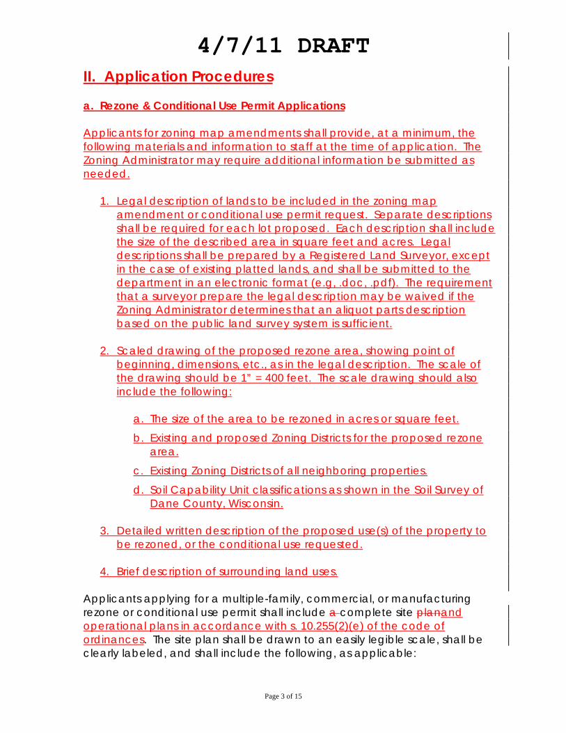
4/7/11 DRAFT
Page 3 of 15
II. Application Procedures a. Rezone & Conditional Use Permit Applications Applicants for zoning map amendments shall provide, at a minimum, the following materials and information to staff at the time of application. The Zoning Administrator may require additional information be submitted as needed.
1. Legal description of lands to be included in the zoning map amendment or conditional use permit request. Separate descriptions shall be required for each lot proposed. Each description shall include the size of the described area in square feet and acres. Legal descriptions shall be prepared by a Registered Land Surveyor, except in the case of existing platted lands, and shall be submitted to the department in an electronic format (e.g, .doc, .pdf). The requirement that a surveyor prepare the legal description may be waived if the Zoning Administrator determines that an aliquot parts description based on the public land survey system is sufficient.
2. Scaled drawing of the proposed rezone area, showing point of
beginning, dimensions, etc., as in the legal description. The scale of the drawing should be 1” = 400 feet. The scale drawing should also include the following:
a. The size of the area to be rezoned in acres or square feet.
b. Existing and proposed Zoning Districts for the proposed rezone area.
c. Existing Zoning Districts of all neighboring properties.
d. Soil Capability Unit classifications as shown in the Soil Survey of Dane County, Wisconsin.
3. Detailed written description of the proposed use(s) of the property to
be rezoned, or the conditional use requested.
4. Brief description of surrounding land uses. Applicants applying for a multiple-family, commercial, or manufacturing rezone or conditional use permit shall include a complete site planand operational plans in accordance with s. 10.255(2)(e) of the code of ordinances. The site plan shall be drawn to an easily legible scale, shall be clearly labeled, and shall include the following, as applicable:

4/7/11 DRAFT
Page 4 of 15
Site plan requirements 1. Scale and north arrow; 2. Location of subject property, parcel number(s), and any relevant
certified survey map (CSM) or plat information related to the identification of the property;
3. Subject property lines and lot dimensions;
4. All building, outdoor use areas, right-of-ways and easements, both
existing and proposed, including provisions for utilities, water, stormwater and sewer, either public or private. Existing and proposed uses should be labeled and clearly distinguishable. All dimensions and setbacks should be shown, including building heights;
5. Location and width of all interior roads or driveways and existing and
proposed driveway entrances and exits onto public and private roadways, traffic pattern flows shall be clearly indicated;
6. Parking lot layout in compliance with all provisions of the Dane County
Code of Ordinances;
7. Zoning district boundaries of the subject property and adjacent properties;
8. Location and distance from subject property and residences on
adjacent properties;
9. Natural features such as cropped areas, woodlands, lakes, ponds, streams (including intermittent steams), significant drainage courses, contour lines, flood zones and wetlands;
10. Any other information which the Zoning Administrator deems necessary
to reasonably determine the location, nature and condition of any actual or proposed feature of the site. The committee shall have the option of reviewing lengthy documents/reports however documents of this nature shall be summarized by Department staff.
b. Certified Survey Map and Subdivision Plat Applications
1. Certified Survey Maps:
4/7/11 DRAFT
Page 5 of 15
a. Applicants for Certified Survey Map approval shall direct a Registered Land Surveyor to prepare the map in accordance with all applicable requirements of Chapter 236 Wis. Stats, A-E7 of the Wis. Administrative Code, and Chapter 75 of the Dane County Code of Ordinances.
b. Staff shall advise applicants of the information and materials required
for a Certified Survey Map application.
c. Per section 75.17(b) of the county land division / subdivision ordinance, the committee has delegated authority to approve Certified Survey Maps to the Department of Planning and Development Land Division Review Officer / Assistant Zoning Administrator, as of <staff to enter date of committee authorization>. The Zoning Committee reserves for itself authority over the following situations:
i. Variance / waiver requests.
Any CSM application where a request is made for a waiver from any applicable provision of the county land division / subdivision ordinance shall be reviewed and acted on by the Committee. Staff will provide a brief written review of any proposed waiver. If a proposed CSM is associated with a rezoning or conditional use permit petition, action on the waiver will be considered and acted on by the committee prior to action on the associated petition.
ii. Re-division of existing lots. Any CSM application not associated with a rezoning or conditional use permit petition that proposes to divide an existing parcel to create a new parcel, shall be reviewed and acted upon by the Zoning Committee. The purpose of this provision is to ensure compliance with town / county density standards.
iii. Action during staff absence
In the event that staff is on vacation or otherwise unavailable to review and act on a final CSM for an extended period of time, applicants shall have the option of requesting that the Committee take action on the final CSM. Such request shall be made in writing to the Chairperson of the Committee.
iv. Requests by staff
Staff may request that the committee take action on any CSM application.
4/7/11 DRAFT
Page 6 of 15
d. At the discretion of the Land Division Review Officer and County Surveyor, certain plat and data submission requirements or the preliminary CSM requirement in s. 75.17(2) may be waived.
2. Subdivision Plats
a. Pre-application consultation: As required under s. 75.15(1), Dane
County Code of Ordinances, prior to submitting an application for a subdivision plat, applicants shall first consult with staff for advice and assistance on the subdivision process. During the pre-application consultation, staff shall advise applicants of the information and materials required for a Subdivision Plat application.
b. Applicants for Subdivision Plat approval shall direct a Registered Land
Surveyor to prepare the plat in accordance with all applicable requirements of Chapter 236 Wis. Stats, A-E7 of the Wis. Administrative Code, and Chapter 75 of the Dane County Code of Ordinances.
c. Where sensitive environmental features are observed within the area
proposed to be covered by a subdivision plat, staff shall require – prior to committee consideration of a preliminary plat – the submittal of appropriate documentation to establish the actual boundaries / extent of such features. This may include, but not be limited to, formal wetland delineations, prepared in accordance with all applicable state / federal guidelines, establishment of flood elevations for areas within a 100 year floodplain as depicted on adopted FEMA FIRM maps, delineation of Ordinary High Water Mark, navigable streams, etc. Applicants may request a site visit by the zoning administrator to determine presence of wetlands / stream navigability, etc.
d. The Committee shall accept preliminary plat applications that satisfy
the submission requirements in s. 75.15(3), and schedule such applications for consideration at a future meeting. Preliminary plats in unincorporated areas shall be presented to the committee along with draft staff recommendations with at least 2 meetings before the final deadline. The staff will provide comments and final recommendations at the meeting before the final deadline.
e. Failure of an applicant to provide documentation or data as required
by ordinance shall constitute grounds for denial of a preliminary plat.
f. Upon approval by staff, fFinal plats in unincorporated areas shall be reported to the committee before the committee Chair signs the plat once all conditions have been met to the satisfaction of the County

4/7/11 DRAFT
Page 7 of 15
Plat Review Officer. Where staff finds ambiguity regarding conformance with any conditions of approval, the Committee shall make the final determination as to whether the conditions of approval have been met. The Chair shall sign the plat at an open meeting of the Committee if all conditions have been met. (added 08-08-2006; modified <staff to insert date of committee action on revised rules & procedures>)
4/7/11 DRAFT
Page 8 of 15
III. Conduct of Public Hearing a. Testimony at the Public Hearing will be recorded on tape and shall be
available to the public in the Department. Recordings shall be held for 2 years.
b. Minutes of the Public Hearing shall only show the names of those appearing
and the position they have taken on the proposal. c. Attendance of petitioners or their agent at the public hearing is
recommended. It is not necessary for anyone to speak regarding the item at the Public Hearing in order for the committee to complete action.
d. When individuals wish to speak all persons wishing to speak in favor of the
petition shall be heard first. All persons wishing to speak against the petition or ask questions shall be heard second. Review of Town action, staff comments and any other communication concerning the matter will be heard next. Where any comments concerning the matter have been made objecting to the petition or questions have been asked, one representative of the applicant may speak in rebuttal.
e. All comments during the public hearing shall be directed to the Committee.
No exchange between attendees is permitted. Committee members may ask questions of individuals participating in the public hearing as they speak.
f. In accordance with Dane County Ordinance all speakers are required to fill
out a Registration sheet indicating the items they are interested in, their name, their affiliation, or representations.
g. Individual speakers are limited to no more than five minutes speaking time. h. All Public Hearings are considered closed upon completion of the meeting at
which the hearing has been scheduled unless otherwise indicated by the Chair.
i. Once the Public Hearing is concluded no additional oral comments to the
committee will be permitted except at future meetings where the item is listed and for the following reasons:
1. Members of the Committee request individuals involved in the item to
respond to questions or concerns.

4/7/11 DRAFT
Page 9 of 15
2. The Chair determines that enough new information has been added to the discussion since the public hearing that additional time is needed. The Chair shall determine an amount of time for comments from the public with an equal amount of time being allotted to people speaking in favor and in opposition to the petition.
4/7/11 DRAFT
Page 10 of 15
IIIIV. Action Items a. The Committee shall not take action on rezonings until the applicable Town
has completed action on the item. This shall be the Committee policy even though the Town has exceeded its legal action period for rezonings. The Committee may consider action on such items without the Town action 60 days after the date of public hearing on an item, and after contacting the Town and advising the Town of its interest in completing action on the matter.
b. In general all information which is relevant to any given item must be
submitted to the staff of the Department by the Thursday prior to the committee meeting at 9:00 a.m. in order for that information to be considered. The Department will make packets available to the committee the Friday prior to the Tuesday meetings. Information submitted after 9:00 a.m. the prior Thursday may not be considered or may cause the item to be deferred to a later meeting. Publicly Noticed Public Hearings will be heard regardless of other information connected to the petition.
c. Committee agendas shall be prepared by the Department and submitted to
the County Clerk’s Office on the Friday prior to the Committee meeting. d. Items IV and V of the work session agenda shall be reserved solely for
petitions with completed town action reports. Town action reports must be received by the department at least 5 calendar days in advance of the scheduled work session. Items without town action and at least 60 days past the public hearing at which the item(s) were first heard, may be placed on the work session agenda at the discretion of the Committee Chair. (Added 7-8-2008)
e. In order to shorten discussion, the following general rules of motion making
shall apply.
1. Unless otherwise indicated a simple motion to postpone shall mean that the item shall be deferred until additional information or action by another agency is received at which time it shall routinely be placed back on the agenda as determined by staff or the Chair.
2. Conditional Rezoning - Unless otherwise indicated a motion to
approve subject to Town Conditions shall mean the rezoning or CUP is approved or recommended subject to the intent of the Town’s conditions as stated in the minutes drafted by staff and approved by the committee. Wherever practical Restrictive Covenants shall be
4/7/11 DRAFT
Page 11 of 15
imposed in a positive manner indicating such things as usage which are permitted.
3. Conditional Use Permits – Unless otherwise indicated, a motion to
approve a Conditional Use Permit, shall mean that the Committee has made affirmative findings of fact for the standards enumerated in §10.255(2)(h), and, if applicable, the relevant factors in §10.123(3)(a), Dane County Code of Ordinances.
4. Whenever a motion is made to approve a re-zoning or CUP with a
condition of a community wastewater system, the condition means that the system shall comply with the nitrate-nitrogen standard established by the federal Maximum Contaminant Level (MCL) and the Wisconsin Groundwater Enforcement Standard (ES). The federal MCL is found in §40CFR141.62. The Wisconsin Groundwater Enforcement Standard is found in Wisconsin Administrative Code Chapter NR 140.10.
f. Action on Rezoning Petitions and CUPs.
1. Zoning Petitions or Conditional Use Permits (CUP) shall be judged “non-controversial” if they meet the following guidelines:
i. No opposition from anyone at public hearing.
ii. No unresolved issues by staff.
iii. No substantive concerns by the Town in their approval.
iv. No committee members in opposition to the petition. (must pass the committee by unanimous vote of all members in attendance and have the agreement of all committee members that it is non-controversial).
2. Rezoning petitions which are non-controversial may be acted
upon at the same committee meeting as the public hearing where they are heard and will be referred to the next County Board meeting. The chair shall note as each item is approved if it is a non-controversial item.
3. The Committee shall have the option of taking action on
combined rezone / CUP applications at the same meeting. The committee shall utilize the following procedures for approving combined rezone / CUP applications at the same meeting:
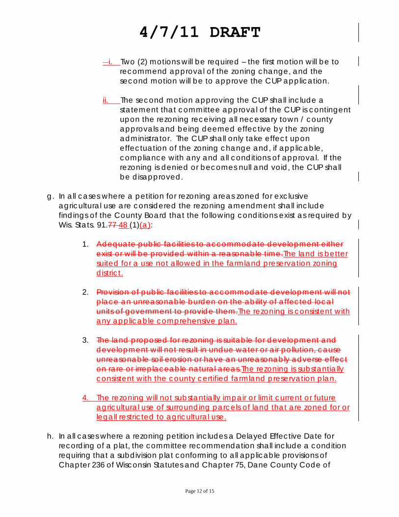
4/7/11 DRAFT
Page 12 of 15
�i. Two (2) motions will be required – the first motion will be to
recommend approval of the zoning change, and the second motion will be to approve the CUP application.
ii. The second motion approving the CUP shall include a
statement that committee approval of the CUP is contingent upon the rezoning receiving all necessary town / county approvals and being deemed effective by the zoning administrator. The CUP shall only take effect upon effectuation of the zoning change and, if applicable, compliance with any and all conditions of approval. If the rezoning is denied or becomes null and void, the CUP shall be disapproved.
g. In all cases where a petition for rezoning areas zoned for exclusive
agricultural use are considered the rezoning amendment shall include findings of the County Board that the following conditions exist as required by Wis. Stats. 91.77 48 (1)(a):
1. Adequate public facilities to accommodate development either
exist or will be provided within a reasonable time.The land is better suited for a use not allowed in the farmland preservation zoning district.
2. Provision of public facilities to accommodate development will not
place an unreasonable burden on the ability of affected local units of government to provide them.The rezoning is consistent with any applicable comprehensive plan.
3. The land proposed for rezoning is suitable for development and
development will not result in undue water or air pollution, cause unreasonable soil erosion or have an unreasonably adverse effect on rare or irreplaceable natural areas.The rezoning is substantially consistent with the county certified farmland preservation plan.
4. The rezoning will not substantially impair or limit current or future
agricultural use of surrounding parcels of land that are zoned for or legall restricted to agricultural use.
h. In all cases where a rezoning petition includes a Delayed Effective Date for
recording of a plat, the committee recommendation shall include a condition requiring that a subdivision plat conforming to all applicable provisions of Chapter 236 of Wisconsin Statutes and Chapter 75, Dane County Code of
4/7/11 DRAFT
Page 13 of 15
Ordinances, be approved by the committee and recorded with the Dane County Register of Deeds within two (2) years of the date of rezone approval by Dane County.
i. If no action has been taken on a petition or application within one (1) year of
the public hearing at which the item is heard, the application shall be expired and considered withdrawn. However, that period of time is tolled while the petition is in litigation. The applicant shall be notified the application is withdrawn, and the Committee will not take further action on the request. If the applicant wishes to pursue the conditional use permit and/or rezoning, the applicant must complete a new application and public hearing in its entirety. (Added 7-8-2008)
j. If the Committee determines that a new public hearing is required for an active
petition, a fee may be assessed to cover the cost of noticing the new public hearing. Any such fee shall be assessed in accordance with the applicable provisions of Chapter 12, Dane County Code of Ordinances. (Added 7-8-2008)
4/7/11 DRAFT
Page 14 of 15
IV. Procedural Items outside of committee meetings. a. The Department shall prepare a Class II notice of Public Hearing as indicated
by Wis. Stats. b. The Department shall send a courtesy copy of a Notice of Public Hearing to
all surrounding property owners within 300 feet of the affected property at least one week prior to the date of the Public Hearing.
c. The Department shall also send the petitions to all parties of interest, (for
example, Dane County Environmental Health, Dane County Highway, etc) for their review and comment. All such comments shall be forwarded to the Committee for consideration.
d. As requested by the Committee the Department shall comment on any item
appearing on the agenda or seek comments from other county departments as appropriate.
e. Plan Review and Approval Process:
Process for review and approval of the local plans and their amendments by the County should generally follow these steps:
1. The local Unit of Government will submit a preliminary version of the
Plan to the Planning and Development Department for staff review.
2. The plan is reviewed by the staffs of the County Planning and
Development Department and other local units of government where appropriate. The local unit makes appropriate adjustments, takes local approval action and submits by letter to the County Clerk along with 90 copies (of which up to 70 copies may be electronic) of the plan amendment.
3. The Plan is then referred to the Committee who will set a Public
Hearing Date allowing for at least a 60 30 day review period.
4. The Department of Planning and Development will then coordinate with the County Clerk and mail the proposed plan to all required jurisdictions for review prior to the hearing.
4/7/11 DRAFT
Page 15 of 15
5. Upon completion of the Public Hearing, the Committee shall consider the matter and make a recommendation to the County Board.
6. County Board shall consider the matter and recommendations of
the Committee, and other commenting agencies and take action as appropriate.