Chester 2009 Plan of Conservation and Development Page 2 1 · Chester 2009 Plan of Conservation and...
26
Page 2‐1 Chester 2009 Plan of Conservation and Development CHAPTER 2 : NATURAL RESOURCES Introduction During the preparation of this Plan, it was clear from responses at the workshops and conversations with Chester residents, as well as previous studies, that Chester’s natural resources lead the list of important factors which define the character of Town. Geologically, most of the sixteen square miles that make up the Town of Chester are composed of very old crystalline metamorphic bedrock folded into a series of north/south oriented hills, with streams flowing through the breaks. This rugged terrain made early agricultural development difficult in many parts of Chester, but provided a boon to young industries during the age of water‐powered mills. The Connecticut River valley itself is much younger geologically, having been created since the departure of the glaciers, between 20 and 30 thousand years ago. The best farmland soils are found near the river and in the western portion of town around Cedar Lake, although little farming has taken place there in recent years. Water Resources Chester’s water resources have played an important role in the past development of the Town. This Plan focuses on the importance of these resources and the role they serve in determining future growth. Chester’s abundant water resources are visible throughout the town. Intermittent streams run into larger streams and eventually into the Connecticut River. Twenty‐seven existing dams throughout the town slow the rushing water, creating mill ponds and dramatic waterfalls over many spillways. During the 18th and 19th centuries, more than fifty industries did business along the Pattaconk Brook. Many of the dams created to provide water power for grist and saw mills for the manufacture of textiles, witch hazel and woodworking tools, are no longer in use for these purposes. Several other dams today hold back the water in reservoirs belonging to the Connecticut Water Company, or contain water in lakes used for recreational purposes. The Connecticut DEP maintains a registration of existing dams and their condition when last inspected. Figure 2‐1 – Cedar Lake (Source: CRERPA/LJD 2007)
Transcript of Chester 2009 Plan of Conservation and Development Page 2 1 · Chester 2009 Plan of Conservation and...

Page 2‐1 Chester 2009 Plan of Conservation and Development
CHAPTER 2 : NATURAL RESOURCES
Introduction
During the preparation of this Plan, it was clear from responses at the workshops and conversations with
Chester residents, as well as previous studies, that Chester’s natural resources lead the list of important
factors which define the character of Town.
Geologically, most of the sixteen square miles that make up the Town of Chester are composed of very
old crystalline metamorphic bedrock folded into a series of north/south oriented hills, with streams flowing
through the breaks. This rugged terrain made early agricultural development difficult in many parts of
Chester, but provided a boon to young industries during the age of water‐powered mills. The Connecticut
River valley itself is much younger geologically, having been created since the departure of the glaciers,
between 20 and 30 thousand years ago. The best farmland soils are found near the river and in the western
portion of town around Cedar Lake, although little farming has taken place there in recent years.
Water Resources
Chester’s water resources have played an important role in the past development of the Town. This Plan
focuses on the importance of these resources and the role they serve in determining future growth.
Chester’s abundant water resources are visible throughout the town. Intermittent streams run into larger
streams and eventually into the Connecticut River.
Twenty‐seven existing dams throughout the town slow the rushing water, creating mill ponds and
dramatic waterfalls over many spillways. During the 18th and 19th centuries, more than fifty industries did
business along the Pattaconk Brook. Many of the dams created to provide water power for grist and saw
mills for the manufacture of textiles, witch hazel and woodworking tools, are no longer in use for these
purposes. Several other dams today hold back the water in reservoirs belonging to the Connecticut
Water Company, or contain water in lakes used for recreational purposes. The Connecticut DEP
maintains a registration of existing dams and their condition when last inspected.
Figure 2‐1 – Cedar Lake (Source: CRERPA/LJD 2007)

Page 2‐2
Water also provided a means of transportation, and Chester Cove was the location of early commerce
and shipbuilding. For a while, the Connecticut River was a major transportation corridor. The last steamship
docked at the Chester town dock along the Connecticut River in 1931.
Drinking Water
There are three major sources of potable water in Chester: the Chester Division of the Connecticut
Water Company (CWC); the CWC‐owned and operated well system at Chester Village West adult
community; and areas not serviced by the water company that rely on private wells drilled to capture water
located in fractures in the bedrock.
Public Water Supply
The Connecticut Water Company owns several water divisions throughout the state. Their Chester
Division serves portions of Chester, Deep River and Essex, with 1,984 hookups serving 9,012 housing units
(according to 2003 data). Daily residential consumption rate in the Chester System is 71 gallons per capita.
Storage for the Chester Division is provided in the Turkey Hill, Wilcox, Deuses Pond and Upper Chester and
Lower Chester Reservoirs in the northern portion of the Town. Water from Turkey Hill and Wilcox
Reservoirs is pumped from Deuses Pond Reservoir to the Lower Chester Reservoir for filtration and
distribution from the Williams Water Treatment Plant. Water is also stored and released from the Upper
Chester Reservoir directly to the Lower Chester Reservoir. The Lower Chester Reservoir is aerated to reduce
manganese pick‐up from bottom sediments. Ground water sources in the division include the Dennison
Well (1962) and three active wells at the Chester Village West System (1989/1990), which are treated by
chlorination, pH treatment and phosphate addition. The Chester Division currently provides an average of
1.34 million gallons per day (mgd) and
1.69 mgd on a peak basis.
The water company has calculated
that the available water supply is
sufficient to meet projected demand
for the next 50 years. CWC’s Water
Supply Plan projects that a part of the
town of Haddam will be included in the
Chester Division service area within the
next 20 years. Within Chester, the
water company expects to expand
service to meet additional
demand north along Route 154
Chester 2009 Plan of Conservation and Development
Figure 2‐4 – Water Company Property Entrance (Source: CRERPA/LJD 2007)

Page 2‐3
and southwest of the Village Center. Provision of public water to areas not previously serviced is likely to
result in a greater burden on disposal systems for on‐site sewage. Any proposed extension of public water
in Chester should consider the ability of the soil to handle additional effluent effectively.
The Chester Village West System consists of three drilled wells, with a safe yield of 9 gallons per minute
each, and provides domestic water service only to the retirement community located on Route 148.
RECOMMENDATIONS CONCERNING PUBLIC WATER:
1. Protect water company lands by adopting restrictive zoning to maintain and protect critical
watershed areas.
2. Limit future expansion of water service to areas where soils are suitable for onsite sewage disposal.
Private Wells
In many towns, drinking water is found underground in large stratified drift deposits. In these areas, new
wells will easily provide an adequate supply of domestic water. Chester’s private wells, however, tap into
bedrock fractures, with much less assurance that an adequate supply will be found. While private wells have
generally provided satisfactory water quality and quantity, some towns with similar geological conditions
require that a satisfactory well be provided prior to construction of a house or business.
RECOMMENDATIONS CONCERING PRIVATE WELLS:
3. Consider requiring a viable well be provided prior to construction.
Water Quality
According to the State DEP, there are no known large areas of ground water contamination in Chester.
The quality of surface water is typically a function of nearby development. Improperly operating septic
systems and contaminants carried by storm water runoff are principal sources of “non‐point source”
pollution. Until recent years, the disposal “solution” for septic waste was to pipe it away, often into the
nearest stream. We now know better, but septic systems built before such knowledge may be hard to repair
or replace. The town is under order from Connecticut DEP to correct contamination resulting from older
dense development in the Village area. Elsewhere in town, there may be scattered systems that are not
performing properly due to lack of maintenance, location or increased water use. Non‐point pollution in
runoff from paved (impervious) surfaces, fertilizers and pesticides from lawns also have an adverse effect on
water quality. Sedimentation and erosion controls and retention of wooded areas along streams are helpful
measures to reduce pollution.
Natural Resources

Protection of Water Company Lands
CWC owns approximately 98% of the watershed area of the Lower Chester and Upper Chester
Reservoirs. Land not under CWC ownership is part of the Cockaponsett State Forest. The Connecticut Water
Company’s Water Supply Plan for the Chester Division recommends that the Chester Plan of Conservation
and Development include provisions for developing watershed regulations to protect these critical areas.
CWC continues to review and comment on proposed amendments to the town’s zoning and inland
wetlands regulations and land use applications that may affect these sources of supply. The State’s
Conservation and Development Policies Plan recommends that these watershed areas be maintained as
existing preserved open space and conservation areas.
RECOMMENDATIONS CONCERNING WATER QUALITY:
4. Increase education of landowners on the importance of preventing deterioration of water quality
caused by the introduction of contaminants into lakes and streams.
5. Monitor water bodies and streams for nutrient content.
6. Promote the maintenance or creation of vegetated buffer strips along lakes and streams.
7. Promote the use of low phosphorous fertilizers and detergent.
8. Promote the use of non‐chemical fertilizers and pesticides on town properties.
9. Continue to enforce proper septic design and maintenance.
10. Minimize impervious surfaces to promote infiltration and filtration of storm water.
11. Regularly clean storm drains on town roads and provide corrective action for siltation and damage to
town roads.
12. Ensure that the state cleans catch basins on state highways.
13. Review storm water management
policies and practices to protect water
quality.
14. Monitor for invasive plant species
in water bodies and streams and take
measures to remove such vegetation
while the infestation is minor, using
non‐chemical methods for removal
when practical.
Page 2‐4 Chester 2009 Plan of Conservation and Development
Figure 2‐6– Maple Street/Main Street 1936 Flood (Source: Chester Historical Society)

15. Consider ecological restoration of town waterways, including a review of dams for installation of fish
ladders or specific dam removals.
16. Conduct boat inspections prior to launching to minimize the possibility of inadvertent introduction of
invasive species.
17. Continue to solicit comment from CWC regarding zoning regulation changes and land use issues.
Hydrology
Chester approved several conventional
subdivisions between 1990 and 2000. New
subdivision development has slowed in recent
years. Recent development in the town has
predominantly been on single lots or in the form of
expansion or reconstruction of existing homes.
New homes tend to be larger than those built in
earlier times. Despite the slow pace of
development compared to most other area towns,
there has been an overall increase in impervious
surface and new lawns. Not only do these
developed surfaces result in increased pollution, but the rate and volume of storm water runoff from these
surfaces is greater than that from forested areas. Combined with changes in weather patterns and the
likelihood of sea level rise, changes in surface cover can increase the threat of flooding, especially when
ground is frozen or saturated. Computer‐generated models from the Federal Emergency Management
Agency show the areas of town that are subject to flooding today. Chester has adopted a Natural Hazards
Mitigation Plan that identifies areas where damage may result from flooding and identifies mitigating
actions that might be taken in advance of such an emergency. All construction of new storm water drainage
systems, bridges, and roads should take into consideration likely future water elevations.
RECOMMENDATIONS CONCERNING HYDROLOGY:
18. Discourage construction of new structures in areas subject to flooding.
19. Require new infrastructure improvements be designed to anticipate potential future sea level rise.
20. Encourage the Connecticut DEP to regularly monitor dams in Chester for safety and enforce their
repair when necessary.
21. Require the use of best storm water management practices to reduce runoff rate and
volume.
22. Review road standards periodically to assure that the town is requiring the most up‐to‐date
management techniques.
Page 2‐5 Natural Resources
Figure 2‐7 – 2007 April Flood – Chrisholm Marina. Barnick Property (Source: LJD/2007)

Chester 2009 Plan of Conservation and Development Page 2‐6

Page 2‐7 Natural Resources

23. Review the Chester Natural Hazards Mitigation Plan to identify measures that should be programmed
into the town’s capital improvement program, including repair to high risk dams.
24. Maintain readiness for management of response and recovery from natural disasters.
Major Water Features of Chester
Connecticut River
Since the early 1990’s, the Connecticut River and its estuary
has been recognized for its outstanding biological resources.
Nationally, the Silvio Conte Refuge was established through the
Fish and Wildlife Service in 1997. The Clinton administration
designated the Connecticut River as one of fourteen American
Heritage Rivers in the United States. The Nature Conservancy
declared the estuary as one of the 40 “Last Great Places” in this
hemisphere. Internationally, the river estuary was recognized in
the Ramsar Treaty as a globally important wetlands area. In 2007,
the Connecticut Greenways Council designated the Gateway area
of the lower Connecticut River as a state greenway. Water quality
in the River has greatly improved since 1970 when it was locally
referred to as “the best landscaped sewer in America”. Today, the
Connecticut River is intimately associated with the positive image
of Chester.
Coastal and Harbor Management
Chester is a “coastal town” regulated under the federal and state coastal management acts. The coastal
boundary is a band of land running along the Connecticut River. By State Statutes, coastal site plan reviews
are required for most development within the boundary area. Chester also has a Harbor Management
Commission, authorized under State Statutes to manage the waters of the town below high tide, including
plans for waterfront use and marina operations. A Harbor Management Plan was adopted by the Town in
1994 and is currently being updated with the identification of separate dock management units within the
harbor management area (HMA), special consideration of public visual access, and the preservation of
currently undeveloped areas. The HMC, through the Town Meeting process, will also adopt the dock
standards under review by Federal and State authorities. Chester has been instrumental in establishing a
regional program, funded by the State, which provides a pump‐out boat for septic waste from
boats in the River. This program has successfully operated for several years.
Page 2‐8 Chester 2009 Plan of Conservation and Development
Figure 2‐8 – Connecticut River and Long Island Sound (Source: Chris Joyell, 2004)

Chester Ferry
The state‐operated Chester‐Hadlyme Ferry not only serves as a tourist attraction, but as a preferred
transportation option for many local residents. On the east bank of the River, in the Town of Lyme, the
approach to the ferry along Whalebone Cove on Route 148 and the ferry crossing itself have been
designated a State Scenic Road. This designation protects the road against state improvements which ignore
the scenic aspects of the area. Consideration should be given to requesting a similar designation for Route
148 from the River to the Killingworth/Chester town line.
The Gateway Commission In 1973, the State Legislature created the regional Gateway Commission, including land in the eight
towns along the Lower Connecticut River, “to protect the unique scenic, ecological, scientific and historic
value, to prevent deterioration of the natural and traditional river scene.” Comprised of two representatives
from each town including Chester, the Commission is active in establishing standards, and in acquiring open
space and conservation easements along the River. While the Town’s holdings along the river are limited,
the Gateway Commission was instrumental in protecting two large waterfront parcels in Chester through
purchases or easements: the
former Garthwaite property,
purchased in fee, and the
Bonanomi property which is
protected by a conservation
easement. These town’s
holdings along the river are
limited but they provide
potential access to and
preservation of water quality
within the Connecticut River.
RECOMMENDATIONS CONCERNING THE CONNECTICUT RIVER:
25. Identify various means to acquire property frontage on the Connecticut River, as well as provide waterfront access including launching canoes, kayaks and row boats. Consistent with the CGS Sections 22a‐101, 22a‐102 and 22a‐104, the Planning and Zoning and Harbor Management commissions should collaboratively work to expand on the Coastal Area Management Plan (CAMP) (1993) with the focus on preservation of historic views, visual access, public access (physical access), protection of coastal resources and water resource dependent uses (currently approved such as marinas, yacht clubs and boat launches). Incorporation of the Dock Management Unit revisions to the Harbor Management Plan should be incorporated into the CAMP.
Page 2‐9 Natural Resources
Figure 2‐9 – Chester Creek and the Connecticut River
Photo Credit - Long Island Sound Resouce Center

Chester 2009 Plan of Conservation and Development Page 2‐10

26. Encourage Chester’s representatives on the Connecticut River Gateway Commission to work on behalf of the town to create passive access and possible viewing of the river from the former 14 acre Garthwaite property.
27. Continue to support efforts of the Gateway Commission to acquire endangered natural areas within
the Gateway Zone of the Connecticut River.
28. Continue to support the state‐funded pump‐out boat for disposal of boat septage.
29. Participate in national and regional efforts to protect the character of the Connecticut River.
30. Seek designation of Route 148 and the Chester Ferry in Chester as a State Scenic Road.
31. Support the continued operation of the Chester Ferry.
Chester Creek
Chester Creek, east of Chester Center to the Connecticut River, is a rare tidal freshwater wetland. At
some locations in the Creek, the tidal fluctuation is approximately 2.6 feet. The entire length of the creek is
identified on the Natural Diversity Database, which shows the general location of state and federally listed
endangered, threatened and special concern species. It is an extremely valuable habitat for both fauna and
flora.
Chester Creek was once
known as Pattaconk Cove. The
“Head of the Cove”, where the
Center is now located, was a
center of trade, complete with
wharfs and merchant houses.
Natural products such as salt
hay and cedar shingles were
first shipped from the Cove,
followed by products produced
in Chester’s many factories. In
the early nineteenth century,
Chester was one of the largest manufacturing locations in Middlesex County, second only to Middletown.
From the mid 1700s to the mid 1800s, there were three shipyards in the Cove building sailing vessels for
coastal and West Indies trade. Very few were built for foreign trade. The Pattaconk was not deep enough
for the larger ships required for the latter. The largest of the 63 ships built during that period was the three‐
masted, 280 ton Adriatic, measuring 89 feet in length. The last major ship was the Schooner Carrie
H. Annis, in 1875. The decline of the Cove as a center of trade was the result of several factors. The
need for larger and faster ships required that ships be longer and narrower, with a deeper draft.
Page 2‐11 Natural Resources
FIGURE 2‐10 ‐Early factory in Chester (Source: Chester Historical Society)

The Cove was never very deep, and the lack of depth meant the Cove could not accommodate these new
vessels. Shipbuilding and trading activities moved to deeper water in other towns. The road from
Saybrook to Hartford, known as the Middlesex Turnpike, was completed in 1816 and a causeway built. A
fixed bridge was installed over the Pattaconk River. The restricted flow through the opening allowed the
cove to fill in. Subsequently, the construction of the Valley Railroad by William Goodspeed along the west
bank of the Connecticut River in 1871 restricted flow even further. The train station was located along the
Connecticut River near the Chester Town Dock. Passenger service lasted until 1933 and freight until 1968,
but the effects of the railroad crossing of Chester Creek lasted much longer. The Head of the Cove was
modified in 1942 by the construction of the former town hall. It was drastically narrowed again in 1970,
when the area on the north bank was filled for parking lots. Additional fill was added in 1980 and the lot
was extended to accommodate the Town sewer pumping station. Flooding is a common occurrence
within the constricted area.
Page 2‐12 Chester 2009 Plan of Conservation and Development
0.09 0 0.09 MilesN
Rte 154 Bridge Railroad Bridge
Figure 2‐12 – Aerial Photo of Chester Creek and Marinas (Source: CRERPA/CLEAR/NOAA) 2004)

Chester Creek is limited by its depth to very small craft such as canoes and kayaks. While there are
several possible points of access for such craft, physical constraints at these areas make their use
impractical. A small launch area at the end of the Chester Land Trust’s Carini Preserve on Water Street could
be made much more accessible with minor improvements. Interest has been expressed in providing
additional access, both active and passive, to the cove, including exploring the possibility of dredging.
Discussion has also focused on the need to clean up the cove, removing trash, invasive species and dead
trees which trap silt. A community of beavers has also modified the flow within the cove. A Chester Creek
Advisory Committee was established several years ago to address issues concerning the area, but it has
since become inactive. The Chester Harbor Management Plan revision committee has recommended, to
preserve the natural beauty, that no dock structures be allowed in the upper section of Chester Cove (from
Middlesex Avenue to the Center).
RECOMMENDATIONS CONCERNING CHESTER CREEK:
32. All active access to the Creek must respect the unique and delicate nature of freshwater tidal marshes.
33. Pursue options for greater passive and visual access of Chester Creek.
34. Seek access to Chester Creek for small non‐motorized craft. Additional access shall also be
incorporated into the design for bridge repair or replacement.
35. Include provisions for pedestrians and cyclists with any reconstruction or improvements to the Route
154 bridge over Chester Creek.
36. Establish a footpath to allow for walking around Chester Cove, connecting the Cove with Chester
Center and North Quarter Park.
37. As recommended in the 1995 Plan, investigate restoration of the cove and mitigation of damage
caused by invasive species and siltation.
FIGURE 2‐11 ‐ Downtown Chester (Source: Chester Historical Society)
Page 2‐13 Natural Resources

Upper Pattaconk Brook Watershed : Cedar Lake Area
The Pattaconk Reservoir in Cockaponsett State Forest is an active recreation site, used by state residents
for boating, fishing, swimming and camping. The Pattaconk Brook flows out of the Reservoir, dropping more
than eighty feet in elevation before it flows into Cedar Lake.
Cedar Lake is a 75 acre body of fresh water with a mean depth of 16 feet and a maximum depth of 43
feet. It was the site of some of the earliest European development in Chester in the 1600s due to the
abundance of cedar. Today, the Cedar Lake area is listed on the Natural Diversity Database for its
outstanding natural resources. The lake is stocked by CTDEP with rainbow and brown trout. The Lake serves
as a recreational site for the town, with swimming, fishing and small boating opportunities. Camp Hazen
YMCA, an independent camp, occupies a portion of the southern shoreline. Cedar Lake was once
surrounded by seasonal dwellings, many of which have been converted to year round use.
A plan for the management of Cedar Lake was completed by the Cedar Lake Advisory Committee in
October 1998 and adopted by Town Meeting that December. That plan included a series of
recommendations to protect the Lake area. In 2002, a survey of submerged aquatic vegetation was
conducted by ENSR International of Westford, MA., including management recommendations. A Plan for
Control of Nuisance Plants in Cedar Lake was completed in 2003. A copy of this plan is posted on the
Chester website. Increased development around the lake and use of the lake itself has impacted water
quality. The presence of milfoil and of flocks of wild geese, as well as storm drainage and nutrients from
Page 2‐14 Chester 2009 Plan of Conservation and Development
Figure 2‐13 – Aerial Photo of Cedar Lake and Cedar Swamp (Source: CRERPA/CLEAR/NOAA 2004)

surrounding development has the potential for additional adverse impacts on the lake’s water quality. Zoning
regulations need to be reviewed to assure measures are in place to protect the lake, and additional
development in the area must be carefully planned to minimize negative impacts.
At the Planning and Zoning Commission workshops, there was disagreement on the types of
improvements desired for the town’s Cedar Lake property. Improved parking, better pedestrian and bicycle
access, more shade trees and better landscaping, better restrooms and services for users were discussed, but
there was also concern that the area not be exploited or overused.
Cedar Swamp, south of Cedar Lake, is a unique habitat, one of the few remaining white cedar swamps in
Connecticut. It is listed on the Natural Diversity Database. Much of the swamp is protected as part of the
Cockaponsett State Forest. The Swamp, located between two ridges running north‐south down to the Deep
River town line, is not visible from public roads except immediately south of Cedar Lake. It is generally
inaccessible.
Beyond Cedar Swamp, the Pattaconk Brook flows to Chester Center, dropping over 200 feet in elevation
between Cedar Lake and Jennings Pond. There are eleven dams between Cedar Swamp and the former
“Head of the Cove”, indicating many former factory sites. Views of the Brook from West Main Street and
Spring Street as it descends through steep hillsides contribute significantly to the scenic quality of Chester.
RECOMMENDATIONS CONCERNING CEDAR LAKE:
38. Continue to pursue measures to protect the water quality of Cedar Lake through long term watershed
management.
39. Develop a wastewater management plan for the lake watershed to reduce potential for
eutrophication.
40. Create a plan for enhancement to town‐owned property at Cedar Lake, including parking, restrooms
and visitor amenities. Include scheduled work or projects in the Town’s capital improvement plan.
Great Brook System
From the Turkey Hill Reservoir on the Chester/Haddam town line, Great Brook crosses through the
Cockaponsett State Forest under Route Nine to the Deep Hollow Reservoir. There are six dams between the
Deep Hollow Reservoir and the point where Great Brook enters Chester Creek. Most of this watershed is
protected, either as State Forest or as water company land. Largely inaccessible by public road, this area of
Chester is key to the drinking water supply of three towns. The undeveloped, forested ledges include some
of the highest land in Chester and serve not only to protect water quality, but also provide a scenic backdrop
of wooded hills that help maintain Chester’s rural character. (See Map 2‐4)
Page 2‐15 Natural Resources

Forests and Uplands
Although Chester’s many water features
have been the most significant factor in
shaping Chester’s growth, the upland forest of
the “Chester Hills” is also an important part of
the town’s character. In the northern part of
the town, elevations above 450 feet are
common, dropping abruptly down very steep
hillsides. Wherever a vista opens to the north
or west, the hills are there. They are recognized
in the historic road names – Goose Hill, Wig Hill,
Turkey Hill. Once farmed where possible, or cut to provide raw material for the many former mills, most of
the hillsides have regrown. They are covered with primarily mixed hardwoods, including oak, hickory,
maple, beech and birch. There are also significant stands of coniferous forest, including hemlock and white
pine, northeast of Cedar Lake, east of Cedar Swamp, and in the Great Brook watershed.
Forest vegetation is constantly changing, and not only as a result of human use. At one time, chestnuts
were the dominant tree, only to succumb to the chestnut blight; elms died from Dutch elm disease; gypsy
moths attacked oak trees; and the wooley adelgid killed many of the Connecticut River Valley’s hemlocks.
The area’s forests are vulnerable today to other natural forces. The Hurricane of 1938 destroyed many
trees. There have been no comparable storms of such velocity since and the area is filled with mature trees.
It is estimated that a Category Three hurricane could destroy up to seventy percent of those mature trees,
changing the landscape significantly. Current emergency preparedness efforts include making plans for
removal of storm debris, which is expected to include significant tree damage.
The Cockaponsett State Forest occupies a large percentage of Chester’s land area. A portion of the
Forest around and including the Pattaconk Reservoir is maintained for active recreation including camping,
hiking, horseback riding, swimming, fishing and picnicking. There is a small ranger station near the Reservoir
and a network of trails leading into other parts of the Forest. It has been suggested that the DEP be
encouraged to work with local schools to develop environmental education programs based on the natural
resources of the State Forest.
RECOMMENDATIONS CONCERNING COCKAPONSETT STATE FOREST:
41. Work with Connecticut DEP to explore the possibility of educational programs based on the natural
resources of the State Forest.
42. Encourage the DEP to prohibit motorized vehicles and mountain bikes in certain areas of the
Forest where erosion will affect water courses.
Page 2‐16 Chester 2009 Plan of Conservation and Development
Figure 2‐14 – Dam on Pattaconk Brook (Source: LJD 2003)

URBAN FORESTRY
Page 2‐17 Natural Resources
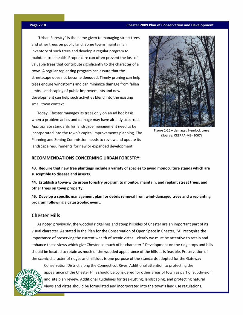
“Urban Forestry” is the name given to managing street trees
and other trees on public land. Some towns maintain an
inventory of such trees and develop a regular program to
maintain tree health. Proper care can often prevent the loss of
valuable trees that contribute significantly to the character of a
town. A regular replanting program can assure that the
streetscape does not become denuded. Timely pruning can help
trees endure windstorms and can minimize damage from fallen
limbs. Landscaping of public improvements and new
development can help such activities blend into the existing
small town context.
Today, Chester manages its trees only on an ad hoc basis,
when a problem arises and damage may have already occurred.
Appropriate standards for landscape management need to be
incorporated into the town’s capital improvements planning. The
Planning and Zoning Commission needs to review and update its
landscape requirements for new or expanded development.
RECOMMENDATIONS CONCERNING URBAN FORESTRY:
43. Require that new tree plantings include a variety of species to avoid monoculture stands which are susceptible to disease and insects.
44. Establish a town‐wide urban forestry program to monitor, maintain, and replant street trees, and other trees on town property.
45. Develop a specific management plan for debris removal from wind‐damaged trees and a replanting program following a catastrophic event.
Chester Hills
As noted previously, the wooded ridgelines and steep hillsides of Chester are an important part of its
visual character. As stated in the Plan for the Conservation of Open Space in Chester, “All recognize the
importance of preserving the current wealth of scenic vistas… clearly we must be attentive to retain and
enhance these views which give Chester so much of its character.” Development on the ridge tops and hills
should be located to retain as much of the wooded appearance of the hills as is feasible. Preservation of
the scenic character of ridges and hillsides is one purpose of the standards adopted for the Gateway
Conservation District along the Connecticut River. Additional attention to protecting the
appearance of the Chester Hills should be considered for other areas of town as part of subdivision
and site plan review. Additional guidelines for tree‐cutting, landscaping, and protecting natural
views and vistas should be formulated and incorporated into the town’s land use regulations.
Page 2‐18 Chester 2009 Plan of Conservation and Development
Figure 2‐15 – damaged Hemlock trees (Source: CRERPA‐MB‐ 2007)

Page 2‐19 Natural Resources

Route 9
Driving along Route 9 through Chester, the rural nature of the town is apparent. Proponents for the
completion of Route 11 east of the Connecticut River have argued for the creation of a “greenway” along
that roadway as a way to preserve the environment and maintain the visual character of that area. Route 9
in Chester is already a “greenway”. Zoning and careful site design should be used to maintain the green
appearance of the corridor, especially in the vicinity of Exits 6 and 7.
RECOMMENDATIONS CONCERNING CHESTER HILLS:
46. Protect views by discouraging large areas of tree‐cutting on hillsides.
47. Encourage proper management of privately‐owned forest lands.
48. Maintain linkages among large contiguous wooded areas.
49. In considering proposed development visible from Route 9, encourage building and site design, tree
retention and landscaping that maintains the rural appearance from the highway, especially at Exit 6.
Preserved Open Space
Approximately 36% of Chester’s total land area has been
preserved as permanent open space. Of that, about 65 percent
is owned by the State of Connecticut, largely in the
Cockaponsett State Forest. The Town of Chester, the Chester
Land Trust and the Connecticut River Gateway Commission all
hold additional protected land. The Connecticut Water
Company land located in the northern half of the town is
currently managed to protect the Chester Division water
supply. State law regulates the sale of water company lands for
other purposes. As long as the CWC continues to use their
system of reservoirs in Chester and Haddam for domestic
water, the lands should remain undeveloped.
In March of 1999, the Chester Town Meeting adopted a Plan
for the Conservation of Open Space in Chester, Connecticut,
prepared by the Chester Conservation Commission. That Plan recommends ten priorities for acquisition of
additional open space in Chester, including both specific areas and actions to enable a rapid response when
such areas become available. The Plan also includes recommendations to protect existing open space. Some
of the recommendations are specifically stated in this Plan. In addition, the Conservation
Commission is currently working on an updated plan.
Page 2‐20 Chester 2009 Plan of Conservation and Development
Figure 2‐6—Carini Preserve (Source Cummings & Good)
A project funded through the United States Fish and Wildlife Service is currently in progress under the
auspices of the Tidewater Institute and the Connecticut River Estuary Regional Planning Agency to involve
the towns of the Lower Connecticut River Valley (including Chester) in the inventory of open land for the
purpose of identifying potential greenways linking towns and regions. When completed, this additional
information will be useful to Chester in its future open space planning.
RECOMMENDATIONS CONCERNING OPEN SPACE:
50. Target open space acquisitions to address specific community needs.
51. Establish a permanent town fund for acquisition and maintenance of open space.
52. Monitor availability of land along rivers, brooks, and ponds for possible town acquisition.
53. Modify zoning and subdivision regulations to require a variety of open space dedications in future
subdivisions, including open fields, wildlife corridors and trail linkages. Modify subdivision regulations so
wetlands are not calculated as part of lot size.
54. Frequently update the Plan for Conservation of Open Space in Chester to include additional parcels
and techniques for land preservation.
55. Actively encourage donation of land to the Town or the Chester Land Trust.
56. Encourage less‐than‐fee acquisitions through the use of conservation easements and deed
restrictions.
57. Support state authorization for a local option property transfer surtax dedicated to the purchase and
maintenance of town open space.
Soils
A discussion of Chester’s natural resources should include mention of its soils. In much of Chester, a thin
layer of soil overlies the bedrock granite under the hills, with bedrock outcroppings visible on the surface in
many locations. Between the hills, many of the valleys are covered with inland wetlands soils, which are
poorly drained to very poorly drained. Areas with inland wetland soils have been mapped and are regulated
locally under state law to protect the functions and habitat of this resource. Along the Connecticut River,
the soils are alluvial within the floodplain which is formed when material is deposited by flowing water. In
several areas of town, farmland soils have been designated by the US Department of Agriculture’s Natural
Resource Conservation Service (NRCS), as either Prime Farmland or Farmland of Statewide Importance. The
NRCS describes prime farmland as “land that has the best combination of physical and chemical
characteristics for producing food, feed, forage, fiber or oilseed crops and is available for these uses.” Prime
farmland has the soil quality, growing season, and moisture supply and favorable temperature,
acceptable acidity or alkalinity, acceptable salt and sodium content, and few or no rocks. Typically
such soils do not flood during the growing season.
Page 2‐21 Natural Resources

Except for a small area in the village center served by a sewage treatment facility, the town relies on
onsite subsurface disposal for septic effluent. Some soil conditions pose limitations for installation and
functioning of subsurface disposal systems. Steep slopes, high ground water, shallow depth to bedrock and
slow permeability (the rate at which water travels through soil) are barriers to a successful on site system.
Installation of community septic systems or sewers is also difficult under those conditions. The NRCS has
classified soils for their potential for subsurface sewage disposal systems. Most of Chester has low, very low
or extremely low potential. Most of the areas with high or medium potential are either already developed
or located on State‐owned land. Great care must be taken in the approval, installation and maintenance of
onsite sewage disposal systems to avoid the need for additional community sewers in the future. Zoning
densities must recognize the limitations of the underlying soil types.
RECOMMENDATIONS CONCERNING SOILS:
58. Consider impervious surface limitations on areas designated as prime farm lands.
59. Review existing allowable zoning densities to assure that those densities adequately reflect
underlying soil conditions for onsite sewage disposal.
60. Subject proposed building lots to strict scrutiny to assure that the soils can support the proposed
development, requiring that subdividers submit a septic system suitability report to the Planning and
Zoning Commission as part of the application, and that the location and results of all soil tests be shown
on the subdivision plan.
Other Natural Resource Concerns
This Plan places special emphasis on the town’s water resources, upland forests and soils. This emphasis
is not intended to diminish other natural resource concerns.
Waste Disposal
In the past, solid waste disposal practices were a local issue and towns struggled to find a suitable means
of disposing of garbage, bulky waste and hazardous waste. While collection and transportation of these
materials is a local responsibility, regional and statewide disposal solutions have replaced the local “dump”.
In many towns, former dump sites remain a source of current water pollution. The former Haddam land fill
is located upstream of the Turkey Hill reservoir and is cause for future concern. Former factory sites may
also contain pollutants formerly used in production. These sites are often referred to as “brownfields” and
must be renovated prior to reuse. Reduction in the amount of various wastes generated within the town is
not only sound environmental policy, but also saves money spent for disposal. Recycling is a preferred
alternative to incineration, and efforts are being made statewide to break up the waste stream into
recyclable components. The town can assist in this effort by informing its citizens of alternatives
and by financially supporting the most appropriate disposal methods.
Page 2‐22 Chester 2009 Plan of Conservation and Development

RECOMMENDATIONS CONCERNING WASTE DISPOSAL:
61. Continue to provide information to citizens concerning appropriate waste disposal alternatives.
62. Continue to educate the public and support local recycling and composting.
Light Pollution
The Planning and Zoning Commission can address excessive lighting of non‐residential uses through its
zoning regulations. In recent years, decorative lighting has been incorporated into landscaping for
residential properties and is generally not reviewed by the land use commissions.
RECOMMENDATIONS CONCERNING LIGHT POLLUTION:
63. Review zoning regulations and consider a town ordinance to control light pollution and energy
consumption.
64. Support dark skies initiative.
Air Quality
Air quality in the Chester area is often affected by airborne pollutants from other areas. Air pollution
comes from many sources, but the generation of energy and the use of the internal combustion engine for
most of our transportation are significant contributing factors. This is not specifically a local issue, but
there are efforts that can address this issue at the local level where possible. Locally generated energy,
reduction of motor vehicle trips, and increased energy efficiency of equipment and structures are all
means of reducing the problem at the local level. Chapter Eight of this Plan discusses possible measures
that can be taken by the town collectively or by its people individually to become a part of the solution.
Many ideas suggested by the Conservation Commission during preparation of this Plan have been included
in Chapter Eight.
RECOMMENDATIONS CONCERNING PROTECTION OF NATURAL RESOURCES:
65. Complete natural resources inventory now in progress by the Conservation Commission and use the
inventory in land use decision making.
66 .Create and expand an integrated town Geographic Information System to make natural resource
information available to town decision makers.
67. Disturb natural areas only to the extent necessary to make use of a site for permitted purposes,
retaining existing trees, grading and landscaping to the greatest extent possible.
68. Encourage “green” and sustainable building practices.
Page 2‐23 Natural Resources

Chester 2009 Plan of Conservation and Development Page 2‐24

Page 2‐25 Natural Resources