Chapter 5 -- On-Site Stormwater Managementcms.cityoftacoma.org/surfacewater/swmm2003/V5-C5.pdf ·...
52
Chapter 5 - On-Site Storm Water Management Note: Figures 5.1 through 5.5 are courtesy of King County, Figures 5.6 and 5.7 are from Ecology’s 1992 Manual, and Figures 5.8 through 5.14 are courtesy of Washington Concrete and Aggregate Association. 5.1 Purpose This Chapter presents the methods for analysis and design of on-site storm water management Best Management Practices (BMPs). Many of these BMPs, although being used elsewhere, are new locally. Efforts are underway to further develop these “low impact development” concepts in Western Washington. Ecology will update these BMPs when local standards are established. The City will update these BMPs as information is made available by Ecology. Design procedures and requirements for storm water management BMPs meeting Minimum Requirement #7, Flow Control, are not found in this Volume but are found in Volume III. 5.2 Application The On-Site Storm Water Management BMPs presented in this Chapter have application to treatment situations specified in Volume V, Chapter 3. On-site BMPs focus on minimization of impervious surface area, the use of infiltration, and dispersion through on-site vegetation for storm water runoff flow control and treatment. Most of the BMPs serve to control runoff flow rate as well as to provide runoff treatment. Non-pollution generating surfaces, such as rooftops and patios, may also use the infiltration BMPs contained in Volume III, Section 3.1, which provide flow control only. Pollution generating surfaces, such as driveways, small parking lots, and landscaping, must use on-site BMPs to provide some water quality treatment. 5.3 Best Management Practices for On-Site Storm Water Management Included are the following specific On-Site Storm Water Management BMPs discussed in this Chapter: Section 5.3.1 - Dispersion and Soil Quality BMPs BMP T5.10 Downspout Dispersion BMP T5.11 Concentrated Flow Dispersion BMP T5.12 Sheet Flow Dispersion BMP T5.13 Post-Construction Soil Quality and Depth January 2003 Volume V – Runoff Treatment BMPs 5-1
Transcript of Chapter 5 -- On-Site Stormwater Managementcms.cityoftacoma.org/surfacewater/swmm2003/V5-C5.pdf ·...

Chapter 5 - On-Site Storm Water Management Note: Figures 5.1 through 5.5 are courtesy of King County, Figures 5.6 and 5.7 are from Ecology’s 1992 Manual, and Figures 5.8 through 5.14 are courtesy of Washington Concrete and Aggregate Association.
5.1 Purpose This Chapter presents the methods for analysis and design of on-site storm water management Best Management Practices (BMPs). Many of these BMPs, although being used elsewhere, are new locally. Efforts are underway to further develop these “low impact development” concepts in Western Washington. Ecology will update these BMPs when local standards are established. The City will update these BMPs as information is made available by Ecology.
Design procedures and requirements for storm water management BMPs meeting Minimum Requirement #7, Flow Control, are not found in this Volume but are found in Volume III.
5.2 Application
The On-Site Storm Water Management BMPs presented in this Chapter have application to treatment situations specified in Volume V, Chapter 3.
On-site BMPs focus on minimization of impervious surface area, the use of infiltration, and dispersion through on-site vegetation for storm water runoff flow control and treatment.
Most of the BMPs serve to control runoff flow rate as well as to provide runoff treatment. Non-pollution generating surfaces, such as rooftops and patios, may also use the infiltration BMPs contained in Volume III, Section 3.1, which provide flow control only. Pollution generating surfaces, such as driveways, small parking lots, and landscaping, must use on-site BMPs to provide some water quality treatment.
5.3 Best Management Practices for On-Site Storm Water Management
Included are the following specific On-Site Storm Water Management BMPs discussed in this Chapter:
Section 5.3.1 - Dispersion and Soil Quality BMPs BMP T5.10 Downspout Dispersion BMP T5.11 Concentrated Flow Dispersion BMP T5.12 Sheet Flow Dispersion BMP T5.13 Post-Construction Soil Quality and Depth
January 2003 Volume V – Runoff Treatment BMPs 5-1

Section 5.3.2 - Site Design BMPs BMP T5.20 Preserving Natural Vegetation BMP T5.21 Better Site Design
Section 5.3.3 – Other Practices BMP T5.30 Full Dispersion BMP T5.31 Vegetated Rooftops BMP T5.32 Cisterns BMP T5.33 Concave Vegetated Surface BMP T5.34 Multiple Small Basins BMP T5.35 Engineered Soil/Landscape Systems BMP T5.36 Soil Compaction Protection and Mitigation
Section 5.3.4 - Permeable/Porous Pavements BMP T5.40 Porous Pavement BMP T5.41 Porous Pavers BMP T5.42 Permeable Interlocking Concrete Pavement
Projects shall employ these BMPs to infiltrate, disperse, and retain storm water runoff on site to the maximum extent practicable without causing flooding or erosion impacts. Infiltration and dispersion systems shall have pre-approval by the City with regard to appropriateness for the project site. Sites that can fully infiltrate (see Volume III, Chapter 3) or fully disperse (see BMP T5.30) are not required to provide runoff treatment or flow control facilities. Full dispersion credit is limited to sites with a maximum of 10% impervious area that is dispersed through 65% of the site maintained in natural vegetation.
Impervious surfaces that are not fully dispersed should be partially dispersed to the maximum extent practicable and then hydrologically modeled. If the model predicts that there will be a 0.1 cfs or greater increase in the 100-year return frequency flow, or if certain thresholds of impervious surfaces or converted pervious surfaces are exceeded within a threshold discharge area (see Volume I, Table 3.2), then a flow control facility is required. Also, a treatment facility is required if the thresholds in Table 3.1 of Volume I are exceeded. Residential roofs that are dispersed through at least 50 feet of native vegetation may be modeled as grass. Other impervious surfaces that are partially dispersed will not be given flow credit. Modular grid pavements will be allowed a flow credit. Porous concrete and asphalt will not be allowed a flow credit at this time due to the uncertainty of long-term viability.
5-2 Volume V – Runoff Treatment BMPs January 2003

5.3.1 Dispersion and Soil Quality BMPs
The following BMPs pertain to dispersion and soil quality applications.
BMP T5.10 Downspout Dispersion Purpose and Definition Downspout dispersion BMPs are splashblocks or gravel-filled trenches that serve to spread roof runoff over vegetated pervious areas. Dispersion attenuates peak flows by slowing entry of the runoff into the conveyance system, allows for some infiltration, and provides some water quality benefits. This information is repeated in Volume III. Applications and Limitations
• Downspout dispersion may be used on all subdivision single-family lots which meet one of the following criteria (with City pre-approval): 1. Lots greater than or equal to 22,000 square feet where downspout
infiltration is not being provided according to the requirements in Volume III, Chapter 3.
2. Lots smaller than 22,000 square feet where soils are not suitable for downspout infiltration as determined in Volume III, Chapter 3 and where the design criteria below can be met.
• All other projects required to apply Roof Downspout BMPs must provide downspout dispersion if downspout infiltration is not feasible or applicable as determined in Volume III, Chapter 3, and if the design criteria below can be met.
General Design Guidelines
• Dispersion trenches designed as shown in the Figures 5.1 and 5.2 shall be used for all downspout dispersion applications except where splashblocks are allowed below. See Figure 5.3 for a typical splashblock.
• Splashblocks may be used for downspouts discharging to a vegetated flowpath at least 50 feet in length as measured from the downspout to the downstream property line, structure, sensitive steep slope, stream, wetland, or other impervious surface. Sensitive area buffers may count toward flowpath lengths. The vegetated flowpath must be covered with well-established lawn or pasture, landscaping with well-established groundcover, or native vegetation with natural groundcover. The groundcover shall be dense enough to help disperse and infiltrate flows and to prevent erosion.
• If the vegetated flowpath (measured as defined above) is less than 25 feet on a subdivision single-family lot, a perforated stub-out connection may be used in lieu of downspout dispersion (see Volume III, Chapter 3). A perforated stub-out may also be used where implementation of downspout dispersion might cause erosion or flooding problems, either on site or on adjacent lots. This provision might be appropriate, for example, for lots constructed on steep hills
January 2003 Volume V – Runoff Treatment BMPs 5-3

where downspout discharge could be cumulative and might pose a potential hazard for lower lying lots, or where dispersed flows could create problems for adjacent offsite lots. This provision does not apply to situations where lots are flat and onsite downspout dispersal would result in saturated yards.
Note: For all other types of projects, the use of a perforated stub-out in lieu of downspout dispersion shall be as determined by the City.
Additional Design Criteria For Dispersion Trenches
• A vegetated flowpath of at least 25 feet in length must be maintained between the outlet of the trench and any property line, structure, stream, wetland, or impervious surface. A vegetated flowpath of at least 50 feet in length must be maintained between the outlet of the trench and any steep slope. Sensitive area buffers may count towards flowpath lengths.
• Trenches serving up to 700 square feet of roof area may be simple 10-foot-long by 2-foot wide gravel filled trenches as shown on Figure 5-1. For roof areas larger than 700 square feet, a dispersion trench with notched grade board as shown in Figure 5-2 may be used as approved by the City. The total length of this design must provide at least 10 feet of trench per 700 square feet of roof area and not exceed 50 feet.
• All dispersions systems shall be at least 10 feet from any structure. If necessary, setbacks shall be increased from the minimum 10 feet in order to maintain a 1:1 side slope for future excavation and maintenance.
• All dispersion systems shall be placed at least 5 feet from any property line. If necessary, setbacks shall be increased from the minimum 5 feet in order to maintain a 1:1 side slope for future excavation and maintenance.
• Dispersion systems shall be setback from sensitive areas, steep slopes, landslide hazard areas, and erosion hazard areas as governed by the Tacoma Municipal Code.
• No erosion or flooding of downstream properties shall result.
• Runoff discharged towards landslide hazard areas must be evaluated by a geotechnical engineer or qualified geologist. The discharge point shall not be placed on or above slopes greater than 20% or above erosion hazard areas without evaluation by a geotechnical engineer or qualified geologist and City approval.
• For sites with septic systems, the discharge point must be downgradient of the drainfield primary and reserve areas. This requirement can be waived by the City's permit review staff if site topography will clearly prohibit flows from intersecting the drainfield.
5-4 Volume V – Runoff Treatment BMPs January 2003

Additional Design Criteria For Splashblocks In general, if the ground is sloped away from the foundation, and there is adequate vegetation and area for effective dispersion, splashblocks will adequately disperse storm runoff. If the ground is fairly level, if the structure includes a basement, or if foundation drains are proposed, splashblocks with downspout extensions may be a better choice because the discharge point is moved away from the foundation. Downspout extensions can include piping to a splashblock/discharge point a considerable distance from the downspout, as long as the runoff can travel through a well-vegetated area as described below. The following conditions must be met to use splashblocks:
• A vegetated flowpath of at least 50 feet must be maintained between the discharge point and any property line, structure, steep slope, stream, wetland, lake, or other impervious surface. Sensitive area buffers may count toward flowpath lengths.
• Flows shall not be directed onto sidewalks.
• A maximum of 700 square feet of roof area may drain to each splashblock.
• A splashblock or a pad of crushed rock (2 feet wide by 3 feet long by 6 inches deep) shall be placed at each downspout discharge point.
• No erosion or flooding of downstream properties may result.
• Runoff discharged towards landslide hazard areas must be evaluated by a geotechnical engineer or qualified geologist. Splashblocks may not be placed on or above slopes greater than 20% or above erosion hazard areas without evaluation by a geotechnical engineer or qualified geologist and approval by the City.
• For sites with septic systems, the discharge point must be downslope of the primary and reserve drainfield areas. This requirement may be waived by the City if site topography clearly prohibits flows from intersecting the drainfield or where site conditions indicate that this is unnecessary (see Volume III, Chapter 3).
January 2003 Volume V – Runoff Treatment BMPs 5-5

BMP T5.11 Concentrated Flow Dispersion Purpose and Definition
Dispersion of concentrated flows from driveways or other pavement through a vegetated pervious area attenuates peak flows by slowing entry of the runoff into the conveyance system, allows for some infiltration, and provides some water quality benefits (see Figure 5.4).
Applications and Limitations • Any situation where concentrated flow can be dispersed through
vegetation. • Dispersion for driveways will generally only be effective for single-
family residences on large lots and in rural short plats. Lots proposed by short plats in urban areas will generally be too small to provide effective dispersion of driveway runoff.
• Figure 5.4 shows two possible ways of spreading flows from steep driveways.
Design Guidelines • A vegetated flowpath of at least 50 feet should be maintained
between the discharge point and any property line, structure, steep slope, stream, lake, wetland, lake, or other impervious surface.
• A maximum of 700 square feet of impervious area may drain to each dispersion BMP.
• A pad of crushed rock (2 feet wide by 3 feet long by 6 inches deep) shall be placed at each discharge point.
• No erosion or flooding of downstream properties may result. • Runoff discharged towards landslide hazard areas must be evaluated
by a geotechnical engineer or qualified geologist. The discharge point shall not be placed on or above slopes greater than 20% or above erosion hazard areas without evaluation by a geotechnical engineer or qualified geologist and approval by the City.
• For sites with septic systems, the discharge point should be downgradient of the drainfield primary and reserve areas. This requirement may be waived by the City if site topography clearly prohibits flows from intersecting the drainfield or where site conditions indicate that this is unnecessary (see Volume III, Chapter 3).
5-6 Volume V – Runoff Treatment BMPs January 2003

BMP T5.12 Sheet Flow Dispersion Purpose and Definition Sheet flow dispersion is the simplest method of runoff control. This BMP can be used for any impervious or pervious surface that is graded so as to avoid concentrating flows. Because flows are already dispersed as they leave the surface, they need only traverse a narrow band of adjacent vegetation for effective attenuation and treatment. Applications and Limitations Flat or moderately sloping (<15% slope) impervious surfaces such as driveways, sport courts, patios, and roofs without gutters; sloping cleared areas that are comprised of bare soil, non-native landscaping, lawn, and/or pasture; or any situation where concentration of flows can be avoided.
Design Guidelines • See Figure 5.5 for details for driveways. • A 2-foot-wide transition zone to discourage channeling should be
provided between the edge of the driveway pavement and the downslope vegetation, or under building eaves. This may be an extension of subgrade material (crushed rock), modular pavement, drain rock, or other material acceptable to the City.
• A vegetated buffer width of 10 feet of vegetation must be provided for up to 20 feet of width of paved or impervious surface. An additional 5 feet of width must be added for each addition 20 feet of width or fraction thereof.
• A vegetated buffer width of 25 feet of vegetation must be provided for up to 150 feet of contributing cleared area (i.e., bare soil, non-native landscaping, lawn, and/or pasture). Slopes within the 25-foot minimum flowpath through vegetation should be no steeper than 8 percent. If this criterion cannot be met due to site constraints, the 25-foot flowpath length must be increased 1.5 feet for each percent increase in slope above 8%.
• No erosion or flooding of downstream properties may result. • Runoff discharge toward landslide hazard areas must be evaluated by
a geotechnical engineer or a qualified geologist. The discharge point may not be placed on or above slopes greater than 20% or above erosion hazard areas without evaluation by a geotechnical engineer or qualified geologist and approval by the City.
• For sites with septic systems, the discharge point must be downgradient of the drainfield primary and reserve areas. This requirement may be waived by the City if site topography clearly prohibits flows from intersecting the drainfield or where site conditions indicate that this is unnecessary (see Volume III, Chapter 3).
January 2003 Volume V – Runoff Treatment BMPs 5-7

BMP T5.13 Post-Construction Soil Quality and Depth Purpose and Definition Naturally occurring (undisturbed) soil and vegetation provide important storm water functions including: water infiltration; nutrient, sediment, and pollutant adsorption; sediment and pollutant biofiltration; water interflow storage and transmission; and pollutant decomposition. These functions are largely lost when development strips away native soil and vegetation and replaces it with minimal topsoil and sod. Not only are these important storm water functions lost, but such landscapes themselves become pollution generating pervious surfaces due to increased use of pesticides, fertilizers and other landscaping and household/industrial chemicals, the concentration of pet wastes, and pollutants that accompany roadside litter. Establishing soil quality and depth regains greater storm water functions in the post development landscape, provides increased treatment of pollutants and sediments that result from development and habitation, and minimizes the need for some landscaping chemicals, thus reducing pollution through prevention.
Applications and Limitations Establishing a minimum soil quality and depth is not the same as preservation of naturally occurring soil and vegetation. It also does not maximize the storm water functions that could be attained through greater soil depth and more specialized formulations as presented in BMP T5.35, Engineered Soil/Landscape Systems. However, establishing a minimum soil quality and depth will provide improved on-site management of storm water flow and water quality. Soil organic matter can be attained through numerous materials such as compost, composted woody material, biosolids, and forest product residuals. It is important that the materials used to meet the soil quality and depth BMP be appropriate and beneficial to the plant cover to be established. Likewise, it is important that imported topsoils improve soil conditions and do not have an excessive percent of clay fines.
Design Guidelines
• Soil retention. The duff layer and native topsoil should be retained in an undisturbed state to the maximum extent practicable. In any areas requiring grading, remove and stockpile the duff layer and topsoil on site in a designated, controlled area, not adjacent to public resources and critical areas, to be reapplied to other portions of the site where feasible.
• Soil quality. All areas subject to clearing and grading that have not been covered by impervious surface, incorporated into a drainage facility or engineered as structural fill or slope shall, at project completion, demonstrate the following: 1. Retention or enhancement of the moisture infiltration rate and soil
moisture holding capacity of the original undisturbed soil native to the site. Areas which have been compacted or have removed
5-8 Volume V – Runoff Treatment BMPs January 2003

some or all of the duff layer or underlying top soil shall be amended to mitigate for lost moisture infiltration and moisture holding capacity; and
2. A topsoil layer with a minimum organic matter content of ten percent dry weight and a pH from 6.0 to 8.0 or matching the pH of the original undisturbed soil. The topsoil layer shall have a minimum depth of eight inches except where tree roots limit the depth of incorporation of amendments needed to meet the criteria. Subsoils below the topsoil layer should be scarified at least 4 inches with some incorporation of the upper material to avoid stratified layers, where feasible (see Volume II).
• These criteria can be met by using on-site native topsoil, incorporating amendments into on-site soil, or importing blended topsoil. If blended topsoil is imported, then fines should be limited to twenty-five percent passing through a 200 sieve.
• The resulting soil should be conducive to the type of vegetation to be established.
Maintenance
• Soil quality and depth should be established toward the end of construction and once established, should be protected from compaction, such as from large machinery use, and from erosion.
• Soil should be planted and mulched after installation.
• Plant debris or its equivalent should be left on the soil surface to replenish organic matter.
• It should be possible to reduce use of irrigation, fertilizers, herbicides and pesticides. These activities should be adjusted where possible, rather than continuing to implement formerly established practices.
January 2003 Volume V – Runoff Treatment BMPs 5-9

5.3.2 Site Design BMPs The two BMPs in this section are general practices for design and maintenance at the site. BMP T5.20 Preserving Natural Vegetation
Purpose And Definition
Preserving natural vegetation on-site to the maximum extent practicable will minimize the impacts of development on storm water runoff. Ecology prefers that 65 percent or more of the development site should be protected for the purposes of retaining or enhancing existing forest cover and preserving wetlands and stream corridors.
Applications and Limitations
New development often takes place on tracts of forested land. In fact, building sites are often selected because of the presence of mature trees. However, unless sufficient care is taken and planning done, in the interval between buying the property and completing construction much of this resource is likely to be destroyed. The property owner is ultimately responsible for protecting as many trees as possible, with their understory and groundcover. This responsibility is usually exercised by agents, planners, designers, and contractors. It takes 20 to 30 years for newly planted trees to provide the benefits for which trees are so highly valued.
Forest and native growth areas allow rainwater to naturally percolate into the soil, recharging groundwater for summer stream flows and reducing storm water runoff that creates erosion and flooding. Conifers can hold up to about 50 percent of all rain that falls during a storm. Twenty to 30 percent of this rain may never reach the ground but evaporates or is taken up by the tree. Forested and native growth areas also may be effective as storm water buffers around smaller developments.
On lots that are one acre or greater, preservation of 65 percent or more of the site in natural vegetation will allow the use of full dispersion techniques presented in BMP T5.30. Sites that can fully disperse are not required to provide runoff treatment or flow control facilities.
Design Guidelines
• The preserved area should be situated to minimize the clearing of existing forest cover, to maximize the preservation of wetlands, and to buffer stream corridors.
• The preserved area should be placed in a separate tract or protected through recorded easements for individual lots.
• If feasible, the preserved area should be located downslope from the building sites, since flow control and water quality are enhanced by flow dispersion through duff, undisturbed soils, and native vegetation.
5-10 Volume V – Runoff Treatment BMPs January 2003

• The preserved area should be shown on all property maps and should be clearly marked during clearing and construction on the site.
Maintenance
• Vegetation and trees should not be removed from the natural growth retention area, except for approved timber harvest activities and the removal of dangerous and diseased trees.
January 2003 Volume V – Runoff Treatment BMPs 5-11

BMP T5.21 Better Site Design
Purpose and Definition
Fundamental hydrological concepts and storm water management concepts can be applied at the site design phase that are: • more integrated with natural topography, • reinforce the hydrologic cycle, • more aesthetically pleasing, and • often less expensive to build. A few site planning principles help to locate development on the least sensitive portions of a site and accommodate residential land use while mitigating its impact on storm water quality.
Design Guidelines
• Define Development Envelope and Protected Areas - The first step in site planning is to define the development envelope. This is done by identifying protected areas, setbacks, easements and other site features, and by consulting applicable local standards and requirements. Site features to be protected may include important existing trees, steep slopes, erosive soils, riparian areas, or wetlands.
By keeping the development envelope compact, environmental impacts can be minimized, construction costs can be reduced, and many of the site’s most attractive landscape features can be retained. In some cases, economics or other factors may not allow avoidance of all sensitive areas. In these cases, care can be taken to mitigate the impacts of development through site work and other landscape treatments.
• Minimize Directly Connected Impervious Areas - Impervious areas directly connected to the storm drain system are the greatest contributors to urban nonpoint source pollution. Any impervious surface that drains into a catch basin or other conveyance structure is a “directly connected impervious surface.” As storm water runoff flows across parking lots, roadways, and other paved areas, the oil, sediment, metals, and other pollutants are collected and concentrated. If this runoff is collected by a drainage structure and carried directly along impervious gutters or in sealed underground pipes, it has no opportunity for filtering by plant material or infiltration into the soil. It also increases in velocity and amount, causing increased peak-flows in the winter and decreased base-flows in the summer.
A basic site design principle for storm water management is to minimize these directly connected impervious areas. This can be
5-12 Volume V – Runoff Treatment BMPs January 2003

done by limiting overall impervious land coverage or by infiltrating and/or dispersing runoff from these impervious areas.
• Maximize Permeability - Within the development envelope, many opportunities are available to maximize the permeability of new construction. These include minimizing impervious areas, paving with permeable materials, clustering buildings, and reducing the land coverage of buildings by smaller footprints. All of these strategies make more land available for infiltration and dispersion through natural vegetation.
Clustered driveways, small visitor parking bays and other strategies can also minimize the impact of transportation-related surfaces while still providing adequate access.
Once site coverage is minimized through clustering and careful planning, pavement surfaces can be selected for permeability. A patio of brick-on-sand, for example, is more permeable than a large concrete slab. Engineered soil/landscape systems are permeable ground covers suitable for a wide variety of uses. Permeable/porous pavements can be used in place of traditional concrete or asphalt pavements in many low traffic applications.
Maximizing permeability at every possible opportunity requires the integration of many small strategies. These strategies will be reflected at all levels of a project, from site planning to materials selection. In addition to the environmental and aesthetic benefits, a high-permeability site plan may allow the reduction or elimination of expensive runoff underground conveyance systems, flow control and treatment facilities, yielding significant savings in development costs.
• Build Narrower Streets - More than any other single element, street design has a powerful impact on storm water quantity and quality. In residential development, streets and other transportation-related structures typically can comprise between 60 and 70 percent of the total impervious area, and, unlike rooftops, streets are almost always directly connected to the storm water conveyance system.
The combination of large, directly connected impervious areas, together with the pollutants generated by automobiles, makes the street network a principal contributor to storm water pollution in residential areas.
• Maximize Choices for Mobility - Given the costs of automobile use, both in land area consumed and pollutants generated, maximizing choices for mobility is a basic principle for environmentally responsible site design. By designing residential developments to promote alternatives to automobile use, a primary source of storm water pollution can be mitigated.
January 2003 Volume V – Runoff Treatment BMPs 5-13

Bicycle lanes and paths, secure bicycle parking at community centers and shops, direct, safe pedestrian connections, and transit facilities are all site-planning elements that maximize choices for mobility.
• Use Drainage as a Design Element - Unlike conveyance storm drain systems that hide water beneath the surface and work independently of surface topography, a drainage system for storm water infiltration or dispersion can work with natural land forms and land uses to become a major design element of a site plan.
By applying storm water management techniques early in the site plan development, the drainage system can suggest pathway alignments, optimum locations for parks and play areas, and potential building sites. In this way, the drainage system helps to generate urban form, giving the development an integral, more aesthetically pleasing relationship to the natural features of the site. Not only does the integrated site plan complement the land, it can also save on development costs by minimizing earthwork and expensive drainage features.
Resource Material
Start at the Source. Residential Site Planning & Design Guidance Manual for Stormwater Quality Protection. Bay Area Stormwater Management Agencies Association. January 1997.
Site Planning for Urban Stream Protection. Center for Watershed Protection. December, 1995.
Better Site Design: A Handbook for Changing Development Rules in Your Community. Center for Watershed Protection. August 1998.
http:\\www.stormwatercenter.net
5-14 Volume V – Runoff Treatment BMPs January 2003

5.3.3 Other Practices The BMPs described in this section are other general practices for on-site treatment of storm water.
BMP T5.30 Full Dispersion
Purpose and Definition This BMP allows for "fully dispersing" runoff from impervious surfaces and cleared areas of development sites that protect at least 65% of the site (or a threshold discharge area on the site) in a forest or native condition.
Applications and Limitations
• Rural single-family residential developments should use these dispersion BMPs wherever possible to minimize effective impervious surface to less than 10% of the development site.
• Other types of development that retain 65% of the site (or a threshold discharge area on the site) in a forested or native condition may also use these BMPs to avoid triggering the flow control facility requirement.
. Design Guidelines • Roof Downspouts - Roof surfaces that comply with the downspout
infiltration requirements in Volume III, Chapter 3, are considered to be "fully dispersed" (i.e., zero percent effective imperviousness). All other roof surfaces are considered to be "fully dispersed" (i.e., at or approaching zero percent effective imperviousness) only if they are within a threshold discharge area that is or will be more than 65% forested (or native vegetative cover) and less than 10% impervious (total), and if they comply with the downspout dispersion requirements of BMP T5.10, and have vegetated flow paths through native vegetation exceeding 100 feet.
• Driveway Dispersion - Driveway surfaces are considered to be "fully
dispersed" if they are within a threshold discharge area that is or will be more than 65% forested (or native vegetative cover) and less than 10% impervious (total), AND if they comply with the driveway dispersion BMPs – BMP 5.11 and BMP T5.12 - and have flow paths through native vegetation exceeding 100 feet. This also holds true for any driveway surfaces that comply with the roadway dispersion BMPs described below.
• Roadway Dispersion BMPs - Roadway surfaces are considered to be "fully dispersed" if they are within a threshold discharge area that is or will be more than 65% forested (or native vegetative cover) and less than 10% impervious (total), and if they comply with the following dispersion requirements:
January 2003 Volume V – Runoff Treatment BMPs 5-15

1. Roadway runoff dispersion is allowed only on rural neighborhood collectors and local access streets. To the extent feasible, driveways should be dispersed to the same standards as roadways to ensure adequate water quality protection of downstream resources.
2. The road section shall be designed to minimize collection and concentration of roadway runoff. Sheet flow over roadway fill slopes (i.e., where roadway subgrade is above adjacent right-of-way) should be used wherever possible to avoid concentration.
3. When it is necessary to collect and concentrate runoff from the roadway and adjacent upstream areas (e.g., in a ditch on a cut slope), concentrated flows shall be incrementally discharged from the ditch via cross culverts or at the ends of cut sections. These incremental discharges of newly concentrated flows shall not exceed 0.5 cfs at any one discharge point from a ditch for the 100-year runoff event. Where flows at a particular ditch discharge point were already concentrated under existing site conditions (e.g., in a natural channel that crosses the roadway alignment), the 0.5-cfs limit would be in addition to the existing concentrated peak flows.
4. Ditch discharge points with up to 0.2 cfs discharge for the peak 100-year flow shall use rock pads or dispersion trenches to disperse flows. Ditch discharge points with between 0.2 and 0.5 cfs discharge for the 100-year peak flow shall use only dispersion trenches to disperse flows.
5. Dispersion trenches shall be designed to accept storm flows (free discharge) from a pipe, culvert, or ditch end, shall be aligned perpendicular to the flowpath, and shall be minimum 2 feet by 2 feet in section, 50 feet in length, filled with ¾-inch to 1½-inch washed rock, and provided with a level notched grade board (see Figure 5.2). Manifolds may be used to split flows up to 2 cfs discharge for the 100-year peak flow between up to 4 trenches. Dispersion trenches shall have a minimum spacing of 50 feet.
6. After being dispersed with rock pads or trenches, flows from ditch discharge points must traverse a minimum of 100 feet of undisturbed native vegetation before leaving the project site, or entering an existing onsite channel carrying existing concentrated flows across the road alignment.
Note: In order to provide the 100-foot flowpath length to an existing channel, some roadway runoff may unavoidably enter the channel undispersed. Also note that water quality treatment may be waived for roadway runoff dispersed through 100 feet of undisturbed native vegetation.
7. Flowpaths from adjacent discharge points must not intersect within the 100-foot flowpath lengths, and dispersed flow from a discharge point must not be intercepted by another discharge point. To enhance the flow control and water quality effects of
5-16 Volume V – Runoff Treatment BMPs January 2003

dispersion, the flowpath shall not exceed 15% slope, and shall be located within designated open space.
Note: Runoff may be conveyed to an area meeting these flowpath criteria.
8. Ditch discharge points shall be located a minimum of 100 feet upgradient of steep slopes (i.e., slopes steeper than 40%), wetlands, and streams.
9. Where the City determines there is a potential for significant adverse impacts downstream (e.g., erosive steep slopes or existing downstream drainage problems), dispersion of roadway runoff may not be allowed, or other measures may be required. See Volume I, Chapter 2 for geographic specific requirements.
• Cleared Area Dispersion BMPs
The runoff from cleared areas that are comprised of bare soil, non-native landscaping, lawn, and/or pasture is considered to be "fully dispersed" if it is dispersed through at least 25 feet of native vegetation in accordance with the following criteria: 1. The contributing flowpath of cleared area being dispersed must be
no more than 150 feet, and 2. Slopes within the 25-foot minimum flowpath through native
vegetation should be no steeper than 8%. If this criterion cannot be met due to site constraints, the 25-foot flowpath length must be increased 1.5 feet for each percent increase in slope above 8%.
January 2003 Volume V – Runoff Treatment BMPs 5-17

BMP T5.31 Vegetated Rooftops (Green Roofs)
Purpose and Definition
Vegetated rooftops, also know as green roofs or eco-roofs, are veneers of living vegetation that are installed on top of conventional roofs. A green roof is an extension of the existing roof, which involves a special root repelling membrane, a drainage system, a lightweight growing medium, and plants.
Applications and Limitations
Vegetated rooftops offer a practical method of managing runoff in densely developed urban neighborhoods and can be engineered to achieve specific storm water runoff control objectives.
Design Guidelines Vegetated rooftops achieve runoff control by mimicking a variety of hydrologic processes that are associated with open space. These include: • Interception of rainfall by foliage • Direct runoff • Infiltration • Percolation • Shallow subterranean flow (i.e., analogous to shallow groundwater
flow) • Root zone moisture uptake and subsequent evapotranspiration
In a vegetated roof cover, all of these functions occur in a thin layer, typically 10 to 20 cm in depth. Through careful design, these hydrologic processes can be modulated to achieve specific outcomes. Vegetated roof covers can be considered as falling into three categories. These are: 1. Single layer system with free drainage. 2. Multi-layer system with a freely-drained basal drainage layer. 3. Multi-layer system, incorporating restricted drainage that causes a
free water surface to form inside the drainage layer (integral storage).
It is important to properly specify the hydraulic properties of materials used in constructing vegetated roof covers. Both the growth media and the drainage layer play an important role in controlling runoff. Growth media properties, including saturated hydraulic conductivity, porosity, and moisture retention exert influence when the cover is dry. When the cover has been soaked by antecedent rainfall, the transmissivity of the drainage layer is more important.
5-18 Volume V – Runoff Treatment BMPs January 2003

It is important to consider practical limitations as well as hydraulic considerations. Hydraulic conductivity of growth media should not be less than 0.03 cm/min to prevent anaerobic conditions from becoming established. Designs that incorporate less transmissive drainage layers will be associated with the transient build-up of hydrostatic pressure over some areas of the waterproofing membrane. This may not be desirable, especially in retrofit situations.
Allowable load capacities of roofs may also constrain the depth of cover.
Resource Material
Miller, C. and Grantley Pyke. Methodology for the Design of Vegetated Roof Covers, Proceedings of the 1999 International Water Resources Engineering Conference, Seattle, Washington.
January 2003 Volume V – Runoff Treatment BMPs 5-19

BMP T5.32 Cisterns
Purpose and Definition A cistern is a vessel that allows storage and use of roof runoff. Cisterns may be either an above ground vessel with a manually operated valve or permanently open outlet or a below ground vessel with a pump. Cisterns should provide at least 1,000 gallons of storage to have any significant hydrologic effect.
Applications and Limitations If the cistern has an operable valve, the valve can be closed to store storm water for irrigation use or infiltration between storms. This system requires continual monitoring by the resident or grounds crew, but provides greater flexibility in water storage and metering. If a cistern is provided with an operable valve and water is stored inside for long periods, the cistern must be covered to prevent mosquitoes from breeding.
A cistern system with a permanently open outlet can also provide for metering storm water runoff. If the cistern outlet is significantly smaller than the size of the downspout inlet (e.g. ¼ or ½ inch diameter), runoff will build up inside the cistern during storms, and will empty out slowly after peak intensities subside. Cisterns require active management and maintenance by all future property owners in order to provide any long-term benefit.
Design Guidelines • Cisterns can be incorporated into the aesthetics of the building and
garden. • If a cistern holds more than 6 inches depth of water, it should be
covered securely or have a top opening of 4 inches or less to prevent small children from gaining access to the standing water.
• The cistern should be designed and maintained to minimize clogging by leaves and other debris.
• Design information is available from the University of Florida Cooperative Extension Service at http://edis.ifas.ufl.edu.
5-20 Volume V – Runoff Treatment BMPs January 2003

BMP T5.33 Concave Vegetated Surfaces
Purpose and Definition
A landscape surface is graded to have a slightly concave slope to collect storm water and promote infiltration.
Applications and Limitations
Landscape surfaces are conventionally graded to have a slight convex slope, causing water to run off a central high point into a surrounding drainage system. If a landscape surface is graded to have a slightly concave slope, it will hold water. Conventional practice in a concave vegetated surface is to place an area drain or catch basin at the center to collect storm water. If the drain is placed not in the central low spot, but at the high edge, just below the adjacent pavements, then the concave surface will hold water until it reaches the level of the catch basin. In locations where a storm drainage system is used, a check dam can serve as an alternative to the overflow drain, allowing the water to overflow from the concave vegetated surface into a swale system.
Design Guidelines
Concave vegetated surfaces need not be very deep to make a significant contribution to overall storm storage capacity and storm water quality. For example, a square lawn area 50 feet on a side, sloping 2 percent towards the center will create a low point 6 inches below the outside rim. This 6-inch slope over 25 feet of distance is barely noticeable, and is similar to standard grading practice for lawn areas. This 50-foot x 50-foot x 6-inch deep lawn area creates a storage capacity of 413 cubic feet. If adjacent impervious surfaces, such as sidewalks, rooftops, and roads are designed to sheet flow into this concave lawn, their runoff can gradually infiltrate into the soil.
If a series of concave vegetated surfaces are designed and located to collect and hold runoff from small storms, most pollutants and storm water can be controlled on-site. Catch basins located at the edge of the concave vegetated surfaces can collect runoff from larger storms.
Effectiveness can be enhanced by the presence of a properly functioning soil system. This requires appropriate soil depth and composition to ensure both short-term and long-term filtration effectiveness. Substantial filtration, retention, and pollution control can occur if soil depths of 8 inches or more are present. Soils should be designed per BMP T5.13, Post-Construction Soil Quality And Depth.
January 2003 Volume V – Runoff Treatment BMPs 5-21

BMP T5.34 Multiple Small Basins
Purpose and Definition
Multiple small infiltration basins or wetponds are designed on site.
Applications and Limitations Multiple small basins can provide a great deal of water storage and infiltration capacity. These small basins can fit into the parkway planting strips. If connected by culverts under walks and driveways, they can create a continuous linear infiltration system. Infiltration basins can be placed under wood decks, in parking lot planter islands, and at roof downspouts. Outdoor patios or seating areas can be sunken a few steps, paved with a permeable pavement such as flagstone or gravel, and designed to hold a few inches of water collected from surrounding rooftops or paved areas for a few hours after a rain.
Rain gardens can be planned and integrated into both new and existing developments. A rain garden combines shrubs, grasses, trees and plants in depressions (about 6 inches deep) that allow water to pool after a rain event. The plants in the rain garden absorb the water and remove nutrients for a very low cost.
These examples of small basins can store water for a brief period, allowing it to infiltrate into the soil, slowing its release into the drainage network, and filtering pollutants.
Effectiveness can be enhanced by the presence of a properly functioning soil system. This requires appropriate soil depth and composition to ensure both short-term and long-term filtration effectiveness. Substantial filtration, retention, and pollution control can occur if soil depths of 8 inches or more are present. Soils should be designed per BMP T5.13, Post-Construction Soil Quality And Depth
5-22 Volume V – Runoff Treatment BMPs January 2003

BMP T5.35 Engineered Soil/Landscape Systems
Purpose and Definition
The engineered soil/landscape system is a self-sustaining soil and plant system that simultaneously supports plant growth, soil microbes, water infiltration, nutrient and pollutant adsorption, sediment and pollutant biofiltration, water interflow, and pollutant decomposition.
Applications and Limitations
Installing an engineered soil/landscape system is not the same as preservation of natural vegetation. However, it can provide improvements to both the post-development plant and soil systems and help them function more effectively. This provides a soil/landscape system with adequate depth, permeability, and organic matter to sustain itself by creating a sustainable nutrient cycle.
Amending existing landscapes and turf systems to improve depth, permeability, and percent organic matter can substantially improve the disease and drought resistance of the vegetation and reduce fertilizer demand. Organic matter is the least water-soluble form of nutrient that can be added to the soil. Composted organic matter generally releases only between 2 and 10 percent of its total nitrogen annually, and this release corresponds closely to many plant growth cycles. If natural plant debris and mulch are returned to the soil this system can continue regenerating natural nutrients indefinitely. Landscaped areas are frequently used to treat and infiltrate runoff from adjacent impervious areas. They are also used in treatment BMPs for removal of pollutants, control of peak flows, and control of erosion. However, the standard modeling approach for hydrologic analysis and flow control prescribes that designers use only marginal values for lawns and landscaping. The best runoff performance allowed for lawns and landscapes is less than that of pasture, grasslands, and woods. Providing an engineered soil/landscape system allows the designer to use the landscape as a flow control system.
Design Guidelines
Provide an engineered soil/landscape system that has the following characteristics: • Protected from compaction and erosion. • A plant system (landscape design) to support a sustained soil quality. • A soil depth that is equivalent to pasture and grassland in runoff curve
numbers. • Permeability characteristics of greater than or equal to 6.0, 2.0, 0.6,
and less than 0.6 inches/hour for hydrologic soil groups A, B, C, and D, respectively (per ASTM D 3385).
January 2003 Volume V – Runoff Treatment BMPs 5-23

• Minimum percent organic matter of 12, 14, 16, and 18 percent for hydrologic soil groups A, B, C, and D, respectively (per ASTM D 2974).
Maintenance The system should be protected from compaction and erosion. Compaction should be prevented using BMP T5.36. • The system should be planted or mulched after installation. • Plant debris or its equivalent should be left on the soil surface. • Pesticides and herbicides should be used infrequently or not at all. • Fertilizer, if used, should be applied in the form of organic matter,
organic-based, or in a slow-release, non-water soluble form.
5-24 Volume V – Runoff Treatment BMPs January 2003

BMP T5.36 Soil Compaction Protection and Mitigation
Purpose and Definition
Landscaped areas are frequently used to treat and infiltrate runoff from adjacent impervious areas. They are also used in treatment BMPs for removal of pollutants, control of peak flows, and control of erosion. Compaction and permeability are directly related. As landscapes mature, they often become more compact due to loss of organic matter, climate- and pathogen-related stress on landscape plantings, foot traffic, vehicle/mower pressures, turf thatching, and similar activities.
Provide protection from compaction through the use of amendments. These include, but are not limited to, organic matter, coarse sand, pumice, granulated rubber, and similar soil components. Also provide protection from compaction through appropriate landscape plant selection and placement, and by defining foot traffic and vehicle pathways.
Design Guidelines
• Compost (WSDOT standard specification 8-02, section 8-12.2 with supplement 02021.FR8) can be used to increase organic matter to the 12 to 18 percent range.
• Coarse sand and pumice can be added to improve permeability. Clay soils may respond differently than other soils. For clay soils, the organic matter should be added first, and then sand or pumice added as a final ingredient to prevent the creation of an impermeable, cement-like matrix.
• Lawns can be aerated and then top-dressed with appropriate amendments to improve permeability.
• Granulated (crumb) rubber has successfully been incorporated into lawns, golf courses (EPA Publication 530-F-97-043), and athletic fields to improve permeability and resistance to compaction where the surface has constant and heavy use.
• Landscapes that are designed to prevent excessive foot traffic and vehicle/mower compression can better retain their permeability.
• Landscapes should have well-defined pathways that are designed to withstand frequent or excessive foot traffic and vehicle compression.
January 2003 Volume V – Runoff Treatment BMPs 5-25

5.3.4 Permeable/Porous Pavements
The BMPs described in this section relate to the use of porous and permeable concrete and asphalt.
BMP T5.40 Porous Concrete and Porous Asphalt
Purpose and Definition
Porous concrete, also known as “no fines concrete,” is a special type of concrete that allows storm water to pass through it, thereby reducing the runoff from a site. In addition, porous concrete provides runoff treatment through filtration and allows for groundwater recharge.
Porous concrete or “No Fines Concrete Paving” is a structural, open textured pervious concrete paving surface consisting of standard Portland cement, fly ash, locally available open graded coarse aggregate, admixtures, fibers, and potable water. When properly handled and installed, porous concrete has a high percentage of void space (approximately 17-22%), which allows rapid percolation of storm water through the pavement. Figure 5.6 illustrates a porous concrete paving section.
Porous asphaltic paving material consists of an open graded coarse aggregate cemented together by asphalt cement into a coherent mass, with sufficient interconnected voids to provide a high rate of permeability to water. Figure 5.7 illustrates a porous asphalt paving section.
Applications and Limitations Porous concrete and asphalt pavements are a replacement for conventional asphalt pavement or other hard paving surfaces provided that the grades, subsoil drainage characteristics and groundwater table conditions are suitable for its use:
• Not recommended on slopes greater than 5 percent and best with
slopes as flat as possible
• The minimum infiltration rate in the subsoils should be 0.25 inches per hour. Infiltration rates less than 2.4 inches per hour and a cation exchange capacity of 5 milliequivalents CEC/100 grams dry soil or greater will provide water quality treatment in the subsoils.
• Minimum depth to bedrock and seasonally high water table should be 3 feet.
Possible areas for use of this paving material include:
• Commercial, public, and municipal parking lots, including perimeter and overflow parking areas;
• Parking aprons, taxiways, and runway shoulders at airports;
5-26 Volume V – Runoff Treatment BMPs January 2003

• Vehicle access areas, including roadway shoulders, medians, fire lanes, on-street parking areas, emergency stopping lanes, and vehicle cross-overs on divided highways;
• Low-speed residential roads;
• Residential driveways, patios, sidewalks, and sport courts;
• Sidewalks, bicycle trails, golf cart paths, community trail/pedestrian path systems, or any pedestrian accessible paved area,
• Areas where additional drainage capabilities are desired with improved structural capacity such as soccer fields, open space areas, or drainage fields; and
• Fill or underlayment for precast, modular paver, or grid systems.
This BMP functions as an infiltration and retention area that can accommodate pedestrians, light and heavy load parking areas, is applicable in most impervious applications in both residential and commercial applications. This combination of functions offers the following benefits:
• Allows site precipitation to reach the root systems for plants and vegetation;
• Mimics natural soils filtration throughout the pavement depth, underlying subbase drainage filter and native soils for improved groundwater quality;
• Reduction of storm water runoff temperatures;
• Increased recharge of groundwater;
• Allows for natural infiltration characteristics of native area soils;
• Elimination of typical random cracking patterns commonly found in improperly jointed concrete;
• Year round construction ability; and
• Use of locally available aggregates. Handling and placement practices for porous concrete are different from conventional concrete placement. Placement should be completed by contractors with experience in placing porous concrete. In the absence of experience in placement, contractors should be required to view instructional porous concrete construction videos. If perimeter, narrow, or integral porous concrete strips are to be used in conjunction with “hard” pavements, drainage curtains should be provided to prevent water migration under adjacent paved areas. Consideration should also be given to areas immediately adjacent to porous concrete edges to minimize spill over of soils or other easily dislodged fine particles.
Pervious pavements should not be used in high vehicle traffic areas.
January 2003 Volume V – Runoff Treatment BMPs 5-27

Design Criteria • Drainage time for the design storm: minimum is 12 hours, maximum
is 72 hours, recommended is 24 hours.
• Run-on to the pavement from offsite areas is not allowed. • On-site soils should be tested for porosity, permeability, and cation
exchange capacity. These properties should be considered when designing the subbase layer.
• Subgrade soils should be uniformly compacted and prepared in accordance with other pavement design considerations.
• The gradation required to obtain a porous concrete pavement is of the “open” graded or coarse type. Generally 5/8-inch or 3/8-inch minus crushed materials are preferred. Readily available aggregates should be considered as not all gradations are locally available. Recycled aggregates are encouraged for open graded subbase materials.
• Local guidelines relative to specifying and constructing, and suggested design procedures for use of pervious concrete are available through the Washington Aggregates & Concrete Association, 399 114th Ave. NE, Bellevue, WA 98004 (or through the website at www.washingtonconcrete.org). These suggested guidelines will assist material suppliers, contractors, specifying agencies and design professionals in the proper procedures used to place porous concrete.
Operation and Maintenance • Routine maintenance involves removal of debris that is too coarse to
be washed through the pavement system. Vacuuming pavement is required to remove particulates that are fine enough to be carried into the pavement but too large to pass through, thus clogging the void space. Porous pavements require no more repair maintenance than conventional pavements, so maintenance problems can generally be reduced to better “housekeeping” practices on the part of area residents and more efficient street cleaning procedures in municipalities.
• Pervious pavements may have a tendency to clog if improperly
maintained. Maintenance procedures include standard vacuum trucks, street sweepers, leaf blowers, and other practices to remove or prevent leaves, needles, or other foliage from collecting in parking areas and streets. Should clogging occur, it is usually limited to spot areas. Remedies include localized vacuuming and power washing and, in severe cases, the clogged area may be removed and replaced.
• Clogging can be prevented by waiting until all other phases of construction are complete; covering and protecting until all landscaping, topsoil import, or hydroseeding are complete; avoiding areas where any pervious pavement would not be successful; and by regular inspection and preventive maintenance practices.
5-28 Volume V – Runoff Treatment BMPs January 2003

• If spills occur, they should be immediately vacuumed up followed by a pressure wash or other appropriate rinse procedure. This treatment will restore permeability to almost prespill levels (95 percent).
Resource Material
Virginia State Water Control Board, Best Management Practices Handbook: Urban, Planning Bulletin 321, Richmond, Virginia, 1979. Thelen, E. and L.F. Howe, Porous Pavement, The Franklin Institute Press, Philadelphia. PA, 1978. Thelen, E. et al., Investigation of Porous Pavements for Urban Runoff Control, prepared by the Franklin Institute Research Laboratories for the U.S. Environmental Protection Agency, NTIS PB-227-5, Springfield, VA, 1972. Smith, R.W., J.M. Rice and S.R. Spelman, Design of Open Graded Asphalt Friction Courses, Federal Highway Administration, U.S. Department of Transportation, FHWA-RD-74-2, 1974.
United States Environmental Protection Agency, Storm Water Technology Fact Sheet, Porous Pavement, EPA 832-F-99-023, September 1999.
January 2003 Volume V – Runoff Treatment BMPs 5-29

BMP T5.41 Porous Pavers Purpose and Definition The various porous paver materials available commercially can be separated into the following categories: • Flexible plastic cellular confinement systems. Examples include
Geoweb, Grasspave 2 and Gravelpave 2, and GRASSYTM PAVERS. • Molded plastic materials. Examples include Geoblock and
Checkerblock. • Interlocking concrete blocks. Examples include UNI Eco-stone and
Turfstone. See BMP T5.42 for further information on these systems. • Cast-in-place concrete blocks. These are made with reusable forms
to create voids needed for planting grass. They can be reinforced with welded wire mesh to prevent differential settlement. Grasscrete is an example of this technology.
Application and Limitations Appropriate soil conditions and the protection of groundwater are among the important considerations that may limit the use of this BMP. Modular pavement is applicable where pavement is desirable or required for low-volume traffic areas. This practice is most applicable for new construction, but it can be used in existing developments to expand a parking area or even to replace existing pavement if that is a cost-effective measure, or for aesthetic reasons. Possible areas for use of these paving materials include:
• Parking aprons, taxiways, blast pads, and runway shoulders at airports (heavier loads may demand the use of reinforced grid systems).
• Emergency stopping and parking lanes and vehicle crossovers on divided highways.
• On-street parking aprons in residential neighborhoods. • Recreational vehicle camping area parking pads. • Private roads, easement service roads and fire lanes. • Industrial storage yards and loading zones (heavier loads may
demand the use of reinforced grid systems). • Driveways for residential and light commercial use. • Bike paths, walkways, patios and swimming pool aprons.
5-30 Volume V – Runoff Treatment BMPs January 2003

Design Criteria Modular pavement systems vary considerably in configuration. Categories include:
• Pre-Cast Concrete Grids - Concrete paving units incorporating void areas are usually precast in a concrete products plant and trucked to a job site for placement on the ground. However, for large jobs these units can be formed and cast at the site. There are two types of grid pavers: 1. Lattice Pavers - Generally flat and grid-like in surface
configuration. 2. Castellated Pavers - Distinguished by a more complex surface
configuration characterized by crenels and merlons that are exposed when pervious materials are added. These units show a higher percentage of grass surface.
• Modular Unit Pavers - Smaller pavers which may be clay bricks, granite sets, or cast concrete of various shapes. These pavers are monolithic units which do not have void areas incorporated into their configuration. They are installed on the ground to be covered with pervious material placed in the gaps between the units.
Construction Criteria All installations of modular pavement should be designed and constructed
according to the manufacturer's specifications. To be consistent with other forms of treatment, stored water must be percolated prior to the time limit specified for other on-site retention systems. However, facilities using vegetative cover in combination with pavers must be capable of disposing of stored waters within time limits necessary to avoid damage to the ground cover (24 to 36 hours for most grasses). Parking areas should avoid extensive ponding for periods exceeding more than an hour or two.
Operation and Maintenance Where turf is incorporated into these installations, normal turf maintenance – watering, fertilizing, and mowing – will be necessary. Mowing is seldom required in areas of frequent traffic. It is documented that the hard surfaces in these installations require very little maintenance. However, fertilizers, pesticides and other chemicals may have adverse effects on concrete products. The use of such chemicals should be restricted as much as possible.
January 2003 Volume V – Runoff Treatment BMPs 5-31

BMP T5.42 Permeable Interlocking Concrete Pavement Description Permeable interlocking concrete pavement (PICP) combines high load-bearing strength with surface permeability through narrow jointing and a built-in pattern of openings. The openings are filled with aggregate and the pavers are typically placed on an open-graded aggregate base for storing runoff. Interlocking concrete pavements are typically constructed as flexible pavements on compacted soil subgrade and compacted aggregate base. The pavers are then placed on a thin layer of bedding sand, compacted, sand swept into the joints, and the units compacted again. When compacted the pavers interlock, transferring vertical loads from vehicles to surrounding pavers by shear forces through the joint sand. The sand in the joints enables applied loads to be spread in a manner similar to asphalt, reducing the stresses on the base and subgrade. PICP has patterns with openings or drainage holes for rainfall to enter, while maintaining high side-to-side contact among units for stability under vehicular loads (Figure 5.8).
Applications and Limitations Typical applications include: • Vehicular access (residential driveways, service driveways, roadway
shoulders, crossovers, and medians, fire lanes and utility access) • Parking areas • Bicycle trails • Golf course (cart paths, cart parking) • Pedestrian access (approaches to monuments, statues, and
foundations, areas for outdoor special events, picnic areas and highway waysides, pathways and trails, sidewalks, pedestrian plazas)
• Equestrian trails • Roof plaza and parking decks
This BMP functions as an infiltration and retention area that can accommodate pedestrians, and vehicular parking and traffic. This combination of functions offers the following benefits: • Filtration through the base and soil for improvement of water quality • Reduction of runoff temperature • Increased recharge of groundwater • Reduction of overall project development costs due to reduction in
storm sewers and drainage appurtenances • Elimination of cracking normal to conventional asphalt and concrete
pavements • Accommodation of year-round construction • Pavement can be opened and closed without using jackhammers,
using less construction equipment, and reusing the same pavers (“reinstatement”).
5-32 Volume V – Runoff Treatment BMPs January 2003

PICP is not recommended for the following circumstances: • When the depth from the bottom of the base to the high level of the
water table is less than 4 feet, or when there is insufficient depth of soil to offer adequate filtering and treatment of water pollutants.
• Over solid rock without a loose rock layer above it. • Over aquifers where there is insufficient depth of soil to filter the
pollutants before entering the groundwater. These can include karst, fissured, or cleft aquifers.
• Over fill soils that can become unstable when saturated. Should any of these conditions apply, an alternative design may incorporate “no infiltration” by using an impermeable liner to capture, store, and release runoff from the base. If infiltration is not provided and the total of new and/or replaced impervious surface is greater than 10,000 square feet, the underdrain must discharge through a flow control facility in compliance with Volume 1 of this manual. If infiltration is not provided and the underdrain is commingled with untreated runoff from other pollution generating surfaces in the conveyance system, the treatment facility for the project must be sized to include the flow from the PICP. In this case, the reduced curve numbers in Volume III, Chapter 2 for permeable pavement should not be used for sizing a treatment BMP. If the flow from the underdrain can be kept separate from untreated runoff from other pollution generating impervious surfaces, it may be discharged without further treatment.
Other considerations: • Total catchment area draining into the permeable pavement cannot
be greater than 15 acres. • The pavement should be upslope from building foundations, and the
foundations should have piped drainage at the footers. • Land surrounding and draining into the pavement cannot exceed
20 percent slope. General Design Criteria A qualified and experienced geotechnical or civil engineer must complete the design of a PICP project. Zollinger et al (1998) and ICPI Tech Spec No. 4, Structural Design of Interlocking Concrete Pavement for Roads and Parking Lots provide detailed information on designing PICP. Dr. Shackel developed the Lockpave Pro computer program to assist in the structural design of interlocking concrete block pavements for a variety of applications. The structural design aspects of PICP are included in the program, as well as a hydraulic design program based on SWMM, the EPA’s Stormwater Management Model. Key performance factors include: • Width of joints (0.08 - 0.12 in) between blocks and proper placement
of the jointing sand. • Use of edge restraints to facilitate development of shear between
concrete blocks
January 2003 Volume V – Runoff Treatment BMPs 5-33

• Minimal roughness in the initial construction of the longitudinal profile. • Uniformity of the bedding layer (maintaining a thickness of 1-1.5 in)
and proper compaction of pavers. Improperly designed and placed bed layers may result in premature rutting.
• Quality of materials (gradation, shape, etc.) should be as uniform as possible.
• Incorporate into design the proper balance between void ratio and gradation limits, and material stability and strength to simultaneously meet both the drainage and structural requirements of the design.
Pavement cross-section design options (Figures 5.9 through 5.13): • Full or partial infiltration – A design for full infiltration uses an
open-graded base with aggregate-filled joints for maximum infiltration and storage of storm water. The water infiltrates directly into the base and through the soil. Partial infiltration does not rely completely on infiltration through the soil to dispose all of the captured runoff. Some of the water may infiltrate into the soil and the remainder drained by pipes. In this latter case, the permeable pavement credit in the WWHM should not be turned on.
• No infiltration – No infiltration is desirable when the soil has low permeability and low strength, or there are other site limitations. An impermeable layer may be used if the pollutant loads are expected to exceed the capacity of the soil and base to treat them. A liner may also be used if the depth to bedrock or to the water table is only a few feet (3 feet). By storing water for a time in the base and then slowly releasing it through pipes, the design behaves like an underground detention pond. In other cases, the soil of the sub-base may be stabilized to render improved support for vehicular loads. This practice reduces infiltration into the soil to nearly zero. The “no infiltration” option requires the use of geotextile and bedding between the pavers and the open-graded base. In this case, no credit for reduction in flow should be taken in the WWHM. The area is modeled as an impervious surface.
• A common error in designing PICP is assuming that the amount or percent of open surface is equal to the percentage of perviousness. The perviousness and amount of infiltration is dependent on the infiltration rate of the joint filling material, bedding layer, and base materials, not the percentage of the open-surface area. A key consideration is the design permeability of the entire pavement cross section, including the soil subgrade. Because of short-term variations in antecedent conditions and long-term reduction in infiltration capacity, a long-term infiltration rate of 10 percent of the initial rate should be used in design.
Additional Design Considerations
• The hydrological performance of PICP should be factored into managing runoff within a larger catchment or watershed. As previously mentioned, Dr. Shackel’s Lockpave Pro software includes a hydraulic design program based on SWMM, titled PC-SWMM for
5-34 Volume V – Runoff Treatment BMPs January 2003

Permeable Pavements. PC-SWMM provides a step by step accounting (conservation of mass) of water movement through the permeable pavement installation, including storm detention, overland flow, infiltration, subsurface storage, and subsurface drainage. If this program is included within a SWMM model that gains Ecology approval as an alternative continuous runoff model, it may be used to estimate the flow benefits of PICP.
• More sophisticated methods for calculating infiltration and exfiltration with a free-draining base or partial exfiltration by drainage pipes, and no infiltration with an impermeable liner and drainpipes are listed in the reference section.
Storm runoff volumes: A storm drainage system should be designed to remove storm water within certain time limits and physical constraints. The rate of runoff is influenced by the intensity and duration of rainfall, the type and moisture condition of the base and soil at the time of rainfall, the slope of the surface, the permeability of fill material in drainage voids on the pavement surface, and the drainage voids in the pavement surface itself. Acceptable methods for calculating runoff volumes for treatment and/or flow control purposes are discussed in Volume III of the Surface Water Manual.
Protection against flooding from extreme storm events: Drainage pipes may be built into the open-graded base to handle overflow conditions from extreme rainfall. If this is done, the permeable pavement credit in the WWHM should not be turned on. An added measure of protection could include an overflow area or drainage swale designed to handle overflows from an adjacent pervious parking lot.
Design for water quality: The type of soil subgrade affects the pollution reduction capabilities of infiltration areas. Unfortunately, many clay soils that are effective pollutant filters do not have sufficiently high infiltration rates or bearing capacity when saturated, and cannot be used under infiltration areas subject to vehicular loads. However, a layer of sand could be placed under the open-graded base to filter and treat pollutants prior to their release into a stream or storm sewer. This would be especially effective with soils that have little treatment capacity. A sand filtering system could also be implemented for filtering runoff from adjacent impervious surfaces.
Collection Systems • A collection system may be necessary for collecting water from the
drainage layer and conveying it to suitable outlets for further treatment or release. If this is done, the permeable pavement credit option in the WWHM should not be turned on. Factors in designing the collection system include the collection system drainage capacity, the location and depth of the collectors and their outlets, the type of collection system to be utilized, and filter protection to provide sufficient drainage capacity and to prevent flushing of the drainage aggregate into the collection system.
January 2003 Volume V – Runoff Treatment BMPs 5-35

• Types of edge drains include the traditional perforated or slotted pipe underdrains, prefabricated geocomposite fin drains, geotextile-wrapped underdrains, and geotextile-socked perforated pipes (see Figure 5.14).
The selection of the type of collection system depends on soil conditions at the site, the function of the collection system (i.e., to be temporary storage or to be a medium for water to pass through), construction feasibility, and economic considerations. Local geotextile suppliers can provide more information on subdrainage designs. Construction Criteria Experienced contractors who hold a current Basic Level Certificate in the ICPI Contractor Certification Program must perform installation. Contractors holding this certification have been instructed and tested on knowledge of interlocking concrete pavement construction. Construction guidelines are provided in ICPI Tech Spec 2, Construction of Interlocking Concrete Pavements, ICPI Tech Spec No. 9, Guide Specification for the Construction of Interlocking Concrete Pavement, ICPI Tech Spec 10, Application Guide for Interlocking Concrete Pavements, and Zollinger et al. (1998). PICP typically consists of a soil subgrade, an aggregate base, bedding sand, concrete pavers, edge restraints, and drainage. Geotextiles are sometimes used under the base, over fine, moist subgrade soils to extend the life of the base and reduce the likelihood of deformation. Preventing and diverting sediment from entering the base and pavement surface during construction must be the highest priority. Preventing muddy construction equipment from entering the area, installing silt fences, and using temporary drainage swales to divert runoff away from the site make a significant difference in keeping the pavement infiltrating well. Practices intended to prevent clogging should be included in the construction drawings and specifications. Existing pedestrian paths should be studied and defined before a parking lot or plaza is constructed. Vehicle lands, parking spaces, and pedestrian paths as well as spaces for handicapped persons can be delineated with solid concrete pavers.
Soils, Geotextile and Drain Pipes • Prior to placing the base, the soil subgrade should be compacted to at
least 95 percent of standard Proctor density (per ASTM D 698) for pedestrian areas and to a minimum of 95 percent modified Proctor density (per ASTM D 1557) for vehicular applications. Compaction will reduce infiltration rates but is necessary in most applications for increased structural stability. Some soils may not achieve these recommended minimum levels of density. These soils may have a low bearing capacity or be continually wet. If they are under a base that will receive constant vehicular traffic, the soils may need to be stabilized or have drainage designed to remove excess water.
5-36 Volume V – Runoff Treatment BMPs January 2003
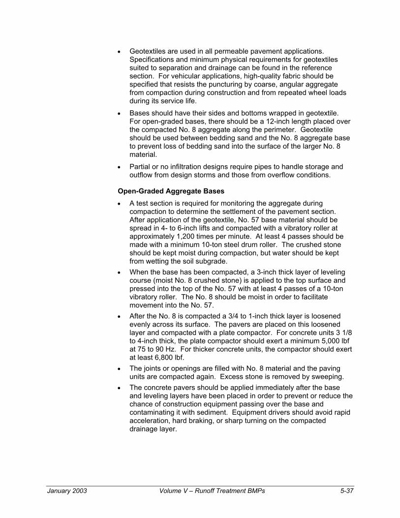
• Geotextiles are used in all permeable pavement applications. Specifications and minimum physical requirements for geotextiles suited to separation and drainage can be found in the reference section. For vehicular applications, high-quality fabric should be specified that resists the puncturing by coarse, angular aggregate from compaction during construction and from repeated wheel loads during its service life.
• Bases should have their sides and bottoms wrapped in geotextile. For open-graded bases, there should be a 12-inch length placed over the compacted No. 8 aggregate along the perimeter. Geotextile should be used between bedding sand and the No. 8 aggregate base to prevent loss of bedding sand into the surface of the larger No. 8 material.
• Partial or no infiltration designs require pipes to handle storage and outflow from design storms and those from overflow conditions.
Open-Graded Aggregate Bases • A test section is required for monitoring the aggregate during
compaction to determine the settlement of the pavement section. After application of the geotextile, No. 57 base material should be spread in 4- to 6-inch lifts and compacted with a vibratory roller at approximately 1,200 times per minute. At least 4 passes should be made with a minimum 10-ton steel drum roller. The crushed stone should be kept moist during compaction, but water should be kept from wetting the soil subgrade.
• When the base has been compacted, a 3-inch thick layer of leveling course (moist No. 8 crushed stone) is applied to the top surface and pressed into the top of the No. 57 with at least 4 passes of a 10-ton vibratory roller. The No. 8 should be moist in order to facilitate movement into the No. 57.
• After the No. 8 is compacted a 3/4 to 1-inch thick layer is loosened evenly across its surface. The pavers are placed on this loosened layer and compacted with a plate compactor. For concrete units 3 1/8 to 4-inch thick, the plate compactor should exert a minimum 5,000 lbf at 75 to 90 Hz. For thicker concrete units, the compactor should exert at least 6,800 lbf.
• The joints or openings are filled with No. 8 material and the paving units are compacted again. Excess stone is removed by sweeping.
• The concrete pavers should be applied immediately after the base and leveling layers have been placed in order to prevent or reduce the chance of construction equipment passing over the base and contaminating it with sediment. Equipment drivers should avoid rapid acceleration, hard braking, or sharp turning on the compacted drainage layer.
January 2003 Volume V – Runoff Treatment BMPs 5-37

Stabilized Bases • Open-graded bases may be stabilized with asphalt prior to placement.
It should be used on the No. 57 layer and not on the No. 8 layer. The use of asphalt will likely reduce the storage capacity of the base, but stabilization may be necessary in weak soils—those subject to frost heave or under high loads.
• To maintain high void space, only enough asphalt to coat the aggregate is required. This is usually 2 to 2 ½ percent asphalt by weight of the aggregate. The asphalt grade should be AC20 or higher.
• Asphalt-stabilized base will need to be compacted at temperatures lower than normal for asphalt pavement. In most cases, the asphalt should cool to less than 200° F before starting compaction.
Edge restraints: ICPI Tech Spec 3, Edge Restraints for Interlocking Concrete Pavements provides guidance on selection of edge restraints for pavement construction with dense-bases. Recommended edge restraints for permeable interlocking concrete pavements on an open-graded base are cast-in-place and precast concrete. Manufacturers of edge restraints fastened by metal spikes should be consulted as to the suitability of their edge restraint systems on open-graded bases subject to pedestrian or vehicular traffic.
Bedding sand: As with all interlocking pavements, the gradation of the bedding sand should conform to ASTM C 33 or CSA A23.1. Limestone screenings or stone dust must never be used. The thickness of the bedding sand should be between 1 and 1 1/2 inches and screened to a consistent thickness.
Paver Installation • PICP concrete pavers are typically installed level to maximize
infiltration. Installation can be done by hand or with mechanical equipment. Mechanized installation may be a cost-efficient means to install the units and will reduce the installation time. ICPI Tech Spec 11, Mechanized Installation of Interlocking Concrete Pavements provides detailed information on mechanical installation.
• Like solid pavers, permeable pavers are vibrated into the bedded material with a high frequency (75-90 Hz), low-amplitude plate compactor. The machine should have a minimum centrifugal compaction force of at least 5,000 lbf for settling units 3 1/8 to 4 inches thick. Thicker units will require equipment capable of at least 6,800 lbf. Units should be cut to fill any spaces along the edges prior to compaction. All installed units should be compacted into the bedding sand or No. 8 aggregate and joints filled with the appropriate material at the end of the day.
• The pavers are again compacted.
5-38 Volume V – Runoff Treatment BMPs January 2003

Operation and Maintenance Infiltration areas can become clogged with sediment over time, thereby decreasing storage capacity and slowing their infiltration rate. The rate of sedimentation depends on the amount of traffic and other sources that wash sediment into the joints, base, and soil. Since the pavement is detaining runoff with sediments, there may be a need to remove and replace the base material when the infiltration is reduced to where the pavement is no longer performing its job in storing and exfiltrating water. Economics may prevent this extent of hydrological rehabilitation to the pavement. The best way to ensure enduring infiltration is to prevent sediment from entering the pavement. A well-designed and maintained pavement can be expected to last from 15 to 25 years. Depending on drainage performance, the base may need to be excavated, sediment removed, and clean aggregate reinstated with the same concrete pavers. The lifetime of the pavement can be extended by pre-treating runoff that originates offsite, such as runoff originating from adjacent impervious surfaces. Filter areas or small basins used to capture sediment in urban runoff will reduce the potential for clogging of the PICP. They will also substantially extend the number of years before removal and replacement with clean sand and aggregate are necessary. The length of years added to the infiltrative performance of the pavement may be worth the additional space and initial expenditure. Permeability has been successfully restored in some PICP projects using conventional street-sweeper equipment with vacuums, water, and brushes. All PICP should have an observation well to monitor the amount of sediment in the water held in the base. The well is typically a 4 to 6-inch diameter capped pipe that can be uncovered and water samples drawn from time to time. Snow can be plowed from pavers as with as other pavement. If a unit cracks from soil or base settlement, it should be removed and replaced. Likewise, the same units can be reinstated after repairs to the base, drainpipes, liners, or to underground utilities.
January 2003 Volume V – Runoff Treatment BMPs 5-39

Resource Material The following references provide detailed information on the technical design and construction of PICP.
AASHTO-AGC-ARTBA Joint Committee. 1990. Guide Specifications and Test Procedures for Geotextiles. Task Force 25 Report. American Association of State Highway and Transportation Officials, Washington DC.
American Association for State Highway and Transportation Officials. 1993a. Designation T-215, Standard Methodology of Test for Permeability of Granular Soils (Constant Head). In Standard Specifications for Transportation Material and Methods of Sampling and Testing, 16th Edition, Part II Tests, Washington, DC.
American Association for State Highway and Transportation Officials. 1993b. Standard Method of Test for the Moisture-Density Relations of Soils Using a 5.5-lb [2.5 kg] Rammer and a 12 in [305 mm] Drop, AASHTO Designation T-99. In Standard Specifications for Transportation Material and Methods of Sampling and Testing, 16th Edition, Part II Tests. American Association for State Highway and Transportation Officials, Washington, DC.
American Association for State Highway and Transportation Officials. 1993c. Standard Method of Test for the Relations of Soils Using a 10-lb Rammer and an 18-in Drop, AASHTO Designation T-180. In Standard Specifications for Transportation Material and Methods of Sampling and Testing, 16th Edition, Part II Tests, American Association for State Highway and Transportation Officials, Washington, DC.
American Association for State Highway and Transportation Officials. 1993d. AASHTO Designation T-193. In Standard Specifications for Transportation Material and Methods of Sampling and Testing, 16th Edition, Part II Tests, Washington, DC.
American Society for Testing and Materials. 1996. ASTM C 33, Standard Specification for Concrete Aggregates. In Annual Book of ASTM Standards, Vol. 04.02. Coshohocken, Pennsylvania.
American Society for Testing and Materials. 1998. ASTM D 698, Standard Test Method for Laboratory Compaction Characteristics of Soil Using Standard Effort (12,400 ft-lbf/ft3(600 kN-m/m3)). In Annual Book of ASTM Standards, Vol. 04.08. American Society for Testing and Materials, Conshohocken, Pennsylvania.
American Society for Testing and Materials. 1991. ASTM C 936, Standard Specification for Solid Concrete Interlocking Paving Units. In Annual Book of ASTM Standards, Vol. 04.05., Conshohocken, Pennsylvania.
American Society for Testing and Materials. 1998. ASTM D 1557, Standard Test Method for Laboratory Compaction Characteristics of Soil Using Modified Effort. In Annual Book of ASTM Standards, Vol. 04.08, Conshohocken, Pennsylvania.
American Society for Testing and Materials. 1998. ASTM D 1883, Standard Test Method for CBR (California Bearing Ratio) of Laboratory-Compacted Soil. In Annual Book of ASTM Standards, Vol. 04.08, Conshohocken, Pennsylvania.
5-40 Volume V – Runoff Treatment BMPs January 2003

American Society for Testing Materials. 1998. ASTM D 2434, Standard Test Methodology for Permeability of Granular Soils. In Annual Book of ASTM Standards, Vol. 04.08, Conshohocken, Pennsylvania.
American Society for Testing and Materials. 1998. ASTM D 2487, Standard Classification of Soils for Engineering Purposes (Unified Soil Classification System). In Annual Book of ASTM Standards, Vol. 04.08. American Society for Testing and Materials, Conshohocken, Pennsylvania.
American Society for Testing and Materials. 1995. ASTM D 2940, Standard Specification for Graded Aggregate Material for Bases or Subbases for Highway or Airports. In Annual Book of ASTM Standards, Vol. 04.03. American Society for Testing and Materials, Conshohocken, Pennsylvania.
Asphalt Institute. 1993. Soils Manual for the Design of Asphalt Pavement Structures, MS-10. Fifth Edition, Lexington, Kentucky.
Asphalt Institute. 1989. The Asphalt Handbook. MS-4, Lexington, Kentucky.
Barksdale, R.D., editor. 1991. The Aggregate Handbook, National Stone Association, Washington, DC.
Canadian Standards Association. 1990. CSA A23.1-M90, Concrete Materials and Methods of Concrete Construction. Canadian Standards Association, Rexdale, Ontario.
Canadian Standards Association. 1995. A231.2-95, Precast Concrete Pavers. Rexdale, Ontario, 1995.
Canadian Standards Association. 1999. A231.1-99, Precast Concrete Paving Slabs. Rexdale, Ontario.
Cao, S.L., Poduska, D. and D.G. Zollinger. 1998. Drainage Design and Rutting Performance Guidelines for Permeable Pavement. Texas A & M University, College Station, Texas.
Cedergren, H.R. 1987. Drainage of Highway and Airfield Pavements. Krieger Publishing Company, Malabar, Florida.
Claytor, R.A., and T.R. Schueler. 1996. Design of Storm water Filtering Systems. Center for Watershed Protection, Silver Spring, Maryland.
Debo, T.N., and A.J. Reese. 1995. Municipal Storm Water Management. Lewis Publishers. CBC Press, Boca Raton, Florida.
Ferguson, B.K. 1994. Stormwater Infiltration. Lewis Publishers. CBC Press, Boca Raton, Florida.
Goforth, G.F., Danuas, E.V. and J.B. Rawhide. 1983. Stormwater Hydrological Characteristics of Porous and Conventional Paving Systems. Municipal Environmental Research Laboratory, Office of Research and Development. US Environmental Protection Agency, Cincinnati, Ohio.
January 2003 Volume V – Runoff Treatment BMPs 5-41

Interlocking Concrete Pavement Institute. 1995a. ICPI Tech Spec 1, Glossary of Terms used in the Production, Design, Construction and Testing of Interlocking Concrete Pavement. Interlocking Concrete Pavement Institute, Washington DC.
Interlocking Concrete Pavement Institute. 1999. ICPI Tech Spec 2, Construction of Interlocking Concrete Pavements. Interlocking Concrete Pavement Institute, Washington DC.
Interlocking Concrete Pavement Institute. 1995b. ICPI Tech Spec 3, Edge Restraints for Interlocking Concrete Pavement. Interlocking Concrete Pavement Institute, Washington DC.
Interlocking Concrete Pavement Institute. 1995c. ICPI Tech Spec 4, Structural Design of Interlocking Pavements for Roads and Parking Lots. Interlocking Concrete Pavement Institute, Washington DC.
Interlocking Concrete Pavement Institute. 1996. ICPI Tech Spec 6, Reinstatement of Interlocking Concrete Pavements. Interlocking Concrete Pavement Institute, Washington DC.
Interlocking Concrete Pavement Institute. 1999b. ICPI Tech Spec 9, Guide Specification for the Construction of Interlocking Concrete Pavement. Interlocking Concrete Pavement Institute, Washington DC.
Interlocking Concrete Pavement Institute. 1998.a ICPI Tech Spec 10, Application Guide for Interlocking Concrete Pavements. Interlocking Concrete Pavement Institute, Washington DC.
Interlocking Concrete Pavement Institute. 1998b. ICPI Tech Spec 11, Mechanical Installation of Interlocking Concrete Pavements. Interlocking Concrete Pavement Institute, Washington DC.
KPFF Consulting Engineers. 2000. Eco-Stone Permeable Pavement System Hydraulic Analysis (DRAFT). Project No. 99493. Prepared for Mutual Materials, Seattle, Washington.
Rollings, R.S. and M.P. Rollings. 1999. SF-Rima: A Permeable Paving Stone System. SF Concrete Technologies, Mississauga, Ontario.
Rollings, R.S. and M.P. Rollings. 1993. Design Considerations for the Uni Eco-Stone Concrete Paver. Uni-Group USA, Palm Beach Gardens, Florida.
Shackel, B. 1999. Lockpave Pro 2000, Structural Design of Interlocking Concrete Block Pavements Software Program. Uni-Group USA, Palm Beach, Florida.
Zollinger, D.G., Cao, S.L., and D. Poduska. 1998. Drainage Design and Performance Guidelines for Uni Eco-Stone Permeable Pavement. The Department of Civil Engineering, Texas A & M University. Uni-Group, U.S.A., Palm Springs, Florida.
5-42 Volume V – Runoff Treatment BMPs January 2003

Figure 5-1 Typical Dispersion Trench
January 2003 Volume V – Runoff Treatment BMPs 5-43

Figure 5-2 Standard Dispersion Trench with Notched Grade Board
5-44 Volume V – Runoff Treatment BMPs January 2003

Figure 5-3 Typical Downspout Splashblock Dispersion
January 2003 Volume V – Runoff Treatment BMPs 5-45

Figure 5-4 Typical Concentrated Flow Dispersion for Steep Driveways
5-46 Volume V – Runoff Treatment BMPs January 2003

Figure 5-5 Sheet Flow Dispersion for Driveways
January 2003 Volume V – Runoff Treatment BMPs 5-47

Figure 5-6 Porous Concrete Pavement Typical Section
Figure 5-7 Porous Asphalt Pavement Typical Section
5-48 Volume V – Runoff Treatment BMPs January 2003

Figure 5-8 Components of a Permeable Interlocking Concrete Pavement
Figure 5-9 Direct Flow into Subgrade
January 2003 Volume V – Runoff Treatment BMPs 5-49

Figure 5-10 Collection and Disposal of Infiltration (Example 1)
Figure 5-11 Collection and Disposal of Infiltration (Example 2)
5-50 Volume V – Runoff Treatment BMPs January 2003

Figure 5-12 Treatment of Contaminated Flow
Figure 5-13 Slow Infiltration Disposal
January 2003 Volume V – Runoff Treatment BMPs 5-51

Figure 5-14 Various Types Of Subdrainage Systems Using
5-52 Volume V – Runoff Treatment BMPs January 2003