Central Mississippi River Basin (CMRB) LTAR
20
CENTRAL MISSISSIPPI RIVER BASIN (CMRB) LTAR USDA-ARS Columbia Missouri Translating Missouri USDA-ARS Research and Technology into Practice A training session provided by USDA-ARS-CSWQRU, 10-11 October 2012, Columbia, MO
description
Central Mississippi River Basin (CMRB) LTAR . USDA-ARS Columbia Missouri. Translating Missouri USDA-ARS Research and Technology into Practice A training session provided by USDA-ARS-CSWQRU, 10-11 October 2012, Columbia, MO. Outline. - PowerPoint PPT Presentation
Transcript of Central Mississippi River Basin (CMRB) LTAR
CENTRAL MISSISSIPPI RIVER BASIN(CMRB) LTAR USDA-ARSColumbia Missouri
Translating Missouri USDA-ARS Research and Technology into Practice A training session provided by USDA-ARS-CSWQRU, 10-11 October
2012, Columbia, MO
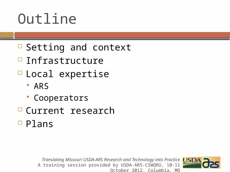
Setting and context Infrastructure Local expertise
ARS Cooperators
Current research Plans
Outline
Translating Missouri USDA-ARS Research and Technology into Practice A training session provided by USDA-ARS-CSWQRU, 10-11 October
2012, Columbia, MO

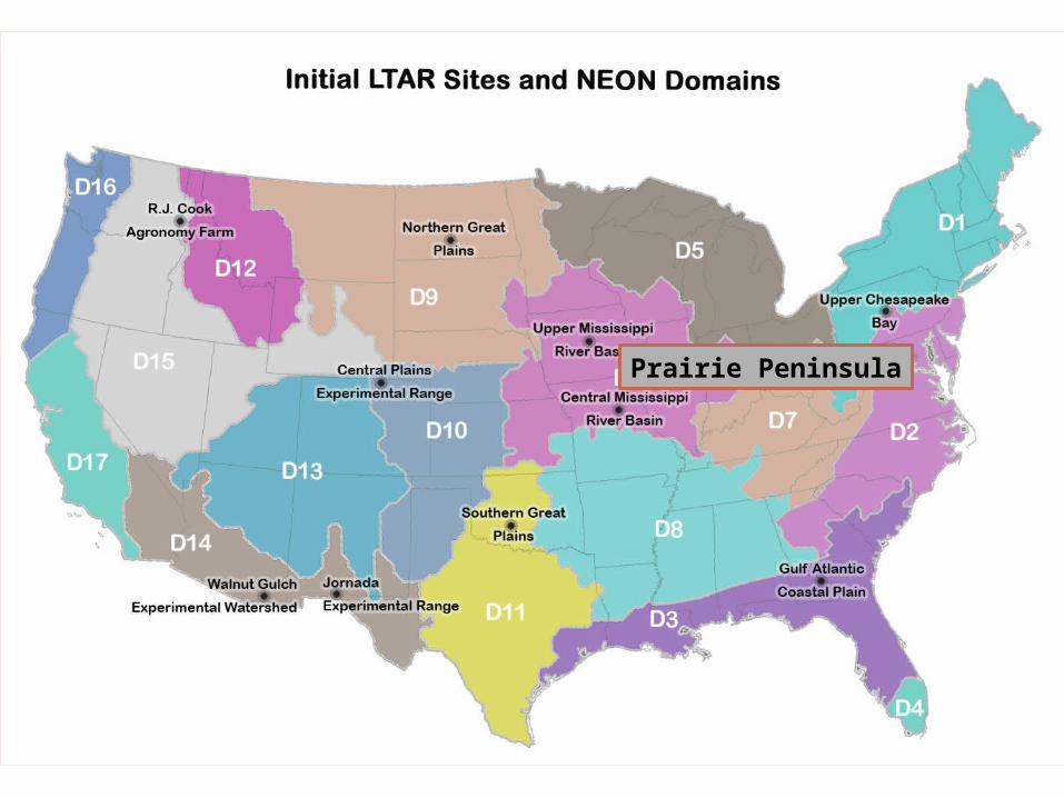
Prairie Peninsula
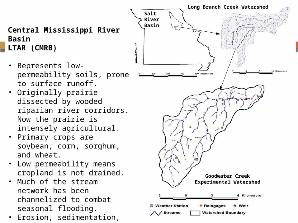
Salt River Basin
Goodwater Creek Experimental Watershed
Long Branch Creek Watershed
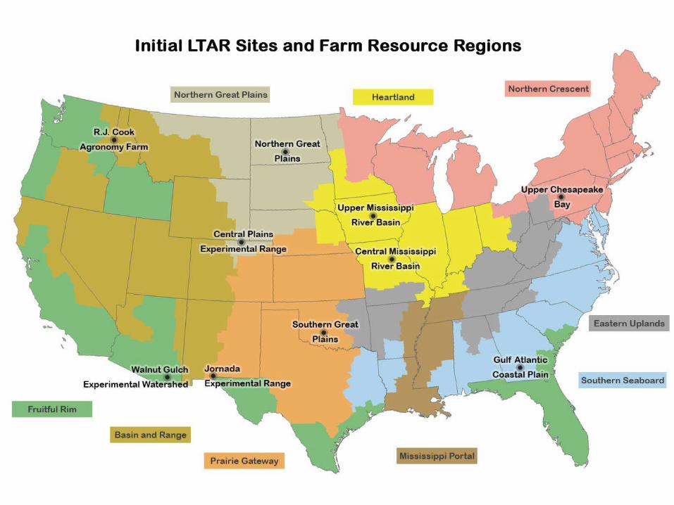
Central Mississippi River BasinLTAR (CMRB)
• Represents low-permeability soils, prone to surface runoff.
• Originally prairie dissected by wooded riparian river corridors. Now the prairie is intensely agricultural.
• Primary crops are soybean, corn, sorghum, and wheat.
• Low permeability means cropland is not drained.
• Much of the stream network has been channelized to combat seasonal flooding.
• Erosion, sedimentation, and streambank processes are important.

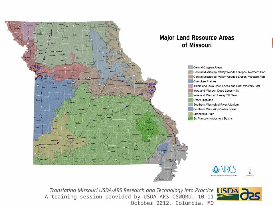
Claypan and Claypan-like Major Land Resource Areas
Distribution of claypan and claypan-like soils in the Midwest. These are the major classifications and not the total area of all clay-pan like soils
109 – Iowa and Missouri Heavy Till Plain
112 – Cherokee Prairies113 – Central
Claypan Area114 – Southern Illinois
and Indiana Thin Loess and Till Plain
Translating Missouri USDA-ARS Research and Technology into Practice A training session provided by USDA-ARS-CSWQRU, 10-11 October
2012, Columbia, MO
Translating Missouri USDA-ARS Research and Technology into Practice A training session provided by USDA-ARS-CSWQRU, 10-11 October
2012, Columbia, MO
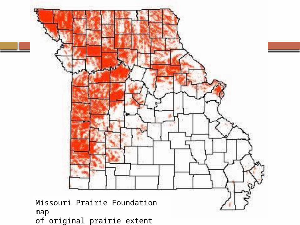
Missouri Prairie Foundation map of original prairie extent
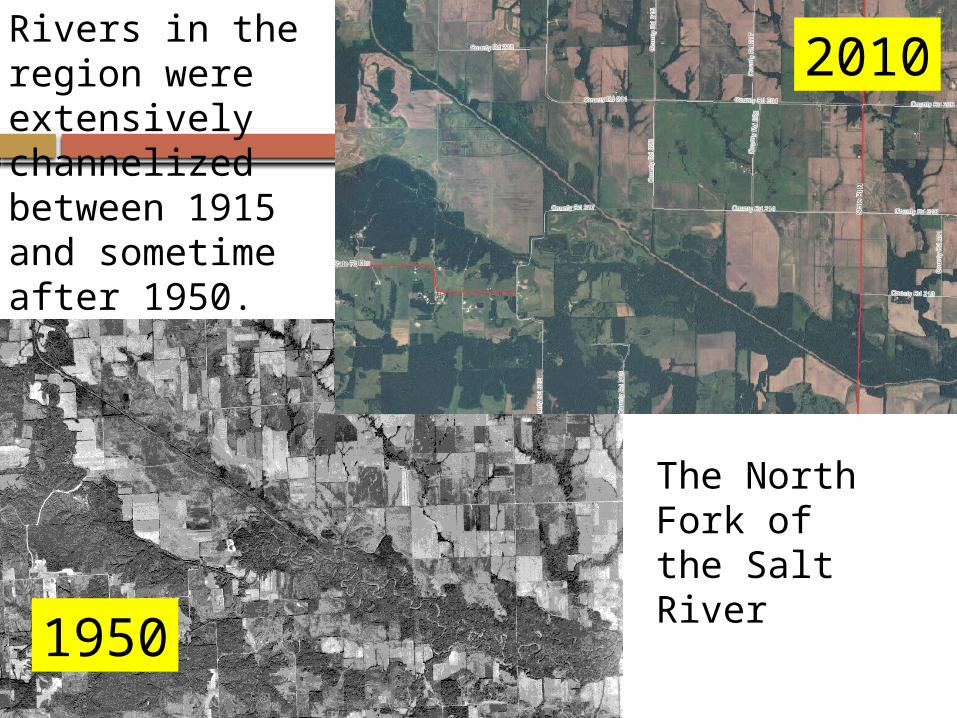
Rivers in the region were extensively channelized between 1915 and sometime after 1950.
2010
1950
The North Fork of the Salt River
Initial phase, ~1970 4 nested design,
At 12, 28, 72 km2 (5:1 weirs), and 195 km2 (USGS) Emphasis on precipitation, streamflow, sediment
MSEA/ASEQ projects, ~1990 Finer scale
Replicated 0.34-ha plots (Parshall flumes) Up to 35-ha fields (3:1 weirs)
Emphasis on water quality Both surface and groundwater Pesticides and nutrients
CEAP, ~2003 12 watersheds at larger scale, up to 1200 km2
Emphasis on effects of conservation practices
Infrastructure
Translating Missouri USDA-ARS Research and Technology into Practice A training session provided by USDA-ARS-CSWQRU, 10-11 October
2012, Columbia, MO
Rain gage network of 9 in 72 km2
Implementing telemetry Automated weather station
Downloaded via telephone under PC control Data visible on web daily
Univ. of Missouri Ag Weather Network NOAA GHCN network
Infrastructure – Weather
Translating Missouri USDA-ARS Research and Technology into Practice A training session provided by USDA-ARS-CSWQRU, 10-11 October
2012, Columbia, MO
Continuing nested design at 72, 195, 466 km2
Parallel to 195 km2 scale Re-commission 12 km2 scale weir Retain 35-ha field weir Installed 18 Parshall flumes with berms,
approaches, and samplers on 0.35-ha plots
Infrastructure – Surface water
Translating Missouri USDA-ARS Research and Technology into Practice A training session provided by USDA-ARS-CSWQRU, 10-11 October
2012, Columbia, MO

Plot sample structures
Translating Missouri USDA-ARS Research and Technology into Practice A training session provided by USDA-ARS-CSWQRU, 10-11 October
2012, Columbia, MO
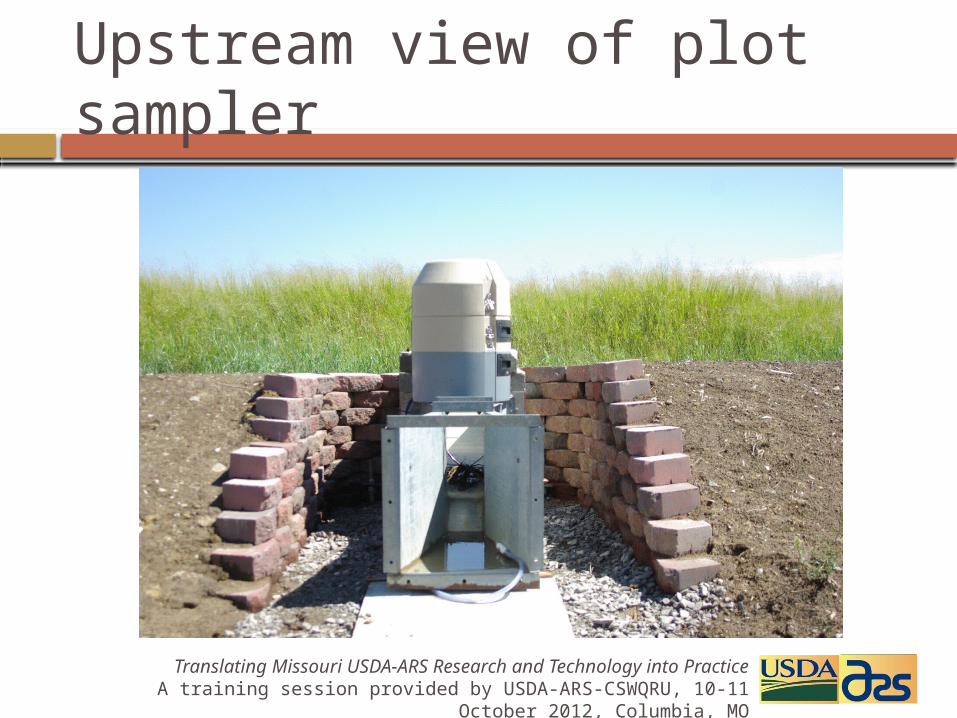
Upstream view of plot sampler
Translating Missouri USDA-ARS Research and Technology into Practice A training session provided by USDA-ARS-CSWQRU, 10-11 October
2012, Columbia, MO
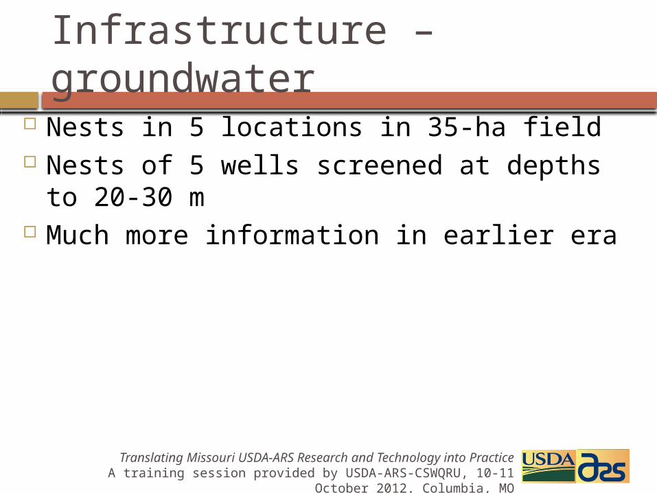
Nests in 5 locations in 35-ha field Nests of 5 wells screened at depths to 20-
30 m Much more information in earlier era
Infrastructure – groundwater
Translating Missouri USDA-ARS Research and Technology into Practice A training session provided by USDA-ARS-CSWQRU, 10-11 October
2012, Columbia, MO
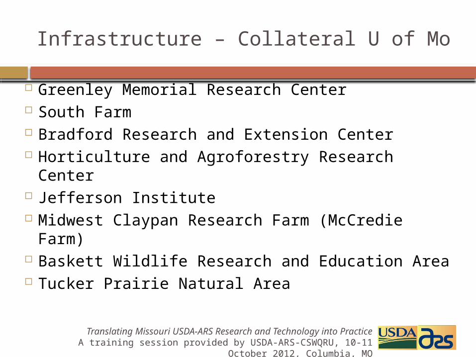
Greenley Memorial Research Center South Farm Bradford Research and Extension Center Horticulture and Agroforestry Research Center Jefferson Institute Midwest Claypan Research Farm (McCredie
Farm) Baskett Wildlife Research and Education Area Tucker Prairie Natural Area
Infrastructure – Collateral U of Mo
Translating Missouri USDA-ARS Research and Technology into Practice A training session provided by USDA-ARS-CSWQRU, 10-11 October
2012, Columbia, MO

ARS Scientists Hydrology, soil fertility, soil chemistry,
microbiology, soil physics, sensor engineering, irrigation engineering
University of Missouri Departments Soil and Atmospheric Sciences, Biological
Engineering, Plant Sciences and Soils Extension, Agroforestry, Forestry, Agricultural Economics, Rural Sociology, Water Quality Extension
Expertise
Translating Missouri USDA-ARS Research and Technology into Practice A training session provided by USDA-ARS-CSWQRU, 10-11 October
2012, Columbia, MO
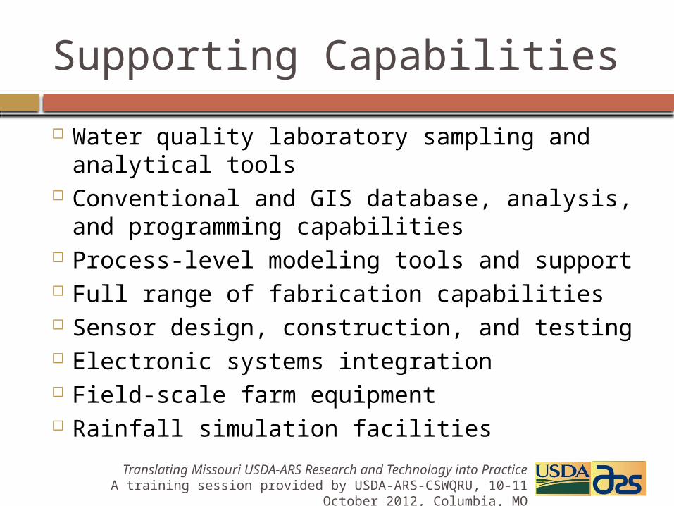
Water quality laboratory sampling and analytical tools
Conventional and GIS database, analysis, and programming capabilities
Process-level modeling tools and support Full range of fabrication capabilities Sensor design, construction, and testing Electronic systems integration Field-scale farm equipment Rainfall simulation facilities
Supporting Capabilities
Translating Missouri USDA-ARS Research and Technology into Practice A training session provided by USDA-ARS-CSWQRU, 10-11 October
2012, Columbia, MO
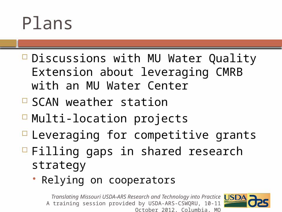
Discussions with MU Water Quality Extension about leveraging CMRB with an MU Water Center
SCAN weather station Multi-location projects Leveraging for competitive grants Filling gaps in shared research strategy
Relying on cooperators
Plans
Translating Missouri USDA-ARS Research and Technology into Practice A training session provided by USDA-ARS-CSWQRU, 10-11 October
2012, Columbia, MO