Case Study - Landslide in Morretes/Brazil
20
Analysis of Landslides in Morretes・Brazil 2011 TokyoJapan, August 7th 2012 Brazil – Eng. Fábio Sato SIMEPAR
-
Upload
fabio-sato -
Category
Environment
-
view
88 -
download
1
Transcript of Case Study - Landslide in Morretes/Brazil
Analysis of Landslides in Morretes・Brazil 2011
Tokyo-‐Japan, August 7th 2012
Brazil – Eng. Fábio Sato -‐ SIMEPAR
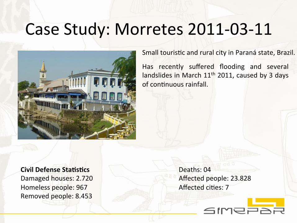
Case Study: Morretes 2011-‐03-‐11 Small tourisNc and rural city in Paraná state, Brazil.
Has recently suffered flooding and several landslides in March 11th 2011, caused by 3 days of conNnuous rainfall.
Civil Defense Sta.s.cs Damaged houses: 2.720 Homeless people: 967 Removed people: 8.453
Deaths: 04 Affected people: 23.828 Affected ciNes: 7
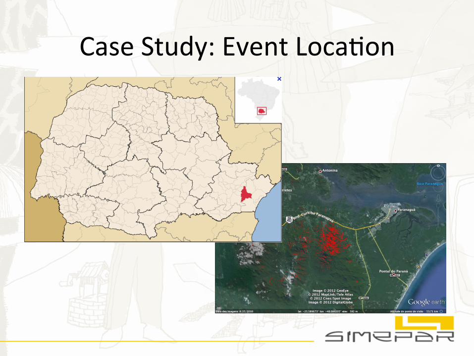
Case Study: Event LocaNon
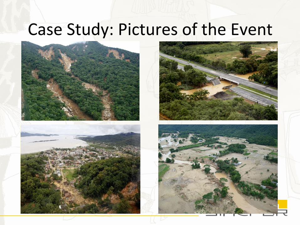
Case Study: Pictures of the Event
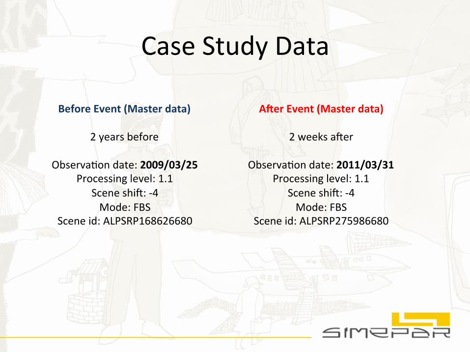
Case Study Data
Before Event (Master data)
2 years before
ObservaNon date: 2009/03/25 Processing level: 1.1
Scene shi[: -‐4 Mode: FBS
Scene id: ALPSRP168626680
A?er Event (Master data)
2 weeks a[er
ObservaNon date: 2011/03/31 Processing level: 1.1
Scene shi[: -‐4 Mode: FBS
Scene id: ALPSRP275986680
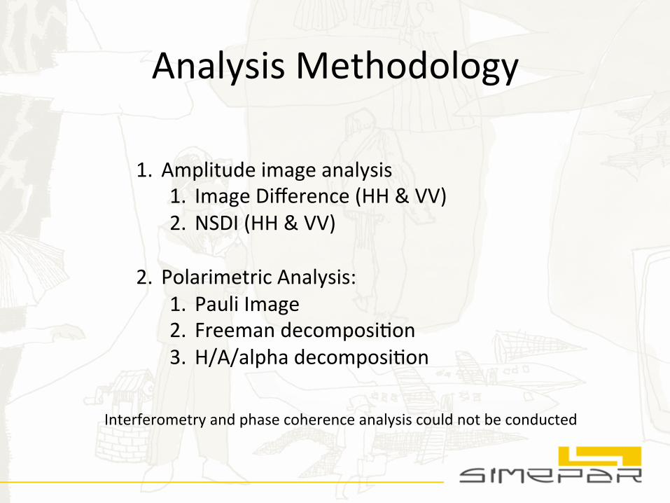
Analysis Methodology
1. Amplitude image analysis 1. Image Difference (HH & VV) 2. NSDI (HH & VV)
2. Polarimetric Analysis: 1. Pauli Image 2. Freeman decomposiNon 3. H/A/alpha decomposiNon
Interferometry and phase coherence analysis could not be conducted
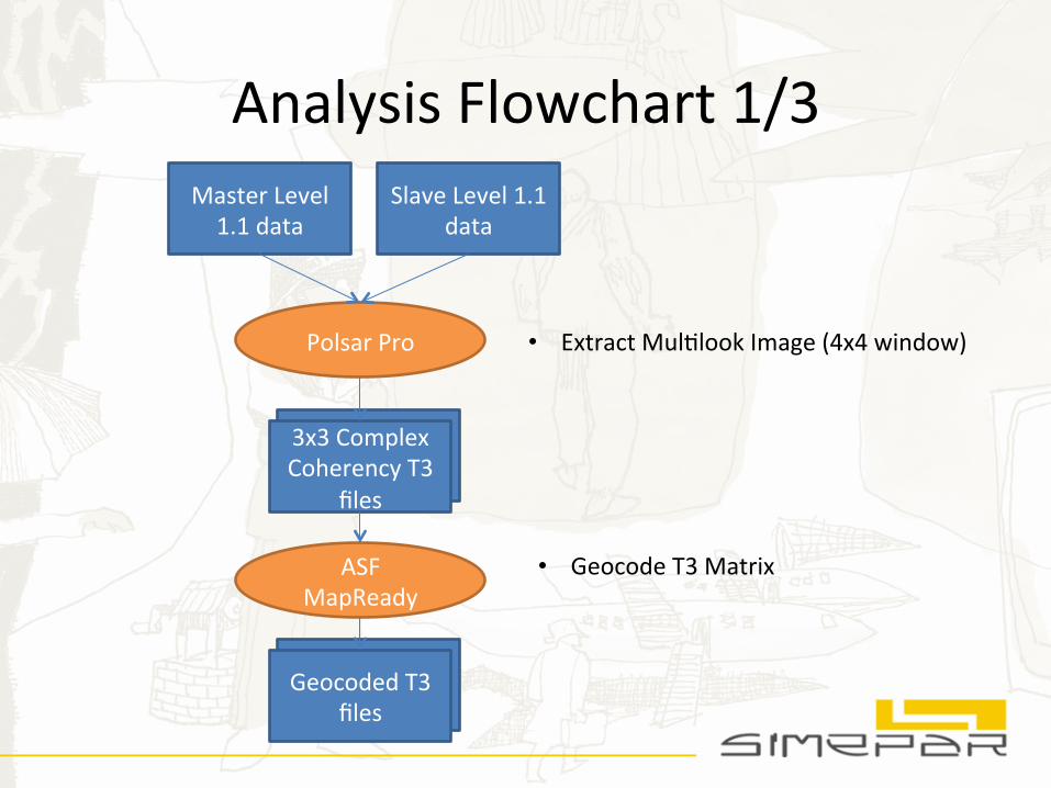
Analysis Flowchart 1/3 Master Level 1.1 data
Slave Level 1.1 data
Polsar Pro
• Geocode T3 Matrix ASF MapReady
3x3 Complex Coherency T3
files
• Extract MulNlook Image (4x4 window)
Geocoded T3 files
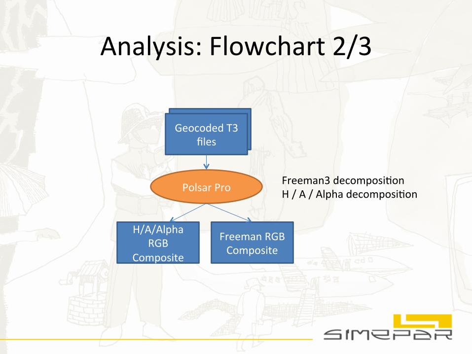
Analysis: Flowchart 2/3
Geocoded T3 files
Polsar Pro Freeman3 decomposiNon H / A / Alpha decomposiNon
Freeman RGB Composite
H/A/Alpha RGB
Composite
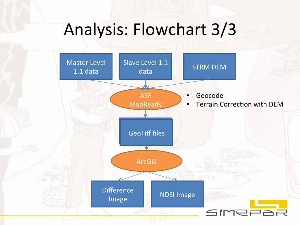
Analysis: Flowchart 3/3
Master Level 1.1 data
Slave Level 1.1 data
ASF MapReady
STRM DEM
GeoTiff files
ArcGIS
Difference Image NDSI Image
• Geocode • Terrain CorrecNon with DEM
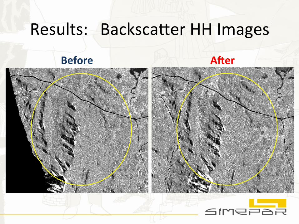
Results: Backscafer HH Images
Before A?er
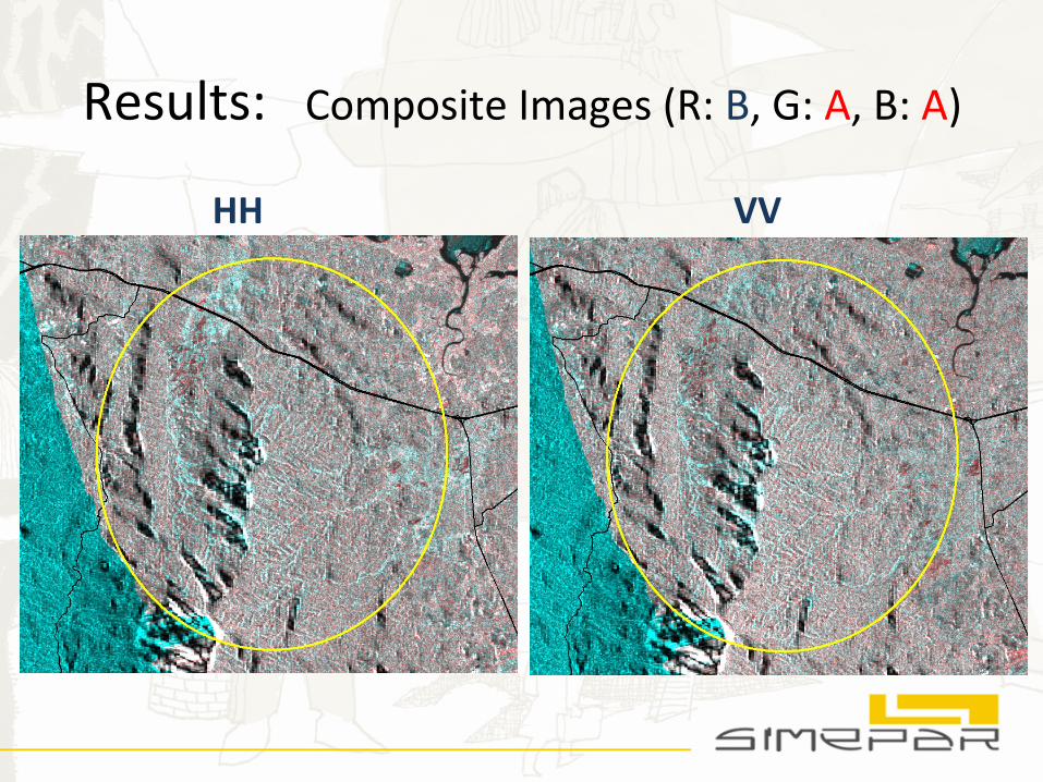
Results: Composite Images (R: B, G: A, B: A)
HH VV
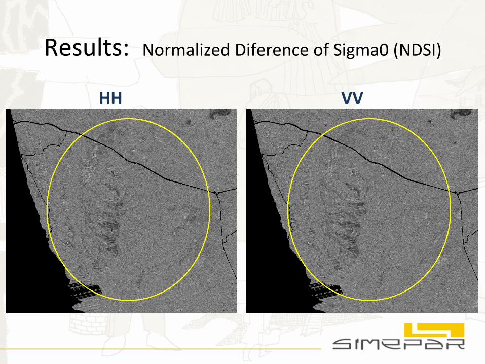
Results: Normalized Diference of Sigma0 (NDSI)
HH VV
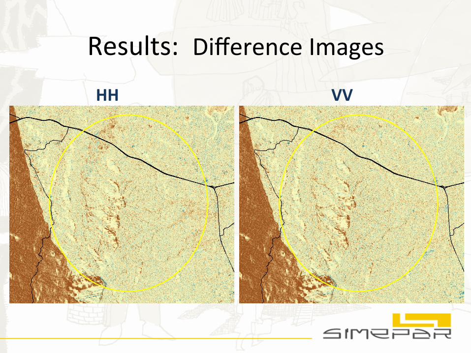
Results: Difference Images
HH VV
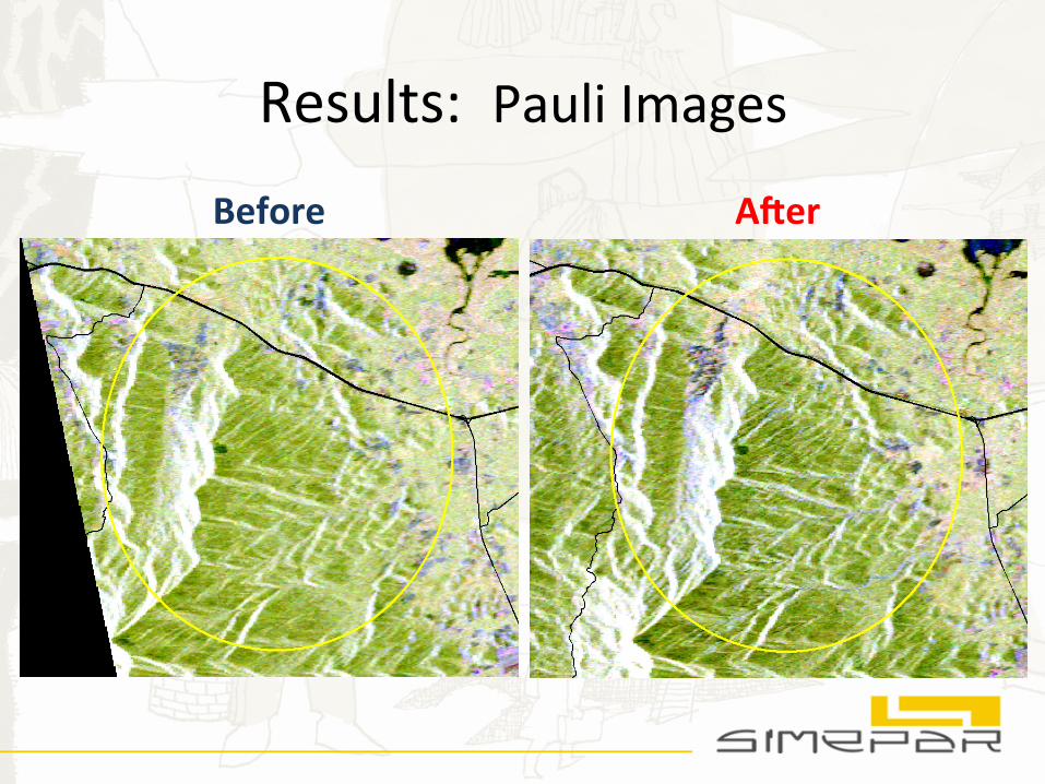
Results: Pauli Images
Before A?er
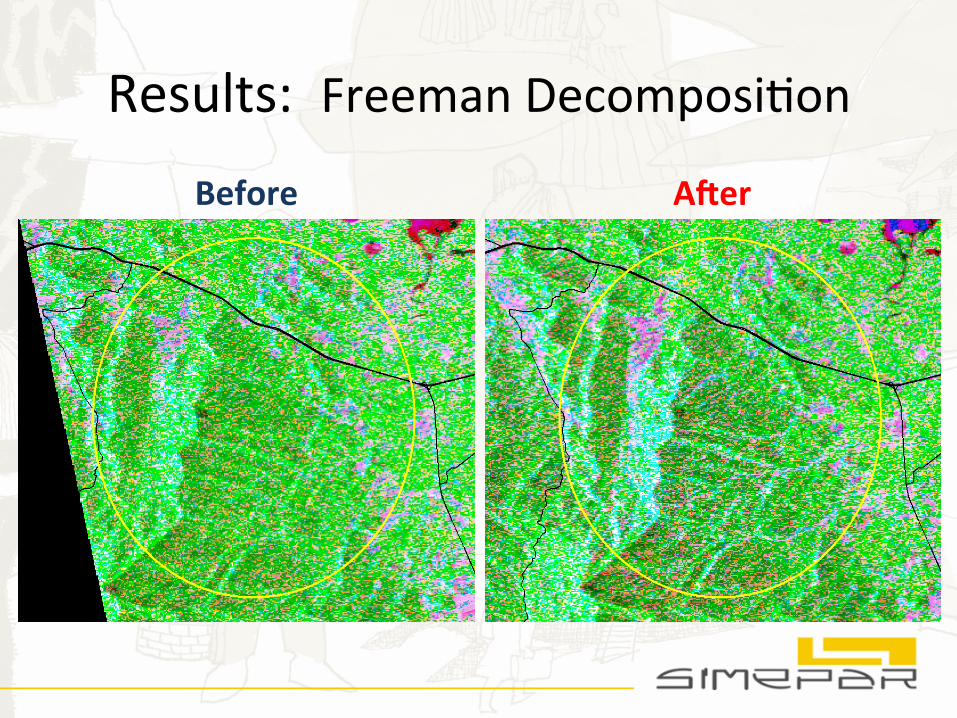
Results: Freeman DecomposiNon
Before A?er
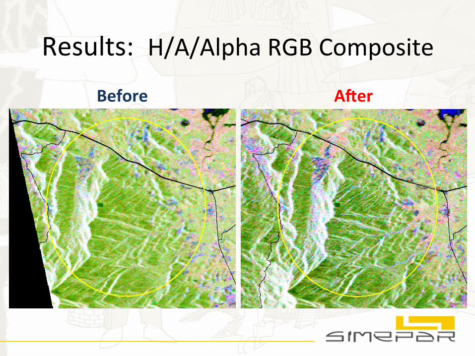
Results: H/A/Alpha RGB Composite
Before A?er
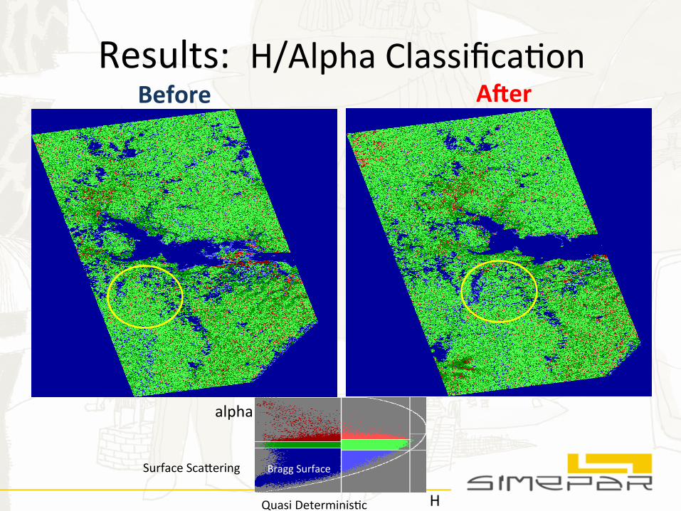
Results: H/Alpha ClassificaNon Before A?er
H
alpha
Surface Scafering
Quasi DeterminisNc
Bragg Surface
Conclusions
• Landslides could be idenNfied on all generated images/products
• In this case, befer results where provided by Difference and NDSI images
• The analysis of polarimetric products are more difficult to interpret
• Although it was possible to detect landslides, it is difficult to produce a final
threshold image of the landslides regions from SAR data
Future Plans
• Short Term: IntegraNon of SAR data into meteorological visualizaNon
systems at SIMEPAR
• Medium Term: Develop operaNonal system for landslide detecNon/
monitoring with satellite opNcal and SAR data in Parana
• Long Term: Pursue research on landslide forecasNng
• OpportuniNes: Propose projects about landslide monitoring in Brazil and
LaNn America