Building a New GIS County Boundary File Gibson...
15
Building a New GIS County Boundary File Gibson County Gibson County
Transcript of Building a New GIS County Boundary File Gibson...
Building a New GIS County Boundary File
Gibson CountyGibson County

Boundaries, Cadastral, PLSS Workgroup
• Surveyor’s Office GIS (2005) Full time County GIS Director (2010) Full-time County GIS Director (2010) Need for an updated County boundary Utili ing S r e or Office GPS field data Utilizing Surveyor Office GPS field data Establishing a basis for our digital cadastre
◘ Sections, Townships, Ranges, Political Townships, Voting , p , g , p , gDistricts, City Limits, Subdivisions, Lot Lines, Parcels, and more…
John E. Howe
Gibson County GIS [email protected]

Southwest Indiana

Gibson County – Revised Statutes of Indiana, 1851-1852, vol 1:176
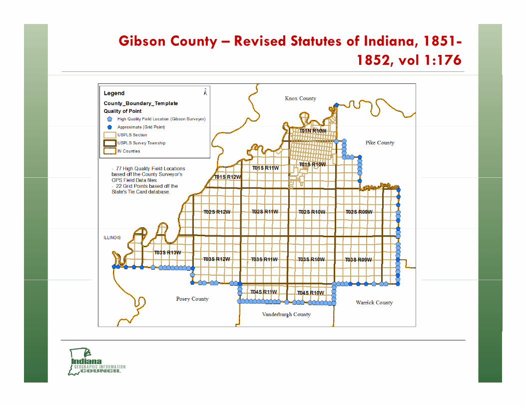
Gibson County – Revised Statutes of Indiana, 1851-1852, vol 1:176

Gibson County – Revised Statutes of Indiana, 1851-1852, vol 1:176
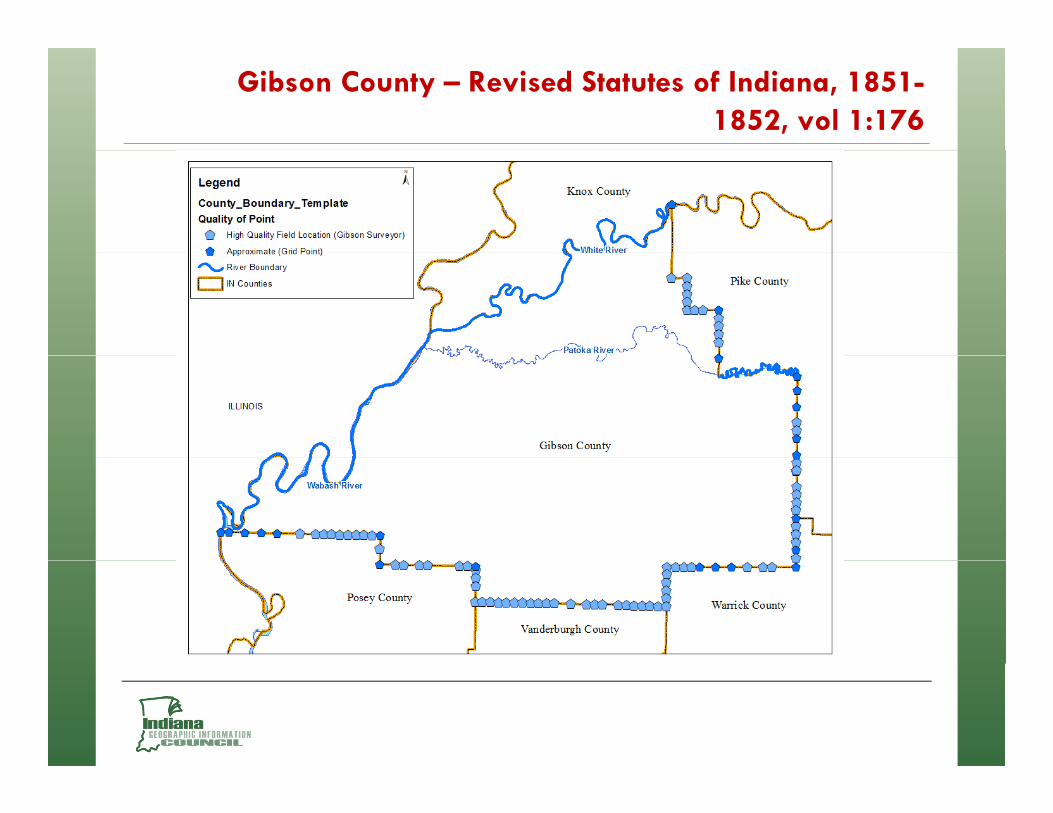
Gibson County – Revised Statutes of Indiana, 1851-1852, vol 1:176

Gibson County – River Scales (White River)

Gibson County – River Scales (Wabash River)

Gibson County – River Scales (Patoka River)

Gibson County – River Scales (Patoka River)

Gibson County – River Scales (Patoka River)

Gibson County – River Scales (Patoka River)

Gibson County – River Scales (Patoka River)

Thank you


![PLSS and Ownership Spatial Data Standard - blm.gov · Management [BLM Thesaurus] Administrative and Political Boundaries (boundaries), 003 [International Organization for Standardization](https://static.fdocuments.us/doc/165x107/5cec9f8188c993f4158dbbd6/plss-and-ownership-spatial-data-standard-blmgov-management-blm-thesaurus.jpg)