

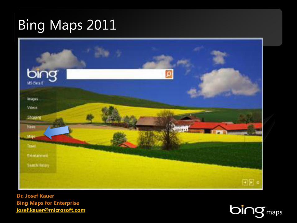
Bing Maps 2011 - EU Science...
15
maps Bing Maps 2011 josef.kauer @ microsoft.com
Transcript of Bing Maps 2011 - EU Science...
maps
Bing Maps 2011
maps
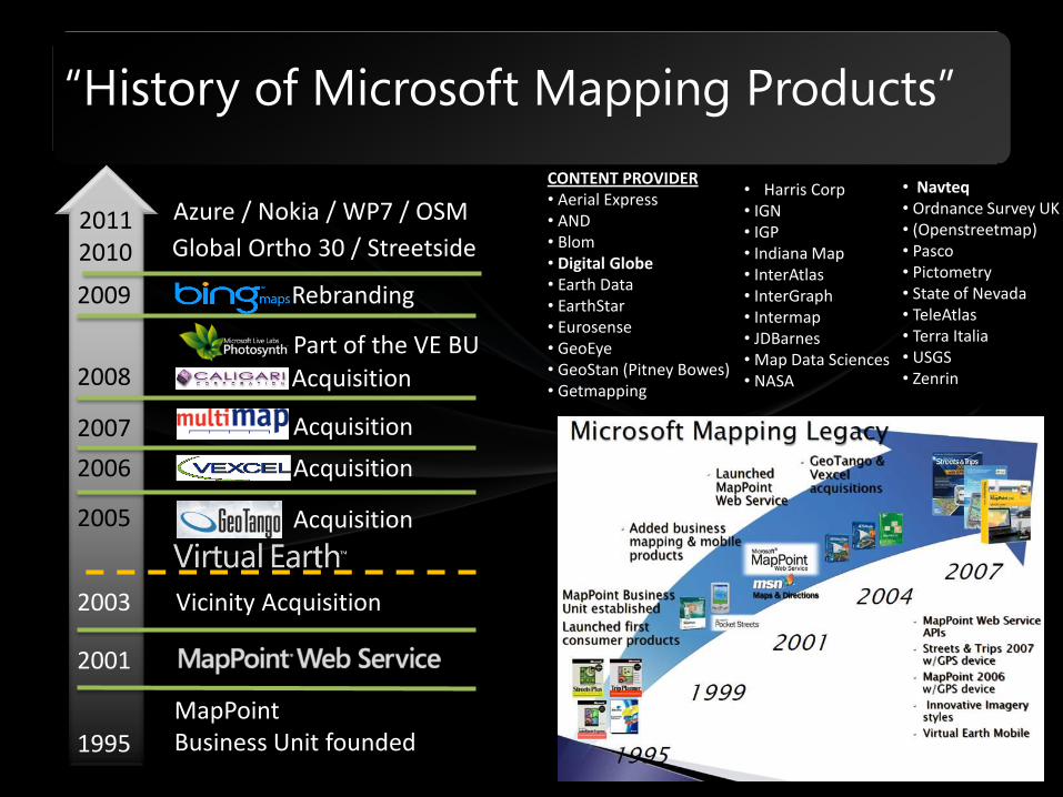
MapPoint Business Unit founded
Vicinity Acquisition
Acquisition
Acquisition
Acquisition
Acquisition 2008
2007
2006
2005
2003
2001
1995
CONTENT PROVIDER • Aerial Express • AND • Blom • Digital Globe • Earth Data • EarthStar • Eurosense • GeoEye • GeoStan (Pitney Bowes) • Getmapping
Part of the VE BU
“History of Microsoft Mapping Products”
• Navteq • Ordnance Survey UK • (Openstreetmap) • Pasco • Pictometry • State of Nevada • TeleAtlas • Terra Italia • USGS • Zenrin
2009 Rebranding
2011 Global Ortho 30 / Streetside
• Harris Corp • IGN • IGP • Indiana Map • InterAtlas • InterGraph • Intermap • JDBarnes • Map Data Sciences • NASA
2010
Azure / Nokia / WP7 / OSM
maps
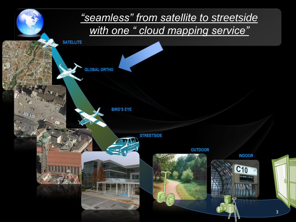
“seamless” from satellite to streetside
with one “ cloud mapping service”
3
OUTDOOR
BIRD’S EYE
SATELLITE
STREETSIDE
GLOBAL ORTHO
INDOOR
maps
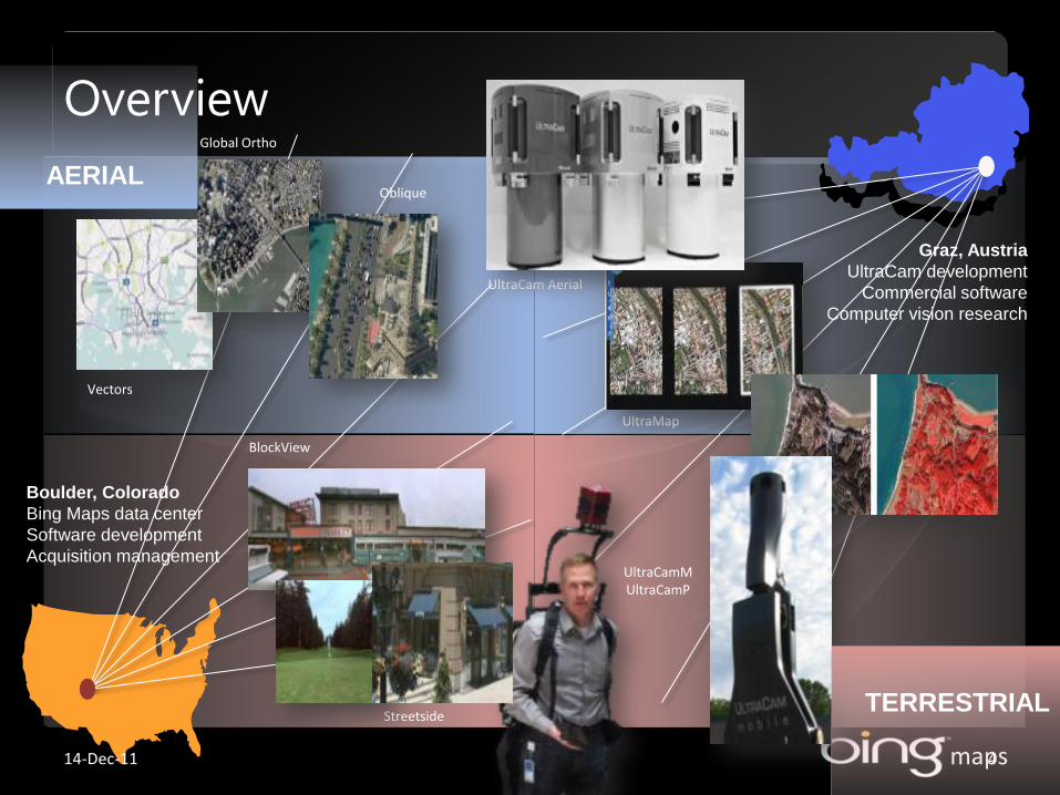
Graz, Austria
UltraCam development
Commercial software
Computer vision research
Boulder, Colorado
Bing Maps data center
Software development
Acquisition management
Streetside
UltraMap
UltraCamM UltraCamP
UltraCam Aerial
Global Ortho
BlockView
Oblique
Vectors
TERRESTRIAL
AERIAL
Overview
14-Dec-11 4
maps
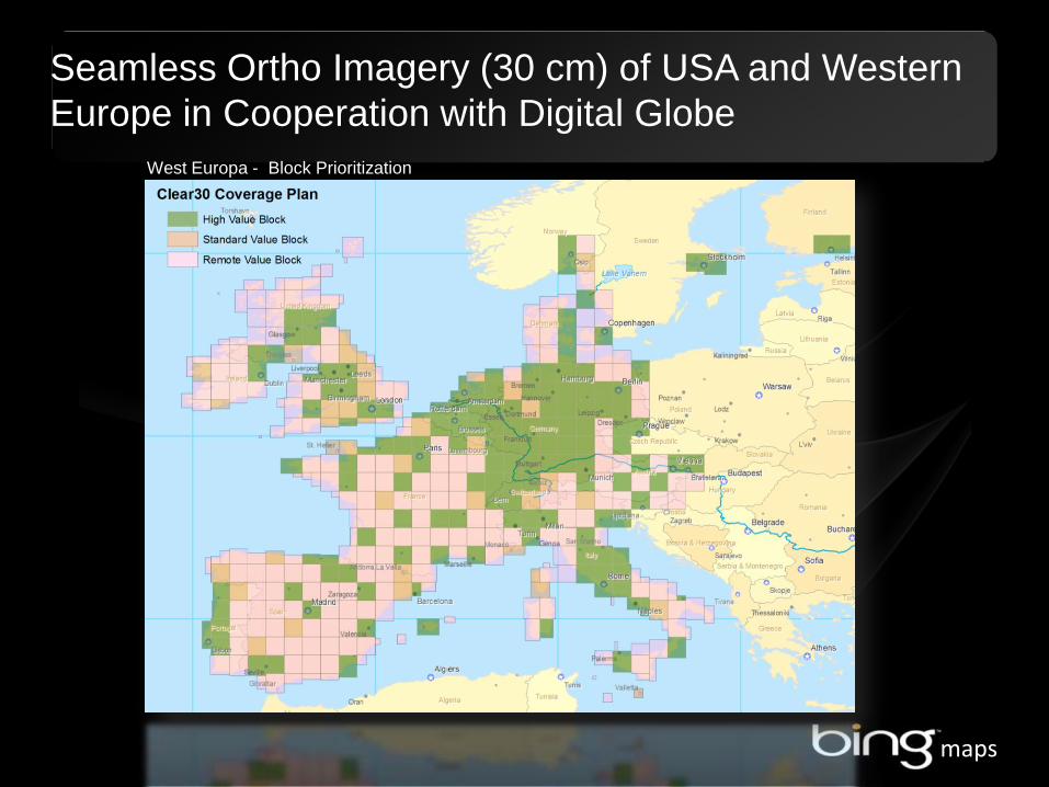
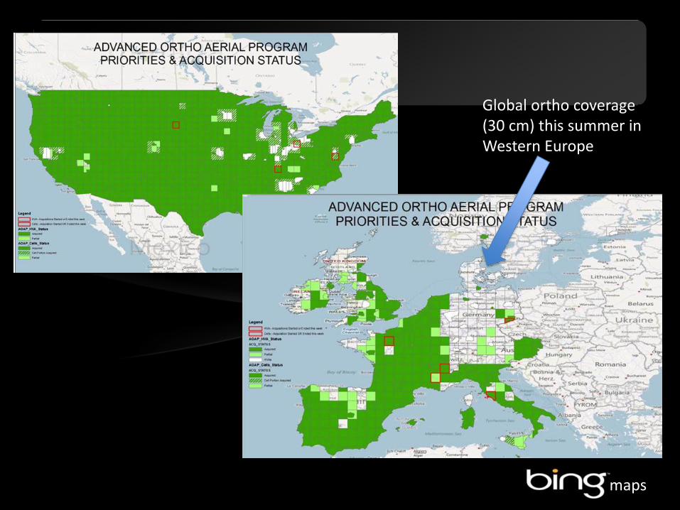
Seamless Ortho Imagery (30 cm) of USA and Western
Europe in Cooperation with Digital Globe
West Europa - Block Prioritization
maps
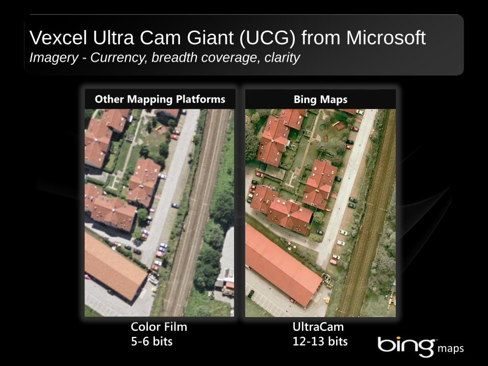
Color Film 5-6 bits
UltraCam 12-13 bits
Other Mapping Platforms
Vexcel Ultra Cam Giant (UCG) from Microsoft Imagery - Currency, breadth coverage, clarity
Bing Maps
maps
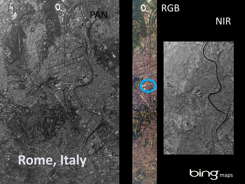
PAN RGB NIR
Rome, Italy
maps
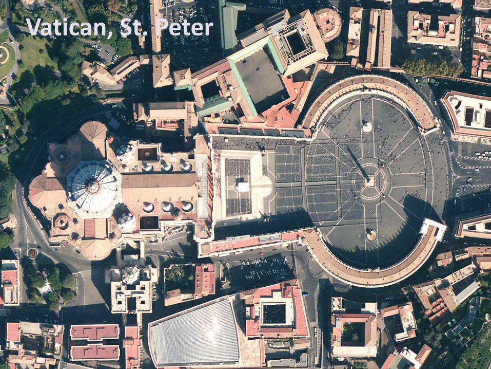
Vatican, St. Peter
maps
Global ortho coverage (30 cm) this summer in Western Europe
maps
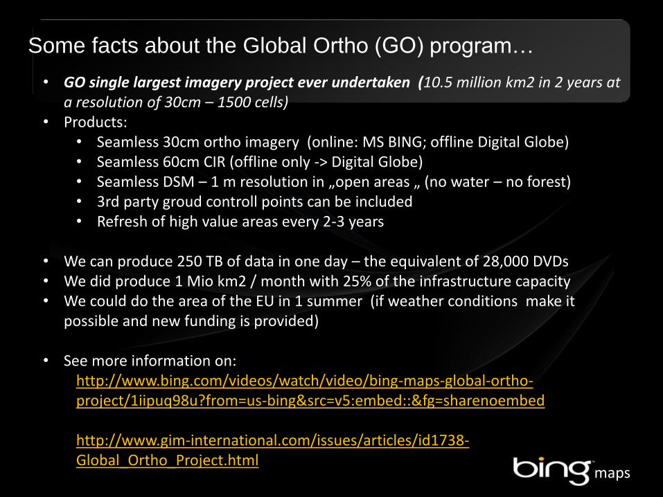
Some facts about the Global Ortho (GO) program…
• GO single largest imagery project ever undertaken (10.5 million km2 in 2 years at a resolution of 30cm – 1500 cells)
• Products: • Seamless 30cm ortho imagery (online: MS BING; offline Digital Globe) • Seamless 60cm CIR (offline only -> Digital Globe) • Seamless DSM – 1 m resolution in „open areas „ (no water – no forest) • 3rd party groud controll points can be included • Refresh of high value areas every 2-3 years
• We can produce 250 TB of data in one day – the equivalent of 28,000 DVDs • We did produce 1 Mio km2 / month with 25% of the infrastructure capacity • We could do the area of the EU in 1 summer (if weather conditions make it
possible and new funding is provided)
• See more information on: http://www.bing.com/videos/watch/video/bing-maps-global-ortho-project/1iipuq98u?from=us-bing&src=v5:embed::&fg=sharenoembed http://www.gim-international.com/issues/articles/id1738-Global_Ortho_Project.html

maps
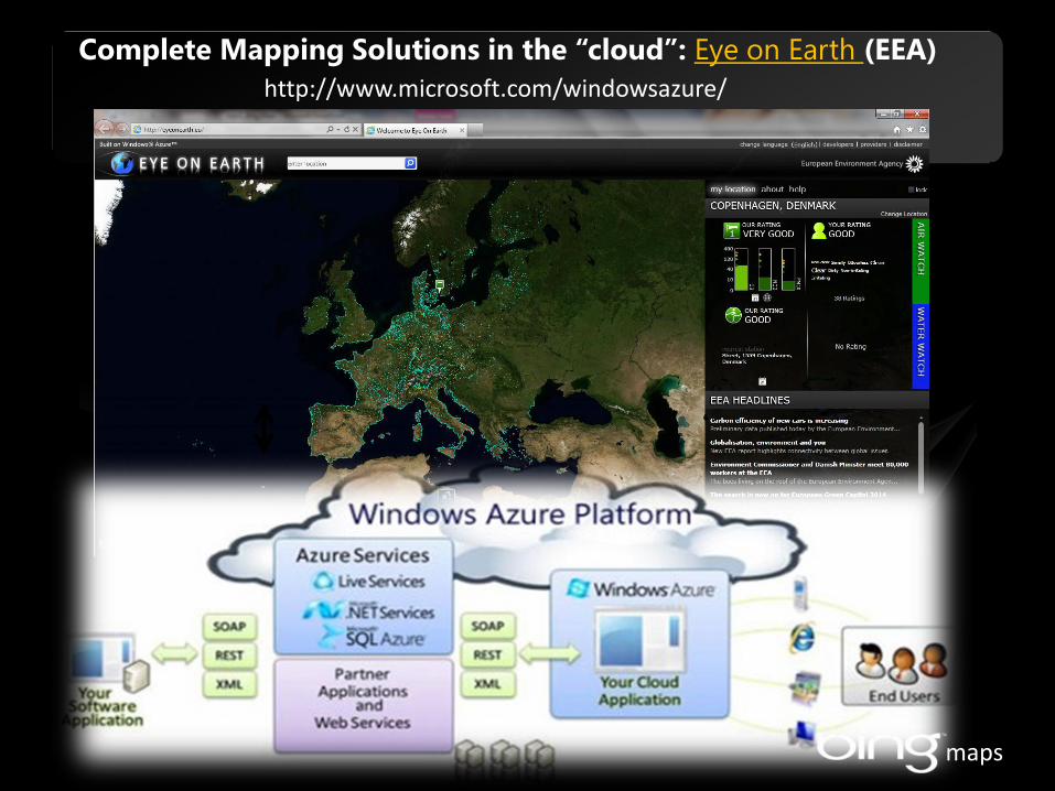
Client: Web-Browser
Web-Server
Basic Architecture using the Bing Maps AJAX Control
AJAX-Call
Database(s)
Website (with reference to Bing Maps Control)
Bing Maps MapControl
Tile Server -roadmaps -aerial images -hybrid maps Birds’ Eyes Images
Microsoft Content Delivery Network
Services -Geocoding -Routing -common services
Webhandler
maps
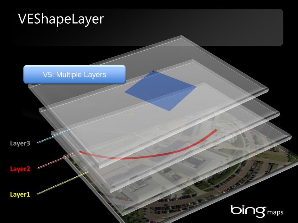
VEShapeLayer
Layer1
Layer2
Layer3
V5: Multiple Layers
maps
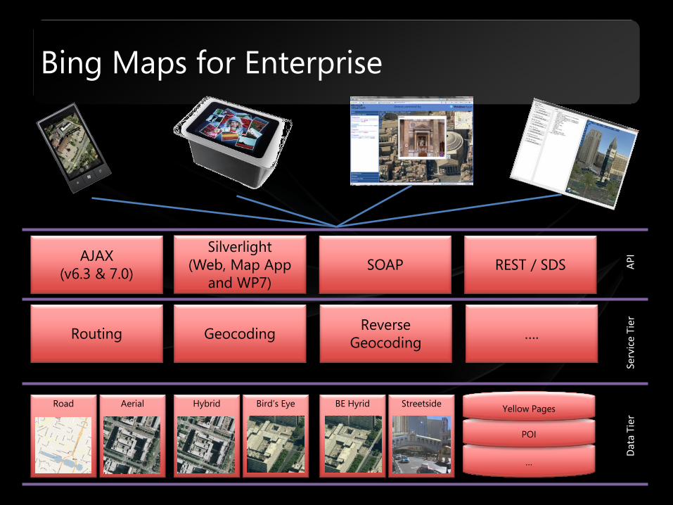
Bing Maps for Enterprise
…
POI
Reverse Geocoding
Geocoding ….
Silverlight (Web, Map App
and WP7) SOAP REST / SDS
Dat
a Ti
er
Serv
ice
Tier
A
PI
Routing
AJAX (v6.3 & 7.0)
Yellow Pages Road Aerial Hybrid Bird’s Eye BE Hyrid Streetside
maps
Complete Mapping Solutions in the “cloud”: Eye on Earth (EEA)
Database(s)
http://www.microsoft.com/windowsazure/


![92- 10920 - NASA · 92- 10920 COLOR-CODED GLOBAL TOPOGRAPHIC MAPS OF MARS, Sherman S. C. Wu, Annie E ... per pixel [3]. By using the DTM, we have generated color-coded global maps](https://static.fdocuments.us/doc/165x107/5b991add09d3f2fd558d2a8f/92-10920-nasa-92-10920-color-coded-global-topographic-maps-of-mars-sherman.jpg)