Bike Network Web page and Redlining Tool
16
Bike Network Web page and Redlining Tool
Transcript of Bike Network Web page and Redlining Tool

Bike Network Web page and Redlining Tool

MassDOT’s Biking and Walking Page
• Available resources include
– Access to MassDOT’s interactive Bicycle Facilities map
– The 2008 Bicycle Plan
– Access to other recreational resources and organizations
http://mass.gov/massdot/bike
MassDOT’s Interactive Web Page

Search Tools • City/Town • Points of Interest • Existing Shared Use
Path
• Spelling Counts!
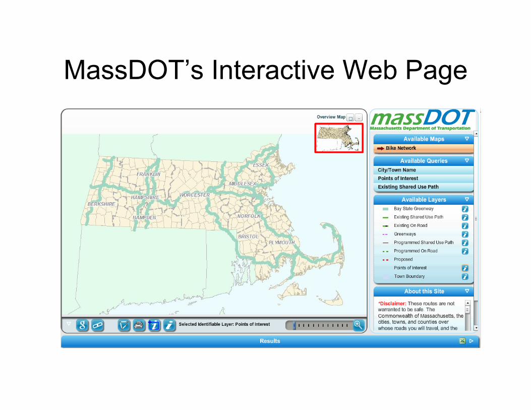
Symbols and Definitions
Are defined here
Symbols shown here

Google like Zoom and Pan Tools

Information button • Provides
– Facility names – Status – Facility Type – Websites when
available • Use by:
– 1st, select the data type of interest
– 2nd, select the “i” button
– 3rd, select the facility of interest
• On-line data dictionary coming soon
1st
2nd
3rd

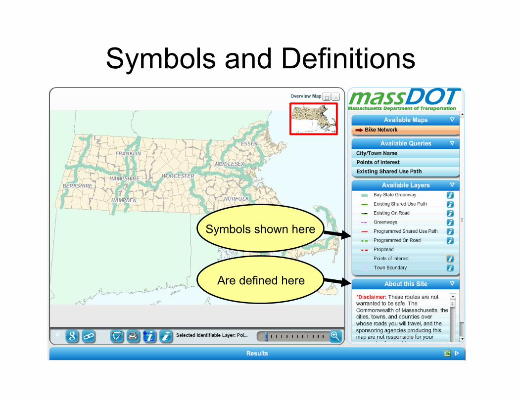
Redlining Tool
• Allows graphics to be used to indicate – Data errors and omissions
• Identify facilities in the wrong location • Identify facilities that should be added to the Bike
Inventory • Locations where bike signs are missing or
damaged
– Show friends and riding groups where to gather for weekend rides!

Redlining Tool • 1st, select
Redlining Tool
• 2nd, decide to draw a point, arc, poly (shape) or write text
2nd step select an option
1st
Redlining Tool
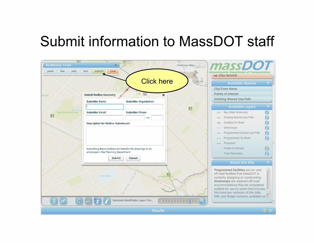
Submit information to MassDOT staff
Click here

Share with a Friend
1st, Click here
2nd Copy and paste this text into
Your e-mail message

Use Google’s Street View to see On-road conditions
Click here

Use Google Maps to see aerial photos or better yet….

Use Google’s Street View to ride before you ride!
• View shoulder widths
• Speed limits • Road condition • Bike use level • Views along the
route

Thank you for your time
See you on the road!!
Remember Safety First