Bartholomew Archive: Maps and Plans - Digital gallery · Bartholomew, publ. George Philip 1865 and...
61
National Library of Scotland Bartholomew Archive: Maps and Plans Preliminary survey listing of maps and plans received as part of the Bartholomew Archive, in the following sequences: • Manuscript maps and plans (Bartholomew), c.1840s-1932 (mainly 1840s-80s) • Printed maps (Bartholomew) Loose sheets, 1826-c.1980; volumes, c.1832-c.1930 (mainly 1850s-80s); also engravings and illustrations • Wall and oversize maps and plans (Bartholomew and other publishers), 1832-1972 • Reference maps and plans (Other publishers) c.1821-1992, c.4000 sheets • Proof maps and plans (Bartholomew) c.1865-c.1990’s, c.16,000 sheets See also the firm’s own Printing Record, with single copies of each item printed by the firm each day from 1877-2002. A partial listing can be found at http://digital.nls.uk/bartholomew/search/index.cfm. See also collection of ~3000 copperplates and letterpress printing blocks, held in the copperplate safe. A listing can be found at http://digital.nls.uk/bartholomew/contents/plates.cfm. Please note that referencing of this material should follow this formula: Bartholomew Archive, Acc.10222/[category of map]/[drawer number] For example: Bartholomew Archive, Acc.10222/Proof Maps/Drawer XX © Trustees of the National Library of Scotland
Transcript of Bartholomew Archive: Maps and Plans - Digital gallery · Bartholomew, publ. George Philip 1865 and...
National Library of Scotland Bartholomew Archive: Maps and Plans Preliminary survey listing of maps and plans received as part of the Bartholomew Archive, in the following sequences:
• Manuscript maps and plans (Bartholomew), c.1840s-1932 (mainly 1840s-80s)
• Printed maps
(Bartholomew) Loose sheets, 1826-c.1980; volumes, c.1832-c.1930 (mainly 1850s-80s); also engravings and illustrations
• Wall and oversize maps and plans
(Bartholomew and other publishers), 1832-1972
• Reference maps and plans (Other publishers) c.1821-1992, c.4000 sheets
• Proof maps and plans
(Bartholomew) c.1865-c.1990’s, c.16,000 sheets See also the firm’s own Printing Record, with single copies of each item printed by the firm each day from 1877-2002. A partial listing can be found at http://digital.nls.uk/bartholomew/search/index.cfm. See also collection of ~3000 copperplates and letterpress printing blocks, held in the copperplate safe. A listing can be found at http://digital.nls.uk/bartholomew/contents/plates.cfm. Please note that referencing of this material should follow this formula: Bartholomew Archive, Acc.10222/[category of map]/[drawer number] For example: Bartholomew Archive, Acc.10222/Proof Maps/Drawer XX © Trustees of the National Library of Scotland
Bartholomew Archive, Acc.10222/Printed Maps/Drawer
2
Manuscript maps and plans, c.1840s-1932 Maps and plans drawn and/or engraved by John Bartholomew, 1840s-60s? (many undated) [as identified and dated by John Bartholomew c.2000] Liverpool 1855, Edinburgh, 1840s?, Loch Ness 1855, Ben Nevis n.d., Ben Cruachan, New South Wales, Tasmania, South Africa, County of Wicklow [1863?[ [County of Longford] [1856? 1878?], Devon, Relief map of England and Wales, Brazil, Central Asia, South America political (with additions by JGB) and South America physical (with additions by JGB)] Manuscript maps and plans drawn and/or engraved by John G. Bartholomew, 1880s? (most undated) [as identified and dated by John Bartholomew c.2000] Compilations edited for Black’s Encyclopaedia Britannica, undated [Norfolk Island, Nineveh 1” : 1 mile, Nantes – central landmarks ½” : 1 mile, Newport (USA) – central landmarks 1¼” : 1 mile, Munich – central landmarks, Environs of Arcachon 2¾” : 1 mile] Compilations for a French historical atlas (after 1880) [Planisphère: grandes découvertes géographiques depuis le moyen âge (Mercator 1:130 M) (pp.40-41), Le Royaume des Pays-Bas (political with inset Bruxelles 1830) (p.42), Les Guerres d’Orient (i.e. S.E. Europe and Turkey) (p.47), L’Empire Français sous Napoléon I (p.88) [Province of Ontario physical 1:75M, Ocean currents and river systems (World Mercator 1:160M), Europe physical 1:27M, Scotland (for pocket atlas of Scotland ref. Church of Scotland), North America. Prior to 1890s? - possibly not by JGB.
Bartholomew Archive, Acc.10222/Printed Maps/Drawer
3
Printed maps Loose sheets of Bartholomew maps, 1826-c.1980 Roughly arranged geographically: no complete list. 1. World, Moon Including World Pictorial Map Series “World of Insects”, c. 1970’s; Royal Geographical Society History of Exploration 1830-1980 2. Oceans, Polar, Hemispheres 3. Africa 4. Americas 5. Asia, Australasia, Middle East Including assorted scale World Contoured Series, c.1950’s; 1:5,800,000 World Travel Series “South East Asia”, 1970; Indian Subcontinent plastic map, 1985 6. Europe Including Europe 1”:300 miles, in Encyclopaedic Dictionary and Atlas, Part 1, 1909; Europe showing Barbarian and Byzantine empires, 1913; 1:4,500,000 World Contoured Series “Russia in Europe”, c.1950’s; Colditz Escape Map in association with Mars Galaxy and Ripple 7. United Kingdom, England and Wales Plan of the Borough of Lambeth showing the 9 wards, 1909; ¼” GB motor [through-routes] samples [samples relate to colours used to show altitude?], 1925; GB road map [for general Accident Insurance, published Charles Letts and Co., 1932; London Fire Brigade Instructional map 1931; British Isles, Physical [wall map] 1”:50 km??? for Meiklejohn and Son 1955. Folder of maps from Guide Books of parts of UK, including index maps, printed for Baddely & Bartholomew c. 1890 8. United Kingdom, England and Wales Includes AA London Route Maps, Coronation day traffic and parking arrangements, 1954 9-10. Scotland Includes many of the important early maps, including Edinburgh 1826, Glasgow 1865, Distillery map of Scotland, Chas. Mackinlay and Co., Leith (undated), maps (3) for Murray’s Scottish General Timetable, A.K. Murray, Bridge of Allan (undated) 11. Scotland: Scottish Rights of Way Society, Edinburgh Zoo Including Pentland Hills as advertisement for the Scottish Rights of Way and Recreation Society (mounted and glazed for hanging); plan for Zoo guide and also some working material for 1912 map of Scottish Zoological Gardens

Bartholomew Archive, Acc.10222/Printed Maps/Drawer
4
12. Scotland Including Scottish Mountaineering Trust Black Cuillin rock relief map; RAC Map of Great Britain South Scotland, 1897; folder of Bathymetrical Survey maps, 1908 13. Maps for books and articles and journals Includes Treasure Island 1896 and map to illustrate R.L. Stevenson’s three cruises in the South Seas, printed sheets for Lawrence’s Seven Pillars of Wisdom, Commercial chart of the world for Scottish Geographical Magazine 1888, Vertical relief of the globe (2 hemispheres), for Scottish Geographical Magazine 1890, Plan for a National Institute of Geography (by Prof. Geddes) for SGM 1902 14. Unsorted (maps received September 2008) Some manuscript material with material in 14
15. Empty 16. Non-cartographic Posters Includes World of Flight, Series 2, Aircraft in Action 1939-1945, 1977 17. Bartholomew exhibition posters, with examples of maps, engravings, plates, film, forms used as display items in exhibitions to show map making and printing processes, including;
• Scottish Maps 1250-1928 • The Art of the Map • Creating a Family Atlas • 5 Centuries of Map Making • Transport, Tourism & Leisure Through the Ages
Volumes of Bartholomew maps, c.1832-c.1930 Maps, plans and illustrations engraved by John Bartholomew, J.G. Bartholomew and other members of the firm of John Bartholomew & Co. and John Bartholomew & Son for their own publications and as contract printers and engravers. Mainly uncoloured plate proofs, with some printed sheets and some manuscript maps and plans; some of the untitled volumes include engraving work by others, notably W.H. Lizars, possibly acquired and/or used as models. For a comprehensive sequence of sheets maps, plans and other work printed daily by the firm of Bartholomew between 1877 and 2002, see the Printing record 18. [untitled volume of early engraving work by John Bartholomew, c.1850s and 1860s? ]

Bartholomew Archive, Acc.10222/Printed Maps/Drawer
5
Plate proofs (uncoloured) pasted onto sheets, including Clue plans for Chambers Handy Guides, Black’s index plan of London, sheets from Black’s large map of Scotland, historical maps of Scotland, Handy guide to the Kent and Sussex Coast, town plans (including Liverpool, Paris and Jerusalem), Lower estuary of the Forth, no.1 and 3 of Garnett’s Travelling Maps of the Lake District, certificates etc. for banks and railway companies, and engravings of scenic buildings and drawings of new house by Edinburgh architect David Cousin [1809-78]; also some loosely inserted coloured printed sheets, including Ports and Harbours of the north-west coast of England, Palestine, Africa and Europe maps for Zell and A.C. Black,. Imprints include the early ‘John Bartholomew, engraver’ and the later ‘John Bartholomew, FRGS’. [untitled] ‘Map engraving and printing from John Bartholomew’, 1860s-1870s Printed and proof engravings of maps and plans pasted onto sheets. Maps include sheets from Imperial map of England and Wales, Black’s large map of Scotland, Philip’s New map of the Isle of Man, Garnett’s map of the Lake District ‘engraved and printed in colours by John Bartholomew, Edinburgh’, Edinburgh and Leith for PO Directory 1872 and Glasgow ditto 1869, Wales (in Welsh) for Blackie and Son, Field map of the Lothians, River Ribble with training wall 1872, Cheshire hunt map for Edwin Slater, Manchester, map of those parts of Ashanti and the British Protectorate...war in 1873-74’ and many small town plans and historical maps. Also loosely inserted are further (later, i.e. 1881-84) maps and town plans and illustrations (including some original artwork and engravings for various Nimmo titles), and the ms mock-up for a book entitled ‘The Book of Adventure and Peril’. Imprints include ‘John Bartholomew, litho, Edinburgh’ on the Ashanti map Possibly this volume was originally compiled for the 1878 Paris exposition? [untitled] 1867-1881 (many not dated). Plate proofs pasted into volumes, maps and plans. Imprints mainly ‘John Bartholomew, Edinburgh’ [untitled] undated [1870s ?] Plate proofs pasted onto sheets; appear to be all maps from [unidentified] atlases (2 volumes) 19. [untitled – early Printing Record style folder] 1879, 1882, 1885 and (mostly) undated. Plate proofs pasted onto sheets, with others loosely inserted. Includes Bett’s globe gores [first printed 1852, but Philip’s later acquired their production lines], map of fortress of Kars, plate 16 from Illustrations of Zoological geography, published by George Philip, and title page of first volume of History of France by William Deans and Fred. Martin, published by Fullarton and Co. [1882] Imprints include ‘John Bartholomew, Edinburgh’ but most with no imprint. ‘Bible Maps’ Volume with map sheets pasted and loosely inserted, all by ‘Bartholomew, Edinburgh’. Printed sheets for William Collins (16 pasted in), additional copies without publisher information, proof engravings stamped April 1907, printed proofs December 1908 and colour proofs April 1909
Bartholomew Archive, Acc.10222/Printed Maps/Drawer
6
‘Historical maps’, undated Volume with printed sheets in various states for various publications, also some loose inserts, all ‘John Bartholomew and Co.’, c.1909, and 4 engraved proofs by ‘John Bartholomew, Edinburgh’ for Blackie and Son, dated 1885 ‘Port plans’ 1909, 1911, 1927 and (most) undated Proof engravings, many hand-coloured, of port towns and ports [at small scale], arranged alphabetically. Manuscript list, with scale and plate number Patch plates, undated 20. Engravings (drawn/engraved by both Bartholomew and others, some possibly kept as examples, most undated) Including: Modern (c. 1980’s) printings of maps and views from original Bartholomew copper and zinc plates, including Thomas Allom views of London (1846) and a limited edition series of maps produced for the American and British market (an explanatory not by Ken Winch accompanies and includes Certificate of Authenticity); Astronomy and Canal illustrations for Encyclopaedia Britannica volumes II and IV respectively; [knots] for Trans. Royal Society of Edinburgh XXVIII plate XV; plans of temples and churches; engravings of people, scenery, monuments, biblical figures, monkeys, Conishead priory and illustration for The Olive Branch 1850 and Sinaitic and Syriac and other scripts from manuscripts; also a packet labelled ‘small engravings – types human life etc’ with illustrations mainly cut-out from published works (include national flags, mariner’s compass and some birds and scenery as well as human figure; Illustrations of animals, people, scenes etc. for plates and map colophons/cartouches, etc. Also two Japanese woodblock prints. Album of commercial advertising engraving work (trademarks, cheques, letterhead, magazine illustration and covers, bottle labels), mostly German, early 1890s, and (loosely inserted) of Edinburgh and other British examples of engraving and printing operations (cards, tickets, invitations, advertisements, covers) c.1868-80s [too late to have been done by John Bartholomew when working with Petermann? – possibly collected as samples?] Catalogue of lamps by J. Bartholomew Portfolio of engraved maps and plans, mainly by contemporary engravers including Petermann, C. Cobley, W. and A.K. Johnston, G.H. Swanston, J. and C. Walker, title pages of works to which he contributed (as Fullarton’s Royal illustrated atlas of modern geography), Philip’s Commercial Atlas of the world by William Rhind, and for A map of Germany, compiled by Bartholomew, publ. George Philip 1865 and for Black’s New large map of Scotland compiled by Bartholomew, undated; also draft tender document and publicity samples/specimens, notices, circulars, invitations, cheques, bookplates and certificates, etc.(including items for Augustine Church 1880-82), RGS dinner menus, and a number of rupee notes engraved by W.H.
Bartholomew Archive, Acc.10222/Printed Maps/Drawer
7
Lizars used as models for engraving, hand-writing and printing in John Bartholomew’s early years? this file also includes a business cards advertising W. and A.K. Johnston as successors to Lizars as bank note engravers. There is a visiting card for Mrs John Bartholomew Jnr., and one of the unidentified and undated proof engravings, Narragansett Bay, is possibly by JB. Plate proofs of maps, plans and other engraving work, [dates?] 6 v. Separate volumes for Atlas maps, Large maps, Railway maps, Tourists maps, ‘Old maps’, New plates 1889- , and Pictures. There is a separate list and alphabetical index to these volumes. The ‘Old maps’ volume has printed maps pasted onto sheets, c.1832- c.1862, with a [contemporary] list at the front of the volume. Maps by A. Arrowsmith, James Gardner [1825 corrected to 1846], W.H. Lizars, John Arrowsmith [1858], J. Wilson Lowry (Sharpe’s Corresponding maps for Chapman and Hall); sheets (complete set?) from William Murphy’s Comparative classical atlas [1832?] and for Cruchley’s British Isles (including OS of the country 30 miles around London at scale 1”:1 mile). Complete? set of maps for Fullarton atlas [the Royal Ill. Atlas of 1862?] with engravings by G.H. Swanston. Some sheets are annotated in crayon ‘polished out’ In SR (Bart.Firm.A.253-A.258). An index to these volumes can be found at Bart.Firm.B.033. Plate proofs of maps and plans, c.1888-19?? 2v. Arranged geographically, with pencil list inside front covers. Each proof with a small sticker with plate and box number and brief sheet and series title. Formerly held with the copperplates and constitutes a print record of them. On top of the ½” revision sheet drawers. 21. Empty 22. Posters and display material relating to the Bartholomew firm and Bartholomew Archive Includes Petermann/German association posters 2005, dedication of the EGI 1997 poster, and posters relating to the Bartholomew Archive Project. Also some reproduced items used in displays including original PR artefacts, covers and pocket knife found during disbanding and scale PR models
Bartholomew Archive, Acc.10222/Oversize and Wall Maps/
8
Wall and oversize maps and plans (Bartholomew and non-Bartholomew), 1832-1972 World [Untitled Bartholomew series of] physical [wall] maps, probably for the world (sheets for British Isles, Asia, Americas) some sheets torn British Empire map of the world by Parkin and Bartholomew 2 sheets; also mounted copy on rollers Mission fields of the United Free Church of Scotland, c.1910 British Isles, England Bartholomew’s general map of the British Isles 1/10”:1 mile 2 copies Scarborough’s census map of England and Wales 1”:10 miles, printed by Bartholomew for Scarborough, c1921 Autocar map for motorists (England and Wales) 8 miles: 1”, undated 2 copies Distillers Co. Railway map of the British Isles 19 miles: 1”, undated Philip’s new map of Middlesex … from the Ordnance Survey, 1”:½ mile by John Bartholomew [1881?] Nightingale’s map of Kent, Surrey and Sussex 1”:3 miles, with index Plan of Birmingham 3¼”:1 mile Scotland Bartholomew’s reduced Ordnance Survey map of Scotland, coloured to show orographical features, ‘proof in Progress’, 2 miles: 1” with manuscript reference scale of colouring composite sheets on cloth Orographical map of Scotland reduced from the Ordnance Survey by JGB, 4 miles:1” [1914?] 2 copies, made up of multiple sheets pasted onto backing cloth; with JGB’s device and motto as Cartographer Royal Orographical map of Scotland by John Bartholomew 10 miles: 1”, Ordnance Gazetteer of Scotland [less colours and depth] Jura 6” Ordnance Survey composite map {not unrolled} ‘Bartholomew’s Ordnance Survey plan of Edinburgh coloured orographically’: hand coloured (water-colour) and lettered (ink title and pencilled contour numbers) over printed sheet Bartholomew’s plan of the City of Edinburgh with Leith and suburbs, reduced from Ordnance Survey by John Bartholomew, 15”:1 mile, 1891 County of the City of Glasgow 5”:1 mile {found rolled with Plan of Birmingham 3¼”:1 mile inside map of Johore 1”:3 miles) Glasgow by A.B. McDonald [1:5300], 1913 7 sheets Glasgow area 1:750,000, 1971 Ireland Composite map ¼” Ireland {not unrolled} Europe, Africa, Americas, Asia, Antarctica Wall map of post-war Europe for Harold Nichols 1”:10 million, c.1926 Political map of Africa by JGB 1:12 million [1894?] Physical map of South Africa showing orographical features 1:1,400,000 by JGB 2 copies, one in good condition
Bartholomew Archive, Acc.10222/Oversize and Wall Maps/
9
Atlas series, Dominion of Canada 69.16 miles to a degree 4 sheets; not backed Asia: geographical environment 1:6 million Mill stereographic projection, Stockholm 1972 [with sticker, ‘published in Great Britain by Bartholomew’] Johore by Prince Ibrahim 1”:3miles, 1912 Western Palestine from PEF surveys, reduced from 1” map: special edition illustrating natural drainage and mountain ranges, by Trelawney Saunders, Stanford, 1881 {rolled inside} Tracings of Portion of the Survey of the Nile Province of the Uganda Protectorate 1”:2 miles by? C. Deliné-Radcliffe, Major Uganda Rifles, 1901 South Polar Chart by John Bartholomew showing Murray’s proposed scheme …Scottish Geographical Magazine, 1898 [Antarctica] Non-Bartholomew printings Scarborough’s map of the world, [1906] [with their map of North and South America on the verso] check if a Bart printing World, physical 1:40 million, no publisher or date [modern] Diagram of the World in 2 sheets, ms and hand coloured (water-colour); ditto outline map of Palestine, partly coloured Commercial and political map of the British Isles, Alexander Gross, ‘Geographia’, undated (c.1910) Nelson’s Royal Wall Atlas, no.1 British Isles [1891?] 12 sheets on a single roller Chart of the coast of Scotland …showing position of lighthouses, 1832 (W.H. Lizars engraver) also Chart showing position of northern lighthouses [Scotland], W and A.K. Johnston, 1894 ‘This plan of the city of Edinburgh and its environs, containing all the recent and intended improvements.’ Robert Kirkwood [1817] poor condition, cracked along centre, surface flaking Road map of the County of the City of Glasgow and the vicinity, compiled from actual survey by A.B. McDonald [scale approx.1”:450’] 1894 2 copies, one partly hand-coloured and one mounted and coated, much worn Reuter’s Nördlicher Himmel, Perthes 1883 Nord Polar Karte von V. v. Haardt, Hölzel, Vienna, undated (after 1895) [tracings] Geological map of South Africa 1:5 million by Alex du Toit and S.H. Houghton, 1950 [ms diagram map of Livingstonia, showing ?mission stations (CM, UM, LM)] undated huge Holy Bible [tree] map [chart] by J.W. Wyld, Joseph C. Jack, undated Untitled ms coloured map of [Palestine] (coastline from Galilee to Markab), undated Ms outline South America on Lambert’s zenithal projection 1:5 million Intercolonial railway, Prince Edward Island Railway of Canada, undated Newfoundland 60 miles to 1 degree latitude, by Alexander Murray and James P. Howley, Stanford, 1879 New South Wales, Dept. of Lands, NSW, undated 9 sheets torn and brittle Reynolds' Astronomical Diagrams, James Reynolds and Sons, undated (drawn and engraved by John Emslie, lithographed E. Weller) [1860s?]

Bartholomew Archive, Acc.10222/Oversize and Wall Maps/
10
[United States] tracing: experimental work by Versatec, produced on a 36” electrostatic printer/plotter at resolution of 100 dots per inch Landsat photographs/sheets of Abu Dhabi environs and Bathymetric depth image analysis of [northern red Sea] 1:100,000, by Ersac Ltd. Roll of satellite images (black and white) supplied by Faerey Survey, Scotland ‘Misc. maps, projection plots and original Kodatrace drawings for GSGS West Africa 1943 drawn here during the war’ {not unrolled}
Bartholomew Archive, Acc.10222/Reference Maps/Drawer
11
Reference maps and plans, c.1821-1992 Printed maps by other publishers, acquired by Bartholomew for reference or received by gift. Arranged chronologically by continent, with a further country sub-division for Europe. 1. Encyclopaedia Britannica maps by Emery Walker For Bartholomew’s maps for EB, see Working copies maps, Drawer 28 2. Stieler’s Hand-atlas and Schul-atlas
• Stieler’s Hand atlas, publ. Justus Perthes: two large folios, each containing 200-300 sheets from various editions of the Atlas from 1856 to [1890]. Each has a printed list of the individual map titles, but these are not in order within the folders. The second volume has some maps grouped in titled parts, but these are usually missing some sheets.
• Stieler’s Hand-atlas, 1907 • Stieler’s Hand atlas: 4 loose sheets (3 world and 1 Europe) (vv.
dates/editions 1880-90) and packet of 18 sheets labelled ‘Stieler’s backed copies’, i.e. maps printed on the back with the title and description in English, French, Italian and Spanish.(1913 edition??
• Mond-Oberfläche plate 5 from Stieler’s Hand Atlas, Perthes, 1872 formerly in A1/2-1
• Stieler’s Schul Atlas, Perthes, 1851: 3 sheets only [formerly in drawer A2/1-1]
3. World maps: part atlases, single atlas sheets and unbound sets
• Schutze-decke zu Kiepert’s Grosser Hand Atlas, 3rd part: map dates span c.1893 to 1912 [sheets V-XVII, XIX-XXVII, XXXIII-XXXIV]. Most in German but some with text in English.
• E. Debes Neuer Handatlas, Leipzig, H.Wagner and E. Debes: labelled Lieferung 12 but contains 39 sheets from various parts of the Atlas, dated 1893-94. Missing 22-25, 27-29, 31-32, 39, 44, 46-48 and 59
• Grosser Deutscher Kolonial Atlas: Reichs-Kolonialamt, Berlin, Dietrich Reimer. Parts 1 (1909) and 3 (1911) plus some section indexes. [note good maps of Marianas, Marshalls, Carolines and Samoa]
• 51 sheets tied together with label ‘Blackwood’s plates of battles and battle grounds’: in fact not only from the Blackwood series (engr. W and A.K. Johnston) but also for map series published by G.H. Swanston and A. Fullarton and Co., many drawn by A. Petermann with some of these engraved by J. Bartholomew (as Military movements in India [led by] Duke of Wellington, Campaign in the Pyrenees and Battle of Vittoria). Some are not military maps, and at least one of these, the Colonial portions of Dutch Guiana, was drawn by J. Bartholomew, FRGS and engraved by J. Bartholomew, Edinburgh. Some have pencilled corrections and additions, e.g. Plymouth Sound has a lengthy attached note on the new text regarding tides and the breakwater light, as well as the addition of the Cornwall railway to the map itself
Bartholomew Archive, Acc.10222/Reference Maps/Drawer
12
• Samuel Arrowsmith’s Bible Atlas: bundle with label ‘Arrowsmith’s Bible Atlas 1836 (Incomplete)’ with 4 copies of title page [with publication date of 1836], text sheets and maps. No name of engraver or date on maps.
• C. Adler’s Schulatlas mit Tertheigabe c.1870 • Folder containing assorted maps including:
-Map of part of Bengal, the Himalaya & Tibet to illustrate Dr. J. D. Hooker’s Routes by Augustus Petermann and published by John Murray, 1854 -Sketch map of east Africa by E. G. Ravenstein, 1860
• Copies of “Cartactual”, c.1976-c.84
4. Miscellaneous part atlases 5. World maps and charts: Oceans, Hemispheres, Polar maps, aeronautical maps, moon and star maps Including:
• facsimile of the General Chart showing Cook’s voyages [1780s-90s] • Behring’s Sea and Arctic Ocean chart c.1868 • Pacific Ocean compiled from British Admiralty Survey …by the India
Rubber, Gutta-Percha and Telegraph Works of Silvertown, engr. J.D. Potter [c.1899]
• North Pacific Ocean with routes for steam vessels, U.S. Hydrographic Office, 1900
• Atlantic, Indian and Pacific Oceans, Plates 1-3 from [unidentified German work] 1912, new edition, A. heft 2, eng. M. Groll
• Carte générale bathymétrique des Océans, Monaco 3rd. ed. 1936-49 • Bathymetric features of the Indian Ocean (2) for Pan-Indian Ocean
Science Association 1952 • Aeronautical charts (4 sheets from Carte aeronautique du monde, Inst.
Geog. National Paris, 1954-57 and 1 sheet of World Aeronautical chart, USAF Aer. Chart. Info. Centre 1953
• Pacific, Indian and Arctic ocean floor maps, National Geographic Magazine 1969- [received 2008]
• Indian Ocean floor sediments 1978
6. World maps: Denoyer-Geppert series, mission maps, and facsimiles of early world maps and charts Including:
• Denoyer-Geppert (Chicago) series maps, 1917-21 (16 sheets) • Baptist Missionary Society maps of China, India (general and Bengal)
Ceylon and West Indies, also England and Wales, on cloth. Most specifically lithographed but India uses a standard printed map with mission locations marked in ink
• Facsimile of Martin Behaim’s Erdapfel [terrestrial globe] 1492, repr. National Geographical Society 1986 from 1908 printing by George Philip and Son; of Ovens and Mortier 1730 Mappemonde; and of approx. 30 other early maps (c.1592-1858), mainly published 1960s-70s?
Bartholomew Archive, Acc.10222/Reference Maps/Drawer
13
7. World Maps: wall atlases/series • 48 sheets Philip’s Comparative series of wall atlases c.1912-14 • 21 sheets Oxford wall series, c.1909-11 (in single folder) • Atlas Scieny, various scales, political and geographical [before 1923]
8. World maps: National Geographic Magazine, geological, relief and specialised topic maps (communication, religion, etc) Including:
• National Geographic Magazine maps, 1936-49 (including Oceans as theatres of war)
• 15 ‘Autograph handmaps’ of British Isles, England and Wales, Scotland, Europe, Africa, Americas, Australasia, various scales,c.1900-08 by Oxford Geographical Institute, Darbishire and Stanford Ltd. [outline reliefs, printed]
• Justus Perthes geological world map, 1:20 million, in 8 sheets, undated • Geological map by H.B. Milner, Stanford 1921 • Polish and Russian world map sheets • Religions of the world, with stations of London Missionary Society,
George Philip 1895 • Wireless map of the world (for Marconi Press Agency), George Philip
c.1914 • [German] United Nations map, undated • Timber map engraved W. and A.K. Johnston,[1921], prepared by J.
Hudson Davies, with special reference to forest regions and geographical distribution of timber trees
• Segelschiffsreisen and Witterungstypen am Kap Horn by Gerhardt Schott, engraved Geo. Lith. Institut, Berlin, 1894 (sheets 11-14 of ………)
• ‘The Student’s Synchronological chart of the religions of the world…accompaniment to Rivers of Life by Major General Forlong’ 1914 and ‘Deacon’s Synchronological chart of Universal History, drawn by Professor Edward Hull’ c.1922. In envelope described as ‘pattern copies, dissected maps, river or tree of ancestry’.
• [map to] The third route by Philip Sassoon, engraved Max Whistler [1929] map drawn by Bartholomew?
• Bevölkerungsdichte world map as at 1960, 1:45 million (sheet 106 of Petermann’s Geogr. Mitteilungen 1962)
• World (in two hemispheres, land/water), National Geographic Magazine 1935
• Operational Navigation Chart, sheets C-3, C-8, F-1 and H-1, covering various areas, scale 1: 1 million, USA c.1973-80 relief portrayal in feet and terrain characteristic units
• Air route maps of commercial airlines 9. Empty
Bartholomew Archive, Acc.10222/Reference Maps/Drawer
14
10. Africa: series map sheets • TSGS 1:1,000,000 series of [1903-1905] (41 sheets) • Service Géographique de l’armee 1:500,000 series of 1925-28 (21
sheets) • French series of the Bas-Congo at scale 1 cm=1 km, 1900 (10 sheets) • Radio navigation map, 3 sheets for North-east, North-west and South,
Service de l’information aéronautique - France, 1975 • East Africa, sheets from 1:25,000 and 1: 50,000 series, mainly war-
time editions • New military map of the Colony of Natal, H.C. Simpson, 1901 (6
sheets) 11. Africa: single map sheets 1875-1980 Including:
• W. Sahara from Geographical Magazine 1876, with annotation ‘1255 sent 28 December 1875’
• Single sheet Africa from Petermann’s Geog. Mitt., published Justus Perthes 1885
• advertisement for Justus Perthes’ Wandkarten von Afrika by Paul Langham, annotated with English translation of natural features colour legend.
• Portuguese charts of Zambezi delta 1891 and Rio Zaire 1933 • Plano hydrographico do Porto de Loanda 1896 • Map of Mahe, Seychelles, c.1900 • Egypt sheet from Encyclopaedia Biblica, Johnston, 1901 • Cameroons, OS Office 1:2 million, 1908 • Gold Coast Vegetation, OS 1910 • War map of German South-West Africa • Nigeria 1:2 million, 1909 and as revised 1920, Tripoli and Egypt 1:3
million 1919 • Zanzibar by Oscar Baumann, 1:20,000, undated • Topomorphic map of Northern Afar, Ethiopia, geomap, 1968; Hoch
Semyen (Ethiopa) 1:50,000, 1967 • Calebasses dam site, Mauritius, film positives (3)
12. Africa: single map sheets ( cont.), 1895- Many of Belgian Congo and other provinces/countries. 13. Americas, United States: mainly 19th century topographical and railway maps Including:
• Military Department map of the South…Georgia and South Carolina, War Dept, 1865
• Railroads of New Jersey, 1869 • Warner, Higgins and Berger’s State of Illinois 1871 • Cram’s new sectional maps of the States of the U.S. 1872-73 • Washington, New Orleans and Philadelphia city plans 1878-c.1900 and • Bancroft’s New Map of California and Nevada, 1883 • Land Office map series (including Territories 1883 showing Indian
tribes) (Bartholomew Library box of 33 sheets)
Bartholomew Archive, Acc.10222/Reference Maps/Drawer
15
• Post Office maps by W.L. Nicholson 1884 showing post offices, mail routes and distances (Bartholomew Library box of 20 sheets)
• US War Dept. weather charts 1885 • Series of historical/scenic maps of areas of the U.S. with illustrations of
people and places, battles etc. • Mount Desert Island, Maine, 1882, with aids to navigation corrected to
1885, at scale 1:40,000 14. Americas, United States: early (cont.) and National Geographic Magazine Including:
• U.S. Coast Survey by A.D. Bache, 1865 (4 sheets) • War dept. military map of the US, 1870 and [damaged] map of North-
east Virginia and vicinity of Washington, 1862 • Post route maps of Pennsylvania, New Jersey, Delaware and Maryland
and the district of Columbia, scale 6 miles: 1”, 1869 • 1872 township map of Lake Superior region and Upper Mississippi,
with signature of A. Fullarton and Co. (with note on merger of cities of Minneapolis and St. Anthony)
• Mills and Co’s Map of Iowa, 1873 • National Geographic Magazine maps of the US and historical and
scenic map series, c.1914-48 15. Americas, United States: geological, travel and general (mainly 20th century) Including:
• Geological map of New Jersey, George B. Cook, 1890 • US Geological Survey: Geologic Map of the United States 1932 (4
sheets), base maps showing status of topographical mapping, aerial photographs and horizontal control, 1948-49,Yosemite Valley 1938, Columbia River Gorge airway map 1931, and other map sheets
• Automobile maps of the United States, counties and cities, c.1930s and 1940s; Rand McNally road atlas of US, Canada and Mexico c.1935; road map of Oregon 1931
• NASA satellite image of the United States, 1973 • Nicknames of American cities, undated • Facsimile of 1857 Map of the United States of America by J.H. Young • Nautical chart 11451 Miami to Marathon and Florida • Close-up USA, National Geographical Society [sealed] • Saranac Lake, orthophotoquad 1:25,000, 1976 • Boston map guide ((booklet) 1:1000, 1980 • Timetable NY Central lines (booklet, ?1903; International Steamship
Co. route and its connections: Eastern sea coast route, 1881 • Casement glacier, Alaska 1:30,000, Dept. of Geography, University of
Glasgow, 1963 [possibly originally part of a collection of maps on glaciers or from a conference paper]

Bartholomew Archive, Acc.10222/Reference Maps/Drawer
16
16. Americas, Canada: Wall maps, geological maps, Manitoba, Ontario and Quebec [in Original Bartholomew Library box files] Include large format wall maps by Johnston, Stanford and series of geological, provincial, town and railway maps, geological series and large scale city plans (e.g. Winnipeg 1884 with inset ill. of buildings) 17. Americas, Canada: Dept. of the Interior and Geological Survey series sheets, coast charts etc., 1864-1950s Including:
• 4 sheets, including 2 ms charts, have annotations by J.S. [James Steele], c.1911
• U.S. Coast Survey, NW coast of America, sheets 1-3, 1868 ownership mark of A. Fullarton and Co.
• Canadian Geological Survey geological map of Canada 1864 • Geological Survey of Canada, Nova Scotia c.1896-1907and series
sheets 1906 • Province of Ontario 1896 • [Dept. of the Interior] North-West territories, Province of Manitoba
showing land surveys to December 1882; Manitoba showing principal government lands for sale, 1907
• Ontario 1”:2 miles, War Office 1908 • U.S. Geological Survey, Geological map of North America, 1:5 million,
1911 • Commission of Conservation, Forest stand types in British Columbia,
1917 • Scarborough’s New map of Newfoundland 1”:10 miles, undated (before
1923) • Dept. of the Interior, Standard Topographical map series 1:500,000
and 1:250,000 series, 1918-20; ditto, Atlas of Canada sheet 32, Routes of explorers, undated (pre-1913)
• National topographical series, 1:50,000 New Brunswick and Nova Scotia, sheets from 1st-3rd editions, 1920s-1950s; ditto 1”:2 miles, various printings 1930s-50s
• Dept. of technical Mines and Survey, Mineral areas, 1950s • George Philip and Son Southern Canada and USA (including Dominion
of Canada sheet) 1”:2,500,000, 1930s? • American Geographical Society of New York, Atlas of the Americas,
Canada sheets 1:5 million, 1948 • Canada 1”:100 miles on Lambert Conformal Conical Projection, 1951 • East and West Kootenay, Dept. of Lands, 1911 • [Russian] relief map sheets (photostats), marked up by the Drawing
Office of John Bartholomew c.1956 18. Americas, Canada: geographical, railway and historical maps and plans Including:
• Geographical Board of Canada, catalogue of maps, 10 sheets with graphical index
Bartholomew Archive, Acc.10222/Reference Maps/Drawer
17
• Dept. of the Interior, showing Dominion lands surveyed and entered to 1880: with note addressed to ‘B’ regarding Manitoba and the line of the Canadian Pacific Railway
• Canadian Pacific Railway system maps, 1886 and later • ‘Historical maps’ of Canada, mostly small maps and plans [reproduced]
from publications of the late 18th and 19th centuries. Some with attached notes on and/or annotated with changes for a new use, as 1790 Surveyor General’s map, subsequently photo lithographed by Bartholomew, used to create tracing for ‘Seignuries of Old Canada’, and a map of Province of Upper Canada,’ Seat of War no.1’ [1812-14], 1860 with a long and interesting note from J.D. [presumably the publisher John Disturnell, 1801-77, who published maps from 1840s-60s] regarding the style to be used.
19. Americas, South and Central America, Mexico and the Caribbean; facsimile maps Including:
• National Geographic Magazine general maps of South America, central America, Mexico and West Indies, and the Caribbean, 1937-47
• South America from Meiklejohn’s series of Oroscopic maps, 1909 (mounted for wall hanging)
• Patagonia/Argentina, sheet 94 of Stieler’s Hand-Atlas, Perthes 1884 Republic of Argentina topographic series, scales variously 1:25,000 to 1:100,000, 54 sheets (2 sets) undated (but with price list as at c.1968); ditto map index to 1:50,000 and 1:100,000 series
• Indian tribes of South America by John Howland Rowe, 1973 (photocopy)
• Panama canal by Ch. Muret, undated with John George Bartholomew’s ownership signature
• The Andes: 3 sheets of republic of Argentine 1:1½ million series, 1901 – to accompany article by M.L. Gallois in Annales de Géographie
• Falkland Islands… • Facsimiles of 17th and 18th century maps of the Americas, including
‘The Duke’s’ plan of New York 1661, published 1664 20. Asia: general and China Including:
• Traditional [Ming dynasty] Province maps (2 sheets) • Russian map 1889 [with focus on Russian/Chinese border and/or
disputed possessions?] • General map of the Chinese empire (geological sheet) 1911 and later
Geological Survey series sheets and satellite images • National Geographic Magazine general maps of Asia and of China,
1921-42 and Polish map of Asia 1 cm:100 km, 1948 • Manchuria ‘the cradle of future world conflict’, 78” x 58”, publ. China
1933 c.f. Owen Lattimore’s book ‘Manchuria, cradle of conflict’, published the previous year
• Chinese map of Manchuria, scale 1:1 million, early 1930s, 4 sheets, Folio entitled ‘Sources for China Directory plans’ including plans (manuscript, photographic copy or blueprint) of Manila, Saigon,
Bartholomew Archive, Acc.10222/Reference Maps/Drawer
18
Penang, Tientsin, Hanoi, Kobe, Shanghai, Tsingtau and Batavia dated between 1896 and 1917. Attached notes
• indicate they were for a directory to be prepared by Bartholomew for the Hong Kong Daily Press
• Hong Kong 1:600 survey sheets from air photos taken 1963-64 21. Asia: Japan, Burma, Indonesia and South-East Asia Including:
• Bruno Hassenstein’s Atlas von Japan, 1st and 2nd parts, Perthes 1885-87
• Imperial Geological Survey of Japan 1889 topographic map sheets and geology maps, 1914
• Land survey map of Japan 1:2 million, 1927 • Isometric drawing of Mt Fuji and Hakone 1:120,000, 1980 • Central Tokyo 1:5000 colour photo map, 1980 • [Large scale plan of Tokyo, in Japanese] • French maps of Indochina, 1:2 million , 1928 and of Vietnam, Laos and
Cambodia, 1:14 million, 1961 • Indochina physical 1:5 million, from Zenkyo’s Atlas (sheet 16), Tokyo,
?1968 • Malaya 1937, 6 miles to 1”, in 4 sheets • Rangoon showing main communications 1:2000, 1926 (drawin • Djakarta, Indonesia 1:50,000, 1967 (2 sheets, photo positive film) • Sarawak map list, 1974 with index map sheets
22. Asia: India, Nepal, Tibet, Afghanistan Including:
• India maps by John Walker, Geographer to the Secretary of State for India, engraved J. and C. Walker, 1860s-70s
• Bacon’s wall atlas of India, undated • Survey of India maps, including Burma and Afghanistan, at scale
1:1,000,000 and 1” to a mile, 1904-5 (few) and 1910-37. Note single sheet from Indian atlas originally published 1868, parts of Ladakh and Maroo Wardwan (Kashmir), [re-engraved 1903?] with areas marked out and note ‘photo litho on same scale of the Area contained within the corners marked by white paper’ and stamp of Edward Stanford Also Survey of India map of Bihar and Orissa, marked up to show commissioners’ divisions, districts and states, and population density [part of a group of maps and satellite images collected together as relevant to representation of population density?]
• India Railway and canal map, 1”:32 miles, 1909 (6 sheets); rainfall chart of India 1:128 miles from Indian Met. Memoirs III no.1, May 1886 (Plate II) with notes
• Hyderabad state communications 1”:16 miles, 1954 • Orissa province approximate boundaries 1”:16 miles no imprint or date • Karte von Afghanistan … Paul Langhans, Perthes, 1897 • Sketch map of Tibet showing explorations and journeys of Sven Hedin
1906-08, publ. W and A.K. Johnston • Royal Geographical Society Tibet and surrounding regions, 1:3.8
million, 1904

Bartholomew Archive, Acc.10222/Reference Maps/Drawer
19
23. Empty 24. Asia: Middle East (including Levant and general ‘Bible lands’) Including:
• Gulf of Suez, compiled from British surveys, James Imray and Sons, 1872
• Die Nilländer und West Arabien 1:5 million, 1893, from Kiepert’s Grosser Handatlas, sheet no.38
• American Geographical Society maps of the Northern Hejaz and North Arabia, according to Alois Musil, 1926
• Levant, scale 1:200,000 by Bureau Topographique des Troupes Francaises du Levant c.1928-32
• Damascus, Service Géographique de l’Armée 1:10,000, 1929 • M.T. route map Egypt, Palestine, Syria 1:1 million, 1946 2nd ed.
(‘Restricted’) • Karten zur alten Geschichte III, Egypt-Palestine from Kiepert’s Atlas
antiquus, Reimer, Berlin, …. • Survey of Egypt, Syria sheet • Near and Middle East [oil] concession map, 1953, with names of oil
companies • Ms text and reprint of article by Dr Charles D. Matthews on ‘Bedouin
life in contemporary Arabia’, 1959 (with maps) • Oman (roll of plans) and SEEB airport, 1:50,000, 1980 • Satellite images of the region, 1984
25. Empty 26. Asia: Palestine
• Palestine Exploration Fund map of Western Palestine: 2 portfolios of maps of 1880 and 1890 editions and 1882 special edition (illustrating the Old Testament etc.) and other maps of Palestine; additional folder of Palestine Exploration Fund Map of Palestine sheets and related maps
[PEF founded 1865 to promote research into Biblical Palestine and the Levant; the survey of Western Palestine 1871-8 was their second major project] Bartholomew supervised the compilation of the 1901 topo-physical map of Palestine from these surveys and other sources
27. Asia: Palestine and Jerusalem (cont.) Including:
• Mimpriss teacher’s class-lesson chart of our Lord’s life and ministry, with ill. and plan of Jerusalem (on glazed cloth, with rollers) [c.1835-40?]
• C.M. van der Velde’s Map of the Holy Land, Perthes, 1858, 8 sections, missing no. 4
• El Haram Esh Sharif, from Survey of Palestine 1944, scale 1:625, with border based on inscription from south wall of Aqsa mosque
• Palestine of the Crusades 1:350,000, c.1937 (with historical introduction and gazetteer); Jerusalem plan, 1:2500, 1943 with index to buildings

Bartholomew Archive, Acc.10222/Reference Maps/Drawer
20
• Haifa 1:10,000, 1940, with note ‘used for ½” Palestine’; Tel Aviv and Jaffa 1:12,500, by Zvi Friedlander, 1950
• Palestine maps from various series, 1920s-40s [received July 2008] 28. Asia: Russia, Turkey*, Balkans, Cyprus Including:
• Kiepert’s map of the Caucasus and Armenia, 1854, Karte von Klein-Asian, Reimer 1854, Karte von Armenien, Kurdistan und Aberbeidschan, Perthes 1858; Turkischen Reich in Asien 1853 and Osmanischen Reiches in Asien [Heinrich Kiepert 1818-99 a German geographer, first publication Atlas von Hellas 1840; World Atlas 1848 and Atlas antiquus 1854; special interest in Asia Minor – his maps were the highest authority for the region at the time]
• Heck’s Russian empire in Europe 1851, from Stein’s Neuer Atlas der ganzen Erde
• Johnston’s chart of the Sea of Azov, 185[5] • Illustrated Russo-Turkish war map, Stanford 1877 • Map of Russian possessions 1888 • Large rolled outline map of USSR , on drawing film, for correction
(undated) • Turkey and Istanbul, undated (Photostats) • Hâmit Sâdi map of Turkey 1929, annotated to show sea distances
between coastal towns and between Turkey and other islands and countries, and with notes of railways/roads under construction
*N.B. see also Drawer 36 for additional maps of Turkey, including WWI (Dardanelles) maps
29. Australasia (Australia, New Zealand, Papua and New Guinea) Including:
• Continental Australia, Dept. of Lands and Survey, Melbourne, 1879, with routes of exploration (4 sheets)
• Geological map of Commonwealth of Australia, 1931 (5 sheets) • Specimens of Australian mapping, including Australia, Dept. of Lands
and Survey, Melbourne, 1887 showing ‘The routes by which the aboriginal race spread itself throughout the continent’, facsimile of early exploration routes, Wiluna-Kimberley stock route exploration of 1906-7, rainfall map of NSW 1910, Torn map of Adelaide and suburbs [1955] and Belair Recreation Park [Adelaide, South Australia] orienteering map
• New Zealand 1:200,000 and other NZ mapping specimens, including photos of 19th century sketch of Middle Island and of Cook’s chart of NZ, plan of Auckland, and charts and sheets of aerial and topographic and satellite images and notes illustrating NZ survey integrated survey/cadastral mapping and title system
• Cold Lakes, Otago, New Zealand, NZ Survey, 1889 • Chart of Capt. Moresby of New Guinea and islands north of Australia,
April 1873 (ms tracing) and Dept. of Territories map of Papua and New Guinea, 1954
30-32. Empty
Bartholomew Archive, Acc.10222/Reference Maps/Drawer
21
33. Europe: general Including:
• Europa by C.F. Weiland 1:10 million, Weimar 1842 • Neue Karte von Europa by C.F. Baur 1:3 million, undated - from Baur’s
Atlas von Europa section IIII (6 sheets) • War map, 1870 (Guardian supplement) and WWI war maps, including
Philip’s large scale strategical war map of Europe, Western area and Le Théâtre Occidental de la Guerre Européenne 1:500,000 by B. Barrechia, Soc. Ed. Geog. Paris, 1918 [see also with maps of France, Turkey etc]
• Europe, political and shipping routes/lines, Paul Langhans, publ. Justus Perthes
• Geological map of Europe, scale 69.16 miles to 1 degree, by Joseph Prestwich (from his Geology V.II), 1888 with colour legend and list of authorities
• Imperial and railway map of Europe 1:100 miles, with illustrations of mountains in Britain, with heights no date or imprint but possibly Bartholomew?
• Europe 1:7500,000 ‘der Natur’ (physical/relief), K.u.k. Militár-geographisches Institut Vienna,c.1898-1903
• Europe 1:500,000, Istituto Geografico Militare, 1898 (originals 1886), various sheets
• Europe 1:1 million, Service Géographique de l’Armée, undated (11 sheets)
• Skeleton map of central Europe 1:750,000, 1914 from Ordnance Survey (6 sheets) see also France for sheets from the 1:500,000 series
• Europe sheets from Ethnographic map 1:1,500,000 by War Office, 1918 (4 sheets)
• [northern Europe/Scandinavia] Östliche Nordsee und Ostseestaaten sheet (nr. 2501) of Europe-Asia air navigation chart 1:2 million produced by the Luftwaffe, revised to 1943
• Diagrammatic road map of Central Europe for the use of automobilists and cyclists 1:3 million by Wood McMurty, Brentano, Paris, undated
• National Geographic Magazine Europe maps, 1929-49 • Colourtext story maps of Europe*, Chicago 1935-36 [one set in
Christmas gift wrappers] *covers are for Scotland map • Facsimiles of historical maps, including Blaeu’s Europe c.1630 includes
some of individual countries and cities otherwise included in drawers 34 ff, e.g. 2 plans of Madrid
• Parts 6 and 7 of Carte Géologique internationale de l’Europe 1:1,500,000, undated (each 5 sheets)
• Road, travel and motoring maps, various [large] scales and publishers including Brentanos, “Geographie”, BP, Kümmerley and Frey, Cartes Blondel, 1950s and 1960s
• European Community, administrative and population maps of member countries 1:400,000, 1959 and 1960
Bartholomew Archive, Acc.10222/Reference Maps/Drawer
22
34. Europe: Germany, Austria,* Luxembourg Including:
• Deutschland, 15 miles to 1degree, Justus Perthes, 1857 • Karte von Deutschland, Perthes 1857 – 25 sheets pasted together onto
linen backing • Atlas der Alpenländer ‘after J.G. Mayr), Perthes 1858 (4 sheets only) • Karte des Deutschen Reiches 1:100,000, sheets 335 and 362, 1883-85 • Karte der Alpen 1:450,000 (4 sheets) from C. Mayr’s Atlas der
Alpenländer, Perthes 1871 • Höhenschlichten den Alpen 1:2.5 million, from Meyer’s Kleiner
Handatlas • Berlin environs 1:100,000, c.1925; Berlin plans c.1930, 1953 and 1975 • Milligen 1:5000, plan produced from air photographs, War Office, 1944 • Travel maps of Germany and Austria 1871ff and road maps ditto,
c.1950-60s • Austria (political) by Wahlmann, Berlin, 1857 • Austrian empire 1:1 million and 1:5 million, undated • Environs of Vienna, undated Bartholomew engraving?? And Vienna
1:15,000 and 1:12,5000 undated • Vienna map for Hotel Ritz • Pharus plans of Cologne (Cöln) 1:8000, undated and Hamburg
1:14,700, undated
* see also Drawer 38 for maps of the Austro-Hungarian Empire 35. Europe: France Including:
• La France: Divisée en Provinces, 1780 (2 copies, with different outline colours, mounted on canvas in sections) facsimile?– no imprint
• ‘France in provinces at the time of the new division in 1871’ engraving, no imprint or date
• General survey map pf France 1:800,000, 1878 • France physical and geographical by R. Leuzinger 1:2 million, Dalp,
Berne, undated [1880], lithographed by Wurster, Randegger and Co. at Winterthur with colour legend for contours
• France 1:100,000, Ministry of the Interior,1886-91 (10 sheets) • Daily Mail Birds’ eye view of the British front [WWI] (France) • GSGS Through-way towns of France, vol.1 North-East France,
Directorate of Military Survey, 1944 • France, various sheets from physical and topographic series from
Institut Géographique National and Ministère des Travaux Publics et des Transports, (some English) at scales 1:50,000 to 1:500,000, 1936-69; also Carte de France 1:50,000 sheets 1950s
• Skeleton map of Western Europe, French 1:5000,000 section (sheets 2,3,5,6,8,9)
• Travel/motoring maps, Pneu Michelin and Grandes Routes series, c.1939-49
• Gorges du Verdon 1:25,000, IGN 1937 • Fortifications of Paris, Johnston, 1870
Bartholomew Archive, Acc.10222/Reference Maps/Drawer
23
• Environs of Paris, undated [no.16 of ….published by G.W. Bacon] • Nice, Les Grands Plans de France series, 1872 • Plan of St Malo, Dinard and environs, del. L.Thuillier, publ. Hachette
(Guides Joanne), printer ?Lemercier, Paris, with annotation ‘this is an excellent map’
• ‘French Taride and De Dion-Bouton’ i.e. 22 sheets of Carte pour cyclistes & automobiles de la France et Belgique [i.e. all Taride?] in green box
• Essai d’une carte botanique et forestrière de la France par Ch. Flahault (with fold-out map)
• Carte topographique du partage des eaux dans le Midi of 1791 [19th century re-print]
• General map of France 1878 in 6 sheets, scale 1:800,000, with altitudes marked
• Corsica 1:520,000, Dept. of War 1886, annotated in Italian with names of stations and halts, and note in English [but written by an Italian speaker?] regarding its continuation/correction
• Paris Nouveau et ses environs, 1866 (bound, with index of streets); Paris exposition Universelle of 1900, [scale 3 mm:10 metres], Taride, 1900; Nouveau plan du Paris, Taride, undated (with index of streets); Paris-plan c.1940
• Plans of Cherbourg 1894 and undated (imprint Auguste Bry), annotated with printing instructions and notes for additions, with note’ plan to be constructed from this’ on verso
• Plans of Lyon 1882 and Bordeaux, Paul Chaumas 1886, [the latter] annotated with changes and additions
• Environs de Rouen 1:80,000 revised to 1885 • Nouvelle carte topographique de la Forêt de Fontainebleau 1:40,000,
1908 (with illustrations and index to sites) • Train timetable, 1927-28 (Livet A) • Large scale map of ?France and Belgium [may be part of a more
extensive series covering Europe], without title, scale or imprint, 4 sheets with between 24-64 section maps pasted onto both sides
36. Europe: Italy, Greece, Macedonia, Turkey Including:
• Railways of Italy 1:1,382,400, 1869 • Carta altimetrica e barometrica del Italia 1:2 million, 1889 • Italy 1:50,000, Istituto Geografico Militare, miscellaneous sheets from
1889, 1894 and 1924 editions • Italy 1:25,000 series, c.1939-54 (various sheets) and 1:250,000, 1943
(for war purposes, ‘Not to be Published’) • Touring Club Italiano, Italy travel map 1:650,000, undated (with street
plan index) and 1:500,000 series, sheets 1-3; Carta turistica de Bolzano e dintorni 1:50,000, undated
• Rome 1:15,000 and Street plan of Rome 1:5000 series by Ermanno Castellani, 1933 (sheets 1-48; and 4 detailed plans of the Vatican) annotated ‘excellent material’ on cover, with note ‘executed by hand and reproduced by the Bazzichelli printing process’
Bartholomew Archive, Acc.10222/Reference Maps/Drawer
24
• Plans of Livorno 1:5000, 1902 and of Florence, undated with note regarding revisions
• Plan of Trieste 1:8000, undated (pre-1911) • Countries of the ancient world engraved R. Scott, Edinburgh from
Manceaux’s French atlas (401 pencilled on verso may refer to plate number)?
• National Geographic Magazine maps of Classical lands 1940 and 1949 • Karten von Attika, Reimer 1883 (Heft II sheet 4 and 5 other sheets) • Greece 1:750,000, 1892 Cyrillic (6 sheets) with notes on transliteration
and English equivalents of names • Greece 1:300,000, [German] Militär-geographisches Institut, 1878-98 • Greece/Macedonia 1:4 million series sheets, 1932-34 • Attica (Attikh) physical 1:100,000, undated [c.1945] • Macedonia 1:3 million, 1933 (including facsimiles of historical maps) • Ottoman empire, supplement to Illustrated London News, 1877 (14
sheets including plan of Constantinople) • Bosphorus-Dardanelles, Stanford, 1877 • European Turkey, Reimer 1870 • European Turkey and Königreichen Greece, F. Köke, Vienna, 1876
physical relief • Turkey in Europe and Greece ‘Proposed new boundaries 1878’ , lith. W
and A.K. Johnston for W and R. Chambers – 2 copies, one with annotation ‘on a plan copy the approximate boundaries could be better shown’
• Turco-Greek frontier, Stanford, 1897; Orographical map of the Dardanelles, 1:50,000 from Egyptian Survey dept, ‘reduced from captured Turkish maps’ (after 1918)
• Mare Mediterraneo 1:3 million, 1954 • Corfu 1:1000,000 by J. Partsch, published Perthes 1887
37. Europe: Middle and Eastern (including Balkans, Poland, Yugoslavia, Albania, Estonia, Czech Republic, Rumania, Russia) Including:
• Mittel-Europa, hypsometrische Karte, Anton Steinhauser, Vienna, 1877 example of layered relief, as also the next item
• Eastern Europe 1:1,200,000 (geographical with contours) Military-Geographical Institute, Vienna, 1887 (2 sets); also 1918 printing/edition (in 4 sheets)
• Balkans 1:800,000, 1903 • Poland 1:100,000 series, Warsaw geog. Institute, 1935 (82 sheets);
1:600,000 (4 sheets) and 1:800,000, Romer, 1952 • Poland, road/travel map, 1969; Warsaw tramways and bus routes,
undated (before 1941) • Jugoslavia, administrative divisions, c.1931; travel and tourist maps
c.1950 • Albania maps and historical atlas, 1965, 1968, 1971 • Rumania 1:750,000 (2 sheets) with ms translation of legend; 1:1
million, Paris 1919 • Yugoslavia and Czech republic 1:750,000 • Estonian map of Estonia, H. Laakmanni 1919
Bartholomew Archive, Acc.10222/Reference Maps/Drawer
25
• Russian road atlas, no title or date photostat prints [was in atlases drawer]
• Fiume 1:19,000, undated 38. Europe: Middle and Eastern (Austro-Hungarian Empire, Hungary, Bulgaria) Including:
• Hungary 1:600,000 (physical) (4 sheets) and nationalities (4 sheets), 1909
• Budapest 1:25,000, 1909; Budapest for English travellers c.1934 • Austro-Hungary Carte automobile 1:1 million, undated • Hegyseg 1:50,000, early 1930s; Geological map series of Little
Hungarian Plain, 1992 • Military map of northern Bulgaria 1:800,000 by E.M. Kogutowicz,
Hungarian Geog. Institute, 1909; Bulgaria 1:500,000 (physical), 1933 in boards
39. Europe: Spain, Portugal, Malta, Cape Verde Including:
• Spain road and railways 1:1 million, 1920; road and travel map (large wall? map in 6 pieces), no title, scale or date - original publication information blocked out for re-issue?
• Carta aeronautica del España 1:1 million, 1951 (4 sheets) • Carta aéronautique du Monde: Gibraltar and îles Baléares, 1951Plan
of Madrid 1:13,225, undated and Toledo 1:4000, 1882 • Spain 1:500,000, undated • [Cartes Blondel] tourist map series of Spain and Portugal 1:500,000,
undated (early 1950s?); Michelin series of maps of Spain and Portugal 1:400,000,
• Mapa hipsometrico Spain-Portugal 1:2 million, 1888-90; Carta Hypsometrica Portugal 1:500,000, 1906 (2 sheets)
• Road maps of Portugal, 1928-29 (29 sheets) • Lisbon 1:10,000, 1927 (4 sheets, in booklet form with index) • Cape Verde islands, 1887 (6 maps, glazed and linen-backed)
40. Europe: Scandinavia Including:
• North Sea chart, no.156, E. Minories, 1895 • Sweden 1:500,000, 1896-1930 series; 1:500,000 series, 1917 (in
Swedish) (12 sheets, bound) note colour lithography; 1:400,000 1920-32 (25 sheets); and other single sheet maps of Sweden to 1985
• Landforms in the surroundings in the Great Swedish Lakes 1:500,000. Sten de Geer, undated colour relief
• Stockholm 1:12,000, 1939 (in travel booklet); Göteborg 1:16,000, 1933 and 1;12,000, 1938
• Norwegian coast chart 1:50,000, 1895 • Norway 1:500,000, 1928-29; 1:600,000 (political), 1924; 1:1 million
(population) 1922; 1:50,000 series, various sheets; Norway travel maps 1897 and undated

Bartholomew Archive, Acc.10222/Reference Maps/Drawer
26
• Bergen 1:10,000, 1921 (in travel booklet) and 1:12,000, Pharus plan, 1938
• Iceland in the 12th century, Clarendon Press 1877 • Iceland, undated, • W. Iceland 1:50,000, 1942-43; Iceland and West Iceland touring maps
1976-77 • Copenhagen 1:15,000, 1939 with index • Faeroe Island chart from Danish Government Survey 1895-1903,
41. Europe: Switzerland Including:
• Topographical map of Switzerland 1:100,000, G.H. Dufour, 1875 (sheets 22, 17)Switzerland 1:200,000 geographical and Touring club 1:200,000
• Geological maps, Kümmerley and Frey and C.H. Bastard, undated (2 sets)
• Switzerland 1:25,000 and 1:50,000, miscellaneous sheets • Switzerland road map 1:300,000, Kümmerley and Frey, Berne,
undated with index and hotels and advertisements, and general ma pof northern Europe, including England, on verso; official Switzerland road map sheet 3, Innsbruck [centred on], no scale or date, Freitag & Berndt , Vienna [1920s?]
• Hypsometric map by J.M. Ziegler, undated [but late 19th century] (4 sheets) and other single sheet maps
• Alpine Club map of Switzerland 1:250,000 ed. R.N.C. Nichols, engraved A.K. Johnston [1874] (north-west sheet only, in 7/9 pieces (2? further pieces missing) having been dis-mounted from former dissected and mounted ; motoring and touring maps 1950s
• Finhaut 1:50,000, 1903 (sheet 525 of ….) 42. Europe: Belgium and Netherlands Including:
• Plates 15-18 (in a single sheet) of a Belgian atlas, 2nd part Géographie spéciale, Namur, Maison d’Editions Ad. Wesmael-Charlier
• Belgium communications map 1:160,000, 1874; railways, 1882; physical map 1:160,000, 1889 Belgium geological map by Lelorrain and E. Henry, c.1877 engraved J. Bartholomew and will be found with the collection of his original work at….
• Belgium motoring maps, various scales and series including Michelin and R. de Rouck, 1949-
• Belgium town plans GSGS misc.78; Brussels plan 1;10,000, 1912; Liége 1:12,5000 with communication routes, Clausen, undated
• Netherlands 1:200,000 series, 1878; 1:300,000, Seyffardt’s Boekhandel, 1925; and 1:25,000 series, 1954-55
• Netherlands motoring maps, various scales and series, 1950s • Amsterdam with public works,1902; also 1:13,900, Seyffardt’s
Boekhandel, annotated for revision • Rotterdam 1:10,000, 1909/10; plan of Haarlem 1:7500, 1921 • Utrecht 1:6000, P.J. Diehle, undated annotated for revision
Bartholomew Archive, Acc.10222/Reference Maps/Drawer
27
43. British Isles: general (mainly facsimiles of early maps) Including:
• Facsimiles of early maps including Ancient map of Great Britain c.1325-1350 in Bodleian Library, Oxford; Speed (1610) and Saxton (1574-78) sheets; and Blaeu’s Britannia; glass negative and print of ms map of Britain, MS Gough Gen. top. 16, sent by OUP to Bartholomew and Son 20 April 1928
• Comic maps of England, Scotland and Ireland, Ormiston & Glass, undated
• Colourtext story maps (Ireland, Scotland, England and Spain0 44. British Isles: Ordnance Survey index and specimen sheets Including:
• Ordnance Survey 10 mile map of Great Britain • Ordnance Survey index map sheets and samples from tourist series,
and of experimental digital maps at 1:10,000 • OS English parishes index maps
45. British Isles: general cont. (including railways and roads), c.1858-1970 Including:
• Official map of railways in England and Scotland by John Arrowsmith, 1858 (2 sheets)
• Bacon’s Commercial and library map of England and Wales from the Ordnance Survey 1”: 10 miles, undated (4 sheets|) J. Bartholomew and Co. copyright imprint
• Stanford’s Library map of England and Wales 1”:6 miles, 1882 (4 sheets)
• Hydrographic map of the British isles 1:6000,000 (approx. 25 miles to 1”), Stanford, undated
• Geological map of the British Islands based on work of the Geological Survey by J.J.H. Teal, 1906; also 3rd ed. by E.B. Bailey, 1939
• OS of Great Britain aeronautical map sheets 1:500,000 (15 sheets) • Railway map of England and Wales, 1”:5 miles, R. Price-Williams,
1892 (9 sheets) • Official railway map of London and environs, 1935 printed John
Bartholomew and Son • Railway maps, mainly national and regional route maps, c.1961-67 • A modern pilgrim’s map of the British Isles by C.E. Riddiford
1:1,622,000, National Geographic Magazine, 1937 • Polish map of GB,1943; complimentary copy sent to Bartholomew by
the author Zofia Holub-Pacewicz • Ministry of Transport, Department of the Environment [marked ‘D of E
Progress Maps’] with motorways and turnpike roads marked as at 1969 and 1970, scale 10 miles:1”
• Autocar map for motorists (England and Wales) 8 miles:1” a Bartholomew map
• Mobil large scale road maps of the British Isles, 1960-68 (7 maps) printed by Bartholomew for A.W. Gatrell and Co.
Bartholomew Archive, Acc.10222/Reference Maps/Drawer
28
46. British Isles: Ordnance Survey of England and Wales, National Parks • OS 10 mile map of Great Britain (2 sheets) • OS of England and Wales, 1”: 1 mile, 1905-12 (3rd edition), sheets 83-
250 • OS of England and Wales 1” outline series (sheets 110 SW and 108
NE re-numbered as New Series 3 and 5) • OS Physical maps of England and Wales, 1928 edition sheets,
Magnetic edition 1:1 million, 1933; ditto for Scotland • OS of Country about Aldershot 1”:1 mile, Army manoeuvres 1874 (and
a further issue dated 1876, without the manoeuvres sub-title) • OS of England 1” coloured physical, (Southampton, sheet 315, 1897)
and geological (Reading, sheet 268, c.1899) OS England and Wales, land utilisation survey (Leicester sheet)
• OS England and Wales, 1” outline edition, isle of Man sheet, 1921 (3rd revision)
• OS plans of Northumberland for 1865 and 1866 • OS 6”:1 mile series, 1850s for northern England and • OS Geographical types, landforms, dissected folds, South England
sheet, 1931 and population map, 1931 • OS England 1” Tourist map (Middle Thames sheet, 1928) • National Park (Designation order) maps (National Parks Commission
boundaries) 1”:1 mile,1951-56 (16 sheets) See also Bartholomew working copies files, Drawer 63 for annotated OS England and Ireland sheets 47. British Isles: England and Wales, country and town plans, war maps and miscellaneous Including:
• Sheet 23 of Johnston’s 3 miles:1” map of England (with their sticker) • Geological survey of England and Wales 1”:1 mile, 1898, Reading and
index map sheets • Bacon’s excelsior map of Lincolnshire 1:2 miles, 1901, with index-
gazetteer • Botanical districts of Kent by B.R. Davies, undated • Grand Union Canal 1”:10 miles • England county borough maps, various dates and scales supplied to
Bartholomew c.1936 for use in their ½” series • England city and town plans, various dates and scales most were
supplied to Bartholomew c.1926 for use in their…… • Miscellaneous estate and house plans, including Welwyn Garden City
estate plan, 6”:1 mile, c.1920; ms? plan of Marlborough Estate, Wealdstone, for Messrs. F and C. Coston, undated ; Blueprint of Turnhouse, various buildings, 1943; Ground plan of Westminster Abbey, June 1921 (published kit); Kingsbury Hill, Brookfield, Kenton and other Middlesex estate plans drawn by surveyor J. Hewlitt; Plan of Yorkshire Philosophical Society’s grounds, c.1913; Plan of Moulsecoombe estate housing order, Brighton Corporation, 1919; Letchworth estate plan 1927; drawings of Alcan Smelting Plant, Lynemouth, 1971
Bartholomew Archive, Acc.10222/Reference Maps/Drawer
29
• Daily Mail War Panorama (16 maps of war in Europe); Philip’s large scale strategical war map of Europe, Western area; Air raid map (from supplement to Harmsworth’s New Atlas)
• UK coasts (channels, straits, seas etc), scale 1:500,000, 1937, compiled from OS aeronautical maps; Dover Harbour soundings
• Port of Manchester: plan of Manchester ship canal, undated • Town plans, England and Wales, no scale or date printed by
Bartholomew for W. and A.K. Johnston, January 1965 • Jewish communities in the British Isles, reprinted from Jewish
Chronicle supplement, 1938 • Comic maps of Scotland, England, Ireland (Ormiston & Glass,
Edinburgh; litho.Scott & Ferguson, Edinburgh), undated Received July 2008 [image on DOD]
48. British Isles: London and environs Including:
• Stanford Library maps of London and its suburbs, 6”:1 mile series: approx.100 sheets in 4 folders, not complete and various editions c.1877-1905; and Stanford’s New map of the County of London, scale 4”:1 mile, 20 sheets (missing 5 and title sheet) Pencilled notes/queries/references on a few sheets, mostly the addition of street names.
• Bacon’s Large scale atlas of London and suburbs (rev. ed. by Wm Stanford); complete including the 4” scale maps of London, the 20 preliminary maps and the large scale plan of central London and street index. Also in portfolio is Bacon’s New map of the environs of London, showing golf courses, 1”:1 mile, 1920 Folio labelled ‘Maps of London’ with 54 sheet maps, dated between c.1880 and 1905 (most 1900-1902). Mainly borough maps (some very detailed, as 1900 plan of Hampstead by Charles H. Lowe, photo lithographed by Sprague and Co.), also Post Office directory sheets, a sewer map 1902 and some plans (e.g. Millwall Dock 1900, West Middlesex water works 1902 (tracing), London waterworks undated, law courts (supplement to The Solicitor January 1883) and a tracing of the Finchley Road area
• Publishers include G.W. Bacon, W.H. and L. Collingridge, Stanford, Ward, Shaw and Sons, Waterlow and Sons. Some sheets are marked for revision (‘reduce’, or with names of new roads to be added or names changed, as in plan of Wimbledon), and a map of the Borough of St Pancras showing wards and polling districts, 1900, published by Edward Stanford, is marked ‘proof’
• Philip’s large print map of London 2”:1 mile, 1963 • Post Office Directory street plan, 1965 • London and suburbs main line railways, 1946 • The City of London Fold-Out Map 5”:1 mile, W. Collins & Son & Co.
Ltd. (undated)
49. British Isles: London and environs (cont.) Including:
• Development Plan of Greater London, prepared 1914-18 by the London Society, scale 3”: 1 mile, 16 sheets bound in paper covers
Bartholomew Archive, Acc.10222/Reference Maps/Drawer
30
• OS 6” plans of London and environs, various editions and revisions 1920/21-1932/34 (>100 sheets)
• 55 sheets of Greater London (HPM Croydon, Kingston upon Thames, Woodford Green etc), with index cards
• Large air photo of London [mainly south of the Thames], undated • London Underground map of central London, Stanford 1946, • 3 boxes of vertical air photos of London, 1933-35, single series,
numbered 1-1396 50. British Isles: Scotland (general)
• Portfolio of 1” Outline Scotland, popular edition (index and 35 sheets only of the 92, variously dated 1925-48)
• Anderson’s Travelling map of Scotland 1838 • Photo relief map series sheets 1 and 11[of Scotland] engraved [Henry]
Brion and McClure 1885, published by the SPCK • Diocesan map of the Episcopal Church in Scotland by Rev. Donald J.
Mackey, printed W. and A.K. Johnston, 1880 (mounted and glazed, on rollers)
• Macpherson’s improved motoring, cycling and touring map of Central Scotland 3 miles:1” and Macpherson’s map of South-west Scotland ditto, engraved W. and A.K. Johnston and published Cluny Map-book Co., Dunfermline, undated (both mounted on cloth) note cost of the latter, 5/-
• Bacon’s excelsior [wall] map of Scotland 1:300,000 (4 sheets, rolled) • King Jingo [political satire] map, G.W. Bacon and Co., 1880
51. British Isles: Scotland (Ordnance Survey series)
• OS of Scotland, 1” 1896/97 and 3rd edition 1902-12, sheets 2-131 Note
trial Ayrshire (7) and Inverness (63) sheets, with layer colouring, mounted,
• OS 1”:1 mile sheets 14 and 32 as issued by W. & A.K. Johnston in red covers (‘printed from an electrotype taken in 1872/1880’]
• O.S. maps from Popular and other editions in folded form with pictorial covers, 8 sheets, c.1907-28
• ½” Scotland (sheet 22, Gaelic, with layers 1914 and sheet 26 1914) • Johnston’s half inch maps for Motorists and Cyclists, sheet 1 Uist and
Barra [Ordnance Survey of Scotland, sheets 1-131 (coloured, in 2 portfolios with ownership label of the Earl of Rosebery), received from the estate of John C. Bartholomew in 2008, has been catalogued separately] 52. British Isles: Scotland (single OS and other map sheets, charts and plans) and Ireland Including:
• Blueprint copy of OS map of Aberdeen/River Dee to show addition of a Fisheries Biochemical Research Unit 1955
Bartholomew Archive, Acc.10222/Reference Maps/Drawer
31
• Sites of the battles of Pinkie and Prestonpans, lith. Ordnance Office 1855, scale 6”:1 mile, with fighting units marked in pink and green
• Admiralty Office chart of River Tay 1885 and Chart St Abbs Head to Aberdeen 1887 [1919]
• Scotland 1:500,000 air navigation chart, 1965 • OS 1”:1 mile Popular edition, sheets 75 (Dunbar and Lammermuir) and
81 (Kelso) • OS City of Edinburgh and environs 5’:1 mile, 8 sheets [from the 1876
and 1881 revisions] • OS Glasgow 1:500,sheet VI.II.8, 1860? (1 sheet only); OS Glasgow
and District ½”:1 mile, 3rd ed. 1930 • OS Dundee and Broughty Ferry (inset) 6”:1 mile, revised to 1922**
[for Dundee 1”:1½ miles, Burns and Harris, 1966 see Bartholomew’s own maps]
• [Dundee and region] composite map, rolled and backed, no scale or imprint
• The Sea of the Hebrides bathymetry, from IGS report 73/14 • Architect’s drawings of proposed airport hotel, Renfrew; drawing for
electrics and drainage of Gorilla house, Royal Zoological Society, Edinburgh Set of 7 miscellaneous sheets of OS of Leith and adjoining wards at scale 5ft:1 mile, 1851, 1860, 1876 and 1881
• Photographic copies of ms historical maps of Perth area and Muir of Methuen, 1774-1854, and of plan of Town and Castle of Sterling, 1725
• Drawings by H. Hall of Dunsapie and St. Margaret’s Loch and [Holyrood] drill field, 1914, with traverse tables
• Loch of Spynie and adjacent grounds, Hugh Kinnaird 1783 [photographic copies of original]
• British Field Sports Society Map of the trout and salmon waters of Scotland, 1947 (3rd edition)
Ireland • Ireland surface geology 1”:10 miles, • Map of Donegal on the basis of the Ordnance Survey, with tour and
excursion routes marked in red and blue and population for 1861 • Borough of Dublin 6”:1 mile, undated
See also Ireland, Political (undated) on verso of Scotland, Physical in Drawer 50 53-54. Relief models
• World, Europe, North America, British Isles and two base maps without colouring or text, various publishers c.1970-87 (moulded plastic)
• France • Ms drawings by A.E. Godson for World projection and relief and
drainage, c.1965 [Purchased by Bartholomew for publication but not used] • Plaster hill shading training models and teaching equipment – kept in
the copperplate safe
Bartholomew Archive, Acc.10222/Proof Maps/Drawer
32
Proof maps and plans: selective summary listing Maps and plans used and created in the course of producing the firm’s own publications and contract printing for others. Comprises printed and proofs, tracings and original drawings, many annotated/marked and some with related notes, lists or correspondence. This list is based on the arrangement by former Bartholomew Librarian, Ken Winch, which distinguishes Bartholomew publications (drawers 6-13), Contract printing, maps (drawers 17- 46) and Contract printing, atlases (drawers 47-77). John C. Bartholomew and Ken Winch created detailed item lists, often with additional valuable information, for much of this material when it was initially received. This is indicated in this summary survey, and a copy of the list is held within the relevant drawer. It should be noted that maps related to individual projects often appear to have become separated in the process of transfer and need to be consolidated. This process has been begun by the collation of material relating to Challenger report/Antarctic exploration, British Empire mapping, Physical Atlas and Survey Atlas of Scotland (drawers 1-5). Files relating to any particular project (including revisions) may include source maps published by others and/or associated non-map material (correspondence, work instructions), although most of such material appears to have been separated at the time of initial survey of these maps. 1. Challenger maps and later maps of Antarctic and Polar regions
• Challenger maps portfolio: 83 sheets including maps from other expeditions and reduction of the Prince of Monaco’s Bathymetrical Chart of the Oceans from Bartholomew’s Physical Atlas
• Group of globe maps/hemispheres/ Pacific-Indian Ocean/Bathy-metric and Bathy-hypsometrical maps of the world, including Bartholomew’s Bathymetrical chart of the Indian Ocean, Deutsche Tiefsee expedition 1898/99 and other Pacific expedition maps, Murray’s Running Survey of Christmas Island, Indian Ocean, 1909 and South Polar chart
• Illustrations to work by Murray and Geikie published in SGS 1892 and for Challenger expedition maps
2. British Empire maps
• British Empire 1892 for SGM • British Empire map for National Mutual Life Association of Australasia
calendar 1942 • Commercial and strategic chart of the British Empire, undated [after
1892]
Bartholomew Archive, Acc.10222/Proof Maps/Drawer
33
2-3. Physical Atlas: Berghaus and Bartholomew plates and related material See also 56
• Plates for v.5 and plates, prospectuses and notes for revision for ‘Natural Phenomena of the World’, c.1899-1907 Berghaus’ Physikalischer Atlas, Perthes 1887-89: 29 sheets in 3 [of 7 planned] sections, Hydrographie, Meteorologie and Pflanzenverbreitung, with some texts.
• Mountain systems of Europe constructed on the basis of contour lines, A.K. Johnston from drawings of Prof. Berghaus. Edinburgh, John Johnstone, W. and A.K. Johnson, undated Map sheet, mounted on canvas, from Physical atlas, geology no.1
• Atlas of Meteorology: translation of Hann’s letterpress [for Bartholomew’s Physical Atlas v.III] 71 pp. ms
• Atlas of Zoology June 1910: Bartholomew’s Physical Atlas v.5, plates 1-35, some with annotations
• Two proof sets of Bartholomew’s Physical Atlas Volume V Atlas of Zoogeography (1911)
4-5. Survey Atlas of Scotland
• [bundle labelled] ‘Scotland, correction copies J. Thomson’s atlas’, with sheets of the 1832 atlas published John Thomson and Co. (county map sheets dated 1821-30) and county maps with imprint of W. and A.K. Johnston – who took over the engraved plates in 1838; also an outline Scotland with a draft ms cartouche for Johnston, a printed map sheet by Lizars, and sheets with imprint of A. and C. Black. 54 sheets of maps, c.1816-[1855?]
• Atlas of Scotland plates 1-68, coloured (John Bartholomew & Co. [1912]
• Atlas of Scotland, 2 miles to 1”, undated, plates 16-62 (not complete) • Atlas of Scotland (sheets 29 and 39 coloured, and some sheets
annotated for revision) • Survey atlas of Scotland 1912, title page, letter press and plate 67 • Atlas of Scotland, 2nd ed. [1912], progressive plate proofs • Atlas of Scotland, print copies of geological maps by Geikie, with
pencilled queries and correspondence fin relation to south section sheet; and large format central Scotland geology, with separate colour legend, undated [but stamped ‘Please return, John Bartholomew, 24 November 1913’)
6. [B5-1] Approx 80 Engravings, proof sheets, mark-ups and sections, c.1914-80 Include:
• Commercial chart of the World on Mercator’s projection (paste-up) • 1:1 million France originals • 1:750,000 Iceland, 1942 and corrected engraving 1942 and [1970
reduction?] • Experimental projections • Bartholomew’s Tourist map of Scotland and ditto Ireland
Bartholomew Archive, Acc.10222/Proof Maps/Drawer
34
• Leslie Bullock’s original drawings of Map of Scotland showing abbeys, cathedrals, battles, historical events and World chart, untitled [human rights?], 1946
• London plans • Aerial Photographs of Zagros Mountains, Iran; 3 sets of mountain map
composites 7. [B5-2] Approx 140 Engravings, proof and printed sheets etc. mainly for Scotland and the United Kingdom, c.1920s and c.1949; some with related notes and correspondence Include:
• Complete set of ½“ England and Wales, with population from figures in 1921 census
• Work sheets for ¼” motor map of Great Britain (printed 1929-20), with correspondence 1926-27 regarding its revision (including with Automobile Association) and list of unmarked tracks in the English Lake District December 1926
• ½” Great Britain sheets with Welsh place names corrected • Tourist map of Scotland [rich relief] 1” to 10 miles • Gaelic and Norse names glossary for Scotland • Ireland ¼” 1947- • Maps for Methuen and Benn publications • Restaurant Map of Edinburgh • Sample of Cyclists Touring Club map revision method
8. [B5-3] Copperplate proofs, mark-ups and printed sheets etc. mainly for United Kingdom but also some for Europe and other parts of the world, c.1933-80; some with related notes and correspondence Include:
• Liverpool plans, 1938 and [1946] revisions • ½” Scotland and England 1959 and 1962 revisions; 1/10” Scotland and
Ireland 1960s revision plate proofs; 1/16” Scotland correspondence copies 1960-61 and ¼” Scotland copperplate proofs 1965-66; plate proofs for world atlas and rivers
• Projection layout for Africa 1:2,500,000 [on] Lambert Zenithal 1948 • Old Road index up to March 1971, with lists of motorways and roads
and of developments in Scotland, England and Wales with the relevant sheet numbers
• Scotiae provinciae mediterranneae….with note ‘proof 18/6/97 – 1060 plain and 110 coloured’ [facsimile printing of original c.1654 map]
• England 1:63,360, 17 sheets, as corrected and checked by W.J.K. 1935
• Tourist map of Scotland mock-up, with related correspondence, lists and publicity
• ¼” GB copperplate proofs for School of Scottish Studies with names in Gaelic, c.1964

Bartholomew Archive, Acc.10222/Proof Maps/Drawer
35
9. Maude Parker maps • Coloured fishing maps by Maude Parker (Tay and Upper and Lower
Wye) 1933 – printed copies [from printing record?], with photos of sections and copies of labels
• Maude Parker’s [original] strip drawings of River Thames • Maude Parker’s original drawings for her Fishermen’s maps 1930-
c.1933
10. [B5-4] Original artwork, final proofs and publicity photographs for Bartholomew maps (Scotland, Europe, Iceland, Africa and South America), c.1920s-1970 Include:
• Extensions to Edinburgh pocket plans • Lambert conic projection USA 1:2,500,000, 1949 and ditto Africa and
South America at 1:10,000,000 • Scotland ½” and Scotland of Old Scotland of Old preparatory stages,
proof sheets and revision sheets • Original/master drawing of Europe at 1:4,000,000 and Scotland of Old • Original engraving and tracings and compilation [correction] sheets of
South America 1:1,000 000 11. [B5-5] Proofs, drawings, file copies, correction copies etc of Bartholomew maps (Scotland, England, Russia and Africa), c.1930-1978 Include:
• Nigeria wall map 1:1,450,000 on 2 sheets – film original and negative • Burma 1942 revision – file copy • Bartholomew’s 1/6” motoring map outline sheets and ½” motorway
sheets, with type lists (examples of sizes and fonts etc), motorway symbol specimens, lists of golf courses etc
• Original drawings for cover of Children’s map of London and for Unicorn’s World Flag map, drawn by Don Pottinger for printing by Bartholomew 1978
• Proof of index to Birmingham and environs plans, A.A. Birmingham original drawings and corrections
12. [B5-6] Original artwork, revision copies, marked proofs, plate proofs and printed sheets of diverse maps published by Bartholomew, c.1930s…. Include:
• Original artwork for Pictorial map of France by Gourdie, 1938 • Photoprint of Pacific Ocean name copy (letter press/type) • ‘Enamel proof of AA London throughways, corrected to November
1939, photographed and new set of negatives made’ • Modern ‘antiquarian’ prints from existing old plates (limited edition for
collectors) of North America, Europe, Asia, Australia, Hampshire, London, World) Includes print from original copper plate from Smith’s ‘Classical Atlas’ of the Peloponnese
• Pictorial Glasgow original artwork by L.G. Bullock 1937 (for Empire Exhibition of 1938)
Bartholomew Archive, Acc.10222/Proof Maps/Drawer
36
• Original drawings for World series covers and original tracings for Double-sided maps of GB
• 1/10” Scotland examples ( tracings, colour, road correction and revision sheets)
• Original drawing of Skye by A. McPhee 13. [B5-7] Correction and revision sheets of Bartholomew maps and town plans (Scotland, France, Pacific, Europe, Manchester, Birmingham), c.1919-1950s Include:
• ¼” copperplate proofs • Atlas, Motoring map of France, Pacific and Scotland 1:1,000,000
correction sheets • Folders of correction sheets for Wartime map of Germany, Switzerland,
Spain and Portugal, contour and general Scotland, AA Duplex Manchester and Railway Europe
• Bundle of revisions for town plan of Birmingham c.1919-31 14. [B6-1] Approx. 280 sheets, 1888-1984, mainly world maps for atlases and series but also single maps and city end estate plans Note that there are multiple copies of many maps (up to 25) Non-series items include:
• Commercial chart of the world, George Philip and Son • Scottish Road Book Map of Scotland for Hay Nesbit and Co. Ltd.
Glasgow 1923 • House plan of Glen Doll Lodge, undated • Plan of Woodmill Steading, 1930 (drawn 1928) • Globe maps (Eastern and Western Hemisphere), undated • Christmas island from sketches made in H.M. ships Flying Fish and
Egeria in1887 • Johore 6 miles:1”, 1912 • Nigeria at scale 1:1,450,000 with stations and RC missions, undated • Mysore and district and town maps – 10 sheets in packet labelled
‘Mysore directory’ 15. [B6-2] Approx. 325 sheets, 1877-1967, including plans and sketches, advertising maps and some illustrations and literary printing work Include:
• Ground plan of International Inventions Exhibition, London 1885 (with separate sheets of advertisements for the Mona Hotel, which advertised on the Exhibitions plan)
• Plan showing position of unfued lands of Craighall, undated • Plan of Saigon (French), undated • Plans of an estate at Newbiggen in parish of Dacre, Cumberland, 1883
(for land agents Messrs W. Heskett and Son, Penrith) and at Kirroughtree in the stewartry of Kirkcuddbright, 1919
• Sketches/plates for books, including laboratory equipment, the River Ouse swing bridge, the Royal progress in Scotland (for Sir Thomas

Bartholomew Archive, Acc.10222/Proof Maps/Drawer
37
Lauder’s book, 1843 [reissue of?]), canal works, estuaries and tidal mouths
• plan and section of the Suez canal for A and C. Black, undated • misc. circular letters, certificates, guides, covers for printing, 1877ff,
including memorial of the Cockburn Association for Improvement of Edinburgh and its neighbourhood (with map showing Clockmill property)
• Indian series of One Anna maps for American Mission Press, Lucknow • Nelson’s wall atlas, British Isles sheets (Scotland, Physical 1:600,000
and England and Wales 1:800,000) • Historical maps (i.e. showing historical events or places at a certain
historical period) • Chambers Stranger’s Guide to Edinburgh 1886 • Plan of the Ribble and Estuary, Port of Preston, 1966-68 • Housing conditions in Manchester and Salford for Citizen’s Association
of Manchester 1904 16. [B6-3] Approx. 115 sheets, mainly road, railway, tourist and special purpose maps and town plans, mostly Scotland and GB, c.1880-1975. Publishers include Ward, Lock and Co., George Philip, A. and C. Black, W.H. Smith and Son, John Stark and the Continental Tyre and Rubber Co. Include:
• File sheets of geographical series postcards by McFarlane and Erskine for John Walker and Co., 1903 [typically a section of a town or city with an inset illustration of a significant building]
• Bartholomew’s Parliamentary map of the British Isles, overprinted ‘Specimen election map’ as advertisement for the Handbook to candidates [1880?]
• London and North-West and Caledonian Railways, West Coast mail routes, England and Scotland, with lists of services and hotels en route, ill. and
• Geological map of England and Wales …[by] Sir Archibald Geikie, topography by John Bartholomew FRGS, del. F. Bosse – 2 editions
• Geological map of Ireland • Facsimile of North Britain and Scotland map by Thos. Kitchin, 1778
used as basis for ‘Scotland coloured according to rock formations’ by L.A. Necker 1808
• Imperial series of radius maps, north-western no.3 sheet, and index to the series (counties and parliamentary divisions, parliamentary cities and boroughs)
• Coal fields of Scotland for James McKelvie and Co., cannel, gas and steam coal exporters
• Channel Islands [tourist] plan, drawn A.R. Warren for Guernsey Press • Map of Carnegie-supported libraries in England and Scotland • Black’s large map of Scotland, ¼” Scotland and Ireland sheets,
Stanford’s railway map, Bacon’s England and Wales sheets • Jarrold’s New map of Norfolk 2 miles: 1”, undated
Bartholomew Archive, Acc.10222/Proof Maps/Drawer
38
17. [B6-4] Approx. 120 sheets, largely town plans, Scotland (Edinburgh, Glasgow) and England, 1865-1969 – with list Include:
• Edinburgh tramways, undated (cable, horse and electric) sheet map, undated
• Edinburgh Corporation (tramways etc) plans and sections, 1924 (13 sheets in bound folio), and Edinburgh plans (including transport) 1954/55, 1966 and undated
• Glasgow plans, variously showing wards, school board districts and developments, 1865-1969 (include Bartholomew’s early maps for Post Office Directory 1865, 1866 and 1870)
• City of Birmingham Housing estates 1931 and City Plan 1955 • Philip’s Plan of Liverpool, undated • Dundee Harbour plans 1931 and 1941 • Cover sheet titles only for Forth Bridge Railway plan and section of
alteration of levels of part of the Authorised Forth Bridge Railway no,.1, March 1880, Sir Thomas Bouch engineer, and for Edinburgh Improvement, plans and sections [as considered] in Parliamentary Session 1893
18. [B6-5] Approx. 200 sheets and 3 portfolios, mainly maps for atlases and map series, with some motoring and transport maps and town plans, c1860?-1967 – with list Include:
• Rivington’s historical maps (many in multiple copies) • Autocar map for tourists (17 sheets) • W. Alexander and Sons route maps for bus and coach services north
of Edinburgh, Glasgow and Stirling. • Maps of Edinburgh showing extension of municipal and police
boundary 1882 and proposed extension of the burgh boundary 1884-85
• “The Lightning” Cities and Road map (UK) 1” to 20 miles series • John Bartholomew map of Africa, scale 60 geographical miles to a
degree, showing exploration etc, undated • Royal Scottish Automobile Club Scotland 1:1 million
19. [B6-6]>300 sheets, mainly atlas and series sheet maps and town plans, with some motoring and touring and railway/coach maps, c.1920s-1940s – with list Also include:
• Estate of Glen Doll Deer Forest, dated in pencil 28/1/22 • Dundee Harbour 1928, 1933 • Scottish Zoological Park, Geddes and Mears architects, undated
(coloured plan) 20. Globe gore drawings and printed sheets (Denoyer-Geppert, Philips, 21-22. [B7-1, B7-2] [Drawing Office] files, arranged in portfolios by name of publisher or project Typically contain working documents for each job (drawings, tracings, film positives, printed correction sheets and proofs) and some also have related
Bartholomew Archive, Acc.10222/Proof Maps/Drawer
39
correspondence. Largely for work 1920-1960s but map contain base maps of earlier dates See also Drawer 70 23. [B7-1] Approx. 200 sheet maps and town plans (printed sheets, proofs and engravings), very varied, c.1920s-1930s (most undated) Include:
• Engravings [from steel plates] of cities and regions of Europe and GB (c100 items)
• Lake District, Canada, LMS railway map of England and Wales (11 sheets)
• RAA Touring Dept. Europe, marked for Drawing Office work, 1929-36 24. [7-3] Approx. 250 maps and town plans (printed and engravings, and some tracings), and some original artwork, very varied, c.1905-37 Include:
• Asia and River Thames maps • Unfinished artwork for London and North-Western Railway station
hotels • Smith and Sons map of Afghanistan, undated • sheets of town plans for Penguin guides • Sheet maps of Russia, World and Europe, with notes on existing state
of existing plates and [limits to] how they could be amended • [untitled[ engraving of central Paris, with ms annotations of
social/wealth districts (‘very rich’, ‘poor’, ‘Polish Jews’, ‘convents’, ‘Russian Jews’, ‘artists’, ‘American colony’, ‘prostitutes’, ‘ploutocrucy’ [sic], etc.
• Bundle of European country maps and city plans, including printed sheets from Bartholomew’s 1893 Tourist’s Atlas-Guide to the Continent of Europe and engravings with Bartholomew stamp dated 1905
25. [B7-4] >300 printed sheets, engravings, tracings and folders of plate proofs, extremely varied in content: some in groups for particular projects, with instructions attached, 1880s-c.1976 Include:
• Plan of Dante’s route through Malebolge • Holy land map engravings (Collins Biblical maps) town plans, Europe
and GB, engr. Wagner and Debes, Leipzig kept for reference or models?
• Outline drawings (on drawing film) of The Black Cullin, Island of Skye, by James Renny for the Scottish Mountaineering Trust, 1:15,000 (4 sheets) marked for colour
• Geikie’s map of the volcanic districts of the British isles • China roads (on film) and England and Scotland roads (proofs) • Snowden corrections (to 1939 map following 1952 correspondence,
which is attached) • A.A. maps of England and Ireland (drawings on film, film negatives for
different colours, scribed originals in colour) • War Office contract printing, maps of fighting areas in WWII, 1942-45,
with ms list with scale and date published (c.30 sheets)
Bartholomew Archive, Acc.10222/Proof Maps/Drawer
40
• Hardy and Smith British geographical distribution maps 2 miles: 1”, undated
• Religion maps for Hardy and Smith, John Murray, Fullarton, Bible dictionary and Portuguese atlas [relate to the ms ‘Mohamedan maps’ ]
• Travel geography maps for Marion Newbigin, with related correspondence
• Blueprint of text and coastline for the steel globe (Swedish map) • Bartholomew map covers, with group of maps etc. attached with stamp
of Ballantyne Press, 5 November 1901?? • Arctic Ocean with track of British Trans-Arctic expedition 1968/69 • Zoogeographical regions of the world on Mercator’s projection • Copies of Commercial chart of the World, marked up to show tropical
disease, for Major D.G. Marshall, Indian Medical Service • Small ms coloured town plan of Rangoon • Malta and Gozo geological maps, (including original? with hand
colouring) • Tracing of Gibraltar • Second World War topographic maps • Folder of ‘Reader’s Digest Australian Supplement’ films and tracings,
particularly relating to editorial/colourist work. Item found in the Glass Plate drawers in August 2010
26. [B7-5] >200 printed sheets, engravings, tracings, many in groups for particular projects, some with notes or letters attached, 1895-1971 Include:
• Glasgow revision sheet proofs 1912 • PO Directory Glasgow 1:10,560 revision sheets, 1939-40 and 1949-50
revisions • British frontiers in Africa (1906 map, drawings, tracings) for revision
1910 • Bell’s map of Labrador, working sheets (including correspondence with
[publisher] A. Constable 1895 • Great Central Company colliery and railway maps, including
correspondence 1912 and notes • Muirfield Links plan by Don Pottinger, for incorporation into 1971 Open
Golf Championship programme (including letter of P.H. Bartholomew) • Engraving of Highland clans map for SMT Magazine supplement 1934 • ‘Historical maps’ folder, Rivington and other series: includes original
drawings, tracings etc of historical maps, all heavily annotated • ‘Quarries letterpress’ folder with indexes to Canadian map series
27. [B7-6] 11 sheet maps and tracings, 1968-70 and undated Comprise:
• Northern Scotland, Survey of landed estates by Roger Millman (provisional compilation) 1968
• Property conveyance [calligraphic exercise?], 1970 • Index map to OS 1” series • Burrows road map of Europe (tracing)
Bartholomew Archive, Acc.10222/Proof Maps/Drawer
41
28. Encyclopaedia Britannica and Statesman’s Year Book maps • Encyclopaedia Britannica complete set of maps for 9th edition • Encyclopaedia Britannica working file: chart of layout and complete
copy of 1930 edition, used for list of corrections for 1937 edition • Encyclopaedia Britannica corrections 1937 (brown prints, i.e. direct
photo reproductions*) and 1939 (coloured prints), bundles for 1st-10th editions
• Working sheets for maps and plans for Statesman’s Year Book 1972/73 and 1975/76, with instructions
29. Survey of Scottish lochs (drawings, marked plates) see also 35-36 Also includes Chambers Encyclopaedia, AA Road Book 1928, Atlas of Norway 30. [B7-7] Miscellaneous maps, plans and original drawings, 1895 and c.1915-39 with list Include:
• Map section of 1895 calendar for The Distillers Co. • Original drawing for City of Edinburgh Transport map by J.G. Rennie,
undated • Revisions sheets for Royal Gymnasium plan of Edinburgh • Revision sheets for AA Handbook for Eastern Europe and Murray’s
handbook of India • Revision sheets for Railway maps 1920s-40s • Revision sheets for 5” Glasgow plans, with correspondence re the
1932-33 revision • Original ink maps and/or tracings for Empire exhibition, Glasgow;
England and Wales frontispiece to Benn’s Blue Guide; U se of land and Vegetation, Dora Boltea; English Place Names Society, Essex hundreds and parishes sheet; Loder’s Colonsay and Oronsay; W. Highlands and islands; Ceylon motor map 1926
• Tracings and printed sheets for Soviet Union year-book map, Steele’s Africa 1932, Du Toit’s geological map of South Africa 1939, Stanford’s Isles of Scilly 1931
• Great War maps c.1915-25 (original tracings) • Paris plans
31. [B7-8] Geological Scotland and England Folder labelled ‘Bartholomew map archive’ contains cut, worn and annotated sections of sheets of Geological Scotland and England and colour legends, showing development of colours, and correspondence with the Geological Survey about the sheets (R. Lunn and B.. P.. to Bosse, J.B. Hill to Howell) and original drawings of lakes by H.R. Mill and E. Heawood, 1873 with list 32. [B7-9] Approx 180 sheets, nearly all town plan revisions, c.1911-62 – with list Include:
• PO Glasgow revisions 1928-29
Bartholomew Archive, Acc.10222/Proof Maps/Drawer
42
• PO Edinburgh revisions 1928-29 • Town plans Scotland, England and Wales, 6” revisions, c.100 sheets
(with alphabetical list with the location of copperplate proofs, scale date and engraver’s number: original plans range in date from1911-62)
• BUA passenger flight maps, British Isles, Europe, Africa and South America (original drawing, interim pos. and negative)
• Phoenix serial map Atlantic and Pacific (original drawing on film, undated)
33. [B7-10] Drawings and tracings, with some printed maps and plans, mainly Europe, c.1914-70 - with list Include:
• Empire Exhibition Scotland, Glasgow plan 1938 (drawing with pasted on letterpress)
• World airways tracing 1946 (for reduction for engraving) • Daily Mirror World Cup car rally, South America, 1970 • Benn’s Holland town plans (tracings) and other European maps and
town plans, 1930s- 1950s • Muirhead’s guidebook sheets (original artwork and prints for reduction) • Malayan peninsula map for Federal Rubber Stamp Co., Penang • Tanganyika original drawings and colour sheets for revision 1936 • Ward Lock’s Brittany and Switzerland series maps (Blue Guide);
Cook’s Rome • Britain with hotel locations, Brown and Green; AA (London, Itinerary
Scotland) and RAC maps; Workers Travel Association, British Isles • Canada map revision 1937 for ?Maclehose (folder includes
Bartholomew drawing of route of George Simpson’s journey 1824-25 and map of his Athabasca journey 1820-21
• Dundee plans, industrial development sites 1930s and 1950s • Manchester bus and tramway plan 1936 • Great Southern railway of Ireland • Site of battle of Bannockburn • England and Wales Farmer and Stockbreeder [subscribers] • English Place Names Society, Essex (enamel print) • Mysore facsimile drawings (originals 1704 and 1808) • Scandinavian guide 1939 • Plans of Bordeaux and other southern French town, also of Père-
Lachaise cemetery, for Muirhead Guide books • British Life Insurance, England and Wales; Leith Provident Cooperative
Society [branches]; Scottish Life Assurance England and Wales • Chinese directory (original drawings of Hong Kong 1920 and Tientsin
foreign concessions 1914) 34. [B7-11] Mainly printed maps and engravings, varied coverage, many heavily annotated, 1897-98 and c.1930s-1950s Include:
• ‘Geological map of England [and Wales], 1897-98, Book of colours’, • Pictorial relief maps for England and Wales, Scotland and Ireland
states showing working up of the final print
Bartholomew Archive, Acc.10222/Proof Maps/Drawer
43
• Plans of Hong Kong, Peking, Shanghai and other Chinese and Japanese cities
• Palestine and Jerusalem maps, mainly from Bartholomew atlases (although the earliest is a map compiled by W.M. Thomson 1880)
• India, plans by Thacker and others, 1920s revision [presumably of the reduced survey map of India 1897 for the Calcutta publisher Thacker, Spink and Co.]
• AA map revisions, 1968 • Greece, Peloponnese, Armenia etc for Historical maps , [work done]
c.1912-13 • England town plans • Barts war map of Italy and the Balkan states
35-36. [B7-12, B7-13] Bathymetric Survey of Scottish Freshwater lochs, c.1890-1907, >100 trace drawings 37. [not listed] 38-40. Portfolios of engravings and proofs arranged by Continent etc
• ‘World and polar’ folder of maps, corrections to engravings, c.1921-50s – include tiny engraving on Berghaus’ Star projection (for Pocket Atlas 1942) and proof 1953 on centred sinusoidal projection
• ‘Africa’ folder, corrections to engravings 1912-c.1955 • Folders for Europe, Asia, Africa, Australasia and ‘Small plans and
islands’ (mainly insets, town plans and details) , 1914-66 41. WW1 trench maps, aerial photography and documentary material Includes:
• WWI trench/army/battlefront maps and other maps of France and Belgium and newspaper cuttings re the war: some have ‘J.B.’, one has ‘G.H.F. Bartholomew’ (22 items, various series)
• Collection of World War 1 trench maps for Belgium and France, many identified as copies of Major William Todd
• Collection of aerial photograph of the front line • First hand accounts of the battles of the Somme, including Mametz
Wood, Delville Wood, Guillemont and Ginchy as well as the Battle of Loos
42. Unsorted (Includes ¼” GB motor 1928 and World Pocket Atlas 4th edition, marked up for revision) 43. [B8-1]Approx 40 sheet maps (contract work) and some original artwork and prints, c.1912-83 (but mostly 1980s) Include:
• Canada map, mock-up for reduction used for ‘References to Seignories’
• Drawings and colour prints of Old Colleges, Edinburgh University by Martin Churchill and David Evans, 1983
Bartholomew Archive, Acc.10222/Proof Maps/Drawer
44
• Artwork by James Ballantine for [?Freemasons] – arms of the City of Edinburgh with cameo of Sir Walter Scott, ‘first Governor of the Company’
• Physical and geological maps and cadastral plans of Middle East and South Asia; also Johore, 1912 (not annotated) and Mozambique 1:50,000, 2 sheets,1930
44. [B8-2]Approx 90 sheet maps for contract printing, mostly work for War Office, and some illustrations and facsimile maps, c.1902 and 1941-44 and undated Include:
• Maps of Norway, Poland, Africa, Middle East and plan of Paris, used for War Office printings 1941-44 (but include maps of earlier date and non-Bartholomew maps)
• Cover and illustrations for The Works of Henry Wordsworth Longfellow, The Works of Flavius Josephus, Treasury of Modern Biography and Treasury of British Eloquence for W.P. Nimmo, Hay and Mitchell, c.1902
• Facsimiles of early maps of Mogul empire, undated • World on kite projection, undated drawing [c.1942? • Poland (7 drawings, Polish language) 1941 and schematic printed
map; Norway !:100,000 (11 sheets), War Office 1940-42 • Folder entitled ‘orographical atlas’ with sheets in various states of
World Bathymetrical Chart, prospectus of Bartholomew’s Physical Atlas, draft list of plates for Atlas of Orography, Hydrography and Oceans, draft Introductory remarks to the Hydrography section and proposed series of papers on Oceanographic section, and correspondence with the Institut für Meereskunde, Königl. Universität of Berlin and Institut Océanographique, Monaco, 1912-13
45. [B8-3] Sheet maps and rolls of tracings, various locations, c.1930s and 1940s - with list Include:
• Tracings and sheet maps for OS Holland 1:250,000 and Holland 1:300,000 tracings for War Office 1940
• Central Africa air routes 1942 and Leeuwarden 1943 for War Office • Drawings for Mozambique 1:50,000 for Portuguese government • Drawings and overlay for geology of Air Bheinn area of the central
complex of Arran [for Geological Society of London?] • West Indies for Sifton, Praed and Co., work dated 31/12/36 • AA West End map of London and London route map, 1967 • Sheets from various Bartholomew atlases, some not identified: hand-
coloured South America, Scotland Highland clans and families, facsimile of Nagel’s Map of Scotland c.1595, plates and letter press from Bartholomew’s physical Atlas and from The Times atlas, Atlas of Scotland and Atlas of word’s commerce c.1912
• Facsimiles of early maps of Mughal empire 46. Miscellaneous annotated maps for work to c.1925 (collected into folders); Estonia c.1920-34
Bartholomew Archive, Acc.10222/Proof Maps/Drawer
45
47. [B10-1] Atlas maps, numerous and varied engravings, drawings and prints for revisions, c.1910-73 Includes:
• London plans, various including railways, buildings, parliamentary boroughs 1921
• Original drawings of administrative districts of Spain and Portugal worn, dirty and damaged
• Original drawings of cover for 1/6” Atlas of GB (Bartholomew’s Road Atlas), prepared in Lithowriters department March 1944
• Europe and the Mediterranean showing…and political boundaries 1930 [not from atlas?]
• Proof sheets of Pocket Atlas of the world, with instructions for reduction and binding; ditto for world sheet entitled ‘The growth of Citizenship’, on kite projection, for the Citizen’s Atlas; proof covers of Columbus Atlas 1953
• Edinburgh Atlas endpapers (facsimile of 1508 Ruysch world map) • Drawing by Bartholomew of Oceania and Pacific Ocean, with pencilled
commentary on lettering a very early practice work? • Overlaps of Atlas of England plates marked on ½” sheets (37 sheets) • Times Atlas of China, Inner Mongolia plate, working file (masks,
scribed negatives, contact positives, compilation and source material)proof sheets for title and contents pages of Citizen’s Atlas 1912
• Untitled world map centred on north pole, in gores • World ethnology map, coloured proof, sketch with hand-colouring, for
….and related correspondence with Professor H.J. Fleure, dept. of geography, University of Alexandria, 1949
• Correspondence and work plan relating to town plans for 1/5” Road Atlas Europe, classical and historical sites, c.1973
• Prelims (sample sheets) for various atlases, letter and map sheets (paste-ups)
• Colour strips for various atlases ( box) • Working sheets for Regional Atlas 1948, Comparative Atlas 1939 and
Road Atlas Europe • World Ethnology, H.J. Fleure 1949 • Proofs of various Projections and of mountain heights illustration
48. [B10-2] Sample sheets and correction copies for Bartholomew atlases, city plans, and large scale maps, c.1911-1955 Include:
• Commerce Atlas world maps • Citizen’s Atlas of the world, corrections for 1947 revision (title page and
index only) • City plans , maps of the World (including Hereford map 1280, i.e. for
….) and Africa maps; relief map of central Europe; NSW and Victoria drawn by J. Bartholomew; BYDCos South Polar regions drawn by J. G. Bartholomew
Bartholomew Archive, Acc.10222/Proof Maps/Drawer
46
• Southern Asia, Europe, E. Australia, Africa, Americas, scales variously 1:2 million to 1:6 million, made up of printed sheets pasted on to large outline drawings
• Ireland, 2 sheets showing creation of relief contour colouring • Original drawings of hemispheres and various projections (small)
49. Arthur Geddes portfolio of maps and papers for Indus-Nile Basin 50. [B10-3] Correction copies (printed sheets) for 1/5” GB road atlas, original artwork for various atlases, and World on various projections, most undated [not clear which editions] - with list Include:
• 1/5” road atlas, correction copies of printed maps for 1967 edition • Citizen’s Atlas, draft mock-up for Growth of Citizenship world map on
Bartholomew’s kite projection • Edinburgh Atlas endpaper (index map overlay) and artwork/sample
sheets for jacket of Graphic Atlas (3 versions/editions), Edinburgh World Atlas of Modern geography [large, mounted on board], Touring Atlas of the British isles, Pocket Atlas, Citizen’s Atlas, Atlas of England and Wales, London Pocket Atlas
• Pacific Ocean/Oceania drawing based on Berghaus’ Physical Atlas plate 15
• World on Nordic projection, and plot (outline) drawing of World 1:30 million on Mollweide Homolographic projection, with formula (and table of y readings at set latitudes)
51. Empty 52.[B10-4] Correction copies and reference material for London atlases, 1950s-1960s – with list Include:
• London reference atlas, correction copies for 13th edition (complete set), with miscellaneous reference material including returns from police and fire departments of station locations and on new road and name changes, c.1962-65
• Reference Atlas London extension, scale 2”: 1 mile, original drawings for reduction, traces and prelim. maps, undated [but c.1951-56]
53. [B10-5] Correction sheets (proofs, i.e. uncoloured engravings, with a few traces), mainly for Bartholomew atlases and for Australasia, c.1913-67 Include:
• Nile delta drawing [for Regional Atlas/} and vegetation map of Africa, corrected hand-coloured plate proof 1924
• ‘Australiana’ file (including Oceania, Pacific Ocean, New Zealand and New Guinea) with heavily corrected proof sheets 1916-40s
• Correction sheets for Graphic Atlas 1947, Handy reference world atlas 1945, Advanced Atlas 1949, Prep. School Atlas 1937, Pocket atlas of the world 1947 and Meiklejohn’s Atlas of Advanced geography, undated [1950 or later]
Bartholomew Archive, Acc.10222/Proof Maps/Drawer
47
• Correction sheets of European road maps (including Bartholomew’s Automobile map of Europe 1:3 ,000,000 and Scandinavia and the Baltic ditto, with pasted in inset of Iceland)
• Correction sheets for London borough maps, Greater London Atlas, 13th ed. 1966-67
54. Atlas printed sheets and proofs, misc.
• Library Reference Atlas sheets • Misc. proofs in folder, also includes cover of Universal Atlas, Cassell
and Co. 55. [B10-7] Atlas correction copies (mainly proof engravings, with some printed sheets and a few tracings, c.1910-74 – with list Include:
• Atlas of Europe (proofs and film negatives), artwork, mock-up (part), description of proposed jacket, original maps, notes,
• 1/5” GB road atlas correction sheets (British towns) 1951 • Edinburgh World Atlas prelims • North and South America and Europe correction sheets (‘old proofs’),
c.1910-40s • Correction sheets for Advanced atlas June 1934, Citizen’s atlas 1944,
Intermediate Atlas • Reference Atlas of London, notes on content alterations and index
sheet drawings for 13th edition • Roadmaster Motor Atlas, printed sheets for checking 1964 and Road
Atlas Europe working sheets • Maps of UK, including proofs of geological and population sheets with
hand-colouring and/or lettering, and North and South Polar region, 1908 [from Physical Atlas?]
56. [B10-8] Berghaus’ Physical Atlas (Bartholomew’s Atlas of Zoogeography)- with list Comprises:
• Correction proof sheets from Berghaus’ Physical Atlas (1884-89) for English translation, c.1891 and 1897 and draft prospectus 1899
• Folder of maps from BPA for Australasia, Asia, Africa and World, with corrections marked for English text and some colour overlays and colour legends
• Atlas of Zoogeography 1911, correction proofs, blank wraps, contents pages, plates 1-2 and 4-34, and correspondence with co-authors Wm Eagle Clarke and Percy Grimshaw 1908-12
• Sheets from Berghaus’ Physical Atlas (including the Atlas der Völkerkunde, abt. VII, by Georg Gerland, 1892) annotated with changes for re-use in Citizen’s Atlas and other atlas projects, 1926-43
57. [B10-9] ‘Old proofs’ and correction copies, World, Africa, Australasia and America, 1886-1940s - with list Include:
• ‘Old proofs’ Africa, 1:2½ mill., 1:12 mill. and others, most engraved proofs but some original drawings, as revised/corrected c.1914-1920s
Bartholomew Archive, Acc.10222/Proof Maps/Drawer
48
• Ditto for Australasia (mostly small areas and minor changes to lettering) and America
• Compilation and correction copies of World, North and South Polar regions, astronomical charts, on various projections, 1886-1940s. Includes early maps by Bartholomew naming the southern continent ‘Antarctica’
58. [B10-10] ‘Old proofs’ and correction copies, Europe, North and South America, c.1930s-1940s – with list 59. [B10-11] ‘Old proofs’ and correction copies, Asia [including India, East Indies, Turkey and Palestine], Europe and South America, 1921-57 – with list 60. [B10-12] ‘Old proofs’ and correction copies, Asia [includes USSR and Middle East.], 1920s-1940s – with list 61. Murray’s Atlas of Classical Greece and Handbook of
• Murray’s Classical Atlas, col. Plates and copperplate proofs. Selected proof maps from W.R. Smith’s ‘Atlas of Ancient Geography’, published by John Murray (1872-74), annotated with corrections and revisions for Murray’s ‘Handy Classical Maps (published 1899-1905), edited by G.B. Grundy. (Selected copper plates from W.R. Smith’s ‘Atlas of Ancient Geography’ are held in Copper Plate Box. 170, and a draft title page for the revised but unprinted Smith/Grove ‘Atlas of Classical Geography – Students’ edition’ (ca. 1894-96), is in Proof Maps Drawer 68)
• ‘Bartholomew map archive’ folder with Bible history and Europe/British history maps and plans, many hand-coloured [for Murray’s ‘Handbook for Travellers in Greece’, 6th ed. 1896]. Includes maps drawn by Charles Muller from Smith’s Classical Atlas and coloured engraved plans of Greek temples etc. in German and Greek, 1881-91, with Bartholomew’s reduction and revision with English names, and a group of Palestine/Holy Land maps engr. by Bartholomew, W. and A.K. Johnston , Hughes and Stanford; also copy of Karten von Attika, heft 1 (4 plates), by E. Curtius and J.A. Kiepert, publ. 1881, cut-up map of Greece used as base and other source maps, on one of which is noted ‘for details copy Baedeker and Kiefert, which he copied’
62. Missions atlas, 1910
• Missions atlas, November 1910, complete edition’, col. Plates 1-23 and frontispiece
• Missions atlas plates (China, India, W. Asia) and folios of annotated engraved plates with tracings (insertion copies) c.1923-24
63. Ordnance Survey of England (various sheets and editions, but mainly 3rd) and Ireland 64. [B11-1] Maps for various contract atlases Include:
• Folder entitled ‘A. and C. Black’s Atlas, plates printed by Barts’ (various sheets and editions; also some sheets from Chambers and other
Bartholomew Archive, Acc.10222/Proof Maps/Drawer
49
atlases) [undated but early work, many with ‘engraved, and printed in colours, by J. Bartholomew, Edinburgh’]
• Misc. sheets from various Bartholomew atlases [and others? e.g. Physical map of the Western and Eastern Hemispheres by W. Hughes from a G. Philip and Son atlas*], including printed sheets of North America, World and Europe and from an Australian atlas, undated (but after 1901)
• Covers of The Times Survey Atlas of the World , as issued in parts (Part 22) and prospectus of RGS Atlas of the World (1983)
• Readers Digest Great World Atlas, relief sheets and 3-d plastic relief, ms colour legend and memo re the Goodson North America relief, 1983
• Untitled atlas index (letterpress) [not an index to the Black atlas] *Hughes World Atlas and school Atlas for Philips were both first published in 1858
65. [B11-2 Maps for various contract atlases (cont) Include:
• Times Atlas of the Moon, plates and text, • Times Atlas, bound volume, 1st edition?, plates only (1-112 and extra of
33 and 34), some with minor pencilled corrections • Historical Atlas of the Holy Land (in folder labelled ‘Graphic Atlas 71’ ) • Two proof sets of The Times Atlas of the World - Mid-Century Edition
(1955-59)
66. OUP Indian atlases Indian Atlas [Tamil Edition-Annas] correction sheets 1934; 67. [B11-3] Maps for various contract atlases - with list Include:
• Printed sheets for Chambers Encyclopaedia atlas, GB Road atlas, Road map of Home Counties; stock sheets for Otava Kolumbus [Finnish] Atlas c.1960-68; proof sheets of UK for Filofax and England and Wales showing National Trust properties
• Atlas d’Histoire par Jules Roland; imprint of Hector Manceaux but with ‘drawn engraved and printed by John Bartholomew’s Geographical Establishment’ on an over-pasted label
• Copies of historical maps done for Methuen and Co. 1940s-1950s 68. [B12-1] Bound volumes, portfolios and loose sheets relating to various [early] atlases, c.1890-1948 and 1968 Include:
• ….. World Atlas, uncoloured proof plates (bound folio, without title page or letterpress), with some single col. plates for atlas for George Philip and Son, undated: all ‘engraved by J. Bartholomew and Son, Edinburgh’
• Untitled portfolio of uncoloured proof plates for a small world atlas for Blackie and Son, British county maps [for Philip’s educational series of County maps?[, and advertisements for Zell’s New descriptive hand-atlas of the world, ‘arranged and ed. by J. Bartholomew, Geographer’
Bartholomew Archive, Acc.10222/Proof Maps/Drawer
50
• ‘Young’s Bible maps’ [i.e. Young’s Concordance Atlas]: printed col. maps, uncoloured engraved proofs, original drawings and tracings, some annotated, also memos and correspondence with William Collins (Herriot Hill works, Glasgow) May 1893 re estimates, size of the maps and manner of colouring. Folder also includes draft title page for Atlas of Classical geography (Student’s edition) by Sir William Smith and Sir George Grove, 1894 revised to 1896, and preliminary draft prospectus for Bartholomew’s Physical Atlas 1893, print of Bartholomew’s 1893 calendar and advertisement for Crouch Hill High School for Girls, with advertisement for Miss A.M. Gregory’s ‘Geodoscope, a scientific model’
• [Bartholomew’s Physical and Political School Atlas (for Macmillan)]* plate proofs, black and white and colour, also original drawing of mountains [used for plate ‘Vertical distribution of climate…’] and draft title page (1890 and 1891) * in card covers for Kiepert’s Grosser Hand-Atlas
• Regional Atlas sheets and index, photos for reduction (stripping negs) • Atlas of the World’s Commerce, original artwork for jacket and
sample sheets for Prospectus , advertisement and reviews • Intermediate Atlas, draft proofs (maps and letterpress) and correction
copies 1947; Pears’ Atlas, correction copies 1948; Excel Atlas for E.J. Larby, correction copies 1948
• Original drawings by John Bartholomew (British Empire, Central Europe and other early, original and/or experimental work with emphasis on lettering, colouring and/or relief]
• Africa 1:10,000,000 sheet fro proposed Atlas of Africa, 1968, with letter JCB to the American Map Company regarding the scheme
69. [B12-2] Portfolios and loose sheets relating to various [early] atlases, 1883, 1890-1940 Include:
• ‘Sir John Eliot met Atlas’ [Climatological Atlas of India], original drawings on outline proofs [complete set?] and printed coloured proofs of 2 sheets
• Nelson’s Canadian Historical Atlas, drawings and tracings and corrected printed sheets, with notes on each plate, typescript chronology, atlas mock-up and notes and comments by Bartholomew on the maps proposed and response by Thomas Nelson and Sons (Toronto), 1924-25. Includes some earlier maps of Canada, including photographic prints, and a letter from James White to JCB re his routes of explorers maps, 21 March 1913
• Atlas of Historical Geography of the Holy Land [1895], cover, text and incomplete series of proof maps, with a few related Bible maps
• Moon and astrological map sheets [for Moon Atlas?] • Encyclopaedia of Islam, text labels and colour proof sheets • Dent Historical Europe colour proofs 1923 and Oxford Press Grant
Robertson’s Historical Atlas 1923, tracings and original checked colour proofs
• Oliver and Boyd [atlas], originals pasted up for printing • ‘Physical copies’ – tracings and printed sheets showing contours and
depth [very mixed collection]
Bartholomew Archive, Acc.10222/Proof Maps/Drawer
51
• Handy Times Atlas, corrected prelims 1940; oxford school Atlas patch up 1940 (including some sheets from old comparative atlases), oxford Advanced Atlas, 5th edition 1936, printed map sheets
• [Pictorial Atlas of the World] exercise book mock-up, with illustrations pasted in and list of maps, and title page for [proposed] Pictorial atlas by JGB for George Newnes; also contains title page for English school Atlas by Prof. Meiklejohn, with outline of contents and letter J.K. on behalf of Bartholomew to Meiklejohn 12 March 1896
• Early maps by JB, similar to those in 12-1, including Western Hemisphere May 1893 with ‘southern ocean/Antarctic Circle but no reference to continent of Antarctica
70. [B12-3] Drawing Office portfolios on individual atlas projects[as 21-22]: Mainly educational atlases, including OUP Vernacular Indian atlas. 71. [B12-4] Folders on particular contract atlases, c.1898-1948 Include:
• ‘Methuen’s Historical’: corrected and hand-coloured engraved proofs for the Student’s Historical and Modern Atlas of the British Empire, c.1905, with a printed volume of the atlas
• Comparative Atlas vegetation supplement October 1936: working file, with original drawings, annotated proofs with hand-coloured colour legends, reports on progress, and a note of Alan Ogilvie to Ian [John] Bartholomew November 1935
• American Regional Atlas, films and enamel plates of map sheets, with a few printed sheets and notes on vegetation colours
• Dent’s Canadian Atlas 1st edition 1923, working file (tracings, annotated proofs and printed sheets) and correction sheets and printed proofs 1946-47 [for revision]
• Atlas of Africa and Australia, printed proof sheets and list of maps required
• XXth century Citizens’ Atlas of the World, undated [1898], letterpress (including introduction by JGB ‘A century of Geography’), jackets for parts, coloured plates (not complete) and The Citizens’ Atlas of the World, 1912, ditto
72. not used 73. [B12-5] Folders on particular atlases and files of ‘Bartholomew map archive’ and ‘old proofs’, 1881-c.1958 – with list Include:
• Correction sheets for various atlases, including Meiklejohn’s Intermediate school, Dents Canadian, Oxford School, OUP Bengali and OUP Telegu
• World and hemisphere maps for The Times Atlas, much annotated/corrected (tracings, drawings, overlays for ocean currents and contours), undated [after 1948]
• Oliver and Boyd geomorphology tracings • R.D. Hawaiian islands tracings
Bartholomew Archive, Acc.10222/Proof Maps/Drawer
52
• 1:1¼mill Europe – compilations copies and misc. film positives and patch-ups (also contains correction copies of Autocar sectional road map of Western Europe 1968)
• Mandir vernacular atlas drawings (outline traces and outline prints) 1948 and roll of World maps, ms titles only for overlay on map sheets
• Indian school atlas proofs (with note that they were not used for the 1931/2 edition but that contact negatives were made from the previous edition) and OUP Indian school vernacular atlas revised prints 1968
• Macmillan-Marsden’s geography, Telegu and Tamil and vernacular drawings of map name, 1914-17 (enamel proofs), Telegu maps (names), as amended 1920, with note on the disposition of the maps on machine stone, and Telegu originals for blocks 1915
74. [B12-6] Folders on particular atlases, c.1902-66 – with list Include:
• Holy Land Atlas, George A. Smith, 1934, file copies, correction copies (traces, prints) with some base maps
• OUP Tamil edition, black and colour correction copies, 1945-47 • Miscellaneous historical maps • Newnes ¼” Road Atlas index map (film drawings) • Untitled [mock-up Holy Land/Bible atlas], coloured printed sheets
pasted onto folio pages, undated (some specimen sheets stamped with date 1906 or 1909)
• Japan 1:2½ million, W.T. series, printed correction sheet • Oliver and Boyd morphology of the earth map by Lester King, 1962
[drawn JCB 1960] • Majumdar atlas India maps, correction sheets and revision traces,
1965 • World food production and minerals maps, c.1966, • Dominion of Canada, annotated colour litho and uncoloured versions;
physical and vegetation maps of Australasia by JB, with hand coloured legends
• Harraps Modern School Atlas, title page and contents • Layout plots(sheet size) for various atlases 1902-26 • Comp. Atlas 1939, 1:5 million Europe sheet, ‘as used before making
copper plate’ • Solar system coloured artwork for Holmes Mcd. Environmental atlas • Oceanographical [atlas] compilation traces, ocean trajectory
compilations
75. [B12-7] Folders on particular atlases, c.1900-55? - with list Include:
• Nelson’s (small) wall atlas, mounted plate proofs for reduction • RD 1/6” British Isles, islands around Britain, drawings and compilations
on film • Atlas of Norway
Bartholomew Archive, Acc.10222/Proof Maps/Drawer
53
76. [B12-8] Folders on vv. atlases and collections of old proofs, c.1883-1981 – with list Includes:
• Unbound copy of Roland’s Atlas d’Histoire, marked with corrections for 1883 edition see also B11-3
• Pictorial school atlas original artwork • Imperial Gazetteer of India; also set of uncoloured plates and plans of
Karachi [for later revision] 1923-24 • ‘Old proofs’ folder of Atlas/Europe sheets, correction copies, most to
engraved proofs, 1920s-1930s, as re-used for various atlases • School Physical and Political atlas proof sheets, lists and letter from
OUP (Humphrey Milford) to JGB regarding criticism of the maps by Professor Lyde 1912-13
• Oxford Classical School atlas 1916, prospectus, plates, letters from W.R. Hardie and Humphrey Milford 1915-16
• Royal atlas of England and Wales, population density maps (traces, hand-coloured and colour litho printed sheets)
• Reader’s Digest South Africa Book of the Road, photocopies of index maps and working notes and memoranda, 1981
• Old proofs of ferries and sea routes within Scotland and between Britain and Ireland etc), with related correspondence, brochures and newspaper cuttings c.1961-69
• [untitled folder] with correction copies and proofs of maps of North and South America, mainly engravings with a few tracings
• Norway tracing projection 77. [B12-9] Folders on particular atlases and collections of proofs and correction sheets, c.1923-75 – with list Include:
• Ancient world, engraved proofs, heavily corrected for revision, 1920s-30s
• ‘Gazetteer atlas [of India], work on plates (proofs)’ 1931, odd plate proofs 1936
• OUP Indian school atlas, drawings on film of particular [revised] plates • Macmillan Chinese atlas, autograph drawings • Oxford Vernacular atlas maps (proof sheets) on Bristol board and
drawing paper • Nelson’s general atlas, brown prints (with imprint details and insets
pasted on), autograph drawings and traces, c.1950? • EB atlas printed sheets, paste-up for printing and original drawings;
Nelson school atlas tracings; Nelson’s Canadian atlas printed sheets • Leopold’s Belgian atlas, Australië plate and proof sheets of Holland
and Belgium • Multiple copies of printed sheets for …. Atlas (Italy and Balkan lands,
South America, Scotland and England), 1975 78. Basic Guides series proof sheets (text and covers) 79. E. Imhof Switzerland atlas proofs (text and maps)

Bartholomew Archive, Acc.10222/Proof Maps/Drawer
54
80. Miscellaneous JCB map projects 1960s-80s Including maps for project on survey coverage of the world for Geography department of the University of Swansea 1962, and London Children’s Atlas 81-139 Times Atlas proof and correction copies 81-89 Times Atlas of the World 81. [B14-6] Times Atlas of the World, 1919-c.1960s – with list
Draft frontispiece based on Royal Geographic Society’s “Survey Atlas of the World”. Also correction and proof copies of maps including India, China, Mexico, Europe and Canada. In folders
82. [B14-1] Times Atlas of the World, c.1920-60s – with list
Correction and proof copies of maps including lithographic film and cyanotypes of France and South Africa, c. 1960’s. Also draft advertising and frontispiece for 1920 edition
83. [B14-2] Times Atlas of the World, c.1940s-60s – with list
Correction and proof copies of maps including Australia and the World. Includes hand coloured maps
84. [B14-3] Times Atlas of the World, c.1940s-60s – with list
Correction and proof copies of maps including Great Britain, Eastern Europe, USSR, Scandinavia, Spain & Portugal and Austria-Hungary. In folders
85. [B14-4] Times Atlas of the World, c.1940s-60s – with list
Correction and proof copies of maps including Iceland, New Zealand, Africa and Israel. In folders
86. [B14-5] Times Atlas of the World, c.1940s-60s – with list
Correction and proof copies of maps including Africa, Greenland, Netherlands and New Guinea. In folders
87. [B14-7] Times Atlas of the World, c.1940s-60s – with list
Correction and proof copies of maps including Atlantic Ocean, Caribbean, Canada, Kenya, Mexico, America and Asia. Also tracings and lithographic film. In folders
Bartholomew Archive, Acc.10222/Proof Maps/Drawer
55
88. [B14-8] Times Atlas of the World, c.1940s-1978 – with list
Correction and proof copies of maps for the “Times Dutch Concise” (1973) and “Times English Concise” (1978). Also assorted other proof maps, in folder
89. [B13-1] Times Atlas of the World, c.1960s – with list
Comprehensive and Mid Century editions, proof and correction maps
90-114 Times Comprehensive, English Editions 90. Times Comprehensive, c.1950’s Correction copies for the 1st edition. In folders 91. Times Comprehensive, c.1950’s Final proofs for the 1st edition 92. Times Comprehensive (English edition), c.1960’s Boxes of photolithographic film of maps 93. Times Comprehensive (English edition), c.1960’s Boxes of photolithographic film of maps 94. Times Comprehensive (English edition), c.1960’s Boxes of photolithographic film of maps 95. Times Comprehensive, c.1960s Correction and proof maps 96. Times Comprehensive, 1972 Correction and proof maps for the 1972 edition 97. Times Comprehensive (English edition), 1979/80 Proof copies of map sheets 98. Times Comprehensive (English edition), 1979/80, 1986 Correction copies of maps
Bartholomew Archive, Acc.10222/Proof Maps/Drawer
56
99. Times Comprehensive, 1980-81, 1985 File copies and proof map sheets for the English and German editions 100. Times Comprehensive, 1983, 1993
Correction copies of maps for the English (1983) and French (1993) editions
101. Times Comprehensive (English edition), 1985 Correction copies of maps 102. Times Comprehensive (English edition), 1985 Correction copies of maps 103. Times Comprehensive, 1990 Correction copies of maps 104. Times Comprehensive, 1992 Correction copies of maps 105. Times Comprehensive, 2003 Folder of preliminary, draft maps 106. Times Comprehensive, 2003 Folder of preliminary, draft maps 107. Times Comprehensive, 2003 Folder of preliminary, draft maps 108. Times Comprehensive, 2003 Folders of proof and correction maps including Iran and Egypt 109. Times Comprehensive, 2003
Folders of proof and correction indexes and maps including Europe
110. Times Comprehensive, 2003
Folders of proof and correction maps including Europe, Oslo, England and Ukraine
Bartholomew Archive, Acc.10222/Proof Maps/Drawer
57
111. Times Comprehensive, 2003 Folders of proof and correction maps including Spain, France and Italy 112. Times Comprehensive, 2003
Folders of proof and correction maps including Asia, China, Africa and India
113. Times Comprehensive, 2003
Folders of proof and correction maps including USA, South America and Canada
114-124 Times Comprehensive, Foreign Language Editions 114. Times Comprehensive (German edition), 1971, 1973 Correction copies of maps 115. Times Comprehensive (German edition), 1976 Correction copies of maps 116. Times Comprehensive (German edition), 1984 Correction copies of maps 117. Times Comprehensive (German edition), 1985 Correction copies of maps 118. Times Comprehensive (German edition), 1992 Correction copies of maps 119. Times Comprehensive (German edition), 1994 Correction copies of maps 120. Times Comprehensive (French edition), 1982 Correction copies of maps and lithographic film 121. Times Comprehensive (French edition), 1987 Correction copies of maps and lithographic film

Bartholomew Archive, Acc.10222/Proof Maps/Drawer
58
122. Times Comprehensive (French edition), 1989 Correction copies of maps and lithographic film 123. Times Comprehensive (Dutch edition), 1977, 1983 Correction copies of maps 124. Times Comprehensive (Polish edition), 1992 Proof and correction copies of maps 125. File copies of ‘mock-ups’ of Times Atlases, 1968-c.1970s
Including the “Times Atlas” (2nd edition), 1968 and “Times Comprehensive”, 1972
126. Times Comprehensive, (1975), Times Concise (c.1980s) Revision copies of maps 127. Times Comprehensive (1990), Times Concise (1987, 1993) Correction copies of maps 128-132 Times Concise, English and Foreign Language Editions 128. Times Concise, 1977-78, 1980, 1982, 1984 Revision copies of maps 129. Times Concise, 1994-95 Revision copies of maps 130. Times Concise (8th edition), c.2000 Folder of preliminary maps of Europe 131. Times Concise (Sigloch edition), 1993 Revision copies of maps 132. Times Concise (Dutch edition), 1981 Revision copies of maps
Bartholomew Archive, Acc.10222/Proof Maps/Drawer
59
133-135 Assorted Times atlases 133. Times Atlas of the Moon, 1969 Proof copies of maps 134. Times Atlas of the Moon, 1969 Proof copies of maps 135. Times Business Planning Map of the British Isles, 1971 Lithographic transparencies and printed copy 136. Lithographic film of assorted Bartholomew maps, c.1980s Includes the GT Map of Great Britain 137. Empty 138. Empty 139-148. Correction copies of Bartholomew’s ½” maps of England and Wales, Bartholomew’s ½” maps of Scotland, Bartholomew’s ½” maps of Great Britain and Bartholomew’s ¼” maps of Ireland. The correction copies comprise sets of multiple maps each focusing on a specific theme such as roads, railways, buildings etc, c.1911-c.1960s 139. ½” maps of Great Britain, undated; ¼” Ireland, undated Porcelain paper proofs.
½” Great Britain sheet 1- (Cornwall) – 61 (Shetland) – sheets 6, 13, 15, 17, 38, 41,44, 54-55 missing
¼” Ireland sheet 1 (Antrim-Donegal) – 5 (Galway – Mayo) – sheet 3
missing 140. ½” maps covering Great Britain, c.1911-c.1949 Revision sheets for maps 1 (Cornwall) – 37 (Cornwall) 141. ½” maps covering Great Britain, c.1912-c.1950s
Revision sheets for maps 1 (Cheviots/Northumberland) – 60 (Caithness)
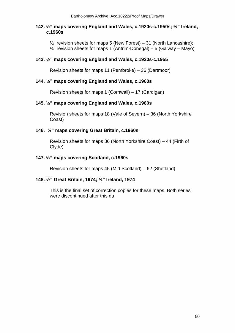
Bartholomew Archive, Acc.10222/Proof Maps/Drawer
60
142. ½” maps covering England and Wales, c.1920s-c.1950s; ¼” Ireland, c.1960s
½” revision sheets for maps 5 (New Forest) – 31 (North Lancashire); ¼” revision sheets for maps 1 (Antrim-Donegal) – 5 (Galway – Mayo)
143. ½” maps covering England and Wales, c.1920s-c.1955 Revision sheets for maps 11 (Pembroke) – 36 (Dartmoor) 144. ½” maps covering England and Wales, c.1960s Revision sheets for maps 1 (Cornwall) – 17 (Cardigan) 145. ½” maps covering England and Wales, c.1960s
Revision sheets for maps 18 (Vale of Severn) – 36 (North Yorkshire Coast)
146. ½” maps covering Great Britain, c.1960s
Revision sheets for maps 36 (North Yorkshire Coast) – 44 (Firth of Clyde)
147. ½” maps covering Scotland, c.1960s
Revision sheets for maps 45 (Mid Scotland) – 62 (Shetland) 148. ½” Great Britain, 1974; ¼” Ireland, 1974
This is the final set of correction copies for these maps. Both series were discontinued after this da

Bartholomew Archive, Acc.10222/Proof Maps/Drawer
61