Automating the Analysis of 3D Point Clouds through Scalable AI
23
ENVIEW PROPRIETARY Automating the Analysis of 3D Point Clouds through Scalable AI 2020 P3DL CoP Conference
Transcript of Automating the Analysis of 3D Point Clouds through Scalable AI

ENVIEW PROPRIETARY
Automating the Analysis of 3D Point Clouds through Scalable AI
2020 P3DL CoP Conference
ENVIEW PROPRIETARY
Unprecedented
Times
We live in a world where access to geospatial data has never been more
prevalent and offered so much potential to improve every aspect of our
lives
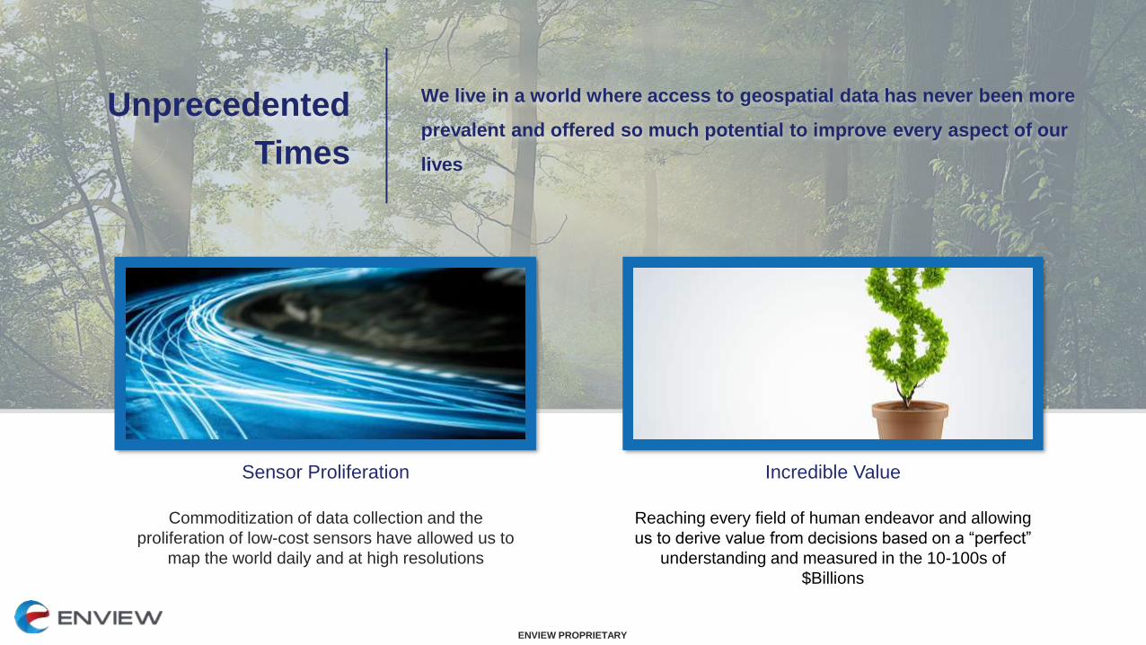
Commoditization of data collection and the
proliferation of low-cost sensors have allowed us to
map the world daily and at high resolutions
Sensor Proliferation
Reaching every field of human endeavor and allowing
us to derive value from decisions based on a “perfect”
understanding and measured in the 10-100s of
$Billions
Incredible Value

ENVIEW PROPRIETARY
However…..Just because we can collect data, does not mean that we can analyze and action it.
Meaningful insights are unable to be realized given the overwhelming firehose of data.

ENVIEW PROPRIETARY
Challenges with
Current Processes
Legacy tools and methodologies are not longer optimal in the age of multi-source
intelligence. New and larger datasets make an analyst's job more difficult and
present the need for technology innovation.
Expected to perform complex analyses with
limited IT infrastructure and desktop software
void of modern architectures
Challenges with Legacy
Software
Big data is easily disrupted at comms
bottlenecks. Traditional analysis is no
longer viable in a post-COVID world.
GEOINT Vulnerabilities
Imagery is deeply valuable, but it doesn’t
accurately represent a 3D battlespace and
requires expert interpretation before it is
actionable.
2D Imagery Doesn’t
Represent a 3D World
3D data is highly desired by end-users but
is large, complicated, and requires expert
analysis.
3D Data is Complex and
Hard to Manage

ENVIEW PROPRIETARY
Negative Impact
and Pain
These challenges result in material pain for organizations, end-users, and the
National mission. Without new tools the problems will get worse as more data
accumulates.
Challenge to produce timely
intelligence products within the enemy
decision cycle.
Delayed Decision-Making
Delay or disruption to timely GEOINT
has a major negative impact to the
warfighter:
Impact to Mission and Warfighter
Mitigation is done by significant
manual effort, pulling personnel away
other mission critical initiatives.
Impact to the Enterprise

ENVIEW PROPRIETARY
Turning to AI/MLThe community is rightfully turning to AI/ML automation to help sift through the mountain of
data and highlight only those kernels of insight that people truly care about

ENVIEW PROPRIETARY
Applicability to 2DOpen libraries like TensorFlow have allowed increased the adoption of AI/ML when trying to
sift through and analyze structured, 2D data sets like imagery…. But once again, 2D data
doesn’t accurately represent a 3D battlespace and manual interpretation is still needed

ENVIEW PROPRIETARY
Age of 3D3D Point Clouds don’t have texture like a 2D image and are pure geometry and
numbers, albeit unstructured. We can now move beyond subjective interpretation
of image texture and into to the quantitative measurement of physical geometry.
Greater level of fidelity and accuracy gives insights
that are not possible with 2D Data
Immense Value
Given its unstructured nature, traditional AI/ML breaks on
3D data. So despite its value the pain points still exist.
AI/ML Limitations

ENVIEW PROPRIETARY
ENVIEW The limitations and pain was experienced firsthand and is what drives us today
Enview was born from lessons
learned in Afghanistan on the
benefits and challenges of 3D
geospatial data
Inspiration
Inferring truths about a 3D world
by interpreting 2D imagery hides
insights and introduces errors
2D Data Limitations
Incredible insights possible but
analysis has been painfully
slow, manual, and prohibitively
expensive
3D Data Challenges

ENVIEW PROPRIETARY
Novel & Unique
AI/ML Framework
Enview has developed a unique, best-in-class set of tools to exploit and
operationalize 3D GEOINT. Modern computing practices enable Enview to
support a scale of data currently underserved by available technology
Many orgs can create 3D data;
doing computer vision on it is a
totally different matter.
3D Computer Vision
Enview has developed custom
convolution kernels and specialized
deep learning frameworks to
massively automate 3D GEOINT
Artificial Intelligence &Deep Learning
Leveraging massive parallelization,
and modular orchestration
to handle thousands of sq miles in
hours versus weeks or months.
Modern Software Architectures

ENVIEW PROPRIETARY
Enview Explore™Harnessing AI/ML to deliver 3D GEOINT at unprecedented scale and speed to
empower analysts and forward-deployed warfighters
Visualize and share data as a
COP or give to analysts for 3D
data exploitation
Easy-to-Use CloudApplication for All Users
Automate data classification and
object detection faster
Automated 3D GEOINT at Scale
Users at the Point of Need get
results at the speed they need
Deploys into Your Workflow

ENVIEW PROPRIETARY
AI/ML Powered
Object Detection
Enview Explore contains custom AI and machine learning to power scene classification,
segmentation and automated object detection. The more data that Explore processes, the
more it learns.

ENVIEW PROPRIETARY
Automatically Virtualize
the Battlespace in 3D
Explore lets you quickly visualize the battlespace in an easy-to-use Common Operational
Picture. There are no limits or restrictions on how many users can access Explore, so
collaborating with teammates is easy and simple.
ENVIEW PROPRIETARY
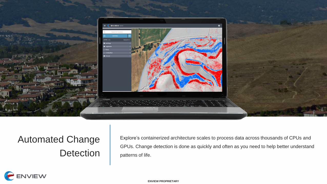
Automated Change
Detection
Explore’s containerized architecture scales to process data across thousands of CPUs and
GPUs. Change detection is done as quickly and often as you need to help better understand
patterns of life.

ENVIEW PROPRIETARY
See Beneath
the Canopy
Enview Explore’s powerful 3D data processing tools enable foliage penetration and hard
object detection below the canopy in a matter of minutes, not days.

ENVIEW PROPRIETARY
From Months
to Minutes
Explore’s containerized architecture can dynamically scale to process data across thousands
of CPUs and GPUs. This automation solves your biggest pain: speed to insight.

ENVIEW PROPRIETARY
Dynamic 2D/3D
Data Fusion
Ingest and present a dynamic catalogue of spatial data from additional sources. Whether
stored locally, in a server, or available via a web-service, combining proprietary and open data
allows for a holistic picture of the mission at hand

ENVIEW PROPRIETARY
Integrates with
Commonly Used Software
In addition to the web browsers, Enview capabilities can integrate with your current tools like
ATAK, Google Earth, ArcGIS, QT Modeler, UDL, and other COPs. Enview will soon work
behind firewalls and on embedded devices.

ENVIEW PROPRIETARY
Quantitative Benefits
Explore gives analysts a massive improvement over current
desktop processing capability. Analysis is scaled across
hundreds of compute resources, and leverages AI/ML for
massive increases in speed and accuracy.
The result: delivering 3D GEOINT at unprecedented scale
and speed to empower analysts and forward-deployed
warfighters
Scalability
1000s of sq mi in
a few hours
Accuracy
98% Vegetation
95% Buildings
Speed
Up to 200x
Increase
The Enview Impact

ENVIEW PROPRIETARY
Qualitative Benefits
• Ability to produce intelligence products faster, removing stress
and increasing fidelity
• Easy way to display and share results, without the need for
training
• Reliable method for encapsulating, accessing and sharing
tradecraft
• Removes the need for IA, GA, and All-Source to all be present
• Faster intelligence yields increased mission success
• Maintain strategic advantage over near pears in AI/ML
• Resilience due to decentralization of GEOINT
• Accessible at the point of need (HQ, Garrison, or TOC)
For the Analyst
For the End Customer

ENVIEW PROPRIETARY
Supporting Multiple
Missions
By dramatically reducing the time it takes to exploit 3D data teams can maximize
the number of products they create in a variety of different functional mission
areas
Imagery
Interpretation
Intelligence Preparation
of the Battlefield
3D Battlespace
Virtualization
Mobility & Terrain
Planning
Mission Planning &
Rehearsal
Pattern of Life
Analysis

ENVIEW PROPRIETARY
Across the NSG/ASG and DoD
Helping solve a need in both the NSG/ASG and DoD.
“Enview’s Geospatial AI represents not just an improvement, but a
game-changing warfighter capability. Its ability to use AI to create
3D models of the physical world are currently unparalleled.”
- USAF PEO for ISR/SOF
“Enview’s Tactical Organic Geospatial AI is the next evolution of
Intelligence, Surveillance, and Reconnaissance. It aligns strongly
with USSOCOM’s AI Roadmap and priorities.”
- USSOCOM PEO for SRSE
“Enview’s AI platform aligns with the USD(R&E) AI and ML
modernization priority. This type of capability could contribute
to multiple future U.S. Army mission needs.”
- CTO for Army ASA/ALT
USAF STRATFi
(SAF/AQ)
Selected as one of the AF’s 21
“big bets” by Dr. Will Roper
USAF Phase II SBIR
(AFSOC, PACAF)
Overland navigation, Rapid
damage assessment, HA/DR
USAF Phase II SBIR
(AMC, ACC, AETC)
Contingency response,
Agile combat employment
NGA CRADA
(3D GEOINT)
Automation of 3D GEOINT
and HCI
USAF Innovation
(COMPACAF)
Installation resiliency, Air mobility
operations, decentralized GEOINT
USAF Phase I SBIR
(SPDE)
Cruise missile defeat
“As soon as I became aware of Enview, I strove to find a way to join
their world-class team. The future of US national security depends
upon innovative tech like Enview. Enview has specific and significant
value to a number of government customers.”
- Robert Cardillo, Director (ret), NGA

ENVIEW PROPRIETARY
Try it For YourselfPlease reach out for access to Explore. We welcome the opportunity to
collaborate and benchmark against your current workflows.
John Dombzalski
VP of Public Sector
202.746.2633