Archaeology and Historic Buildings...
32
Archaeology and Historic Buildings Record Site List Report Inc. Events and Sources 10 Jun 2016 Run date: Enhanced with indexing standards from English Heritage and mda. Data within this report may be derived from the NMR © English Heritage. Page: 1 of 32 SOURCE Hampshire County Council 1984 Census AP Hampshire County Council 1984 SOURCE Ordnance Survey Archaeology Branch Record Card Ordnance Survey EVENT CELTIC FIELD SYSTEM Unassigned Early Iron Age (1)Celtic fields visible on air photographs in area centred overleaf. (1957). HCC 1984 Census AP Run 7;185-186. -800 42 - to EVENT MODERN EVENT Air Photo Survey Modern 1986 - Site: 21102 Y MONUMENT SU 452000155300 Hannington Additional Info Held? Parish: EVENT BOWL BARROW Created Early Bronze Age (1) Ploughed down bowl barrow, 26.5m in diameter, 0.4m high. No visible ditch. On the crest of a N-S ridge. (1956). (2) HCC AP ref run 7e185-186 (3) RCHME AP refs: SU5254/23-24 -2200 -801 - to Site: Bowl barrow, E of Tidgrove Warren Farm 21117 Y MONUMENT SU 452537154780 Hannington Additional Info Held? Parish:
Transcript of Archaeology and Historic Buildings...

Archaeology and Historic Buildings Record
Site List Report Inc. Events and Sources
10 Jun 2016Run date:Enhanced with indexing standards from English Heritage and mda. Data within this report may be derived from the NMR © English Heritage.
Page: 1 of 32
SOURCE Hampshire County Council 1984 Census AP
Hampshire County Council 1984
SOURCE Ordnance Survey Archaeology Branch Record Card
Ordnance Survey
EVENT CELTIC FIELD SYSTEM Unassigned Early Iron Age
(1)Celtic fields visible on air photographs in area centred overleaf. (1957). HCC 1984 Census AP Run 7;185-186.
-800 42- to
EVENT MODERN EVENT Air Photo Survey Modern 1986-
Site: 21102
Y
MONUMENT
SU 452000155300
Hannington
Additional Info Held?
Parish:
EVENT BOWL BARROW Created Early Bronze Age
(1) Ploughed down bowl barrow, 26.5m in diameter, 0.4m high. No visible ditch. On the crest of a N-S ridge. (1956). (2) HCC AP ref run 7e185-186 (3) RCHME AP refs: SU5254/23-24
-2200 -801- to
Site: Bowl barrow, E of Tidgrove Warren Farm21117
Y
MONUMENT
SU 452537154780
Hannington
Additional Info Held?
Parish:
Archaeology and Historic Buildings Record
Site List Report Inc. Events and Sources
10 Jun 2016Run date:Enhanced with indexing standards from English Heritage and mda. Data within this report may be derived from the NMR © English Heritage.
Page: 2 of 32
SOURCE Ordnance Survey Archaeology Branch Record Card
Ordnance Survey
SOURCE RCHME oblique air photograph RCHME 1989
SOURCE Tidgrove Warren Farm, Geophysical Survey Report BACK UP UNDER MONUID 58168
Strutt, K. 2004
SOURCE Hampshire County Council 1984 Census AP
Hampshire County Council 1984
EVENT INHUMATION Deposited Early Bronze Age
The geophysical survey results suggest the presence of a primary burial associated with the barrow, however the results do suggest that this has been disturbed in some way.
-2200 -801- to
EVENT MODERN EVENT Air Photo Survey Modern 1956-
EVENT MODERN EVENT Geophysical Survey Modern
A geophysical survey was carried out to determine the nature and extent of the barrow. The sub circular ditch around the barrow is clearly visible and encloses a number of maculae. A number of further features are identified outside of the barrow ditch and are suggestive of a number of pits associated with the contemporary activity around the barrow.
2004-

Archaeology and Historic Buildings Record
Site List Report Inc. Events and Sources
10 Jun 2016Run date:Enhanced with indexing standards from English Heritage and mda. Data within this report may be derived from the NMR © English Heritage.
Page: 3 of 32
SOURCE Hampshire County Council 1984 Census AP
Hampshire County Council 1984
SOURCE Ordnance Survey Archaeology Branch Record Card
Ordnance Survey
SOURCE Tidgrove Warren Farm, Geophysical Survey Report BACK UP UNDER MONUID 58168
Strutt, K. 2004
EVENT BOWL BARROW Created Early Bronze Age
(1)Ploughed down bowl barrow, 26m in diameter and 0.4m high on an eastern slope. No visible ditch. (1956). HCC 1984 Census AP Run 7E; 185-186.
-2200 -801- to
EVENT MODERN EVENT Air Photo Survey Modern 1956-
EVENT MODERN EVENT Geophysical Survey Modern
A geophysical survey was carried out to determine the extent and nature of the barrow. No evidence of a sub circular ditch was identified, in addition there are faint traces of a linear feature ot the south west.
2004-
Site: Bowl Barrow21118
Y
MONUMENT
SU 452510154240
Hannington
Additional Info Held?
Parish:
Site: King's Houses, Tidgrove21127
Y
MONUMENT
SU 452680154635
Hannington
Additional Info Held?
Parish:

Archaeology and Historic Buildings Record
Site List Report Inc. Events and Sources
10 Jun 2016Run date:Enhanced with indexing standards from English Heritage and mda. Data within this report may be derived from the NMR © English Heritage.
Page: 4 of 32
EVENT MODERN EVENT Air Photo Survey Modern
Crop or soil mark feature observed on an AP dated 1947
1947-
EVENT MODERN EVENT Air Photo Survey Modern
Aerial photography in 1947 revealed the bank and outer ditch of a roughly rectangular enclosure as crop marks (light and dark bands). The enclosure measured c.80x50m overall. A former watercourse was visible on the east side of the enclosure.
1947-
EVENT HUNTING LODGE Built Medieval
A medieval hunting lodge has been identified during geophysics and subsequent excavations.
1066 1539- to
EVENT MODERN EVENT Air Photo Survey Modern
During Aerial Photography in 1967, it was reported that there was no trace of the enclosure site in a young crop.
1967-
EVENT MODERN EVENT Excavation Modern
Excavation took place intermitently between 2005-2008 and the pottery evidence suggests that this site continued to be in use beyond the 1170s (previously thought to be abandoned). A large quantity of buildi9ng rubble was identified within the excavations, the walls were of flint construction and the original structure probably had a vaulted roof.
2005 2008- to
EVENT MODERN EVENT Excavation Modern
A minor excavation within the ditch area was carried out in September 2001 by Raleigh Place, as well as fieldwalking of the area. Six sherds of C12 to C14 cooking pots, eight sherds of C13 tripod pitcher were discovered; nine C13 to C14 green glazed jug sherds were found as was one C15/C16 decorated fragment of pot rim.
2001-

Archaeology and Historic Buildings Record
Site List Report Inc. Events and Sources
10 Jun 2016Run date:Enhanced with indexing standards from English Heritage and mda. Data within this report may be derived from the NMR © English Heritage.
Page: 5 of 32
EVENT MODERN EVENT Personal Observation Modern
In September 1956 a field investigator reported that the enclosure was at the bottom of an eastern slope, but that, apart from the remains of part of the ditch on the south side, there was no trace of the earthwork. It was probably a Romano-British settlement site connected with the field system recorded as centred at SU520545.
1956-
EVENT MODERN EVENT Personal Observation Modern
Further research & thought led Legg to strongly suggest that this original earthwork, far from being IA, is medieval & the remains of the domus regis built by Henry II in 1172
2001-
EVENT MODERN EVENT Geophysical Survey Modern
Geophysical survey undertaken at Tidgrove Warren Farm, near Kingsclere. The survey was carried out by Kingsclere Heritage Association, and focussed on two sites, a medieval royal enclosure and a potential romano-british farmstead or villa. The survey successfully located a number of archaeological features associated with the medieval and Roman sites, including the enclosure ditch of the royal house and structural remains of the farmstead.
2003-
EVENT MODERN EVENT Field Walking Modern
Field walking was carried out in October 2000 within the ditch area of the enclosure and produced a few fragments of late New Forest Ware, and a considerable number of pottery sherds mostly dated to the 11th to 14th centuries, together with a few late medieval or post-medieval sherds.
2000-
EVENT MODERN EVENT Personal Observation Modern
A further field investigation in 1967 reported that there was now no trace of the enclosure in a young crop and that no surface finds were made.
1967-
EVENT MODERN EVENT Metal detecting survey Modern
The most significant finds as a result of metal detecting within the enclosure were a C13 belt buckle, an iron arrowhead, and a falconner's grommet.
2000-
Archaeology and Historic Buildings Record
Site List Report Inc. Events and Sources
10 Jun 2016Run date:Enhanced with indexing standards from English Heritage and mda. Data within this report may be derived from the NMR © English Heritage.
Page: 6 of 32
FIND ARROWHEAD IRON 1066 1900- to
FIND ARCHITECTURAL FRAGMENT CEMENT 9999-
EVENT PIT Created Medieval
A number of large pits were identified with a ram chalk fill. It is possible that these once formed part of a larger structure.
1066 1539- to
EVENT MODERN EVENT Personal Observation Modern
On May 30th 1926 Mr G. B. Bull observed in Bogley Bottom a dark rectangular crop mark in the corn. The mark was 1.5 yards wide and measured approximately 88x44 yards. Mr Bull also reported that Roman pottery occurred in the area and concluded that it was possibly the site of a Roman camp.
1926-
EVENT UNDERCROFT Built Medieval
Whilst much of the hunting lodge had been damaged by plough action, significant remains of an undercroft or cellar have been identified as being cut into the hill slope. The undercroft was 2.5m deep, and the flint and mortar walls were 1.2m thick and it has been suggested that this site was similar in scale to the early Clarendon Palace.
1066 1539- to
EVENT RECTANGULAR ENCLOSURE Created Medieval
Bank and outer ditch of a roughly rectangular enclosure measuring 80m x 50m overall was revealed as crop - marks on AP in 1947. The enclosure is sited on the bottom of an eastern slope. Only the remains of part of the ditch c. 8m wide and 0. 3m deep on the south side can be seen (1956). No trace of this enclosure could be seen under young crop, (1967). Finds recovered range from the Roman to post-Medieval periods. Examination of this enclosure suggested strongly that this was the location of the King's Houses (domus regis) which Henry II caused to be built at Tidgrove, the discovery of an oyster shell suggests that the site was indeed high status. NOTE: SEE EVENT No. 11 FOR MEDIEVAL HUNTING LODGE
1066 1539- to
Archaeology and Historic Buildings Record
Site List Report Inc. Events and Sources
10 Jun 2016Run date:Enhanced with indexing standards from English Heritage and mda. Data within this report may be derived from the NMR © English Heritage.
Page: 7 of 32
SOURCE Excavations and Royal Houses in Kingsclere, Hampshire
Hinton, D. 2009
SOURCE Excavation of the Medieval Ditched Enclsoure at Tidgrove Warren Farm, Hampshire
Barker, D., Hinton, D. A., and Strutt, K. D. 2007
SOURCE Hampshire AHBR AP Collection (use this)
Hampshire County Council
FIND TILE CLAY 9999-
FIND HOOD (HAWKING) METAL 410 1900- to
FIND BUCKLE COPPER ALLOY 1500-
FIND LITHIC IMPLEMENT STONE 9999-
FIND POTTERY CLAY 43 409- to
FIND POT CLAY 300 409- to

Archaeology and Historic Buildings Record
Site List Report Inc. Events and Sources
10 Jun 2016Run date:Enhanced with indexing standards from English Heritage and mda. Data within this report may be derived from the NMR © English Heritage.
Page: 8 of 32
SOURCE Ordnance Survey Archaeology Branch Record Card
Ordnance Survey
SOURCE Tidgrove Warren Farm Archaeological Project; An integrated approach to the study of an archaeological landscape in Hampshire
Strutt. k. 2007
SOURCE Note on The Kings Houses at Tidgrove
Robert Legg
SOURCE Notes on the Kings Houses at Tidgrove
Robert Legg 2001

Archaeology and Historic Buildings Record
Site List Report Inc. Events and Sources
10 Jun 2016Run date:Enhanced with indexing standards from English Heritage and mda. Data within this report may be derived from the NMR © English Heritage.
Page: 9 of 32
FIND COIN METAL 253 268- to
SOURCE Ordnance Survey Archaeology Branch Record Card
Ordnance Survey
EVENT FINDSPOT Unassigned Roman
(1)Antoninianus of Gallienus (AD253-268) found E of Tidgrove Farm (formerly Warren Farm). (1951) Area of finds is at the bottom of a SE slope above a dry water course. The coin was seen in the possession of Mr G B Bull, Kingsclere. It was labelled 'Antoninianus of Gallienus from Warren Farm, Tidgrove pottery site, left of road to farm.' Roman pottery (B) was also found in this area. (1955)
43 409- to
EVENT MODERN EVENT Stray Finds - Non verified Modern 1956-
Site: 21137
N
FINDSPOT
SU 451890154250
Hannington
Additional Info Held?
Parish:

Archaeology and Historic Buildings Record
Site List Report Inc. Events and Sources
10 Jun 2016Run date:Enhanced with indexing standards from English Heritage and mda. Data within this report may be derived from the NMR © English Heritage.
Page: 10 of 32
FIND POTTERY CLAY 43 409- to
SOURCE Ordnance Survey Archaeology Branch Record Card
Ordnance Survey
EVENT FINDSPOT Unassigned Roman
(1)Roman pottery found east of Tidgrove Farm (formerly Warren Farm). (1951). Area of finds is at the bottom of a south-eastern slope above a dry water course. Several sherds of pottery from 'Warren Bottom' site seen in Basingstoke Museum. Roman coin also found in this area. (1956).
43 409- to
EVENT MODERN EVENT Stray Finds - Non verified Modern
For details of the finds, please refer to the back-up file for site 21127.
1956-
Site: 21165
Y
FINDSPOT
SU 451890154250
Hannington
Additional Info Held?
Parish:

Archaeology and Historic Buildings Record
Site List Report Inc. Events and Sources
10 Jun 2016Run date:Enhanced with indexing standards from English Heritage and mda. Data within this report may be derived from the NMR © English Heritage.
Page: 11 of 32
FIND PICK STONE 9999-
SOURCE Ordnance Survey Archaeology Branch Record Card
Ordnance Survey
EVENT FINDSPOT Unassigned Uncertain
(1)Pick. (1951) No further information given. Exact location of findspot not known. Whereabouts and condition of implement at present also not known. (JB 1986).
9999-
EVENT MODERN EVENT Stray Finds - Non verified Modern 1986-
Site: 21166
N
FINDSPOT
SU 452030154090
Hannington
Additional Info Held?
Parish:

Archaeology and Historic Buildings Record
Site List Report Inc. Events and Sources
10 Jun 2016Run date:Enhanced with indexing standards from English Heritage and mda. Data within this report may be derived from the NMR © English Heritage.
Page: 12 of 32
FIND SCRAPER (TOOL) STONE 9999-
SOURCE Ordnance Survey Archaeology Branch Record Card
Ordnance Survey
EVENT FINDSPOT Unassigned Uncertain
(1)Scraper. (1951). No further information. Exact location and condition of implement not known. (JB 1986).
9999-
EVENT MODERN EVENT Stray Finds - Non verified Modern 1986-
Site: 21169
N
FINDSPOT
SU 452860153720
Hannington
Additional Info Held?
Parish:

Archaeology and Historic Buildings Record
Site List Report Inc. Events and Sources
10 Jun 2016Run date:Enhanced with indexing standards from English Heritage and mda. Data within this report may be derived from the NMR © English Heritage.
Page: 13 of 32
EVENT MODERN EVENT Stray Finds - Non verified Modern 1949-
EVENT FINDSPOT Unassigned Early Neolithic
1. A number of neolithic flint tools recovered from Polhampton Lodge included; a chisel, an axe, a fabricator, a pick, a barbed arrowhead and a knife.
-4000 -2201- to
FIND AXE FLINT -4000 -2201- to
Site: 33899
N
FINDSPOT
SU 451400154600
Overton
Additional Info Held?
Parish:
SOURCE Ordnance Survey Archaeology Branch Record Card
Ordnance Survey
EVENT MODERN EVENT Unknown Modern 1967-
EVENT BOWL BARROW Unassigned Early Bronze Age
1) Plough damaged bowl barrow 22.0m diameter by 0.7m high.
-2200 -801- to
Site: 31285
Y
MONUMENT
SU 451230154300
Overton
Additional Info Held?
Parish:
Archaeology and Historic Buildings Record
Site List Report Inc. Events and Sources
10 Jun 2016Run date:Enhanced with indexing standards from English Heritage and mda. Data within this report may be derived from the NMR © English Heritage.
Page: 14 of 32
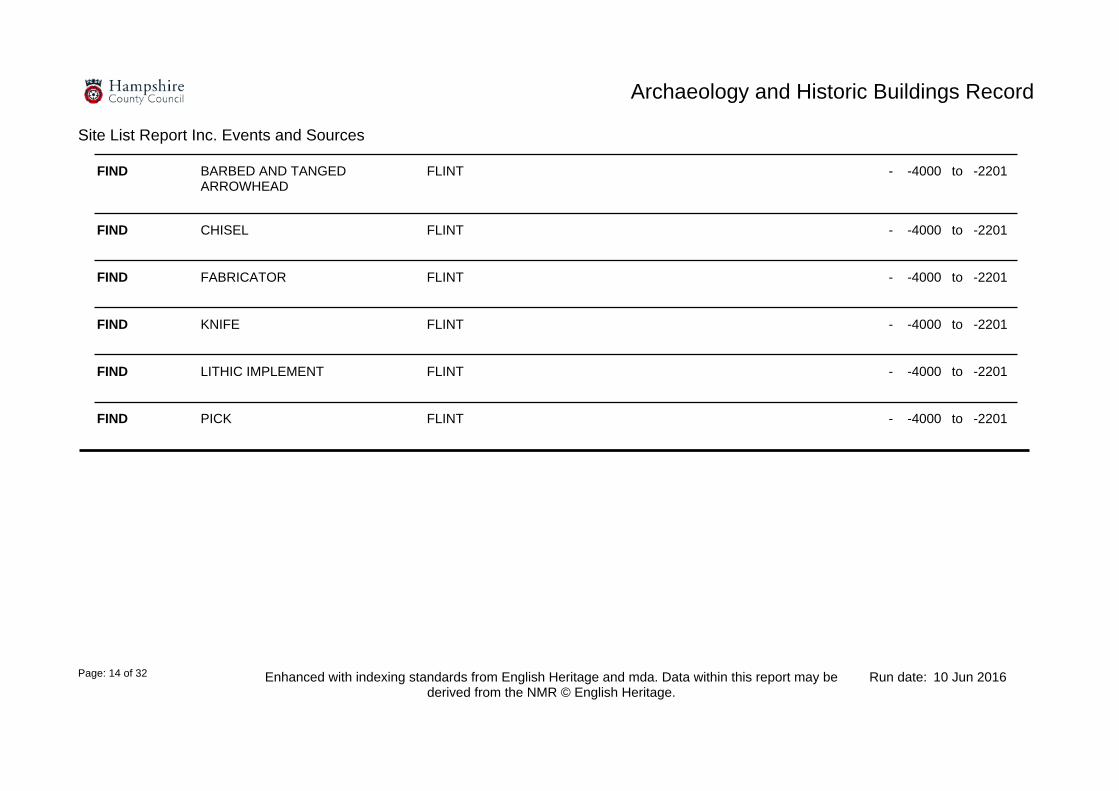
FIND KNIFE FLINT -4000 -2201- to
FIND LITHIC IMPLEMENT FLINT -4000 -2201- to
FIND PICK FLINT -4000 -2201- to
FIND BARBED AND TANGED ARROWHEAD
FLINT -4000 -2201- to
FIND CHISEL FLINT -4000 -2201- to
FIND FABRICATOR FLINT -4000 -2201- to

Archaeology and Historic Buildings Record
Site List Report Inc. Events and Sources
10 Jun 2016Run date:Enhanced with indexing standards from English Heritage and mda. Data within this report may be derived from the NMR © English Heritage.
Page: 15 of 32
SOURCE 1:10 560 Composite AP plot Hampshire County Council
SOURCE Hampshire AHBR AP Collection (use this)
Hampshire County Council
SOURCE Hampshire County Council 1984 Census AP
Hampshire County Council 1984
EVENT FIELD SYSTEM Unassigned Uncertain
(1) A general area of cultivation formed by ploughed out lynchets visible as both dark and light distinct soil marks on air photographs. HCC AP ref: run8e130. Towards the northern end some of these lynchets are visible as slight banks. HCC AP ref: run7e184 (2) AP refs: F22/581 RAF/2079:200 5154/9/227
9999-
EVENT MODERN EVENT Air Photo Survey Modern
Cropmark features (poorly) observed on an AP dated 1947
1947-
EVENT MODERN EVENT Air Photo Survey Modern 1984-
Site: Field System, Polhampton Lodge Stud36914
N
MONUMENT
SU 451400154000
Overton
Additional Info Held?
Parish:

Archaeology and Historic Buildings Record
Site List Report Inc. Events and Sources
10 Jun 2016Run date:Enhanced with indexing standards from English Heritage and mda. Data within this report may be derived from the NMR © English Heritage.
Page: 16 of 32
SOURCE Hampshire County Council 1984 Census AP
Hampshire County Council 1984
EVENT MODERN EVENT Air Photo Survey Modern 1984-
EVENT LYNCHET Unassigned Uncertain
(1) A linear feature running NE - SW visible on air photographs. It may survive as a slight earthwork. Probably a lynchet. HCC AP ref: run7e184
9999-
Site: 36920
N
MONUMENT
SU 451240154520
Overton
Additional Info Held?
Parish:
SOURCE Hampshire County Council 1984 Census AP
Hampshire County Council 1984
EVENT MODERN EVENT Air Photo Survey Modern 1984-
EVENT LYNCHET Unassigned Uncertain
(1) A long linear feature running NW - SE with smaller linears adjoining it at right angles. These features may survive as low earthworks. Probable lynchets. HCC AP ref: run7e184
9999-
Site: 36919
N
MONUMENT
SU 451610154870
Hannington
Additional Info Held?
Parish:

Archaeology and Historic Buildings Record
Site List Report Inc. Events and Sources
10 Jun 2016Run date:Enhanced with indexing standards from English Heritage and mda. Data within this report may be derived from the NMR © English Heritage.
Page: 17 of 32
SOURCE David Graham's AP transcriptions Graham, David
SOURCE Hampshire AHBR AP Collection (use this)
Hampshire County Council
EVENT MODERN EVENT Air Photo Survey Modern 1997-
EVENT BANJO ENCLOSURE Unassigned Early Iron Age
A small banjo enclosure with a trackway to the SSE. There is an associated linear feature to the south of the eastern end of the trackway.
-800 42- to
EVENT MODERN EVENT Air Photo Survey Modern
Cropmark feature observed on an AP dated 1976
1976-
Site: Banjo Enclosure A, Polhampton Lodge36922
N
MONUMENT
SU 451270154770
Overton
Additional Info Held?
Parish:

Archaeology and Historic Buildings Record
Site List Report Inc. Events and Sources
10 Jun 2016Run date:Enhanced with indexing standards from English Heritage and mda. Data within this report may be derived from the NMR © English Heritage.
Page: 18 of 32
SOURCE David Graham's AP transcriptions Graham, David
SOURCE Hampshire AHBR AP Collection (use this)
Hampshire County Council
EVENT MODERN EVENT Air Photo Survey Modern 1997-
EVENT BANJO ENCLOSURE Unassigned Early Iron Age
(1) Complex of features including a small banjo enclosure with a western trackway/funnel entrance. There are associated curvilinear and rectilinear features to the north west.
-800 42- to
EVENT MODERN EVENT Air Photo Survey Modern
Cropmark features observed on an AP dated 1976
1976-
Site: Banjo Enclosure B, Polhampton Lodge36923
N
MONUMENT
SU 451590154610
Hannington
Additional Info Held?
Parish:
Archaeology and Historic Buildings Record
Site List Report Inc. Events and Sources
10 Jun 2016Run date:Enhanced with indexing standards from English Heritage and mda. Data within this report may be derived from the NMR © English Heritage.
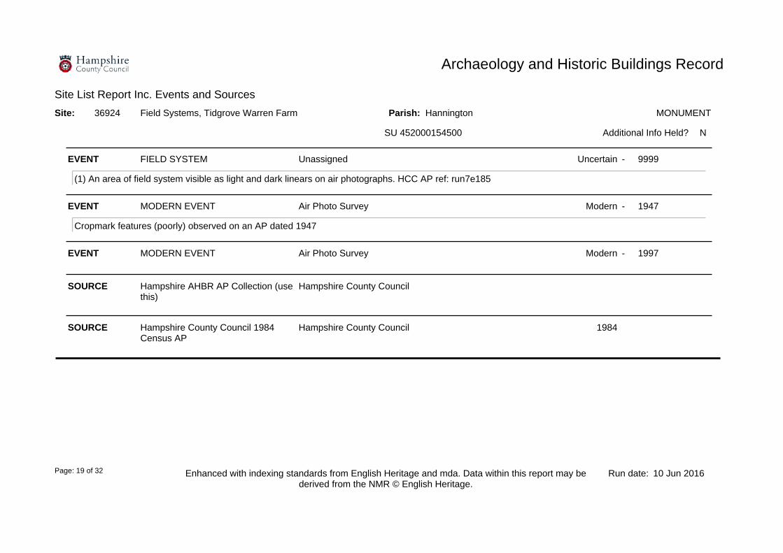
Page: 19 of 32
SOURCE Hampshire AHBR AP Collection (use this)
Hampshire County Council
SOURCE Hampshire County Council 1984 Census AP
Hampshire County Council 1984
EVENT MODERN EVENT Air Photo Survey Modern 1997-
EVENT FIELD SYSTEM Unassigned Uncertain
(1) An area of field system visible as light and dark linears on air photographs. HCC AP ref: run7e185
9999-
EVENT MODERN EVENT Air Photo Survey Modern
Cropmark features (poorly) observed on an AP dated 1947
1947-
Site: Field Systems, Tidgrove Warren Farm36924
N
MONUMENT
SU 452000154500
Hannington
Additional Info Held?
Parish:

Archaeology and Historic Buildings Record
Site List Report Inc. Events and Sources
10 Jun 2016Run date:Enhanced with indexing standards from English Heritage and mda. Data within this report may be derived from the NMR © English Heritage.
Page: 20 of 32
SOURCE 1:10 560 Composite AP plot Hampshire County Council
SOURCE Hampshire County Council 1984 Census AP
Hampshire County Council 1984
EVENT LINEAR FEATURE Unassigned Uncertain
(1) A linear feature running NW - SE and visible as a dark soil mark on air photographs. HCC AP ref: run8e129 (2) There are fdurther parallel features possibly forming a trackway. At the southern end is a possible rectangular enclosure (SU55SW87). Transcription taken from the composite plot
9999-
EVENT MODERN EVENT Air Photo Survey Modern 1984-
Site: 36925
N
MONUMENT
SU 452200154250
Hannington
Additional Info Held?
Parish:
EVENT MODERN EVENT Air Photo Survey Modern 1996-
EVENT DITCH Created Early Iron Age
An Iron Age V shaped ditch was identified, the depth of the ditch suggests that it is of a defensive nature. A number of further ditches were also identified and again the depth of them suggested that they are of a defensive nature.
-800 42- to
Site: 36926
N
MONUMENT
SU 452030154070
Hannington
Additional Info Held?
Parish:

Archaeology and Historic Buildings Record
Site List Report Inc. Events and Sources
10 Jun 2016Run date:Enhanced with indexing standards from English Heritage and mda. Data within this report may be derived from the NMR © English Heritage.
Page: 21 of 32
FIND POTTERY CLAY -800 42- to
FIND BURNT FLINT FLINT -800 42- to
SOURCE 1:10 560 Composite AP plot Hampshire County Council
FIND QUERN STONE -800 42- to
EVENT POST HOLE Created Early Iron Age
A number of post holes were identified during the excavations but the nature and extent of them may suggest that they are part of an Iron Age Roundhouse.
-800 42- to
EVENT MODERN EVENT Excavation Modern
Evidence from the 2011 and 2012 excavations have demonstrated that parts of the landscape were occupied. the excavation were carried out by Southampton University as part of the Tidgrove Warren Farm Project.
2011 2012- to
FIND ANIMAL REMAINS BONE -800 42- to
EVENT RECTANGULAR ENCLOSURE Created Early Iron Age
(1) A possible rectangular enclosure with an entrance at the northern corner. Situated at the southern end of the linear (SU55SW86). No AP ref cited.
-800 42- to

Archaeology and Historic Buildings Record
Site List Report Inc. Events and Sources
10 Jun 2016Run date:Enhanced with indexing standards from English Heritage and mda. Data within this report may be derived from the NMR © English Heritage.
Page: 22 of 32
SOURCE 1:10 560 Composite AP plot Hampshire County Council
EVENT MODERN EVENT Air Photo Survey Modern 1996-
EVENT LINEAR FEATURE Unassigned Late Neolithic
(1) A series of parallel curvilinear features running east - west, visible on air photographs. AP refs: BWQ36, 5254/10/88
-3000 42- to
Site: 36927
N
MONUMENT
SU 451700154030
Hannington
Additional Info Held?
Parish:
SOURCE 1:10 560 Composite AP plot Hampshire County Council
EVENT MODERN EVENT Air Photo Survey Modern 1997-
EVENT FIELD SYSTEM Unassigned Early Bronze Age
(1) Traces of an extensive rectilinear field system (probably a continuation of SU55SW85) AP ref: AXD35
-2200 409- to
Site: Field System36928
N
MONUMENT
SU 452870154930
Hannington
Additional Info Held?
Parish:

Archaeology and Historic Buildings Record
Site List Report Inc. Events and Sources
10 Jun 2016Run date:Enhanced with indexing standards from English Heritage and mda. Data within this report may be derived from the NMR © English Heritage.
Page: 23 of 32
SOURCE 1:10 560 Composite AP plot Hampshire County Council
SOURCE Hampshire AHBR AP Collection (use this)
Hampshire County Council
SOURCE Hampshire County Council 1984 Census AP
Hampshire County Council 1984
EVENT FIELD SYSTEM Unassigned Early Bronze Age
(1) An area of field system formed by plough damaged lynchets visible as diffuse rectilinear dark and light marks. HCC AP ref: run8e128-9 (2) Transcription derived from the composite plot. AP refs: 5253/11/118 5252/16/230 5253/12/225 P21 58/RAF/2079:200 CPE/UK/2061:4029 OS55SW
-2200 409- to
EVENT MODERN EVENT Air Photo Survey Modern
Cropmark features (poorly) observed on an AP dated 1947
1947-
EVENT MODERN EVENT Air Photo Survey Modern 1984-
Site: Field Systems S of Tidgrove Farm36986
N
MONUMENT
SU 452260153580
Hannington
Additional Info Held?
Parish:

Archaeology and Historic Buildings Record
Site List Report Inc. Events and Sources
10 Jun 2016Run date:Enhanced with indexing standards from English Heritage and mda. Data within this report may be derived from the NMR © English Heritage.
Page: 24 of 32
SOURCE RCHME Medieval Settlement Project Royal Commission on the Historical Monuments of England
1996
EVENT MODERN EVENT Bibliographic Reference Modern
Recorded as part of the RCHME Medieval Settlement Project.
1996-
EVENT FARMSTEAD Unassigned Early Medieval
First documented in AD 1023 as WAECHA HRIC (WACCA'S or WAECCA'S ridge).
1023-
Site: WALKERIDGE FARM39284
N
NAME
SU 452500155300
Hannington
Additional Info Held?
Parish:

Archaeology and Historic Buildings Record
Site List Report Inc. Events and Sources
10 Jun 2016Run date:Enhanced with indexing standards from English Heritage and mda. Data within this report may be derived from the NMR © English Heritage.
Page: 25 of 32
SOURCE RCHME Medieval Settlement Project Royal Commission on the Historical Monuments of England
1996
EVENT MODERN EVENT Bibliographic Reference Modern
Recorded as part of the RCHME Medieval Settlement Project.
1996-
EVENT FARMSTEAD First mentioned Medieval
First documented in AD 1086 as TITEGRAVE (TITA'S grove or thicket).
1086-
Site: TIDGROVE WARREN FARM39288
N
NAME
SU 452200154400
Hannington
Additional Info Held?
Parish:
EVENT DITCH Created Early Iron Age
A large ditch was identified during the geophysical survey results which has been interpreted as the edge of a settlement feature. The settlement at Tidgrove Warren is based on a simple sub-rectangular enclosure. Two ditches were identified during the excavations. The inner ditch had a V shaped profile, demonstrated no evidence of being recut and was 1.2m deep. Whilst the outer ditch had a shallow profile and demonstrated evidence of being recut.
-800 409- to
Site: Romano-British farmstead or villa West of Tidgrove Warren Farm
56882
Y
MONUMENT
SU 451827154339
Hannington
Additional Info Held?
Parish:

Archaeology and Historic Buildings Record
Site List Report Inc. Events and Sources
10 Jun 2016Run date:Enhanced with indexing standards from English Heritage and mda. Data within this report may be derived from the NMR © English Heritage.
Page: 26 of 32
EVENT MODERN EVENT Excavation Modern
A excavation was carried out after the results of a geophysical survey suggested the site of Romano-Britsih settlement. The excavation, in the main, focused on identifiying the extent of the settlement and identifying the longevity of its useage. The ditches of the rectangular enclosure were excavationed and a number of neonate burials were found within this. The material deposits point to a late Iron Age foundation for the settlement.
2004-
EVENT INHUMATION Deposited Roman
A number of infant inhumations were identified within the trenches in addition to up to 9 other adult individuals. There were varying degrees of preservation and many had been disarticulated. Two of the neonates had puncture wounds to their skulls, and whilst this may be the result of post burial distrubance it cannot be ruled out that this may be a deliberate trauma.It is thought that the neonates were burried around the same time.
43 409- to
EVENT MODERN EVENT Geophysical Survey Modern
Geophysical survey undertaken at Tidgrove Warren Farm, near Kingsclere. The survey was carried out by Kingsclere Heritage Association, and focussed on two sites, a medieval royal enclosure and a potential romano-british farmstead or villa. The survey successfully located a number of archaeological features associated with the medieval and Roman sites, including the enclosure ditch of the royal house and structural remains of the farmstead.
2003-
EVENT MODERN EVENT Resistivity survey Modern
A resistivity survey was carried to determine the extent and nature of a Romano-British Settlement, the survey picked up a number of features that would be consistant with the presene of a building.
2004-
EVENT MODERN EVENT Magnetrometry survey Modern
A magnetrometry survey was carried out over the potential Romano-British Site. The results demonstrated anumber of features that would substantiate the presence of a settlement.
2004-

Archaeology and Historic Buildings Record
Site List Report Inc. Events and Sources
10 Jun 2016Run date:Enhanced with indexing standards from English Heritage and mda. Data within this report may be derived from the NMR © English Heritage.
Page: 27 of 32
FIND ANIMAL REMAINS BONE 43 409- to
FIND AMPHORA CLAY 43 409- to
EVENT SETTLEMENT Occupied Roman
There was sufficient evidence in the excavations to demonstrate that this was an area of settlement.
43 409- to
EVENT POST HOLE Created Roman
A number of post holes were identified during the excavations, however further investigations of the inside of the enclosure will be needed to determine the natrue of the settlement.
43 409- to
EVENT PIT Created Roman
The poistion of the trenches aimed to identify the large ditch features however a small number of pits were identified within the excavations.
43 409- to
EVENT SETTLEMENT Created Late Iron Age
A Romano-British Settlement was identified during the geophysical survey of 2004. A number of features associated with a possible structure were visible.
-400 409- to
EVENT RECTANGULAR ENCLOSURE Created Roman
A ditch with a U shaped profile created the sub-rectangular settlement enclosure with a break along the eastern edge suggesting the position of the entrance. The fill of the ditch contained animal bone and pottery of a Roman date.
43 409- to
Archaeology and Historic Buildings Record
Site List Report Inc. Events and Sources
10 Jun 2016Run date:Enhanced with indexing standards from English Heritage and mda. Data within this report may be derived from the NMR © English Heritage.
Page: 28 of 32
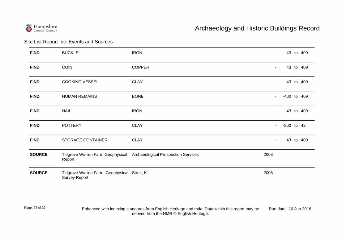
FIND STORAGE CONTAINER CLAY 43 409- to
FIND POTTERY CLAY -800 42- to
SOURCE Tidgrove Warren Farm Geophysical Report
Archaeological Prospection Services 2003
SOURCE Tidgrove Warren Farm, Geophysical Survey Report
Strutt, K. 2005
FIND COIN COPPER 43 409- to
FIND BUCKLE IRON 43 409- to
FIND COOKING VESSEL CLAY 43 409- to
FIND NAIL IRON 43 409- to
FIND HUMAN REMAINS BONE -400 409- to

Archaeology and Historic Buildings Record
Site List Report Inc. Events and Sources
10 Jun 2016Run date:Enhanced with indexing standards from English Heritage and mda. Data within this report may be derived from the NMR © English Heritage.
Page: 29 of 32
Site: Excavations at Tidgrove Warren Farm58168
Y
MONUMENT
SU 452270154218
Hannington
Additional Info Held?
Parish:
SOURCE Tidgrove Warren Farm Geophysical Report
Archaeological Prospection Services 2005
EVENT SETTLEMENT Occupied Early Iron Age
A number of archaeological features associated with the Iron Age and Roman phases of settlement in the area, including the extension of the settlement.
-800 409- to
EVENT MODERN EVENT Geophysical Survey Modern
The results of the 2005 geophysical survey were successful in locating a number of features associated with the Romano-British settlement at Tidgrove Warren Farm. The results show the extent and nature of the settlement as a whole, including the outer and inner enclosures, and associated structural remains, and evidence of agricultural activity. Evidence for a number of potential industrial features has also now been recorded to the west of the modern hedgerow. There appear to be at least four possible kilns or corn-driers spread along the ridge. The western and northern limits of the settlement also appear to have been reached. There does not appear to be any evidence of substantial structures of the form and scale of a vill at the site. The badly disturbed nature of archaeological deposits in the western part of the settlement can also be seen in the survey results.
2005-
Site: Geophysical Survey at Tidgrove Warren Farm57174
Y
MONUMENT
SU 451707154255
Hannington
Additional Info Held?
Parish:
SOURCE Tidgrove Warren Farm, Geophysical Survey Report BACK UP UNDER MONUID 58168
Strutt, K. 2004

Archaeology and Historic Buildings Record
Site List Report Inc. Events and Sources
10 Jun 2016Run date:Enhanced with indexing standards from English Heritage and mda. Data within this report may be derived from the NMR © English Heritage.
Page: 30 of 32
EVENT ENCLOSURE Built Early Neolithic
The 2005-07 excavations were concentrated within two enclosures. The smaller inner one was felt to be of prehistoric date, although no firm dating evidence was found.
-4000 42- to
EVENT CELLAR Built Medieval
The 2005-07 excavations uncovered the remains of a cellar situated close to the southern enclosure ditch. This was a flint and mortar walled structure measuring approximately 8m x 4.5m wide. It would have been accessed by a set of teps to the northeast corner. Hollows cut into the chalk floor suggest the presence of fittings within the cellar. In addition, a medieval key was found close to the chalk floor surface.The cellar was a grand structure, with plastered flint-lined walls and a side entrance with stone-lined stairs. It probably had a stone barrel-vaulted roof with buildings above it.
1066 1539- to
EVENT AISLED HALL HOUSE Built Medieval
The 2005-07 excavations discovered an aisled hall to the northwest of the cellared building. The foundations had been robbed but there was evidence of two rows of three support beams and a narrow slot for the walls of the building. Several features were noted beneath the floor and were felt to relate to a previous hall or earlier, prehistoric, activities.
1066 1539- to
EVENT ENCLOSURE Built Medieval
The 2005-07 excavations were concentrated within two enclosures. The larger outer enclosure was felt to be of later date than the prehistoric inner one. A medieval date was suggested for this feature.
1066 1539- to

Archaeology and Historic Buildings Record
Site List Report Inc. Events and Sources
10 Jun 2016Run date:Enhanced with indexing standards from English Heritage and mda. Data within this report may be derived from the NMR © English Heritage.
Page: 31 of 32
SOURCE CBA Wessex News (Autumn 2009) CBA Wessex 2009
SOURCE CBA (Wessex) Newsletter CBA 2008
SOURCE Diagram of Tidgrove Warren Excavations
2007
EVENT MODERN EVENT Geophysical Survey Modern
A geophysical survey using resistivity and magnetrometry was carried out in 2004 to determine the nature and extent of the archaeology at Tidgrove Warren Farm. Within this survey two barrows and the nature of the Romano British settlement were identified.
2004-
EVENT MODERN EVENT Excavation Modern
Southampton University carried out fieldwork in the area around Tidgrove Warren Farm from 2005-07 in order to investigate the patterns of prehistoric/Roman/medieval settlement in an area of lowland close to the line of the Portway. This work focused on a medieval ditched enclosure and identified a number of multi-period features. These comprised a small prehistoric enclosure, a larger medieval enclosure, the remains of a medieval cellared building and aisled hall along with a possible well or latrine. These features may be related/described by other sites in the area. Therefore see also Monuids 21127, 36924, 36925, 36926, 56882, 56883 and 57174.
2005 2007- to
FIND KEY (LOCKING) IRON 1066 1539- to
EVENT WELL Built Medieval
The 2005-07 archaeological excavations reported a large circular feature. This feature cut the earliest ditch edge and was identified as a possible well/latrine.
1066 1539- to

Archaeology and Historic Buildings Record
Site List Report Inc. Events and Sources
10 Jun 2016Run date:Enhanced with indexing standards from English Heritage and mda. Data within this report may be derived from the NMR © English Heritage.
Page: 32 of 32
SOURCE Tidgrove Warren Farm, Geophysical Survey Report BACK UP UNDER MONUID 58168
Strutt, K. 2004