
Appendix T Section 4(f) Resources Technical Memorandum · Appendix T Section 4(f) Resources...
22
DECEMBER 2009 SR 520, Medina to SR 202: Eastside Transit and HOV Project ENVIRONMENTAL ASSESSMENT SR 520 BRIDGE REPLACEMENT AND HOV PROGRAM Appendix T Section 4(f) Resources Technical Memorandum
Transcript of Appendix T Section 4(f) Resources Technical Memorandum · Appendix T Section 4(f) Resources...

DECEMBER 2009
SR 520, Medina to SR 202: Eastside Transit and HOV Project
ENVIRONMENTAL ASSESSMENTSR 520 BRIDGE REPLACEMENT AND HOV PROGRAM
Appendix T
Section 4(f) Resources Technical Memorandum


Plaza 600 Building 600 Stewart Street, Suite 520
Seattle, Washington 98101-1217 Phone: 206-770-3500
Fax: 206-770-3569
MEMORANDUM
To: Project File Contract & Task Order: 180171.AQ.ES.08.02
From: Lori Durio CH2M HILL
File Code:
Date: November 11, 2009
Copies To:
Subject: Section 4(f) De Minimis Finding
Introduction
The Washington State Department of Transportation (WSDOT) is proposing to construct the SR 520, Medina to SR 202: Eastside Transit and HOV Project to reduce transit and high-occupancy vehicle (HOV) travel times and to enhance travel time reliability, mobility, access, and safety for transit and HOVs in rapidly growing areas along the State Route (SR) 520 corridor east of Lake Washington. Exhibit 1 shows the project vicinity. The project includes building a complete HOV system between Evergreen Point Road and 108th Avenue NE and restriping the existing HOV lanes from the outside lanes to the inside lanes between the 108th Avenue NE interchange and
SR 202 in Redmond.
Section 4(f) of the Department of Transportation Act of 1966 (49 U.S.C. Section 303) prohibits the Federal Highway Administration (FHWA) from approving a project or program that uses land from a significant public park, recreation area, wildlife or waterfowl refuge, or historic site
unless:
There is no feasible and prudent avoidance alternative to the use of the land; and
The project includes all possible planning to minimize harm to the property; or
The project will not have more than a “de minimis impact” on the property.
Section 4(f) allows for some exceptions to the law, including temporary occupancy and trails
located within a transportation right of way.

Medina to SR 202: Eastside Transit and HOV Project
Exhibit 1. Project Vicinity
Source: King County (2005) GIS Data (Streets), KingCounty (2007) GIS Data (Waterbody) and CH2M HILL(2008) GIS Data (Parks and Streams). Horizontal datum forall layers is NAD83(91); vertical datum for layers is NAVD88.
\\SIMBA\PROJ\PARAMETRIX\180171\GIS\MAPFILES\EA\EA\CH1\EA_CH1_VICINITYMAP.MXD 11/5/2009
Lake Washington
UV520
§̈¦5 §̈¦405
UV202
§̈¦405
UV520
UV202
LakeWashington
FairweatherBay
CozyCove
YarrowBay
LakeSammamish
140
TH
AV
E N
E
108
TH
AV
E N
E
132
ND
AV
E N
E
NE 20TH ST
BELLEVUE REDMOND RD
NE 70TH ST
124
TH
AV
E N
E NORTHUP WAY
148
TH
AV
E N
E
BE
LL
EV
UE
WA
Y N
E
112T
H A
VE
NE
NE 24TH ST
NE 85TH ST
92N
D A
VE
NE
84T
H A
VE
NE
EV
ER
GR
EE
N P
OIN
T R
D
R E D M O N D
B E L L E V U E
K I R K L A N D
M E D I N A
C L Y D EH I L L
Y A R R O WP O I N T
H U N T SP O I N T
¯ 0 10.5 Miles
Construction Extent
Restriping Extent
Park
City Limits
AREA OF DETAIL

3
Temporary Occupancy
Temporary occupancies of land that are so minimal as to not constitute a use within the meaning of Section 4(f) are exempt from Section 4(f) approval (23 CFR--Part 774.13[d]). In order for a
temporary occupancy to meet the exemption, the following conditions must be satisfied:
1. Duration must be temporary, i.e., less than the time needed for construction of the project,
and there should be no change in ownership of the land;
2. Scope of the work must be minor, i.e., both the nature and the magnitude of the changes to
the Section 4(f) property are minimal;
3. There are no anticipated permanent adverse physical impacts, nor will there be interference with the protected activities, features, or attributes of the property, on either a temporary or
permanent basis;
4. The land being used must be fully restored, i.e., the property must be returned to a condition
which is at least as good as that which existed prior to the project; and
5. There must be documented agreement of the official(s) with jurisdiction over the Section 4(f)
resource regarding the above conditions.
Trails within Right of Way
23 CFR 774.13(f)(3) identifies an exception to the requirement for Section 4(f) approval for certain “trails, paths, bikeways, and sidewalks that occupy a transportation facility right-of-way without limitation to any specific location within that right-of-way, so long as the continuity of
the trail, path, bikeway, or sidewalk is maintained.”
De Minimis
In accordance with 23 CFR Part 774, FHWA’s Guidance for Determining De Minimis Impacts to Section 4(f) Resources states “…once the U.S. Department of Transportation (DOT) determines that a transportation use of Section 4(f) property, after consideration of any impact avoidance, minimization, and mitigation or enhancement measures, results in a de minimis impact on that property, an analysis of avoidance alternatives is not required and the Section 4(f)
evaluation process is complete.”
For de minimis to be applicable, a project must meet specified impact criteria. The criteria and associated determination requirements are different for parks, recreation areas, and wildlife and
waterfowl refuges than for historic properties:
De minimis impacts on publicly owned parks, recreation areas, and wildlife and waterfowl refuges are defined as those that do not "adversely affect the activities, features and
attributes" of the Section 4(f) resource.”
4
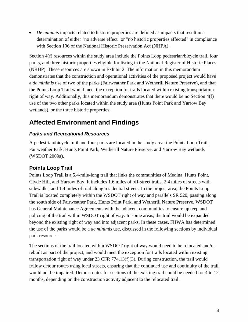
De minimis impacts related to historic properties are defined as impacts that result in a determination of either "no adverse effect" or "no historic properties affected" in compliance
with Section 106 of the National Historic Preservation Act (NHPA).
Section 4(f) resources within the study area include the Points Loop pedestrian/bicycle trail, four parks, and three historic properties eligible for listing in the National Register of Historic Places (NRHP). These resources are shown in Exhibit 2. The information in this memorandum demonstrates that the construction and operational activities of the proposed project would have a de minimis use of two of the parks (Fairweather Park and Wetherill Nature Preserve), and that the Points Loop Trail would meet the exception for trails located within existing transportation right of way. Additionally, this memorandum demonstrates that there would be no Section 4(f) use of the two other parks located within the study area (Hunts Point Park and Yarrow Bay
wetlands), or the three historic properties.
Affected Environment and Findings
Parks and Recreational Resources
A pedestrian/bicycle trail and four parks are located in the study area: the Points Loop Trail, Fairweather Park, Hunts Point Park, Wetherill Nature Preserve, and Yarrow Bay wetlands
(WSDOT 2009a).
Points Loop Trail Points Loop Trail is a 5.4-mile-long trail that links the communities of Medina, Hunts Point, Clyde Hill, and Yarrow Bay. It includes 1.6 miles of off-street trails, 2.4 miles of streets with sidewalks, and 1.4 miles of trail along residential streets. In the project area, the Points Loop Trail is located completely within the WSDOT right of way and parallels SR 520, passing along the south side of Fairweather Park, Hunts Point Park, and Wetherill Nature Preserve. WSDOT has General Maintenance Agreements with the adjacent communities to ensure upkeep and policing of the trail within WSDOT right of way. In some areas, the trail would be expanded beyond the existing right of way and into adjacent parks. In these cases, FHWA has determined the use of the parks would be a de minimis use, discussed in the following sections by individual
park resource.
The sections of the trail located within WSDOT right of way would need to be relocated and/or rebuilt as part of the project, and would meet the exception for trails located within existing transportation right of way under 23 CFR 774.13(f)(3). During construction, the trail would follow detour routes using local streets, ensuring that the continued use and continuity of the trail would not be impaired. Detour routes for sections of the existing trail could be needed for 4 to 12
months, depending on the construction activity adjacent to the relocated trail.

Exhibit 2. Section 4(f) Resources
LakeWashington
FairweatherBay
520
CozyCove
520
YarrowBay
M E D I N A C L Y D E H I L L
H U N T SP O I N T
Y A R R O WB A Y
EVER
GREE
N PO
INT R
D
HUNT
S PO
INT R
D
28TH AVE NE
24TH AVE NE
92ND
AVE N
E
BELL
EVUE
WAY
NE
108T
H AVE
NE
NORTHUP WAY
LAKE WASHINGTON BLVD NE
Yarrow BayWetlands
B E L L E V U E
K I R K L A N D
2851 EvergreenPoint Road
BellevueChristianSchool
10606Northup Way
Fairweather Park
HuntsPointPark
WetherillNature
Preserve
Points LoopTrail
Bicycle/Pedestrian PathHistoric PropertyParks and Recreation Areaswithin Study AreaPark beyond Study AreaCity Limits
0 1,000 2,000500 Feet
Source: City of Bellevue (2005) GIS Data (Trail), KingCounty (2007) GIS Data (Waterbody), King County (2005GIS Data (Stream and Street), City of Bellevue (1999)GIS Data (City Limits), King County (2004) GIS Data (CityLimits), and CH2M HILL (2008) GIS Data (Parks).Horizontal datum for all layers is NAD83(91); verticaldatum for layers is NAVD88.
Lake Washington
520
5 405
\\SIMBA\PROJ\PARAMETRIX\180171\GIS\MAPFILES\EA\SECTION(4)F\EA_S4F_SECTION4FRESOURCE.MXD 10/29/2009
Medina to SR 202: Eastside Transit and HOV Project
AREA OF DETAIL

6
The highway construction would require removal of existing vegetation along the trail; this vegetation enhances the recreational experience for trail users and serves as a buffer from the highway. Replacement of the vegetation strip with noise wall may affect the character of the trail. However, the proposed noise walls would reduce noise levels in 2030 by 5 to 15 A-weighted decibels (dBA) compared with existing conditions and by 6 to 16 dBA compared with the No Build Alternative. As a result, the change in character of the trail is not anticipated to be so severe that it would impact the continued use of the trail. Many trail users may experience a more
comfortable experience with the reduction in noise levels (WSDOT 2009b).
Fairweather Park Fairweather Park is a public park in Medina consisting of 11 acres of forested open space. The terrain ranges from upland forest to wetland, and is bisected by a spring-fed stream. Tennis
courts and a small grassy playfield are in the western area of the park.
Approximately 0.07 acre in the southwest corner of the park would be acquired and be permanently converted to the relocated Points Loop Trail/regional bike trail; the Points Loop Trail and the proposed regional bike trail merge together within the park (Exhibit 3). This affected area comprises less than 1 percent of the total park area and is located in the passive use area of the park. The new Evergreen Point Road lid would have beneficial visual effects on the park. This landscaped lid over SR 520 would increase green space adjacent to the park and would provide a new entrance to the park from the reconstructed Evergreen Point Road crossing of SR 520. The proposed noise walls would reduce noise levels in 2030 by 5 to 15 dBA
compared with existing conditions and by 6 to 16 dBA compared with the No Build Alternative.
During construction, an additional 0.07 acre of the southwest corner of the park would be temporarily occupied for construction of the Evergreen Point Road lid and relocation of the Points Loop Trail. This area would be fenced off and not available to park users for up to 12 months. Because the park entrance is at the north boundary of the park, access and use of the park would continue during construction, and use of the tennis courts would not be affected. The affected area is primarily vegetated with shrubs and grasses. After construction, the area would be regraded and revegetated. During construction, the park would experience temporary construction effects such as noise and fugitive dust. However, these effects would not have a
severe effect on the park’s activities, features, or attributes (WSDOT 2009b).

NE 32ND ST
NE 32ND ST
80T
H A
VE
NE
EV
ER
GR
EE
N P
OIN
T R
D
Permanent Use:0.07 Acre (3,170 Square Feet)
Temporary Use:0.07 Acre (3,013 Square Feet)
Fairweather Park
Medina to SR 202: Eastside Transit and HOV Project
Source: King County (2006) Aerial Photo, King County(2005) GIS Data (Stream), CH2M HILL (2008) GIS Data(Park), City of Bellevue (1999) GIS Data (City Limits), andKing County (2004) GIS Data (City Limits). Horizontal datumfor all layers is NAD83(91); vertical datum for layers isNAVD88.
Temporary Use
Permanent Use
Proposed Pavement
Proposed Lid
Limits of Construction
Proposed Regional Bicycle/Pedestrian Path
Proposed PointsLoop Trail
¯ 0 100 20050 Feet
Lake Washington
§̈¦405UV520
\\SIMBA\PROJ\PARAMETRIX\180171\GIS\MAPFILES\EA\SECTION(4)F\EA_S4F_FAIRWEATHERPARK_8X11.MXD 11/11/2009
Exhibit 3. Fairweather Park
AREA OF DETAIL

8
For the reasons noted above, the project will have a de minimis impact on Fairweather Park. Based on FHWA guidance for determining de minimis impacts (FHWA 2005), the agency with jurisdiction over the Section 4(f) resource must concur that the project effects would not adversely affect the activities, features, and attributes of the Section 4(f) resource. WSDOT has met with the Medina Park Board to discuss the project and its effects on Fairweather Park. Coordination with the Park Board and City of Medina is ongoing, and more meetings are planned in the coming months. They have been supportive of the proposed project and the benefits that the park will experience. A letter expressing concurrence with the de minimis finding from the City of Medina as the agency with jurisdiction over the park will be received
before the final decision document is completed.
Wetherill Nature Preserve The 16-acre Wetherill Nature Preserve was donated to the towns of Hunts Point and Yarrow Point in 1988 with the requirement that the towns protect the land in perpetuity from development and preserve its native wildlife and plants. Today, many trees and shrubs in the park are labeled, and extensive plant and animal lists are provided at the entrance kiosk. A number of pedestrian-only trails wind through the preserve and provide waterfront views. The parkland is privately maintained through volunteer efforts and contributions. The Points Loop Trail is located immediately adjacent to the south side of the park within the WSDOT right of way and connects to pedestrian paths within the preserve (Exhibit 4). The project would widen the highway, requiring construction of retaining walls, which in turn would require reconstruction of the trail with upgrades for Americans with Disabilities Act (ADA) accessibility. In order to meet acceptable ADA criteria, landings are proposed for users to rest at 100-foot intervals in sections of 10-percent grade and at 50-foot intervals in sections of 11-percent grade. To accommodate this change, approximately 0.04 acre of the Wetherill Nature Preserve along the border of SR 520 would be acquired and permanently converted to WSDOT right of way to accommodate the relocated Points Loop Trail. This affected area comprises less
than 1 percent of the total park area.
During construction, an additional 0.15 acre of the park would be temporarily occupied for the relocation and reconstruction of the Points Loop Trail along the southern boundary of the preserve adjacent to the SR 520 right of way. Access to pedestrian paths within the preserve would be maintained during project construction. This area would be fenced-off for safety and not available to park users for up to 12 months. Movable vegetative screening would be used to visually screen the park from construction activities during this period. During construction, the preserve would experience temporary construction effects such as noise and fugitive dust. However, these effects would not have a severe effect on the preserve’s activities, features, or
attributes (WSDOT 2009b).

Temporary Use:0.15 Acre (6,467 square feet)
CozyCove
YA
RR
OW
PO
INT
HU
NT
S P
OIN
T
UV520
POINTS D
R NE
NE 33RD ST
Cozy Cove Creek
HuntsPointPark
WetherillNature
Preserve
Permanent Use:0.04 Acre (1,718 square feet)
Medina to SR 202: Eastside Transit and HOV Project
Exhibit 4. Wetherill Nature Preserve
Source: King County (2006) Aerial Photo, King County(2005) GIS Data (Stream), CH2M HILL (2008) GIS Data(Park), City of Bellevue (1999) GIS Data (City Limits), andKing County (2004) GIS Data (City Limits). Horizontal datumfor all layers is NAD83(91); vertical datum for layers isNAVD88.
Temporary Use
Permanent Use
Proposed Pavement
Proposed Lid
Limits of Construction
Proposed Regional Bicycle/Pedestrian Path
Proposed PointsLoop Trail ¯ 0 100 20050 Feet
\\SIMBA\PROJ\PARAMETRIX\180171\GIS\MAPFILES\EA\SECTION(4)F\EA_S4F_WETHERILLNATUREPRESERVE2.MXD 11/17/2009
Lake Washington
§̈¦405
UV520
AREA OF DETAIL

10
For the reasons noted above, the project will have a de minimis impact on the Wetherill Nature Preserve. Based on FHWA guidance for determining de minimis impacts (FHWA 2005), the agency with jurisdiction over the Section 4(f) resource must concur that the project effects would not adversely affect the activities, features, and attributes of the Section 4(f) resource. WSDOT has met with the Wetherill Nature Preserve Commission to discuss the project and its effects on the preserve. Coordination with the Preserve Commission and towns of Hunts Point and Yarrow Point are ongoing, and they have been supportive of the proposed project. Letters from these agencies with jurisdiction over the preserve expressing concurrence with the de minimis finding
will be received before the final decision document is completed.
Hunts Point Park and Yarrow Bay Wetlands Hunts Point Park, also known as D.K. McDonald Park, encompasses roughly 2.5 acres in the south part of the Town of Hunts Point. Park amenities include tennis courts, a children’s play area, an open sports area, and benches. The parkland was originally acquired from the Bellevue School District and named after long-time resident D. K. McDonald, who purchased enough
bonds to finance construction of the park. The park also contains the Town Hall.
The Yarrow Bay wetlands is a 73-acre wildlife conservancy area that can be explored either by nonmotorized craft, such as canoes and kayaks, or by following one of two trails that border the park. The park is located at the south end of Kirkland. Although most of the Yarrow Bay wetlands can only be explored by boat, a land route is accessible from a small parking lot at 101st Way NE and NE Points Drive just north of SR 520. The parking lot leads to a trail with
interpretive signs.
The project would result in no permanent acquisition of Hunts Point Park or Yarrow Bay wetlands. However, there would be temporary occupancy in each of these parks during project construction. In Hunts Point Park, 0.03 acre (1 percent of the total park area) in the southwest corner of the park adjacent to Hunts Point Road would be regraded as part of the roadway construction (Exhibit 5). In the Yarrow Bay wetlands, 0.12 acre (less that 1 percent of the total park area) would need to be accessed for construction of a culvert outflow beneath Points Road NE (Exhibit 6). The temporary occupancy in each of these parks would be up to 1 year in duration. Areas disturbed during construction would be revegetated. The temporary occupancy of these parks would not constitute a Section 4(f) use of these resources as outlined in 23 CFR--Part 774.13(d). As noted earlier, 23 CFR--Part 774.13[d] requires documented agreement by the official(s) with jurisdiction over the Section 4(f) resource with the evaluation that the temporary occupancy is so minimal that it does not constitute a use within the meaning of Section 4(f). Coordination with the towns of Hunts Point and Yarrow Point and the City of Kirkland is ongoing. Letters of agreement from these municipalities will be received before the final
decision document is completed.

84T
H A
VE
NE
NE 28TH ST
HUNTS POINT LN
CLYDE HILL
HUN TS POINT
UV520
Temporary Occupancy:0.002 Acre (95 square feet)
Hunts Point Park
Medina to SR 202: Eastside Transit and HOV Project
Exhibit 5. Hunts Point Park
Source: King County (2006) Aerial Photo, King County(2005) GIS Data (Stream), CH2M HILL (2008) GIS Data(Park), City of Bellevue (1999) GIS Data (City Limits), andKing County (2004) GIS Data (City Limits). Horizontaldatum for all layers is NAD83(91); vertical datum for layersis NAVD88.
Temporary Occupancy
Proposed Pavement
Proposed Lid
Limits of Construction
Proposed Regional Bicycle/Pedestrian Path
Proposed PointsLoop Trail ¯ 0 100 20050 Feet
Lake Washington
§̈¦405
UV520
\\SIMBA\PROJ\PARAMETRIX\180171\GIS\MAPFILES\EA\SECTION(4)F\EA_S4F_HUNTSPOINTPARK.MXD 10/29/2009
AREA OF DETAIL

YarrowBay
Yarrow Bay Wetlands
E 38TH ST
NE LA K E WASHINGTON BLVD
10
2N
D A
VE
NE
96
TH
AV
E N
E
98
TH
AV
E N
E
BE
LL
EV
UE
WA
Y N
E
10
1S
T W
AY
NE
103R
D AV
E N
E
LA
KE
WA
SH
ING
TO
N B
LVD
NE
KIR
KL
AN
D
CL
YD
E H
ILL
BE
LL
EV
UE
YAR
RO
W P
OIN
T
TemporaryOccupancy:0.07 Acre(3,201 Square Feet)
Medina to SR 202: Eastside Transit and HOV Project
Exhibit 6. Yarrow Bay Wetlands
Source: King County (2006) Aerial Photo, King County(2005) GIS Data (Stream), CH2M HILL (2008) GIS Data(Park), City of Bellevue (1999) GIS Data (City Limits), andKing County (2004) GIS Data (City Limits). Horizontal datumfor all layers is NAD83(91); vertical datum for layers isNAVD88.
Temporary Occupancy
Proposed Pavement
Proposed Lid
Limits of Construction
Proposed Regional Bicycle/Pedestrian Path
Proposed PointsLoop Trail ¯ 0 250 500125 Feet
Lake Washington
§̈¦405
UV520
\\SIMBA\PROJ\PARAMETRIX\180171\GIS\MAPFILES\EA\SECTION(4)F\EA_S4F_YARROWBAYWETLANDS.MXD 10/29/2009
AREA OF DETAIL

13
Because of the proposed noise walls, future noise levels in these parks are expected to be lower than current levels (WSDOT 2009b). The proposed lid over SR 520 at 84th Avenue NE would serve as an extension of Hunts Point Park and enhance the open space and community connections that these parks provide. Therefore, the proximity effects would not constitute a constructive use that would substantially impair the activities, features, or attributes of these park
resources.
For the reasons noted above, there would be no Section 4(f) use of these parks.
Historic/Cultural Resources
A Historic Built Environment Cultural Resources Technical Memorandum for the SR 520, Medina to SR 202: Eastside Transit and HOV Project was prepared and submitted to the State Historic Preservation Officer (SHPO) in September 2009. A total of three historic properties eligible for listing in the National Register of Historic Places (NRHP) were identified and
recorded within the Area of Potential Effects (APE):
2851 Evergreen Point Road, Medina—James Arntson House
10606 Northup Way, Bellevue—BurgerMaster
7800 NE 28th Street, Medina—Bellevue Christian School
The location of these properties is shown in Exhibit 2. Section 4(f) historic properties are limited to properties listed in or eligible for listing in the NRHP. No archaeological, cultural, or
traditional cultural properties listed in or eligible for the NRHP were identified in the APE.
The project will have minimal effect on the characteristics of these identified historic properties and will not adversely affect their activities, features, or attributes (WSDOT 2009c). The SHPO concurred on November 4, 2009 that project actions will have No Effect or No Adverse Effect
on these historic properties (see Attachment 1).
2851 Evergreen Point Road, Medina—James Arntson House This Modern-style residence was constructed in 1953. It is eligible for listing in the NRHP under Criterion C for its distinctive architectural characteristics, which are uniquely representative of its mid-century period. The new Evergreen Point Road lid would have beneficial visual and audible effects on the Arntson House. This landscaped lid would increase green space adjacent to the property and reduce the visibility of SR 520 from the property, which would partially restore the original setting of the house, and it would decrease the noise level from the operation of SR 520. During construction, the property may experience temporary construction effects such as construction noise and fugitive dust. During construction, driveway access to the property would be maintained. None of these effects would impact the integrity of the Arntson House or

14
the characteristics that qualify it for the NRHP; it would experience No Adverse Effects from the
project. There will be no use of the property.
10606 Northup Way, Bellevue—BurgerMaster BurgerMaster restaurants were founded by Phil Jensen in Seattle in 1952. The Bellevue BurgerMaster building is architecturally significant as a rare surviving example of Googie-style roadside architecture. It maintains very good integrity, including its monument sign topped with a neon steer head. Its design embodies distinctive, identifiable characteristics of the style, such as cantilevered canopies, diagonal metal supports, a butterfly roof, distinctive lighting, and a period monument sign with neon. It is eligible for the NRHP under Criterion C for its architectural significance and unique defining characteristics. During construction, the property may experience temporary construction effects such as fugitive dust and limited access during non-business hours. None of these effects would impact the integrity of BurgerMaster or the characteristics that qualify it for the NRHP; BurgerMaster would experience No Adverse Effects
from the project. There will be no use of the property.
7800 NE 28th Street, Medina—Bellevue Christian School Originally built as the Three Points Elementary School in 1961, this collection of Modern buildings was designed by the noted Seattle architectural firm of Narramore, Bain, Brady and Johanson, now known as NBBJ. Founded in 1943, NBBJ became a regional leader in the Pacific Northwest. Over the years, the firm has grown to become the third largest design practice in the
United States and the fifth largest in the world.
The complex, which is currently leased by the private Bellevue Christian School for use as an elementary school, has had few alterations and is intact and well maintained. It will meet the 50-year age criterion in 2011. At that time, it will be eligible for the NRHP under Criterion C for its distinctive architectural characteristics, representational of educational design theories of its period, and as the work of a masterful, world-renowned architectural firm. The Bellevue Christian School would receive beneficial effects from the new Evergreen Point Road lid and new noise walls, which would reduce the existing sound level. The school would experience a visual effect from the presence of the new noise walls, but because the walls would also serve to visually screen the school from part of SR 520, to which it is currently exposed, the visual change from the new noise walls would not be adverse (WSDOT 2009b). None of these effects would impact the integrity of the Bellevue Christian School or the characteristics that qualify it
for the NRHP; it will experience No Adverse Effects from the project.
During construction, approximately 0.2 acre of the school property adjacent to the existing SR 520 right of way would be temporarily occupied to construct the noise wall. This construction would occur within an existing slope easement. This temporary occupancy would not constitute a
use of the historic property.

15
References FHWA. 2005. Guidance for Determining De Minimis Impacts to Section 4(f)
Resources. December 13, 2005.
WSDOT. 2009a. Social Elements Technical Memorandum; SR 520, Medina to SR 202: Eastside Transit and HOV Project. November 2009.
WSDOT. 2009b. Noise Technical Memorandum; SR 520, Medina to SR 202: Eastside Transit and HOV Project. November 2009.
WSDOT. 2009c. Historic Built Environment Cultural Resources Technical Memorandum; SR 520, Medina to SR 202: Eastside Transit and HOV Project. November 2009.


Attachment 1
Agency Correspondence


STATE OF WASHINGTON
DEPARTMENT OF ARCHAEOLOGY & HISTORIC PRESERVATION 1063 S. Capitol Way, Suite 106 � Olympia, Washington 98501
Mailing address: PO Box 48343 � Olympia, Washington 98504-8343 (360) 586-3065 ���� Fax Number (360) 586-3067 ���� Website: www.dahp.wa.gov
November 4, 2009
Mr. Ken Juell
Cultural Resources Specialist
WSDOT ESO Mega Projects
401 Second Ave. South, Suite 300
Seattle, Washington 98104-3850
In future correspondence please refer to:
Log: 101408-10-FHWA
Property: SR 520 Eastside Transit and HOV
Re: NO Adverse Effect
Dear Mr. Juell:
Thank you for contacting the Washington State Department of Archaeology and Historic Preservation
(DAHP). The SR 520 Eastside Transit and HOV project has been reviewed on behalf of the State Historic
Preservation Officer under provisions of Section 106 of the National Historic Preservation Act of 1966
(as amended) and 36 CFR Part 800. My review is based upon documentation contained in your
communication.
National Register of Historic Places (NRHP) eligibility determinations have already been made for built
environment resources within the area of potential effect (APE) for the project. In April 2009, three
properties were concurred upon by our office as eligible for listing (Arnston House, Bellevue Christian,
and BurgerMaster. The remaining 62 properties identified in Volume I of the cultural resources report
were determined to be not eligible for listing in the NRHP.
Regarding the two archaeological sites that were identified within the APE, a remnant of the old Lake
Washington Boulevard and an unimproved farm road with associated bridge, neither site retains sufficient
integrity of data potential to be considered eligible for listing in the NRHP at this time.
We do, however, agree with your recommendation that a professional archaeological monitor be present
during ground-disturbing excavations greater than one foot deep in all proposed detention pond and
stream enhancement sites. Also, monitoring should be conducted with all excavations that occur on the
parcel adjacent to the Keller Farm site. Should any additional project components be added to the project,
DAHP must be notified immediately and revisions made to the APE as applicable.
I concur that the current project as proposed will have "NO ADVERSE EFFECT" on National Register
eligible or listed historic or cultural resources. If additional information on the project becomes available,

or if any archaeological resources are uncovered during construction, please halt work in the area of
discovery and contact the appropriate Native American Tribes and DAHP for further consultation.
Please note that effective Nov. 2, 2009, DAHP requires that all cultural resource reports be submitted in
PDF format on a labeled CD along with an unbound paper copy. For further information please go to
http://www.dahp.wa.gov/documents/CR_ReportPDF_Requirement.pdf.
Thank you for the opportunity to review and comment. If you have any questions, please contact me.
Sincerely,
Matthew Sterner, M.A., RPA
Transportation Archaeologist
(360) 586-3082