A39 Camelford High Level Options Assessment Report · EDG1342 – A39 Camelford High Level Options...
77
A39 Camelford High Level Options Assessment Report EDG1342/OAR/01 v1 CORMAC Consultancy CORMAC Western Region, Radnor Road, Scorrier, Redruth, Cornwall, TR16 5EH.
Transcript of A39 Camelford High Level Options Assessment Report · EDG1342 – A39 Camelford High Level Options...

A39 Camelford High Level Options Assessment Report
EDG1342/OAR/01 v1
CORMAC Consultancy CORMAC Western Region, Radnor Road, Scorrier, Redruth, Cornwall, TR16 5EH.


Issue & Revision Record
Revision Date Originator Checked Authorised Purpose of Issue Nature of Change
0.1 08.08.17 DP NH AO Draft for comment
0.2 25.08.17 DP AO CS Draft Client Issue
0.3 30.08.17 DP AO SB Updated following Client meeting
0.4 14.09.17 DP AO SB Updated following 2nd Client meeting
1 05.10.17 DP AO NH First Issue
This document has been prepared for the titled project or named part thereof and should not be relied upon or used for any other project without an independent check being carried out as to its suitability and prior
written authority of Cormac Solutions Ltd being obtained. Cormac Solutions Ltd accepts no responsibility or liability for the consequences of this document being used for a purpose other than the purposes for which it was commissioned. Any person using or relying on the document for such other purposes agrees, and will by
such use or reliance be taken to confirm his agreement to indemnify Cormac Solutions Ltd for all loss or damage resulting therefrom. Cormac Solutions Ltd accepts no responsibility or liability for this document to
any party other than the person by whom it was commissioned.
Prepared by Engineering Design Group
CORMAC Solutions Ltd Head Office, Higher Trenant Road, Wadebridge, Cornwall PL27 6TW
If you would like this report in another format, please contact CORMAC Solutions Ltd Head Office Higher Trenant Road Wadebridge Cornwall PL27 6TW Tel: 01872 323 313 Email: [email protected] www.cormacltd.co.uk/

- Page Left Intentionally Blank -

CONTENTS
1 INTRODUCTION 1
1.1 The A39 Route 1 1.2 Existing Issues 1 1.3 Traffic Flows 1
2 BACKGROUND 3
2.1 Camelford Bypass Scheme History 3 2.2 Air Quality 4
3 CLIENT BRIEF 7
3.1 High Level Route Assessment 7
4 DO NOTHING OPTION 9
4.1 Introduction 9 4.2 Traffic Flows 9 4.3 Future developments 10 4.4 Air Quality Action Plan 11 4.5 Recommendation 11
5 TRANSPORTATION INTERVENTIONS 13
5.1 Connecting Cornwall: 2030 (Local Transport Plan 3; 2010 to 2030) 13 5.2 Cornwall Council Local Plan 13 5.3 Draft Camelford Neighbourhood Plan 14
6 REVIEW OF CAMELFORD BYPASS PROPOSALS 17
6.1 Benefits of Bypass 17 6.2 Historic Scheme Costs 17 6.3 2010 Construction Cost Update 19 6.4 2017 Construction Costs 19 6.5 2017 Land Costs 20 6.6 2017 Design costs 20 6.7 Client and Project Control Costs 21 6.8 2017 Whole Project Costs 21 6.9 2023 Construction Costs 21 6.10 2023 Land Costs 22 6.11 2023 Design Costs 22 6.12 Client and Project Control Costs 23 6.13 2023 Whole Project Costs 23 6.14 Optimism Bias 24 6.15 Suitability of Current Design 24 6.16 Recommendation 25
7 HIGH STREET INTERVENTIONS 27
7.1 Introduction 27 7.2 Current Layout 27 7.3 Existing Issues 28 7.4 Options Being Investigated 30 7.5 Issues & Benefits 31 7.6 Traffic Modelling Methodology 31 7.7 Traffic Modelling Results 33 7.8 MOVA 36

7.9 Conclusion 36 7.10 Recommendation 37
8 LGV / HGV DIVERSION ROUTE 39
8.1 Description 39 8.2 Traffic 40 8.3 Recent Road Improvements since the 2004 Review 40 8.4 Environmental Assessment of 2004 HGV Diversion Route 41 8.5 Historic Scheme Cost (Dec 2003 Rates) 42 8.6 2017 Whole Project Costs 43 8.7 2023 Whole Project Costs 45 8.8 Optimism Bias 45 8.9 Alternative HGV Diversion Scheme 46 8.10 Temporary Trial of HGV Diversion Route 48 8.11 Conclusion 49 8.12 Recommendation 49
9 DOWNGRADING OF A39 TO B ROAD 51
9.1 Road classification guidance 51 9.2 Impact of downgrading through Camelford 51 9.3 Recommendation 51
10 STRATEGIC ROUTE 53
10.1 Northern Link Road - Bodmin 53 10.2 Southern Link Road – Wadebridge 54 10.3 A389 Upgrade 54 10.4 Effect on Traffic Flows for Camelford 54 10.5 Recommendation 54
11 A30 SIGNAGE OPTIONS 55
11.1 Site Survey 55 11.2 A30 Northbound 55 11.3 A30 Southbound 58 11.4 A389 Westbound (Bodmin to Wadebridge) 62 11.5 A39 travelling north and south 63 11.6 Recommendation 63
12 FUNDING OPPORTUNITIES 65
12.1 Requirements for funding 65 12.2 Discounted funding sources 65 12.3 Department for Transport (DfT) 65 12.4 Recommendation 65
13 REPORT RECOMMENDATION 67

DRAWINGS
EDG1342-CSL-GEN-SX105835-DE-D-0001 EDG1342-CSL-GEN-SX105835-DE-D-0002 EDG1342-CSL-GEN-SX105835-DE-D-0003 EDG1342-CSL-GEN-SX105835-DE-D-0004 EDG1342-CSL-GEN-SX105835-DE-D-0005 EDG1342-CSL-GEN-SX105835-DE-D-0006 EDG1342-CSL-GEN-SX105835-DE-D-0007 EDG1342-CSL-GEN-SX105835-DE-D-0008 EDG0276_C_01 EDG0276_C_02


APPENDICES
Appendix A – Cornwall Council Local Plan – PP12 Camelford CNA Appendix B – Draft Camelford Neighbourhood Plan Appendix C – LINSIG Modelling Results Appendix D - Infographic


EDG1342 – A39 Camelford High Level Options Assessment Report 1 October 2017
1 INTRODUCTION
1.1 The A39 Route
1.1.1 The existing A39 route is the primary road through Camelford’s town centre, but its narrow carriageway impedes the flow of traffic and leads to congestion, delays and associated environmental (e.g. noise and air quality), and community (e.g. pedestrian obstruction) issues.
1.1.2 The route through the town centre comprises of a single carriageway road, interrupted by traffic signals and a priority shuttle layout through the town centre. This causes congestion at peak and seasonal times, resulting in air quality issues.
1.1.3 The route through Camelford has many designations within Cornwall, these being:-
• Strategic freight network • Seasonal traffic sensitive route • Secondary abnormal load route • Fire brigade strategic route • Bus route
1.2 Existing Issues
1.2.1 The existing issues with the current A39 through Camelford are:-
• The A39 was a Trunk Road maintained by the Highways Agency until it was de-trunked in 2002 and handed to Cornwall County Council to maintain
• The A39 is now designated the ‘Atlantic Highway’ between Fraddon and the county boundary
• The A39 is designated as part of the county’s Strategic Freight Network • The road links Wadebridge to Bude and provides the most direct route
through the north of Cornwall • The route has to cope with a significant uplift in vehicle numbers during
the summer months as a result of tourism in the local area • The town centre layout is restricted by a priority shuttle layout and
traffic signals causing queueing traffic and congestion • Idling vehicles, combined with narrow roads fronted by tall (3-4 storey)
buildings impacts significantly on air quality • HGV traffic makes up only 7% of the total traffic flow but contributes
nearly 40% of the NOx pollution 1.3 Traffic Flows
1.3.1 There has been an increase in traffic flows using the A39 over the past few years. The Annual Average Daily Traffic (AADT) was 5,506 in 2014. In 2015 this increased by 9.5% to 6,028 and a further 10.1% increase to 6,637 in 2016.

EDG1342 – A39 Camelford High Level Options Assessment Report 2 October 2017
1.3.2 These traffic flows are significantly affected by tourism traffic. In July and August 2016 the average 24hr flow increased to 9,546, with a maximum 24hr flow of 11,231 vehicles – this is a 69% increase from the AADT flows.
1.3.3 The capacity of a single carriageway road is predicted to be approximately 7,300 vehicles per day (based upon a 6.1m, 2 lane carriageway). The A39 through Camelford is more restricted than this with the addition of the traffic signals and priority shuttle layout, reducing the capacity further.
1.3.4 Based on the above capacity, the AADT for the A39 is assumed to be at saturation for the existing layout. This is further exacerbated during summer months with the increased tourism vehicles.

EDG1342 – A39 Camelford High Level Options Assessment Report 3 October 2017
2 BACKGROUND
2.1 Camelford Bypass Scheme History
2.1.1 The A39 Camelford Bypass Study was undertaken between 1992-94 by the Highways Agency and identified three routes to be taken to public consultation.
2.1.2 The route which was then taken forward as part of the Cornwall Council major scheme submission in 2001 was the western route with a northern extension which bypassed Camelford and Valley Truckle but did not sever the hamlet of Trefrew from Camelford.
2.1.3 The objectives of the major scheme submission were:
• To improve the safety in the town and on its approaches for all those using the highways;
• To provide easy access by all modes, to employment opportunities that help reduce local unemployment levels;
• To improve accessibility in and around the town centre and enhance the urban environment so that Camelford can fulfil its role as a local centre thereby reducing the need for people to travel further afield for services and facilities, and providing a wider range of options for those who find travel difficult and too expensive;
• To reduce congestion and the damage it does to health and the built environment;
• To address the problems encountered in the town and on its approaches without causing significant adverse impact on the natural environment; and
• To reduce delays for traffic using the A39 as a strategic access route linking towns and villages along the north coast of Devon and Cornwall.
2.1.4 In April 2002 a number of route options were consulted on and a preferred route was selected. The estimated cost for the preferred route was between £6.7million and £7.3million and the contract for design and construction was put out to tender in 2003.
2.1.5 Costain were selected as the Design & Build Contractor for the Camelford Distributor Road under an Early Contractor Involvement (ECI) arrangement.
2.1.6 A Planning Application to North Cornwall District Council for the road was submitted in 2004. On 23 June 2005 the application was “Approved with Conditions” and the route protected from future development.
2.1.7 In 2006 the central government funding was removed when the scheme failed to make the Regional Funding Allocation (RFA) for the period to 2016. The scheme was subsequently put on hold, pending the availability of future funding.

EDG1342 – A39 Camelford High Level Options Assessment Report 4 October 2017
2.1.8 The Planning Permission for the scheme has since lapsed, although the Draft Neighbourhood Plan for Camelford has the objective of protecting the route of the bypass from any other development.
2.1.9 There is currently no identified funding mechanism for the scheme. The Government’s Major Scheme Business Case assessment prioritises schemes that unlock growth in housing and jobs and reduce congestion.
2.2 Air Quality
2.2.1 Air quality monitoring has been undertaken in Camelford since 2010.
2.2.2 In October 2016, an air quality assessment for Camelford was published by Cornwall Council (www.cornwall.gov.uk/media/21941428/air-quality-assessment-camelford-2016.pdf). This report highlighted that between 2010 and 2015, two locations within Fore Street and High Street had recorded levels of Nitrogen Dioxide (NO2) in exceedance of the annual mean Air Quality Standards (AQS) objective of 40µg/m3. A further location within Fore Street recorded levels of NO2 with an annual mean in excess of 60µg/m3, indicating a potential exceedance of the NO2 hourly mean AQS objective.
2.2.3 Current 2016 data has identified a further two locations within Fore Street and High Street in exceedance of the annual mean AQS objective of 40µg/m3. It is thought that this data has been impacted upon by the construction of the A30 Temple to Higher Carblake scheme, with additional traffic either diverted during times of road closure or shifting onto the A39 as a result of delays to the A30.
2.2.4 Source apportionment was undertaken to establish the main traffic components affecting air quality in Camelford. Using data collected from the Redgate's Automated Traffic Counter, the main sources contributing to oxides of nitrogen (NOx) at location CAM 5 (Fore Street) is shown in Figure 2.1 below.

EDG1342 – A39 Camelford High Level Options Assessment Report 5 October 2017
Figure 2.1 Source Apportionment of road NOx
2.2.5 As can be seen from Figure 2.1, diesel cars are making the largest contribution to the levels of NOx in Camelford with 33% of the total.
2.2.6 In addition HGV traffic (Artic HGV, Rigid HGV, Buses & Coaches), which account for only 7% of the total traffic flows, contribute 37% of the NOx pollution.
2.2.7 As a result of the monitoring, Camelford was formally declared an Air Quality Management Area (AQMA) by Cornwall Council on 4th January 2017. Figure 2.2 below shows the boundary of the AQMA.
Figure 2.2 Camelford Air Quality Management Area
Motorcycles 0%
Other 0%
Regional Background
6% Local Background
5% Petrol Cars
6%
Diesel Cars 33%
Petrol LGV 0%
Diesel LGV 13%
Rigid HGV 15%
Artic HGV 4%
Buses / Coaches
18%
CAM5

EDG1342 – A39 Camelford High Level Options Assessment Report 6 October 2017
2.2.8 Within 12 – 18 months of declaring the AQMA, Cornwall Council are required to produce an Air Quality Action Plan (AQAP).
2.2.9 This plan will include measured targets to improve air quality and may include measures within an existing transport plan as well as new measures designed specifically to improve air quality.
2.2.10 Following the consultation on the declaration of an AQMA, some suggested ideas to improve air quality were:-
• Build a bypass around Camelford • Reduce emissions from heavy vehicles • Improvement to traffic lights on the A39, installing a MOVA system to
increase traffic flow through the lights at times of congestion • Investigate changes to the road layout to improve traffic flow • Diversion of traffic onto alternative routes.

EDG1342 – A39 Camelford High Level Options Assessment Report 7 October 2017
3 CLIENT BRIEF
3.1 High Level Route Assessment
3.1.1 The Client met with Councillors and representatives of Camelford Town Council on 01 February 2017. Arising from the meeting was an action to undertake a high level route assessment for Camelford which will consider the following:-
• Do-nothing assessment (see Chapter 4) • Review how Camelford wishes to develop and what transportation
interventions may be appropriate (see Chapter 5) • Review the case for the road (see Chapter 6) • Consider intervention in High Street with traffic lights or other to
alleviate congestion (see Chapter 7) • Investigate use of LGV/HGV diversion route with possible upgrade (see
Chapter 8) • Give consideration to down grading of the A39 from A-road to B-road
(see Chapter 9) • Assess the option of a strategic route that facilitates a bypass of
Camelford but also alleviates traffic currently travelling through Bodmin to access the north coast (see Chapter 10)
• Investigate signing options from the A30 (see Chapter 11) • Investigate and report funding opportunities (see Chapter 12)


EDG1342 – A39 Camelford High Level Options Assessment Report 9 October 2017
4 DO NOTHING OPTION
4.1 Introduction
4.1.1 This section considers what changes may occur in Camelford by 2030 should no action be taken by Cornwall Council to improve the road network.
4.1.2 Consideration will be made to traffic flows, growth, developments and impact of the Air Quality Action Plan (AQAP).
4.2 Traffic Flows
4.2.1 An active Automatic Traffic Counter (ATC) camera is located along the A39 at Redgate’s, to the north of Camelford, which counts vehicles continuously (see Figure 4.1 below).
Figure 4.1 Location of Redgate’s Automatic Traffic Counter
4.2.2 This ATC camera has been used to estimate an Annual Average Daily Traffic
(AADT) figure for the years 2010- 2016. This is summarised in Table 4.1, as well as the percentage change from the previous year.
Year AADT % change
2010 5,516 -
2011 4,911 -11%
2012 5,096 4%
2013 5,295 4%
2014 5,506 4%
2015 6,028 9.5%
2016 6,637 10.1%
Table 4.1 Changes in AADT between 2010 and 2016

EDG1342 – A39 Camelford High Level Options Assessment Report 10 October 2017
4.2.3 Ongoing roadworks on the A30 began in 2015 as well as in Bodmin town centre in 2016. These works are likely to have contributed to the increase in traffic flows through Camelford, and therefore traffic is likely to fall back closer to the 5,500 after works are complete.
4.2.4 The fall of 11% in 2011 is likely to be attributed to the economic fall in the UK in the last quarter of 2010.
4.2.5 TEMPRO 7 has been used to calculate the future growth with the following selections made:
• Trip ends by time period • Cornwall 004 (E02003934) – Camelford and Launceston rural north • Years 2014-2030 • All purposes transport definition with the mode being selected for all
except rail/underground • Time period set to Average Day • Trip end type: Origin/Destination • Growth Factors • NTM AF09 dataset – with default selections made
4.2.6 The resultant adjusted local growth figure calculated is 1.2679
(approximately a 27% increase).
4.2.7 If this growth is applied to the 2014 AADT figure, then the growth for 2030 is calculated to be 6,981 AADT. This works out at around 350 more vehicles than was calculated to be travelling through the network in 2016.
4.2.8 The theoretical capacity of the road through Camelford has been assessed to be below the 7,300 vehicles for a single carriageway road as a result of the traffic signals and priority shuttle layout. This increase in traffic growth will therefore result in increased congestion, longer travel times and increased pollution for the town centre.
4.2.9 Assuming a 5% HGV split based of the MTC (Manual Turning Counts) around Camelford, approximately 350 of the 6,981 AADT will be HGVs, compared to 275 HGV split in 2014. (Note – 7% HGV was calculated at the Redgate’s ATC for A39 traffic only, 5% was calculated from the manual counts which included the A39 and side road networks).
4.2.10 This increase is likely to increase the pressures on the local network, decreasing the route’s reliability and air quality which is already below acceptable levels through the high street, and increase congestion and traffic delays.
4.3 Future developments
4.3.1 The Local Plan Strategic Policies 2010-2030 indicate a requirement to provide 1,200 dwellings (60 a year) between the periods 2010-2030. The Cornwall Local Plan – strategic policies 2010-2030 indicate the total for Camelford and Camelford Community Network Area (CAN) remainder equates to 1,000 housing.

EDG1342 – A39 Camelford High Level Options Assessment Report 11 October 2017
4.3.2 One of the key planning applications in Camelford is planning reference PA17/03148, for the construction of 104 dwellings to the South-West of Camelford. This application is still awaiting a decision.
4.3.3 The air quality assessment suggests that there would be 53 vehicles per day (16 HGVs) during construction period. The modelling suggests that the concentrations of NO2, PM10 and PM2.5 with development will not be significant in opening year and compliant with the relevant air quality planning policy.
4.3.4 The application includes improvements to the existing network at its access point; which includes pedestrian footways and uncontrolled pedestrian crossing, realignment and the inclusion of a new right turn lane.
4.4 Air Quality Action Plan
4.4.1 An AQAP is due for Camelford in 2018 following the declaration of an AQMA, as described in Chapter 2.2.
4.5 Recommendation
4.5.1 The action of the AQAP will impact upon the Camelford high street, meaning that the “do nothing” scenario is no longer a possibility.


EDG1342 – A39 Camelford High Level Options Assessment Report 13 October 2017
5 TRANSPORTATION INTERVENTIONS
5.1 Connecting Cornwall: 2030 (Local Transport Plan 3; 2010 to 2030)
5.1.1 Connecting Cornwall: 2030 is the third local transport plan for Cornwall and covers the period 2010 to 2030. It is used for the planning, development and management of transport in Cornwall. The document is split into both a strategy and future vision for Cornwall.
5.1.2 The strategy engages in the vision, goals, policies and objectives of transport. The goals are to:
• Tackle climate change • Support economic prosperity • Respect and enhance the environment • Encourage healthy lifestyles • Support community safety and individual well being • Support equality of opportunity.
5.1.3 These goals are split into objectives which are further broken down into
policies and proposals.
5.1.4 The key objectives which can be applied to this Camelford assessment are as follows:
• Reduce noise and air quality impacts • Improve road safety • Ensure a resilient and reliable transport system for people, goods
and services • Support the vitality and integrity of our town centres and rural
communities
5.1.5 Camelford is mentioned once in the Implementation Plan 2011-2015. This is for an A39 Valley Truckle walking scheme with a total cost of £50,000; and it is not mentioned at all in the 2015-2019 Implementation Plan.
5.2 Cornwall Council Local Plan
5.2.1 Cornwall Council’s Local Plan, adopted in November 2016, sets out the Council’s planning approach and policies for Cornwall, highlighting how development will be managed until 2030.
5.2.2 The plan is intended to help deliver the vision and objectives of ‘Future Cornwall’, the Council’s sustainable community strategy. The underlying principles of the strategy seek to manage future development to ensure all communities in Cornwall have an appropriate balance of jobs, services, facilities and homes.
5.2.3 The Local Plan established 17 Community Network Areas, to act as a local focus for debate and engagement, with many local objectives reflecting the overall approach to the plan.

EDG1342 – A39 Camelford High Level Options Assessment Report 14 October 2017
5.2.4 Camelford Community Network Area (PP12) covers the parishes of Advent, Camelford, Davidstow, Forrabury and Minster, Lesnewth, Michaelstow, Otterham, St Breward, St Clether, St Juliot, St Teath, Tintagel, Tremaine, Treneglos, Tresmeer, Trevalga and Warbstow.
5.2.5 The Local Plan for Camelford highlights two transportation objectives. These are:-
Objective 2 Congestion – Address congestion within Camelford town centre; and Objective 3 Travel – Reduce private car use and improve and encourage the use of public and community transport within the area and with adjoining areas.
5.2.6 A copy of the plan for Camelford can be found in Appendix A.
5.3 Draft Camelford Neighbourhood Plan
5.3.1 A draft version of the Neighbourhood Plan for Camelford Parish was received from the Town Council on 05 June 2017, with an updated draft received on 21 September 2017. It is proposed that the Camelford Neighbourhood Plan will be consulted upon in October 2017, with the intention of being operational from Spring 2018.
5.3.2 Camelford Town Council began the process of creating a Neighbourhood Plan in 2014 principally to influence planning decisions made within Camelford. Once adopted, the plan must be consulted by planners and developers when considering any developments within the Parish.
5.3.3 The Neighbourhood Plan runs until 2030 with the objective of building upon the National Planning Policy Framework (NPPF) and the Cornwall Local Plan, providing another layer of detail for development within the local area.
5.3.4 A Neighbourhood Plan is a community-led framework for guiding future development, regeneration and conservation of an area. It is about the use and development of land and may contain a vision, aims, planning policies, proposals for improving the area or providing new facilities, or allocation of key sites for specific kinds of development. It is not a method to stop development – it is a method by which to influence the location of developments and how they will look.
Vision and Objectives for Camelford
5.3.5 Following a ‘vision’ meeting held at Camelford Hall on 2nd November 2015, to which working group members and the general public were invited, comments were put forward as suggested visions for the community in the future. These visions were incorporated into the following 10 objectives that the Parish Council want to achieve through the plan:
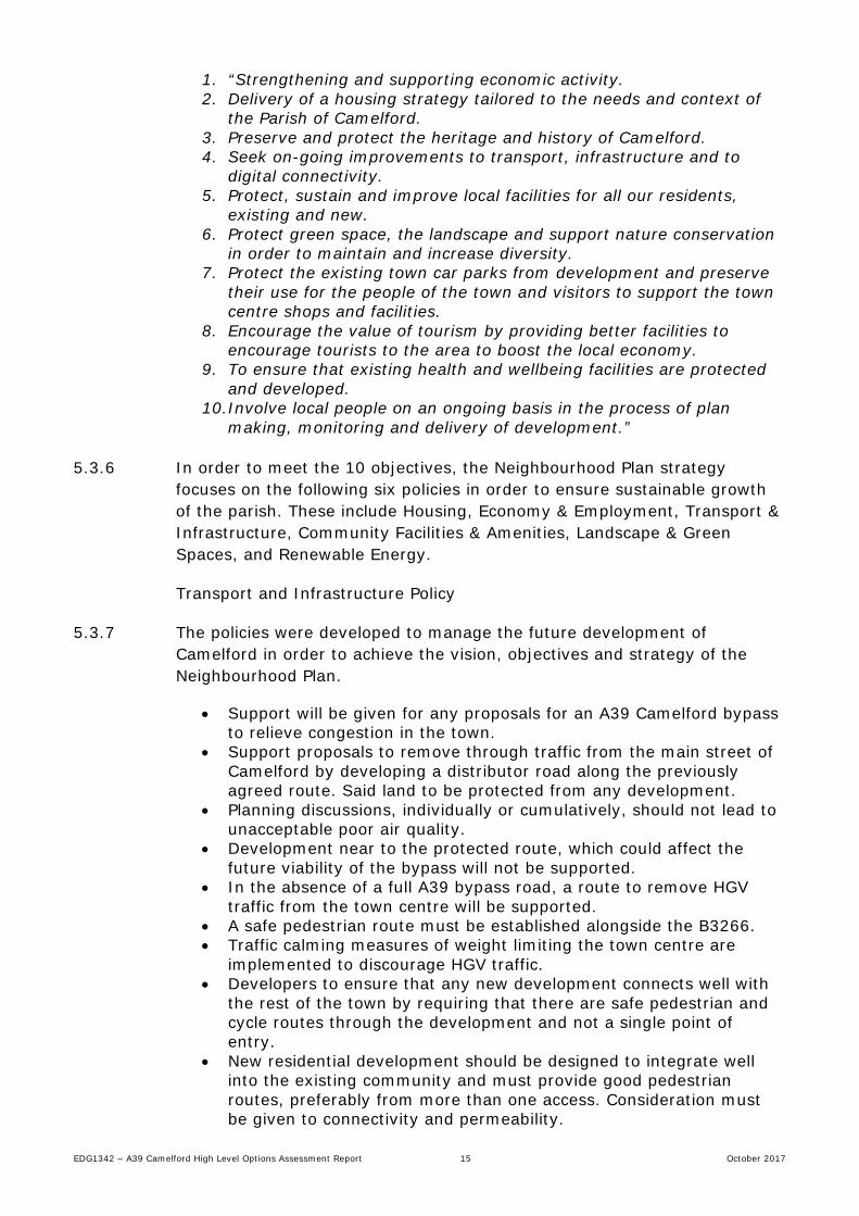
EDG1342 – A39 Camelford High Level Options Assessment Report 15 October 2017
1. “Strengthening and supporting economic activity. 2. Delivery of a housing strategy tailored to the needs and context of
the Parish of Camelford. 3. Preserve and protect the heritage and history of Camelford. 4. Seek on-going improvements to transport, infrastructure and to
digital connectivity. 5. Protect, sustain and improve local facilities for all our residents,
existing and new. 6. Protect green space, the landscape and support nature conservation
in order to maintain and increase diversity. 7. Protect the existing town car parks from development and preserve
their use for the people of the town and visitors to support the town centre shops and facilities.
8. Encourage the value of tourism by providing better facilities to encourage tourists to the area to boost the local economy.
9. To ensure that existing health and wellbeing facilities are protected and developed.
10.Involve local people on an ongoing basis in the process of plan making, monitoring and delivery of development.”
5.3.6 In order to meet the 10 objectives, the Neighbourhood Plan strategy
focuses on the following six policies in order to ensure sustainable growth of the parish. These include Housing, Economy & Employment, Transport & Infrastructure, Community Facilities & Amenities, Landscape & Green Spaces, and Renewable Energy.
Transport and Infrastructure Policy
5.3.7 The policies were developed to manage the future development of Camelford in order to achieve the vision, objectives and strategy of the Neighbourhood Plan.
• Support will be given for any proposals for an A39 Camelford bypass to relieve congestion in the town.
• Support proposals to remove through traffic from the main street of Camelford by developing a distributor road along the previously agreed route. Said land to be protected from any development.
• Planning discussions, individually or cumulatively, should not lead to unacceptable poor air quality.
• Development near to the protected route, which could affect the future viability of the bypass will not be supported.
• In the absence of a full A39 bypass road, a route to remove HGV traffic from the town centre will be supported.
• A safe pedestrian route must be established alongside the B3266. • Traffic calming measures of weight limiting the town centre are
implemented to discourage HGV traffic. • Developers to ensure that any new development connects well with
the rest of the town by requiring that there are safe pedestrian and cycle routes through the development and not a single point of entry.
• New residential development should be designed to integrate well into the existing community and must provide good pedestrian routes, preferably from more than one access. Consideration must be given to connectivity and permeability.

EDG1342 – A39 Camelford High Level Options Assessment Report 16 October 2017
• Site layouts must be designed to provide safe routes to schools and other local amenities, including the town centre and giving consideration to footpaths and cycle paths where appropriate. Any leisure provision within or associated with a residential development must be designed to encourage use by both future and existing residents.
• Developments that cause a significantly adverse impact on the local road network that cannot be managed or mitigated will not be supported.
5.3.8 A draft drawing showing the allocation of development sites for Camelford
can be found in Appendix B. The sites were selected due to:-
• Ease of access to the town centre facilities without the use of a car • Ease of access to the protected by-pass route and / or the HGV relief
road. Development of selected sites will be closely linked to the improvement of the road infrastructure
• Ease of access to education and leisure facilities without use of a car

EDG1342 – A39 Camelford High Level Options Assessment Report 17 October 2017
6 REVIEW OF CAMELFORD BYPASS PROPOSALS
6.1 Benefits of Bypass
6.1.1 The construction of a bypass scheme would bring about the following benefits:-
• A reduction in the level of traffic and number of HGVs travelling through the town centre, diverting the traffic onto a more appropriate route
• Reduced delays for traffic using the A39 as a strategic access route linking towns and villages along the north coast of Devon and Cornwall
• Removes the main causes of poor air quality from the town centre • Reduced driver frustration • More resilient journey times • Supports the key objectives of the Council’s Local Transport Plan 3
(Connecting Cornwall:2030) by:- o Reducing noise and air quality impacts o Ensure a resilient and reliable transport system for people,
goods and services o Support the vitality and integrity of our town centres and rural
communities • The need for a bypass is highlighted as the main transportation
priority for the town in the Draft Neighbourhood Plan for Camelford • Cornwall Council Local Plan identifies the main transportation
objective as addressing congestion within Camelford town centre • Permits expansion of employment opportunities for Camelford which
has been identified as key to the regeneration potential of the town.
6.2 Historic Scheme Costs
6.2.1 Camelford Distributor Road was entered in the Local Transport Plan (LTP) in 2001 at an estimated construction cost of £5.05m, with a total project outturn cost of £6.8m allowing for land costs, design costs and 3% per annum inflation over the course of the project. In the LTP 2003, the total project outturn was revised to £8.043m.
6.2.2 In order to obtain certainty of construction cost, tenders were sought in spring 2003 to involve a contractor in the detail design development of the project. Costain Ltd was the successful contractor and confirmed, as did the other tenderers, that the estimated construction costs in the tender documents were of the right order. Separately, independent quantity surveyors, Trett Consulting and Leach Consultancy, examined the estimates in May 2003, and recommended increases of between 5 & 9% on the totals.

EDG1342 – A39 Camelford High Level Options Assessment Report 18 October 2017
6.2.3 Tacit agreement to cross the Camel Valley Special Area of Conservation (SAC) had been initially obtained from English Nature during the preparatory design stage. Following appointment of the Contractor, more detailed engineering assessments were made and during further detailed discussions with CCC and Costain in August/September 2003, English Nature identified a particularly sensitive issue in the valley. This resulted in alterations being required to the route and to the type of viaduct that could be constructed. These alterations resulted in a significant increase in the estimated out-turn cost of the scheme.
6.2.4 Table 6.1 below compares the cost estimate entered into the Local Transport Plan in 2001, with the revised design following the appointment of Costain, showing the main increases in cost.
LTP 01 Dec 03 Costain
Land / Compensation £460,000 £1,227,329
Preliminaries £598,826 £1,527,971
Earthworks £522,966 £1,081,141
Estimated Quantities 99,000m3 134,246m3
Drainage £401,495 £969,655
Estimated Quantities (Pavement Area) 50,670m2 51,696m2
Pavement £1,070,653 £1,885,483
Estimated Quantities (Pavement Area) 50,670m2 51,696m2
Structures £1,241,383 £2,947,479
Inflation £910,000 £2,513,502
Table 6.1 Camelford Bypass Cost Comparison between LTP01 and Costain’s 2003 cost
6.2.5 The total cost estimate for the scheme, excluding the land costs and design fees, but allowing for inflation at 5.5% per annum was costed at £12.46m. This is shown in Table 6.2 below.
Estimated Costs
Con
stru
ctio
n
Works £8,913,083
Lan
d C
osts
Acquisition £286,023
Risk £668,481 Compensation £466,335
Contractor Overhead & Profit £474,287 Part 1 Claims £405,500
Total £10,055,851 Total £1,157,858
Inflation £2,403,348 Inflation £69,471
TOTAL £12,459,199 TOTAL £1,227,329
Table 6.2 Camelford Bypass 2003 Construction Costs
6.2.6 As part of the review by Costain, risk was priced at 7.5% of the works cost, whilst contractor overhead & profit was been priced at 4.95% of works cost and risk. Optimism Bias has not been included in the estimate.
6.2.7 The design fees for the scheme were estimated at £1.65m, giving a total scheme cost of £15,335,217.

EDG1342 – A39 Camelford High Level Options Assessment Report 19 October 2017
6.2.8 It was estimated that an out-turn saving of approximately £800,000 could be achievable as a result of constructing a lower standard carriageway and amendments to the design for the bridge structure.
6.3 2010 Construction Cost Update
6.3.1 As part of the A30 Temple to Higher Carblake scheme, the cost of the Camelford bypass was reviewed as a means to assessing the use of the A39 as an alternative to a dual carriageway scheme on the A30.
6.3.2 The original construction cost of £10.06m was brought up to 2010 prices using the Council’s Baxter rate from the Term Maintenance Contract as a quick assessment. This method estimated that the construction costs for the scheme would have increased to £14.35m. A review of the land and design costs was not undertaken at this time.
6.3.3 A review of the inflation rates between 2003 and the current year (see section 6.3 below) has suggested that the £14.35m was an overestimation. Based on the actual inflation rates between 2003 and 2010 an average of 3% inflation was experienced. This would have therefore calculated the 2010 construction cost of the Camelford bypass at approximately £12.4m.
6.4 2017 Construction Costs
6.4.1 Using the UK inflation rates since 2003, the original construction costs were updated to reflect the current predicted costs.
6.4.2 Table 6.3 shows the inflation rates from 2003 to 2017 as well as the calculated construction cost for that year.
Year Inflation Estimated Construction Cost
2003 Base £10,055,851
2004 3.00% £10,357,527
2005 2.80% £10,647,537
2006 3.20% £10,988,258
2007 4.30% £11,460,754
2008 4.00% £11,919,184
2009 -0.50% £11.859,588
2010 4.60% £12,405,129
2011 5.20% £13,050,196
2012 3.20% £13,467,802
2013 3.00% £13,871,836
2014 2.40% £14,204,760
2015 1.00% £14,346,808
2016 1.80% £14,605,050
2017 2.90% £15,028,597
Table 6.3 Increases in construction costs as a result of inflation since 2003

EDG1342 – A39 Camelford High Level Options Assessment Report 20 October 2017
6.4.3 Risk and contractor overhead & profit have been priced as per the 2003 review and included in the construction costs shown in Table 6.3. Optimism Bias has again not been included in the estimate.
6.5 2017 Land Costs
6.5.1 As shown in Table 6.2, the Costain review in 2003 calculated land acquisition costs to be £286,023, compensation costs of £466,335 and Part 1 claims of £405,500.
6.5.2 According to Savills Market Survey for UK Agricultural Land (2015) the cost of agricultural land increased dramatically between 2004 and 2014 by 277% for prime arable land or 254% across all types of arable land. This would increase land acquisition costs to £726,498.42 for 2014, but is considered to be too great an increase in costs to be realistic.
6.5.3 Following the recent pricing exercise for the A30 St Austell link scheme, an alternative methodology for pricing land was adopted. This included acquisition costs of £10,000 per acre (slightly above market value, which may be in the region of £8,000 per acre based upon the quality of agricultural land being acquired) as well as legal costs of £3,000 per acquisition and £3,500 to cover Land Agent fees.
6.5.4 It is estimated that the by-pass scheme would require the acquisition of approximately 160,000m2 of agricultural land (approximately 39.5 acres or 16 hectares).
6.5.5 Based upon the rate of £10,000 per acre, Land acquisition costs are predicted to be £394,414 at 2017 prices. The total cost for acquisition including the legal and agent fees is expected to total £556,914.
6.5.6 By increasing the compensation and Part 1 claims cost in accordance with inflation since 2003 (as per the inflation rates used in Table 6.3) the 2017 estimated costs are as shown in Table 6.4 below.
Land Costs (2017 prices)
Acquisition £556,914
Compensation £696,944
Part 1 Claims £606,025
TOTAL £1,859,883
Table 6.4 Estimated Land Acquisition Costs (2017)
6.6 2017 Design costs
6.6.1 The design fee for the scheme in 2003 was predicated at £1.56m (£1.65m including inflation).
6.6.2 The A30 St Austell link scheme calculated the design fees as a percentage of the total works cost. As a benchmark across the industry a percentage of between 10 and 30% is typically used.

EDG1342 – A39 Camelford High Level Options Assessment Report 21 October 2017
6.6.3 The 2003 design fees were 15.51% of the total construction cost (excluding inflation costs). Assuming the same percentage split for the 2017 scheme, it is therefore estimated that the design fees would cost in the region of £2.33m.
6.7 Client and Project Control Costs
6.7.1 The cost of Client involvement was not included in the previous estimates. Neither was the cost for a Project Control company to undertake the management of the scheme and supervision.
6.7.2 The Client costs have been calculated at 5% of the works cost which is £960,942, while Project Control is calculated at 10% of the works costs which is calculated as £1,921,885.
6.8 2017 Whole Project Costs
6.8.1 Using the methodology described in Chapters 6.3 to 6.7, constructing the bypass scheme at 2017 prices is estimated to cost £22,101,677 (see Table 6.5 below for breakdown)
Whole Project Costs (2017 Prices)
Works Cost £13,320,715
Risk £999,053
Contractor OH & P £708,828
Land Acquisition & Compensation Cost £1,859,882
Design Cost £2,330,371
Client Costs £960,942
Project Control Cost £1,921,885
TOTAL £22,101,677
Table 6.5 2017 Whole Project Costs for the By-pass route (2017)
6.9 2023 Construction Costs
6.9.1 Should funding be secured for the scheme, construction would not take place for a few years, therefore it is important to estimate the future cost of the scheme.
6.9.2 The future inflation profile until 2022/ 2023 has been predicted using the Royal Institution of Chartered Surveyors (RICS) Building Cost Information Service (BCIS) All-in Tender Price Index (TPI) #101 as shown in Table 6.6. Two separate estimates have been included as a result of the future economic uncertainty over the UKs withdrawal from the European Union. In the estimates the calculation producing the highest future cost will be used for improved cost certainty.

EDG1342 – A39 Camelford High Level Options Assessment Report 22 October 2017
Year RICS BCIS All-in TPI #101 v1 RICS BCIS All-in TPI #101 v2
Inflation Estimated Construction Cost Inflation Estimated
Construction Cost
2017 Base £15,028,597 Base £15,028,597
2018 1.00% £15,178,882 3.00% £15,479,454
2019 0.40% £15,239,598 2.50% £15,866,441
2020 3.00% £15,969,786 3.50% £16,421,766
2021 5.60% £16,575,806 5.00% £17,242,854
2022 6.20% £17,603,506 5.50% £18,069,427
2023 4.00% £18,307,646
Table 6.6 Increases in construction costs as a result of predicted inflation from 2017 to 2023
6.10 2023 Land Costs
6.10.1 The future inflation profile for land cost until 2022/ 2023 has been predicted using the Savills Market Survey for UK Agricultural Land (2015) which estimates an increase in land type of 8% per annum on top quality agricultural land, 4-6% per annum on average quality and 0 to 3% on poor quality land. As the land is grade 3 & 4 agricultural land, this is considered average / poor, therefore a 3% increase in costs per annum has been used.
6.10.2 The cost of compensation and Part 1 claims until 2022 / 2023 has been calculated using the RICS BCIS All-in Tender Price Index (TPI) #101 future inflation profile used in Table 6.6.
6.10.3 Table 6.7 below calculates the predicted inflation for the land costs, compensation costs and Part 1 claims to the year 2023.
Year Land
Inflation
Estimated Land
Acquisition Cost
Inflation Estimated
Compensation Cost
Estimated Part 1 Claims Cost
2017 Base £556,914 Base £696,944 £606,025
2018 3.00% £573,621 1.00% £703,913 £612,085
2019 3.00% £590,830 0.40% £706,729 £614,533
2020 3.00% £608,555 3.00% £727,931 £632,969
2021 3.00% £626,811 5.60% £768,695 £668,416
2022 3.00% £645,616 6.20% £816,354 £709,858
2023 3.00% £664,984 4.00% £849,008 £738,252
Table 6.7 Increases in land costs as a result of predicted inflation from 2017 to 2023
6.11 2023 Design Costs
6.11.1 By applying the same percentage cost for the design fees to the updated construction costs, we are able to predict the design fees for the future years.
6.11.2 Table 6.8 below shows the predicted design fees up until 2023.

EDG1342 – A39 Camelford High Level Options Assessment Report 23 October 2017
Year Estimated Design Cost
2017 £2,330,371
2018 £2,353,675
2019 £2,363,090
2020 £2,433,982
2021 £2,570,285
2022 £2,729,643
2023 £2,838,829
Table 6.8 Increases in design costs as a result of predicted inflation from 2017 to 2023
6.12 Client and Project Control Costs
6.12.1 By applying the same percentage cost for the Client and Project Control fees to the updated construction costs, we are able to predict the fees for the future years.
6.12.2 Table 6.9 below shows the predicted Client & Project Control fees up until 2023.
Year Estimated Client Cost Estimated Project Control Cost
2017 £960,942 £1,921,885
2018 £971,210 £1,942,419
2019 £975,839 £1,951,680
2020 £1,005,122 £2,010,244
2021 £1,060,602 £2,121,203
2022 £1,125,350 £2,250,700
2023 £1,169,936 £2,339,872
Table 6.9 Increases in Client and Project Control costs as a result of predicted inflation from 2017 to 2023
6.13 2023 Whole Project Costs
6.13.1 Using the methodology described in Chapters 6.7 to 6.9, whole project costs for the years to 2023 can be found in Table 6.10 below.
Year Estimated Works Cost
Estimated Risk
Estimated Contractor OH & P
Estimated Land
Acquisition &
Compensation Cost
Estimated Design
Cost
Estimated Client Cost
Estimated Project Control
Cost
TOTAL
2017 £13,320,715 £999,053 £708,828 £1,859,882 £2,330,371 £960,942 £1,921,885 £22,101,677
2018 £13,453,922 £1,009,044 £715,916 £1,891,637 £2,353,675 £971,210 £1,942,419 £22,337,824
2019 £13,507,738 £1,013,080 £718,780 £1,914,111 £2,363,090 £975,839 £1,951,680 £22,444,318
2020 £13,912,970 £1,043,472 £740,343 £1,971,675 £2,433,982 £1,005,122 £2,010,244 £23,117,809
2021 £14,692,097 £1,101,907 £781,802 £2,065,943 £2,570,285 £1,060,602 £2,121,203 £24,393,839
2022 £15,603,007 £1,170,225 £830,274 £2,173,849 £2,729,643 £1,125,350 £2,250,700 £25,883,048
2023 £16,227,127 £1,217,034 £863,485 £2,252,244 £2,838,829 £1,169,936 £2,339,872 £26,908,527
Table 6.10 Increases in whole project costs as a result of predicted inflation from 2017 to 2023

EDG1342 – A39 Camelford High Level Options Assessment Report 24 October 2017
6.13.2 It is therefore predicted that to construct the scheme in 2023 would cost
£26,908,527 (excluding Optimism Bias).
6.14 Optimism Bias
6.14.1 Optimism Bias is an adjustment applied to estimates to allow for the tendency for those involved in projects, to be too optimistic in terms of forecasting project costs, scale, timing and benefits. Accordingly, advice is that in any appraisal an Optimism Bias adjustment should be made.
6.14.2 The main objectives of applying Optimism Bias is to:-
• Make adjustments to the estimates of capital and operating costs, benefits values and time profiles; and
• Provide a better estimate of the likely capital costs and works’ duration
6.14.3 For a standard civil engineering project in the early stages, Optimism Bias is applied at 44% of the total costs.
6.14.4 Applying Optimism Bias to the cost for the bypass would increase the costs to £31,826,415 for 2017, while for 2023 the total cost would be £38,748,278.
6.15 Suitability of Current Design
6.15.1 The 2004 design contained carriageway widths of 3.65m with a 1m hard strip (9.3m total width) and 2.5m verges.
6.15.2 The route of the 2004 design can be seen on drawings EDG1342-CSL-GEN-SX105835-DE-D-0001 and EDG1342-CSL-GEN-SX105835-DE-D-0002.
6.15.3 Although documented evidence could not be found in any of the historic files, it is believed that the design speed for the bypass was 100kph. Notes from a meeting held in October 2003 discussing potential cost savings considered reducing the design speed to 85kph.
6.15.4 The bypass route would have a theoretical capacity of 13,000 (based upon a single carriageway road). This would be sufficient capacity to cope with the current traffic flows on the A39 (including the seasonal uplifts) as well as the predicted increases in traffic flows to 2030 as highlighted in Chapter 4.
6.15.5 Should the bypass scheme be progressed further, the design will need to be reviewed in light of development since planning was submitted in 2004 and also for future development highlighted in the Local & Neighbourhood Plans to ensure that it remains fit for purpose.

EDG1342 – A39 Camelford High Level Options Assessment Report 25 October 2017
6.16 Recommendation
6.16.1 It is considered that the construction of a bypass of Camelford would be a suitable long term solution to addressing the issues of increased traffic flows and poor air quality currently evident within the town centre.
6.16.2 If the bypass option is to be pursued, there is considerable further work required to inform a funding application.
6.16.3 It is recommended that further funding is sought so that a more detailed feasibility study can be undertaken which would permit a review of the 2004 traffic modelling exercise.
6.16.4 If further funding is sought, this should include the development of an Outline Business Case to assess the economic viability of the scheme.
6.16.5 It is anticipated that funding in the region of £1m would be required in order to develop the Outline Business Case for the scheme to permit submission to the Department for Transport, with a timescales for delivery of between 18 months to 2 years from commissioning.
6.16.6 The Outline Business Case would need to be produced to meet five specific cases, defined by the DfT as being Strategic, Economic, Financial, Commercial and Management.
6.16.7 The bypass scheme can be seen to meet the five cases due to:-
Strategic – The issues of congestion, journey time reliability, poor resilience of the route, poor air quality are aligned with the key objectives of the Council’s Local Transport Plan Connecting Cornwall: 2030 by reducing noise and air quality impacts, improving road safety, ensuring a resilient and reliable transport system for people, goods and services and by supporting the vitality and integrity of our town centres and rural communities. Economic – The economic outputs of the scheme will need to be fully assessed, however as part of the scheme assessment carried out in 2003 the Benefit to Cost ratio of the scheme was calculated to be between 1.18 (low growth) and 1.78 (high growth). Financial – Funding for the scheme is to be decided, though it is anticipated that the Department of Transport would be the most suitable funding. This may be supplemented through a level of match funding from the Council or other available funding streams. Commercial – It is anticipated that a reference design for the project would be developed by the Council’s “in-house” arms-length design unit, CORMAC Solutions Ltd with support from their Framework partner AECOM. Procurement for the Construction of the project would follow the Council’s procurement guidelines, using NEC 3 Option C (Target price) as a Design & Build Contract. Management – The management of the development and delivery of the project would be undertaken by Cornwall Council as the lead authority, with project management methodology based on PRINCE2.


EDG1342 – A39 Camelford High Level Options Assessment Report 27 October 2017
7 HIGH STREET INTERVENTIONS
7.1 Introduction
7.1.1 This section looks to identify the key on-street issues and test a number of scenarios which could assist in addressing the identified traffic problems in Camelford.
7.2 Current Layout
Figure 7.1 – Current on-street layout
7.2.1 The current layout of Camelford is shown in Figure 7.1, highlighting the
following:

EDG1342 – A39 Camelford High Level Options Assessment Report 28 October 2017
• Shuttle works, priority section • Traffic light controlled area • Pedestrian crossing • Loading bay locations • Free public car parks • Road accesses between and including Clease Road and the North Car
Park.
7.2.2 To briefly summarise Figure 7.1; there are 9 road accesses onto the A39, 2 pedestrian crossings (north signal controlled), 3 loading bays and 2 free car parks (with an additional small number of ½ hour spaces between the library and hotel).
7.2.3 A 12 hr pedestrian crossing survey carried out in 2004 indicated that there were 794 trips (388 West to East and 406 East to West) in the survey period, with the peak being 1,000 with a total of 146 trips made.
7.3 Existing Issues
7.3.1 One of the key issues identified in Camelford is in relation to air quality. The results of the NO2 monitoring locations are shown in Fig 7.2 below.
Figure 7.2 – NO2 monitoring locations 2015, Air Quality Assessment (2016)
7.3.2 Areas indicated by a red dot, and showing NO2 concentrations of >60ug/m3
are the approximate locations of the signal heads and the priority system. The worst case position is recorded to be by the southbound traffic lights.
7.3.3 The air quality assessment report (2016) suggested that the rise in NO2 and NOx can be largely attributed to vehicles idling whilst waiting at both the priority system and the traffic lights, as well as the canyon effect of the narrow streets and high buildings.

EDG1342 – A39 Camelford High Level Options Assessment Report 29 October 2017
7.3.4 Similarly the number of vehicles travelling through Camelford has increased in recent years. AADT data from 2010 indicates a rise in the number of vehicles travelling along the A39 by just over 20% (as shown in Table 4.1, 5,516 vehicles in 2010 increasing to 6,637 in 2016).
7.3.5 It has been suggested that this rise may be partially be attributed to the A30 Temple to Higher Carblake and Bodmin town centre roadworks which could have resulted in vehicle reassignment as people attempt to avoid roadwork delays. It is a reasonable assumption to assume traffic flows will decrease with the opening of A30 Temple in particular.
7.3.6 The upwards trend in number of vehicles on the route, has added additional stress onto the Camelford network and added to local congestion.
7.3.7 A number of side roads which adjoin the A39 within Camelford have poor emergence visibility. This is particularly prominent on Clease Road and Chapel Street.
7.3.8 Chapel Street is a one way road exiting onto the A39. The location of this side road is north of the traffic lights and visibility for emerging traffic is poor to the south of the junction due to both hard and soft physical obstructions.
7.3.9 Emerging traffic from Clease Road is also poor, this is due to hard physical obstructions, mainly housing and geometric design of the road.
7.3.10 A number of car parks and concealed entrances are located along the A39 High Street route, adding to turning movements along the network.
7.3.11 Footpaths are narrow and on a steep gradient throughout Camelford’s High Street, making the footways unappealing for wheelchair users.
7.3.12 In the Design manual for Roads and Bridges (DMRB TA90/05 - The Geometric Design of Pedestrian, Cycle and Equestrian Routes) specifies that the acceptable minimum for pedestrian routes is 2 metres and 1.3 metres may be provided over short distances if necessary. The preferred width is quoted as 2.6 metres. Cornwall Councils standard document “Development Layout Design: General Design Considerations for Adoptable Highways” specifies a minimum footway width of 1.8m.
7.3.13 Sections of the pavement through Camelford are below the accepted 1.3 metres, particularly along the western side of the road where the pavement narrows to below 1m along some sections.
7.3.14 Loading bays and bus stops are located outside:
• The co-operative food shop – south of the traffic lights, north of the priority system
• Lloyds Bank – between the traffic lights • Needle and thread, and Bliss shop – between the traffic lights • Bus stop to the north of the lights outside Spar

EDG1342 – A39 Camelford High Level Options Assessment Report 30 October 2017
7.3.15 Designated parking along the High Street is minimal, however there are 2 free car parks located at either side of Camelford traffic lights. One is Clease Road, the other adjacent to the church of St Thomas of Canterbury.
7.3.16 A small number of 30 min parking spaces are located adjacent to the Darlington, as well as a number of small car parks for businesses. However, there is evidence of cars parking or waiting in the designated loading bays as well, particularly outside the Co-op.
7.4 Options Being Investigated
7.4.1 Three options have been proposed for model testing as well as the current on street signals layout. The first option is linked to changes at the current signal location. The final two are proposals for signals at the current priority system, south of the traffic lights. These areas are indicated in Figure 7.3 below.
Figure 7.3 – Location points for traffic control
7.4.2 Option 1 involves the adjustment of the traffic signals so that they are
further apart. This moves the positions of where cars must wait. See drawing EDG1342-CSL-GEN-SX105835-DE-D-0006.
7.4.3 Option 2 considers the signalisation of the priority system outside of Co-op in High Street, using a 2 way signalised layout. This design involves positioning traffic signals on the A39, either side of the priority system. Side roads incorporated within the signalised zone are able to egress onto the A39 at the driver’s judgement. This option may require the removal or the relocation of the Co-op parking bay, however the existing zebra crossing will remain. See drawing EDG1342-CSL-GEN-SX105835-DE-D-0007.
Southbound Traffic Lights
Northbound Traffic Lights
Un-signalised Priority System

EDG1342 – A39 Camelford High Level Options Assessment Report 31 October 2017
7.4.4 Option 3 includes 3 way signalisation of the same priority system as Option 2. This includes the signalisation of the A39 and the B3266 (Clease Road). In this option the signal heads are designed to be further back than those in option 2 to incorporate the third arm. This may involve the removal or the relocation of the loading bay and the current zebra crossing. A pedestrian phase could be incorporated into the traffic signals to compensate for the loss of the zebra crossing. See drawing EDG1342-CSL-GEN-SX105835-DE-D-0008.
7.5 Issues & Benefits
7.5.1 General benefits of the proposed scenarios are:
• Relocation of the signals stop line moves the location of the waiting queue into a more open area, in order to assist in the dispersal of NOx gases away from the main Camelford street
• Either 2 way or 3 way traffic signals at the priority junction will allow for organised movement along this section of the network
• Synchronising two signalised junctions could reduce queues within the “enclosed” area of Camelford, instead organising queuing to the south of the un-signalised priority and to the north of the signalised section.
7.5.2 The issues however are as follows:
• Queueing will still occur and affect air quality • The longer the internal area of the junction between signal heads, the
longer the waiting and subsequent queuing lengths • There are a number of side roads which may require amending should
changes be made • Location of signal heads and other street furniture could be challenging
based on the highway geometry and parking bay areas. 7.6 Traffic Modelling Methodology
7.6.1 Modelling has been carried out using the LinSig 3.2 modelling software, testing the current signalised junction and the 3 proposed scenarios.
7.6.2 LINSig is a shortened word for ‘Lincolnshire Signals’, and was developed by the Lincolnshire County Council using developed equations based on empirical research. The software program uses aggregated traffic flows as the main data input and evenly distributes these flows across a set averaged period. Equations are used to calculate and split green times and total cycle time evenly for each time period in relation to delay and queueing. The signals calculations in LINsig orientate around the role of phases, this is intended to more accurately reflect the operation of an ‘on–street’ traffic signal controller.
7.6.3 A number of parameters are required for the models, the assumptions and data incorporated into the models are described in the following section.

EDG1342 – A39 Camelford High Level Options Assessment Report 32 October 2017
7.6.4 Traffic flows have been calculated using available Manual Turning Counts (MTC) data. Figure 7.4 indicates the locations of available MTC data and Table 7.1 summarises the junction name and collection date.
Junction Name Collection date
1 Washaway 30/07/2014
2 Sportsmans Rd/ Clease Rd 29/06/2015
3 High St/Clease Rd 25/07/2016
4 Camelford Station 22/08/2016
5 Collans Cross NE Camelford 14/09/2011
6 A39/Sportsmans Rd 21/08/2013
Table 7.1 – MTC junction summary
Figure 7.4 – MTC junction count locations
7.6.5 Both the existing traffic signals and the location of proposed signals are just
north of junction 3 where data was collected and the priority system is located just south of the junction. Therefore data from junction 3 is used to test all the scenarios. Data has been summarised and rounded to the nearest 50 vehicles, to simplify the modelling (with the exception of Clease Road, which has been rounded to the nearest 10 vehicles).
7.6.6 The base model has been developed using the existing signal positioning, and operational characteristics.
7.6.7 The current traffic signal system provides separate green periods for the following three traffic movements:
• A39 South • A39 North • Small car park

EDG1342 – A39 Camelford High Level Options Assessment Report 33 October 2017
7.6.8 Due to the size of this car park it is known that this phase is rarely called
and therefore this phase has been omitted from the modelling to achieve a more realistic output.
7.6.9 Phasing of the signals has been set so that phase A is always the most northerly point and moves in a clockwise direction. Therefore the A39 southbound traffic lights are phase A and the A39 northbound is phase B in all scenarios. There is an additional phase C in option 3 which is for Clease Road to the west of the junction.
7.6.10 A key parameter in the model is saturation flow, which is defined as ‘the theoretical discharge rate of vehicles across the stopline.’ Saturation flows have been assumed to be 1800 for straight ahead and, for turning traffic this is generally set at 1600 pcu/hr. (Note - pcu refers to passenger car units which is a measure used primarily to assess highway capacity, for modelling purposes. Different vehicles are assigned different values, according to the space they take up. A car has a value of 1; smaller vehicles will have lower values, and larger vehicles will have higher values.)
7.6.11 However, the pcu/hr for Camelford has been assumed on some junctions to be lower than 1800 and 1600, due to the confined nature of the route and the steep gradient through the town. The following pcu/hr has been assumed for each scenario and associated junction arms.
Scenario A39 southbound
A39 northbound
Clease road
Current Signals 1600 1600 -
Signal extension 1600 1600 -
2 way signals 1600 1600 -
3 way signals 1600 1600 1500
Table 7.2 – Assumed pcu/hr for each scenario arm
7.6.12 The percentage of HGVs has been calculated for each junction and these
figures used to test the models. The figures were 5% HGV on the A39 northbound trips and approximately 4% HGV in the southbound trips. The HGV percentage travelling from Clease Road however was 1% of the total trips. The HGV and non-HGV flow has been combined to form a common factor known as passenger car units (PCU) the modelling then uses PCUs in analysis.
7.6.13 These distances have been used to calculate the intergreens. Intergreens represent a safety period to guard against collisions.
7.7 Traffic Modelling Results
7.7.1 The following tables provide the key results included from the LINSIG modelling, full modelling results can be found in Appendix C.
7.7.2 Recorded results include:

EDG1342 – A39 Camelford High Level Options Assessment Report 34 October 2017
• The relevant model peak period • The average signal cycle time for that period • The total site practical reserve capacity (PRC) for that period • The total traffic delay across whole junction • Each arm degree of saturation flow and mean max queues
7.7.3 In general the theoretical models have optimised the signal timings to give
the best results. The key figure in relation to results in the practical reserve capacity (PRC), if the PRC is positive the relevant junction layout is considered to be operating at acceptable levels. A positive PRC indicates that the layout has spare capacity.
Option description Base traffic with signal timings as on site
Period AM Peak (1000-1100) PM Peak (1700-1800)
Cycle time 56 seconds 56 seconds
Site PRC -25% -23.7%
Total traffic delay 48.3 pcu/hr 47.7pcu/hr
Deg
Saturation (%)
Mean Max Queue (PCU)
Deg Saturation
(%)
Mean Max Queue (PCU)
A39 SB 112.5 37.1 107.7 26.2
A39 NB 105.0 17.8 111.4 27.9
Table 7.3 – Base model with on-street cycle time configuration
Option
description Base traffic with model optimisation
Period AM Peak (1000-1100) PM Peak (1700-1800)
Cycle time 69 seconds 68 seconds
Site PRC 2.0% 0.6%
Total traffic delay 11.1 pcu/hr 11.8 pcu/hr
Deg
Saturation (%)
Mean Max Queue (PCU)
Deg Saturation
(%)
Mean Max Queue (PCU)
A39 SB 88.2 11.5 89.5 10.9
A39 NB 86.3 8.3 87.5 9.4
Table 7.4 – Base model with the model Practical Reserve Capacity (PRC) optimised
7.7.4 Two sets of models have been run for the base traffic data to indicate the
variance between onsite optimisation results and modelled optimisation results. The differences could be a result of a number of different factors including the following:
• The omission of the all red phases and the third arm signal control • The simplification of the traffic flows
7.7.5 Therefore these differences between the model and the actual signals
should be kept in mind when considering the following scenarios.

EDG1342 – A39 Camelford High Level Options Assessment Report 35 October 2017
Option description Traffic signal extension
Period AM Peak (1000-1100) PM Peak (1700-1800)
Cycle time 72 seconds 72 seconds
Site PRC 0% 0%
Total traffic delay 12.2 pcu/hr 12.3 pcu/hr
Deg
Saturation (%)
Mean Max Queue (PCU)
Deg Saturation
(%)
Mean Max Queue (PCU)
A39 SB 88 11.8 90 11.5
A39 NB 90 9.5 87.5 9.8
Table 7.5 – Extension of the traffic signals and stop lines
7.7.6 The results from the traffic signal extension, compared to the optimised base model shows:
• Extension of the stop line requires a longer cycle time • Results in longer traffic delays and queue lengths
7.7.7 Therefore the longer the distance made between the two signals, the worse
the impacts are shown to be.
Option description 2 way priority signals
Period AM Peak (1000-1100) PM Peak (1700-1800)
Cycle time 41 seconds 40 seconds
Site PRC 5.4% 2.9%
Total traffic delay 8.17 pcu/hr 9.03 pcu/hr
Deg
Saturation (%)
Mean Max Queue (PCU)
Deg Saturation
(%)
Mean Max Queue (PCU)
A39 WB 85.4 6.9 87.5 6.8
A39 EB 85.4 5.9 87.5 6.8
Table 7.6 – 2 way signalisation of the A39 at the current unsignalised priority junction
Option description 3 way priority signals
Period AM Peak (1000-1100) PM Peak (1700-1800)
Cycle time 78 seconds 69 seconds
Site PRC 1.2% 1.4%
Total traffic delay 13.2 pcu/hr 11.7 pcu/hr
Deg
Saturation (%)
Mean Max Queue (PCU)
Deg Saturation
(%)
Mean Max Queue (PCU)
A39 WB 87.8 12.4 88.8 9.8
A39 EB 88.9 9.9 86.3 8.7
Clease road 39.0 1.5 34.5 1.3
Table 7.7 – 3 way signalisation of the A39 and Clease Road at the current unsignalised priority junction

EDG1342 – A39 Camelford High Level Options Assessment Report 36 October 2017
7.7.8 Design of the 3 way priority assumes a certain level of use at Clease Road where it is called in every cycle, in reality an increase in capacity could be achieved if this minor road was called every other cycle where Clease Road is used less.
7.7.9 However, based on the modelling of the priority signals, the two arm signalisation is shown to be more efficient, with smaller minimum cycle times, and smaller queues on the main A39 arms.
7.8 MOVA
7.8.1 Microprocessor Optimised Vehicle Actuation (MOVA), is a sophisticated self-balancing control technique for Traffic Signals.
7.8.2 MOVA reduces delays and increases capacity, especially at congested junctions. Within the traffic signal controller a separate MOVA computer is located, the MOVA software sustains the optimum approach green period relevant to prevailing traffic conditions; this minimises queuing at traffic signals.
7.8.3 MOVA was created by the Transport Research Laboratory (TRL) and it is acknowledged that it is a sophisticated and efficient alternative to traditional Vehicle Actuated control.
7.8.4 The older Vehicle Actuation technique relies for its decision making process upon whether vehicles are present to extend the current stage green, as determined from detection up to a maximum 39m from the stopline. Where approach speeds are above 30 mph MOVA offers better green time availability, with a range of input parameters being adjusted to suit unique site specific characteristics employing detectors up to 90m from the stop line.
7.8.5 Signal controllers can be linked with one another, to provide co-ordination and avoid lost time due to lack of co-ordination. Therefore should option 2 or 3 be considered, MOVA may be used to assist in creating a co-ordinated ‘greenwave’ through Camelford.
7.9 Conclusion
7.9.1 Based on the modelling completed for the three proposed options the following conclusions can be made.
7.9.2 The extension of the current traffic signals will result in a negative impact on delays and queuing traffic, due primarily to the new requirement for more green time.
7.9.3 2 way signalisation of the current priority section is shown to be the most effective of the two signal options however there are a number of potential issues associated with this option. These are as follows:
• Location of the loading bay at co-op • Potential constraints for signal poles and stop lines

EDG1342 – A39 Camelford High Level Options Assessment Report 37 October 2017
• Consideration of pedestrian crossing location, currently a zebra crossing just north of Clease Road
• Number of accesses on to the A39 7.9.4 MOVA linking of the traffic signals could help, allowing a through flow of
traffic along the narrow sections of Camelford.
7.9.5 All these options stop traffic. Therefore air quality problems are quite likely to merely be relocated rather than removed from Camelford.
7.10 Recommendation
7.10.1 The introduction of a scheme within the town centre would be of a limited and short term benefit only.
7.10.2 There are limited opportunities to improve the existing layout of the town centre and the options investigated would not fully address the congestion or air quality issues.
7.10.3 The improvement to traffic flows may aid congestion and air quality, but this would not be a permanent solution able to cope with the predicted future traffic flows as discussed in Chapter 4.

EDG1342 – A39 Camelford High Level Options Assessment Report 39 October 2017
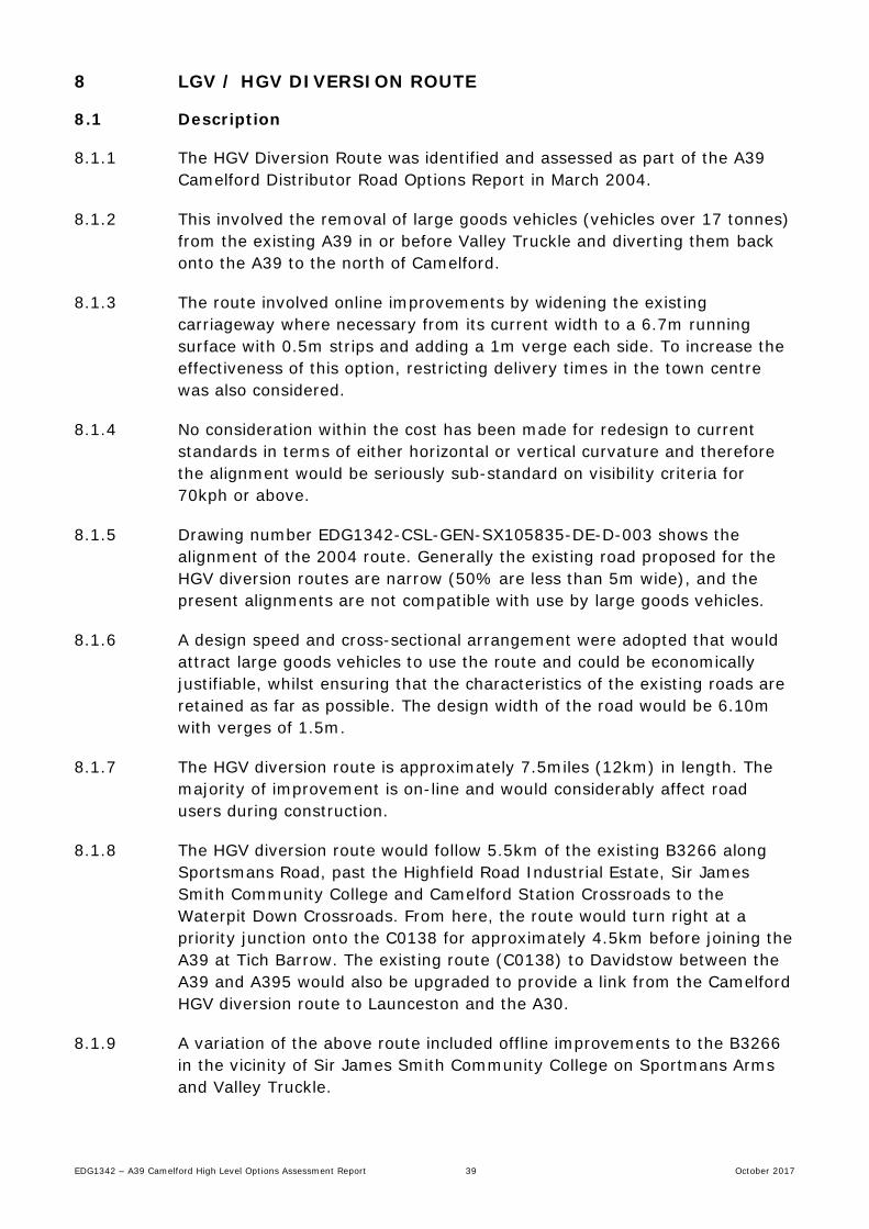
8 LGV / HGV DIVERSION ROUTE
8.1 Description
8.1.1 The HGV Diversion Route was identified and assessed as part of the A39 Camelford Distributor Road Options Report in March 2004.
8.1.2 This involved the removal of large goods vehicles (vehicles over 17 tonnes) from the existing A39 in or before Valley Truckle and diverting them back onto the A39 to the north of Camelford.
8.1.3 The route involved online improvements by widening the existing carriageway where necessary from its current width to a 6.7m running surface with 0.5m strips and adding a 1m verge each side. To increase the effectiveness of this option, restricting delivery times in the town centre was also considered.
8.1.4 No consideration within the cost has been made for redesign to current standards in terms of either horizontal or vertical curvature and therefore the alignment would be seriously sub-standard on visibility criteria for 70kph or above.
8.1.5 Drawing number EDG1342-CSL-GEN-SX105835-DE-D-003 shows the alignment of the 2004 route. Generally the existing road proposed for the HGV diversion routes are narrow (50% are less than 5m wide), and the present alignments are not compatible with use by large goods vehicles.
8.1.6 A design speed and cross-sectional arrangement were adopted that would attract large goods vehicles to use the route and could be economically justifiable, whilst ensuring that the characteristics of the existing roads are retained as far as possible. The design width of the road would be 6.10m with verges of 1.5m.
8.1.7 The HGV diversion route is approximately 7.5miles (12km) in length. The majority of improvement is on-line and would considerably affect road users during construction.
8.1.8 The HGV diversion route would follow 5.5km of the existing B3266 along Sportsmans Road, past the Highfield Road Industrial Estate, Sir James Smith Community College and Camelford Station Crossroads to the Waterpit Down Crossroads. From here, the route would turn right at a priority junction onto the C0138 for approximately 4.5km before joining the A39 at Tich Barrow. The existing route (C0138) to Davidstow between the A39 and A395 would also be upgraded to provide a link from the Camelford HGV diversion route to Launceston and the A30.
8.1.9 A variation of the above route included offline improvements to the B3266 in the vicinity of Sir James Smith Community College on Sportmans Arms and Valley Truckle.

EDG1342 – A39 Camelford High Level Options Assessment Report 40 October 2017
8.1.10 This offline section would commence at a major junction between Valley Truckle and the existing B3266(S) junction. The proposed junction would include a new link to the B3266(S). From Valley Truckle it would head North West approximately 150m south of the existing Valley Truckle B3266(N) junction and would cross the existing B3266 close to the Lanteglos Road and Hendra Lane junctions.
8.1.11 The B3266 would be diverted from its present alignment along Sportsmans Road from the C0567 junction (Hendra Road) to approximately 200m north of the Community College. Hendra Road would link to the B3266 to form a new junction.
8.2 Traffic
8.2.1 The traffic modelling undertaken in 2004, anticipated that traffic through Camelford (along the existing A39) would fall by around 2% compared to the Do Minimum Option.
8.2.2 Increases would occur along the rural stretches of the B3266 and other minor roads to the north of Camelford, by around 10% above the Do Minimum scenario.
8.2.3 The amount of large goods vehicle traffic through Camelford would decrease by around 30%, but would increase along the B3266 and rural roads to the north of Camelford.
8.3 Recent Road Improvements since the 2004 Review
8.3.1 A Local Safety Scheme was implemented at Waterpit Down Crossroads in late 2016 / early 2017.
8.3.2 This junction was considered as a Local Safety Scheme site on the 2014/2015 programme following a review of the Police reported accidents during the 3 year period between January 2011 and December 2013.
8.3.3 This revealed a total of three injury accidents and all involved the failure to give way or overshoot from the minor arm junctions into the path of vehicles travelling along the B3266.
8.3.4 Further collision analysis, covering a ten year period between 01/01/05 to 31/12/14 has shown that there have been other instances when vehicles have failed to give way or overshot the junction.
8.3.5 Previously, the alignment of the minor roads on approach to the give way markings, was straight allowing drivers to ‘see through’ the junction and mistakenly interpret that the road continues, uninterrupted, across the main road.
8.3.6 To highlight the presence of the junction and to reduce the likelihood of further collisions of this type, improvements to the junction included:

EDG1342 – A39 Camelford High Level Options Assessment Report 41 October 2017
• Realignment of the junction layout to allow splitter islands to be introduced and to create a slight stagger to highlight the presence of the junction.
• Provision of ‘keep left’ bollards on the splitter islands to alert drivers to the presence of the junction and segregate traffic movements.
• Rationalising of direction signs at the junction to avoid driver confusion.
8.3.7 The revised junction layout can be seen on drawings EDG0276_C_01 and
EDG0276_C_02.
8.3.8 The geometry of the junction would not permit the required turning movements for the largest HGVs in this area and therefore would need to be re-designed as part of the HGV diversion route.
8.4 Environmental Assessment of 2004 HGV Diversion Route
8.4.1 The HGV diversion route was assessed in 2004 as part of the Environmental Impact Assessment (EIA) for the bypass scheme in accordance with DMRB Volume 11.
8.4.2 A summary of the results of the assessment can be found in Table 8.1 below. (Please note that alternatives routes such as the western route and the “Do minimum” discussed in the table below are alternative routes assessed as part of the EIA in 2004 and are not relevant to this report)
Assessment Results
Air Quality • All levels of vehicle derived pollutants were predicted to be lower than present day levels by the year 2022.
• Air quality levels resulting from road vehicle emissions within the Camelford area as a result of the HGV Diversion Route in years 2007 and 2022 fell at those sensitive receptors near to the existing A39, albeit at low levels.
Cultural Heritage
• Significant impact on highway boundaries - approximately 5,700m3 of field and property boundaries are likely to be removed .
• The removal of almost 250 heavy goods vehicles from the town centre each day, these being the vehicles of most influence on the townscape, causing more vibration damage than others and contributing most of the particulate matter emissions that cause staining. Reductions in traffic, especially of the more damaging kind, will slow the rate of decay currently evident. Although many of the most damaging vehicles would be removed, they are relatively few in number, resulting in only a slight benefit to the townscape.
Disruption Due to Construction
• Disruption would occur along the length of the B3266, with a large number of properties potentially affected by dust and noise however, there is likely to be a fairly low level of dust or mud, as the works will be to existing carriageway.
• The amount of works on the B3266 means that there would be traffic disruption along it for several months.
Ecology and Nature
Conservation
• Significant loss of Cornish Hedges along the whole route. This will be mitigated by the construction of replacement hedges using site won materials
• Numerous badger setts, tracks and latrines were recorded in the study area. The high concentration of badger setts on this route means that without mitigation the impact would be of major significance.
Landscape Effects
• Whilst there are planning designation implications (3no. slight), these relate to the absolute edge of AONB and Heritage Coast designations for which the local roads provide a convenient boundary edge and are of no significance in the wider context of these designations.
Land Use • The HGV Diversion Route takes about 3ha of agricultural land, none of which meets the best and most valuable criterion. The land all lies at the margins of fields.
• In the main agricultural land impacts would relate to field accesses being adequately

EDG1342 – A39 Camelford High Level Options Assessment Report 42 October 2017
replaced. There would be minimal impacts likely to agricultural holdings. • Consideration of the limited area and value of land to be lost (agricultural), and the context
of the surrounding area, the scale of any disturbance to land use is not significant, with a negligible adverse impact expected.
Traffic Noise and Vibration
• By 2022, no residential properties would experience a reduction in road traffic derived noise, but 195 would experience a negligible but un-noticeable increase in road traffic noise.
Pedestrians, Cyclists,
Equestrians and Community
Effects
• The journey times for pedestrians within Camelford would not change significantly except for those routes that cross the B3266.
• No footpaths would be affected by the HGV Diversion Route. • The HGV Route does not result in any significant or noticeable change to the roads in and
around Camelford that would affect cyclists, other than a slight decrease in the amount of HGV traffic through the High Street.
• There would be (virtually) no impact on equestrians, due to the limited activity around Camelford.
• Overall, due to the negligible scale of the decrease in traffic through the town, and the minor increases along the B3266 and other roads along which HGVs would be diverted, no impact is predicted.
Vehicle Travellers
• There would be no changes for the vast majority of vehicle travellers while the HGV diversion route would result in a negligible decrease in driver stress.
Water Quality and Drainage
• The HGV diversion route would not pose a significant risk with a return interval of 1 in 324years.
• In terms of surface waters run-off affecting water quality, the HGV diversion route would not increase copper and zinc concentrations in the River Camel such that the concentrations exceed the relevant EQSs for these metals.
Geology and Soils
• The HGV Route utilises existing road corridors and would not require cuttings or embankments since it would be constructed along the existing road contours. Accordingly, this option would not affect local geology.
Table 8.1 Summary of Environmental Assessment of HGV Diversion Route, undertaken in 2004
8.4.3 The major environmental impact of the scheme was the significant loss of Cornish Hedges as well as the presence of numerous badger setts. If this option was to be progressed further, detailed mitigation measures would be required to offset these impacts.
8.5 Historic Scheme Cost (Dec 2003 Rates)
8.5.1 The estimated out turn cost for the HGV diversion route was approximately £10.7m at Dec 2003 rates, compared with the figure of £15.335m for the Western Route, showing a saving of some £4.635m. This comparison used similar rates, inflation and risk figures, however needs to be viewed with caution as the benefits to Camelford and the damage to the environment were not fully examined but likely to be less advantageous.
8.5.2 The above estimate of costs is for simply widening the existing carriageway (which is some 5.5 miles in length compared with the 2.5 miles for the 2004 bypass route) from its current width, which varies from about 5m to 7m (in a few locations) to a 6.7m running surface with 0.5m strips and adding a 1m verge each side (different design standard than was evaluated as part of the environmental assessment). An allowance for removal and rebuilding of Cornish hedge to one or both sides as appropriate and for nominal drainage and earthworks along with a pavement overlay has been made.

EDG1342 – A39 Camelford High Level Options Assessment Report 43 October 2017
8.5.3 No consideration within the cost has been made for redesign to current standards in terms of either horizontal or vertical curvature and therefore the alignment would be seriously sub-standard on visibility criteria for 70kph or above.
8.5.4 No examination of existing road surface condition was undertaken and therefore the structure of the road is unknown and could require full construction, in part an allowance for some reconstruction has therefore been made.
8.5.5 Junction improvements are likely to be needed in terms of both capacity and alignment and there are numerous entrances and accesses which would require some improvement. A new junction would be required on the eastern tie in to the A39.
8.5.6 It has been anticipated that there would be a requirement for “SuDS” drainage and again this has been allowed for.
8.5.7 The buildability of this scheme would require careful consideration and would lead to a piecemeal construction programme and hence higher material, plant and labour rates and a higher level of traffic management input.
8.5.8 Environmentally the removal of up to 10,000m of hedgerow is unlikely to be acceptable although the estimate covers the rebuilding of the same.
8.5.9 An additional option would be to modify the HGV route by introducing an improved offline section of carriageway between Valley Truckle and Sportsmans to reduce congestion and improve junctions in these locations. This would add at least £2.4m to the cost.
8.6 2017 Whole Project Costs
8.6.1 The level of detail available for use in updating the HGV diversion route cost is more limited than was available for the by-pass scheme, with only the provisional out-turn cost provided (excluding Optimism Bias).
8.6.2 It is therefore not known what percentage of this out-turn cost was attributed to the construction costs, land purchase or design costs. As a result, the only comparison that can be undertaken is to increase the total cost in accordance with inflation rates.
8.6.3 The 2003 prices for the HGV diversion route was £10.7m rising to £13.1m if the Valley Truckle Improvement is included. The increase in total scheme costs as a result of inflation are shown in Table 8.5 over the page.

EDG1342 – A39 Camelford High Level Options Assessment Report 44 October 2017
Year Inflation Estimated Construction Cost
HGV Route
Estimated Construction Cost HGV Route & Valley truckle
Improvement
2003 Base £10,700,000 £13,100,000
2004 3.00% £11,021,000 £13,493,000
2005 2.80% £11,329,588 £13,870,804
2006 3.20% £11,692,135 £14,314,670
2007 4.30% £12,194,897 £14,930,201
2008 4.00% £12,682,692 £15,527,409
2009 -0.50% £12,619,279 £15,449,772
2010 4.60% £13,199,766 £16,160,461
2011 5.20% £13,886,154 £17,000,805
2012 3.20% £14,330,511 £17,544,831
2013 3.00% £14,760,426 £18,071,176
2014 2.40% £15,114,676 £18,504,884
2015 1.00% £15,265,823 £18,869,933
2016 1.80% £15,540,608 £19,026,351
2017 2.90% £15,991,285 £19,578,116
Table 8.2 Increases in construction costs as a result of inflation since 2003
8.6.4 It should be noted that when compared to the bypass route, the calculation for the cost of the HGV route with Valley Truckle Improvement becomes more expensive at the current 2017 prices than the bypass route (£19.58m versus £19.22m for the bypass), when there was a £2.235m difference in 2003. This is as a result of the different calculation methods used.
8.6.5 A more appropriate method of estimating the increased costs for the project may be to work out the percentage increase in costs between the 2003 and 2017 costs for the bypass, and apply the same percentage uplift to the HGV diversion route costs.
8.6.6 The 2017 costs for the bypass were calculated to be 125.32% of the original 2003 scheme estimate. When this is applied to the 2003 rates for the HGV route, an out-turn cost of £13,409,767 is calculated, whilst for the HGV route with Valley Truckle Improvement, the out-turn cost at 2017 prices would be £16,417,566.
8.6.7 The addition of costs for the Client and Project Control will also be required, using the same 5% and 10% as per the bypass assessment. For the HGV diversion route these costs are calculated as £670,488 and £1,340,977, whilst for the HGV route with Valley Truckle Improvement the costs are £820,878 and £1,641,757 respectively.
8.6.8 For the HGV route, the whole project cost of £15,421,233 is calculated, whilst for the HGV route with Valley Truckle Improvement, the whole project cost at 2017 prices would be £18,880,201.

EDG1342 – A39 Camelford High Level Options Assessment Report 45 October 2017
8.7 2023 Whole Project Costs
8.7.1 The future inflation profile until 2022/ 2023 has been predicted using the Royal Institution of Chartered Surveyors (RICS) Building Cost Information Service (BCIS) All-in Tender Price Index (TPI) #101 as shown in Table 8.6 below. Two separate estimates have been included as a result of the future economic uncertainty over the UKs withdrawal from the European Union. In the estimates the calculation producing the highest future cost will be used for cost certainty.
Year
RICS BCIS All-in TPI #101 v1 RICS BCIS All-in TPI #101 v2
Inflation
Estimated Construction
Cost HGV Route
Estimated Construction
Cost HGV Route & Valley truckle Improvement
Inflation
Estimated Construction
Cost HGV Route
Estimated Construction
Cost HGV Route & Valley truckle Improvement
2017 Base £13,409,767 £16,417,566 Base £13,409,767 £16,417,566
2018 1.00% £13,543,865 £16,584,741 3.00% £13,812,061 £16,910,093
2019 0.40% £13,598,041 £16,648,068 2.50% £14,157,362 £17,332,845
2020 3.00% £14,005,982 £17,147,510 3.50% £14,652,870 £17,939,495
2021 5.60% £14,790,316 £18,107,771 5.00% £15,385,513 £18,836,469
2022 6.20% £15,707,316 £19,230,453 5.50% £16,231,716 £19,872,475
2023 4.00% £16,335,609 £19,999,671
Table 8.3 Increases in construction costs as a result of predicted inflation from 2017 to 2023
8.7.2 Using the same methodology for calculating the 2017 costs, the bypass
costs received 121.75% uplift between 2017 and 2023. This uplift would calculate the HGV route at £16,326,231 and the HGV route with Valley Truckle Improvement at £19,988,189, which are both within approximately £10,000 of the estimates using predicted inflation.
8.7.3 Client and Project Control costs, using the same 5% and 10% as previous, calculate for the HGV diversion route as £816,780 and £1,633,561, whilst for the HGV route with Valley Truckle Improvement the costs are £999,984 and £1,999,967 respectively.
8.7.4 For the HGV route, the whole project cost of £18,785,950 is calculated, whilst for the HGV route with Valley Truckle Improvement, the whole project cost at 2023 prices would be £22,999,622.
8.8 Optimism Bias
8.8.1 When applying Optimism Bias at 44% (as per Chapter 6.11) the cost for the HGV diversion route would be £22,206,575 for 2017, while the HGV Route & Valley truckle Improvement would cost £27,187,489 for the same year.
8.8.2 For the year 2023, the HGV diversion route would be estimated to cost £27,051,769, while the HGV Route & Valley truckle Improvement would cost £33,119,455.

EDG1342 – A39 Camelford High Level Options Assessment Report 46 October 2017
8.9 Alternative HGV Diversion Scheme
8.9.1 Following a meeting with the Town Council on 05.06.17 it was suggested that a reduced version of the HGV diversion route could be explored as an alternative to the full HGV diversion route discussed previously. This scheme will follow the same route as the original scheme but be constructed to a reduced width and to a lower standard.
8.9.2 Previously the proposed diversion route had been utilised by all A39 traffic travelling through Camelford when the town centre was closed for approximately 10 weeks between 03.10.11 and 09.12.11 when South West Water closed Fore Street and Market Street to undertake the relining / replacement of nearly 300m of sewer pipe.
8.9.3 Local traffic wishing to access roads within Camelford were able to use Clease Road & some side roads, whilst the shorter diversion route through Slaughterbridge may have been utilised by some traffic with local knowledge.
8.9.4 This diversion route would have included the two way movement of HGVs as well as a much higher volume of general traffic than would be expected for the HGV diversion.
8.9.5 To the knowledge of the Town Council, the route was able to sustain the diverted traffic without major incident. A review of the collision records for the same timescale supports this claim, but the records may not have recorded damage only collisions, which you may expect to occur on narrow roads.
8.9.6 The existing diversion route has therefore been re-assessed based upon a lower design standard. In this assessment, a road width of 5.5m has been used as the minimum required width (5.5m permits the passing of 2 standard HGVs, but is tight for the very large vehicles and requires low speed and good driving). Consideration may therefore be needed for overrunning of verge areas if two of the largest HGVs meet on the diversion route.
8.9.7 Due to the length of the proposed route, road width measurements have not been undertaken, instead the review has been based upon the presence of a carriageway centreline, which are only provided where the carriageway width exceeds 5.5m (as per Paragraph 4.6 of The Traffic Signs Manual, Chapter 5).
8.9.8 Drawings EDG1342-CSL-GEN-SX105835-DE-D-0004 and EDG1342-CSL-GEN-SX105835-DE-D-0005 shows the assessment of the route and has highlighted those areas which exceed the 5.5m minimum carriageway width.

EDG1342 – A39 Camelford High Level Options Assessment Report 47 October 2017
8.9.9 For those sections of carriageway below 5.5m, a further identification has been carried out where the carriageway could be widened to provide passing bays both within the assumed existing highway boundary and also where the acquisition of land under third party ownership would be required.
8.9.10 Rather than setting a frequency at which the passing bays will be provided (i.e. at every 200m), they have only been located at areas of poor visibility and increased likelihood of HGVs meeting (i.e. prior to a bend etc.).
8.9.11 Where possible, the provision of passing bays will be within the assumed highway boundary, but due to the narrow constraints of some sections with Cornish hedges immediately fronting the carriageway, this has not always been possible.
8.9.12 Drawings EDG1342-CSL-GEN-SX105835-DE-D-0004 and EDG1342-CSL-GEN-SX105835-DE-D-0005 shows the provision 11no passing bays, 6 wholly within the existing highway and 5 within third party land. As an approximate cost, it has been estimated that the cost of constructing these passing bays would be in the region of £920,000 (including the costs of construction, risk, contractor OH & P, design, Client & Project Control as well as Optimism Bias).
8.9.13 A Traffic Regulation Order (TRO) would be required to restrict HGVs to “Access only” for the town centre. This would ensure that the alternative route is used by HGV through traffic and may also include limiting the timing of deliveries within the town centre to outside of peak hours.
8.9.14 It was further suggested by the Client that during periods of high demand for the A39, the diversion route could be utilised by all-traffic in addition to just the HGVs.
8.9.15 This would be made possible through the provision of Variable Message Signs (VMS) on the A39 on the approaches to Camelford, prior to the diversion route. In addition, detection equipment would be installed, usually in the form of queue loops cut into the carriageway surfacing, which would be used monitor the traffic volume and lengths of queues through the town centre.
8.9.16 The VMS operation would be set so that when either traffic volumes reached a certain level or queues extended for a set length, that the signs would become active and display a message directing all traffic to use the diversion route as an alternative to the A39 through the town centre. This can be set for either eastbound traffic, westbound traffic, or for both directions.
8.9.17 It is estimated that the provision of VMS and associated ducting / installation of queue loops would cost in the region of a further £320,000 (including the costs of construction, risk, contractor OH & P, design, Client & Project Control as well as Optimism Bias)..

EDG1342 – A39 Camelford High Level Options Assessment Report 48 October 2017
8.9.18 With regard to a TRO for the diversion route, advice would need to be obtained from the Cornwall Council legal team to confirm, but it is not thought that a legal obligation could be placed upon the non-HGV road users to divert onto the alternative route as and when required. The ad-hoc nature of when the diversion route would be required would mean that a TRO would not be enforceable.
8.9.19 The diversion route would only apply to through traffic as vehicles wishing to access the town centre will still need to remain on the A39. As there would be no legal obligation on vehicles to turn off and use the diversion route, therefore local vehicles may be willing to wait the 10 to 15 minute delay in travelling through the town centre as opposed to driving the 5.5mile diversion.
8.10 Temporary Trial of HGV Diversion Route
8.10.1 In order to fully assess the benefits of the HGV diversion route, a trial study could be undertaken during the summer months when the seasonal uplift in traffic volume is evident and congestion within the town centre would be at its maximum.
8.10.2 This would involve the introduction of an Experimental TRO for a set period of time, diverting HGVs from using the town centre and at the same time implement the diversion route for all traffic at times of congestion. As part of the trial, the diversion may be set up for eastbound, westbound or both directions of traffic.
8.10.3 The scheme would be set up in the same way as the reduced HGV diversion route, with the provision of VMS to divert traffic, but as is a trial, improvements to the diversion route in the form of passing places would not be implemented.
8.10.4 Throughout the trial period, monitoring would be required for the traffic flows, air quality, journey times etc. in order to provide true data to assess the effectiveness of the scheme.
8.10.5 The temporary trial would allow the benefit of assessing the scheme’s effectiveness, without the major financial outlay required to permanently construct the scheme. Also, if the scheme is found to be not effective, it can be stopped without the need to rectify the initial changes to the road network.
8.10.6 Considerations of the following issues would be required prior to the carrying out of any temporary trial:-
• If an experimental TRO is implemented, a minimum of a 6 month period is usually required in order to assess its effectiveness
• The requirements of the trial to include either eastbound vehicles, westbound vehicles, or both
• Cost requirements of hiring the VMS signs as opposed to using permanent equipment that could be purchased, installed into sockets,

EDG1342 – A39 Camelford High Level Options Assessment Report 49 October 2017
and removed and used on other schemes when the Camelford trial has ended
• Monitoring requirements – air quality would be required in addition to traffic flows, consideration to be given to installation of Automatic Number Plate Recognition (ANPR) cameras to allow analysis of vehicle types using town centre / diversion route, journey times, etc.
8.10.7 Further investigation would be required into the implementation of a trial so
that accurate costs may be provided. It is understood from the Council’s ITC team that a minimum of 12 week notice would be required for them to be able to source the equipment required to undertake the trial.
8.11 Conclusion
8.11.1 The traffic modelling undertaken in 2004, anticipated that traffic through Camelford (along the existing A39) would fall by around 2% as a result of 30% of HGVs using the diversion route. It is unclear if this included a TRO restricting HGV access & deliveries to off-peak times.
8.11.2 This modelling would need to be updated with current traffic flows and suggested town centre restrictions to quantify the full benefits of the scheme.
8.11.3 Based upon the 2004 traffic modelling results, it is thought that the construction of the HGV diversion route would bring about a short term improvement for Camelford. The impact of removing the traffic from the town centre would however, be counteracted by the predicted increases in traffic using the A39 highlighted in the ‘Do nothing’ assessment (Chapter 4).
8.11.4 The effect of removal the HGV traffic may have a positive benefit on the AQMA, but would not be the long term solution to Air Quality issues.
8.12 Recommendation
8.12.1 It is considered that the use of a HGV diversion route for Camelford would be a suitable short term solution to addressing the issues of increased traffic flows and poor air quality currently evident within the town centre.
8.12.2 Due to the cost of the full HGV route, the benefits of the alternative HGV diversion discussed in Chapter 8.9 should be explored further through the use of a temporary trial.
8.12.3 This temporary trial to assess the effectiveness of the scheme should be undertaken during a forthcoming summer where traffic flows are at their greatest. Assessments carried out during this trial would provide more reliable evidence of its effectiveness than can be ascertained through traffic modelling.

EDG1342 – A39 Camelford High Level Options Assessment Report 50 October 2017
8.12.4 It is therefore recommended that further funding is sought so that the temporary trial with appropriate traffic and air quality monitoring can be undertaken as well as a more detailed feasibility study can be undertaken which would permit a review of the 2004 traffic modelling exercise to assess future years traffic growth.
8.12.5 If further funding is sought, this should include the development of an Outline Business Case to assess the economic viability of the scheme, should it be constructed as a permanent scheme.

EDG1342 – A39 Camelford High Level Options Assessment Report 51 October 2017
9 DOWNGRADING OF A39 TO B ROAD
9.1 Road classification guidance
9.1.1 The following definitions provided by the Department of Transport (DfT), in the document ‘Guidance on road classification and the primary route network’, for A and B roads are as follow:
• An A road: major road intended to provide large scale transport links within or between areas
• B road: roads intended to connect different areas, and to feed traffic between A roads and smaller roads on the network.
9.1.2 The actual difference between the two classes is very slim, but an A road is generally considered to be the more direct route and have the greatest significance to through traffic.
9.2 Impact of downgrading through Camelford
9.2.1 Downgrading the A39 to a B road is unlikely to have any significant impact on Camelford.
9.2.2 The A39 is the only A road connecting Wadebridge to Bude and provides the most direct road through the north of Cornwall. Downgrading this road to a B road will influence the fact that on a map the route will still be the most direct route. The main difference will just be a change in road colour.
9.2.3 There are no signed alternatives for traffic to take through the north of Cornwall and, should the road be downgraded, all signs would require a change in classification.
9.2.4 The route is known by locals and therefore all local trips will still use the road as a through route.
9.3 Recommendation
9.3.1 Due to the minimal difference between the requirements of an A road and a B road, it is unlikely that the downgrading of the road classification will have any great significance to Camelford flows.


EDG1342 – A39 Camelford High Level Options Assessment Report 53 October 2017
10 STRATEGIC ROUTE
10.1 Northern Link Road - Bodmin
10.1.1 The proposed route for a northern link road was included in the Bodmin Masterplan Consultation draft (May 2011), which shows the route travelling from Callywith to Dunmere on the northern side of Bodmin. Figure 10.1 shows a schematic of the route included within the Masterplan draft.
Figure 10.1: Northern link road schematic
10.1.2 The purpose of the northern connection is to remove unnecessary through traffic from Dennison Road in particular and the town centre in general and to improve the strategic accessibility of Beacon Technology Park.
10.1.3 The route was not designed as a bypass but as a corridor which would open up the area for wider growth.
10.1.4 Cornwall Council’s Bodmin Town Framework dated March 2013 explains in section 4.4 that the Council sought alternative options to the route due to the significant risk of the highway infrastructure and the associated cost of £35m.
10.1.5 There is currently no evidence to suggest that this route will be brought forward in the near future.

EDG1342 – A39 Camelford High Level Options Assessment Report 54 October 2017
10.2 Southern Link Road – Wadebridge
10.2.1 The additional provision of a southern link road around Wadebridge would link the A39 with the A389. Although a route has not been identified for this link road, it is anticipated that it would exit the A39 to the west of the Royal Cornwall showground and link to the A389 in the Egloshayle / Sladesbridge area.
10.2.2 As a route has not been identified for the link road, an estimated cost is not available. Also there is currently no evidence to suggest that a route for this area will be brought forward in the near future.
10.3 A389 Upgrade
10.3.1 If a scheme progressed which resulted in the construction of both the Bodmin and Wadebridge link roads, improvements to the A389 would also be required so that a direct, high standard carriageway between the A30 and the A39 was established.
10.4 Effect on Traffic Flows for Camelford
10.4.1 Traffic modelling has not been undertaken for these options, but it is anticipated that if the 2 roads were constructed as well as improvements to the A389, some traffic wishing to travel between the A30 & A39 would use the new route rather than the current A39 / A395 which involves travelling through Camelford.
10.4.2 For traffic using the A30 or A39 and wishing to visit north Cornwall / south Devon or for local traffic to Camelford, the scheme is not expected to have any impact on the routes taken.
10.4.3 In order to fully quantify this impact, detailed traffic modelling and knowledge of the origin & destination of vehicles travelling through Camelford, would need to be undertaken.
10.5 Recommendation
10.5.1 The provision of the northern link road for Bodmin could be expanded to include improvements to the A389. This route could be used to meet the traffic requirements for both Camelford and Bodmin by providing a direct route between the A30 and A39.
10.5.2 In order to assess the viability of this option, consideration would need to be given to the effect of this strategic route on the flows for Bodmin, Launceston, Camelford & Wadebridge.
10.5.3 Current information available for use is insufficient, therefore if this option was to be investigated further, the gathering of additional information to inform a further study would be required.

EDG1342 – A39 Camelford High Level Options Assessment Report 55 October 2017
11 A30 SIGNAGE OPTIONS
11.1 Site Survey
11.1.1 A site survey was carried out on 12 May 2017 and augmented by further investigations on google maps to review existing signage from the A30 to North Cornwall destinations including Camelford and consider if any alterations can contribute to reducing impacts on Camelford.
11.2 A30 Northbound
11.2.1 Highgate Hill leaving the A30 and taking the A39
Wadebridge, Newquay, St Dennis and Indian Queens are listed but no towns north of Wadebridge, which would necessitate vehicles moving through Camelford. At the junction of the A392 and A39, no towns north of Camelford are listed.
Figure 11.1 A30 Highgate Hill northbound signage
11.2.2 Victoria Interchange leaving the A30 and taking the B3274
Roche and Victoria are listed but no towns north of Camelford. Signs on the off-slip leading to the interchange list no towns north of Camelford.

EDG1342 – A39 Camelford High Level Options Assessment Report 56 October 2017
Figure 11.2 A30 Victoria Interchange northbound signage
11.2.3 Innis Downs leaving the A30 and taking the A389 / A391
Wadebridge A389 and St Austell A391 are listed but no towns north of Camelford. It is possible that drivers wishing to reach Tintagel, Boscastle or Bude may consider using the A389, then the A39, instead of travelling further on the A30 to the A395. Taking the A389 to Wadebridge drivers will arrive at the junction of Boundary Road/A389, where they will be directed to Wadebridge and Camelford along Boundary Road (National speed); this is a local road with a single lane in each direction at the start, narrowing to less than the minimum width of 5.5m, required for centre of the road markings. It should be noted that this has been designated an HGV route. Boundary Road eventually joins the A389 and drivers continue to Wadebridge Camelford on a suitable road.
Figure 11.3 A30 Innis Downs northbound signage

EDG1342 – A39 Camelford High Level Options Assessment Report 57 October 2017
Figure 11.4 A389 Boundary Road signage
11.2.4 Leaving the A30 and taking the A389/A38
Bodmin A389 and Liskeard/Plymouth A38 are listed. Launceston, as a town north of Camelford, is listed but reached by continuing on the A30.
Figure 11.5 A30 Carminnow Cross northbound signage
11.2.5 Kennards House leaving the A30 and taking the A395
Tregadillett, South Petherwin and Camelford A395 are listed. Again Launceston is reached by continuing on the A30.

EDG1342 – A39 Camelford High Level Options Assessment Report 58 October 2017
Figure 11.6 A30 Kennards House northbound signage
11.2.6 In conclusion, there are no destinations listed that would necessitate A30
northbound traffic traveling through Camelford. Launceston is signed along the A30 until a junction north of Bodmin is reached. The likelihood of drivers leaving the A30 and using the A39 and A389 south of Bodmin, travelling via Camelford, to reach Launceston, or other destinations such as Bude is minimal, unless there is a major delay on the A30.
11.3 A30 Southbound
11.3.1 Liftondown leaving the A30 and taking the A388
Tavistock B3362 is the only town listed. No towns in the direction of Camelford are listed.

EDG1342 – A39 Camelford High Level Options Assessment Report 59 October 2017
Figure 11.7 A30 Liftondown southbound signage
11.3.2 Pennygillam leaving the A30 and taking the A388, B3254, A30, A390
Launceston A388, Bude B3254, Callington A30, A388, Liskeard A390. No towns south of Camelford are listed.
Figure 11.8 A30 Pennygillam southbound signage

EDG1342 – A39 Camelford High Level Options Assessment Report 60 October 2017
11.3.3 Kennards House
North Cornwall, Wadebridge and Camelford on the A395 and A39. Wadebridge is south of Camelford from this junction and necessitates drivers travelling through Camelford to reach their destination. The A39 is part of the primary route network and as such is an appropriate route for drivers to use to the reach Wadebridge when travelling south on the A30. An option to remove some vehicles travelling through Camelford to reach Wadebridge would be to direct them further south to Innis Downs, where they would be directed through Lanivet and onto Bodmin.
Figure 11.9 A30 Kennards House southbound signage
11.3.4 Leaving the A30 and executing a u-turn around the central reservation
towards Polyphant and Hicksmill
This junction appears to be mainly for residents living the in area south of the A395 and the north-eastern edge of Bodmin Moor; access from the A395 is more difficult than the u-turn situation at present. Drivers could possibly use the route from Polyphant, across the airfield, and on to join the A39 but whilst the western part of the route is a reasonable width, the eastern from the A30 is only a single lane in many parts and unsuitable as an alternative route. The route across the airfield is narrow and appears to prone to a number of areas standing water during rainfall.

EDG1342 – A39 Camelford High Level Options Assessment Report 61 October 2017
Figure 11.10 A30 Polyphant southbound signage
11.3.5 Innis Downs leaving the A30 and taking the A389 and A391
Wadebridge A389 and St Austell A391 are listed but no towns north of Camelford. Directing drivers travelling southbound on the A30 from Kennards House to this junction would increase the through-traffic in Lanivet and would impose upon the residents the same problems as the residents of Camelford have at present. The road is of a reasonable standard and width through the village and there are already problems with drivers exceeding the maximum speed limit (30mph). The increase in vehicles could divide the village in two, unless remedial measures to allow pedestrians to cross the road and permit easy vehicle access to, and egress from, residences and local side-roads. There is also a “pinch-point” in the village, just north of Mill Row, where vehicles travelling south from Bodmin can encroach on the opposite carriageway owing the proximity of a high hedge to the carriageway edge obscuring their forward vision. The route between Lanivet and Bodmin is of a decent standard and width but, on arrival at the outskirts of Bodmin, drivers will be directed along Boundary Road to join the A389 west of Bodmin. Refer to comments in 11.2.3 as to unsuitability of an increase in vehicles number along Boundary Road.
Figure 11.11 A30 Innis Downs southbound signage

EDG1342 – A39 Camelford High Level Options Assessment Report 62 October 2017
Figure 11.12 Lanivet gateway signage
11.4 A389 Westbound (Bodmin to Wadebridge)
11.4.1 A389
The road is of a decent standard and width but does pass through the centre of a number of villages.
11.4.2 Leaving the A389 and taking the B3266 at Mount Charles
Camelford B3266 are the listed destinations. The B3266 is of a decent standard and width. It is a more direct route to Camelford than continuing along the A389 to meet the A39 and passes through on one small group of residences.
11.4.3 There is little benefit in redirecting vehicles from B3266, onto the A389 to travel to Camelford via the A39. The journey is longer and thus creates more pollution. Even if drivers are directed to Camelford along the A389 to the A39, it’s unlikely that a majority of drivers will use this route as it would appear the B3266 is the route of choice for commuters and local residents.
EDG1342 – A39 Camelford High Level Options Assessment Report 63 October 2017
11.5 A39 travelling north and south
11.5.1 It would seem that the majority of the vehicles travelling through Camelford are using the primary route network (A39) between Wadebridge and Launceston. As the A39 is part of the primary route network linking Cornwall to Devon, it is more than likely that drivers from Wadebridge and towns on the north coastal area will use the A39 to travel to Bude, Bideford and Barnstaple. The A39 is a more direct route and shorter than using the A30 and A386. Towns such as Bude and Kilkhampton are most easily reached by using the A39.
11.6 Recommendation
11.6.1 Based upon the review of the existing signing arrangements for the approach roads to Camelford, it is considered that the current provision is appropriate.
11.6.2 The signing of individual locations is suitable for the roads that are being used. There are no destinations signed through Camelford unnecessarily.
11.6.3 It is therefore recommended that amendments to the signing are not required.


EDG1342 – A39 Camelford High Level Options Assessment Report 65 October 2017
12 FUNDING OPPORTUNITIES
12.1 Requirements for funding
12.1.1 In order to progress a viable scheme for Camelford, funding would be required to develop a business case, which if successful, could then be used to bid for further funds to cover the full cost of constructing the scheme.
12.2 Discounted funding sources
12.2.1 The following revenue streams are not considered appropriate to acquire the funding required to progress the scheme:-
• Cornwall and Isles of Scilly Local Transport Boards (CISLTB) • Cornwall Council’s Local Transport Plan • European Regional Development Fund (ERDF) • Roads Investment Strategy (RIS) • Housing and Infrastructure Fund • Private Developments / S106
12.2.2 These have been discounted for the following reasons:-
• Available funding for the period has already been allocated to other schemes
• The United Kingdom’s withdrawal from the European Union • The scheme benefits may not meet the requirements of the individual
funding pots aspirations • Timing for the availability of the funding
12.3 Department for Transport (DfT)
12.3.1 Following the lead of the St Austell to A30 Link Road, funding was successfully sought from the Department for Transport for the development of an Outline Business Case.
12.3.2 This application to the DfT was within the last couple of years and therefore the existing contacts and the same method of applying / lobbying for funding could be utilised for the Camelford scheme.
12.4 Recommendation
12.4.1 The Department for Transport seems to be the most viable source of funding for the scheme and should be investigated further as a priority.
12.4.2 An Infographic on the scheme has been developed to assist with any funding application, which can be found in Appendix D.


EDG1342 – A39 Camelford High Level Options Assessment Report 67 October 2017
13 REPORT RECOMMENDATION
13.1.1 It is the recommendation of this report that a temporary trial of the HGV diversion route should be progressed to enable the assessment of the effectiveness of the scheme without significant outlay for the project.
13.1.2 This temporary trial should be undertaken during a forthcoming summer where traffic flows are at their greatest, allowing assessments of traffic flows and air quality impacts to be undertaken, providing reliable evidence of the schemes impact.
13.1.3 Following the review of the 2004 traffic modelling exercise and anticipated future traffic growth to 2030, the HGV diversion route for Camelford is only considered to be a short term solution to addressing the issues of increased traffic flows and poor air quality currently evident within the town centre.
13.1.4 The assessment of the different options in the report concluded that the construction of the bypass route for Camelford would be the preferred long term solution
13.1.5 It is therefore the further recommendation of the study that funding should be sought to undertake an extended feasibility study and an Outline Business Case for the bypass option in parallel to implementing the HGV diversion route trial as the long term solution to the traffic volume and air quality issues for Camelford.
13.1.6 Based on the current information available for use, there is considerable work required to permit an application to the Department for Transport to attract funding for the scheme.
13.1.7 As part of the extended feasibility study, it would be required to review and update the 2004 traffic modelling exercise, as well as reviewing the previous design for its current day suitability.
13.1.8 The development of an Outline Business Case would be required in order to assess the economic viability of the scheme going forward.
13.1.9 Further work to feed into the business case / extended feasibility study may also include:-
• Discussions with landowners and business owners • Surveys of businesses • Public consultation on the route • Site investigations such as GI, noise & air quality surveys • Environmental surveys • Progression of detailed design
13.1.10 Although many of the above tasks may have been carried out in
development of the scheme in 2003 / 2004, they will be out of date and require updating / revisiting.