A Spatial Informatics for Aged Care
16
A Spatial Informatics for Aged Care Presenter Hamish Robertson Doctoral Student Australian Institute of Health Innovation University of New South Wales
Transcript of A Spatial Informatics for Aged Care

A Spatial Informatics for Aged Care
Presenter
Hamish Robertson
Doctoral Student
Australian Institute of Health Innovation
University of New South Wales

Contents
• Introduction
• The Digitisation of Everything
• Spatial Science and Health Informatics
• Population Ageing as a Global Issue
• Simulation, Visualisation and Spatialisation
• Examples
• Conclusion
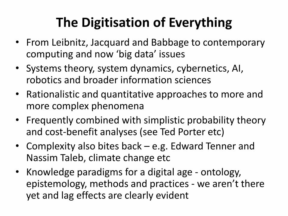
The Digitisation of Everything
• From Leibnitz, Jacquard and Babbage to contemporary computing and now ‘big data’ issues
• Systems theory, system dynamics, cybernetics, AI, robotics and broader information sciences
• Rationalistic and quantitative approaches to more and more complex phenomena
• Frequently combined with simplistic probability theory and cost-benefit analyses (see Ted Porter etc)
• Complexity also bites back – e.g. Edward Tenner and Nassim Taleb, climate change etc
• Knowledge paradigms for a digital age - ontology, epistemology, methods and practices - we aren’t there yet and lag effects are clearly evident
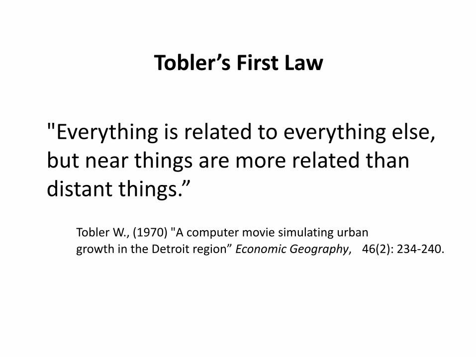
Tobler’s First Law
"Everything is related to everything else, but near things are more related than distant things.”
Tobler W., (1970) "A computer movie simulating urban
growth in the Detroit region” Economic Geography, 46(2): 234-240.

Geotechnology is one of the three "mega technologies" for the 21st century and promises to
forever change how we conceptualize, utilize and visualize spatial relationships in scientific research and commercial applications (U.S. Department of Labor)
Modelling involves analysis of spatial relationships and patterns
Prescriptive Modelling
Why So What What if…
Global Positioning System (location and navigation)
Remote Sensing(measure and classify)
GPS/GIS/RS
The Spatial Triad
Mappinginvolves precise placement
of physical features and inventories
(Discrete/Graphic)
Descriptive Mapping
(Nanotechnology) Geotechnology (Biotechnology)
Source: Joseph Berry, 2010
Map Analysis …provides “tools” for investigating spatial patterns and relationships
Geographic Information Systems (map and analyze)
is
Where What
(Berry)
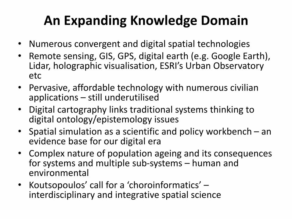
An Expanding Knowledge Domain
• Numerous convergent and digital spatial technologies• Remote sensing, GIS, GPS, digital earth (e.g. Google Earth),
Lidar, holographic visualisation, ESRI’s Urban Observatory etc
• Pervasive, affordable technology with numerous civilian applications – still underutilised
• Digital cartography links traditional systems thinking to digital ontology/epistemology issues
• Spatial simulation as a scientific and policy workbench – an evidence base for our digital era
• Complex nature of population ageing and its consequences for systems and multiple sub-systems – human and environmental
• Koutsopoulos’ call for a ‘choroinformatics’ –interdisciplinary and integrative spatial science

Mapping and Analysis
• Modern mapping is digital and mathematico-statistical (Berry calls this ‘map-ematical’)
• We can have multiple data sets within the one ‘map’ and apply relevant, appropriate analytical techniques
• Maps are (selective) representations of reality – we deliberately include some things and leave (turn on/turn off) other things out
• We can map increasingly complex natural and environmental phenomena and the relations between them
• We can map specific social variables (e.g. age 65+) or composite variables (e.g. vulnerability) and include physical phenomena such as hospitals, GPs, pharmacies, ambulance stations etc
• We can also map known data or model likely scenarios and relate the two for pattern seeking and analysis – hypothesis development and testing -> scientific applications
• Simulation, visualisation and spatialisation in ageing informatics
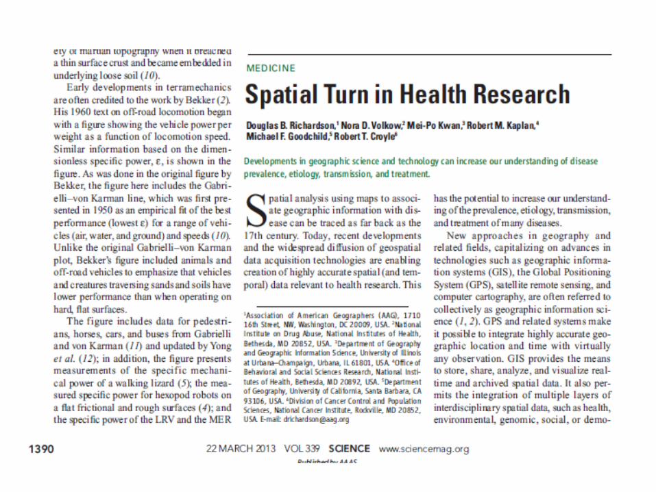
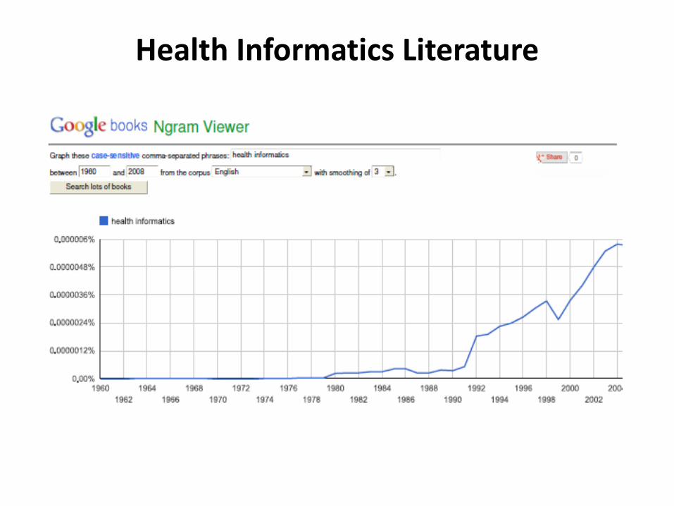
Health Informatics Literature
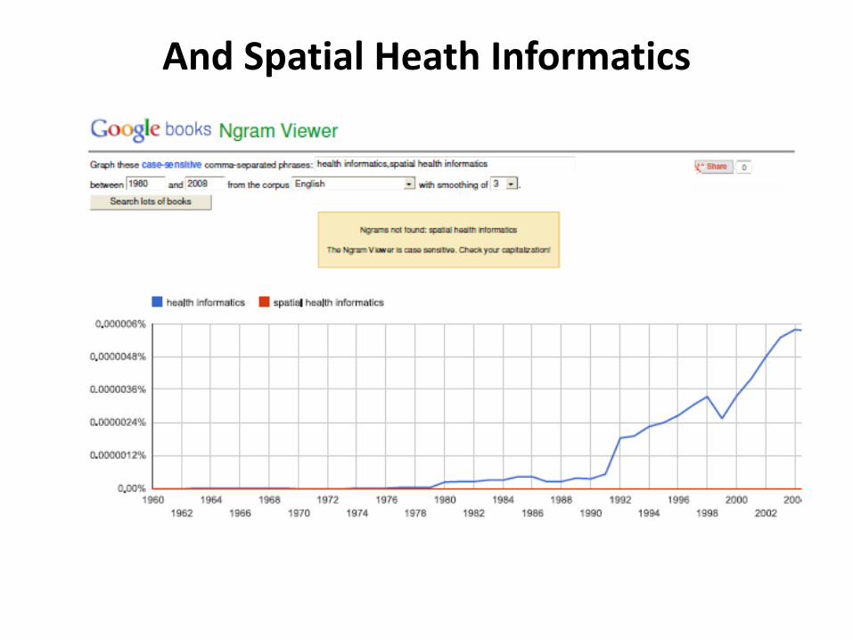
And Spatial Heath Informatics

Population Ageing is a Global PhenomenonSource: World Economic Forum 2012
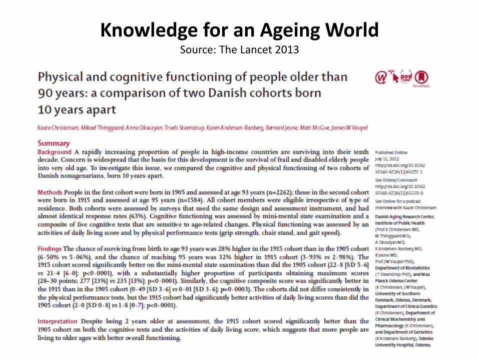
Knowledge for an Ageing WorldSource: The Lancet 2013

Mapping People – Number and Proportion
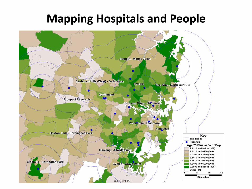
Mapping Hospitals and People
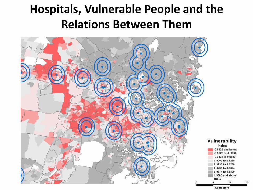
Hospitals, Vulnerable People and the Relations Between Them
Conclusion
• Digitisation makes multidimensional data capture and analysis feasible (3D, 4D, 5D…)
• Methods for analysis and visualisation are improving rapidly
• Population ageing is challenging, complex and dynamic – knowledge grows and changes quickly
• Spatial science enhances understanding of the known and can help build knowledge where it is lacking
• Ageing is a key example of how reality constantly challenges our beliefs and understanding
• Health informatics for ageing in this era needs to be spatially informed and enabled