4140 ScopingNorth Report 040913 - Parks Australia
26
Scoping Report for the Northern Planning Area Scoping Report ∨ Healthy for the oceans: wisely Healthy for the
Transcript of 4140 ScopingNorth Report 040913 - Parks Australia

Scoping Reportfor the Northern Planning Area
Scoping Report
∨Healthyfor theoceans:
wiselyHealthyfor the

S c o p i n g R e p o rt f o r t h e N o rt h e r n P l a n n i n g A r e a
Title:Scoping Report for the Northern Planning Area
Copyright: © National Oceans Office, 2004
Disclaimer: This document was prepared by the National Oceans Office to facilitate consultation on the regional marine planning process to promote integrated and ecosystem-based management of Australia’s northern waters. The views expressed in this report are not necessarily those of the Commonwealth. The Commonwealth does not accept responsibility for the contents of this document.
Sourcing: Copies of this document are available from:The National Oceans Office Level 1, 80 Elizabeth Street, HobartGPO Box 2139Hobart TAS 7001Tel: 03 6221 5000Fax: 03 6221 5050www.oceans.gov.au
For further information about this document, contact the Public Affairs Officer, tel: 03 6221 5000
Reproduction:Information in this document may be reproduced in whole or in part for study or training purposes, subject to the inclusion of acknowledgement of the source and provided no commercial usage or sale of the material occurs. Reproduction for purposes other than those given above requires written permission from the National Oceans Office. Requests for permission should be addressed to the Public Affairs Officer, National Oceans Office, GPO Box 2139, Hobart TAS 7001.
Published by the National Oceans Office
Photo credits: Front cover, left to right: Trawler in the Northern Prawn Fishery (Source: Australian Fisheries Management Authority); Boy with Spear (© Kerry Trapnell); Mangrove – Western Cape York Peninsula (© Kerry Trapnell)
Insets: Gulf beach – sand ripples (© Kerry Trapnell); Coral on beach (Source: National Oceans Office)
Opposite page: Trawling silhouette (Source: Australian Fisheries Management Authority)
Inside back cover: Mangrove – Western Cape York Peninsula (© Kerry Trapnell)
Scoping Report for the Northern Planning Area
ISBN 1-877043-38-9
The National Oceans Office is an Executive Agency of the Australian Government

> 1 >
S c o p i n g R e p o rt f o r t h e N o rt h e r n P l a n n i n g A r e a
The Northern Planning
Area is one of Australia’s
most distinctive coastal
and marine
regions,
complemented by
unique ecological and
human values.
Contents
Executive Summary . . . . . . . . . . . . . . . . . . . . . . . . . . . . . . . . . . . . . . . . . . . . . . . . . 2
PART A . . . . . . . . . . . . . . . . . . . . . . . . . . . . . . . . . . . . . . . . . . . . . . . . . . . . . . . . . . . . . . . . . . . . . . . 5
Outlines activities undertaken during the Scoping Phase.
PART B . . . . . . . . . . . . . . . . . . . . . . . . . . . . . . . . . . . . . . . . . . . . . . . . . . . . . . . . . . . . . . . . . . . . . . . 11
Highlights common themes that emerged during the
Scoping Phase, and proposes objectives to be pursued
through the planning process.
PART C . . . . . . . . . . . . . . . . . . . . . . . . . . . . . . . . . . . . . . . . . . . . . . . . . . . . . . . . . . . . . . . . . . . . . . . 21
Describes the future steps in the Northern regional
marine planning process, and the institutional arrangements
needed to support this process.
Scoping Reportfor the Northern Planning Area
Sc
op
ing
re
po
rt
2
S c o p i n g R e p o rt f o r t h e N o rt h e r n P l a n n i n g A r e aS c o p i n g R e p o rt f o r t h e N o rt h e r n P l a n n i n g A r e a
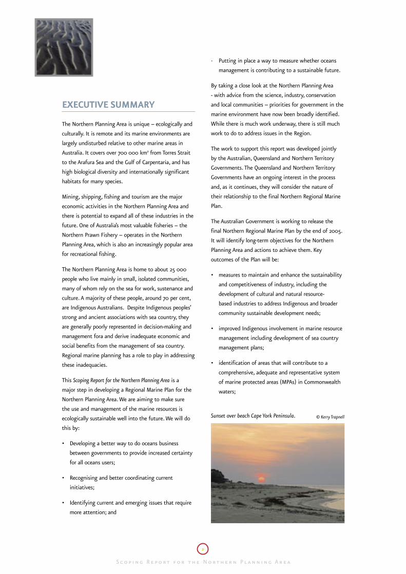
Sunset over beach Cape York Peninsula. © Kerry Trapnell
EXECUTIVE SUMMARY
The Northern Planning Area is unique – ecologically and
culturally. It is remote and its marine environments are
largely undisturbed relative to other marine areas in
Australia. It covers over 700 000 km2 from Torres Strait
to the Arafura Sea and the Gulf of Carpentaria, and has
high biological diversity and internationally significant
habitats for many species.
Mining, shipping, fishing and tourism are the major
economic activities in the Northern Planning Area and
there is potential to expand all of these industries in the
future. One of Australia’s most valuable fisheries – the
Northern Prawn Fishery – operates in the Northern
Planning Area, which is also an increasingly popular area
for recreational fishing.
The Northern Planning Area is home to about 25 000
people who live mainly in small, isolated communities,
many of whom rely on the sea for work, sustenance and
culture. A majority of these people, around 70 per cent,
are Indigenous Australians. Despite Indigenous peoples’
strong and ancient associations with sea country, they
are generally poorly represented in decision-making and
management fora and derive inadequate economic and
social benefits from the management of sea country.
Regional marine planning has a role to play in addressing
these inadequacies.
This Scoping Report for the Northern Planning Area is a
major step in developing a Regional Marine Plan for the
Northern Planning Area. We are aiming to make sure
the use and management of the marine resources is
ecologically sustainable well into the future. We will do
this by:
• Developing a better way to do oceans business
between governments to provide increased certainty
for all oceans users;
• Recognising and better coordinating current
initiatives;
• Identifying current and emerging issues that require
more attention; and
· Putting in place a way to measure whether oceans
management is contributing to a sustainable future.
By taking a close look at the Northern Planning Area
- with advice from the science, industry, conservation
and local communities – priorities for government in the
marine environment have now been broadly identified.
While there is much work underway, there is still much
work to do to address issues in the Region.
The work to support this report was developed jointly
by the Australian, Queensland and Northern Territory
Governments. The Queensland and Northern Territory
Governments have an ongoing interest in the process
and, as it continues, they will consider the nature of
their relationship to the final Northern Regional Marine
Plan.
The Australian Government is working to release the
final Northern Regional Marine Plan by the end of 2005.
It will identify long-term objectives for the Northern
Planning Area and actions to achieve them. Key
outcomes of the Plan will be:
• measures to maintain and enhance the sustainability
and competitiveness of industry, including the
development of cultural and natural resource-
based industries to address Indigenous and broader
community sustainable development needs;
• improved Indigenous involvement in marine resource
management including development of sea country
management plans;
• identification of areas that will contribute to a
comprehensive, adequate and representative system
of marine protected areas (MPAs) in Commonwealth
waters;

Southern Surveyor. Source: CSIRO
S c o p i n g R e p o rt f o r t h e N o rt h e r n P l a n n i n g A r e a
> 3 >
S c o p i n g R e p o rt f o r t h e N o rt h e r n P l a n n i n g A r e a
• actions to minimise impacts on the marine
environment, including better use of measures
– other than marine protected areas – to achieve
conservation objectives including reducing the
impact of marine debris and sustainably managing
turtle and dugong populations;
• integrated spatial management of marine uses to
meet conservation, industry, infrastructure and
community development objectives, to provide a
fair and transparent basis for resource allocation
decisions;
• better coordination of research and communication
to make information more accessible for decision-
makers as well as industry, communities and
Indigenous interests; and
• a performance assessment system with long-term
monitoring, risk assessment, reporting and review
arrangements to guide sustainable development and
measure the effectiveness of management decisions.
During the development of the Plan, the Australian
Government will continue to work with the Queensland
and Northern Territory Governments, key stakeholders
and Indigenous people. There will also be:
• research to address some key information
gaps – biophysical, social and economic – and
analytical tools developed, including a National
Bioregionalisation and an atlas of marine uses;
• identification of areas of high conservation, social,
economic and cultural significance and development
of a greater understanding of pressures on them;
• refinement of objectives in the Scoping Report and
grouping of issues into three categories: Sustainable
Industries and Communities – Biodiversity
Conservation and Ecosystem Health – Institutional
Arrangements and Governance. Discussion papers will
be developed around each of these themes; and
• release of a draft Northern Regional Marine Plan for
public comment.
The National Oceans Office is establishing a Northern
Planning Advisory Committee which, in the first
instance, will develop the discussion papers to inform
the development of the Draft Northern Regional
Marine Plan.
In October 2003, the National Oceans Office released
the Snapshot of the Northern Planning Area, which broadly
outlines the known characteristics and values of the
Northern Planning Area. It provides the context for this
Scoping Report and these two documents should be read
in conjunction.
Sc
op
ing
re
po
rt

4
S c o p i n g R e p o rt f o r t h e N o rt h e r n P l a n n i n g A r e aS c o p i n g R e p o rt f o r t h e N o rt h e r n P l a n n i n g A r e a

S c o p i n g R e p o rt f o r t h e N o rt h e r n P l a n n i n g A r e a
> 5 >
S c o p i n g R e p o rt f o r t h e N o rt h e r n P l a n n i n g A r e a
Turt
le t
rack
s So
urce
: Nat
iona
l Oce
ans
Offic
e
Part A
Introduction
Sound oceans management is fundamental to Australia’s
future. Marine industries and coastal communities
depend upon healthy ocean ecosystems for their long-
term survival.
With the various community, industry, conservation
and recreational sectors sharing an interest in Australia’s
oceans, it is not surprising that at times their interests
diverge. The problems associated with divergent
interests have sometimes been exacerbated because
historically management systems have been sectorally
focussed. Increasingly, however, governments are
recognising the need to integrate decision making across
sectors in order to maximise overall benefits to society
and maintain ecosystem health.
Most laws and regulations cover specific types of marine
industries and other human uses, each of which tend to
be administered through separate government agencies.
However, natural systems and marine resources do not
recognise jurisdictional boundaries in the water. In some
cases, these jurisdictional boundaries are not understood
or even recognised by people. Because regional marine
planning is undertaken on a whole-of-system basis using
an integrated approach, it is well placed to address those
marine-related issues that are cross-jurisdictional and
cross-sectoral.
Through integrated management of the oceans we are
seeking to avoid many of the mistakes made on land.
By undertaking regional marine planning, governments
and non-government organisations and interests now
have an opportunity to develop a system to avoid
and resolve conflicts, to optimise the use of ocean
resources and to avoid costly degradation of the marine
environment.
Australia’s Oceans Policy
Australia’s Oceans Policy reflects the Australian
Government’s commitment to achieve sustainable
development of Australia’s oceans through integrated
processes that meet the needs of government,
conservation, industry, Indigenous people and the
broader community. The policy presents a vision for
Australia’s oceans and is built around nine broad goals
with the overall objective of achieving:
Healthy oceans: cared for, understood and used wisely for the benefit of all, now and in the future.
The goals and principles of Australia’s Ocean Policy are
available at www.oceans.gov.au.
Australia’s Oceans Policy incorporates the concepts of
Ecologically Sustainable Development and ecosystem-
based management. The goal of Australia’s National
Strategy for Ecologically Sustainable Development is
development that improves the quality of life, both now
and in the future, in a way that maintains the ecological
processes on which life depends. The core objectives of
the Strategy are to enhance individual and community
wellbeing by following a path of economic development
that safeguards the welfare of future generations; to
provide for equity within and between generations;
to protect biological diversity; and maintain essential
ecological processes and life-support systems.
Australia’s Oceans Policy recognises ocean ecosystem health
and integrity is fundamental to Ecologically Sustainable
Development. As one tool to achieve this, ecosystem-
based management is an approach that, in recognising
human uses and ecosystem health are interdependent,
takes as its starting point the fundamental importance
of maintaining the structure and function of ecosystems.
Understanding and minimising the adverse consequences
of human activities on ecosystem integrity should be a
primary consideration in making management decisions.
Australian and State and Territory Governments
are working toward a set of national principles for
integrated oceans management.
Sc
op
ing
re
po
rt
6
S c o p i n g R e p o rt f o r t h e N o rt h e r n P l a n n i n g A r e aS c o p i n g R e p o rt f o r t h e N o rt h e r n P l a n n i n g A r e a
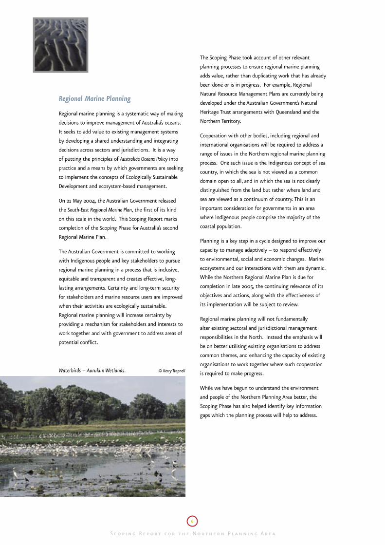
Waterbirds – Aurukun Wetlands. © Kerry Trapnell
Regional Marine Planning
Regional marine planning is a systematic way of making
decisions to improve management of Australia’s oceans.
It seeks to add value to existing management systems
by developing a shared understanding and integrating
decisions across sectors and jurisdictions. It is a way
of putting the principles of Australia’s Oceans Policy into
practice and a means by which governments are seeking
to implement the concepts of Ecologically Sustainable
Development and ecosystem-based management.
On 21 May 2004, the Australian Government released
the South-East Regional Marine Plan, the first of its kind
on this scale in the world. This Scoping Report marks
completion of the Scoping Phase for Australia’s second
Regional Marine Plan.
The Australian Government is committed to working
with Indigenous people and key stakeholders to pursue
regional marine planning in a process that is inclusive,
equitable and transparent and creates effective, long-
lasting arrangements. Certainty and long-term security
for stakeholders and marine resource users are improved
when their activities are ecologically sustainable.
Regional marine planning will increase certainty by
providing a mechanism for stakeholders and interests to
work together and with government to address areas of
potential conflict.
The Scoping Phase took account of other relevant
planning processes to ensure regional marine planning
adds value, rather than duplicating work that has already
been done or is in progress. For example, Regional
Natural Resource Management Plans are currently being
developed under the Australian Government’s Natural
Heritage Trust arrangements with Queensland and the
Northern Territory.
Cooperation with other bodies, including regional and
international organisations will be required to address a
range of issues in the Northern regional marine planning
process. One such issue is the Indigenous concept of sea
country, in which the sea is not viewed as a common
domain open to all, and in which the sea is not clearly
distinguished from the land but rather where land and
sea are viewed as a continuum of country. This is an
important consideration for governments in an area
where Indigenous people comprise the majority of the
coastal population.
Planning is a key step in a cycle designed to improve our
capacity to manage adaptively – to respond effectively
to environmental, social and economic changes. Marine
ecosystems and our interactions with them are dynamic.
While the Northern Regional Marine Plan is due for
completion in late 2005, the continuing relevance of its
objectives and actions, along with the effectiveness of
its implementation will be subject to review.
Regional marine planning will not fundamentally
alter existing sectoral and jurisdictional management
responsibilities in the North. Instead the emphasis will
be on better utilising existing organisations to address
common themes, and enhancing the capacity of existing
organisations to work together where such cooperation
is required to make progress.
While we have begun to understand the environment
and people of the Northern Planning Area better, the
Scoping Phase has also helped identify key information
gaps which the planning process will help to address.
S c o p i n g R e p o rt f o r t h e N o rt h e r n P l a n n i n g A r e a
> 7 >
S c o p i n g R e p o rt f o r t h e N o rt h e r n P l a n n i n g A r e a
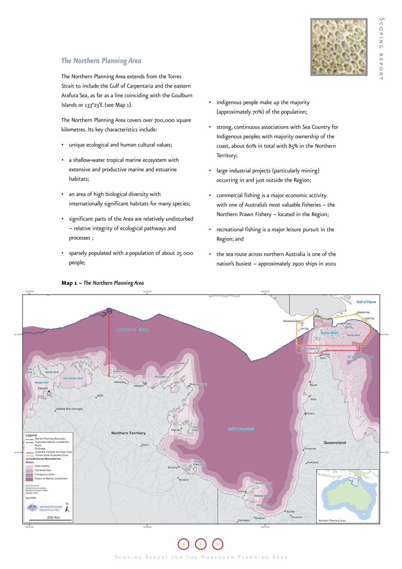
Map 1 – The Northern Planning Area
The Northern Planning Area
The Northern Planning Area extends from the Torres
Strait to include the Gulf of Carpentaria and the eastern
Arafura Sea, as far as a line coinciding with the Goulburn
Islands or 133°23’E (see Map 1).
The Northern Planning Area covers over 700,000 square
kilometres. Its key characteristics include:
• unique ecological and human cultural values;
• a shallow-water tropical marine ecosystem with
extensive and productive marine and estuarine
habitats;
• an area of high biological diversity with
internationally significant habitats for many species;
• significant parts of the Area are relatively undisturbed
– relative integrity of ecological pathways and
processes ;
• sparsely populated with a population of about 25 000
people;
• indigenous people make up the majority
(approximately 70%) of the population;
• strong, continuous associations with Sea Country for
Indigenous peoples with majority ownership of the
coast, about 60% in total with 85% in the Northern
Territory;
• large industrial projects (particularly mining)
occurring in and just outside the Region;
• commercial fishing is a major economic activity
with one of Australia’s most valuable fisheries – the
Northern Prawn Fishery – located in the Region;
• recreational fishing is a major leisure pursuit in the
Region; and
• the sea route across northern Australia is one of the
nation’s busiest – approximately 2900 ships in 2001
Sc
op
ing
re
po
rt

8
S c o p i n g R e p o rt f o r t h e N o rt h e r n P l a n n i n g A r e aS c o p i n g R e p o rt f o r t h e N o rt h e r n P l a n n i n g A r e a
Recreational fishing at Karumba. Source: National Oceans Office
– with a growing number of cruising yachts also
traversing the Region. Torres Strait is recognised as an
international shipping strait.
In October 2003, the National Oceans Office released a
Snapshot of the Northern Planning Area. This report broadly
describes the environmental, social and economic
characteristics of the Region and is available from the
National Oceans Office or electronically at www.oceans.
gov.au/publications
Torres Strait
Due to significant ecological and institutional differences
to the rest of the Northern Planning Area, planning in
Torres Strait will be progressed through a separate but
concurrent process linked to the Natural Heritage Trust-
funded regional natural resource management planning
process in Torres Strait.
The following issues will be progressed through the
Torres Strait marine planning process:
• The conservation needs;
• The future of the seabed mining and drilling
moratorium;
• The promotion of marine-based industries; and
• The adequacy of marine resource information
management arrangements.
For the purposes of this report, references to the
Northern Planning Area do not specifically include Torres
Strait.
The Scoping Phase
The Scoping Phase was undertaken through memoranda
of understanding between the Queensland, Northern
Territory and Australian Governments. The memoranda
committed all three governments to work together
on a whole of government basis and applied until
the end of the Scoping Phase. The Queensland and
Northern Territory Governments will continue a formal
engagement and will consider the nature of their
relationship to the Northern Regional Marine Plan as the
process progresses.
The cooperative approach between governments has
been assisted by the employment of Oceans Liaison
Officers in Cairns and Darwin by the National Oceans
Office. These officers will continue to provide direct
communication with the National Oceans Office for
individuals and groups in the Region.
Several information-gathering projects have been
undertaken during the Scoping Phase to collate
existing knowledge and assist in identifying issues and
knowledge gaps. Some of these were specific to the
Region and others were part of the National Oceans
Office’s National Science Work Program and will continue
into the planning process. These projects include:
• A Snapshot of the Northern Planning Area – To
provide an overview of major uses and ecological
characteristics of the Northern Planning Area;
• The National Bioregionalisation – To update the
regional classification of Australia’s oceans based
on relevant biophysical information including
mapping of demersal fish and sponge distributions,
updating bathymetric coverage of Australia’s ocean
floor, mapping sediment distributions and mapping
oceanographic characteristics;
• The National Socio-Economic Program – To collate
and map contextual information including marine
resource uses and activities, employment in particular
sectors, and employment within coastal regions to
assist marine management and planning;
• A Description of Key Species Groups in the
Northern Planning Area – To collate and describe

S c o p i n g R e p o rt f o r t h e N o rt h e r n P l a n n i n g A r e a
> 9 >
S c o p i n g R e p o rt f o r t h e N o rt h e r n P l a n n i n g A r e a
the known information about key species groups
in the Northern Planning Area, including the
identification of major knowledge gaps;
• A Description of State and Territory Marine
Management and Institutional Arrangements –
To describe the current Australian, State and Territory
governance arrangements in the Region including
relevant legislation, regulation, administrative
arrangements, policies, plans and institutions;
• Coordinating Input by Conservation Non-
Government Organisations – This culminated
in a report produced by members of the Northern
Australia Environmental Alliance containing members’
views on the conservation priorities for the Northern
regional marine planning process;
• Consultation with Indigenous Communities and
Literature Review – To consult with Indigenous
communities about sea country issues with
associated literature review;
• A Preliminary Identification and Description of
Ecosystem Impacts of Current Activities in the
Northern Planning Area – To identify the known
impacts of current activities in the Northern Planning
Area on the ecosystems of the Region; and
• The Finding Solutions – Derelict Fishing Gear
and Other Marine Debris in Northern Australia
– To identify options for addressing problems
associated with derelict fishing gear and other marine
debris in northern Australia.
Most of these projects are now complete. More
information on the current status of work undertaken by
the National Oceans Office can be found at www.oceans.
gov.au. The reports will be publicly released as they
become available.
The Scoping Phase has involved extensive consultation
with governments, communities and interest groups.
This consultation has involved:
• direct discussions with organisations and their
representatives;
• using existing consultative mechanisms, eg fisheries
management advisory committees;
• dedicated consultative projects to facilitate discussion
with Indigenous communities and the conservation
sector;
• facilitating collaboration between research
organisations; and
• convening workshops in Cairns and Darwin with
representatives of key groups in the Region.
Workshops were held in Darwin and Cairns on 8-9
and 11-12 September 2003. Participants discussed the
planning process and worked together to identify issues
in the Region that may appropriately be addressed
through regional marine planning. The reports from
these workshops are available on the National Oceans
Office website.
The Scoping Phase identified a range of issues that may
be appropriate to address through the regional marine
planning process. These issues are presented as common
themes in Part B of this report. Associated with
each common theme are a number of recommended
objectives to be pursued through the planning
process. While objectives can be articulated with some
confidence, in general actions to progress them need
to be further developed through consultation with
stakeholders and other interests. In some cases, where
there is already strong community and government
endorsement, actions to advance the objectives can be
implemented throughout the planning process.
The common themes and objectives have been drawn
from a review of information in the area, input from
management and policy agencies and the involvement
of individuals and groups who live or have an interest
in the Region. Feedback on this document and further
consultation may reveal other issues that may need
to be considered. Where possible, actions will be
implemented throughout the planning process for those
issues that are clearly a priority. This will enable issues
to be progressed and ensure emerging risks can be
addressed in a timely way.
Sc
op
ing
re
po
rt

10
S c o p i n g R e p o rt f o r t h e N o rt h e r n P l a n n i n g A r e aS c o p i n g R e p o rt f o r t h e N o rt h e r n P l a n n i n g A r e a

Rivermouth – Gulf of Carpentaria. © Kerry Trapnell
S c o p i n g R e p o rt f o r t h e N o rt h e r n P l a n n i n g A r e a
> 11 >
S c o p i n g R e p o rt f o r t h e N o rt h e r n P l a n n i n g A r e a
Shel
ls –
Gul
f of C
arpe
ntar
ia.
© K
erry
Trap
nell
Part B
Common themes emerged from research and
consultations undertaken during the Scoping Phase
that warrant further investigation through the regional
marine planning process. Not all of the objectives will
be met during the planning process and most are likely
to be further refined. Regional marine planning provides
an opportunity to identify and address priorities where
resolution requires holistic approaches.
The ability of communities and organisations engaged
in the planning process to respond to the common
themes and objectives identified through the Scoping
Phase varies considerably. Different organisations and
communities require different forms of information and
different mechanisms to facilitate their involvement.
Capacity building is a common thread running through
many government-community interactions and is
reflected in many of the common themes identified in
this report.
Theme 1: Understanding the Region
Our understanding of northern marine ecosystems
is rudimentary. Information on the socioeconomic
dependence on these systems is also sparse. Improving
our understanding of ecosystems, and our reliance on
them, is important if we are to effectively manage
human activities within the capacity of the ecosystems
to support them.
It is unlikely we will ever have complete knowledge of
ecosystems, or possess sufficient resources to adequately
address gaps in our understanding. As a consequence we
need to:
• target our research, management and other activities
towards addressing the most pressing priorities with
the best available knowledge;
• manage cautiously and adaptively; and
• seek to address issues at the most appropriate scale.
Objectives to be pursued through the planning process
include:
• further identifying and addressing priority
information needs associated with environmental,
cultural, economic and social objectives using
the most effective means, including enhanced
coordination of science agency activities;
• enhancing research collaboration with Australia’s
neighbours to address issues of mutual concern,
including through the Arafura and Timor Seas Expert
Forum; and
• broadening the knowledge base and management
capacity by drawing on modern science and
Indigenous knowledge.
Sc
op
ing
re
po
rt

12
S c o p i n g R e p o rt f o r t h e N o rt h e r n P l a n n i n g A r e aS c o p i n g R e p o rt f o r t h e N o rt h e r n P l a n n i n g A r e a
Darwin Workshop September 2003. Source: National Oceans Office
Theme 2: Communicating and sharing information
Much current information of potential value to managers
and other interests is in forms that are difficult to access
or readily interpret. Informed decision making relies on
an awareness of what information is available, timely
access to the information and a capacity to make best
use of it and to understand the impacts of decisions
on others. Good access to information helps to ensure
people and organisations are informed and able to
influence decisions in which they have an interest.
One of the roles performed by the National Oceans
Office is capacity-building in the area of national marine
information management. The Office is sponsoring
initiatives specifically designed to improve access to
marine science data resources and the mechanisms
by which we can publish and communicate marine
information. The regional marine planning process will
help to apply national initiatives at a regional scale.
Through initiatives such as the Oceans Portal Project
(www.oceans.gov.au/oceans_portal.jsp ) it will be
possible to access data and information held by a wide
range of custodians through the web.
The National Oceans Office is strongly supporting the
development of fundamental datasets in accordance
with the Australian Government Spatial Data Access
and Pricing Policy (www.osdm.gov.au). The policy is
designed to ensure datasets are captured and made
available to underpin environmental and socio-economic
management.
The National Oceans Office will also work with others
to develop appropriate methods for dissemination of
information collected through the regional marine
planning process, recognising that many of the
interests in the Northern Planning Area require specific
approaches to meet their information needs.
It is not always appropriate to make information publicly
available. Cultural and legal sensitivities and policy
objectives at times require a degree of confidentiality in
information management.
Improving understanding and mutual respect between
interests in the Northern Planning Area is necessary for
harmonious and sustainable development of the Region
and requires an appreciation of the rights and needs of
other marine resource users. Improving understanding
and communication between Indigenous and non-
Indigenous people is particularly important given the
significant cultural and conceptual differences that exist
in relation to issues such as ownership and management
in marine environments.
Objectives for the planning process include:
• promoting mutual respect and understanding
between those with an interest in the Northern
Planning Area;
• working with research and management agencies,
communities and industries to collect and
communicate data and information relevant to
regional marine planning; and
• ensuring data and information, including data
descriptions or metadata, are collected, maintained
and made readily available through appropriate
methods of dissemination.

S c o p i n g R e p o rt f o r t h e N o rt h e r n P l a n n i n g A r e a
> 13 >
S c o p i n g R e p o rt f o r t h e N o rt h e r n P l a n n i n g A r e a
Theme 3: Biodiversity and ecosystem health
The Northern Planning Area is biologically diverse.
Healthy populations of species and habitats must be
maintained for ecosystem integrity and some species
may be key indicators of ecosystem function and
health. Some species, such as prawns, are vital for
certain industries. Others, including marine turtles
and dugongs, are vital for the maintenance of culture.
Still others, such as sawfish and migratory birds, are of
conservation concern. There are legal responsibilities
for the management of protected species and ecological
communities.
Different organisations and people have an interest in
the management of many of the species of the Northern
Planning Area. These interests may vary and, particularly
where conservation, economic and cultural objectives
intersect, good coordination of management across these
interests is important.
There is an increase in marine pollution world-wide.
Australia has put in place robust arrangements, such
as oil spill responses, to deal with pollution within its
jurisdiction. The regional marine planning process can
assist to implement these arrangements through better
information sharing, improved risk assessment capacity
and improved monitoring arrangements, including the
involvement of communities in this sparsely inhabited
Region.
The high volume of marine debris, particularly in the
form of discarded fishing nets originating beyond
Australia’s marine jurisdiction, is posing a significant
threat to biodiversity and habitats in the Northern
Planning Area. The nets are also navigational hazards
and of concern to Indigenous and other coastal people of
the Region.
The National Oceans Office and the Department of
Environment and Heritage recently commissioned a
report entitled Finding Solutions – Derelict Fishing Gear
and Other Marine Debris in Northern Australia. The report
was produced by the Key Centre for Tropical Wildlife
Management at Charles Darwin University with
assistance from the World Wide Fund for Nature and the
Dhimurru Land Management Aboriginal Corporation. It
was released by Dr David Kemp, former Minister for the
Environment and Heritage, in December 2003.
As part of the regional marine planning process, the
National Oceans Office will work with Australian,
Queensland and Northern Territory Government
agencies and non-government interests to consider
and implement the recommendations of the report.
This includes working to develop the international
collaboration required to stem the discarding of fishing
nets at sea.
The growing numbers of commercial and recreational
vessels using the waters of the Northern Planning Area
will increase the risk of introduction and spread of
marine species. Regional marine planning will support
the application of regulatory arrangements and other
initiatives to manage introduced marine species.
The National Introduced Marine Pests Consultative
Group, which includes industry representatives, is the
cross-jurisdictional body responsible for advising on
national action to address introduced marine pests.
Regional marine planning provides one vehicle for
implementing this group’s recommendations in the
Northern Planning Area.
The Australian Government is developing a National
Representative System of Marine Protected Areas in
waters under its jurisdiction as part of regional marine
planning. Decisions on the National Representative
System of Marine Protected Areas will be based on the
best scientific and community resource advice available,
incorporating community and industry knowledge.
In 2001, the Minister for the Environment and Heritage
decided to assess the Gulf of Carpentaria seagrass beds,
within the Northern Planning Area, to identify if marine
protected areas were warranted. To avoid confusion and
duplication, the assessment of the seagrass beds will be
integrated into the identification of a comprehensive,
adequate and representative system of marine protected
areas in the Northern Planning Area. This work is being
undertaken as part of the regional marine planning
process by the recently established Marine Protected
Area Taskforce located in the Australian Government
Department of Environment and Heritage.
Sc
op
ing
re
po
rt

14
S c o p i n g R e p o rt f o r t h e N o rt h e r n P l a n n i n g A r e aS c o p i n g R e p o rt f o r t h e N o rt h e r n P l a n n i n g A r e a
Dugong and calf. Source: Great Barrier Reef Marine Park Authority
Queensland and the Northern Territory are also working
to assess their state and territory wide conservation
needs, including the need for marine protected areas.
Objectives to be pursued through the planning process
include:
• developing mechanisms to maintain biodiversity
and ecosystem health including those that integrate
conservation, cultural (including customary
management regimes), economic and other
objectives;
• pursuing international, national and regional
cooperation between government agencies and other
interests in the management of species and ecological
communities;
• encouraging the development of cross-cultural
knowledge and management systems for sustainable
use of resources (including Indigenous use of turtle
and dugong);
• supporting national action under the National System
for the Prevention and Management of Introduced
Marine Pests to address introduced marine species
issues, including community-based monitoring
programs;
• ensuring adequate processes are in place to reduce
threats associated with apprehended and abandoned
vessels;
• addressing sources and impacts of marine debris
at appropriate scales including consideration of
recommendations from the report Finding Solutions
– Derelict Fishing Gear and Other Marine Debris in Northern
Australia and the development and implementation
of a national threat abatement plan for the Key
Threatening Process Injury and Fatality to Vertebrate
Marine Life Caused by Ingestion of, or Entanglement in,
Harmful Marine Debris;
• establishing an effectively managed, comprehensive,
adequate and representative system of marine
protected areas using consultative processes and
appropriate science tools; and
• fostering cooperation between jurisdictions to seek
complementarity of marine protected areas in the
Northern Planning Area.
S c o p i n g R e p o rt f o r t h e N o rt h e r n P l a n n i n g A r e a
> 15 >
S c o p i n g R e p o rt f o r t h e N o rt h e r n P l a n n i n g A r e a
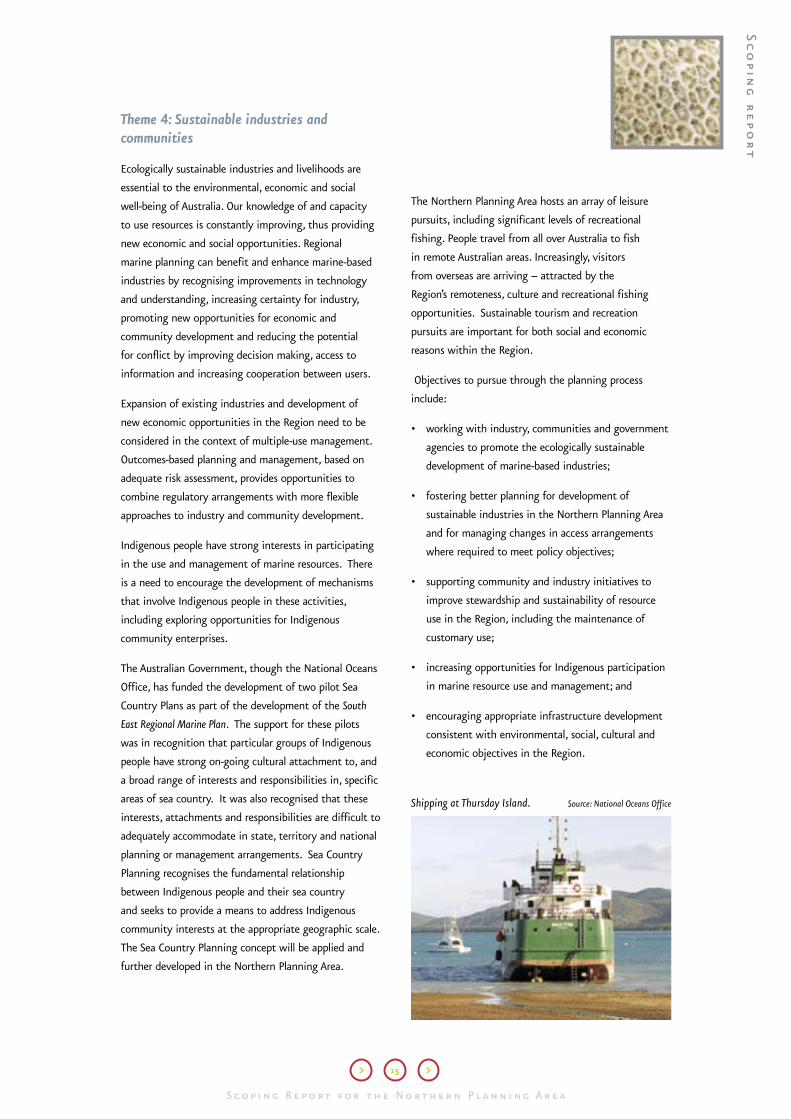
Shipping at Thursday Island. Source: National Oceans Office
Theme 4: Sustainable industries and communities
Ecologically sustainable industries and livelihoods are
essential to the environmental, economic and social
well-being of Australia. Our knowledge of and capacity
to use resources is constantly improving, thus providing
new economic and social opportunities. Regional
marine planning can benefit and enhance marine-based
industries by recognising improvements in technology
and understanding, increasing certainty for industry,
promoting new opportunities for economic and
community development and reducing the potential
for conflict by improving decision making, access to
information and increasing cooperation between users.
Expansion of existing industries and development of
new economic opportunities in the Region need to be
considered in the context of multiple-use management.
Outcomes-based planning and management, based on
adequate risk assessment, provides opportunities to
combine regulatory arrangements with more flexible
approaches to industry and community development.
Indigenous people have strong interests in participating
in the use and management of marine resources. There
is a need to encourage the development of mechanisms
that involve Indigenous people in these activities,
including exploring opportunities for Indigenous
community enterprises.
The Australian Government, though the National Oceans
Office, has funded the development of two pilot Sea
Country Plans as part of the development of the South
East Regional Marine Plan. The support for these pilots
was in recognition that particular groups of Indigenous
people have strong on-going cultural attachment to, and
a broad range of interests and responsibilities in, specific
areas of sea country. It was also recognised that these
interests, attachments and responsibilities are difficult to
adequately accommodate in state, territory and national
planning or management arrangements. Sea Country
Planning recognises the fundamental relationship
between Indigenous people and their sea country
and seeks to provide a means to address Indigenous
community interests at the appropriate geographic scale.
The Sea Country Planning concept will be applied and
further developed in the Northern Planning Area.
The Northern Planning Area hosts an array of leisure
pursuits, including significant levels of recreational
fishing. People travel from all over Australia to fish
in remote Australian areas. Increasingly, visitors
from overseas are arriving – attracted by the
Region’s remoteness, culture and recreational fishing
opportunities. Sustainable tourism and recreation
pursuits are important for both social and economic
reasons within the Region.
Objectives to pursue through the planning process
include:
• working with industry, communities and government
agencies to promote the ecologically sustainable
development of marine-based industries;
• fostering better planning for development of
sustainable industries in the Northern Planning Area
and for managing changes in access arrangements
where required to meet policy objectives;
• supporting community and industry initiatives to
improve stewardship and sustainability of resource
use in the Region, including the maintenance of
customary use;
• increasing opportunities for Indigenous participation
in marine resource use and management; and
• encouraging appropriate infrastructure development
consistent with environmental, social, cultural and
economic objectives in the Region.
Sc
op
ing
re
po
rt

16
S c o p i n g R e p o rt f o r t h e N o rt h e r n P l a n n i n g A r e aS c o p i n g R e p o rt f o r t h e N o rt h e r n P l a n n i n g A r e a
Fishing for barra – Gulf of Carpentaria. © Kerry Trapnell
Theme 5: Access to natural resources and areas
The seeking of access by different sectors, industries,
community interests or jurisdictions to the same
areas and resources can be a source of conflict. As
opportunities for economic development in the Northern
Planning Area increase, the potential for such conflict is
likely to rise. At the same time, secure and long-term
access to resources and markets is essential for
sustainable marine-based industries and therefore the
future prosperity of the Region.
In general, ocean resources should be allocated to the
mix of uses within an area that offers the greatest
long-term community benefits (taking economic,
environmental, social and cultural values into account)
compatible with maintaining ecosystem health.
Visitors, such as tourists, to the Region are often
unfamiliar with Indigenous protocols and unaware of
when they are on Indigenous land. Access to Aboriginal
country and respect for Indigenous culture is an
important issue in the Northern Planning Area.
The diversity of marine resources and the uses we
make of them, the multiple jurisdictions responsible
for management and resultant complexity of the ocean
regulatory system combine to make it difficult to
manage for sustainability through sectoral management
arrangements alone. The Australian Government is
establishing a best-practice, integrated process to address
broad-scale resource sharing issues. These mechanisms
are outlined in Oceans Policy: Principles and Processes
available at www.oceans.gov.au/publications.
Objectives for the planning process include:
• developing integrated processes for allocating
resources between sectors and interests consistent
with ecosystem-based management and the
principles of Ecologically Sustainable Development;
• assisting to develop protocols for sustainable
multiple-use and clarify issues regarding rights and
access to natural resources and areas; and
• promoting greater understanding of the importance
of marine resources to Indigenous communities and
promoting cross-cultural education and awareness to
ensure Aboriginal country is respected and accessed
appropriately.
S c o p i n g R e p o rt f o r t h e N o rt h e r n P l a n n i n g A r e a
> 17 >
S c o p i n g R e p o rt f o r t h e N o rt h e r n P l a n n i n g A r e a
Northern Planning Area. There is a need to raise
awareness and communicate to promote understanding
of not only the use of the marine environment but of
the rights and needs of other marine resource users.
Objectives to pursue through the planning process
include:
• ensuring effective cross-jurisdictional and cross-
sectoral arrangements are in place to effectively
manage surveillance and compliance systems;
• identifying and progressing opportunities for
industries and communities to play an appropriate
and effective role in surveillance, compliance and
enforcement arrangements where required in the
Region including monitoring and detection of marine
pollution and introduced marine pests; and
• increasing awareness in local communities of
their rights and responsibilities and of the roles of
agencies responsible for surveillance, compliance and
enforcement in the Northern Planning Area.
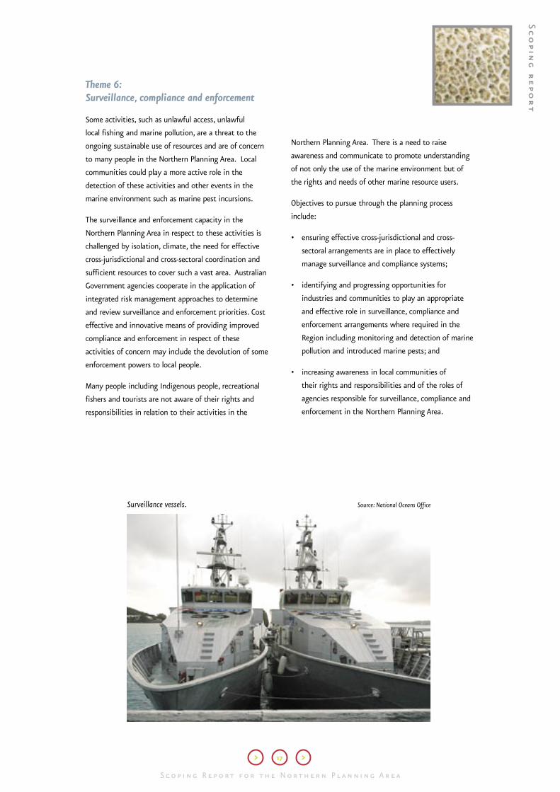
Surveillance vessels. Source: National Oceans Office
Theme 6: Surveillance, compliance and enforcement
Some activities, such as unlawful access, unlawful
local fishing and marine pollution, are a threat to the
ongoing sustainable use of resources and are of concern
to many people in the Northern Planning Area. Local
communities could play a more active role in the
detection of these activities and other events in the
marine environment such as marine pest incursions.
The surveillance and enforcement capacity in the
Northern Planning Area in respect to these activities is
challenged by isolation, climate, the need for effective
cross-jurisdictional and cross-sectoral coordination and
sufficient resources to cover such a vast area. Australian
Government agencies cooperate in the application of
integrated risk management approaches to determine
and review surveillance and enforcement priorities. Cost
effective and innovative means of providing improved
compliance and enforcement in respect of these
activities of concern may include the devolution of some
enforcement powers to local people.
Many people including Indigenous people, recreational
fishers and tourists are not aware of their rights and
responsibilities in relation to their activities in the
Sc
op
ing
re
po
rt

18
S c o p i n g R e p o rt f o r t h e N o rt h e r n P l a n n i n g A r e aS c o p i n g R e p o rt f o r t h e N o rt h e r n P l a n n i n g A r e a
Theme 7: Adaptive management
The marine environment and our understanding of
it are dynamic. Management of marine resources
therefore needs to be adaptive and open to continuous
improvement. Adaptive management is a proactive,
precautionary and planned approach to management.
It provides for different management options based on
the identification of risks and uncertainties. It seeks
to ensure that there are clear options to change the
use and management of resources as we increase our
understanding of how the marine environment works
and how the different management strategies are
performing.
Good adaptive management should also include
transparent processes for decision making.
Human activities will always impact in some way on the
marine environment and potentially on the activities
of other users. The challenge for management is to
ensure these activities are sustainable and consistent
with broader social and policy objectives. Managing the
cumulative impacts of a wide range of users and uses
over time is particularly challenging.
Our capacity to manage for unknown but likely impacts
of large-scale changes in natural systems, such as
climate change, is currently limited. Regional marine
planning may provide an opportunity for preliminary
consideration of such potential impacts.
A better understanding of the social, cultural,
environmental and economic impacts of current or
proposed activities is important to ensure we don’t limit
ecologically sustainable development options.
Objectives to pursue through the planning process
include:
• improving capacity to monitor, predict and manage
changes in relationships between humans and the
natural environment;
• identifying and addressing current and cumulative
impacts of uses on human and ecological
communities ;
• applying appropriate risk assessment methods; and
• developing a performance assessment system to
inform adaptive management.
Sunset – Mitchell River. © Kerry Trapnell

Mangroves and floodplain. © Kerry Trapnell
S c o p i n g R e p o rt f o r t h e N o rt h e r n P l a n n i n g A r e a
> 19 >
S c o p i n g R e p o rt f o r t h e N o rt h e r n P l a n n i n g A r e a
Theme 8: Managing across the land-sea interface
Activities in river catchments can have adverse
downstream impacts on coastal and marine
environments. The concept of Integrated Catchment
Management reflects recognition in terrestrial natural
resource management of the need to manage across
sectors and across landscapes. This need also applies to
the marine environment and to the interface between
marine and terrestrial environments – the coastal zone.
Terrestrial run-off during the wet season is an important
driver of natural systems in shallow waters of the Gulf of
Carpentaria.
The Natural Heritage Trust Natural Resource
Management planning is an example where the
Australian, Queensland and Northern Territory
Governments are working cooperatively to develop
better ways to manage across jurisdictional and
landscape boundaries where this is required to
achieve sustainable natural resource management and
environmental objectives.
Objectives to pursue through the planning process
include:
• improving the capacity of management agencies,
industries and communities to manage across the
land and sea interface; and
• assisting to apply the Framework for a National
Cooperative Approach to Integrated Coastal Zone
Management in the Northern Planning Area.
Sc
op
ing
re
po
rt

20
S c o p i n g R e p o rt f o r t h e N o rt h e r n P l a n n i n g A r e aS c o p i n g R e p o rt f o r t h e N o rt h e r n P l a n n i n g A r e a

S c o p i n g R e p o rt f o r t h e N o rt h e r n P l a n n i n g A r e a
> 21 >
S c o p i n g R e p o rt f o r t h e N o rt h e r n P l a n n i n g A r e a
Part C
Process
For regional marine planning to be effective,
objectives must be articulated, stakeholders and other
interests must be informed and engaged, research
and information activities must be efficient and well
targeted, and there must be transparent processes for
decision-making.
While the Australian Government is responsible for the
final form and content of the Northern Regional Marine
Plan, working effectively with community and other
interests in the Region is fundamental to the planning
process. This is essential to ensure the objectives pursued
are the most relevant and that planning outcomes are
implemented by all with a stake in the Region.
The objectives for the planning process outlined in
Part B will not automatically translate into long-term
objectives for the Region in the Draft Northern Regional
Marine Plan itself.
The final Plan will incorporate an adaptive management
framework for the Northern Planning Area. This will
include a performance assessment system. This is
essential to ensure:
• the management, regulatory and policy measures do
contribute to environmental, social and economic
outcomes;
• management measures promote Ecologically
Sustainable Development and mitigate identified
threats to it; and
• governments are spending money effectively and
efficiently.
The Australian Government has endorsed an Oceans
Adaptive Management Framework. This framework will
be implemented in the northern marine planning process
and has been incorporated into the South-East Regional
Marine Plan. It is outlined in Figure 1.
Figure 1: Oceans Adaptive Management Framework
��������������������������������������
�������������������������������������
��������
������������������������������������������������������������������������������������
�����������������������������������
�����������������������������
�������������������������������������������
������
����������������������
��������
�������������������
����������������������������
�������������
�������������������������������������������
�������������������������������
����������������������������
�������������������������������������������������������������
���������������������������������
���������������������������
Gulf
beac
h –
sand
ripp
les.
© K
erry
Trap
nell
Note: ESD — Ecologically Sustainable Development
Sc
op
ing
re
po
rt

22
S c o p i n g R e p o rt f o r t h e N o rt h e r n P l a n n i n g A r e a
Effectively, the Scoping Phase has addressed steps 1 and
2 of this framework. The Northern Regional Marine Plan
will address steps 3-6 and will outline the process for
steps 7 and 8.
Figure 2 broadly outlines the process for regional marine
planning in the Northern Planning Area. The common
themes and objectives in Part B will be progressed
in discussion papers to be drafted during 2004. The
discussion papers will be developed by a Northern
Planning Advisory Committee (described below).
Engagement
The levels and types of engagement of organisations,
communities and individuals will reflect the nature of
the common themes and objectives and organisational,
community and individual needs for consultation.
Consultation with existing stakeholder and Indigenous
organisations will continue, but in addition, a new body
is required to progress the planning process.
The Northern Planning Advisory Committee
The Northern Planning Advisory Committee will be
a sectoral-based committee, providing advice to the
Director of the National Oceans Office.
The committee’s advice will not be considered to
necessarily reflect the views of the organisations or
sectors represented and will not be considered to be
binding on governments or sectoral interests.
Figure 2: Regional marine planning process for the Northern
Planning Area
����������������������������������
��������������������������������
����������������
��������������������������������������������������������������������������������������������
����������������������������������������������������������������������������������������
���������������������������������������������
�����������������������������������������������
������������
����������������������
��������������
����������������������������������������
����������������������������
�����������������
������������������������������������
���������������������
������������������������������������������
�
�

S c o p i n g R e p o rt f o r t h e N o rt h e r n P l a n n i n g A r e a

Healthy oceans: cared for, understood and used wisely for the benefit of all, now and in the future. Healthy oceans: cared for,
understood and used wisely for the benefit of all,
S c o p i n g R e p o rt f o r t h e N o rt h e r n P l a n n i n g A r e a
Level 1, 80 Elizabeth St, Hobart
GPO Box 2139, Hobart, Tas, Australia 7001
Tel: 03 6221 5000 Fax: 03 6221 5050
www.oceans.gov.au
The National Oceans Office is an Executive Agency of the Australian Government