2040 Transportation Plan - Pages Transportation Plan.pdf · The 2040 Transportation Plan is the...
31
Kane County 2040 Transportation Plan Overview A Plan that Focuses on Mobility and Connectivity
Transcript of 2040 Transportation Plan - Pages Transportation Plan.pdf · The 2040 Transportation Plan is the...
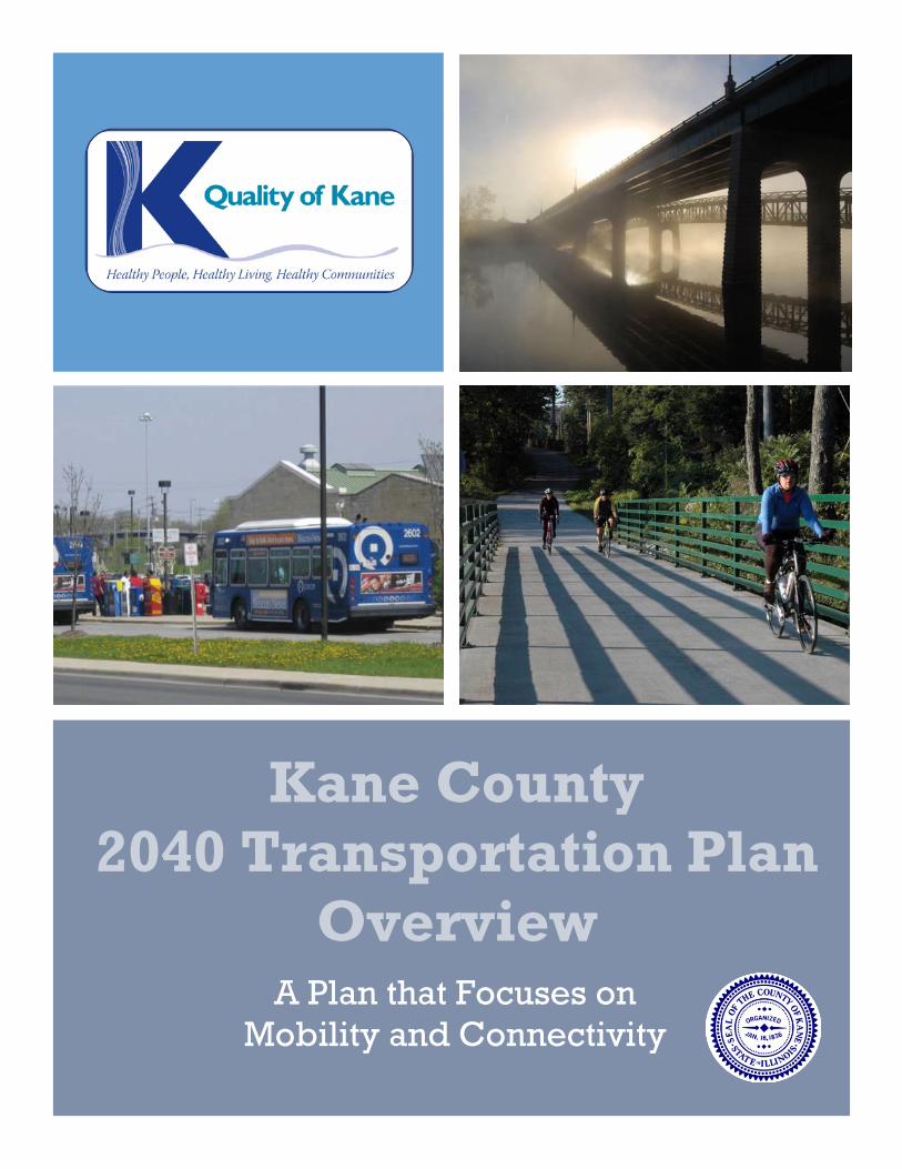
Kane County 2040 Transportation Plan
Overview A Plan that Focuses on
Mobility and Connectivity

2
This page is intentionally left blank.

3
Table of Contents
INTRODUCTION ............................................................................................................ 5 Regional Setting .....................................................................................................................................6
OBJECTIVES AND STRATEGIES ........................................................................................ 7 Safety Objective ....................................................................................................................................7 Personal Mobility Objective ..................................................................................................................7 Cooperative Planning Objective ...........................................................................................................8 Quality of the Environment Objective ....................................................................................................8 System Efficiency Objective ..................................................................................................................8
IMPROVEMENT STRATEGIES .......................................................................................... 9 Roadway ................................................................................................................................................9 Bicycle and Pedestrian ........................................................................................................................ 10 Transit .................................................................................................................................................. 11
Kane County Long Range Transit Plan .......................................................................................... 11 Randall Road Pace Route 529 Study .............................................................................................. 12 Randall/Orchard Corridor Bus Rapid Transit Study ..................................................................... 12 Paratransit and the Ride in Kane Program .................................................................................... 13
EFFECT OF LAND USE POLICIES ON TRANSPORTATION .................................................. 15 Reducing the Growth in Congestion through Land Use Decisions ............................................... 15 Impact Fee Discount Program ...................................................................................................... 16 IL 47 Corridor Planning Study ...................................................................................................... 18
PUBLIC OUTREACH ...................................................................................................... 21
PLAN IMPLEMENTATION & ON-ONGOING MANAGEMENT ............................................. 23 Transportation and Land Use Integrated Planning ............................................................................... 23 Plan Evaluation to Objectives and Strategies ....................................................................................... 23
Safety Objective ........................................................................................................................... 23 Personal Mobility Objective ......................................................................................................... 24 Cooperative Planning Objective .................................................................................................. 24 Quality of the Environment Objective .......................................................................................... 25 System Efficiency Objective ......................................................................................................... 26
On-Going Management of the Plan ...................................................................................................... 26 Future Planning Opportunities ............................................................................................................. 27
Coordinated planning .................................................................................................................. 27 Transportation and Land Use ........................................................................................................ 27 Aggressively Seek Funding for Transportation Projects .............................................................. 27 Context Sensitive Solutions .......................................................................................................... 28 Access Management .................................................................................................................... 28 Rustic Roads ................................................................................................................................. 29 Travel Control Measures .............................................................................................................. 29 Historic Preservation .................................................................................................................... 29
SUMMARY ................................................................................................................... 31

4
This page is intentionally left blank.
5
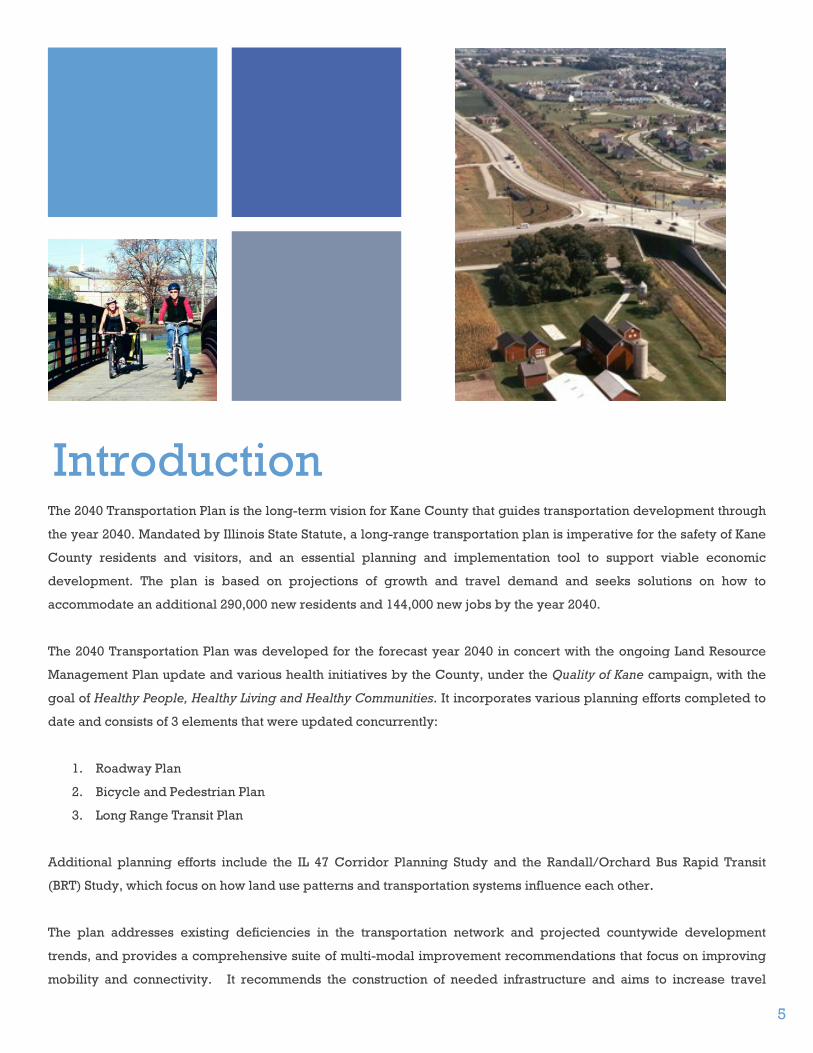
Introduction The 2040 Transportation Plan is the long-term vision for Kane County that guides transportation development through
the year 2040. Mandated by Illinois State Statute, a long-range transportation plan is imperative for the safety of Kane
County residents and visitors, and an essential planning and implementation tool to support viable economic
development. The plan is based on projections of growth and travel demand and seeks solutions on how to
accommodate an additional 290,000 new residents and 144,000 new jobs by the year 2040.
The 2040 Transportation Plan was developed for the forecast year 2040 in concert with the ongoing Land Resource
Management Plan update and various health initiatives by the County, under the Quality of Kane campaign, with the
goal of Healthy People, Healthy Living and Healthy Communities. It incorporates various planning efforts completed to
date and consists of 3 elements that were updated concurrently:
1. Roadway Plan
2. Bicycle and Pedestrian Plan
3. Long Range Transit Plan
Additional planning efforts include the IL 47 Corridor Planning Study and the Randall/Orchard Bus Rapid Transit
(BRT) Study, which focus on how land use patterns and transportation systems influence each other.
The plan addresses existing deficiencies in the transportation network and projected countywide development
trends, and provides a comprehensive suite of multi-modal improvement recommendations that focus on improving
mobility and connectivity. It recommends the construction of needed infrastructure and aims to increase travel

6
options that provide safe access to land uses for motorists, pedestrians, cyclists and public transportation
patrons. Furthermore, the plan includes revenue and expenditure forecasts to assist with the determination of
roadway improvement projects that are to be incorporated in the fiscal program.
Regional Setting
Kane County is part of the Chicago metropolitan area, located in the far west suburbs with a land area of 522
square miles. With its unique blend of agricultural lands to the west and the more urbanized areas located
adjacent to the Fox River in the east, Kane County exists as a desirable place to live, work, and enjoy the
recreational options throughout the County.
The county measures approximately 30 miles north to south and 18 miles east to west with 16 townships and 30
municipalities. In 2010, the Census population for Kane County was 515,269, and the Chicago Metropolitan
Agency for Planning estimated Kane County’s employment at 224,546. The County is divided into three principal
land use areas with a north/south orientation; the Sustainable Urban Area in the east, the Critical Growth Area in
the center and the Agricultural/Food, Farm, and Small Town Area in the west. It is within commuting distance of
Chicago and other regional employment centers such as Rockford, Schaumburg, and Oak Brook. O’Hare
International Airport lies 18 miles to the east.

7
Objectives and Strategies Kane County Division of Transportation’s Mission Statement is: To provide and maintain a safe and efficient
transportation system while sustaining the County’s vision and values. The Transportation Objectives and
Strategies outlined in this plan are designed to set the context for specific individual decisions, which the County
must make regarding future transportation facilities or actions. The principles controlling these decisions are
arranged in several major categories similar to those established previously in the Kane County 2030
Transportation Plan. The major objectives are:
• Safety
• Personal Mobility
• Cooperative Planning
• Quality of the Environment
• System Efficiency
A broad, overall strategy is postulated for each major objective of the plan. This is followed by more specific
strategies. The objectives and strategies are presented in no particular order.
Safety Objective
Provide a multi-modal transportation system that is safe for all users.
Strategies:
• Utilize safe roadway designs and access management standards (in accordance to industry standards and
requirements) that increase safety for motorists, pedestrians, cyclists and public transportation users.
• Design solutions and implement improvements to address safety concerns at high accident locations.
• Provide a high level of roadway maintenance and traffic operations management that increases the safety
of the motoring and non-motoring public.
Personal Mobility Objective
Develop a balanced multi-modal transportation system that adds to the available travel options, increases
personal mobility and offers alternatives to the Single Occupancy Vehicle (SOV).
Strategies:
• Promote and consider designs and roadway improvements that result in safe, attractive and comfortable
access and travel for all users.
• Consider transit and multi-modal supportive infrastructure and connectivity when designing and
improving roadway facilities.
• Develop a comprehensive network of safe, local and regional bicycle and pedestrian systems through
coordinated planning efforts at local and regional levels.
• Promote a safe, convenient and ADA accessible public transportation system that is both cost and time
competitive and serves local and regional trips.

8
Cooperative Planning Objective
Coordinate local and regional transportation planning to provide a transportation system that accommodates both
existing and future travel demands and supports County and regional land use plans and policies.
Strategies:
• Preserve and protect potential and existing rights-of-way for transportation systems.
• Balance the need for additional capacity with the need to preserve and maintain the local area’s character
while applying Context Sensitive Designs (CSDs).
• Encourage Transit Oriented Development (TOD) and Transit Corridor Planning (TCP) strategies in new
developments or redevelopment projects where appropriate.
• Encourage public involvement as part of the transportation planning process and provide an updated
website to keep the public informed.
Quality of the Environment Objective
Maintain and improve the quality of the environment while providing transportation services and facilities.
Strategies:
• Pursue and encourage improvements that reduce congestion and improve air quality.
• Investigate and utilize relevant Transportation Control Measures to improve and protect the air and
environmental quality of Kane County.
• Design and construct transportation improvements in a manner and method that preserves and protects
the natural resources of Kane County.
System Efficiency Objective
Reduce the growth in congestion and vehicle miles traveled, while preserving the County’s transportation system
and its carrying efficiency.
Strategies:
• Prioritize maintenance of facilities in order to preserve the public investment and efficiency of the
transportation system.
• Investigate, promote and institute relevant Transportation Control Measures (ITS, TDM, TSM etc.) to
improve traffic mobility and to optimize system efficiency.
• Provide continuous routes between activity centers and improved access to Tollway facilities.
• Design major roadways to consolidate access and provide connectivity for motorists, pedestrians, cyclists
and public transportation users.
• Consider capacity improvements that support economic development and address recent and projected
growth that is supported by the County’s planning efforts and policies.
• Promote and support land use planning, policies and decisions that minimize vehicle trip generation and
vehicle miles traveled.
9
Improvement Strategies The 2040 Transportation Plan includes a comprehensive suite of improvements to provide a safe and efficient
transportation system, to reduce the growth of congestion, to provide a variety of transportation options and to
foster healthy and livable communities. Overall, the recommended transportation enhancements for Kane County
focus on roadways, transit, Intelligent Transportation Systems (ITS), bicycle/pedestrian travel, alternative
strategies including Transportation Demand Management (TDM) and Transportation System Management (TSM),
connectivity and a system wide grid network, and land use decisions that minimize vehicle trip generation.
The majority of travel is on the roadway system. The proposed roadway improvements include widening of
arterials and the tollways, new corridors and realignments, and the promotion of a local collector road system.
Transit improvements are also planned to expand and improve the services provided by Metra and Pace and
include employer and municipal sponsored transit services. Bicycle/pedestrian travel will be improved by
connecting existing trails, increasing the bicycle level of service (BLOS) for on-street routes, and developing new
trails. To support the transportation system, alternative strategies are also explored to include the development
and promotion of TDM and TSM practices.
Roadway The 2040 Recommended Roadway Plan includes a list of highway improvements identified from the transportation
modeling effort that focuses on expanding the highway system and includes improvements to the Tollways,
Strategic Regional Arterials (SRAs), other arterials, new bridge and road corridors, and new roadway alignments.
Many of the projects were identified through planning efforts and by multiple sources. The resulting roadway
improvement list incorporates all of the recommendations from CMAP’s GOTO 2040 Plan, Kane County’s Impact
Fee Comprehensive Road Improvement Plan (CRIP) and previous recommendations from the 2030 Transportation
Plan.
The initial set of improvements in the 2040 Recommended Roadway Improvement Plan includes the committed
projects that consist of the Anderson Road extension and grade separation project, the widening of Orchard Road,
the full interchange improvement at IL 47 and I-90, and elements of the Stearns Road Bridge Corridor project.
These projects are underway and/or programmed in the County’s 5-year Transportation Improvement Plan.
Although the Impact Fee CRIP is vastly underfunded, many of the projects are intersection improvements, and are
also considered to be near term needs. Other recommended improvements are for roadways with regional
significance including limited access freeways, SRAs, expressways, and tollways. The projects were evaluated to
determine their effectiveness at reducing congestion.
The total cost of the Recommended Roadway Plan excluding the Prairie Parkway is estimated at approximately
$2.87 Billion. The estimated cost of improvements on the County highway system, not including committed

10
projects, is approximately $1.25 Billion. Compared to needs, Kane County has limited revenues. As a result, the
County would not be able to fund the entire capacity expansion projects within the planning horizon of the plan.
The revenues available for capacity improvements are estimated at $136 Million over the 30 year planning
horizon. However, the County has funding commitments from the federal government and may also receive
additional federal funds in the future. Additionally, the County is investigating future funding and project
implementation alternatives such as project staging, cooperative planning, intergovernmental agreements, etc.
As another unique funding opportunity, the County is also considering constructing and operating the
Longmeadow Parkway Bridge over the Fox River as a toll Bridge.
Given limited resources projected for capital improvements, priorities have been established as follows:
• Public safety Improvements
• Randall Road and Orchard Road Capacity Enhancements
• Anderson Road Extension and Grade Separation Project
• Longmeadow Parkway Bridge Corridor
• IL 47/I-90 Interchange
• Various Intersection Improvements
Additional recommendations include local bridge projects, locally planned capacity improvements to the
collector roadway system, access management, and transportation system management (such as intelligent
transportation systems).
Bicycle and Pedestrian The broad objectives of the Kane County Bicycle and Pedestrian Plan are to collect all previous bicycle and
pedestrian planning studies, comprehensively identify all existing, proposed, regional and conceptual bikeways,
and strategically plan for bikeway projects to expand the countywide network. This network will improve public
safety, encourage alternative modes of transportation, and increase recreational opportunities in the county. The
recommended plan recognizes that no single type of bicycle facility accommodates all types of bicyclists and
therefore recommends design standards for various types of facilities. The plan also contains design
recommendations for pedestrian facilities. Additionally, it investigates various design options to reduce conflict
and improve safety both at intersections and mid-block crossing locations.
The plan proposes two strategies. The first strategy is to have municipalities adopt policies and programs to
encourage the development of bicycle and pedestrian facilities during roadway design and construction and to
encourage bikeway connectivity to the existing system. The second strategy is the construction of physical
improvements to the bikeway and sidewalk network to connect people with popular destinations and origins. The
objectives of physical improvements are to link bicycle and pedestrian destinations, increase pedestrian and
bicyclist safety, improve bicycle network connectivity, support multimodal transportation, eliminate barriers that
prevent bicycle and pedestrian trips, and develop future bikeway corridors.

11
The plan proposes the expansion and creation of bicycle and pedestrian facilities in Kane County that encompass
regional facilities, local multi-use paths, planned facilities, conceptual trails and transit links. Currently, there are
approximately 136 miles of regional and 215 miles of local bicycle and pedestrian facilities in Kane County. Most
of the local paths are within neighborhoods or link major pedestrian destinations such as schools, parks, Metra
commuter rail stations, recreation facilities or regional trails. The 2011 Kane County Bicycle Planning Map
recognized over 430 miles of additional planned bikeway facilities and approximately 380 miles of conceptual
trails in Kane County.
The expanding bikeway network allows the use of bicycles as a safe transportation option. Also, a safer
environment with connections between origins and destinations encourages walking for short errands and
improves access to transit. Bicycle and pedestrian paths are considered integral parts of the transportation system
and can be used in place of automobiles to meet air quality improvement goals. These facilities have many
positive effects on the community; they are environmentally sound, reduce congestion and associated air
pollution, and provide health benefits.
Transit
Kane County Long Range Transit Plan
The Kane County Long Range Transit Plan (LRTP) is the transit element of Kane County’s long-range
comprehensive planning efforts, built upon previous plans that addressed transit, including the County’s 2030
Transportation and Land Resource Management Plans and the 2002 Transit Opportunity Assessment. Today, most
Kane County residents who have access to a car depend on it for travel. The LRTP identifies the need to address
automobile dependence in Kane County in order to accommodate projected population and employment growth
while mitigating increased traffic congestion and its adverse impacts on air quality and quality of life. It also
recognizes the relationship between existing land use patterns in the County and the challenge of providing
efficient transit service. Reducing automobile dependence and fostering land use patterns that support “active”
forms of transportation like walking, bicycling, and transit (which typically involves at least one walking trip) are
now increasingly recognized as key elements of healthy living and sustainability. In the public outreach
conducted for the LRTP, numerous stakeholders articulated the importance of providing quality transit service for
people who depend on it by making transit a more convenient, reliable travel option for County residents.
Current economic conditions make it hard for private and public entities to invest in new services and sustain
existing ones. Pace, along with other public transit providers, has struggled to maintain existing bus routes and
has had to discontinue some services. Strategies to make transit a viable travel option for County residents must
recognize these fiscal constraints in the short-term. With this in mind, the short-term strategies in the LRTP focus
on implementing non-traditional services sponsored by municipalities and employers, changing development
patterns, integrating transit with land use planning, and improving transit marketing and information. Finally, the
plan recommends that Kane County coordinate with the municipalities and Pace officials in order to develop a

12
Primary Transit Network (PTN) Policy to coordinate transit and land uses. A PTN is a network of transit corridors
planned and developed for the greatest transit ridership and community benefit.
Randall Road Pace Route 529 Study
In addition to the long range transit plan, the County’s Randall Road Pace Route 529 Plan identifies bus stop and
pedestrian crossing improvements associated with access to Transit for near-term future.
In Fall 2005, Pace Route 529 was extended to Randall Road to serve riders along five growing communities in Kane
County; Aurora, North Aurora, Batavia, Geneva, and St Charles. Recognizing the transit potential of the Randall
Road corridor, the Kane County Division of Transportation embarked on a study to evaluate possible alternatives
for improving bus access and ridership along the corridor from Sullivan Road to Illinois Route 38. Guided by an
advisory council consisting of representatives from the impacted municipalities, Kane County, the Regional
Transportation Authority (RTA), Pace Suburban Bus, and the consultant team, the study provides a set of
recommendations to:
• Optimize transit operations
• Support transit-oriented land use within corridor
• Improve ridership
• Provide a cost-effective implementation plan and final report
The study assessed surface infrastructure deficiencies in order to improve pedestrian access, evaluated route
service alternatives to maximize transit operations, and developed future land use design guidelines to promote
transit-oriented development. Short and long-term recommendations included installation of bus shelters, waiting
pads, connecting walkways, crosswalks, and access ramps at bus stop locations that have high ridership.
Additional stops are recommended at strategic locations to enhance transit service without major impacts to
existing roadway operations. Future land use guidelines were developed in an effort to encourage long term
transit oriented development and capture future riders. These guidelines include: encouraging mixed-use
development; connecting residences to the corridor; orienting buildings to the street; creating public and open
spaces; recreating the parking environment; and designing for the pedestrian experience.
Short-term and a long-term strategies were identified in the implementation plan and included potential funding
sources and strategies for future development. Through partnering with Pace and the RTA, Kane County is ready
to take the first steps in improving transit and pedestrian access to the Randall Road corridor and seize the
opportunity to promote transit service along a major corridor connecting the northern and southern parts of the
County. Many of the recommended infrastructure improvements are programmed for implementation in 2012.
Randall/Orchard Bus Rapid Transit (BRT) Study
The County’s BRT study focuses on creating a regional vision for transit, changing the current mindset regarding
land use along Randall, and incremental implementation of transit infrastructure to ultimately support the
proposed future BRT. The Randall/Orchard BRT Study is currently in progress, and this section will be updated
and expanded upon the completion of the study.
13
The study examines the land use conditions required to support a higher level of transit service and the potential
benefits in terms of traffic congestion, air quality improvements, increased land values, job creation and economic
development. Today, the Randall Road corridor has difficulty supporting fixed route transit services, but the
County’s vision is, that over the next 30 years, (re) development along the corridor could include mixed-use,
higher density, transit supportive land use patterns with improved pedestrian linkages and access to the
corridor. These conditions, along with the major medical and employment centers, would have the ability to
accommodate an enhanced transit service that offers many of the same attributes as rail transit, such as fast,
frequent, and reliable service, specialized vehicles and high-amenity stations.
While it is anticipated that new land uses and redevelopment at future station areas and stops would be approved
through municipal decisions, Kane County will have a major role in coordinating station area access
improvements to the county highway right of way in order to accomplish a BRT system.
Paratransit and the Ride in Kane Program
Kane County adopted the Kane County Paratransit Coordination Study in 2003, which identified transportation
needs and available transportation options for the elderly and people with disabilities, and developed
recommended approaches to coordinate the existing services to best meet those needs. Based on the findings of
the study, the Kane County Paratransit Coordinating Council (KCPCC) was established in October 2003 to share
information, expand awareness of transportation issues, and identify opportunities for better coordination and
operation of paratransit service. The KCPCC also provides a forum for identifying best practices for paratransit
services.
Subsequent to the formation of the KCPCC, the Ride in Kane (RIK) Program started operations in February 2008.
This program provides curb-to-curb, dial a ride paratransit transportation utilizing taxis, vans and lift equipped
paratransit buses. Service is available to seniors, individuals with disabilities, and some low-income persons
(traveling for work related purposes) who reside in Kane County or adjacent areas as approved by participating
sponsors. To participate, RIK riders must be registered and sponsored by a local government or organization that
is a member of the RIK Sponsor Committee and provides funding support. Currently there are 19 RIK partners.

14
This page is intentionally left blank.
15
Effect of Land Use Policies on
Transportation Reducing the Growth in Congestion through Land Use Decisions
The shape and design of developments play an important role in how much people travel by car. When
neighborhoods are compact and many of a person’s daily needs can be accommodated by transit, bicycle, or
within a few minutes’ walk, vehicle trips per household decline rapidly. Supportive land use patterns and site
design can result in:
• Reductions in the growth of VMT, pollutant emissions, and energy consumption;
• Increased transit use and productivity; and
• Walkability of activity centers;
(Transit Cooperative Research Program [TCRP] Report 95, 2003).
At higher densities, use of alternative modes of transportation, particularly transit and pedestrian travel, is higher,
and per capita passenger vehicle trips and Vehicle Miles Travelled (VMT) are lower.
There is general consensus regarding the positive relationship between land use density and transportation. A
number of studies have shown a relationship between population density and per-capita auto travel, with less per-
capita vehicle travel at higher densities. Higher densities are associated with lower proportions of travel by single
occupancy vehicle, lower vehicle miles travelled, and most strongly linked with higher use of transit and walking
modes. However, the success of density in reducing vehicle trips is also dependent on the following factors:
1. Distance to transit – the location of a development relative to transit can result in a mode shift and
therefore reduce VMT. Typically, Transit Oriented Developments (TODs) include residential and
commercial centers designed around a rail or bus station and should consider the following design
features to optimize vehicle trip reduction:
a. A transit station/stop located within a 5-10 minute walk (approximately ¼ mile); or
b. A rail station located within a 20 minute walk (approximately ½ mile)
Effects of TOD on Housing, Parking, and Travel (TCRP Report 128, 2008) states that TODs have 47% lower
vehicle trip rates and have 2 to 5 times higher transit mode share.
2. Location – the location of a development relative to urban/suburban contexts influences the amount of
VMT. Density has a negligible impact on VMT reduction in a rural environment (or Greenfield site, unless

16
it’s a master planned community) because jobs and amenities may not be accessible without the use of a
vehicle. Growing Cooler (Ewing, et al, 2008) reviewed 10 studies that consider the affect of location on
VMT and found that infill locations generate substantially lower VMT per capita than do Greenfield
locations, ranging from 13-72% lower VMT.
3. Mix of uses – typically residential and commercial development and the degree to which they are
balanced in an area (jobs-housing balance). A mixture of land uses reduces the number of vehicle trips
by reducing travel distances and allowing more trips by alternative modes (i.e. cycling, walking and
transit). Trip reduction is further reduced when affordable housing is located in job-rich areas
(Modarres1993; Kuzmyak and Pratt 2003; Ewing, et al. 2010; Spears, Boarnet and Handy 2010).
4. Design and Walkability – Neighborhood layout and street characteristics, particularly connectivity,
block size, presence of sidewalks and other design features (e.g. shade, scenery, presence of attractive
homes and stores) that enhance the pedestrian and bicycle friendliness of an area.
The 2040 Conceptual Land Use Strategy adopted by the Kane County Board is the framework for the 2040 Land
Resource Management Plan (LRMP). The land use strategies are given for three areas within the county – the
Sustainable Urban Corridor Area located in the easternmost portion of the county along the Fox River; the Critical
Growth Area located west of the Urban Corridor generally in the center of the county; and the Agricultural/Food,
Farm and Small Town Area in the westernmost portion of the county. Two of the Smart Growth Principles from the
2040 Conceptual Land Use Strategy are to create walkable neighborhoods and provide a variety of transportation
choices. It is acknowledged that communities are beginning to implement new approaches to transportation
planning, such as better coordinating land use and transportation; planning for land uses that can support higher
quality transit service; creating connectivity within the transportation networks and between pedestrian, bike,
transit and road facilities.
The County’s 2040 LRMP recognizes the role of all of the 10 smart growth principles as well as the new Livability
Principles recommended by the Partnership for Sustainable Communities, in providing more transportation
choices, and creating active and convenient communities that link people to jobs as well as to commercial, retail
and entertainment centers. The County encourages communities to embrace the Smart Growth and Livability
Principles to support and create more livable communities, and to reduce the growth in congestion through smart
land use decisions.
Impact Fee Discount Program
In 2004, when Kane County completed the 2030 Land Use and Transportation Plans, many policy challenges
related to growth became apparent, one of which was future traffic congestion. At that time, the County estimated
that municipalities would have made 90% of future land use decisions by the year 2030. The challenge was to look
at ways to reduce travel demand by encouraging municipal land use decisions that support vehicle trip reduction
and alternative forms of transportation, such as transit, biking and walking.

17
In Illinois, counties with populations over 400,000 are able to implement a Road Improvement Impact Fee
Program. Illinois’ statute states that “...new development should bear its fair share of the cost of meeting the
demand for road improvements through the imposition of road improvement impact fees.” During the most
recent update to the County’s Impact Fee Ordinance, Kane County implemented a Discount Program that would
allow for a reduced impact fee for land use decisions that utilize smart growth principles in order to reduce traffic
impacts.
The County’s discount program utilizes several LEED-ND (Leadership in Energy and Environmental Design –
Neighborhood Development) smart growth principles that encourage reduced traffic impacts such as Smart
Location and Linkage, and Neighborhood Pattern and Design. By meeting all 4 basic requirements in the County’s
Discount Program: transit availability, proximity of multiple land uses, density, and walkability, a developer can
receive a 40% Impact Fee discount.
The 4 basic requirements of the program are:
1. Transit Availability - The main or public building entrance is to be located within ½ mile walking
distance of a fixed-route public bus service OR within 1 mile walking distance of a public commuter rail
service.
This requirement reduces vehicle trips by providing an alternative option to the single occupancy vehicle.
2. Proximity of multiple land uses – All building entrances must be within ¼ mile (represents about a 5
minute walk) of a least 4 of various land uses or trip generators (specified in the Comprehensive Road
Improvement Plan for Impact Fees) OR within ½ mile of at least 6 of various land uses or trip generators.
Developments that include a variety of land uses help reduce vehicle trips by having commonly visited
land uses within walking distance of a development.
3. Density - The average residential density is at least 7 units per acre OR average non-residential or mixed
use floor area ratio is at least 0.5, (which is the minimum units per acre to support basic bus service on the
half hour).
Studies have shown that 7 units per acre densities are generally required to successfully support basic
transit service, which would also help reduce vehicle trips.
4. Walkability - No parking is allowed between the building and the sidewalk along the street AND the
average block perimeter is limited to a maximum of 2,200 feet.
An inviting pedestrian environment with small block sizes will encourage increased walking and biking,
therefore providing transportation options alternate to the SOV.
18
Each of the following is worth an additional 10% discount:
• Location efficiency - If the new development is located on an infill site OR on a previously developed
site.
• Additional Density - If the developer increases the average residential density to at least 14 units/acre or
a FAR of at least 1.0. If the developer increases the average residential density to at least 28 units/acre or
FAR of at least 1.5, another 10% impact fee discount may be provided.
The Discount Program may help to influence land use decisions and thereby minimize the growth in vehicle miles
traveled. The County Board unanimously passed the program in 2007.
IL 47 Corridor Planning Study
IL 47 travels through agricultural areas as well as connecting the regional centers of Woodstock, Huntley, and
Sugar Grove. The IL 47 Corridor Planning Study provides economic, land use and transportation strategies and
tools to address the planning challenges associated with growth and development. The goal of the Study is to
encourage a healthy population and economy through the promotion of sustainable land use practices, complete
streets, and smart growth principles.
The study recognized that more than a boundary agreement is needed to address the challenges associated with
growth, and demonstrated how municipalities and other agencies need to work collectively to mitigate the
impacts of growth and work towards commonly defined objectives. A regional vision can also help to mitigate
congestion, which can be achieved in part by the local land use practices addressed in the study. The formation of
a Corridor Planning Council, consisting of the governmental agencies that influence the Corridor, was seen as an
important strategy to promote regional coordination.
The study focused on the planning challenges that the municipalities will face as the Corridor develops. A
significant challenge being that public sector roadway expansion likely will not keep pace with private sector
land use growth. Multiple agencies with overlapping jurisdiction of economic development, land use,
infrastructure, and transportation in the Corridor create unique challenges. The study promoted regional thought
and coordination in improving and reducing the growth in traffic congestion along the corridor.
The intent of the study was to identify challenges associated with planning and accommodating Corridor growth.
The study aimed at addressing the following objectives established by stakeholders:
• Keep traffic moving
• Coordinate local, regional, and state decision-making
• Improve economic development
• Encourage growth nodes that promote transit and walking

19
• Protect natural areas
• Promote placemaking
• Strengthen existing developed areas
The study includes a toolbox of resources, best practices, and strategies to help municipalities address the
identified planning challenges, and a valuable market analysis that provides data to suggest the type of industry
that could be supported in the Corridor.

20
This page is intentionally left blank.
21
Public Outreach For over 50 years, Kane County has reaped the benefits of cutting-edge planning policies designed to achieve a
prosperous, more desirable county. To continue those efforts, the County developed a public outreach campaign
called Quality of Kane that embodied the continuous mission to create an exceptional Kane County with Healthy
People, Healthy Living and Healthy Communities. In the Spring and Fall of 2011, the County held a series of
community outreach meetings across the County to get active participation and input on the long range planning
efforts.
In addition to the Quality of Kane campaign outreach efforts, the County also solicited feedback from
municipalities, park districts, the Forest Preserve, the Regional Transportation Authority, the Chicago
Metropolitan Agency for Planning, the transit service boards (Pace and Metra), the Illinois Department of
Transportation, the Tollway, special interest groups and other local agencies through the Kane/Kendall Council of
Mayors Policy Committee, Bicycle/Pedestrian Committee, Transit Committee, Paratransit Committee and Full
Council.

22
This page is intentionally left blank.

23
Plan Implementation &
On-Going Management
Transportation & Land Use Integrated Planning The 2040 Transportation Plan is a synthesis of several planning projects the County has completed in recent years.
The 2040 Transportation Plan brings together these studies, along with a long-term vision for roadway
improvements, and establishes a common platform from which Kane County and representative stakeholders
would make decisions regarding the development of the future transportation system. The Plan establishes a
prioritization for the County’s roadway capacity enhancements that are projected to be financially attainable by
identifying the priority and committed projects that have known construction funding sources and are anticipated
to be built in the near term. These priority projects along with the other transportation strategies can be
implemented over time in relationship to development patterns.
Kane County’s challenge is to be responsive to growth by enhancing mobility and yet maintaining the objectives
and policies of the County’s 2040 Transportation and Land Resource Management Plans. The Transportation Plan
identifies the needed infrastructure and transportation strategies to support the projected growth of
approximately 290,000 people and 144,000 jobs in Kane County by 2040. The roadway improvements will address
capacity, safety, and access issues, as well as the maintenance of existing roadways. In addition, the projected
growth will require a sustained commitment to maintain and expand transit service, bicycle and pedestrian
facilities, and TSM and TDM strategies thereby providing a comprehensive and coordinated multi-modal
transportation system that serves the differing needs of Kane County residents.
Plan Evaluation to Objectives & Strategies Safety Objective
The 2040 Transportation Plan provides improvement recommendations that include design elements to address
the safety and needs of all users of the transportation system. For example, the transit planning efforts (for
instance the Pace Route 529 Study) have resulted in improvements to the transportation system that include
enhancing transit and pedestrian linkages and the addition of bus shelters as a safety refuge for transit riders. The
on-going bicycle and pedestrian planning efforts have resulted in additional multi-use trail facilities, and the
identification of Bicycle Level of Service (BLOS) along the roadway system which provides a level of comfort
indicator for bicyclists of all experience level. Roadway projects contain essential safety elements such as grade
separations, intersection improvements and improved connectivity.
24
As the County moves forward with the implementation of the plan, each project will be considered for safe
roadway designs and access management standards to increase safety for motorists, pedestrians, cyclists and
public transportation users.
Personal Mobility Objective
The 2040 Transportation Plan is a multi-modal approach to providing Kane County residents a number of options
for transportation service between origin and destination. While mobility will be served primarily by the
automobile, improvements to transit, paratransit, bus, bike and pedestrian facilities have been studied by the
County and regional transportation agencies to support the County’s various transportation needs. In addition to
the improvements to traditional public transit system, supporting community and employer sponsored services
and facilities such as transportation hubs, centers and park-n-ride lots will encourage transit use.
The IL 47 Corridor Study and Randall/Orchard BRT Feasibility Study both link land use and transportation and
provide planning and design recommendations for developments that connect people to employment,
commercial and retail centers; foster healthy communities; encourage the use of alternative modes of
transportation; and therefore improve personal mobility.
Cooperative Planning Objective
The planning process has capitalized on the planning efforts at both the local and regional level as critical inputs
to the foundation of the recommended Transportation Plan. At the regional level, CMAP’s GO TO 2040 Plan for
northeastern Illinois was referenced to identify major capital projects that will serve the future transportation
needs of the metropolitan area. In addition, the CMAP socioeconomic forecasts were used as a basis for defining
future development in Kane County and the corresponding travel within the County and the surrounding area.
To gain insight from a local level, Kane County’s sub-area plans were used to define growth trends and the need
to provide commensurate investment in the transportation infrastructure. These planning efforts engaged a variety
of stakeholders, and provided a common platform in which to develop long-range sub area plans for roadway,
transit, and bike and pedestrian facilities that bridged local government boundaries.
The ten Smart Growth and 6 Livability principles provide a connection between the County’s Transportation and
Land Resource Management Plans. These principles are:
Smart Growth Principles
1. Mix land uses
2. Take advantage of compact building design
3. Create a range of housing opportunities and choices
4. Create walkable neighborhoods
5. Foster distinctive, attractive communities with a strong sense of place
6. Preserve open space, farmland, natural beauty and critical environmental areas

25
7. Strengthen and direct development towards existing communities
8. Provide a variety of transportation choices
9. Make development decisions predictable, fair and cost effective
10. Encourage community and stakeholder collaboration in development decisions
Livability Principles:
1. Provide more transportation choices
2. Promote equitable affordable housing
3. Enhance economic competitiveness
4. Support existing communities
5. Coordinate and leverage federal policies and investments
6. Value communities and neighborhoods
Based on both the Smart Growth and Livability Principles, the County’s 2040 Land Resource Management Plan
provides a vision for safe, healthy and livable communities that maintain a balance between growth and land
preservation. The 2040 Transportation Plan provides a road map from which the County would coordinate with
municipalities to establish transportation improvements that would meet the needs of the County. The County will
also coordinate with the municipalities when new developments are proposed to ensure that the necessary
transportation improvements are implemented. Land use and transportation planning should be conducted in
concert to ensure that development is efficiently served by the transportation system. Implementation of the Land
Resource Management Plan, combined with effective coordination of land use and transportation planning, could
ultimately result in a reduction of reliance on the roadway system.
Quality of the Environment Objective
Roadway improvements identified in the 2040 Roadway Improvement Plan were generally considered in
relationship to existing environmental constraints. At locations where there were obvious conflicts, an attempt was
made to avoid sensitive environmental features. Potential conflicts would be evaluated in more detail during the
design phases of the individual projects. The County will continue to focus on preserving and protecting natural
resources throughout each phase of project development.
Planning efforts such as the IL 47 Corridor Planning Study and the Randall/Orchard BRT Feasibility Study
encourage development patterns that reduce trip generation and the use of the single occupancy vehicle, provide
alternative transportation options and therefore reduce energy consumption and improve air quality.
Overall, the Transportation Plan was developed concurrently with the County’s Land Resource Management Plan.
A key element of the planning process is the recognition of maintaining 50 percent of land in Kane County as
either farmland or designated open space. The goals of conservation and preservation related to land
development are linked to the infrastructure needs. To that end, the process of implementing improvements in
conjunction with land development provides a necessary link between the planning and implementation of
transportation improvements.
26
System Efficiency Objective
The overall Transportation Plan is comprised of arterial roadway improvements, collector roads, regional
connections, bike and pedestrian trails, transit enhancements, transit supportive land use recommendations,
access management and alternative transportation control measures. The Recommended Roadway Plan
improvements are critical elements of the Transportation Plan and are essential in reducing congestion. The sub-
area planning studies focused on providing an adequate collector road system in areas where development was
projected. The new collector road systems in combination of the arterial improvements would serve to enhance
system transportation efficiency by:
• Shifting traffic from the arterial to the collector roads;
• Providing an alternative route in the case of incidents or special events; and
• Providing easy and safe access to abutting residential areas.
In combination with the roadway improvements, the implementation of access control guidelines will enhance
system efficiency. Access management recognizes the relationship between the functional classification of the
roadway and the need to balance mobility and land access. The Kane County Permit and Access Control
Regulations consider the following elements of access planning:
• The roadway;
• The access point; and
• Abutting property and the associated land development.
A recommendation of the Transportation Plan is to include more County roads where access control management
would be applied along with the coordination of access issues with various transportation agencies.
On-Going Management of the Plan The Kane County 2040 Transportation Plan is comprehensive by incorporating roadway, transit and non-
motorized improvements. A complete list of roadway improvements has been developed as part of the
recommended Transportation Plan. A prioritization of the County’s road improvements (i.e. capacity
enhancements, bridge corridors, and intersection improvements) has been made through the identification of
roadway projects as part of the county priorities. The County’s priority projects would be either primarily funded
by Kane County, other than the IL 47 and I-90 interchange project. As a result, the County will focus on
implementing these improvements to address the projected transportation needs. For the remaining roadway
improvements contained in the Plan, the County will coordinate with State and Local agencies to implement these
projects as funding becomes available. The County will also continue its on-going process of evaluating projects
annually and determine which projects should be incorporated in the County’s 5-year transportation improvement
plan. It is this process that allows the County to identify priority projects in the short-term by considering local
development trends, implementation of regional improvements, and funding issues.

27
Future Planning Opportunities Coordinated Planning
The implementation of the recommended Transportation Plan will require significant coordination from Kane
County and various agencies from planning through construction. Kane County has developed a Transportation
Plan that balances the County’s objectives from the Land Resource Management Plan and the projected needs
given the significant growth in development over the planning horizon. The County’s efforts in coordinating with
local municipalities to manage transportation and land use issues will be a key success factor in developing a
comprehensive transportation system. The County will continue to focus on the preservation and acquisition of
right-of-way needed to implement transportation projects in the recommended Transportation Plan. As part of
new developments, Kane County will also continue to coordinate with local municipalities and developers to
incorporate collector roadways that would provide sufficient connectivity to the existing roadway network.
It will be imperative for Kane County to continue to coordinate with state and federal transportation agencies to
coordinate roadway, transit, and non-motorized improvements. Capacity enhancements to major arterials and
interstate facilities within the County will be needed to handle the projected growth in travel. The availability of
both transit and non-motorized improvements will be important in providing alternative modes of transportation.
Transportation and Land Use The Conceptual Land Use Strategy adopted by the Kane County Board is the framework for the Land Resource
Management Plan. Land use strategies are established for three areas within the County – the Sustainable Urban
Area located in the easternmost portion of the County along the Fox River; the Critical Growth Area located west
of the Urban Corridor generally in the center of the County; and the Agricultural/Food, Farm and Small Town Area
in the westernmost portion of the County.
Two of the Smart Growth Principles are to create walkable neighborhoods and provide a variety of transportation
choices. It is acknowledged that communities are implementing new approaches to transportation planning, such
as better coordinating land use and transportation; planning for land uses that can support higher quality transit
service; creating redundancy, resiliency and connectivity within the transportation networks; and ensuring
connectivity between pedestrian, bike, transit, and road facilities. Both the IL 47 Corridor Planning Study and the
Randall/Orchard BRT Feasibility Study promote development patterns that include mixed-use, higher density,
transit supportive land use patterns with improved pedestrian linkages and access to the arterial corridors. These
conditions have the ability to accommodate enhanced transit services and create walkable neighborhoods.
Aggressively Seek Funding for Transportation Projects
The County’s needs are funded from several major sources: property tax, local and state MFT, and federal
subsidies. Kane County’s recommended Transportation Plan has identified more needs than revenues. Even the
fiscally constrained plan would require additional revenue sources to meet the near term needs.

28
In 2004, the County enacted an Impact Fee Program that will offset a small percentage of the roadway
improvement costs, but more capital will be needed. Additionally, the County was proactive in financing roadway
improvements with bonds issued in 2001 and 2009. Kane County will continue to work with governmental and
transportation agencies to develop cost sharing strategies to finance future roadway improvements. The County
should also continue to seek other ways in which to fund transportation improvements.
Context Sensitive Design
Implementation of the recommended Transportation Plan should be guided to a large extent by principles that are
sensitive to the context of each project.
Context Sensitive Designs (CSD) is among the most significant concepts to emerge in highway project planning,
design and construction in recent years. Also referred to as “Thinking Beyond the Pavement,” CSD reflects the
increasingly urgent need to consider highway projects as more than transportation. CSD recognizes that a
highway or road itself, by the way it is integrated within the community, can have far-reaching impacts (positive
and negative) beyond its traffic or transportation function. The term CSD refers to as much an approach or process
as it does to an actual outcome (NCHRP Report 480, A Guide to Best Practices for Achieving Context Sensitive
Solution, Transportation Research Board, 2002).
“Context Sensitive Design asks questions first about the need and purpose of the transportation project, and then
equally addresses safety, mobility, and the preservation of scenic, aesthetic, historic, environmental, and other
community values. Context sensitive design involves a collaborative, interdisciplinary approach in which citizens
are part of the design team” (FHWA, Flexibility in Highway Design, 1998).
Inclusion of CSD principles in the Kane County project development process will ensure stakeholder participation
in development of the transportation system. It will also assist in maintaining aesthetic and environmental values
as land use changes occur in rapidly developing areas of the County.
Access Management
Access management in Kane County is controlled by the Kane County DOT Permit Regulations and Access Control
Regulations approved by the County Board on January 1, 2004. These regulations provide updated policies and
detailed procedures for permitting access to County highways.
The guiding philosophy of the Access Control Regulations is to “provide safe, efficient transportation systems
compatible with land use” by controlling access on roadways to minimize curb cuts and local street intersections
and maintaining existing roadway capacity.
It is important that the County continue to enforce access management on the County highway system, particularly
along major arterial roadways that are primarily intended to serve higher levels of traffic of a more regional
nature. The benefits of access management are improved safety, greater roadway capacity, decreased travel time
and congestion, improved air quality, and the maintenance of travel efficiency with related economic prosperity.

29
Rustic Roads
The Kane County Board adopted the Kane County Rustic Roads Program in July 2000. The objective of this
program is to preserve and enhance Kane County’s rural character while incorporating new development and
transportation needs as subtly as possible. In this respect, it compliments and furthers the Context Sensitive
Solutions (CSS) principles, described above, and should be an important element in long-range transportation
planning and implementation.
The Rustic Roads program applies to both roads and surrounding features along a designated roadway corridor. It
is intended to protect some of the rural roads and scenic vistas for future generations. Features of the roadway
corridor that should be protected and enhanced are defined in a Corridor Management Plan developed when the
route is designated a Rustic Road.
Travel Control Measures
Travel control measures consist of actions to improve either the demand (TDM – Traffic Demand Management) or
supply (TSM – Traffic System Management) of transportation. TDM is not one action, but rather a set of actions or
strategies, the goal of which is to encourage travelers to use alternatives to driving alone, especially at the most
congested times of the day. The term TDM encompasses both alternative modes to driving alone and the
techniques, or strategies that encourage use of these modes. The primary goal of most TDM programs is to reduce
commute trips in a particular area and/or at a particular time of day. Program effectiveness varies widely by
program type, by site, and by the TDM strategies chosen.
TSM is the concept of more efficiently using existing transportation systems by means other than large-scale
construction. Just as TDM strategies are aimed at managing transportation demand, TSM strategies are directed at
managing the transportation system. Examples of TSM include:
• Physical improvements to roadways, intersections and interchanges such as lane or shoulder widening,
channelization, grade separations, and removal of restrictive segments that prevent full utilization of
capacity
• Traffic Incident Management and advance traffic control and surveillance systems
• Preferential or exclusive lanes for transit and/or high occupancy vehicles (HOVs)
• Provisions for parking and loading
• Pedestrian and bicycle facilities
Historic Preservation
Amendments to the Kane County Historic Preservation Ordinance, enacted in June 2000, expanded the scope of
historic preservation to include “road corridors.” Road corridors were defined to include not only the roadway
itself, but also adjacent properties and scenic vistas and view sheds. This program, which empowers the County to
protect and enhance facilities that have historic significance, is another important tool that will be retained and
applied in the development of the recommended Transportation Plan.

30
This page is intentionally left blank.

31
Summary
The 2040 Transportation was developed with the involvement of the communities, special interest groups and
regional transportation and planning agencies. It is the long-term vision that guides county policy and
programming decisions, and is representative of the County’s continued commitment to safety, personal mobility,
cooperative planning, the environment and system efficiency. It consists of three main elements:
1. Roadway Plan
2. Bicycle/Pedestrian Plan
3. Transit Plan
These coordinated planning efforts, result in a comprehensive suite of improvement recommendations and
strategies to accommodate all users of the transportation system, provide transportation options to increase
connectivity and personal mobility, and improve the overall quality of life.
In light of the financial forecast, and with needs far exceeding the projected revenues, the County will continue to
work with governmental and transportation agencies to develop cost sharing strategies and seek additional
funding opportunities to implement the transportation plan.
The implementation of the 2040 Transportation Plan will require an on-going process of evaluating how future
projects conform to the objectives and strategies set forth in this plan. An emphasis in the planning process has
been, and will continue to be, the interaction of transportation planning and land use. Considering the Smart
Growth and Livability principles in the development and implementation of projects will yield a transportation
system that is multi-modal and serves the differing needs of those who live and work in Kane County.