2009 Annual Report - Ecoshare
50
USDA Forest Service Pacific Northwest Region Ecology Program Accomplishments for Fiscal Year 2009 (October 2008-September 2009)
Transcript of 2009 Annual Report - Ecoshare

Region 6 Ecology Program 1
USDA Forest Service
Pacific Northwest Region
Ecology Program
Accomplishments for Fiscal Year 2009
(October 2008-September 2009)

Region 6 Ecology Program 2
Annual Report
USDA Forest Service
Pacific Northwest Region
Ecology Program
USDA Forest Service
Pacific Northwest Region
333 SW First Avenue
Portland, Oregon 97204-3440
Contact:
Tom DeMeo, Regional Ecologist
e-mail: [email protected]
Cover photo, taken by John Hutmacher, is of a rainbow over Crooked River National
Grasslands.
Region 6 Ecology Program 1
Table of Contents:
Table of Contents ................................................................................................................ 1 Ecology Program objectives ............................................................................................... 2
About the program .............................................................................................................. 2 Western Washington Area Ecology Program ..................................................................... 3 Eastern Washington Area Ecology Program .................................................................... 10 Northeastern Oregon Area Ecology Program ................................................................... 18 Central Oregon Area Ecology Program ............................................................................ 22
Southwest Oregon Area Ecology Program ....................................................................... 34 Northwest Oregon Ecology Program ................................................................................ 39 Pacific Northwest Regional Office ................................................................................... 47
Region 6 Ecology Program 2
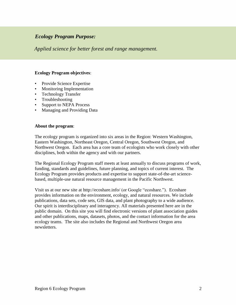
Ecology Program objectives:
• Provide Science Expertise
• Monitoring Implementation
• Technology Transfer
• Troubleshooting
• Support to NEPA Process
• Managing and Providing Data
About the program:
The ecology program is organized into six areas in the Region: Western Washington,
Eastern Washington, Northeast Oregon, Central Oregon, Southwest Oregon, and
Northwest Oregon. Each area has a core team of ecologists who work closely with other
disciplines, both within the agency and with our partners.
The Regional Ecology Program staff meets at least annually to discuss programs of work,
funding, standards and guidelines, future planning, and topics of current interest. The
Ecology Program provides products and expertise to support state-of-the-art science-
based, multiple-use natural resource management in the Pacific Northwest.
Visit us at our new site at http://ecoshare.info/ (or Google ―ecoshare.‖). Ecoshare
provides information on the environment, ecology, and natural resources. We include
publications, data sets, code sets, GIS data, and plant photography to a wide audience.
Our spirit is interdisciplinary and interagency. All materials presented here are in the
public domain. On this site you will find electronic versions of plant association guides
and other publications, maps, datasets, photos, and the contact information for the area
ecology teams. The site also includes the Regional and Northwest Oregon area
newsletters.
Ecology Program Purpose:
Applied science for better forest and range management.

Region 6 Ecology Program 3
Team: Jan Henderson, Robin Lesher, and Chris Ringo
Projects
1) Potential Natural Vegetation (PNV) Model and Mapping Project: We led a
coordinated PNV mapping project for Region 6 with wall-to-wall coverage for
Washington and Oregon. We provided products, data, and technical expertise from
this mapping effort (including maps, spatial data on potential vegetation and
environmental gradients, methodology, interpretation, training, and technical support)
to various government and land management agencies, resource professionals and
scientists throughout the Pacific Northwest. A wall-to-wall vegetation zone map at a
90-meter pixel resolution was completed for Oregon and Washington.
• PNV Overview Manuscript: Submitted manuscript ―Modeling potential natural
vegetation of the Olympic Peninsula USA using boundary equations and newly
developed environmental variables‖ to Ecological Society of America for possible
publication as a ―Concepts and Synthesis‖ paper in the journal Ecological
Monographs. Manuscript presents an overview of modeling and mapping
potential vegetation zones using a boundary equation approach, and presents the
newly defined environmental variables ―Precipitation at Sea Level‖, ―Mean
Annual Temperature at Sea level‖, ―Fog Effect‖ and ―Cold Air Drainage‖ effect,
plus modifications to existing concepts for the variables of Topographic Moisture
and Temperature Lapse Rate.
• PNV Model Development: Vegetation Zones, Plant Association Groups,
Environmental Gradient Models
• Calibrated, refined and completed map displaying 12 vegetation zones for
Washington State
• Installed over 1600 check-plots in OR and WA for calibrating and refining
vegzone map.
• Calibrated, refined and completed map displaying 20 vegetation zones for
Oregon State.
• Completed three vegzone field checking trips focusing on southwest and
eastern Oregon.
See map on following page: Potential Natural Vegetation Zones of Washington and
Oregon.
Western Washington Area Ecology Program (Area 1)
Mt. Baker-Snoqualmie, Olympic, and Gifford Pinchot National Forests

Region 6 Ecology Program 4
Region 6 Ecology Program 5
• PNV Model Application and Data Development
• Developed model architecture to address specific needs for modeling
vegetation in Oregon, specifically refining the function for stratifying the
landscape by geological regions (georegions), including Mt. Mazama ash
deposits, pyroclastic flows and serpentine bedrock.
• Developed NRCS soils-based model for a salt desert georegion based on soil
taxonomy.
• Incorporated layer of Pleistocene lake basins into the Cold Air Drainage
Model.
• Developed model for calculating Potential Evapotranspiration for
incorporation into PNV model
• Revised Oregon Ecoregion stratification and boundaries.
• Assembled and processed regional and other agency datasets of ecoplots to
use for building and calibrating vegzone model.
• Downloaded, processed and incorporated additional weather station and
SNOTEL data for Region 6 and adjacent areas.
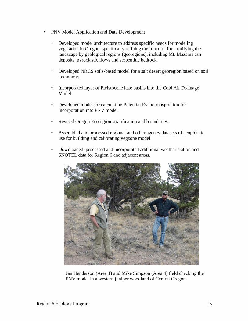
Jan Henderson (Area 1) and Mike Simpson (Area 4) field checking the
PNV model in a western juniper woodland of Central Oregon.

Region 6 Ecology Program 6
• Obtained and assembled the NLCD Landcover data for OR and WA
• Obtained and assembled the 25m ETM+ Landsat scenes for OR and WA
• Continued development and refinement of PNV Model PC Application, code
update and development, including online help manual and documentation
• Developed tools for analysis and display of data layers and model outputs
• Provided PNV Model application support for model users
Tom Sensenig and Pat Hochhalter (Area 5) and Jan Henderson (Area 1)
field checking the PNV Model in the Rogue River valley, Oregon.
2) Interagency Mapping and Assessment Project (IMAP) support: Provided updated
vegetation zone and plant association group maps
3) Ecology Program Database and GIS
• Data entry and maintenance of Western Washington Area Ecology database
• Continued data recovery efforts for Olympic National Forest corrupted fire
history GIS layer by reconstructing and/or restoring about 100 corrupted files
4) Cook Creek Cedar Theft (Olympic National Forest): Continued participation with
USFS law enforcement personnel and U.S. Attorney’s office on the Cook Creek
Region 6 Ecology Program 7
Cedar theft case on the Olympic National Forest. Henderson testified as an expert
witness at the restitution hearing in U.S. District Court in Tacoma on May 12, 2009.
Consultation and support:
1) Cedar Huckleberry Technical Committee for Tulalip Tribes – Mount Baker-
Snoqualmie National Forest Memorandum of Agreement (MOA)
Served on committee with representatives of Tulalip Tribes and Mount Baker-
Snoqualmie National Forest to develop recommendations for implementation of
provisions of the MOA, specifically those related to the gathering of botanical
resources and the distribution, ecology and sustainable management of these
resources to facilitate the exercise of treaty rights.
2) Vegetation Management
• Provided ecoplot data to Forest Silviculturist, including species composition,
stand structure and growth and yield data for the Beckler Thin Project Area, and
South Fork Thin monitoring plots
• Field consultation with Forest Silviculturist on alder ecology and management in
Beckler Project area.
• Provided list of native trees and shrubs for use in Washington State Department of
Transportation highway project at Stevens Pass area to the Forest Landscape
Architect
3) Forest Monitoring Report: Prepared report on monitoring activities of the Area
Ecology Program for the Forest Annual Monitoring Report.
4) Other consultation and support
• Fire history data for upper Suiattle area trail reconstruction project
• Provided review and ecological description for Bedal boat launch site for Forest
Landscape Architect
Cooperation and Technology Transfer
Ecology staff had contacts with resource professionals, scientists and academics from a
variety of agencies (USFS, BLM, NPS, NRCS, Department of Natural Resources, PNW,
USFWS, Oregon Natural Heritage Program, Washington Natural Heritage Program) and
universities in the PNW (University of Washington, Oregon State University, University
of Idaho). We responded to requests for technical expertise, knowledge and information

Region 6 Ecology Program 8
regarding PNV mapping, as well as a diverse set of ecological issues, questions and
subject matter.
1) Northwest Scientific Association 81st Annual Meeting: Henderson presented
―Vegetation History of Western Washington‖ in the plenary session; Lesher presented
―A Potential Habitat Model for Salal for the Olympic National Forest‖.
2) Olympic and Mt. Baker-Snoqualmie fire history data for talk at national fire
conference.
3) Slides on species habitat modeling for presentation at national mycological
conference.
4) Provided SW Oregon vegzone map to wildlife biologists working on West Coast
Fisher strategy.
5) Provided vegzone grids of Oregon and Washington to wildlife biologist researcher at
LaGrande PNW lab for input to a spatial model of elk nutritional resources.
6) Provided consultation, data and map products (vegzone and plant association group
maps) to the National Park Service and Oregon Natural Heritage Program for the
field sampling, classification and mapping project for the three National Parks in
Washington State.
7) Consulted with University of Washington PhD student investigating native uses of
huckleberries in Washington, including review of research proposal, and a site visit to
the study area to address questions and provide ecological training in field sampling
methods and protocols.
8) Cooperated with research scientist at University of Idaho studying genetics and
distribution of Abies species in the west; provided information and specimens to aid
in the research effort.
9) Provided data on high elevation plant species to participants in a national workshop to
develop critical loads for nitrogen deposition in alpine and subalpine ecosystems.
10) Consulted with research forester at University of Idaho Intermountain Forest Tree
Nutrition Cooperative regarding project to develop site type models of forest stand
productivity and maximum density, and use of environmental gradients and potential
vegetation. Provided Precipitation at Sea Level and Mean Annual Temperature at
Sea Level grids to aid in spatial and ecological analysis, and draft manuscript on
potential vegetation mapping and development of environmental variables.
11) Consultation with science teacher at Terrace Park Elementary School in Mountlake
Terrace regarding curricula for environmental education and the use of Terrace Creek
Park as a learning laboratory.

Region 6 Ecology Program 9
12) Addressed forest ecology questions on the Mt. Baker Ski Area for writer of
Snowboard Canada magazine.
13) Lesher serves on the Board of Trustees and is Secretary for the Northwest Scientific
Association, and was on the program committee for the 81st annual meeting held at
University of Washington, Seattle in March 2009. The meeting theme was ―The
Pacific Northwest in a Changing Environment‖. Most of this was accomplished as a
volunteer.
Program Goals FY2010 and beyond:
1) Complete manuscript of the PNV Vegetation Zone Model and Map for Washington
State. Submit for publication as Northwest Science Special Issue.
2) Complete Plant Association Group analysis, map and publication for western
Washington.
3) Monitor and install ecology benchmark plots and thinning monitoring plots to
document growth/mortality, changes in species composition and abundance and stand
structure.
4) Publish papers on thinning monitoring; species habitat models; benchmarks for old-
growth forest restoration; stand growth, development and succession for western
Washington forests.
5) Western WA Ecology database - develop Access database application--corporate and
public version
6) Consultation on Area Forests
7) Develop species habitat models for species of interest
8) Mt. Baker-Snoqualmie National Forest Office Guide
9) Fire History maps and stand year of origin analysis for northwest Washington
10) Non-forest classification for Mt. Baker-Snoqualmie and Olympic National Forests
11) Maintain 20-year old remote temperature stations to document climate change.

Region 6 Ecology Program 10
Team: Rod Clausnitzer, Kelly Baraibar, Gunnar Carnwath, Bill Gaines,
Richy Harrod, Pete Ohlson
Projects
The Area 2 Ecology Program was involved with projects during the 2009 field season
that represent area priorities in vegetation, fire, and wildlife ecology. The
accomplishments are reported in these three emphasis areas.
1) Vegetation Ecology
• One of the priorities was to re-establish and monitor Range Condition and Trend
clusters for the Tonasket Ranger District.
• In addition, seven streams were identified on the Methow Valley Ranger District
to assess the effects of range management on stream channels and streamside
vegetation. Multiple Indicator Monitoring (MIM) protocol was used to establish
implementation monitoring sites.
• The Ecology Program was involved in a monitoring study of the effects of
ungulate use on the fen meadows and, in particular, Carex gynocrates in the
Upper Falls Creek on the Methow Valley Ranger District.
• In the middle of the field season, the Okanogan-Wenatchee National Forest
Resource Staff recruited the Ecology Program crew to support botanical and
invasive plant surveys for the priority project, Travel Management Plan.
2) Condition and Trend Range Sampling, Okanogan-Wenatchee National Forest
• The Area 2 Ecology Program re-sampled allotment key areas during the 2009
summer season. Sampling followed the Nested Frequency, Cover Frequency and
Parker 3-Step methodologies. Data collection is compatible with the R6 Range
protocols and Natural Resource Information System (NRIS)-Terra database.
Allotments were selected based on interviews with forest personnel; the
allotments sampled would need allotment NEPA in the next few years.
• A total of 3 permanent clusters were re-sampled. Time was also spent on
planning for logistics, organization, photo labeling and management, GPS
correction and export to shapefile, and local Parker 3-Step database entry. All site
and vegetation data and narratives, Cover Frequency, and Nested Frequency data
were entered into NRIS. A Parker 3-Step analysis was performed on all three
Eastern Washington Area Ecology Program (Area 2)
Colville and Okanogan-Wenatchee National Forests

Region 6 Ecology Program 11
clusters to assess vegetation status (rating) by the same yardstick that was used
during the previous analyses.
Parker 3-Step analysis of range
clusters sampled in 2009
In addition, data that was previously migrated from the older NRIS Terra database to
the newer database contains several spatial points that are not in the correct location.
This data is currently being sorted and corrected.
3) Multiple Indicator Monitoring (MIM), Okanogan-Wenatchee National Forest
• An Interdisciplinary Team selected seven stream reaches on the Methow Valley
Ranger District to be monitored by Area 2 Ecology personnel. During the 2009
field season, seven designated monitoring areas were established and monitored.
Data were entered and analyzed in the MIM Data Analysis Module. The table
below contains the results of streams that were monitored.
Streams monitored on the Methow Valley Ranger District
Stream Name Ecological Status
Ben Canyon Creek Good
East Fork Buttermilk Creek Good
Libby Creek Good
Black Pine Creek Fair
Hornet Draw Creek Good
Little Bridge Creek Good
Poorman Creek Fair
4) Upper Falls Creek Carex gynocrates Monitoring Program
• The Ecology Program was involved in establishing a 3 year monitoring study of
the effects of ungulate use on the fen meadows and the TES sedge, Carex
gynocrates. Three buck and pole exclosures were constructed using on site
materials. One site showing very little cattle use was established as a control.
Water samples were gathered from 5 sites during spring run-off and again during
3 other periods during the season to look at possible changes in water chemistry.
Calcium and pH are indicators of fen health associated with cattle use. Eight
transects were installed at each of the 4 sites (3 w/ exclosures and 1 control). The
study design, field layout, data collection, and data entry was accomplished in
collaboration with personnel on the Methow Valley RD. Three pictures depicting
the fen and exclosures follow:
District Cluster Name Condition Trend
Tonasket Dugout C-1 Fair Static
Tonasket Dugout C-2 Fair Down
Tonasket Dugout C-5 Poor Static

Region 6 Ecology Program 12
Exclosure to the right and transects outside the exclosure to the left.
Transect with sampling frame
inside the exclosure at Site #2.

Region 6 Ecology Program 13
Transect tapes inside the exclosure at Site 2.
5) Botanical & Invasive Surveys for the Oka-Wen NFs Travel Management Plan
Two Districts on the Okanogan-Wenatchee NFs needed support to complete field
surveys for the Travel Management Plan. These two districts also had the most miles
of new proposals – approximately 100 miles of trails and roads to survey. Ecology
crew personnel conducted rare plant and invasive plant surveys to meet the survey
objectives for the 2009 field season. The Ecology Program was responsible for
coordinating with the RA’s on these districts to get information on routes to be
surveyed, flagging of routes and getting GPS information back to RA’s when illegal
routes were discovered. These sites can be used to inform future management
decisions regarding risk of invasives establishment and spread as a result of proposed
recreation activities.
6) Fire Ecology
• Completed progress report of Deer Point Fire Area snag plots (including data
collected during summer 2008. This report will be updated periodically (every 2-
3 years) to monitor snag decay rates of fire killed trees.
• Prepared ―A User’s Guide to Thinning with Mastication Equipment‖; posted on
Forest website.
• Visited all mastication sites and re-photographed plot photo points to visually
assess changes in forest vegetation following treatments.

Region 6 Ecology Program 14
• Worked with Methow Valley RD personnel to re-vegetate shrub species in safety
zone/wetland area that was created during the 2006 Tripod Fire. Established
transects (Oct 2008) to monitor survival and growth and re-sampled those same
transects (June 2009) for first year survival (85.9% overall survival). Prepared
report for RD on survival rates by different species within this area.
• Completed post-treatment re-sample, data analysis and prepared report of
FIREMON plots in the Burnt Valley project area of the Colville NF.
• Developed monitoring protocols to quantify in detail the surface fuel loads and
understory and overstory forest conditions. Established and collected data from
90 of these permanent plots in project areas on multiple Ranger Districts. These
plots will be re-measured following treatments that include various combinations
of thinning and prescribed fire to assess the impact of those treatments.
• Completed re-sample of ponderosa pine transects that were initially established in
2007 following the 2006 Tripod Fire. Trees were assessed for fire damage to
boles and crowns, mortality and current proportion of live crown recovery.
• Provided training to new employee on the Colville NF on general forest
measurements, monitoring plot establishment procedures and fire ecology of
inland northwest forests.
• Classified forest stand characteristics from aerial photographs of 360 random
polygon locations on the Naches RD for elk habitat research classification project.
• Assisted National Forest and PNW Lab personnel in aerial photo interpretation
and field reconnaissance of a large portion of the Naches RD.
• Collected field data on surface fuel loads and snag condition in past wildfire areas
as part of a Joint Fire Science re-burn project to assess the impacts of salvage
logging.
• Assisted PNW lab entomologist with permanent plot establishment and data
collection in stands of whitebark pine to assess the distribution of that species and
the occurrence of blister rust and mountain pine beetle damage. Also assisted
with cone collection of mature cones and additional data on whitebark pine to be
used as a potentially superior seed source for nursery stock.
7) Post-fire Salvage Harvest and Cavity Nesting Bird Monitoring
These funds were used to support a graduate student that is completing a Master’s
degree in Biology at Central Washington University. The funding this year was used
to complete data analysis and begin writing of the manuscripts for publication. Draft
manuscript should be submitted for publication in 2010. This information will be
valuable in determining the long term impacts of post-fire timber harvest on snag fall

Region 6 Ecology Program 15
rates, cavity nesting birds, and shrub nesting birds. Currently there is a lack of long-
term monitoring information on the effects of post-fire timber harvest on wildlife.
Partners include the Wenatchee Forestry Sciences lab and Central Washington
University.
8) Barred Owl Resource Selection Model Validation
A barred owl resource selection model was published in the Journal of Wildlife
Management in 2009 based on a study of barred owls completed on the Okanogan-
Wenatchee National Forest, Wenatchee River District. The Ecology Program funds,
along with other funds obtained from the Regional Office, were used to extrapolate
the resource selection model to the entire eastern-Cascades province and then barred
owl surveys were conducted in the spring and early summer of 2009 to test the model.
Surveys were conducted on the Entiat District, in the Icicle drainage on the
Wenatchee River District, and on the Naches District. Preliminary results of the
model validation are very encouraging and a final report is being prepared. This
information will allow district managers to determine the probability of barred owl
occupancy and evaluate the potential for vegetation management projects to affect the
probability of barred owl occupancy. This is a key factor in the recovery of threatened
northern spotted owl. Partners in this project included the Wenatchee Forestry
Sciences lab and the Wenatchee Field Office of US Fish and Wildlife Service.
9) Climate Change and Habitat Connectivity
This effort involves a wide range of partners collectively referred to as the
Washington Wildlife Habitat Connectivity Working Group (WWHCWG). Partners
include the Washington Department of Fish and Wildlife, Washington Department of
Transportation, Washington Biodiversity Council, University of Washington,
University of Montana Western Transportation Institute, The Nature Conservancy,
Conservation Northwest, US Fish and Wildlife Service, and US Forest Service.
During this past fiscal year, efforts were focused on addressing the existing condition
relative to habitat connectivity for a wide range of focal wildlife species. In addition,
field data were collected to obtain genetic material from a subset of the focal species
that can be used to validate our assessment of the current level of habitat connectivity.
A report summarizing the current condition will be drafted by the end of 2010 and
then work will begin on the evaluation of climate changes scenarios and possible
implications for wildlife habitat connectivity. This information will be valuable as we
address habitat connectivity and climate change in our forest plan revision process.
10) Effects of Thinning and Prescribe Fire on Large and Old Trees
The objective of this effort was to determine the effects that thinning and/or
prescribed fire have on the mortality of large and old trees. To evaluate this, large
trees were re-sampled within the Fire and Fire Surrogate Study units to determine
mortality rates by each of the treatments. A total of 1860 trees were sampled within
nine units to representing thin-only, burn-only, thin-burn, and control treatments. A

Region 6 Ecology Program 16
draft sampling protocol was also developed and will be finalized pending study
results. Results of the monitoring will be analyzed and summarized in FY 2010. This
study was also funded in part by the Regional Office as a result of concerns over the
loss of big trees from fuels reduction treatments. Our results and monitoring protocol
will be used across other parts of Region 6 where this issue is also controversial.
Partners for this monitoring effort included Region 6 Wildlife Ecology Program and
the Wenatchee Forestry Sciences lab.
11) Colville NF Snag Monitoring
This monitoring effort was supervised by Chris Loggers from the Colville National
Forest. The objective was to implement a snag monitoring protocol developed and
implemented on the Okanogan-Wenatchee a few years back to determine the effects
of thinning and/or burning treatments on the retention or creation of snag habitat.
Additional monitoring will occur to track the fate of the marked snags and to add
more sample units with different treatments in 2010.
12) Effects of Competition and Environmental Factors on Climate-Growth Relationships:
Implications for Forest Restoration and Management on the Colville National Forest
This project is an investigation of factors influencing the climatic sensitivity and
vulnerability of Pinus ponderosa and Psuedotsuga menziesii on the Colville National
Forest. Conclusions will help researchers better predict climate change-related
responses for these two dominant conifers species as well as inform new management
actions.
• Collected detailed individual-tree data and approximately 1300 tree cores from
thirteen stands across the full elevational distribution of Pinus ponderosa and
Psuedotsuga menziesii on the Colville National Forest.
Field sampling: Stand
measurements & core
collection

Region 6 Ecology Program 17
• Successfully completed all field work and data collection necessary to achieve the
proposed project.
• Utilized external funding to acquire laboratory equipment and personnel
necessary to mount, sand, cross-date, and measure all cores in partnership with
the University of Montana.
Cooperation and Technology Transfer
• Climate Change and Habitat Connectivity: This effort involves a wide range of
partners collectively referred to as the Washington Wildlife Habitat Connectivity
Working Group. Partners include the Washington Department of Fish and Wildlife,
Washington Department of Transportation, Washington Biodiversity Council,
University of Washington, University of Montana Western Transportation Institute,
The Nature Conservancy, Conservation Northwest, US Fish and Wildlife Service, and
US Forest Service. Further information given above.
• Partners for Effects of Thinning and Prescribe Fire on Large and Old Trees
monitoring effort included Region 6 Wildlife Ecology Program and the Wenatchee
Forestry Sciences lab.
• Singleton, P.H., J.F. Lehmkuhl, W.L. Gaines, and S.A. Graham. 2010. Barred Owl
Space Use and Habitat Selection in the Eastern Cascades, Washington. Journal of
Wildlife Management 74(2):285-294
• Worked with a graduate student that is completing a Master’s degree in Biology at
Central Washington University. The funding this year was used to complete data
analysis and begin writing of the manuscripts for publication on Post-fire Salvage
Harvest and Cavity Nesting Bird Monitoring.
Program Goals FY2010 and beyond:
• Continue working on Washington Wildlife Habitat Connectivity Working Group on
the Climate Change and Habitat Connectivity project.
• Follow-up monitoring on the Colville NF Snag Monitoring project.

Region 6 Ecology Program 18
Team: Sabine Mellmann-Brown, Jennifer Ferriel, Ken Stella
Projects
1) Ecology web pages: A region-wide overhaul of FS web pages to comply with
regional direction for accessibility and using a more standardized format is in
progress. Sabine will take over the webmaster duties when the overhaul on our web
pages is complete.
2) Ecology Database: Data entry for the 2009 field season is in progress. Legacy slides
will be scanned this winter. Student Temporary Employment Program student has
been hired and started 11-16-09.
3) Ranger District Assistance
• Three riparian restoration site visits on the Umatilla NF in conjunction with a
white paper on lessons learned, to be written this winter.
• Four site visits to the North Fork Burnt River riparian restoration project on the
Wallowa-Whitman, Whitman Unit to look at and discuss revegetation efforts and
potential fencing of aspen.
• Six days of range monitoring for the Long Creek RD, Malheur NF.
• Logan Fen visit to assess as possible new Research Natural Area proposal.
Sabine Mellmann-
Brown, Area 3 Lead
Ecologist, and Joe
Rausch, Malheur NF
Forest Botanist,
examine a dwarf
willow in Logan Fen.
Northeastern Oregon Area Ecology Program (Area 3) Wallowa-Witman NF, Malheur NF and Umatilla NF

Region 6 Ecology Program 19
• Site visit to Brock Allotment on Walla Walla RD, Umatilla NF.
• Three days of assisting in interpreting indicators of rangeland health in Hells
Canyon National Recreation Area for the Westside Rangeland Analysis
Environmental Impact Statement.
• Cusick Mountain limber pine visit.
4) Blue Mountains Forest Plan Revision Support: Vegetation Database Comparison
Meeting.
5) Fire effects studies
• Sampled permanent fire-effects monitoring plots for fires with dates ranging from
1990 to 2003. Malheur NF: 4 plots in 2 fires; Wallowa-Whitman NF: 14 plots in
2 fires.
• Two weeks of monitoring the Egley Fire with Fred Hall (one week in May, one
week in October).
6) Interagency Special Status and Sensitive Species Program (ISSSSP) projects
• Updated Fungi Management Effects Bibliography. This is an online resource for
information on mycorrhizal special status and sensitive species fungi (a subgroup
of ―Survey and Manage‖ species). The annotated bibliography entailed compiling
the best available science for management effects and developing an annotated
bibliography. The annotated bibliography is used for effects analysis in NEPA
documents.
• Survey for Rubus bartonianus, an ISSSSP endemic shrub of the Snake River
Canyon. Presented a poster on our study at the 24th Idaho Rare Plant Conference.
11 days were spent inventorying known sites and expanding population areas. A
preliminary report was compiled. We plan to develop a R. bartonianus habitat
model this winter. Funding was secured for the second field season.
• Four Days Assisting the Wallowa-Whitman botanist in collecting and identifying
threatened and endangered Carex species in the Wallowas.
7) Research Natural Areas (RNA): Visited Indian Creek RNA and Pt. Prominence
proposed-RNA regarding grazing issues and the potential expansion of the Eastside
Allotment.
8) Exclosures: Funded maintenance work by Ranger District staff on long-term ecology
monitoring exclosures in the Egley Fire area.

Region 6 Ecology Program 20
Personnel updates
Student Career Experience Program student (Ken Stella) was converted to an ecologist on
the Malheur National Forest in October 2009. Ken (most recently) came from Flagstaff,
AZ where he received a MS in Forest Ecology, from the School of Forestry, Northern
Arizona University.
Sabine Mellmann-Brown joined the Area 3 Ecology program in June FY09 as our lead
ecologist. Sabine comes from Bozeman MT, where she worked for Montana State
University as a post-doc on a variety of vegetation and landscape ecology projects.
Cooperation and Technology Transfer
1) Swanson, et al. In press. ―Aspen ecology and management in the Blue Mountains‖.
2) Stella, K.A., C.S. Sieg, P.Z. Fulé. In Press. ―Minimal effectiveness of native and
non-native seeding following three high-severity wildfires‖ Submitted to International
Journal of Wildland Fire.
Dr. Evan Larson with the OPB crew
examining an old growth limber
pine on Cusick Mountain.
Crossdating revealed a minimum
age of 868 years (Origin of inner
ring AD 1141, distance to actual
pith unknown).

Region 6 Ecology Program 21
Malheur NF employees,
at Plant Association
Training, examine
Potentilla gracilis.
3) Training provided
• Annual Tri-Forest range training session in Pendleton, March 2009. Two
presentations by Area 3 Ecology: 1. Monitoring: How much is enough? 2. How
to choose riparian monitoring locations and key species.
• Umatilla and Wallowa-Whitman Plant Association guide training, Umatilla NF,
Pendleton.
• Introduction to the Ecology Web Site and Plant Association guide training,
Malheur NF, John Day

Region 6 Ecology Program 22
Team: Gregg Riegel, Mike Simpson, Beth Johnson, Sara Prueitt Lovtang, Michael Mann
Projects
1) Administrative Studies Fire Ecology
Our program currently consists of several ongoing long-term studies. These studies
include examination of fuel treatments effects on understory vegetation, repeated fire
return interval, and of post-wildfire salvage logging.
Fire Ecology Plots Measured in 2009
Deschutes Modoc Total
Alternative Fuels Treatments Study Plots (plot size =1.0 ha)
Fall Burn 3
3
Spring Burn 5
5
Mow 2 4 6
Thin & Burn
4 4
Fire Return Interval Study Metolius Research Natural Area (RNA)
5-Year Fall 3 3
10-Year Fall 3 3
10-Year Spring 3 3
20-Year Fall 3 3
Control 3 3
Post-Wildfire Salvage Logging (plot size = 1.0 ha)
Logged 3
3
Not Logged 3
3
Old Growth Ponderosa Pine Long Term Monitoring Pringle Falls RNA (plot size
= 1.0 ha)
Burned 3
3
Totals 34 8 42
• Alternative Fuels Treatment Study:
A long-term study which began in 2000, the Alternative Fuels Treatment Study
was designed to examine the ecological effects of mowing and thinning, as
compared to the effects of prescribed burning in ponderosa pine/antelope
bitterbrush (Purshia tridentata) plant associations on the Deschutes, Fremont-
Winema, and Modoc National Forests. We currently have sixty four, 1.0 ha,
permanent plots, with new plots added when requested by individual forests.
Treatments include prescribed spring and fall burning, mowing, thinning, thinning
and burning, and control. Following NEPA approval, treatment implementation
Central Oregon Area Ecology Program (Area 4) Deschutes, Ochoco and Fremont-Winema National Forests

Region 6 Ecology Program 23
began in 2001. All plots were measured pre-treatment, and post-treatment
measurements are made annually though year 5, and then will be on a five year
interval through year 20. Matt Busse, Research Soil Microbial Ecologist, PSW,
Davis, is a cooperator.
The difference between litter and duff depth between the two treatments was no
longer statistically significant by the fifth year post-treatment
Bitterbrush cover has continued to increase on the control plots, but is only slowly
recovering on the plots which were commercially thinned then burned

Region 6 Ecology Program 24
• Reintroducing Fire in Eastside Ponderosa Pine Forests: Repeated Fire Interval
Study
We are examining long-term changes in understory composition, structure, and
soil processes in units that are repeatedly burned within old growth ponderosa
pine in Metolius Research Natural Area. This was the first and is the longest
running repeated fire interval study in the northwest. One other study was
conducted near Flagstaff, Arizona but these results cannot be extrapolated to
ponderosa pine in Central OR. Three treatment time intervals 5, 10, and 20 years,
and a control were selected based on the minimum, mean, and roughly the
maximum intervals from Joyce Bork’s dissertation (OSU, 1985) on Central
Oregon fire history. The original burns were done in the spring from 1992 to
1994. We are examining the effect of season of burn by comparing a spring
treatment vs. fall treatment within three replicate blocks that are reburned in the
spring at a 10 year interval. All other treatments receive their reburn in the fall
typically in late September through early October. This is a randomized block
experimental design with five treatments and three replicates per treatment.
Blocks range in size from 20 to 40 acres and each block has a 1.0 ha square plot
where we conduct our measurements.
In June and July 2009 we conducted the 17th year remeasurement. All 15 plots
were remeasured and one experimental unit was burned in late September 2009.
Our cooperator, Research Forester Andy Youngblood, PNW, La Grande, is
studying composition and structural changes within the overstory and downwood.
Perennial forb cover on control plots is slightly lower than on treated plots, but no
other clear trends in forb cover have emerged following repeated prescribed fire

Region 6 Ecology Program 25
Katie Gast and Lauren
Miller, COFMS fire effects
monitors, taking weather
observations during
Metolius RNA prescribed
fire. This unit is on a five
year fire return interval.
• Post-Wildfire Salvage Logging Study
In 2003, the 18 Fire burned approximately 3810 acres of ponderosa pine 3.5 miles
southeast of Bend, Oregon. Three of the Deschutes Alternative Fuels plots, a
control, a burn, and a mow plot, were burned by this crown fire. These three plots
were subsequently removed from the Alternative Fuels study, and became part of
the new Post-Wildfire Salvage Logging Study. Three additional plots were
installed, and each plot was assigned either salvage or non-salvage treatments.
Salvage treatments occurred in 2004. All six plots were measured in 2009,
providing us with a full five years of data since the logging occurred.
Shrub cover on
logged plots is
slightly lower
than on plots
which were not
logged, but in
both cases total
shrub cover has
already returned
to pre-fire levels,
and continues to
increase.

Region 6 Ecology Program 26
• Old Growth Ponderosa Pine Long Term Monitoring Pringle Falls RNA
Three long-term plots were treated with prescribed fire in 2006. These had been
installed in 1982, and were remeasured in 2006 prior to treatment, and have since
been remeasured annually.
Emily Heyerdahl, a
Research Forester at the
Missoula Fire Sciences Lab,
and collaborating partner on
the Long Term Monitoring
study, collecting fire scar
samples on the Ochoco
National Forest
2) Support to Interagency Mapping and Assessment Project (IMAP)
• Supported Forest Vegetation Simulator (FVS) calibration of Vegetation
Dynamics Development Tool (VDDT) models for East Cascades with Amy
Krommes
• Continued to explore feasibility of IMAP products for use at the project scale.
3) Potential Natural Vegetation Modeling for Central Oregon (Completed working draft
of sub-series Maps for the North Klamath Province (Eco-Regions 20208, 20209,
20210, 10305)
This project, a cooperative effort with Jan Henderson and Robin Lesher (Area 1
Ecologists), is currently in progress. It builds on methods developed by Henderson
and Lesher and applies them to Oregon east of the Cascades Mountains. A
significant portion of this project included creating a spatial soils layer with the
assistance of Peter Sussmann, Soil Scientist for Deschutes NF, for central and eastern
Oregon from numerous existing data sources (SSURGO, TEUI, SRI, ESI, and
STATSGO) and creating common soil attributes to use in the models. Work
continues on the north half (Bend to the Columbia River from the Cascade Crest east
to the John Day River).

Region 6 Ecology Program 27
• This work supports IMAP (defines area where specific VDDT models apply) and
supports Pine Bark Beetle Risk Mapping Project (FHM Project).
• Implements New East Cascades Plant Association Classification (at the sub-series
level)
• Draft Vegetation Zones (series level) and Plant association groups (sub-series
level) of the south half of the area (Bend to the California Border from the
Cascade Crest east to Plush) were delivered in September 2009.
4) National Riparian Technical Guide
This project began in spring of 2007 and is expect to be field tested during the field
season of 2010. Project objective: 1) review and synthesize existing protocols and 2)
produce a technical guide with a suite of protocols stratified by ecoregion that will be
a consistent and scientifically credible approach for inventorying and monitoring of
riparian areas on National Forest System lands.
5) Continued to work on cheatgrass study: Tested ―distance to nearest road‖ and
analyzed minimum and maximum temperatures and precipitation for the months of
January, February, March, April, May, October, November and December. Revised
draft document and preparing for submission to the journal Ecological Indicators.
Map showing the probability of cheatgrass for the Deschutes and Ochoco NFs

Region 6 Ecology Program 28
6) Wrote and submitted grant application for Title II (Secure Rural Schools and
Community Self-Determination Act of 2000) for the ―Weed Monitoring and Seeding
Trials After Wildland/Urban Interface Fuels Treatment‖ project. Coordinated with
fuels managers and botanists on the BLM and Crooked River Grasslands to enlarge
the scope of the proposed study.
7) NEPA Support for Forests in Area 4
• Cascade Lakes Scenic Byway Interpretive and Corridor Management Plan
Represented the Ecology Program as a core member of the Cascade Lakes Scenic
Byway Interdisciplinary Team. In FY09 we began the task of updating the
Interpretive Plan and Corridor Management Plan. The last update was in 1996,
and many of the goals in the 1996 plan had been accomplished, while others
needed to be added to or reprioritized. The updated plan will reflect the changing
demographics in the central Oregon area, as well as planning for the use of newer
technologies such as websites and podcasts. We are also in the process of using
grant money to develop 6 new interpretive signs, as prioritized by the Interpretive
and Corridor Management Plan. The final draft of the Interpretive and Corridor
Management Plan will be completed in FY2010.
• Firewood IDT, Bend-Ft. Rock
With continued beetle kill and high fire danger in portions of the RD of the
Deschutes NF, and a growing demand from the local population for firewood
collecting areas, two new areas were opened. Evaluated proposed impacts on a
variety of wildlife species, for Forest Plan compliance. Monitoring of the project
will continue into FY2010.
• Flank IDT, Bend-Ft. Rock RD
The proposed Flank project is designed to restore forest health and reduce the
accumulation of fuels which has resulted from past timber projects and fire
suppression efforts. Field work has included goshawk and log and snag surveys.
• North-South Arterial Trail Biological Evaluation (BE)
Wrote BE for wildlife species potentially affected by the creation of a new
mountain bike trail west of Bend.
8) Other support to Forest Projects within Area 4
• Developed Viable Ecosystems-GNN–FVS Tools with Leo Yanez for project
analysis. These tools implement local landscape vegetation analyses on Ochoco,
Deschutes, and Fremont-Winema NF’s.

Region 6 Ecology Program 29
• Eastside Spotted Owl Habitat Analysis
• Developed spatial queries of Size-Structure and Species Composition (Large
Douglas-Fir) using the GNN Data
• Rim-Paunina Project: A watershed on the south end of Crescent Ranger District
where the goal is to utilize forestry techniques to create and maintain a diversity
of habitats closer to what historically occurred (Crescent RD, Deschutes NF).
• Completed Landscape Ecology (HRV) Assessment using Viable Ecosystems
tools with Joe Bowles.
• Pringle Falls Experimental Forest project: silvicultural and fuel treatments within
the Lookout Mountain unit of the Pringle Falls Experimental Forest (Bend-Ft.
Rock RD, Deschutes NF)
• Completed Landscape Ecology Historical Range and Variability Assessment
using Viable Ecosystems tools with Paul Brna
Consultation (funded by others):
1) Assessment of Region 6 Aerial Detection Survey (ADS) mountain pine beetle (MPB)
mortality using CVS repeat measurements of individual tagged trees.
Conducted a formal region-wide assessment of ADS MPB mortality estimates in
terms of spatial agreement and intensity of mortality with ground based sampling of
lodgepole pine mortality.

Region 6 Ecology Program 30
Key findings: ADS significantly under-estimates the spatial extent of MPB mortality.
Only 18% of plots with dominant and co-dominant tree mortality were mapped by
ADS. Low spatial accuracy is attributable to failure to detect on-going mortality not
spatial misalignment of the mapped polygons. High MPB mortality within the CVS
plot re-measurement period increases the likelihood of detection. MPB mortality
events prior to CVS plot establishment seems to inhibit aerial detection of subsequent
MPB mortality and decrease the probability of inclusion in a ADS mortality polygon.
Where ADS and CVS data sources both show mortality, ADS underestimates
dominant and co-dominant tree mortality levels by a factor of 2-3 times. A journal
article documenting the methods and results is planned.
2) Calibration of Pine Bark Beetle Spatial Risk Maps for the State of Oregon. 20%
2008-2009.
Helped to develop a process for testing fine scale (30m) mountain pine beetle hazard
predictions (risk maps) derived from retrospective Gradient Nearest Neighbor (GNN)
imputations of ground based plot data. The GNN imputations were created with 1996
remote sensing data (TM) and 1993-1997 plot data (CVS plots) and represent the
existing vegetation in 1996. We then applied multiple rule sets for mountain pine
beetle hazard prediction to the existing vegetation dataset from 1996.
• Model rule sets:
• National Insect & Disease Risk Map (NIDRM) non spatial rules applied
spatially
• Host Tree Weighted rules (currently based on the number of LPP>9‖)
• Spillover attack (Host tree weighted rules calibrated by proximity to existing
MPB attacks)
• Site Quality (Spillover attack rules calibrated by site productivity): The hazard
predictions derived from each rule set were then compared to actual mountain
pine beetle activity from 1996-2008 based on cumulative ADS survey data
and actual mortality on the ground based CVS plots between establishment
(1993-1997) and re-measurement (1996-2007). Data analysis is still in
progress. A journal article documenting the methods and results is planned.
Cooperation and Technology Transfer
1) Dryland Forest Landscape Working Group-US Fish and Wildlife Service
2) USDA-Forest Service Technical Assistance Trip Kingdom of Morocco. In Support to
USAID/Morocco Technical Assistance on Grazing Management with Morocco’s

Region 6 Ecology Program 31
High Commission on Forests, Water and Combating Desertification For USAID-
Morocco’s Office of Economic Growth- May 5-19, 2009
3) Trainings, presentations and lectures given
• Presentations and trainings were given by Mike Simpson on how to use GNN Data
for the IMAP project: Winema-Fremont, Deschutes, and Ochoco National Forests
• Introduction to Fire Effects, course number RX310, Pacific Northwest Training
Center. Gregg Riegel was guest lecturer for the class located at the Redmond Air
Center February 9, 2009.
• Alternative Fuels Study Update for Fremont-Winema NF personnel. Johnson, E.J.
and G.M. Riegel. January 12, 2009.
• Poster created by Mike Simpson at the 2009 National Forest Health Monitoring
conference and a Formal presentation at the 2009 Western Forest Insects Work
Conference.
• Poster presented by E. Johnson, and G. Riegel. Fire return interval study in a
ponderosa pine forest in central Oregon. The California Association for Fire Ecology
Pacific Coast Fire Conference: Changing Fire Regimes, Goals and Ecosystems,
December 1-4, 2008.
• Presentation: E. Johnson and G. Riegel. Effects of fuel treatment alternatives on
antelope bitterbrush (Purshia tridentata) population dynamics, understory
composition, and overstory structure Johnson. The California Association for Fire
Ecology Pacific Coast Fire Conference: Changing Fire Regimes, Goals and
Ecosystems, December 1-4, 2008.
• Vasquez, E.A., G. Riegel, T.J. Svejcar. 2009. Litter Decomposition in a Sierra
Nevada Riparian Meadow as a function of Plant Species, Distance from Stream Edge,
and Grazing. Soc. For Range Manage, 62nd Annual Meeting, Feb. 8-12,
Albuquerque, NM.
4) Publications in draft or in print
• Publication on ―Estimating the Historical Range of Variability‖ using VDDT,
submitted by Jim Merzenich, Mike Simpson, Tom DeMeo, and Miles Hemstrom as
part of a GTR.
• Busse, M.D., and G.M. Riegel. 2009. Response of antelope bitterbrush to repeated
prescribed burning in Central Oregon ponderosa pine forests. Forest Ecology and
Management 257 (2009) 904–910.

Region 6 Ecology Program 32
• Busse, M.D., P.H. Cochran, W. E. Hopkins, W.H. Johnson, G.M. Riegel, G.O.
Fiddler, A.W. Ratcliff, and C.J. Shestak. 2009. Developing resilient ponderosa pine
forests with mechanical thinning and prescribed fire in Central Oregon’s pumice
region. Canadian J. of Forest Research 39:1171-1185.
5) The Ecoshare website was updated to include the IMAP project
(http://ecoshare.info/imap/), and added and edited documents for the IMAP site.
6) National Inventory and Assessment of Rangelands; Implementation Strategy for Data
Collection and Analysis, Policy Implications ―2007 Oregon Pilot‖. November 2008.
7) Attended a four-day training ―Restoration of Disturbed Sites with Native Plants: An
Integrated Approach‖ in June.
8) Graduate Committee Member for the following students:
Shuffield, C. Reexamining the encroachment of lodgepole pine on ponderosa pine in
the pumice zone of central Oregon M.S. Depart. of Forest Engineering, Resources
and Management, OSU. Expected completion date, June 2010.
Hoban, I. Physiologic Response of Antelope Bitterbrush to Varying Resources
Gradients. M.S. Dept of Forest, Range, and Watershed Stewardship, Colo. State
Univ. Expected completion date, September 2010. Co Major Professor.
Personnel update
The Area 4 Ecology Program faced many challenges during 2009 when two long-term
temporary employees’ positions expired, and a third permanent-employee on a detail was
in danger of sudden relocation. Several months of work were lost during the summer
field-season. Significant time was spent in changing one empty GS-07 permanent
position in the organizational charts into a GS-09, and then filling it. Further negotiations
are in progress to convert two long-term temporary positions into 1.5 permanent
positions. This will help alleviate time wasted in scrambling to solve staffing crises.
The Area 4 Ecology Program is grateful to the Student Temporary Employment Program
student, Michael Mann, for taking so much responsibility during the 2009 field season.
Program Goals FY2010 and beyond:
1) Grant awarded in 2009 by Joint Fire Sciences Program to develop A Guide to Fuels
Management in Riparian Areas of the Interior West. Principal Investigator: Kathleen
Dwire USFS Rocky Mt. Research Station. Co-Principal Investigators: Gregg Riegel,
Sandra Ryan, Timothy Burton.

Region 6 Ecology Program 33
2) Oregon Rangeland Pilot: Riegel, who is one of the three members of the Range
Technical Team, will be reviewing and preparing a final document in FY 2010. The
overarching goal of the ―Oregon Rangeland Pilot‖ is to formally test the feasibility of
a strategic inventory of all private and public rangelands using USDA NRI’s and
USFS FIA’s existing sampling designs for conducting a national assessment of
rangelands. The secondary goal is the development of a data base, for inventory and
future monitoring reports addressing the extent and amount of range indicators. The
thirteen county area of Central Oregon was chosen for the pilot. Rangeland resource
field sampling occurred in 2007, data analysis in 2008 and an external review was
delivered in November 2008 to the Washington Office of USFS, NRCS, and BLM.
External review was conducted by an oversight panel selected by the Ecological
Society of America in the winter of 2009.

Region 6 Ecology Program 34
Team: Tom Sensenig, Patricia Hochhalter
Projects
1) Monitoring and Field Studies - Forest Level Work
• Interdisciplinary participation on the Ashland Forest Resiliency Project, a fuels
and forest health treatment proposal for the City of Ashland, Oregon’s watershed,
in collaboration with the City of Ashland and The Nature Conservancy
• Research on fuel recovery dynamics on the almost 500,000 acre Biscuit Fire –
done in cooperation with Oregon State University (OSU), PNW, and Amy
Nathanson, a current Student Career Experience Program student in the Ecology
Program
• Utilizing Area Ecology data (Plant Association and ecology plot data); prepared
statistical analysis for site productivity for southwest Oregon
• Prepared local Down Wood and Snag Analysis for the National Hazard Tree
Removal Program.
• Working with OSU and PNW, prepared LIDAR (light detecting and ranging)
interpretive procedures utilized for ecological monitoring of the 2002 Biscuit Fire
• Implemented a fire history study in Late Successional Reserves on Prospect
Ranger District to aid in the understanding of how fire influenced the
development and growth of old-growth forests
• Completed comprehensive data processing of field collected records from the
Biscuit and Tiller Fires for use in density and stocking analyses
• Collaborated with Dr. Thomas Atzet to interpret and preserve valuable historic
legacy ecological data from: 1965 Dick Waring, 1973 Bill Emmingham, 1975
David Milner, and 1965 – 1970 Siskiyou NF Air and Temperature data
• Member of Forest Interdisciplinary (ID) Team for the Lower Rogue Vegetation
Strategy – Gold Beach Ranger District
• Forest-wide project scale mapping project
Southwest Oregon Area Ecology Program (Area 5) Umpqua and Rogue River-Siskiyou National Forests

Region 6 Ecology Program 35
Aging old-growth
stands on Lower
Rogue, Gold Beach
Ranger District, Oregon
2) Vegetation Classifications, Data Analysis, and Modeling
• Interagency Mapping and Assessment Project (IMAP) FVS/VDDT verification
process started, in cooperation with the Forest Silviculturist. VDDT (Vegetation
Development Dynamic Tool) is a forest landscape model that simulates and
compares the amount, age, and structure of vegetation types among varying future
management scenarios. Our ecology program assisted PNW’s Jim Merzenich and
Allison Reger in the development of VDDT models for southwest Oregon’s 16
potential vegetation types. This involved analyses of stand growth rates,
disturbance probabilities (fire, insects, disease, and wind) and their effects on
stand conditions, structures, and regeneration.
• Potential Natural Vegetation (PNV) mapping and modeling review with Dr. Jan
Henderson and Dr. Robin Lesher

Region 6 Ecology Program 36
Cooperation and Technology Transfer
1) Interagency Taskforces
• Participating member of the Northern Spotted Owl Recovery Plan Science Review
Team
• Panelist on the Klamath Province Dry Forests Recovery Plan Science Team
• Prepared the ecology analysis section for the Rogue River-Siskiyou NF Forest Plan
Amendment to incorporate Wildland Fire Use as a fire management tool
• Prepared responses to litigants in the Survey and Manage Species Environmental
Impact Statement Lawsuit
• Discussions with Forest Supervisors on ways in which the Ecology Program can help
the Forests with management issues that may develop with a changing climate.
Review of Port Orford cedar disease
resistance at the Dorena genetic laboratory
Cascade Siskiyou National Monument pine
plantation restoration in the newly
designated Soda Mt. Wilderness

Region 6 Ecology Program 37
• Conducted field reviews of legacy pine plantations in preparation for the development
of silvicultural prescriptions to enhance late-successional forest characteristics in the
recently designated Cascade Siskiyou National Monument
• Participated on the regional Port-Orford-cedar (and root disease) Technical Review
Team
2) Collaboration
• Participating on the Fuel Reduction and Forest Health Multi-Party Monitoring Team
in collaboration with TNC, Southern Oregon University, City of Ashland, the US
Forest Service, and several Environmental Organizations
• In collaboration with multiple agencies and universities, published the ―Influences of
Climate, Fire, and Topography on Contemporary Age Structure Patterns of Douglas-
fir at 205 Old Forest Sites in Western Oregon‖ 2009. Poage, Nathan, Peter Weisberg,
Peter Impara, John Tappeiner, Thomas Sensenig. Can. J. For. Res. 39:1518-1530.
• Preparing for publication ―Long-term Stand Development Patterns in Old-Growth
and Young Forests in Southwestern Oregon‖ with OSU’s John Bailey and John
Tappeiner
3) Outreach and Educational Development and Presentations: An important role of our
ecology program is to assist in educational and professional development.
• Participated on the teaching cadre for OSU Master Land Stewardship Course
OSU Rogue Tree School, a ―master gardener‖-like program for woodland owners.
Upon graduation participants will have prepared a long-term management plan for
their property.
• The Ecology program assisted the Ashland, OR. Parks and Recreation
Department – North Mountain Park Nature Center, in the preparation of a field
guide of the Vegetation History of the Bear Creek Watershed
• Instructor in the OSU/Southern Oregon Small Woodland Association training
program
• Presentation: Coastal Ecosystem Ecology, Agness, OR
• Presentation: The ecology of Lower Rogue River Vegetation, Curry County
Fairgrounds
• Presentation: Southern Oregon University’s Tree School Program
• Presentation: The geophysics of dry forest ecosystems at the TNC – Dry Forests

Region 6 Ecology Program 38
• Ecology Conference for State and County Land Managers
• Instructor at the Interagency Silviculture Training, Oregon Caves National
Monument
• Presentation (field) for the University of Washington and Oregon State University
Ecology Class – in conjunction with Jerry Franklin and Norm Johnson

Region 6 Ecology Program 39
Team: Cindy McCain, Jane Kertis, Jeanne Rice, Robin Dobson, Richard Hardt, Nancy
Sawtelle, Barbara Raible, Hugh Snook, Linda Geiser, Doug Glavich, Nancy Lankford,
Cheryl Friesen, and Jenny Lippert
Projects
1) Successional Pathways/ IMAP
In a long-standing NWO ecology group project, ecologists and silviculturists have
been describing the range of current stand conditions (structure and composition) and
common successional trajectories for forests across northwest Oregon. This effort
has become part of the regional Interagency Mapping and Assessment Process
(IMAP) project to develop successional models and planning tools for assessing
future management scenarios. The purpose of IMAP is to model the landscape
cumulative effects of treatments, to predict future vegetation conditions and to model
wildlife habitat. Using satellite imagery, FIA and environmental layers, the dataset
uses GNN (gradient nearest neighbor) method to map current conditions useful for
mid- to large-scale assessments. IMAP uses VDDT and Forest Vegetation Simulator
(FVS) to develop state-and-transition models for each distinct ecosystem. Current
ranges of tree density, size class distribution, species composition, and snag and down
wood densities have been summarized for the 13 vegetation types found in northwest
Oregon. Vegetation types vary from series level designations such as Sitka spruce to
sub-series level types such as cool western hemlock. In FY09 we completed initial
state and transition VDDT succession models for all the forested vegetation in NW
Oregon.
We are now using the FVS to validate the VDDT model state and transition times and
trajectories. Common trajectories include pathways under managed and natural
disturbance regimes. Model validation and modification is on schedule for the end of
FY10.
A draft of mapped initial conditions has been completed using attributes from the
GNN coverage. Products due in FY10/11include: diagrams of common pathways,
tables of ranges of structural and compositional attributes, and VDDT state and
transition models. This information will feed into various efforts underway, such as
Forest Service Forest Plan Revision, project plans, NEPA and silvicultural
prescription documents. This information has already been used to refine the
trajectory models for the pilot IMAP project in the Central Oregon Landscape Area
(COLA), and is being used as a key component in a National Science Foundation
grant with Oregon State University, the University of Oregon, and PNW Station.
Northwest Oregon Ecology Program (Area 6)
Mount Hood, Siuslaw, Willamette National Forests,
Columbia River Gorge National Scenic Area, in cooperation with Salem and Eugene
BLM Districts and the Central Cascades Adaptive Management Project

Region 6 Ecology Program 40
Below is an example of the intermediate mountain hemlock model:
2) Landscape level deadwood assessment
The ecology program's objective was to provide the NW Oregon forests with
summaries of existing deadwood conditions (using GNN) and reference deadwood
conditions (using localized DecAid unharvested inventory data) to provide a basis for
a forest-wide strategy for management of deadwood. In FY09, we analyzed updated
imagery. This year we also incorporated recent large fires to better reflect large wood
concentrations. We cooperated with the Regional Wildlife Biologist, forest and
district level biologists to mesh data with DecAID-based analyses to bring landscape
level coarse wood data into forest and project planning. Data revisions are ongoing.
Preliminary examples were being circulated among NWO FS units for review. In
FY10, the Mt. Hood NF plans to develop a forest-wide strategy; the Willamette NF
biologist will develop templates and sample analysis for projects there. Products will
be circulated among NF units as well as BLM units in Northwest Oregon.

Region 6 Ecology Program 41
3) National Science Foundation Grant: The Interactions of Climate Change, Land
Management Policies and Forest Succession on Fire Hazard and Ecosystem
Trajectories in the Wildland-Urban interface
The NW Oregon Ecology group is working with scientists from University of
Oregon, Oregon State University, PNW Research Station, and the R6 Regional Office
to model interactions and feedbacks between human and biological systems under the
influences of climate change and human population growth in the Willamette Valley
and low foothills. We will be modifying the current potential vegetation types and
VDDT modeling from the IMAP project and linking with climate change (MC1) and
fire (FlamMap) models to predict vegetation change through time. This will be
coupled with a human systems model that parameterizes people’s likely responses to
climate change, land use regulation and incentives, land markets, perceived fire
hazard, land management costs, and aesthetic preferences. The project is in the first
year of a four year cycle. We are just beginning to work out the specifics of the
modeling, mapping initial conditions, and developing the climate change link to our
IMAP products. This is a pilot project for the Region to develop a protocol to link
our vegetation models to climate change projections.
4) Huckleberries—Tribal culturally significant species
Ecologist Jeanne Rice provided support to the districts on huckleberry restoration,
revisiting existing photo monitoring plots and establishing new plots. She also
supported ID team stand selection and incorporated the use of plant association
guides. She will be working in FY10 with the PLASMA team to coordinate the Mt.
Hood NF huckleberry management plan and timing to work with the Confederated
Tribes of the Warm Springs.
5) Whitebark Pine
Developed the whitebark pine interpretative proposal for submission to the National
program. Ecologist Doug Glavich participated in field data collection to record white
bark pine blister rust conditions and complete plot species composition on Mt. Hood.
6) Special Habitats
• Oak/pine existing and historic vegetation mapping: The objective is to map
existing and historic oak and pine habitats across federal lands in NW Oregon and
describe the range to stand types and ecological amplitude in which they are
found. Oregon white oak, black oak, and ponderosa pine habitats have decreased
dramatically from historical conditions throughout their range. This component
of biodiversity provides habitat to over 200 wildlife species. The project can
identify restoration opportunities for Forests and BLM Districts. The existing
habitats are being mapped by NW Habitat Institute; historic mapping is being
completed using GLO survey notes. In 2009, after consultation with the eastside
districts and the Gorge, we contracted for completion of three orthoquads and four
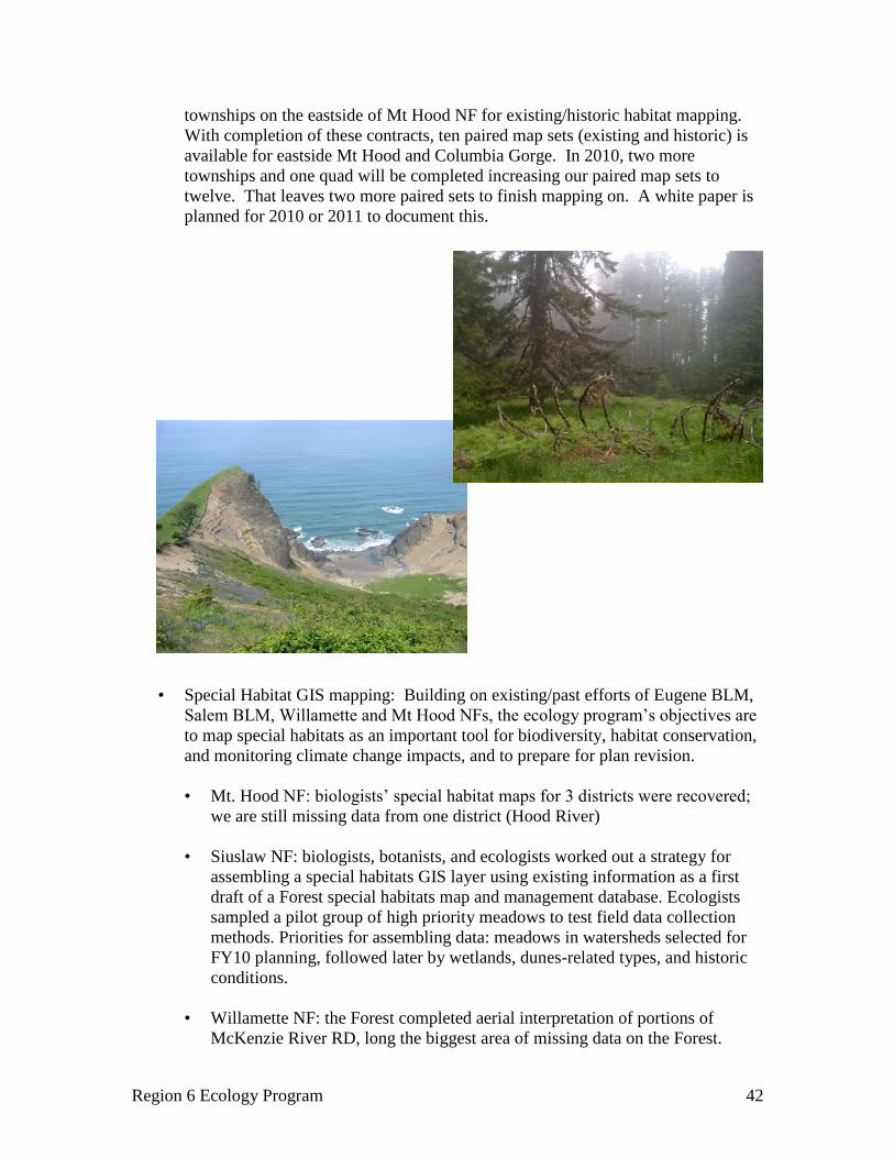
Region 6 Ecology Program 42
townships on the eastside of Mt Hood NF for existing/historic habitat mapping.
With completion of these contracts, ten paired map sets (existing and historic) is
available for eastside Mt Hood and Columbia Gorge. In 2010, two more
townships and one quad will be completed increasing our paired map sets to
twelve. That leaves two more paired sets to finish mapping on. A white paper is
planned for 2010 or 2011 to document this.
• Special Habitat GIS mapping: Building on existing/past efforts of Eugene BLM,
Salem BLM, Willamette and Mt Hood NFs, the ecology program’s objectives are
to map special habitats as an important tool for biodiversity, habitat conservation,
and monitoring climate change impacts, and to prepare for plan revision.
• Mt. Hood NF: biologists’ special habitat maps for 3 districts were recovered;
we are still missing data from one district (Hood River)
• Siuslaw NF: biologists, botanists, and ecologists worked out a strategy for
assembling a special habitats GIS layer using existing information as a first
draft of a Forest special habitats map and management database. Ecologists
sampled a pilot group of high priority meadows to test field data collection
methods. Priorities for assembling data: meadows in watersheds selected for
FY10 planning, followed later by wetlands, dunes-related types, and historic
conditions.
• Willamette NF: the Forest completed aerial interpretation of portions of
McKenzie River RD, long the biggest area of missing data on the Forest.
Region 6 Ecology Program 43
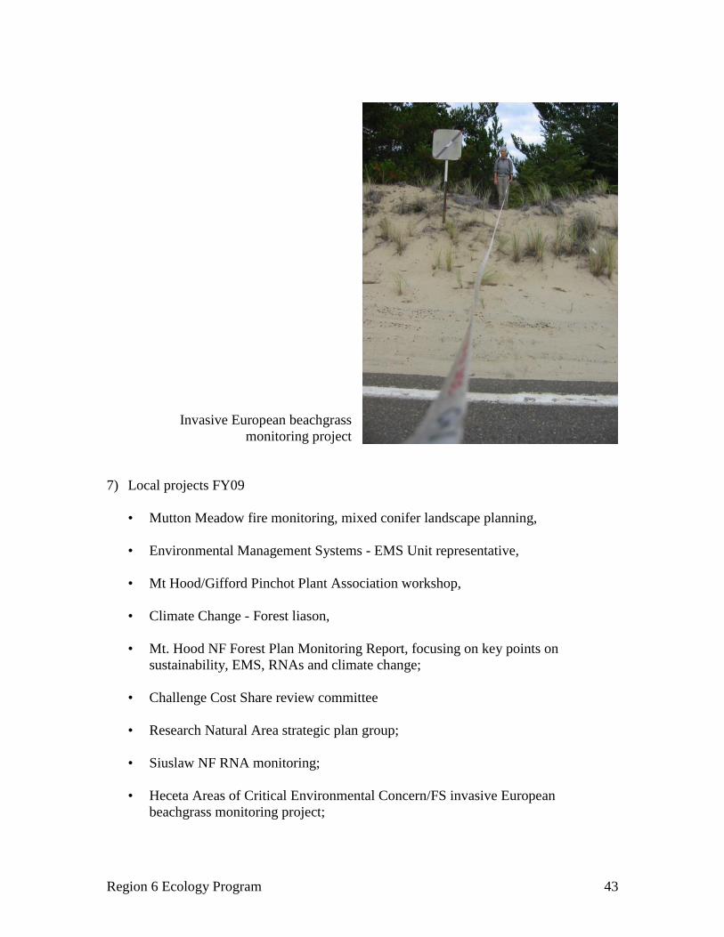
Invasive European beachgrass
monitoring project
7) Local projects FY09
• Mutton Meadow fire monitoring, mixed conifer landscape planning,
• Environmental Management Systems - EMS Unit representative,
• Mt Hood/Gifford Pinchot Plant Association workshop,
• Climate Change - Forest liason,
• Mt. Hood NF Forest Plan Monitoring Report, focusing on key points on
sustainability, EMS, RNAs and climate change;
• Challenge Cost Share review committee
• Research Natural Area strategic plan group;
• Siuslaw NF RNA monitoring;
• Heceta Areas of Critical Environmental Concern/FS invasive European
beachgrass monitoring project;

Region 6 Ecology Program 44
• estuarine restoration monitoring (Siuslaw NF Drift Creek Alsea project);
• Willamette NF Special Habitats Management Guide revision;
• cooperated with Oregon Natural Heritage Information Center in analyzing
riparian plant communities in the Willamette Valley.
8) Forest Interdisciplinary Teams (IDT):
• Willamette NF—member of Jim’s Creek IDT; oversight for the Rigdon dry forest
project; Mutton Meadow spring vs. fall meadow monitoring of fire effects on
understory native and non-native species as well as mortality and regeneration of
Oregon white oak and pine
• Siuslaw NF—Marys Peak Landscape Plan IDT; Salmon River Estuary
Restoration IDT
• Mt. Hood NF—forest wide deadwood strategy team
Consultation Cooperation and Technology Transfer
1) Torrey/Charlton RNA and Charlton Fire post-wildfire monitoring
• A paper summarizing post-1996 wildfire vegetation recovery in Torrey Lake Mire
is in draft, and should be submitted for publication this fiscal year.
• A draft paper documenting snag and down wood patterns the first 10 post-fire
years is scheduled for completion September 2010.
2) Annual Information sharing meeting (Area 6 Cheryl Friesen, lead)
The one day workshop explored available datasets, novel approaches for analysis, and
technological visualization tools for exploring natural resources at the landscape
level. Topics included a wide range of current efforts in the region that are pertinent
to FS and BLM: IMAP and VDDT, BLM’s Western Oregon Plan Revision—
analytical surprises; Gradient Nearest Neighbor spatial coverages, LiDAR,
FLAMMAP, and NETMAP.
3) Fire Regime Condition Class: Technology transfer sessions continue with the
Willamette National Forest Fuels Group, the Middle Fork District and the Siuslaw
National Forest fire group. We also worked with a fuels specialist on the Gifford
Pinchot National Forest to conduct a Forest wide FRCC analysis. We reviewed and
discussed appropriate interpretation and use in project planning, analysis and
reporting. Ecologist Jeanne Rice assisted Regional Ecologist Tom DeMeo on field
stops, stand history and instruction on the June 2009 FRCC workshop.

Region 6 Ecology Program 45
4) Oregon Oak Communities Fall Working Group: The NW Oregon Ecology group
helped organize this one day meeting, highlighting ongoing and completed work on a
landowner’s property.
5) Analysis of fire effects in dry forest ecosystems: May ’09 meeting. NW Oregon
Ecology Group and the Central Cascades Adaptive Management Partnership
(CCAMP) co-sponsored this information sharing meeting. The idea grew from
Willamette NF’s Middle Fork RD interest about burning and fire effects on dry site
forests. The morning session outlined information about fire effects, species
responses and fire history in these types, with an afternoon session of practitioners
discussing what’s worked and what hasn’t worked.
6) Analysis and planning tools for landscape level fire planning: May ’09 meeting. The
training session was co-sponsored by the Ecology Program and CCAMP. This hands-
on workshop focused on available fire behavior tools (FlamMap) to help fire
specialists plan and implement fuels treatments at the landscape level.
7) Summer field workshop on montane and foothills meadow restoration:
Two day workshop on Eugene BLM and Willamette NF. Presentations on restoration
projects in a wide range of meadow types were followed by field trips to active
meadow restoration sites in the Cascades.
8) Parks Creek IDT presentation, Willamette fuels group presentations
9) Plant Association Workshop—Gifford Pinchot NF: Ecologists provided a one day
plant association training for new employees and a refresher for those that had the
training before. The purpose was to show the utility of plant associations in the field
and in landscape assessments. More than 30 people participated.

Region 6 Ecology Program 46
Program Goals FY2010 and beyond:
• Prepare for large scale forest planning: complete input necessary to run Interagency
Mapping and Analysis (IMAP) scenarios for NW Oregon; test application of models
in landscape planning projects
• Provide fire ecology information to our clients: produce GTR and journal article for
post-fire studies at Warner Creek, Waldo Lake, as well as fire history of Willamette
Valley foothills and report on Cascade Crest fire history; continue technology transfer
and consultation with fire regime condition class (FRCC) analysis process and
implementation.
• Provide information on special habitats: oak pine work, estuaries, alpine/subalpine
meadows, Coast Range meadows, forest level mapping
• Train FS and BLM employees to understand and interpret plant communities in
management for silviculture, wildlife, botany, and recreation. Broaden understanding
of how potential natural vegetation models are integrated into planning and
management models.
• Hold a conference on managing early seral habitats for NW Oregon
• Continue to provide support at the local and regional scales for FS and BLM

Region 6 Ecology Program 47
Staff: Tom DeMeo, regional ecologist, works with contractors Sara Lovtang
(documentation and data management), Steffen Rasile (website), and Chris Ringo (GIS
applications). Presidential Management Fellow Nikola Smith will soon join this team as
an assistant ecologist.
The regional ecologist works in a team spirit with all disciplines using a distributed
leadership model. During FY09, in particular, we collaborated with Jim Merzenich and
Melinda Moeur (planning staff) on IMAP implementation; with Jim Alegria and Carol
Apple of the inventory group on data management; with Michael Golden (Regional
remote sensing specialist) on developing a Regional LIDAR strategy, with Tom Hilken
(Regional range program manager) on range data management and field monitoring, with
wildlife ecologist Kim Mellen-McLean on HRV/wildlife habitat issues; and with fire
ecologist Louisa Evers on building the fire science consortium and implementing
standards for post-fuels treatment monitoring.
Administration
The ecology regional commitment was $1.604 million in FY09, a 3.4% increase over the
FY08 level, and 9% greater than the FY07 budget. Ecologists were also actively
developing VDDT models and mapping for IMAP, and contributing to the migration of
NRIS data to the central Kansas City server, which is now complete.
We are building our capacity for data analysis, GIS, and website needs at the Regional
level. In FY09 Sara Lovtang joined us as a contractor, and has been assisting with adding
material to the IMAP portion of our website (http://ecoshare.info). Sara has also been
meeting some Central Oregon ecology program needs, such as preparing the riparian
scorecard guide for publication. FY09 also saw a major metamorphosis in ecoshare. The
site (www.reo.gov/ecoshare) was becoming untenable because of old software and a
rapidly changing Forest Service web environment. After a lengthy process of working
with the Regional Data Resource Management (DRM) unit to craft the best solution, it
was decided to not house ecoshare on a Forest Service server. Late in the fiscal year,
website manager Steffen Rasile was hired as a Tetra Tech contractor, and crafted the new
site. The new ecoshare also encompasses IMAP (Regional vegetation mapping and
monitoring), at least for now.
We were fortunate to add two ecologists to the cadre in FY09. Sabine Mellmann-Brown
became the Northeast Oregon area ecologist in July (filling the position vacated by Dave
Swanson), and Ken Stella joined the group in a new position on the Malheur National
Forest. Sabine came to us from the Nature Conservancy in Montana. Ken is considered
part of the Northeast Oregon ecology team, and converted from a SCEP position.
Pacific Northwest Regional Office
33 SW First Avenue, Portland, Oregon

Region 6 Ecology Program 48
Regionally, the vegetation zone layer of the Henderson potential natural vegetation layer
was completed wall to wall for Oregon and Washington. Kudos to Jan Henderson, Robin
Lesher, Chris Ringo, and others for this achievement. In FY10 we are striving to finish
the plant association group (PAG) layer, now being completed by Miles Hemstrom’s
landscape assessment team, in cooperation with Mike Simpson and Sabine Mellman-
Brown of the ecology program.
We are assisting the silviculturists in migrating to FSVeg Spatial, the agency’s NRIS
standard for local existing vegetation mapping. In FY09 we facilitated agreement on a
standard polygon numbering system for the Region, and Forest began migrating their
data. By the end of the fiscal year the Malheur NF had been migrated, and four other
Forests were nearing completion.
In the fire arena, FY09 saw the formation of the Pacific Northwest Fire Science
Consortium, a collaborative effort of Federal and state agencies, NGOs, and universities
to foster better technology transfer. We successfully competed for a Joint Fire Science
Program grant, and moved forward on meetings with the field, establishing a website, and
plans for a user conference (held in FY10).
Ecology also held a Regional FRCC training at Welches in June, assisted by Steve
Barrett of the National LANDFIRE tech transfer team, and by Jeanne Rice, ecologist on
the Mt. Hood NF. There are plans to hold another training on the Wallowa-Whitman in
June 2010.