2.0 INVENTORY - Jviationsites.jviation.com/ftg/MP/documents/FTG-Ch2-Inventory...Pave & mark Runway...
50
2‐1 2.0 INVENTORY The first step in the airport master planning process, as outlined in Federal Aviation Administration (FAA) Advisory Circular 150/5070‐6B, Airport Master Plans, involves gathering information about the airport and its environs. An inventory of current conditions is essential to the success of a master plan since the information also provides a foundation, or starting point, for subsequent evaluations. 2.1 Airport Overview Front Range Regional Airport (FTG or the Airport) is a public‐use, general aviation airport owned and operated by Adams County. Located in northeastern Colorado, Adams County is the fifth most populous county in Colorado, with a current population of approximately 460,000. As FTG’s owner, the County is responsible for operating and maintaining the Airport in a safe condition, and leasing properties within the Airport boundary. FTG is located along the Interstate 70 corridor near the town of Watkins, Colorado (Figure 2‐1), 26 miles east of downtown Denver and seven miles southeast of Denver International Airport (DEN). One of the largest general aviation airports in the country, FTG encompasses 3,349 acres of relatively flat agricultural land covered with prairie grass and a sparse collection of trees, of which 85 acres have been developed. The current Airport Reference Point (ARP)—defined as the approximate center of an airport’s runways— is located at Latitude 39°47’03.1200”N and Longitude 104˚32’15.4400”W. The Airport elevation—identified as the highest point along an airport’s runways—is 5,512 feet above mean sea level (MSL), and is located at the approach end of Runway 35. Established by the Adams County Board of Commissioners (BoCC), the Front Range Airport Advisory Board encourages community involvement and asks individuals with relevant expertise to make recommendations to the BoCC regarding the attraction, recruitment, retention, and infrastructure needs of FTG. The ten‐member board is appointed by the BoCC and consists of the County Manager or designee and members of the community from the following areas: current owners/tenants of the Airport, economic development, marketing, UAV sector, space sector, aviation sector, non‐ aviation business sector, Adams County citizen representation, and intergovernmental representation. This Airport Master Plan is intended to provide a comprehensive evaluation of FTG and result in a long‐term facilities and operational plan for the Airport.
Transcript of 2.0 INVENTORY - Jviationsites.jviation.com/ftg/MP/documents/FTG-Ch2-Inventory...Pave & mark Runway...

2‐1
2.0 INVENTORY
The first step in the airport master planning process, as outlined in Federal Aviation Administration (FAA) Advisory Circular 150/5070‐6B, Airport Master Plans, involves gathering information about the airport and its environs. An inventory of current conditions is essential to the success of a master plan since the information also provides a foundation, or starting point, for subsequent evaluations.
2.1 Airport Overview
Front Range Regional Airport (FTG or the Airport) is a public‐use, general aviation airport owned and operated by Adams County. Located in northeastern Colorado, Adams County is the fifth most populous county in Colorado, with a current population of approximately 460,000. As FTG’s owner, the County is responsible for operating and maintaining the Airport in a safe condition, and leasing properties within the Airport boundary. FTG is located along the Interstate 70 corridor near the town of Watkins, Colorado (Figure 2‐1), 26 miles east of downtown Denver and seven miles southeast of Denver International Airport (DEN).
One of the largest general aviation airports in the country, FTG encompasses 3,349 acres of relatively flat agricultural land covered with prairie grass and a sparse collection of trees, of which 85 acres have been developed. The current Airport Reference Point (ARP)—defined as the approximate center of an airport’s runways—is located at Latitude 39°47’03.1200”N and Longitude 104˚32’15.4400”W. The Airport elevation—identified as the highest point along an airport’s runways—is 5,512 feet above mean sea level (MSL), and is located at the approach end of Runway 35.
Established by the Adams County Board of Commissioners (BoCC), the Front Range Airport Advisory Board encourages community involvement and asks individuals with relevant expertise to make recommendations to the BoCC regarding the attraction, recruitment, retention, and infrastructure needs of FTG. The ten‐member board is appointed by the BoCC and consists of the County Manager or designee and members of the community from the following areas: current owners/tenants of the Airport, economic development, marketing, UAV sector, space sector, aviation sector, non‐aviation business sector, Adams County citizen representation, and intergovernmental representation.
This Airport Master Plan is
intended to provide a
comprehensive evaluation of FTG
and result in a long‐term facilities
and operational plan for the
Airport.

2‐2
The Airport provides Adams County with aviation facilities designed to accommodate a full range of aviation services and operators, ranging from small general aviation aircraft to large corporate business jets. In addition to its many aviation‐related benefits, FTG is an economic generator for the region, directly supporting industry, promoting tourism, and encouraging business development and expansion.
FIGURE 2‐1 ‐ FTG PROXIMITY MAP
-
2.2 Airport History
In 1974, the Denver Regional Council of Governments (DRCOG) adopted the Denver Regional Airport System Plan (RASP) that projected those aviation facilities required to meet existing and future aviation demand within the region through the year 2000. When incorporating the diminishing role of Denver Stapleton Airport for general aviation usage, the RASP’s forecasted growth in aviation activity for the region exceeded those existing airport facilities that were available at the time (both public and private). The RASP concluded that even if the region’s existing public airports were expanded to their maximum development potential, four new general aviation airports would be required by the year 2000. The 1980 National Airport System Plan recommended construction of two new general aviation reliever airports in the Denver Metropolitan Region; one of these airports was Adams County Airport, which later became Front Range Airport.
FTG’s first Master Plan was completed in 1982, and included a phased development plan through the year 2003. An Environmental Assessment (EA) of the impacts of the proposed airport development was prepared in conjunction with the Master Plan. The EA was presented at a public hearing in April of 1982, and subsequently submitted to the Federal Aviation Administration (FAA). The FAA accepted the Master Plan and approved the EA. Construction of the Airport began in 1983 and Runway 8/26 was opened for service in August 1984.
Chapter 2 – Inventory
Front Range Airport Master Plan 2018 2‐3
FTG’s 2004 Master Plan focused on the long‐term development of the Airport with a focus on promoting and enhancing general aviation activities, providing opportunities to develop air cargo operations to satisfy regional demands, providing continued growth prospects for aviation‐related industries, and promoting continued local economic growth and development. While the 2004 Master Plan reflected an aggressive development plan, most of those projects have yet to be executed. In particular, the focus on air cargo operational development at FTG has been tabled indefinitely.
Additional information related to the development of the Airport since 1982 can be seen by examining the history of FAA Airport Improvement Program (AIP) grants, as shown in Table 2‐1.
TABLE 2‐1 ‐ HISTORY OF AIP GRANTS
AIP Number Fiscal Year
AIP Federal Funds Work Description
3-08-0016-01 1982 $2,750,000 Grade & drain Runway 8/26 parallel and connecting taxiways, building area & airport access road. Relocate portion of County Rd. 26N. Install perimeter fence
3-08-0016-02 1982 $3,300,000 Pave & mark Runway 8/26, aircraft parking apron and access Rd. Install segmented circle and lighted wind cone
3-08-0016-03 1983 $1,948,588 Pave & mark parallel taxiway system for Runway 8/26. Install MIRL and signage system, VASI-2, Beacon & airport security lights
3-08-0016-04 1985 $1,320,321
Grade, drain, pave & overlay Runway 17/35 and connecting Taxiway. Install MIRL for Runway 17/35. Expand Terminal Apron. Install drainage in Special base operator Area. Install Airport access road lighting
3-08-0016-05 1986 $440,492 Land acquisition for approach protection
3-08-0016-06 1986 $105,140 Construct 2-bay maintenance equipment building
3-08-0016-07 1986 $130,974 Land acquisition
3-08-0016-08 1987 $500,000 Pave airport owned hangar. Master Plan Update; including EA & land acquisition. FAA: Construct aprons & connecting taxiways
3-08-0016-09 1987 $19,998 Airport Layout Plan (ALP) Update
3-08-0016-10 1987 $1,311,697 Install ILS/MALSR system; replace MIRL/HIRL, apply markings to Runway 8/26, land reimbursement (Parcel 1B); upgrade AWOS-II to AWOS III
3-08-0016-11 1988 $1,300,000 $800,000 land reimbursement (Parcels IC, ID & 5A) $500,000 expansion of Terminal apron, apron flood lighting
3-08-0016-12 1989 $2,552,588 Acquire parcels 2, 4B, 5, 6, 7, 7B, 9, 9B, 11 and parcel 1 improvements; provide relocation assistance
3-08-0016-13 1990 $3,033,392 Site preparation and drainage for Runway 17R/35L including parallel taxiway D and connecting Taxiway C
3-08-0016-14 1991 $3,976,768 Pave and light Runway 17R/35L, pave parallel taxiways
3-08-0016-15 1991 $460,698 Reimbursement for acquisition of parcels 4, 4D, and 9C; 156 acres
3-08-0016-16 1991 $1,721,579 Construct a General Aviation apron area and dual connector taxiway
3-08-0016-17 1992 $417,923 Reimbursement for acquisition of parcels 3, 9D & 9E
3-08-0016-18 1993 $1,956,203 $400,000 for NAVAIDs; acquire SRE, grade Runway critical areas
3-08-0016-19 1993 $2,588,605 Construct access road, SRE building, and east taxiway system
3-08-0016-20 1996 $1,630,120 Rehabilitate Runway 8/26 & connector taxiways; improve Runway edge, lights and Runway precision markings
The FAA has invested over $48
million in FTG since its construction
in 1983.

2‐4
AIP Number Fiscal Year
AIP Federal Funds Work Description
3-08-0016-21 1998 $434,500 Rehabilitate guidance signs for Taxiways A, B, C, D, E and connecting taxiways. Install signage & supplemental wind cones for Runways 8/26 & 17/35
3-08-0016-22 1999 $580,000 Rehabilitate Terminal Apron. Construct Portland cement concrete parking slab.
3-08-0016-23 1999 $185,000 Land Acquisition
3-08-0016-24 1999 $306,000 Land Acquisition
3-08-0016-25 2000 $200,000 Land Acquisition for approach protection of 8/26. Relocation assistance and demolition of buildings
3-08-0016-26 2001 $200,033 Update Airport Master Plan
3-08-0016-27 2002 $150,000 Acquire SRE, acquire land for approach protection
3-08-0016-28 2003 $2,003,587 Runway 17/35 Overlay
3-08-0016-29 2005 $300,000 Rehabilitate Taxilanes, Taxiway A7, install AWOS
3-08-0016-30 2006 $163,977 Rehabilitate west half of Taxilane 7B
3-08-0016-31 2008 $150,000 Rehabilitate east half of Taxilane 7A
3-08-0016-32 2009 $2,100,000 Rehabilitate Terminal Apron
3-08-0016-33 2009 $129,072 Rehabilitate west half of Taxilane 7A
3-08-0016-34 2010 $150,000 Rehabilitate east half of Taxilane 7B
3-08-0016-35 2010 $1,000,000 Construct electrical vault, replace airfield lighting control system
3-08-0016-36 2011 $130,000 Replace Runway 17/35 edge lights
3-08-0016-37 2011 $1,205,000 Rehabilitate Taxiway D
3-08-0016-38 2012 $3,859,000 Rehabilitate Runway 8/26
3-08-0016-39 2014 $3,049,000 Rehabilitate Taxiway A
Source: FAA
2.3 Airport Role
Airports can play different functional roles and can contribute at many levels in meeting the transportation and economic needs on national, regional, state, and local levels. Identifying and understanding the various roles that an airport plays is essential for that airport to be developed with facilities and services appropriate to fulfilling its respective roles. Following are FTG’s various role classifications.

Chapter 2 – Inventory
Front Range Airport Master Plan 2018 2‐5
2.3.1 National Plan of Integrated Airport Systems (NPIAS)
The NPIAS is an FAA‐sponsored national airport system plan whose purpose is to identify the airports that are important to national air transportation. Being identified within NPIAS makes an airport eligible to receive grants under the FAA’s Airport Improvement Program (AIP) for the planning and implementation of airport capital improvements and infrastructure development. Specifically, NPIAS defines an airport by its service level, which reflects the type of service that a given airport provides for its host community. This service level also defines the funding categories established by Congress to assist in the distribution of funding resources for airport development.
The 2015‐2019 NPIAS classified FTG as a public‐use Reliever service level airport. Reliever airports are airports designated by the FAA to relieve congestion at Commercial Service Airports and to provide improved general aviation access to the overall community.
2.3.2 General Aviation Airports: A National Asset
In 2012, the FAA prepared General Aviation Airports: A National Asset (ASSET 1) which further classifies the nation’s nearly 3,000 general aviation (GA) airports, heliports, and seaplane bases identified in the FAA's NPIAS. This in‐depth analysis highlights the pivotal role GA airports play in our society, economy, and the aviation system. The study also aligns the general aviation airports into four categories—national, regional, local, and basic—based on their existing activity levels. These categories better capture their diverse functions and the economic contributions GA airports make to their communities and the nation.
The FAA’s Asset study classifies FTG as a Regional airport, defined as an airport that supports general aviation activities such as emergency service, charter or critical passenger service, cargo operations, flight training, and personal flying. This grouping is characterized as having “high levels of activity with some jets and multi‐engine propeller aircraft, averaging about 90 total based aircraft, including 3 jets.”
In 2014, ASSET 2 was released to further review those NPIAS airports that were unclassified in ASSET 1. ASSET 2 did not impact FTG’s classification as a Regional airport.
2.3.3 Colorado Statewide Airport System Plan
Colorado Department of Transportation (CDOT) Aeronautics conducted a study in 2011 to provide an analysis of the statewide airport system of public use airports. CDOT produced an extensive assessment of the current system’s condition, as well as a guide for meeting its current and future needs. This plan provided tools to help facilitate the continued successful development of its aviation system, and to show the relationship between system performance measures, benchmarks, and facility and service objectives that were established in 2000.
Front Range Airport is classified in the CDOT Airport System Plan's Technical Report as a Major General Aviation airport. Airports must meet the following objectives to be classified in this category:

2‐6
Runway length adequate for all small aircraft
Primary runway width of at least 75 feet
Full or partial parallel taxiway for the primary runway
2.4 Economic Impact
In 2013, CDOT conducted an Economic Impact Study for Colorado airports that measured the economic contributions that stem from on‐airport activities and off‐airport spending by visitors that arrive via an airport. The economic contributions of these activities are measured through jobs, associated payroll, and economic output. On‐airport activities include tenants and airport‐related activities such as administration, operation, and maintenance. Visitor spending includes food, lodging, transportation, entertainment, and retail purchases that result in support of local jobs and payroll. Capital improvement projects at the airports also support jobs and payroll over the duration of the project. The capital improvement, airport, tenant, and visitor impacts, in conjunction with multiplier effects, represent total economic contribution for a given airport.
Through this planning effort, FTG’s annual economic impact in 2013 was estimated to be $75.5 million in total economic output, generating 489 jobs with a total annual payroll of $31.6 million. Additionally, according to this study, FTG generates 19,000 visitors to Colorado.
2.5 Primary Airport Data
Table 2‐2 provides a summary of some of the important primary data elements for FTG. The most recent (2014) Airport Layout Plan was utilized as the source for much of the data.
TABLE 2‐2 ‐ PRIMARY AIRPORT DATA
Data Element FTG Data
Airport Name Front Range Airport
FAA Designation FTG
Airport Sponsor Adams County
Associated Town Watkins, CO
Date Established 1983
Airport Management Full-time staff Front Range Airport Advisory Board
Airport Roles FAA NPIAS: Reliever FAA ASSET: Regional CDOT: Major General Aviation
Radio Frequencies Unicom: 122.95 MHz CTAF: 120.2 MHz ATIS: 119.025 (303-261-9104)
Airspace Classification Class G up to 699 AGL, Class D surface-8,000 AGL (when ATCT operating)
Airport Reference Point N 39° 47' 03.1200" W 104° 32' 15.4400"
Elevation 5,512’ Mean Sea Level
Acreage 3,349 acres
FTG Economic Impact in 2013

Chapter 2 – Inventory
Front Range Airport Master Plan 2018 2‐7
Data Element FTG Data
Sectional Chart Denver
Mean Maximum Temperature 88.1°F (July)
Precipitation
Mean Maximum Rain: 2.43” (May) Total Average Annual Rainfall: 15.48” Mean Maximum Snow: 12.6” (March) Total Average Annual Snow: 59.6”
Source: FTG ALP 2014; FAA 5010 Airport Master Record, Western Region Climate Center Notes: AGL‐ Above Ground Level
2.6 Airside Facilities
Airside facilities consist of the parts of the Airport that accommodate the movement of aircraft, and encompass runways, taxiways, airfield lighting, and other facilities necessary to support flight activity. Figure 2‐2Error! Reference source not found. depicts FTG’s existing airside facilities.
FIGURE 2‐2 ‐ FTG AIRSIDE FACILITIES
Source: Jviation

2‐8
2.6.1 Runways
As shown in Figure 2‐2, FTG has two runways (Runway 8/26 and Runway 17/35) that are perpendicular to each other, although they do not intersect. Both runways have full parallel and connecting taxiways that provide aircraft access to the terminal and other facilities on the Airport. Table 2‐3 provides additional detail about each runway: size, markings, pavement type/strength, elevation, gradient, runway design code (RDC), and critical aircraft intended to use the runway most frequently.
TABLE 2‐3 ‐ FTG RUNWAY INFORMATION
Element Runway Data
Runway 8/26
Dimensions 8,000’ x 100’
Runway Markings Precision-Instrument
Runway Surface Type Asphalt
Runway End Elevations 5449.8’ / 5485.4’
Visual Slope Indicator PAPI-2L
Effective Gradient .4%
Pavement Strength 28,000 pounds Single Wheel (SW) 40,000 Dual Wheel Gear (DW)
Pavement Condition Excellent (PCI = 86-100)
RDC C-II
Critical Aircraft Bombardier Challenger CL604
Runway 17/35
Dimensions 8,000’ x 100’
Runway Markings Precision-Instrument
Runway Surface Type Asphalt
Runway End Elevations 5472.5’ / 5511.5’
Visual Slope Indicator PAPI-4L
Effective Gradient .5%
Pavement Strength 34,000 pounds Single Wheel (SW) 75,000 pounds Dual Wheel Gear (DW)
Pavement Condition Fair (PCI = 56-70)
RDC C-II
Critical Aircraft Bombardier Challenger CL604
Source: FTG ALP 2014; CDOT; FAA 5010 Airport Master Record
Runway 8 at FTG

Chapter 2 – Inventory
Front Range Airport Master Plan 2018 2‐9
2.6.2 Taxiways
Taxiways are paved areas over which airplanes move from one part of the airfield to another. One of their more important uses is to provide access between the terminal/hangar facilities and the runways. There are three types of taxiways: parallel, entrance/exit, and access. Taxiways that are parallel to runways generally provide a route for aircraft to reach the runway end. Entrance/exit taxiways, which usually connect runways to parallel taxiways, provide paths for aircraft to enter the runway for departure or leave the runway after they have landed. Access taxiways provide a means for aircraft to move among the various airside components of an airport: hangar areas, aprons, fueling areas, etc.
FTG has two full‐length parallel taxiways (one for each runway), each with seven connecting taxiways. Table 2‐4 details information about each taxiway including type, associated runway, width, and condition (based on pavement condition index standards).
TABLE 2‐4 ‐ FTG TAXIWAY INFORMATION
Taxiway ID Type Associated Runway
Width (feet) Condition
A Parallel 8/26 50 Excellent (PCI = 86-100)
A3 Entrance/Exit 8/26 50 Excellent (PCI = 86-100)
A4 Entrance/Exit 8/26 50 Excellent (PCI = 86-100)
A5 Entrance/Exit 8/26 50 Excellent (PCI = 86-100)
A6 Entrance/Exit 8/26 50 Excellent (PCI = 86-100)
A7 Entrance/Exit 8/26 50 Excellent (PCI = 86-100)
A8 Entrance/Exit 8/26 50 Excellent (PCI = 86-100)
A9 Entrance/Exit 8/26 50 Excellent (PCI = 86-100)
R1 Access 8/26 50 Poor (PCI = 41-55)
R2 Access 8/26 50 Fair (PCI = 56-70)
B Access 8/26 & 17/35 50 Good (PCI = 71-85)
C Access 8/26 & 17/35 50 Poor (PCI = 41-55)
C1 Access 8/26 & 17/35 90 Poor (PCI = 41-55)
C2 Access 8/26 & 17/35 90 Poor (PCI = 41-55)
E Access 17/35 50 Good (PCI = 71-85)
E7 Entrance/Exit 17/35 70 Fair (PCI = 56-70)
D Parallel 17/35 50 Fair/Good Poor (PCI = 41-70)
D1 Entrance/Exit 17/35 70 Fair/Good Poor (PCI = 41-70)
D2 Entrance/Exit 17/35 90 Fair/Good Poor (PCI = 41-70)
D3 Entrance/Exit 17/35 90 Fair/Good Poor (PCI = 41-70)
D5 Entrance/Exit 17/35 90 Fair/Good Poor (PCI = 41-70)
D6 Entrance/Exit 17/35 70 Fair/Good Poor (PCI = 41-70)
D7 Entrance/Exit 17/35 70 Fair/Good Poor (PCI = 41-70)
Source: Jviation, CDOT
Taxiway at FTG
2‐10
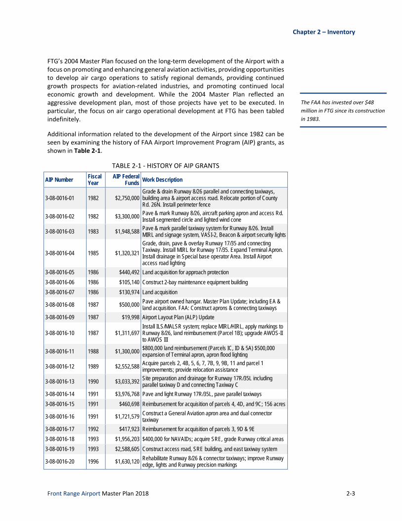
2.6.3 Aprons
An aircraft apron area is used for aircraft movement and positioning, vehicle movement and parking, and aircraft tie‐down. FTG has two aircraft aprons: the Terminal Apron, and the East Apron. Located south of Runway 08/26 and Taxiway A, the asphalt Terminal Apron measures approximately 2,400 feet by 300 feet and serves the needs of both based and transient aircraft. It has 144 marked tie‐downs for all aircraft, and has a concrete hardstand that measures approximately 210 feet by 90 feet. Pavement conditions of the Terminal Apron currently range from fair on the western half of the apron to poor and very poor on the eastern half. The asphalt East Apron measures approximately 1,200 feet by 400 feet and is located on the east side of the Airport, adjacent to the airport maintenance buildings. The pavement condition of the East Apron is currently considered to be poor.
2.6.4 Airfield Lighting
Identification Lighting
A rotating beacon with the universally accepted optical system for lighting airports identifies the location of the Airport. This beacon projects alternating green and white beams from dusk to dawn. When activated during daylight hours, the beacon signals Instrument Flight Rule (IFR) conditions. The FTG beacon is located in the terminal area.
Runway Lighting
Lighting aids are necessary to provide pilots with critical takeoff and landing information concerning runway alignment, lateral displacement, rollout operations, and distance. Table 2‐5 identifies the lighting aids available for each runway.
Runway edge lights are used to outline edges of runways during periods of darkness or restricted visibility conditions. Runway 6/24 is outfitted with High Intensity Runway Lights (HIRL) while Runway 17/35 has Medium Intensity Runway Lights (MIRL).
A Precision Approach Path Indicator (PAPI) is a series of lights that provides visual guidance during a runway approach. At FTG, each runway approach end is equipped with PAPIs that are owned and maintained by the Airport. Additionally, both Runway 8 and Runway 17 have Medium Intensity Approach Lighting System with Runway Alignment Indicator Lights (MALSR) that provide visual information to pilots on runway alignment, height perception, roll guidance, and horizontal references. On the other ends, Runway 26 and Runway 35 are equipped with Runway End Identifier Lights (REIL).
TABLE 2‐5 ‐ FTG RUNWAY LIGHTING
Lighting Runways
8 26 17 35
Approach Lighting REIL MALSR REIL MALSR
Runway Edge Lighting HIRL HIRL MIRL MIRL
Terminal Apron at FTG
Chapter 2 – Inventory
Front Range Airport Master Plan 2018 2‐11
Lighting Runways
8 26 17 35
Centerline Lighting None None None None
Visual Glide Slope Indicator (VGSI) PAPI PAPI PAPI PAPI
Source: FAA 5010 Airport Master Record
Taxiway Lighting
At FTG, only Taxiway D and its associated connectors are equipped with a Medium Intensity Taxiway Light (MITL) system to identify pavement edges. No other taxiways on the airport (e.g., Taxiways A, C, B, E and their associated connectors) are equipped with a taxiway lighting system, although their taxiway edges are marked with blue and yellow reflectors.
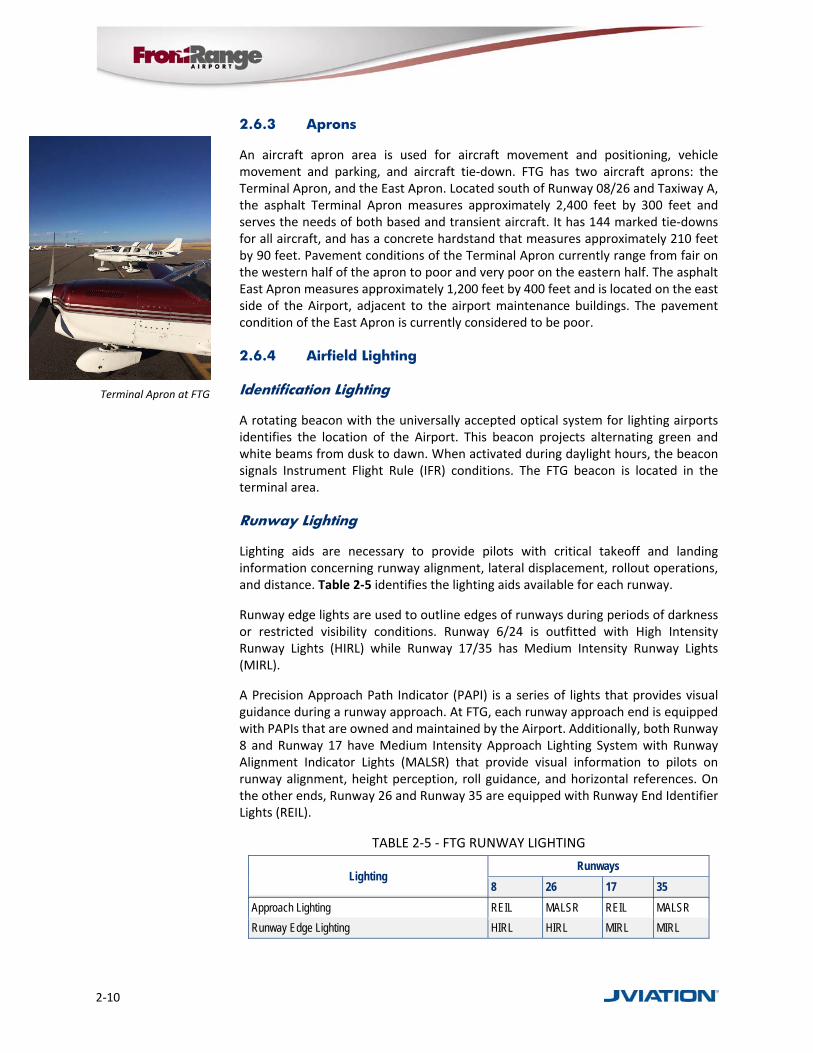
Visual Aids
Additional visual aids and instrumentation at FTG assist pilots in arriving or departing. The Airport’s segmented circle and integrated wind cone provide pilots with traffic pattern and wind direction/velocity information. This equipment is centrally located near the terminal area. The segmented circle/wind cone is lighted and located north of the mid‐point of Runway 8/26.
Signage provides essential guidance to identify items and locations on an airport. Airfield signage gives pilots visual guidance information for all phases of movement on the airfield. FTG is equipped with FAA‐compliant signs that include instruction, location, direction, destination, and information signs.
2.6.5 Automated Weather Observation System
FTG has an Automated Weather Observation System‐III (AWOS) that provides continuous weather reports transmitted via VHF radio frequency. An AWOS is an automated sensor suite that is voice synthesized to provide a weather report that can be transmitted via VHF radio, non‐directional beacon (NDB), or VHF omni‐directional radio range (VOR), ensuring that pilots on approach have up‐to‐date airport weather for safe and efficient aviation operations. Most AWOS observe and record temperature and dew point in degrees Celsius, wind speed and direction in knots, visibility, cloud coverage and ceiling up to 12,000 feet, freezing rain, thunderstorm (lightning), and altimeter setting. This information can be heard on frequency 119.025. The AWOS at FTG was installed through grants from CDOT and the FAA.
2.7 Landside Facilities
Landside development at the Airport includes a terminal building, fixed base operator facilities, and aircraft hangar facilities.
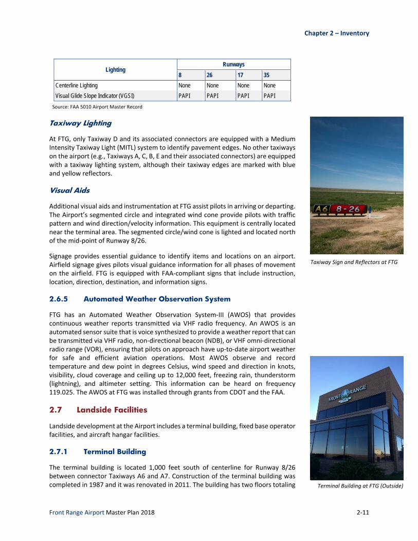
2.7.1 Terminal Building
The terminal building is located 1,000 feet south of centerline for Runway 8/26 between connector Taxiways A6 and A7. Construction of the terminal building was completed in 1987 and it was renovated in 2011. The building has two floors totaling
Taxiway Sign and Reflectors at FTG
Terminal Building at FTG (Outside)

2‐12
9,500 square feet, with the first floor consisting of a 900‐square‐foot pilot's lounge, restroom facilities, public telephones, vending machines, office space, customer service counter, employee locker room, and dining area. The second floor is home to the Airport administrative offices, a large conference room, and storage area. It is in excellent condition.
Fixed Base Operator (FBO)
Airports must provide a wide range of services to meet the varied demands of its individual market area. These demands are frequently accommodated by a fixed base operator (FBO) located on the airport that provides a variety of aeronautical services for pilots, aircraft, and passengers. FBO Services at Front Range is a full‐service FBO that is owned and managed by Adams County. Located adjacent to the terminal apron and integrated with the terminal building, the FBO is open seven days a week from 7am to 9pm; Avgas self‐fueling is available 24 hours a day. The FBO also provides the following non‐inclusive list of services.
Aircraft maintenance
FlyBuys Rewards Program
Hertz Rent‐A‐Car on‐site
Catering
Deicing/anti‐icing
Corporate/crew lounge with shower
Corporate and general aviation services
Courteous, professional line service
Meeting and conference facilities
Airport cars
Shuttles to DEN and local hotels
Flight planning and weather room
The Aviator Bar and Grill
Ground power units/lavatory services
Heated hangars
Hotel reservations
2.7.2 Hangars
Hangars are enclosed structures for the parking, servicing, and maintenance of aircraft, designed to protect aircraft from adverse weather conditions such as wind, snow, hail, ice, sun, and rain. FTG currently has over 790,000 square feet of on‐airport hangar space consisting of box hangars and T‐hangars. In order to manage the large number of hangar buildings and units, FTG has broken down and identified specific areas on the airport by “modules,” with the Terminal Area accommodating Module 1, Module 2, and Module 3. Figure 2‐3 depicts the hangar locations and their respective modules.
Box hangars, also known as conventional hangars, have a square or rectangular footprint that can be sized to accommodate a wide range of aircraft storage needs,
Terminal Building at FTG (Inside)
Hangar Area at FTG

Chapter 2 – Inventory
Front Range Airport Master Plan 2018 2‐13
Box Hangars at FTG
ranging from one single‐engine aircraft up to multiple corporate jets. FTG currently has 21 box hangar structures that accommodate 156 individual units. There are also nine large executive hangars on the property. In total, these hangars provide approximately 466,000 square feet of hangar space.
T‐hangars are a series of interconnected aircraft hangars with footprints in the shape of a “T” that can store one single‐ or multi‐engine aircraft in each unit. FTG currently has 148 nested T‐hangar units in 12 separate structures. In total, these provide over 324,000 square feet of hangar space.
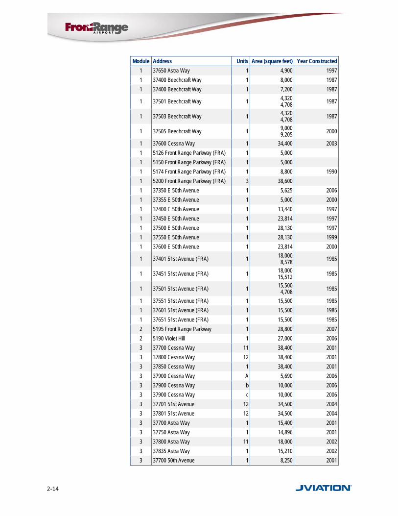
FTG’s existing hangar and building units are listed in Table 2‐6.
FIGURE 2‐3 ‐ FTG HANGAR LAYOUT
Source: Jviation
TABLE 2‐6 ‐ FTG HANGARS
Module Address Units Area (square feet) Year Constructed
1 37350 Astra Way 1 3,500 2002
1 37400 Astra Way 13 13,000 1997
1 37450 Astra Way 13,440 1998
1 37500 Astra Way 6 13,824 1997
1 37550 Astra Way 10 37,440 2000
1 37355 Astra Way 1 3,000 2000
1 37600 Astra Way 6 13,940 36,642 1997
1 37625 Astra Way 1 5,400 2000
2‐14
Module Address Units Area (square feet) Year Constructed
1 37650 Astra Way 1 4,900 1997
1 37400 Beechcraft Way 1 8,000 1987
1 37400 Beechcraft Way 1 7,200 1987
1 37501 Beechcraft Way 1 4,320 4,708 1987
1 37503 Beechcraft Way 1 4,320 4,708 1987
1 37505 Beechcraft Way 1 9,000 9,205 2000
1 37600 Cessna Way 1 34,400 2003
1 5126 Front Range Parkway (FRA) 1 5,000
1 5150 Front Range Parkway (FRA) 1 5,000
1 5174 Front Range Parkway (FRA) 1 8,800 1990
1 5200 Front Range Parkway (FRA) 3 38,600
1 37350 E 50th Avenue 1 5,625 2006
1 37355 E 50th Avenue 1 5,000 2000
1 37400 E 50th Avenue 1 13,440 1997
1 37450 E 50th Avenue 1 23,814 1997
1 37500 E 50th Avenue 1 28,130 1997
1 37550 E 50th Avenue 1 28,130 1999
1 37600 E 50th Avenue 1 23,814 2000
1 37401 51st Avenue (FRA) 1 18,000 8,578 1985
1 37451 51st Avenue (FRA) 1 18,000 15,512 1985
1 37501 51st Avenue (FRA) 1 15,500 4,708 1985
1 37551 51st Avenue (FRA) 1 15,500 1985
1 37601 51st Avenue (FRA) 1 15,500 1985
1 37651 51st Avenue (FRA) 1 15,500 1985
2 5195 Front Range Parkway 1 28,800 2007
2 5190 Violet Hill 1 27,000 2006
3 37700 Cessna Way 11 38,400 2001
3 37800 Cessna Way 12 38,400 2001
3 37850 Cessna Way 1 38,400 2001
3 37900 Cessna Way A 5,690 2006
3 37900 Cessna Way b 10,000 2006
3 37900 Cessna Way c 10,000 2006
3 37701 51st Avenue 12 34,500 2004
3 37801 51st Avenue 12 34,500 2004
3 37700 Astra Way 1 15,400 2001
3 37750 Astra Way 1 14,896 2001
3 37800 Astra Way 11 18,000 2002
3 37835 Astra Way 1 15,210 2002
3 37700 50th Avenue 1 8,250 2001

Chapter 2 – Inventory
Front Range Airport Master Plan 2018 2‐15
Module Address Units Area (square feet) Year Constructed
3 37825 North Avenue 1 4,200 2002
3 37835 50th Avenue 1 3,300 2002
3 37870 50th Avenue 2 9,000 2008
3 37900 50th Avenue 2 9,000 2008
Source: Airport Records 2016
2.8 Airport Support Facilities and Equipment
2.8.1 Aircraft Fuel Storage
Front Range Airport offers both Jet‐A and Avgas fuels for sale and use by aircraft. Avgas (or aviation gasoline) is used by aircraft having reciprocating piston engines. The most common grade of Avgas is 100 low lead (or 100LL). Jet‐A is a kerosene‐based fuel that contains no lead and is used for powering turbine‐engine (jet or turboprop) aircraft. As previously mentioned, Adams County has retained the right to have FTG personnel serve as the Airport’s lone FBO, resulting in the Airport realizing all profits associated with fuel sales.
Aviation fuel at FTG is stored in two locations. The first site abuts the terminal apron and provides 100LL self‐fueling capabilities through a single, 10,000‐gallon, single‐walled above‐ground storage tank. The second site is a dedicated fuel farm located on Cessna Way, southeast of the terminal area. This site houses three underground fuel storage tanks: one 20,000‐gallon 100LL tank, and two 15,000‐gallon Jet‐A storage tanks. A leak detection system has been installed for each underground tank, and all tanks are in good condition. This site also offers self‐serve fueling capabilities through a dispenser located immediately adjacent to the fuel farm. Table 2‐7 depicts the total fuel flowage at FTG for the period of 2004‐2014.
TABLE 2‐7 FUEL FLOWAGE
Year 100LL (Gallons) Jet A (Gallons)
2004 219,261 150,862
2005 207,772 160,803
2006 203,886 157,779
2007 186,393 194,123
2008 156,950 162,667
2009 172,972 167,932
2010 152,935 175,600
2011 137,372 167,199
2012 120,351 168,607
2013 132,617 155,109
2014 131,881 188,362
Source: Airport Records, 2015
Fuel Farm at FTG
Self‐Fueling Site at FTG

2‐16
The Airport also utilizes fuel trucks to deliver and dispense aircraft fuel. These mobile fuel trucks include a Bowser 100LL fuel truck, an International Jet‐A fuel truck, and two Ford 800s also used for Jet‐A fuel. The conditions of these fuel trucks range from fair to good. All storage tanks and fuel trucks are owned by Adams County.
2.8.2 Airport Equipment
FTG owns and operates an inventory of vehicles and equipment to perform airfield maintenance, snow removal, and aircraft rescue and firefighting operations. Snow removal and firefighting equipment are eligible for FAA funding, while other maintenance equipment may be eligible for funding through CDOT Aeronautics.
Aircraft Rescue and Firefighting Equipment
Aircraft Rescue and Firefighting (ARFF) is a special category of firefighting on airports for response, evacuation, and possible rescue of passengers and crew in an aircraft. Since FTG is not a Federal Aviation Regulations (FAR) Part 139 airport (commercial certificated airport), it is not required to provide ARFF services. However, FTG does offer ARFF services with an FAA‐defined Index B truck with a 1,500‐gallon water/foam capacity, an Index E truck containing 500 pounds of dry chemical powder, and a Rapid Intervention Vehicle with 250 gallons of water‐foam capacity as well as 300 pounds of dry powder. CDOT donated these vehicles to FTG, and are all in fair condition. They are stored in the maintenance bay with most of the other maintenance vehicles. Additionally, a mutual governmental agreement to provide emergency response exists between FTG and the Bennett Fire Department.
Snow Removal Equipment
Snow Removal Equipment (SRE) is used to clear runway, taxiways, and aprons during snow events. FTG currently owns and operates the SRE inventoried in Table 2‐8.
TABLE 2‐8 ‐ SRE INVENTORY
Year Brand and Type Condition
1993 International Plow Truck Fair
1993 International Plow Truck Fair
1993 Oshkosh P-Series Truck Fair
1993 Oshkosh P-Series Truck Fair
1996 Stewart Stevenson broom Fair
1996 Stewart Stevenson broom Fair
1993 International Paystar 5000 truck Fair
1994 International Paystar 5000 truck Fair
1982 Oshkosh Blower Poor
1987 Oshkosh Blower Poor
2003 Oshkosh Broom Good
Source: Airport Records
Snow Broom at FTG
Fuel Truck at FTG
ARFF Truck at FTG

Chapter 2 – Inventory
Front Range Airport Master Plan 2018 2‐17
Other Airport Maintenance Equipment
FTG has a variety of other maintenance equipment in its inventory for mowing, aircraft fueling and operations, and general maintenance. Table 2‐9 shows a list of existing equipment and current condition.
TABLE 2‐9 ‐ AIRPORT EQUIPMENT & VEHICLES
Year Make/Model Use Condition
2002 Chevy Blazer Operations/Maintenance Fair
2004 Chevy 2500 Silverado Pick Up Operations/Maintenance Good
2004 Chevy 2500 Silverado Pick Up Operations/Maintenance Good
1997 Chevy 2500 Cheyenne Pick Up Operations/Maintenance Fair
1996 GMC 3500 1 Ton Pick Up Operations/Maintenance Fair
2002 GMC 3500 Van Operations/Maintenance Fair
2001 Case 821 Loader Maintenance Fair
1986 Case Backhoe 580 E Maintenance Fair
1985 Yanmar Tractor YM 336 D Maintenance Poor
2009 Schulte Mower Deck Maintenance Poor
1991 Rhino Mower Deck Maintenance Poor
1992 Bush Hog Mower Deck Maintenance Poor
2014 John Deere 5085E Maintenance New
2009 New Holland TV 6070 tractor Maintenance New
2008 Bobcat S220 Maintenance Good
1998 Bobcat 873 Maintenance Poor
1984 Ford F-800 Dump Truck Maintenance Poor
1994 International H Flatbed Truck Maintenance Fair
1958 Ford F-800 Boomtruck Maintenance Poor
1993 Air Compressor Trailer Maintenance Fair
Unknown Light Trailer Maintenance Fair
2012 Magma 230 Cracksealer Maintenance Good
1996 Berry Crack Sealer Maintenance Fair
2002 Tymco air sweeper Maintenance Fair
1986 Tennant 95AA sweeper Maintenance Poor
1965 Towmotor forklift Maintenance Poor
Unknown Miller welder Maintenance Good
2012 Lighted X’s trailer #one Maintenance Good
2012 Lighted X’s trailer #two Maintenance Good
1985 Ford F-800 Sludge Truck Maintenance Poor
1999 Ford F-40 Tow Truck Maintenance Good
1999 GMC 3500 Crane Truck Maintenance Good
Unknown PSI Tug FBO Equipment Fair
1986 United Tug FBO Equipment Poor

2‐18
Year Make/Model Use Condition
1981 White Tug FBO Equipment Fair
2006 Eagle Tug FBO Equipment Fair
1998 Hobart Ground Power Unit FBO Equipment Fair
Unknown Blue Hobart GPU FBO Equipment Poor
2006 International 100LL fuel truck FBO Equipment Good
2005 100LL Bowser fuel truck FBO Equipment Fair
2007 International Jet fuel truck FBO Equipment Good
1985 Ford F- 800 Jet fuel truck FBO Equipment Poor
1990 Ford F-150 PU FBO Equipment Poor
1998 Chevy C1500 PU FBO Equipment Fair
1998 Jeep Cherokee SE FBO Equipment Poor
2008 Chevy Impala Silver FBO Equipment Good
2008 Chevy Impala Red FBO Equipment Good
2008 Chevy Impala White FBO Equipment Good
2000 Buick Le Sabre FBO Equipment Fair
2002 GMC Envoy Red FBO Equipment Fair
2004 GMC Envoy Silver FBO Equipment Fair
1992 E-One ARFF ARFF Good
1984 GMC ARFF ARFF Poor
2009 WWTP Generator Good
2008 Terminal Cummings Generator Good
2011 Electrical Vault Cummings Generator Good
2005 Tower Cummings Generator Good
Source: Airport Records 2016
ARFF/SRE/Airfield Maintenance Buildings
The ARFF/SRE/Airfield maintenance building is located 2,400 feet east of Runway 17/35 centerline and 500 feet north of the approach end to Runway 17. The building is only one level, but when it was constructed, it was designed to support the addition of a second floor when activity and demand at the Airport warrant such an expansion. The existing building is approximately 11,000 square feet with seven bays for equipment storage. Four of the bays have overhead doors that are 25 feet wide by 18 feet high, two bays have doors that are 16 feet wide by 18 feet high, and the last bay has an overhead door that is 12 feet wide by 18 feet high.
Located 165 feet to the east, a second maintenance storage building was constructed in 2012. This metal‐sided, 6,400‐square‐foot building was constructed to provide covered storage for additional equipment in order to extend their operational lifespans. It should be noted that even with these two buildings, the Airport must store some vehicles and equipment outside.
ARFF/SRE/Airfield Maintenance
Building at FTG
Chapter 2 – Inventory
Front Range Airport Master Plan 2018 2‐19
2.8.3 Airport Access Roadways and Parking
Adequately accommodating automobile traffic and storage are important considerations during a master plan as they facilitate ease of access to airport users and can enhance the customer service experience. The following section summarizes existing road and parking conditions at the Airport.
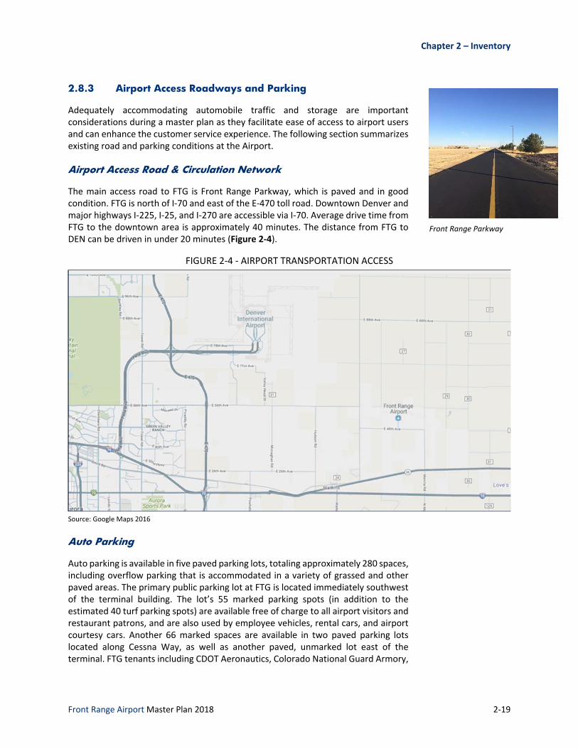
Airport Access Road & Circulation Network
The main access road to FTG is Front Range Parkway, which is paved and in good condition. FTG is north of I‐70 and east of the E‐470 toll road. Downtown Denver and major highways I‐225, I‐25, and I‐270 are accessible via I‐70. Average drive time from FTG to the downtown area is approximately 40 minutes. The distance from FTG to DEN can be driven in under 20 minutes (Figure 2‐4).
FIGURE 2‐4 ‐ AIRPORT TRANSPORTATION ACCESS
Source: Google Maps 2016
Auto Parking
Auto parking is available in five paved parking lots, totaling approximately 280 spaces, including overflow parking that is accommodated in a variety of grassed and other paved areas. The primary public parking lot at FTG is located immediately southwest of the terminal building. The lot’s 55 marked parking spots (in addition to the estimated 40 turf parking spots) are available free of charge to all airport visitors and restaurant patrons, and are also used by employee vehicles, rental cars, and airport courtesy cars. Another 66 marked spaces are available in two paved parking lots located along Cessna Way, as well as another paved, unmarked lot east of the terminal. FTG tenants including CDOT Aeronautics, Colorado National Guard Armory,
Front Range Parkway
2‐20
and Colorado State Patrol, among others, have adequate, dedicated paved parking spaces.
2.8.4 Airport Security
Security measures on and around FTG are currently limited to the protection of critical navigational aids and infrastructure. This generally takes the form of locked security fencing, including a secured fence and badge access control system that serves as the access control measures for FTG’s Air Traffic Control Tower (ATCT). No other airfield perimeter fence, wildlife, or security fence is present at FTG for security or access control.
2.8.5 Airport Utilities
FTG has a variety of public utilities, including natural gas, electrical service, water supply, fiber optics, and communications. All utility lines serving the Airport are underground and provide service to buildings and airfield facilities.
Natural gas is supplied by Excel; propane is only on the east side of the airfield.
Electricity is provided by Xcel Energy, located on Imboden Road.
Water supply is distributed through a master meter at FTG. Potable water is purchased from the City of Aurora. The water supply originates through a series of deep‐wells which is treated, pressurized, and then pumped to FTG.
A wastewater treatment facility was built on airport property southwest of the airfield in 2008. The treatment facility is for on‐ and off‐airport customers, and currently treats about 9,000 gallons of wastewater per day, with peaks of up to 12,000 gallons per day1.
Century Link provides phone service, internet, and data services to FTG.
2.9 Airspace System / Navigation and Communications
FTG operates within the larger National Aviation System (NAS), which includes a wide array of services, systems, and requirements for airports and pilots that function within it. The following sections provide an overview of some of FTG’s key considerations with respect to navigating and operating within the NAS.
2.9.1 Air Traffic Service Areas and Aviation Communications
Within the continental United States, there are 22 geographic areas that are under Air Traffic Control (ATC) jurisdiction. Air traffic services within each area are provided by air traffic controllers in Air Route Traffic Control Centers (ARTCC). The ARTCCs provide air traffic service to aircraft operating on Instrument Flight Rule (IFR) flight plans within controlled airspace, and primarily during the enroute phase of flight. Those aircraft operating under Visual Flight Rules (VFR) that depend primarily on the “see and avoid” principle for separation may also contact the ARTCC or other ATC services to request traffic advisory services. Traffic advisory service is used to alert pilots of other air traffic known in the vicinity of, or within the flight path of, the
1 Airport Data records 2011

Chapter 2 – Inventory
Front Range Airport Master Plan 2018 2‐21
aircraft. The airspace overlying FTG is contained within the Denver ARTCC jurisdiction, which includes the airspace of all Colorado and portions of Kansas, Nebraska, Wyoming, Utah, Arizona, and New Mexico. The Denver ARTCC can be reached at frequency 118.575 MHz.
Aircraft approaching or departing an airport are subject to airspace and air traffic control that is designed to serve one primary purpose: safe separation between aircraft. The primary means of controlling aircraft employed by air traffic controllers is computerized radar systems that are supplemented with two‐way radio communications. Altitude assignments, speed adjustments, and radar vectors are examples of techniques used by controllers to ensure that aircraft maintain proper separation. Controllers use the following lateral and vertical separation criteria for aircraft:
Lateral Aircraft Separation: three miles (radar environment)
Lateral Aircraft Separation: five miles (non‐radar environment)
Vertical Aircraft Separation: 1,000 feet (below 29,000 feet) and 2,000 feet (29,000 feet and above)
FTG’s ATCT was dedicated in June 2005 and is the tallest general aviation tower in the United States, with a height of 190.6 feet Above Ground Level (AGL). The ATCT is operated by a private company through FAA's Contract Tower Program. This program is used by airports that benefit from Air Traffic Control yet may not meet criteria that supports full time FAA staffing. The ATCT provides service to aircraft within a four‐mile radius of FTG during its hours of operation (0700‐2100 local time). The FTG ATCT is also equipped with a radar repeater scope, yet does not provide radar vectors or traffic advisories. Since FTG is located seven miles southeast of DEN, there is constant and close coordination occurring between the FTG and DEN ATC in order protect against potential traffic conflicts for aircraft arriving and departing the area. During the hours of operation, the FTG ATCT also operates the ground control frequency of 124.7 MHz. Denver approach and departure control operate on frequency 128.25 MHz. Clearance delivery is available during the hours of 2100‐0700 local time on frequency 123.7 MHz.
A Common Traffic Advisory Frequency (CTAF) is used at FTG during the hours that the ATCT is closed. The CTAF frequency (120.2MHz) is used by pilots to communicate within the proximity of the airport and activate the approach lighting system, PAPIs, REILs, MITLs and runway lighting systems. The UNICOM frequency serves a similar function on 122.95MHz, yet is used primarily by the fixed base operator (FBO). An AWOS‐3 is located on the Airport as is an Automatic Terminal Information Service (ATIS), both of which can be accessed on 119.025 MHz. The FTG ATIS can also be reached via telephone at 303.261.9104.
2.9.2 Airspace
To ensure a safe and efficient airspace environment for all aspects of aviation, the FAA has established an airspace structure through the Federal Aviation Regulations (FAR) that regulates and establishes procedures for aircraft that use the NAS. This airspace structure essential provides for two basic categories of airspace: controlled
ATCT at FTG
2‐22
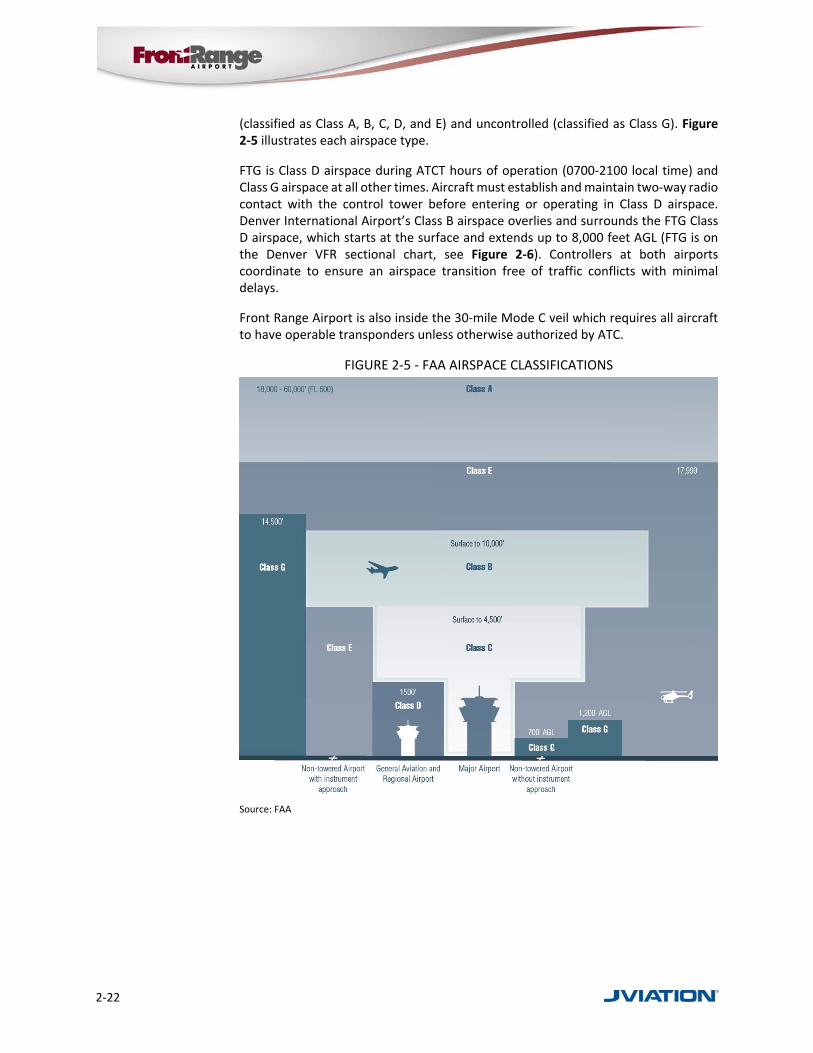
(classified as Class A, B, C, D, and E) and uncontrolled (classified as Class G). Figure 2‐5 illustrates each airspace type.
FTG is Class D airspace during ATCT hours of operation (0700‐2100 local time) and Class G airspace at all other times. Aircraft must establish and maintain two‐way radio contact with the control tower before entering or operating in Class D airspace. Denver International Airport’s Class B airspace overlies and surrounds the FTG Class D airspace, which starts at the surface and extends up to 8,000 feet AGL (FTG is on the Denver VFR sectional chart, see Figure 2‐6). Controllers at both airports coordinate to ensure an airspace transition free of traffic conflicts with minimal delays.
Front Range Airport is also inside the 30‐mile Mode C veil which requires all aircraft to have operable transponders unless otherwise authorized by ATC.
FIGURE 2‐5 ‐ FAA AIRSPACE CLASSIFICATIONS
Source: FAA

Chapter 2 – Inventory
Front Range Airport Master Plan 2018 2‐23
FIGURE 2‐6 ‐ DENVER SECTIONAL CHART WITH FTG
Source: Denver Sectional Chart, US Department of Commerce, National Oceanic and Atmospheric Administration
2.9.3 Navigational Aids (NAVAIDs)
A variety of NAVAIDs are available to pilots around FTG, whether located near the field or at other locations within the region. Many of these NAVAIDs are available to enroute air traffic. They are used by pilots in the vicinity of the Airport and include those facilities listed in Table 2‐10.
TABLE 2‐10 ‐ NAVAIDS NEAR FTG
Type ID Name Frequency Radial Range
VORTAC DVV Mile High 114.7 141° 7.7 nm
VORTAC FQF Falcon 116.3 023° 6.8 nm
VOR-DME DEN Denver 117.9 099° 5.9 nm
VOR-DME BJC Jeffco 115.4 095° 28.8 nm
Source: http://www.airnav.com/airport/KFTG
A VORTAC NAVAID consists of a co‐located VHF omnidirectional range (VOR) beacon and a tactical air navigation system (TACAN) beacon. Both types of beacons provide pilots azimuth information, but the VOR system is generally used by civil aircraft and the TACAN system by military aircraft. However, the TACAN distance measuring equipment is also used for civil purposes. There are two VORTACs in range of FTG.
A VOR/DME system is a VOR Station with distance measuring equipment (DME) transmitting very high frequency signals, 360 degrees in azimuth oriented from magnetic north. The DME is used to measure, in nautical miles, the slant range distance of an aircraft from the NAVAID. There are two VOR/DMEs in range of FTG.
Localizer at FTG

2‐24
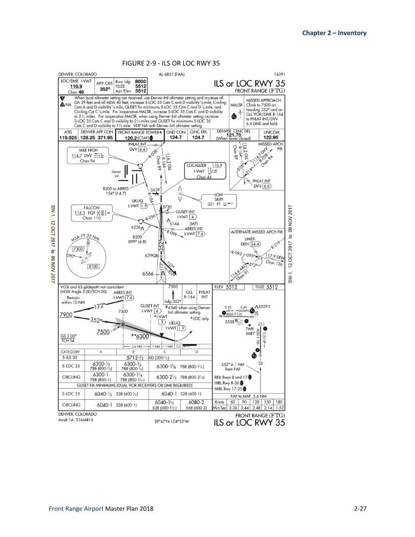
FTG currently has seven published instrument approaches, summarized in Table 2‐11. The Airport has three Instrument Landing System (ILS) approaches, two of which provide the lowest ceiling (200 feet) and visibility minima (½ mile). Figure 2‐7, Figure 2‐8, Figure 2‐9, Figure 2‐10, Figure 2‐11, and Figure 2‐12 show the current approach plates for these published instrument approaches.
TABLE 2‐11 ‐ LOWEST INSTRUMENT APPROACH MINIMUMS
Instrument Approach Lowest Straight-in Approach Lowest Circling Approach
Ceiling Visibility Ceiling Visibility
ILS or LOC RWY 17 200 feet ¾ mile 600 feet 1 mile
ILS or LOC RWY 26 200 feet ½ mile 600 feet 1 mile
ILS or LOC RWY 35 200 feet ½ mile 600 feet 1 mile
RNAV (GPS) RWY 17 200 feet ¾ mile 600 feet 1 mile
RNAV (GPS) RWY 26 200 feet ½ mile 600 feet 1 mile
RNAV (GPS) RWY 35 200 feet ½ mile 600 feet 1 mile
NDB RWY 26 600 feet ¾ mile 600 feet 1 mile
Source: FAA
Glideslope at FTG

Chapter 2 – Inventory
Front Range Airport Master Plan 2018 2‐25
FIGURE 2‐7 ‐ ILS OR LOC RWY 17

2‐26
FIGURE 2‐8 ‐ ILS OR LOC RWY 26
Chapter 2 – Inventory
Front Range Airport Master Plan 2018 2‐27
FIGURE 2‐9 ‐ ILS OR LOC RWY 35

2‐28
FIGURE 2‐10 ‐ RNAV (GPS) RWY 17

Chapter 2 – Inventory
Front Range Airport Master Plan 2018 2‐29
FIGURE 2‐11 ‐ RNAV (GPS) RWY 26

2‐30
FIGURE 2‐12 ‐ RNAV (GPS) RWY 35

Chapter 2 – Inventory
Front Range Airport Master Plan 2018 2‐31
2.9.4 Part 77 Airspace Surfaces
FAR Part 77, Objects Affecting Navigable Airspace, is a tool used to protect the airspace over/around a given airport and each of its runway approaches from potential obstructions to air navigation. It is a federal regulation that all airports in the national airspace system are subject to the requirements of Part 77. To determine whether an object is an obstruction to air navigation, Part 77 establishes several imaginary airspace surfaces in relation to an airport and to each runway end. The dimensions and slopes of these surfaces depend on the configuration and approach categories of each airport’s runway system. The size of the imaginary surfaces depends largely upon the type of approach to the runway in question. The principal imaginary surfaces are described below and illustrated in Figure 2‐13.
Primary Surface: Longitudinally centered on the runway at the same elevation as the nearest point on the runway centerline.
Horizontal Surface: Located 150 feet above the established airport elevation, the perimeter of which is established by swinging arcs of specified radii from the center of each the primary surface end, connected via tangent lines.
Conical Surface: Extends outward and upward from the periphery of the horizontal surface at a slope of 20:1 for a horizontal distance of 4,000 feet.
Approach Surface: Longitudinally centered on the extended centerline, and extending outward and upward from each runway end at a designated slope (e.g. 20:1, 34:1, 40:1, and 50:1) based on the runway approach.
Transitional Surface: Extends outward and upward at a right angle to the runway centerline at a slope of 7:1 up to the horizontal surface.
FIGURE 2‐13 ‐ PART 77 PLAN VIEW
Source: FAA
A full representation and analysis of all current and future Part 77 surfaces as they relate to FTG are depicted on the ALP set completed as part of this study. The

2‐32
appropriate sheets of the ALP include the degree to which obstructions penetrate the surfaces and how best to resolve them. As part of this planning effort, an aerial survey of the Airport was undertaken that included an obstructions survey.
2.10 Other Airports
FTG lies within the eastern side of the Denver metropolitan area. Competition for based aircraft, tenants, and services at FTG can be compared with airports in the area that accommodate general aviation activities. Table 2‐12 represents some of the general aviation airports near FTG.
TABLE 2‐12 ‐ GENERAL AVIATION AIRPORTS NEAR FTG
Airport Name (ID)
Distance from FTG
Runway(s) & Dimensions (ft.)
Operations per Year
Based Aircraft Services Offered
Centennial (APA) 19 nm SW 10/28: 4,800 x 75 17L/35R: 10,000 x 100 17R/35L: 7,001 x 75
321,569 984 100LL, Jet A, tie-downs, hangars, major airframe and power plant service, high/low oxygen, avionics, charter, rental, sales, instruction
Platte Valley Airpark (18V) 21 nm NW 15/33: 4,100 x 40
9/27: 2,500 x 90 (turf) 4,800 76 100LL, tie-downs, hangars, minor airframe and power plant service, instruction
Erie Municipal (EIK) 27 nm NW 15/33: 4,700 x 60 52,000 170
100LL, Jet A, tie-downs, hangars, high/low oxygen, major airframe and power plant service, rental, instruction, sales
Rocky Mountain Metropolitan (BJC)
28 nm W 3/21: 3,600 x 75 12L/30R: 9,000 x 100 12R/30L: 7,002 x 75
142,663 365 100LL, Jet A, tie-downs, hangars, major airframe and power plant service, high/low oxygen, avionics, cargo, charter, rental, sales, instruction
Source: FAA 5010 Airport Master Record
2.11 Airport Environs
The purpose of the following sections is to establish context for FTG within its community and regional setting. This includes demographic and economic considerations in Adams County and a brief discussion of other factors such as land use and environmental considerations
2.11.1 Community Overview
Formed in 1902 out of what had been part of Arapahoe County, Adams County is now the fifth‐most populous of Colorado’s 64 counties. Located predominantly north and east of the Denver Metropolitan Area, Adams County contains a total of 1,185 square miles (759,000 acres). The County stretches approximately 17 miles in latitude (north to south), and is approximately 72 miles wide (east to west). Land uses range from intensive urban activities in the west, to crop and grazing land in the central and east. Eight incorporated cities and two towns are wholly or partially located in Adams County, including the cities of Arvada, Aurora, Brighton, Commerce City, Federal Heights, Northglenn, Thornton, and Westminster and the towns of Bennett and Lochbuie. Together, they comprise 15% of the County’s total land area. Agricultural activities are the single largest land use throughout the County, accounting for more than three quarters of the land area. An extensive network of canals in the northwest part of the County supports most of the irrigated farmland. The central portion of the County primarily produces wheat, while the eastern area is primarily pasture.

Chapter 2 – Inventory
Front Range Airport Master Plan 2018 2‐33
Adams County’s economy is heavily tied to the rapidly growing Denver metropolitan area; its relatively central location makes it a natural location as a distribution hub for the American West, while also supporting a number of growing industries in technology and telecommunications. The metro area’s location just east of the mineral‐rich Rocky Mountain range encouraged mining and energy companies to spring up in the area, making the energy industry another staple of regional economy. Adams County has experienced significant growth in related industries and in support of rapidly growing residential communities. The County currently has over 481,000 residents, a large share of which (about 90,000 or 20 percent) live within the unincorporated areas of the county.
2.11.2 Area Demographics
Between the years of 2010 and 2014, Colorado’s population increased by 8.5 percent, while the population of Adams County increased by 8.4 percent.2 Figure 2‐14 provides further detail about population changes over that time period for Colorado and Adams County.
The per capita income for residents of Adams County during 2015 was $25,039 with median household income of $58,946, while for the State of Colorado it was $32,217 and $60,629 respectively.
FIGURE 2‐14 ‐ POPULATION GROWTH RATE BY COUNTY
Source: Jviation, U.S. Census Bureau, Colorado Information Market Place (https://data.colorado.gov/)
2 U.S. Census Bureau 2010‐2014 Data
Adams County Government Center

2‐34
2.11.3 Area Economy
In 2015, the unemployment rate in Adams County averaged between 3.6 and 5.4 percent3. For the same year, the national unemployment rate averaged between 5.0 and 5.7 percent. The top ten industries for employment in Adams County in 2015 are shown in Table 2‐13.
TABLE 2‐13 ‐ TOP INDUSTRIES IN ADAMS COUNTY ‐ 2015
Industry Employment
Construction 20,199
Retail trade 19,998
Health care and social assistance 17,864
Local government (including education) 17,296
Wholesale trade 16,188
Accommodation and food services 14,916
Transportation and warehousing 14,427
Manufacturing 13,756
Administrative and waste services 12,416
Professional and technical services 6,073
Source: US Bureau of Labor Statistics
2.11.4 Local Development Initiatives
In order to support and encourage economic growth throughout the County, Adams County considers economic development a strategic priority. Adams County is experiencing significant growth as a key part of the Denver metro area, having an abundance of land development opportunities that are unparalleled within the region. With a population that is projected to double by 2040, the County is ideally located at the crossroads of the metro area’s transportation network, providing provides businesses and residents convenient access to I‐25, I‐70, I‐270, and I‐76. Adams County also surrounds DEN, connecting it to the global transportation network. Several of the most prominent development initiatives within the County include the following:
The RTD FasTracks program is under construction within Adams County, and when the new transit lines open in 2017 and 2018, this project will bring 11 new mass transit stations to the county’s residents and businesses.
A wide variety of companies continue to locate facilities within Adams County. According to Adams County Economic Development’s 2016 annual report, $300 million in capital improvements were invested in Adams County in 2016, up 14.5 percent from $262 million in 2015; 566 new jobs were added in the Adams County Enterprise Zones, a 52.7 percent jump from 2015; and there was a 31.5 percent increase in employer prospects from 2015 to 2016.
The Colorado Aerotropolis is a 21,000‐acre development corridor is an urban form surrounding DEN that is projected to connect workers, suppliers, executives, and goods to the global marketplace. A CDOT vision study
3 http://data.bls.gov/map/MapToolServlet

Chapter 2 – Inventory
Front Range Airport Master Plan 2018 2‐35
projected 18 to 32 million square feet of new commercial development to occur in areas west and south of DEN in coming years, bringing with it up to $630 million in tax revenue. By 2040, that study also projects that the aerotropolis could attract 210,000 new residents and create up to 9,000 direct and 3,200 indirect construction jobs over 25 years.
Spaceport Colorado is an initiative to establish FTG as a future hub for commercial space transportation, research and development. Leveraging Colorado’s aerospace workforce, the second largest in America, Spaceport Colorado will be a premier horizontal launch spaceport, ultimately becoming the foundation for America’s global suborbital transportation network.
The Gaylord Rockies Resort and Convention Center is an $800‐million development located minutes from DEN in Aurora; it will feature over 1,500 guest rooms and over 485,000 square feet of meeting and convention space.
2.11.5 Local Comprehensive Planning
A local comprehensive plan is a strategic long‐range document that addresses land use and zoning as it relates to growth and development of a county or municipality. With respect to an airport that lies within a community, it is critical that local comprehensive planning efforts acknowledge and address the issue of land use compatibility near an airport.
Adams County’s latest Comprehensive Plan was completed in 2012 and includes multiple references to FTG, including the following:
Inclusion of FTG as a major regional economic generator.
Inclusion of FTG as a resource for the job creation strategy to supply suitable land for commercial and industrial development.
Inclusion of FTG for the job creation strategy of determining how the County can best leverage its existing assets, as well as the potential development of a spaceport.
Establishment of Policy 11.4 to alert future residents of residential development of any potential airport‐related impacts, including notices and avigation easements.
Establishment of an overall area‐specific policy (Policy 18.0) to harvest the significant future growth potential exists along the I‐70 Corridor east of Imboden Road in the FTG environs and adjacent to the Town of Bennett and the unincorporated community of Strasburg.
Establishment of Policy 18.1 to continue to support and develop the Front Range Airport to accommodate large aircraft, as a general aviation and intermodal cargo hub for the state and region.
Establishment of Policy 18.2 to support compatible commercial and industrial development around FTG.
Establishment of Policy 18.3 to ensure that land uses outside the Airport Influence Zone surrounding FTG are compatible with airport operations and impacts.
Inclusion of FTG in all relevant Comprehensive Plan maps.

2‐36
2.11.6 Existing Land Use and Zoning
Of critical interest to any airport is the degree to which it is compatible with surrounding land uses. Airport compatible land uses can be defined as “those uses that can co‐exist with an airport without constraining the safe and efficient operation of the airport or exposing people living or working nearby to unacceptable levels of noise or hazards.”4 This definition is intentionally broad since there are many variables that must be factored when considering whether a given land use is compatible with in an airport operational environment.
Appropriate land‐use compatibility promotes the safety, health, and welfare of airport users and surrounding neighbors by protecting airspace and ensuring appropriate uses of lands both within and surrounding airport property boundaries. Typically, development actions that may affect surrounding land uses are changes in airport fleet mix and/or the number of aircraft operations, air traffic changes, and new approaches.
Per the Adams County Development Standards and Regulations, Chapter 3, Zone District Regulations, FTG is zoned by Adams County as AV, and the land immediately surrounding the Airport is zoned as A‐1, A‐3, and PUD, as depicted in Figure 2‐15. These zoning designations are defined as follows:
AV – Aviation. Land intended to provide for non‐residential land uses associated with aviation operations, while minimizing risks to public safety and hazards to aviation users, including those employed at public aviation facilities.
A‐1 – Agricultural District. The purpose of the Agricultural‐1 District is to provide a rural, single‐family dwelling district where the minimum lot area for a home site is intended to provide for a rural living experience. Limited farming uses are permitted, including the keeping of a limited number of animals for individual homeowner’s use. This district is primarily designed for the utilization and enjoyment of the County’s rural environment.
A‐3 – Agricultural District. The purpose of the Agricultural‐3 District is to provide land primarily in holdings of at least thirty‐five (35) acres for dry land or irrigated farming, pasturage, or other related food production uses.
PUD – Planned Unit Development. In accordance with the Planned Unit Development Act of 1972, the objective of a Planned Unit Development is to establish an area of land, controlled by one or more landowners, to be developed under unified control or unified plan of development for a number of dwelling units, commercial, educational, recreational, or industrial uses, or any combination of the foregoing, the plan for which does not correspond in lot size, bulk, type of use, density, lot coverage, open space, or other restrictions to the existing land use regulations.
A PUD allows greater flexibility in the design of a development, more variety and diversification in the relationships between buildings, open spaces and uses, and conservation and retention of historical and natural topographic features, while meeting the goals, policies, and objectives of the
4 Airport Cooperative Research Program, Enhancing Airport Land Use Compatibility, Volume 1: Land Use Fundamentals and Implementation Resources. (National Academies Press, 2010), 1‐25.

Chapter 2 – Inventory
Front Range Airport Master Plan 2018 2‐37
comprehensive plan. This results in a PUD is to encourage the development of land as a single unit.
All uses that are in general conformity with the Adams County Comprehensive Plan, including, but not limited to, the contemplated density or intensity of land use, and are compatible with the site’s physical and environmental characteristics, may be allowed within the PUD. The proposed land uses shall be compatible or designed to mitigate externalities with the existing, allowed, or conditional land uses adjacent to the proposed development. The PUD document for specific development shall establish permitted uses. The uses shall be specifically defined and approved as part of the PUD.
In addition to the above‐mentioned zones, Adams County has implemented an Airport Influence Zone (AIZ) that encompasses the extents of the Airport property. The purpose of the AIZ is “to provide areas within the County suitable for the economic development and safe operation of air carrier and/or general aviation airports for public use without adversely affecting the activities upon surrounding properties. The AIZ is also intended to provide notice and disclosure of the airport location to owners of residential and non‐residential properties in areas which may be subjected to aircraft activities, such duration and frequency which may constitute a nuisance to residential and other uses.”5
Lands surrounding FTG are zoned for uses that are compatible with activities that occur both at and near the Airport.
5 Adams County, Adams County Development Standards and Regulations, Chapter 3, Zone District Regulations, 2007

2‐38
FIGURE 2‐15 ‐ FTG ZONING
Source: Jviation, Adams County Business Solutions Group Open Data Catalog
2.11.7 Environmental Overview
This section addresses environmental factors that specifically apply to FTG according to FAA Advisory Circular 150/5070‐6B, Airport Master Plans. FTG has completed multiple environmental studies since 2010, which have been reviewed and are utilized in this section. Current information from federal, state and local agencies concerning environmental conditions on and near FTG have also been reviewed.
FAA Order 1050.1F, Environmental Impacts: Policies and Procedures, and FAA Order 5050.4B, National Environmental Policy Act: Implementation Instruction for Airport
Chapter 2 – Inventory
Front Range Airport Master Plan 2018 2‐39
Actions, address specific environmental categories that are evaluated in environmental documents in accordance with the National Environmental Policy Act (NEPA). The sections below provide an inventory of the applicable environmental categories as related to FTG. The following environmental categories have not been included in this overview since they are not relevant to FTG or any potential projects:
Coastal Resources
Climate
Socioeconomic, Environmental Justice, and Children's Environmental Health and Safety Risks
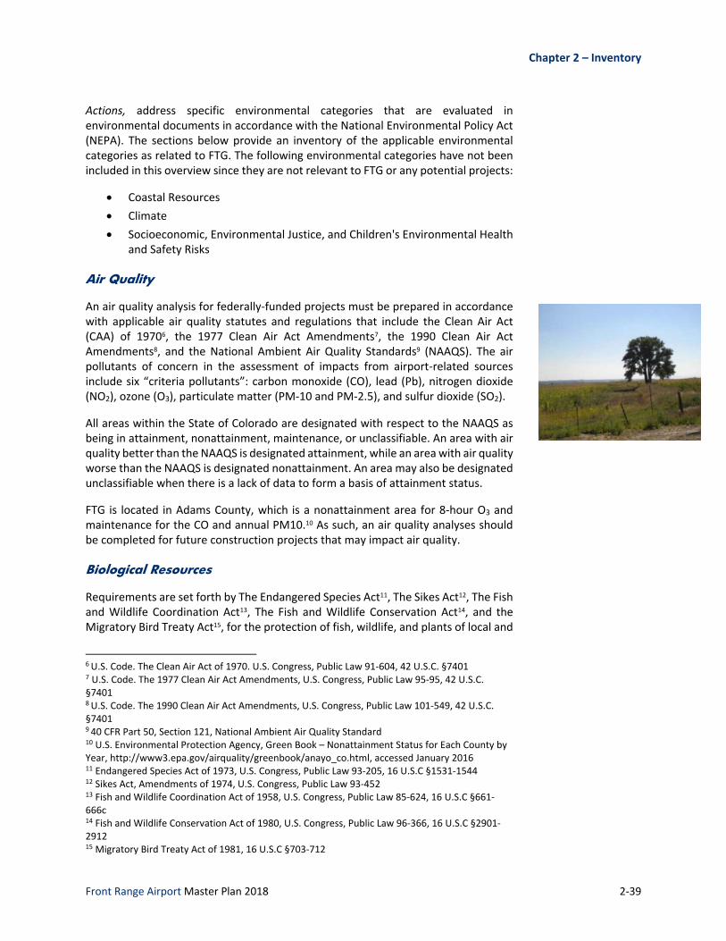
Air Quality
An air quality analysis for federally‐funded projects must be prepared in accordance with applicable air quality statutes and regulations that include the Clean Air Act (CAA) of 19706, the 1977 Clean Air Act Amendments7, the 1990 Clean Air Act Amendments8, and the National Ambient Air Quality Standards9 (NAAQS). The air pollutants of concern in the assessment of impacts from airport‐related sources include six “criteria pollutants”: carbon monoxide (CO), lead (Pb), nitrogen dioxide (NO2), ozone (O3), particulate matter (PM‐10 and PM‐2.5), and sulfur dioxide (SO2).
All areas within the State of Colorado are designated with respect to the NAAQS as being in attainment, nonattainment, maintenance, or unclassifiable. An area with air quality better than the NAAQS is designated attainment, while an area with air quality worse than the NAAQS is designated nonattainment. An area may also be designated unclassifiable when there is a lack of data to form a basis of attainment status.
FTG is located in Adams County, which is a nonattainment area for 8‐hour O3 and maintenance for the CO and annual PM10.10 As such, an air quality analyses should be completed for future construction projects that may impact air quality.
Biological Resources
Requirements are set forth by The Endangered Species Act11, The Sikes Act12, The Fish and Wildlife Coordination Act13, The Fish and Wildlife Conservation Act14, and the Migratory Bird Treaty Act15, for the protection of fish, wildlife, and plants of local and
6 U.S. Code. The Clean Air Act of 1970. U.S. Congress, Public Law 91‐604, 42 U.S.C. §7401 7 U.S. Code. The 1977 Clean Air Act Amendments, U.S. Congress, Public Law 95‐95, 42 U.S.C. §7401 8 U.S. Code. The 1990 Clean Air Act Amendments, U.S. Congress, Public Law 101‐549, 42 U.S.C. §7401 9 40 CFR Part 50, Section 121, National Ambient Air Quality Standard 10 U.S. Environmental Protection Agency, Green Book – Nonattainment Status for Each County by Year, http://www3.epa.gov/airquality/greenbook/anayo_co.html, accessed January 2016 11 Endangered Species Act of 1973, U.S. Congress, Public Law 93‐205, 16 U.S.C §1531‐1544 12 Sikes Act, Amendments of 1974, U.S. Congress, Public Law 93‐452 13 Fish and Wildlife Coordination Act of 1958, U.S. Congress, Public Law 85‐624, 16 U.S.C §661‐666c 14 Fish and Wildlife Conservation Act of 1980, U.S. Congress, Public Law 96‐366, 16 U.S.C §2901‐2912 15 Migratory Bird Treaty Act of 1981, 16 U.S.C §703‐712
2‐40
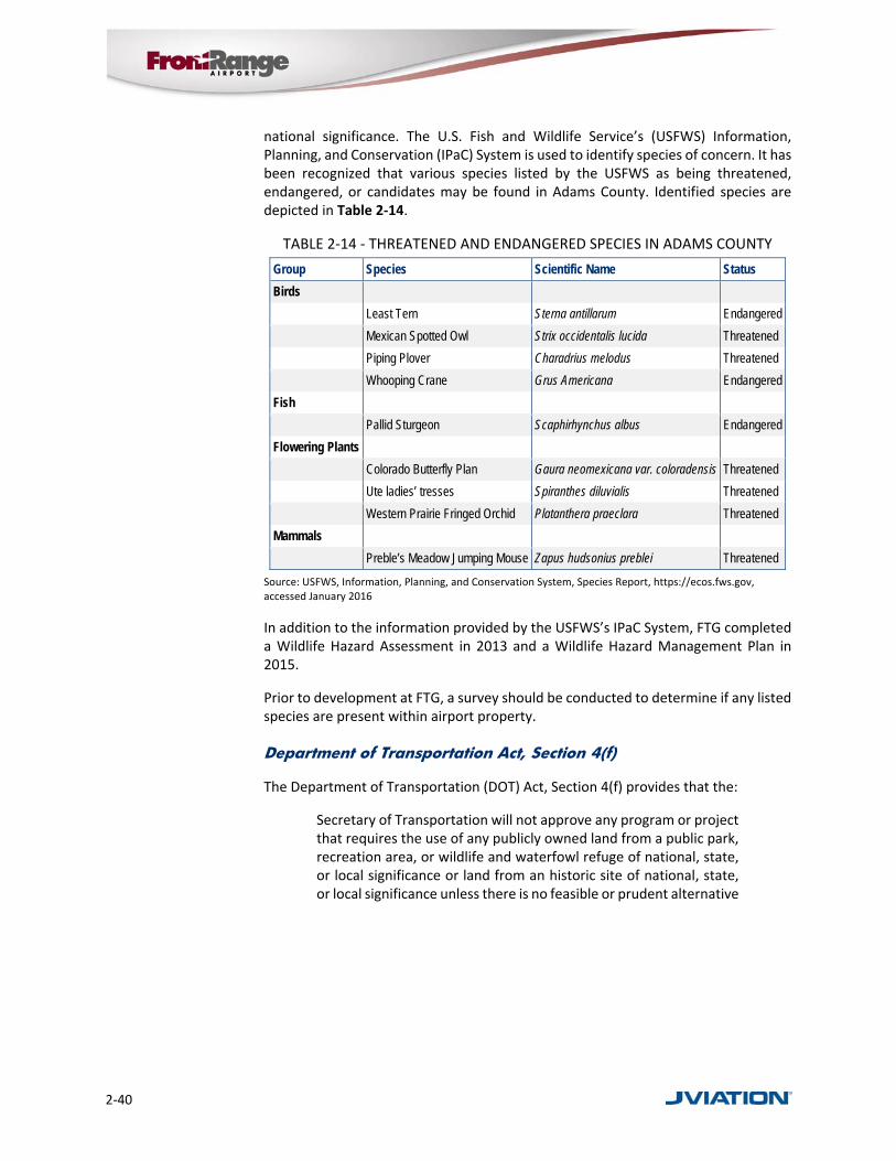
national significance. The U.S. Fish and Wildlife Service’s (USFWS) Information, Planning, and Conservation (IPaC) System is used to identify species of concern. It has been recognized that various species listed by the USFWS as being threatened, endangered, or candidates may be found in Adams County. Identified species are depicted in Table 2‐14.
TABLE 2‐14 ‐ THREATENED AND ENDANGERED SPECIES IN ADAMS COUNTY
Group Species Scientific Name Status
Birds
Least Tern Sterna antillarum Endangered
Mexican Spotted Owl Strix occidentalis lucida Threatened
Piping Plover Charadrius melodus Threatened
Whooping Crane Grus Americana Endangered
Fish
Pallid Sturgeon Scaphirhynchus albus Endangered
Flowering Plants
Colorado Butterfly Plan Gaura neomexicana var. coloradensis Threatened
Ute ladies’ tresses Spiranthes diluvialis Threatened
Western Prairie Fringed Orchid Platanthera praeclara Threatened
Mammals
Preble’s Meadow Jumping Mouse Zapus hudsonius preblei Threatened
Source: USFWS, Information, Planning, and Conservation System, Species Report, https://ecos.fws.gov, accessed January 2016
In addition to the information provided by the USFWS’s IPaC System, FTG completed a Wildlife Hazard Assessment in 2013 and a Wildlife Hazard Management Plan in 2015.
Prior to development at FTG, a survey should be conducted to determine if any listed species are present within airport property.
Department of Transportation Act, Section 4(f)
The Department of Transportation (DOT) Act, Section 4(f) provides that the:
Secretary of Transportation will not approve any program or project that requires the use of any publicly owned land from a public park, recreation area, or wildlife and waterfowl refuge of national, state, or local significance or land from an historic site of national, state, or local significance unless there is no feasible or prudent alternative
Chapter 2 – Inventory
Front Range Airport Master Plan 2018 2‐41
and the use of such land includes all possible planning to minimize harm resulting from the use.16
The FAA has adopted the regulations the Federal Highway Administration (FHWA) and the Federal Transit Administration (FTA) issued in March 2008 (23 CFR Part 774)17 to address project‐related effects on Section 4(f) resources.
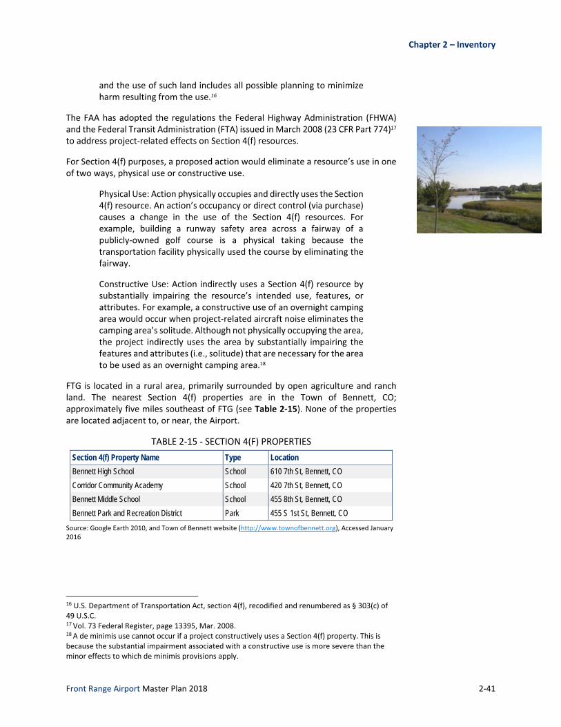
For Section 4(f) purposes, a proposed action would eliminate a resource’s use in one of two ways, physical use or constructive use.
Physical Use: Action physically occupies and directly uses the Section 4(f) resource. An action’s occupancy or direct control (via purchase) causes a change in the use of the Section 4(f) resources. For example, building a runway safety area across a fairway of a publicly‐owned golf course is a physical taking because the transportation facility physically used the course by eliminating the fairway.
Constructive Use: Action indirectly uses a Section 4(f) resource by substantially impairing the resource’s intended use, features, or attributes. For example, a constructive use of an overnight camping area would occur when project‐related aircraft noise eliminates the camping area’s solitude. Although not physically occupying the area, the project indirectly uses the area by substantially impairing the features and attributes (i.e., solitude) that are necessary for the area to be used as an overnight camping area.18
FTG is located in a rural area, primarily surrounded by open agriculture and ranch land. The nearest Section 4(f) properties are in the Town of Bennett, CO; approximately five miles southeast of FTG (see Table 2‐15). None of the properties are located adjacent to, or near, the Airport.
TABLE 2‐15 ‐ SECTION 4(F) PROPERTIES
Section 4(f) Property Name Type Location
Bennett High School School 610 7th St, Bennett, CO
Corridor Community Academy School 420 7th St, Bennett, CO
Bennett Middle School School 455 8th St, Bennett, CO
Bennett Park and Recreation District Park 455 S 1st St, Bennett, CO
Source: Google Earth 2010, and Town of Bennett website (http://www.townofbennett.org), Accessed January 2016
16 U.S. Department of Transportation Act, section 4(f), recodified and renumbered as § 303(c) of 49 U.S.C. 17 Vol. 73 Federal Register, page 13395, Mar. 2008. 18 A de minimis use cannot occur if a project constructively uses a Section 4(f) property. This is because the substantial impairment associated with a constructive use is more severe than the minor effects to which de minimis provisions apply.

2‐42
Farmlands
The Farmland Protection Policy Act (FPPA) requires coordination with the local office of the U.S. Department of Agriculture, Natural Resources Conservation Service if a proposed project includes irreversible conversion of prime farmland to nonagricultural uses. The FPPA defines farmland as “prime or unique land as determined by the participating state or unit of local government and considered to be of statewide or local importance”. Farmland subject to this requirement does not have to be currently used for cropland; it may be forested or pasture, but not urban or built‐up land.
The Natural Resources Conservation Service (NRCS) Web Soil Survey was used to review soils on and around FTG. Figure 2‐16 details the soil types on Airport property. FTG resides on land classified as “Prime Farmland if Irrigated” and “Not Prime Farmland.”
FIGURE 2‐16 ‐ FTG FARMLAND CLASSIFICATIONS
Source: Natural Resource Conservation Service, Web Soil Survey, https://websoilsurvey.nrcs.usda.gov/, Accessed January 2016

Chapter 2 – Inventory
Front Range Airport Master Plan 2018 2‐43
Hazardous Materials, Solid Waste, and Pollution Prevention
The Resource Conservation and Recovery Act (RCRA)19, Comprehensive Environmental Response, Compensation, and Liability Act (CERCLA)20, Superfund Amendments and Reauthorization Act (Superfund)21, and the Community Environmental Response Facilitation Act (CERFA)22 are the four primary laws regulating actions related to the use, storage, transportation, or disposal of hazardous materials, chemicals, substances, and wastes. For airports, hazardous materials used for operation and maintenance of aircraft, runways, and taxiways include fuels, degreasers, and aviation lubricants and oils.
Federal actions that pertain to the funding or approval of airport projects require the analysis of the potential for environmental impacts per the regulating laws, including a review of the National Priority List (NPL) in relation to an airport’s location. Following a review and evaluation of the NPL, it was determined that there are currently no relevant sites located on or near FTG.
Historical, Architectural, Archeological, and Cultural Resources
The National Historic Preservation Act23, and the Archaeological and Historical Preservation Act24 regulate the preservation of historical, architectural, archaeological and cultural resources. Through these acts, it is required that the potential impacts by all Federal actions and undertakings on these resources be evaluated. Specifically, Section 106 of the National Historic Preservation Act (36 CFR 800 [Section 106]) requires federal agencies to account for the effects of their undertakings on historic properties and afford the Advisory Council on Historic Preservation (Council) reasonable opportunity to comment on such undertakings. Projects subject to Section 106 must consult with the State Historic Preservation Officer, Tribal Historic Preservation Officer(s), and Council to determine if the project has the potential to affect historic properties listed on or eligible for listing on the National Register of Historic Places (NRHP) and what, if any, alternatives exist to avoid, minimize or mitigate the adverse effect(s) to National Register and National Register‐eligible properties.
For this Master Plan, historic, archaeological and cultural resources are defined as districts, sites, buildings, structures, objects, landscapes, and Native American Traditional Cultural Properties (TCPs) that are on or eligible for listing on the NRHP. Currently, the NRHP includes 17 properties located in Adams County, listed in Table 2‐16. Nevertheless, a survey is required prior to development to determine if any historic, archaeological, and cultural resources occur on airport property.
19 U.S. Code, 1976, Resource Conservation and Recovery Act, 42 USC, §6901 20 U.S. Code 1980, Comprehensive Environmental Response, Compensation and Liability Act, 42 USC, §9601‐9628 21 U.S. Code 1986, Superfund Amendments and Reauthorization Act, 42 USC 22 U.S. Code 1992, Community Environmental Response Facilitation Act, Public Law 102‐426 23 U.S. Code, 1966, National Historic Preservation Act of 1966, Public Law 89‐665 24 U.S. Code, 1974, Archaeological and Historical Preservation Act of 1974, 16 USC 469

2‐44
TABLE 2‐16 ‐ NATIONAL REGISTER OF HISTORIC PLACES ‐ ADAMS COUNTY
Property Name Location Date Added to Registry
Distance to Airport
Engelbrecht Farm 2024 Strasburg Rd., Strasburg 2014 14 miles
Fuller, Granville, House 2027 Galena St., Aurora 2012 16 miles
Robidoux, M.J. Lavina, House 1615 Galena St., Aurora 2011 16 miles
Bromley Farm--Koizuma Hishinuma Farm 15820 E. 152nd Ave., Brighton 2007 17 miles
Wilson, Blanche A., House 1671 Galena St., Aurora 1996 17 miles
Brighton High School 830 E. Bridge St., Brighton 1998 19 miles
Adams County Courthouse 22 S 4th Ave., Brighton 2006 20 miles
Riverside Cemetery 5201 Brighton Blvd., Denver 1994 20 miles
Thede Farmhouse 3190 W. 112th Ave., Northglenn 1998 22 miles
Eastlake Farmers Co-Operative Elevator Company
126th Ave and Claude Ct, Thornton 2010 23 miles
Union High School 3455 W. 72nd Ave., Westminster 2000 24 miles
Bowles House 3924 W. 72nd Ave., Westminster 1988 25 miles
Brannan Sand and Gravel Pit #8--Lake Sangraco Boathouse Complex Address Restricted 2011 25 miles
Gregory, William J., House 8140 Lowell Blvd., Westminster 1996 25 miles
Harris Park School 7200 Lowell Blvd., Westminster 1990 25 miles
Metzger Farm 12080 Lowell Blvd., Westminster 2013 25 miles
Westminster University 3455 W. 83rd Ave., Westminster 1979 25 miles
Source: National Register of Historic Places, www.nationalregisterofhistoricplaces.com, Accessed January 2016
Noise and Noise Compatible Land Use
Aircraft noise and other airport‐related noise, in particular aircraft noise, is often an area of primary concern as related to the airport environment. Within the context of an Airport Master Plan, actions and development that may be considered that change runway configurations, airport operational patterns, aircraft fleet mix, flight patterns, among others that have the potential to alter noise impacts on communities located in the vicinity of an airport. Laws governing airport noise include the following:
49 U.S.C. 47501‐47507 (Aviation Safety and Noise Abatement Act of 1979, as amended); 14 CFR part 150, Noise Control and Compatibility Planning for Airports Advisory Circular, 150/5020.
49 U.S.C. 40101 et seq., as amended by PL 103‐305 (Aug. 23, 1994) (The Federal Aviation Act of 1958).
The Control and Abatement of Aircraft Noise and Sonic Boom Act of 1968; 14 CFR part 161 Notice and Approval of Airport Noise and Access Restrictions.
Chapter 2 – Inventory
Front Range Airport Master Plan 2018 2‐45
49 U.S.C. 47101 et seq., as amended by PL 103‐305 (Aug. 23. 1994) (The Airport and Airway Improvement Act).
49 U.S.C. 2101 et seq. (Airport Noise and Capacity Act of 1990).
49 U.S.C. 44715 (The Noise Control Act of 1972).
Adams County Development Standards and Regulations include an Airport Noise Overlay (ANO) that includes the entire FTG property as well as adjacent lands. The ANO provides protection for residential and non‐residential land uses near the Airport that may be subjected to noise levels of duration and frequency that could be considered a nuisance for residential and other like uses.
Existing noise conditions near the Airport are typical of areas containing the surrounding land uses. Aircraft operating on FTG must meet requirements of 14 CFR, section 36.103, which outlines aircraft noise limits. Figure 2‐17 shows areas on and near FTG that may be exposed to increased airport‐related noise. These contours were generated in association with the 2004 Airport Master Plan and reflect potential future operations that have yet to occur at FTG (i.e., large aircraft air cargo operations).
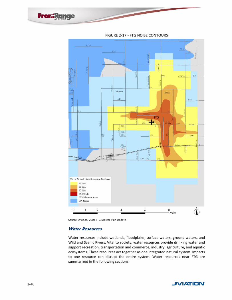
2‐46
FIGURE 2‐17 ‐ FTG NOISE CONTOURS
Source: Jviation, 2004 FTG Master Plan Update
Water Resources
Water resources include wetlands, floodplains, surface waters, ground waters, and Wild and Scenic Rivers. Vital to society, water resources provide drinking water and support recreation, transportation and commerce, industry, agriculture, and aquatic ecosystems. These resources act together as one integrated natural system. Impacts to one resource can disrupt the entire system. Water resources near FTG are summarized in the following sections.

Chapter 2 – Inventory
Front Range Airport Master Plan 2018 2‐47
Wetlands
Federal agencies are required to minimize the destruction, loss, or degradation of wetlands. Principle federal laws governing Wetlands include the following:
Clean Water Act, section 401 and 404 [33 U.S.C. 1344] [PL 92‐500, as amended by PL 95‐217 and PL 100‐4]; 33 CFR parts 320‐330.
Rivers and Harbors Act of 1899, section 10; Order DOT 5660.1A, Preservation of the Nation’s Wetlands.
Executive Order 11990, Protection of Wetlands (May 24, 1977) (42 FR 26961).
According to the National Wetlands Inventory (NWI) wetlands have not been identified or delineated on FTG property (Figure 2‐18).
FIGURE 2‐18 ‐ FTG WETLANDS
Source: Jviation, U.S. Fish and Wildlife Service

2‐48
Floodplains
Construction in floodplains is regulated to reduce the risk of flood loss, minimize the impact of floods on human safety, health and welfare, and restore and preserve the natural and beneficial values provided by floodplains. Executive Order 11988, Floodplain Management,25 directs federal agencies to avoid adverse impacts associated with the occupancy and modification of floodplains.
According to flood maps provided by Adams County GIS, shown in Figure 2‐19, no floodplains exist within existing FTG property bounds. The figure does reflect a “river” located on the southeast corner of the Airport that runs under Runway 17/35; however, this river does not contribute to any 100‐ or 200‐year floodplains.
FIGURE 2‐19 ‐ FTG FLOODPLAINS
Source: Jviation, FEMA
25 Executive Order 11988, Floodplain Management, 1977

Chapter 2 – Inventory
Front Range Airport Master Plan 2018 2‐49
Surface and Ground Waters
The Federal Water Pollution Control Act, as amended by the Clean Water Act (CWA)26 and the Safe Drinking Water Act, as amended, protect and regulate Federal actions that have the potential to impact surface and ground waters27.
According to Colorado Division of Water Resources, FTG is located in the Denver Basin Aquifer system, which itself includes four aquifers: the Dawson aquifer, the Denver aquifer, the Arapahoe aquifer, and the Laramie‐Fox Hills aquifer.28 There are no surface waters within the vicinity of the Airport.
Hazardous materials used for operation and maintenance of aircraft, runways, and taxiways include fuels, degreasers, and aviation lubricants and oils. The Airport has a current Spill Prevention Control and Countermeasures (SPCC) Plan that establishes procedures for handling these substances. This plan is designed to provide preventative measures to ensure that any oil spills are contained and avoid oil spills reaching navigable waters. With its last plan completed in 2003 and required to be updated every five years, FTG is in the process of updating its SPCC Plan. Note that the 2003 FTG SPCC Plan included information such as:
Basic overview of the airport storage facilities and their location
Transfer and storage operations of oil
Spill history ‐ none reported
Potential failure and oil migration identification and concerns
Identification of spill control measures
Implementation of SPCC Plan
Conformance to guidelines
Security of fuel storage and handling facilities
Training recommendations and requirements
Recommendations for oil storage
Other general forms/logs and supporting documentation
Additionally, under the CWA, National Pollutant Discharge Elimination System (NPDES) permits are required for any discharge of storm water from municipalities and industrial sites. The Colorado Department of Health permit administers the Colorado Discharge Permit System. Through this, the FTG is required to submit a permit and develop a site‐specific Storm Water Management Plan (SWMP). Last completed in 2002, the SWMP provides information such as:
Basic overview of types of industrial waste
List of FBO and tenant services as well as contact information
Description of the site (FTG)
Potential pollution sources and materials
26 33 U.S.C. Chapter 26. 27 42 U.S.C. 300.f. 28 Colorado Division of Water Resources, http://water.state.co.us/groundwater/, Accessed January 2016

2‐50
Risk identification and assessment
Preventative maintenance techniques
Spill prevention and countermeasures and best management practices
Erosion control
Employee training
Comprehensive inspections
Record keeping and internal reporting procedures
Wild and Scenic Rivers
The Wild and Scenic Rivers Act, as amended, designates rivers and those eligible to be designated in the Wild and Scenic Rivers System. Wild and Scenic Rivers are designated as “rivers having remarkable scenic, recreational, geological, fish, wildlife, historic, or cultural values.” The Department of the Interior (National Park Service, U.S. Fish and Wildlife Service, and Bureau of Land Management) and the Department of Agriculture (U.S. Forest Service) are the oversight agencies for the Wild and Scenic Rivers System. Federal agencies with jurisdiction over lands the border upon, or are adjacent to any designated rivers, are required to take the necessary actions to protect the rivers, as stated in Section 12 of the Wild and Scenic Rivers Act.
Colorado only has one river listed in the National Wild and Scenic Rivers System, the Cache la Poudre River. The nearest designated portion of this river is located approximately 40 miles northwest of FTG.29
29 U.S. Forest Service, Cache la Poudre River, 2010