12ATSBL07 November 2011 Implementation of RVSM in ... Leaflets/Air Traffic... · 12ATSBL07 November...
8
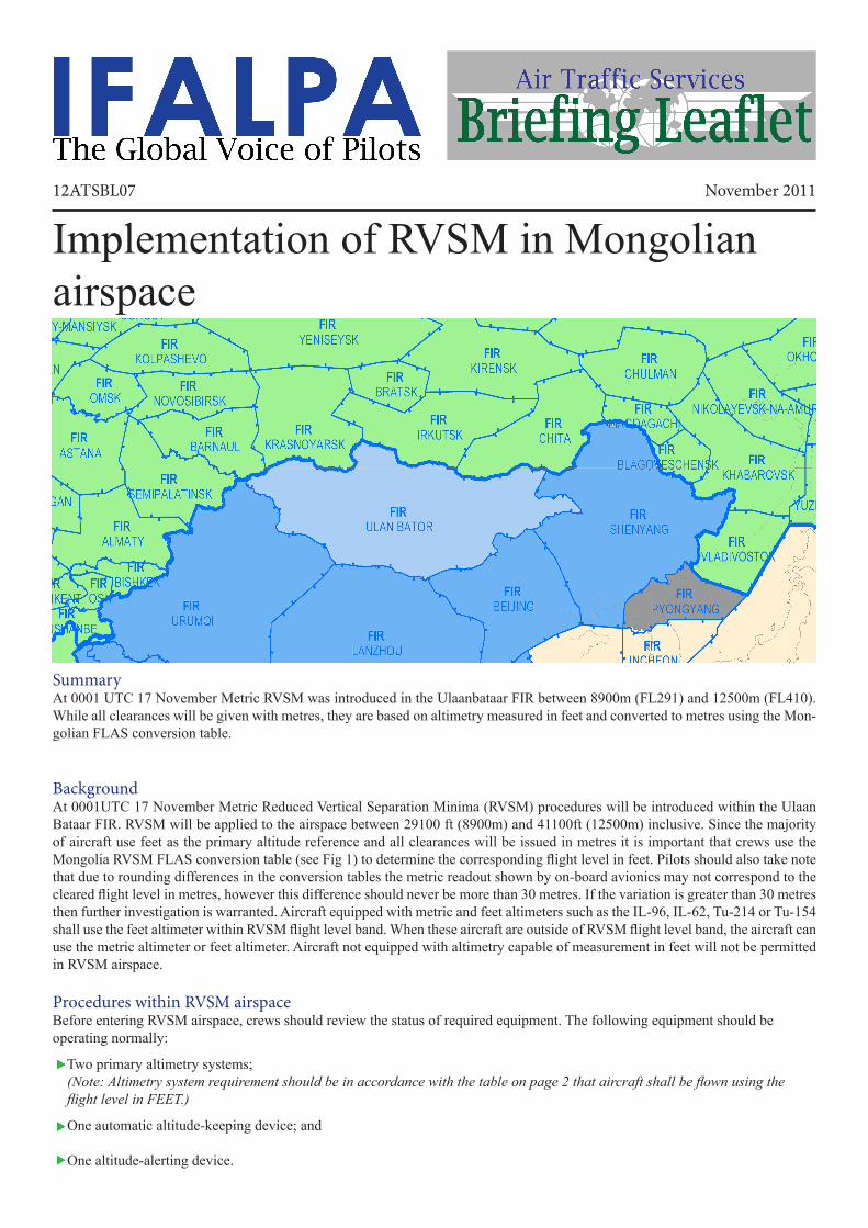
12ATSBL07 November 2011 Implementation of RVSM in Mongolian airspace Summary At 0001 UTC 17 November Metric RVSM was introduced in the Ulaanbataar FIR between 8900m (FL291) and 12500m (FL410). While all clearances will be given with metres, they are based on altimetry measured in feet and converted to metres using the Mon- golian FLAS conversion table. Background At 0001UTC 17 November Metric Reduced Vertical Separation Minima (RVSM) procedures will be introduced within the Ulaan Bataar FIR. RVSM will be applied to the airspace between 29100 ft (8900m) and 41100ft (12500m) inclusive. Since the majority of aircraft use feet as the primary altitude reference and all clearances will be issued in metres it is important that crews use the Mongolia RVSM FLAS conversion table (see Fig 1) to determine the corresponding flight level in feet. Pilots should also take note that due to rounding differences in the conversion tables the metric readout shown by on-board avionics may not correspond to the cleared flight level in metres, however this difference should never be more than 30 metres. If the variation is greater than 30 metres then further investigation is warranted. Aircraft equipped with metric and feet altimeters such as the IL-96, IL-62, Tu-214 or Tu-154 shall use the feet altimeter within RVSM flight level band. When these aircraft are outside of RVSM flight level band, the aircraft can use the metric altimeter or feet altimeter. Aircraft not equipped with altimetry capable of measurement in feet will not be permitted in RVSM airspace. Procedures within RVSM airspace Before entering RVSM airspace, crews should review the status of required equipment. The following equipment should be operating normally: Two primary altimetry systems; (Note: Altimetry system requirement should be in accordance with the table on page 2 that aircraft shall be flown using the flight level in FEET.) One automatic altitude-keeping device; and One altitude-alerting device.
Transcript of 12ATSBL07 November 2011 Implementation of RVSM in ... Leaflets/Air Traffic... · 12ATSBL07 November...
12ATSBL07 November 2011
Implementation of RVSM in Mongolian airspace
Summary At 0001 UTC 17 November Metric RVSM was introduced in the Ulaanbataar FIR between 8900m (FL291) and 12500m (FL410). While all clearances will be given with metres, they are based on altimetry measured in feet and converted to metres using the Mon-golian FLAS conversion table.
Background At 0001UTC 17 November Metric Reduced Vertical Separation Minima (RVSM) procedures will be introduced within the Ulaan Bataar FIR. RVSM will be applied to the airspace between 29100 ft (8900m) and 41100ft (12500m) inclusive. Since the majority of aircraft use feet as the primary altitude reference and all clearances will be issued in metres it is important that crews use the Mongolia RVSM FLAS conversion table (see Fig 1) to determine the corresponding flight level in feet. Pilots should also take note that due to rounding differences in the conversion tables the metric readout shown by on-board avionics may not correspond to the cleared flight level in metres, however this difference should never be more than 30 metres. If the variation is greater than 30 metres then further investigation is warranted. Aircraft equipped with metric and feet altimeters such as the IL-96, IL-62, Tu-214 or Tu-154 shall use the feet altimeter within RVSM flight level band. When these aircraft are outside of RVSM flight level band, the aircraft can use the metric altimeter or feet altimeter. Aircraft not equipped with altimetry capable of measurement in feet will not be permitted in RVSM airspace.
Procedures within RVSM airspaceBefore entering RVSM airspace, crews should review the status of required equipment. The following equipment should be operating normally:
Two primary altimetry systems; (Note: Altimetry system requirement should be in accordance with the table on page 2 that aircraft shall be flown using the flight level in FEET.)
One automatic altitude-keeping device; and
One altitude-alerting device.

12ATSBL07
The crew must notify ATC whenever the aircraft: Is no longer RVSM compliant due to equipment failure; or
Experiences loss of redundancy of altimetry systems; or
Encounters turbulence that affects the capability to maintain flight level.
RVSM Levels
180° - 359° MAG 000° - 179° MAGMetres Feet Metres Feet
15500
14300
13100
12200
11600
11000
10400
9800
9200
8400
7800
6600
6000
5400
4800
4200
3600
3000
2400
1800
1200
50900
46900
43000
40100
38100
36100
34100
32100
30100
27600
25600
23600
21700
19700
17700
15700
13800
11800
9800
7900
7200
5900
3900
14900
13700
12500
11900
11300
10700
10100
9500
8900
8100
7500
6900
6300
5700
5100
4500
3900
3300
2700
2100
1500
900 3000
4900
6900
8900
10800
12800
14800
16700
18700
20700
22600
2460026600
29100
31100
33100
35100
37100
39100
41100
44900
48900
Fig 1 Metric Flight levels and their corresponding values measured in feet. Data extracted from the AIC published by the Civil Aviation Authority of Mongolia 22 Sep 2011.

12ATSBL07
Transition between FL’sDuring cleared transition between levels, the aircraft should not overshoot or undershoot the assigned FL by more than 45m (150ft).
Pilot level callWithin RVSM airspace, pilots shall report reaching any assigned altitude.
Procedures for wake turbulencePilots encountering or anticipating wake turbulence in Mongolia RVSM airspace have the option of requesting FL change, or if capable, a vector, or a lateral offset.
Procedures for Strategic lateral offset (SLOP)The flight crew may apply strategic lateral offset in remote continental airspace within the airspace of Mongolia when the aircraft is equipped with automatic offset tracking capability. The decision to apply a strategic lateral offset shall be the responsibility of the flight crew. IFALPA policy on the application of SLOP is that to maximize effectiveness it should be applied as a random offset of either 0, 1NM or 2NM (for more information click here for 11ATSBL03 – Strategic Lateral Offset Procedure). However, within the air-space of Mongolia, the strategic lateral offset shall be established at a distance of 2 NM to the right of the centre line of the route relative to the direction of flight. Pilots are not required to inform ATC that a strategic lateral offset is being applied.
Phraseology related to RVSM operations
(call sign) CONFIRM RVSM APPROVED
For a pilot of a non-RVSM approved State aircraft to report non-RVSM approval status, in response to the phrase (call sign)CONFIRM RVSM APPROVED:
NEGATIVE RVSM, STATE AIRCRAFT
Denial of clearance into the RVSM airspace: (call sign) UNABLE ISSUE CLEARANCE INTO RVSM AIRSPACE, MAINTAIN [or DESCEND TO, or CLIMB TO] FLIGHT LEVEL
For a pilot to report when severe turbulence affects the aircraft’s capability to maintain the height-keeping requirements for RVSM UNABLE RVSM DUE TURBULENCE
For a pilot to report that the aircraft’s equipment has degraded enroute below that required MASPS Minimum Aviation System PerformanceStandards for flight within the RVSM airspace.
(This phrase is to be used to convey both the initial indication of the non-MASPS compliance, and henceforth, on initial contact on all frequencies within the lateral limits of the RVSM airspace until such time as the problem ceases to exist, or the aircraft has exited the RVSM airspace.)
UNABLE RVSM DUE EQUIPMENT
For a pilot to report the ability to resume operations within the RVSM airspace after an equipment or weather-related contingency.
READY TO RESUME RVSM
For a controller to confirm that an aircraft has regained its RVSM approval status or to confirm that the pilot is ready to resume RVSM operations. REPORT WHEN ABLE TO RESUME RVSM
Message Phraseology
For a pilot to report non-RVSM approval status:
i) On the initial call on any frequency within the RVSM airspace(controller shall provide a read-back with the same phrase); and
ii) In all requests for flight level changes pertaining to flightlevels within the RVSM airspace; and
iii) In all read-backs to flight level clearances pertaining to flightlevels within the RVSM airspace.
NEGATIVE RVSM
Additionally, except for State aircraft, pilots shall include this phrase to read back flight level clearances involving the vertical transit through 8900m or 12500m
For a pilot to report RVSM approval status: AFFIRM RVSM
For a controller to ascertain the RVSM approval status of an aircraft:

12ATSBL07
Example 1:A non-RVSM approved aircraft, maintaining 7800m, subsequently requests a climb to 9800m.
Pilot: (call sign) REQUEST 9800m, NEGATIVE RVSM
Controller: (call sign) CLIMB TO 9800m
Pilot: (call sign) CLIMB TO 9800m, NEGATIVE RVSM
Example 2:A non-RVSM approved aircraft, maintaining 11000m, subsequently requests a climb to 11600m.
Pilot: (call sign) REQUEST 11600m, NEGATIVE RVSM
Controller: (call sign) CLIMB TO 11600m
Pilot: (call sign) CLIMB TO 11600m, NEGATIVE RVSM
Example 3:A non-RVSM approved civil aircraft maintaining 8400m, subsequently requests a climb to 9800m.
Pilot: (call sign) REQUEST 9800m, NEGATIVE RVSM
Controller: (call sign) UNABLE ISSUE CLEARANCE INTO RVSM AIRSPACE, MAINTAIN 8400m
Example 4:Air traffic controller instructs a RVSM approved civil aircraft to maintain 9200m, but he finds the aircraft is actually flying FL302. ATC will inform the Pilot to use the Mongolia RVSM FLAS Diagram to determine the corresponding flight level in feet. Controller: (call sign) MAINTAIN 9200m Pilot: (call sign) MAINTAIN 9200m Controller: (call sign) MAINTAIN 9200m, CONVERT ALTITUDE WITH MONGOLIA RVSM FLIGHT LEVEL CHART. The Pilot shall using the Mongolia RVSM FLAS Diagram to determines that, for 9200m, the corresponding flight level in feet is FL301, then flies the aircraft at FL301, and then:
Pilot: (call sign) MAINTAIN 9200m
Pronunciation of Flight Levels
1500m
2100m2400m2700m3000m3300m3600m
3900m4200m4500m
9500m9800m10100m
10400m10700m
11000m11300m
SEV-en TOU-SAND AIT HUN-dred METERSAIT TOU-SAND WUN HUN-dred METERS
AIT TOU-SAND FOW-er HUN-dred METERSAIT TOU-SAND NIN-er HUN-dred METERSNIN-er TOU-SAND TOO HUN-dred METERSNIN-er TOU-SAND FIFE HUN-dred METERSNIN-er TOU-SAND AIT HUN-dred METERS
WUN ZE-RO TOU-SAND WUN HUN-dred METERS
WUN ZE-RO TOU-SAND FOW-er HUN-dred METERS
WUN ZE-RO TOU-SAND SEV-en HUN-dred METERSWUN WUN TOU-SAND METERS
WUN WUN TOU-SAND TREE HUN-dred METERS
WUN WUN TOU-SAND SIX HUN-dred METERSWUN WUN TOU-SAND NIN-er HUN-dred METERS
WUN TOO TO-SAND TOO HUN-dred METERSWUN TOO TO-SAND FIFE HUN-dred METERS
Flight Level English Pronunciation Flight Level English Pronunciation
600m900m
1200m
1800m
4800m5100m5400m
5700m6000m6300m6600m6900m
7200m7500m7800m8100m
8400m8900m9200m
11600m11900m12200m12500m13100m13700m14300m14900m
SIX HUN-dred METERSNIN-er HUN-dred METERS
WUN TOU-SAND TOO HUN-dred METERS
WUN TOU-SAND FIFE HUN-dred METERSWUN TOU-SAND AIT HUN-dred METERS
TOO TOU-SAND WUN HUN-dred METERSTOO TOU-SAND FOW-er HUN-dred METERS
WUN FOW-er TOU-SAND TREE HUN-dred METERS
TOO TOU-SAND SEV-en HUN-dred METERSTREE TOU-SAND METERS
TREE TOU-SAND TREE HUN-dred METERS
TREE TOU-SAND SIX HUN-dred METERSTREE TOU-SAND NIN-er HUN-dred METERSFOW-er TOU-SAND TOO HUN-dred METERSFOW-er TOU-SAND FIFE HUN-dred METERSFOW-er TOU-SAND AIT HUN-dred METERSFIFE TOU-SAND WUN-HUN-dred METERS
FIFE TOU-SAND FOW-er HUN-dred METERSFIFE TOU-SAND SEV-en HUN-dred METERS
SIX TOU-SAND METERSSIX TOU-SAND TREE HUN-dred METERSSIX TOU-SAND SIX HUN-dred METERS
SIX TOU-SAND NIN-er HUN-dred METERS
SEV-en TOU-SAND TOO HUN-dred METERSSEV-en TOU-SAND FIFE HUN-dred METERS
WUN TREE TOU-SAND WUN HUN-dred METERSWUN TREE TOU-SAND SEV-en HUN-dred METERS
WUN FOW-er TOU-SAND NIN-er HUN-dred METERS

12ATSBL07
Transition between Ulaanbataar and adjacent FIRs
Flight planning Unless special arrangement is made as detailed below, RVSM approval is required for operators and aircraft to operate within designated RVSM airspace. The operator must determine that the appropriate State authority has granted them RVSM operational approval and they will meet the RVSM requirements for the filed route of flight and any planned alternate routes.
The letter “W” shall be inserted in Item 10 (Equipment) of the ICAO standard flight plan to indicate that both the aircraft and operator are RVSM approved.
The request for specific metric flight level within Mongolia RVSM airspace in Flight Plan shall be expressed as S followed by four figures (such as S1250, S1220 and S1190 which represent 12500m, 12200m and 11900m respectively).
Procedures for operation of non-RVSM approved aircraft in RVSM airspaceIt should be noted that RVSM approved aircraft will be given priority for level allocation over non-RVSM approved aircraft. The vertical separation minimum between non-RVSM aircraft operating in the RVSM levels and all other aircraft is 600m (2000ft). Aircraft that are not RVSM compliant may not flight plan between 8900m (29100ft) and 12500m (41100ft), except for the follow-ing situations:
The aircraft is being initially delivered to the State of Registry or Operator (see paragraph 11 for additional details and information); or
The aircraft was RVSM approved but has experienced an equipment failure and is being flown to a maintenance facility for repair in order to meet RVSM requirements and/or obtain approval; or
The aircraft is being used for mercy or humanitarian purposes; or
State aircraft (aircraft used by military, customs and police services shall be deemed state aircraft).
Aircraft operators requesting that approval shall, if departing from an airport within Ulaanbataar FIR, obtain approval from the ATFM and Flight Permit Department of Civil Aviation Authority of Mongolia and Tactical Planning Unit of Air Traffic Services Division of Civil Aviation Authority of Mongolia. ATFM and Flight Permit Department and Tactical Planning Unit will provide notification of approval via AFTN, SITAor e-mail as appropriate; Aircraft operators shall include the ’STS/Category of operations (i.e. FERRY/HUMANITARIAN/MILITARY/CUSTOMS/PO-LICE/STATE)/ NON-RVSM COMPLIANT’ in Field 18 of the ICAO Flight Plan;
ULAANBATAARFIR
BEIJINGFIR
ALMATYFIR
BISHKEKFIR
SEMIPALATINSKFIR
BARNAULFIR
KRASNOYARSKFIR IRKUTSK
FIR CHITAFIR
SHENYANGFIR
NOVOSIBIRSKFIR
KOLPASHEVOFIR
YENISEYSKFIR
BRATSKFIR
KIRENSKFIR
URUMQIFIR
SARIN
NOPUS
NIGOR DARNO LETBI SERNASULOK
Click on the waypoint name to see the transition procedure for that waypoint.

12ATSBL07
Continuous climb/descent of non-compliant aircraft through RVSM airspaceNon-RVSM compliant aircraft may be cleared to climb to and operate above 12500m (41100ft) or descend to and operate below 8900m (29100ft) provided that they:
Do not climb or descend at less than the normal rate for the aircraft; and
Do not level off at an intermediate level while passing through the RVSM stratum.
Delivery flights for aircraft that are RVSM compliant on deliveryAn aircraft that is RVSM compliant on delivery may operate in RVSM airspace provided that the crew is trained on RVSM poli-cies and procedures applicable in the airspace and the responsible State issues the operator a letter of authorization approving the operation. State notification to MAAR should be in the form of a letter, e-mail or fax documenting the one-time flight. The planned date of the flight, flight identification, registration number and aircraft type/series should be included.
Procedures for Suspension of RVSMAir traffic services will consider suspending RVSM procedures within affected areas of Ulaanbaatar FIR when there are pilot re-ports of greater than moderate turbulence. Within areas where RVSM procedures are suspended, the vertical separation minimum between all aircraft will be 600m (2000ft).
Guidance for pilots in the event of aircraft system malfunction or turbulence greater than moderateInitial pilot actions in contingency situations
Severe turbulence and/or mountain wave activity (MWA) induced altitude deviations of more than approx 60m (200ft)
MWA Encounters - general Note: MWA encounters do not necessarily result in altitude deviations on the order of 60m (200ft). The guidance
below is intended to address less significant MWA encounters.
Initial Pilot Actions when unable to maintain flight level (FL) or unsure of aircraft altitude-keeping capability:
• Notify ATC and request assistance as detailed below.
• Maintain cleared flight level, to the extent possible, while evaluating the situation.
• Maintain watch for conflicting traffic both visually and by reference to TCAS.
• Alert nearby aircraft by illuminating exterior lights.
• If unable to contact ATC, broadcast position, flight level and intention on 121.5 MHZ (or, as a backup 5680KHZ).
Pilot actions:• When experiencing severe turbulence and/or MWA inducedaltitude deviations of approximately 60m (200ft) or greater, pilotwill contact ATC and state ’Unable RVSM Due (state reason)’(e.g., turbulence, mountain wave).
• If not issued by the controller, request vector clear of traffic atadjacent FL’s.
• If desired, request FL change.
• Report location and magnitude of turbulence or MWA to ATC.
Controller actions:• Assess the traffic situation to determine if the aircraft can beaccommodated through the provision of lateral, longitudinal orincreased vertical separation and, if so, apply the appropriateminimum.
• Advise pilot of conflicting traffic.
• Issue FL change, traffic permitting.
• Issue PIREP to other aircraft.
Pilot actions:
• Contact ATC and report experiencing MWA.
• Report location and magnitude of MWA to ATC.
• If so desired, pilot may request a FL change or deviation fromthe intended route.
Controller actions:
• Advise pilot of conflicting traffic at adjacent FL.
• If pilot requests, vector aircraft to avoid merging target with traffic at adjacent RVSM flight levels, traffic permitting.
• Issue FL change or re-route, traffic permitting.
• Issue PIREP to other aircraft.

12ATSBL07
Wake turbulence encounters
Unable RVSM due to equipment (Failure of automatic altitude control system, altitude alerter or all primary altimeters)
Transponder failure
One primary altimeter remains in operation
Procedures for aircraft requiring rapid descent
Controller actions:
• Issue clearance of vector, FL change or lateral offset to right 2NM, traffic permitting.
Pilot actions:
• Contact ATC and request vector, FL change or, if capable, alateral offset to right 2NM.
Controller actions:Pilot actions:• Contact ATC and state "Unable RVSM Due Equipment".
• Request clearance out of RVSM airspace unless operationalsituation dictates otherwise.
• Provide 600m (2000ft) vertical separation or appropriate horizontal separation.
• Clear aircraft out of RVSM airspace unless operational situation dictates otherwise.
Controller actions:Pilot actions:• Cross check stand-by altimeter.
• Notify ATC of operation with single primary altimeter.
• If unable to confirm primary altimeter accuracy, follow actions for failure of all primary altimeters.
• Acknowledge operation with single primary altimeter.Note: Aircraft are able to operate in RVSM airspace with this situation except that pilots should report unable RVSM due equipment.
• Relay to other controllers or facilities who will subsequently handle the aircraft and any special handling requirement or being provided.
Controller actions:Pilot actions:• Contact ATC and request authority to continue to operate atcleared flight level.
• Comply with revised ATC clearance, if issued.
• Consider request to continue to operate at cleared flight level.
• Issue revised clearance, if necessary.
Controller actions:Pilot actions:Notify ATC of aircraft location and request FL change asrequired.
• Upon declaring an emergency a pilot may exercise his right andchange his assigned flight level. He shall notify ATC immediatelyand submit a report upon arrival at the destination.
• If unable to contact ATC and rapid descent required:
a) Deviation procedure for level change: 30° right and trackout 20 kilometers (i.e. deviate right of airway centerline by10 km or 5 NM), then turn left to track parallel the originalroute, then climb or descend to the new level, and then returnto the original one (when appropriate).Note: When return to the original route, it is possible to haveconflict traffic on that route.
• Issue ATC clearance to change flight level.

12ATSBL07
©2011 The International Federation of Air Line Pilots’ AssociationsIFALPA provides this data for information only, in all cases pilots should follow their company’s guidance and procedures. In the interests of flight safety, reproduction of this Bulletin in
whole or in part is encouraged. It may not be offered of sale or used commercially. All reprints must credit IFALPA.
Procedures for air-ground communication failureThe air-ground communication failure procedures specified in ICAO PANS-ATM Doc 4444 should be applied, in conjunction with AIP Mongolia.
Pilot actions (continued):b) Establish communications with and alert nearby aircraft bybroadcasting, at suitable intervals: flight identification, flightlevel, aircraft position and intention on the frequency in use,as well as on frequency 121.5 MHZ (or, as a backup5680KHZ).
c) Establish visual contact with conflicting traffic.
d) Turn on all aircraft exterior lights.