11 Annual Report Operation ofthe Colorado River Basin · PDF file11 th Annual Report Operation...
35
11 th Annual Report Operation of the Colorado River Basin 1981 Projected Operations 1982
Transcript of 11 Annual Report Operation ofthe Colorado River Basin · PDF file11 th Annual Report Operation...

11 th Annual Report Operation of theColorado River Basin 1981Projected Operations 1982

Colorado River Basin
Wyoming
New Mexico

Contents
Searchlight Steamer above the Salton Sea Damsite (1906).
U.S. Department of the Interior
Bureau of Reclamation
January 1982
(Prepared pursuant to the Colorado River Basin ProjectAct of 1968, Public Law 90-537)
Branches frame leisurely float trip.
Introduction. . . . . . . . . . . . . . . . . . . . . . . . . . . . . . . . . . . . . . . . . . . . . . . . . . . . . . . . . . . . . . . . . . . . . . . .. 2Authority for Report. . . . . . . . . . . . . . . . . . . . . . . . . . . . . . . . . . . . . . . . . . . . . . . . . . . . . . . . . . . . . . . . .. 2Actual Operations Under Criteria - Water Year 1981. . . . . . . . . . . . . . . . . . . . . . . . . . . . . . . . .. .. 2Projected Plan of Operation Under Criteria - Water Year 1982. . . . . . . . . . . . . . . . . . . . . . . . . .. 3
Determination of "602(a) Storage" ..... > • • • • • • • • • • • • • • • • • • • • • • • • • • • • • • • • • • • • • • • • • • •• 3Mexican Treaty Obligations . . . . . . . . . . . . . . . . . . . . . . . . . . . . . . . . . . . . . . . . . . . . . . . . . . . . . . . . .. 3Regulatory Wastes. . . . . . . . . . . . . . . . . . . . . . . . . . . . . . . . . . . . . . . . . . . . . . . . . . . . . . . . . . . . . . . . .. 4
Additional Releases -Water Year 1981 . . . . . . . . . . . . . . . . . . . . . . . . . . . . . . . . . . . . . . . . . . . . . . .. 4Projected Plan of Operation - Water Year 1982 . . . . . . . . . . . . . . . . . . . . . . . . . . . . . . . . . . . . . . .. 5Upper Basin Reservoirs
Fontenelle Reservoir. . . . . . . . . . . . . . . . . . . . . . . . . . . . . . . . . . . . . . . . . . . . . . . . . . . . . . . . . . . . . . .. 6Flaming Gorge Reservoir. . . . . . . . . . . . . . . . . . . . . . . . . . . . . . . . . . . . . . . . . . . . . . . . . . . . . . . . . . .. 8Wayne N. Aspinall Unit - Blue Mesa, Morrow Point and Crystal Reservoirs 10Navajo Reservoi r 12Lake Powell 14
lower Basin ReservoirsLake Mead 16Lake Mohave > ••••••••••••••••••••••••••••••••••••••••••• 18Lake Havasu 20
River Regulation. . . . . . . . . . . . . . . . . . . . . . . . . . . . . . . . . . . . . . . . . . . . . . . . . . . . . . . . . . . . . . . . . . . . . 22Flood Control > • 23Beneficial Consumptive Uses
Upper Basin Uses and Losses 24Lower Basin Uses and Losses 24
Water Quality Operations 25Enhancement of Fish and Wildlife
Upper Basin 26Lower Basin 27
Preservation of Environment 28Power Operations
Upper Basin-Golorado River Storage Project 29Generating Unit Maintenance 30Lower Basin. . . . . . . . . . . . . . . . . . . . . . . . . . . . . . . . . . . . . . . . . . . . . . . . . . . . . . . . . .. . 30Generating Unit Maintenance . . . . . . . . . . . . . . . . . . . .. . 32
Introduction Authority for Report Actual Operations UnderCriteria - Water Year 1981
Concrete forms on the Havasu Pumping Plant. Raft race on the Green River.
The operation of the Colorado River Basinduring the past year and the projectedoperations for the cu rrent year reflectdomestic use, irrigation, hydroelectric powergeneration, flood control, water qualitycontrol, fish and wildlife propagation,recreation, and Colorado River Compactrequ irements.
Storage and release of water from the UpperBasin reservoirs are governed by allapplicable laws and agreements concerningthe Colorado River, including theimpoundment and release of water in theUpper Basin required by Sec. 602(a) of PublicLaw 90-537. The operation of the Lower Basinreservoirs reflects Mexican Treaty obligationsand Lower Basin contractual commitments.
Nothing in this report is intended to interpretthe provisions of the Colorado River Compact(45 Stat. 1057), the Upper Colorado RiverBasin Compact (63 Stat. 31), the Water Treatyof 1944 with the United Mexican States(Treaty Series 994,59 Stat. 1219), the decreeentered by the Supreme Court of the UnitedStates in Arizona v. California, et al. (376 U.S.340), the Boulder Canyon Project Act (45 Stat.1057), the Boulder Canyon Project AdjustmentAct (54 Stat. 774; 43 U.S.C. 618a), theColorado River Storage Project Act (70 Stat.105; 43 U.S.C. 620), or the Colorado RiverBasin Project Act (82 Stat. 885; 43 U.S.C.1501).
2
Pursuant to the Colorado River Basin ProjectAct (Public Law 90-537) of 1968, I am pleasedto present to the Congress, and to theGovernors of the Colorado River Basin States,the eleventh annual report on the Operation ofthe Colorado River Basin.
This report describes the actual operation ofthe reservoirs in the Colorado River drainagearea constructed under the authority of theColorado River Storage Project Act, theBoulder Canyon Project Act, and the BoulderCanyon Project Adjustment Act during wateryear 1981 and the projected operation ofthese reservoirs during water year 1982 underthe "Criteria for Coordinated Long-RangeOperation of Colorado River Reservoirs,"published in the Federal Register June 10,1970.
James G. Watt, SecretaryU.S. Department of the Interior
The initial operational plan for water year 1981 ,assuming average runoff conditions, reflectedthe concepts of equalization of storagebetween Lake Powell and Lake Mead andanticipatory releases from Lake Mead forflood control and river regulation purposes.However, beginning in November 1980,precipitation at the 13 selected stationsdropped below normal and continued thisdecline throughout the year. In view of theJanuary forecast of below normal April-Julyrunoff and projected reservoir conditions, theoperating plan was modified to provide forminimum releases from Lake Powell andreduced releases from Hoover to meetdownstream requ irements.
During water year 1981, the water supply inthe Colorado River Basin was approximately49 percent of the long-term average, rangingfrom 58 percent for the Green River aboveFlaming Gorge Dam to 49 percent for the SanJuan River above Navajo Dam. The majorstorage reservoirs in the Colorado River Basinstayed within the normal operating rangeduring water year 1981 . Aggregate ColoradoRiver system storage at the end of the wateryear was 49,573,000 acre-feet, representing adecrease of 4,941,000 acre-feet from theprevious year. Despite the extremely lowrunoff, active storage in the system wasapproximately 88 percent of the January 1maximum available storage, due to the largecarryover from previous years.

Projected Plan ofUnder Criteria --
peralionater 1982
Spilling at lake Powell.
On September 30,1981, the active content ofLake Powell was 20,751 ,000 acre-feet and thestorage at Lake Mead was 21 ,870,000 acrefeet. Releases from Lake Powell amounted to8,295,000 acre-feet. By the end of the wateryear, the goals of the 1981 operation plan forthe major storage reservoirs in the systemhad been achieved.
Lone boat dots the waters of Lake Mead.
Determination of "602(a) Storage"Sec. 602(a)(3) of the Colorado River BasinProject Act of September 30,1968, (PublicLaw 90-537), provides for the storage ofColorado River water, not required to bereleased under article III(c) and 111(d) of theColorado River Compact in Upper Basinreservoirs, to the extent the Secretary finds itnecessary to assure compact deliverieswithout impairment of annual '-''\oJ;' IV"-'I!'I',,-'\"
uses in the Upper Basin.
Article II of the ·'Criteria for Coordinated LongRange Operation of Colorado River Reservoirs"provides that the annual plan of operationshall include a determination by the '-''''''l..J~ ""~\AI
of the quantity of water considered necessaryto be in Upper Basin storage as of '-''-'~~1~'-", I'LJ'I;.J:'
30 of the current year.
This determination shall consider ailapplicable laws and relevant factors including,but not limited to the following: (a) historicstreamflows; (b) the most critical ofrecord; (c) probabilities of water supply;(d) estimated future depletions in the UpperBasin, including the effects of recurrence ofcritical periods of water supply; (e) the"Report of the Committee on Probabilities andTest Studies to the Task Force on OperatingCriteria for the Colorado River," datedOctober 30, 1969, and such additional studiesas the Secretary deems necessary; (f) thenecessity to assure that Upper Basinconsumptive uses are not impaired becauseof failure to store sufficient water to assure
Morrow Point Dam on the Gunnison River.
deliveries under Sec. 602(a)(1) and (2) ofPublic Law 90-537.
Taking into consideration these relevantfactors, the Secretary has determined that theactive storage in Upper Basin reservoirsforecast for September 30, 1982, exceeds the"602(a) Storage'~ requirement under anyreasonable range of assumptions which mightbe applied to those items previously Hsted.Therefore., the accumulation of '1602(a)Storage" is not the criterion governing therelease of water the current year.
Mexican ObUgationsAnnual calendar year schedules of monthlydeliveries of water in the section ofthe Colorado River, allotted in accordancewith the Mexican Water Treaty signed in 1944,are formulated the Mexican Section andpresented to the United States Section~
Internationai Boundary and WaterCommission, before the beginning of eachcalendar year.
3

Parker Dam and Powerplant.
Additional ReleasesWater Year 1981
Hoover Dam from a visitor's viewpoint.
Upon 30 days advance notice to the UnitedStates Section, Mexico has the right to modify,within the total schedule, any monthly quantityprescribed by the schedule by not more than20 percent. During water year 1981, Mexicoreceived a total delivery of about 3,622,000acre-feet at the Northerly InternationalBoundary. Of that amount, it is estimated thatabout 379,000 acre-feet was attributable toGila River inflow (as measured at the gagenear Dome, Ariz.) and the remainder, about3,243,000 acre-feet, was released from theColorado River mainstem reservoirs. The GilaRiver inflow to the Colorado is a combinationof flood control releases from Painted RockDam and irrigation return flows.
Of the 3,243,000 acre-feet of mainstemColorado River water reaching the boundary,about 2,224,000 acre-feet was deliveredthrough Pilot Knob Powerplant wasteway fromthe All-American Canal. An estimated 658,000acre-feet was released through Laguna Dam.The remainder of the flow at the NortherlyInternational Boundary was made up of returnflows to the Colorado River below LagunaDam, and returns to the Gila River below thegaging station near Dome.
The United States will make scheduleddeliveries of 1,500,000 acre-feet of ColoradoRiver water to the Republic of Mexico incalendar year 1982. Representatives of theRepublic of Mexico will be kept informed ofoperating schedules through the UnitedStates Section of the Commission.
4
Regulatory Wastes
Deliveries to Mexico consist of river waterdelivered to Imperial Dam and waste anddrainage return flows from water users belowImperial Dam. In addition to assuring normalwater deliveries, the small amount ofregulatory storage space in Imperial, Laguna,and Senator Wash Reservoirs was used attimes to limit potential downstream flooddamages during water year 1981. Regulatorywaste for water year 1982 will depend on theactual hydrologic conditions occurring duringthat time.
On April 10, 1980, a meeting of Federal, State,and basin interests to discuss "Colorado RiverBasin Water Conditions" and proposed plansfor reservoir operations was held in LasVegas, Nev. The principal subject ofdiscussion at that meeting was the proposedrelease of an average of 19,000 cubic feet persecond from Parker Dam, beginning May 1,1980, and continuing through December 31 ,1980, in order to avoid making future floodcondition releases and coincidentally, tooptimize power generation.
This plan of operation, including the furtheradditional releases, was implementedconsistent with the operational strategyapproved by the Assistant Secretary of theInterior in 1979. During water year 1981 , theadditional Hoover releases totaledapproximately 1,177,000 acre-feet. Noadditional releases were made after January1981.

Projected Plan of Operation -Water Year 1982
';;"~::~~~:'Mountain snow holds future runoff.
A proposed operation plan for water year1982 for the Colorado River reservoir systemwas formulated and distributed torepresentatives of the Colorado River BasinStates during November 1981. The plan wasprepared in accordance with the operatingcriteria published June 4, 1970, in compliancewith Sec. 602, Public Law 90-537. The planreflects domestic use, irrigation, hydroelectricpower generation, water quality control, floodcontrol, fish and wildlife propagation,recreation, and Colorado River Compactrequ irements.
On September 30, 1981 , storage in LakePowell was 1.1 million acre-feet less than thestorage in Lake Mead. Therefore, theproposed operation plan for average runoffconditions is based on a release from LakePowell of 8.23 million acre-feet. At the end ofwater year 1982, storage in Lake Powell willbe equal or less than the storage in LakeMead with this minimum objective release.The 1982 operating plan for average, mostadverse, lower and upper quartile conditionscalls for releases from Lake Mead limited tosatisfying minimum downstream consumptiveuse requirements only.
The projected operation for average runoffconditions for each reservoir in the ColoradoRiver Basin for water year 1982 is describedin the following pages. Charts 1-8 show theprojected monthly outflows from thereservoirs, the projected end-of-monthelevation, and active storage in the reservoirsfor average and also three other assumptionsof the 1982 modified runoff from the basin.The four assumptions are: (1) Average basedon the 1906-80 record r.unoff; (2) Upperquartile based on the level of annualstreamflow which has been exceeded 25percent of the time during 1906-80; (3) Lowerquartile based on flows exceeded 75 percentof the time during 1906-80; and (4) Mostadverse based on the lowest year of record,which was 1977.
Pipe for the Havasu Pumping Plant discharge line.
5

110,000 Kilowatts
*does not include 563 acre-feet of dead storagebelow 6408 feet
Fontanelle Active Storage·
Reservoir (Acre-Feet)
650664916485
Chart 1
EI.(Ft.)
18 Miles
344,834233,789194,962
8058 Acres
Maximum StorageRated HeadMinimum PowerSurface Area (Full)Reservoir Length(Full)Power Plant
Number of UnitsTotal Capacity
The nlaximum release is primarilyon the of the inflow. If the inflow isin the upper outflow is vl\""'vvl.vU
to be less than With an averageinfiovv, the outflow is lessthan 5,000 f13/s. a lower quartileinflow, the outflo\lv will probably be no greaterthan 3,000 fP/s.
Water Year 1982At the of water year 1982, theelevation at Fontenelle Reservoir was 6,493feet with a content of 245,000 acre-feet.Releases from the reservoir, assumingaverage runoff conditions, will be scheduledto draw the "vater down to 6,479 feet prior tothe runoff.
The reservoir is scheduled to fill in June 1982unless the inflow is considerably less thanaverage. After the spring runoff, the reservoirlevel will be controlled by adjusting thereleases the to graduallyreduce the elevation to 6,504 feet by the endof the summer of 1982.
Watsr Year 1981Fontenelle Reservo! r is oo~~rated
generation, water fishand wildlife enhancement, and recreation.The water surface was loweredfrom an elevation of feet at thebeginning of the water to a IOVI of 6,482feet in May 1981. the reservoirelevation came two-tenths of a foot offilling.
6
Tubing at Fontenelle Creek recreation site. Fontenelle Dam spillway intake.
6506
,.~" 6465
Elevation (Feet) Non-linear Scale
ONDJ FMAMJ J AProjected 1982
°ONDJFMAMJJActual 1981
345l---+--+----+_t--+--f---+-__+~t---+--+--_+__+-+___+___+__+__t-+_~
100
200
StorageUsable Content in 1000 Acre-Feet
Average
5.-.--+--+---1.-.--+--+-1---+-__+_---1.-.--+-__+_---1
41---+--+---1'-'--+--+-1---+-~
3 1---_+__--+----1I----+---+-I--_+__--..,
2 I----+---+----fo-+--+---+-
1
Outflow Release in 1000 Cubic Feet/Second
Actual Operation 1981
51---+---+-11----+---+-+---+---+--11---_+__--+-----1
431---+---+-1----+---+-+---+---+-----11----+----+-----1
21---+--+-.-.--+--+-1---+---+----1.-.--+-__+_~
1
Projected Operation 1982Upper Quartile7654321 ......
Lower Quartile
31----+---+-----11---+--+--+---+----+-----1--+----+-----1
21----+--+----fo-+--+---+-
1
legendMost ProbableUpper QuartileLower QuartileMost Adverse
Most Adverse321---+--+-1---+--+-+---+---+----1--+---+----1
1o N 0 J F M A M J J A S
7

Flaming Gorge Reservoir(Green River)
Setting sun reflects off Flaming Gorge Lake. Three selective withdrawal structures.
Flaming Gorge Active Storage* Chart 2
*does not include 40,000 acre-feet of dead storagebelow 5740 feet
91 Miles
3108,000 Kilowatts
EI.(Ft.)
(Acre-Feet)
3,749,000 60401,062,000 5946
233,000 587142,020 Acres
Reservoir
Maximum StorageRated HeadMinimum PowerSurface Area (Full)Reservoir Length(Full)Power Plant
Number of UnitsTotal Capacity
Since there are both enough storage spacefor a high inflow and enough stored water incase of a low inflow, releases from FlamingGorge are not dependent on inflow for wateryear 1982, but rather on the demand forelectric power and the availability of energyfor purchase and exchange.
Water Year 1982During water year 1982, the reservoir level atFlaming Gorge is projected to be drawn from6,018 feet to about 6,013 feet before thespring of 1982. The water level should remainhigh enough to launch boats from thereservoir's nine ramps. Average inflow wouldresult in a maximum elevation of 6,027 feetwith a storage of 3,247,000 acre-feet du ringJuly.
The normal minimum release at FlamingGorge Reservoir is 800 f13/s. The maximumrelease through the powerplant is 4,600 f13/sat rated head. During the water year, a total of1,063,000 acre-feet was released through thepowerplant.
Water Year 1981At the beginning of water year 1981, thereservoir water surface elevation was 6,023feet with a content of 3,076,800 acre-feet.Prior to the spring runoff the reservoirelevation was drawn down to 6,019 feet. TheApril through July 1981 runoff above FlamingGorge was 576,000 acre-feet, 50 percent ofthe long-term average. With this runoff, thereservoir reached its seasonal maximumelevation of 6,021 feet with a content of3,027,000 acre-feet by mid-July. By the end ofSeptember, the elevation was 6,018 feet witha content of 2,916,800 acre-feet.
8

Scenic view of Flaming Gorge Lake. Rafting the Green River below Flaming Gorge Dam.
Outflow Release in 1000 Cubic Feet/Second
Actual Operation 1981StorageUsable Content in 1000 Acre-Feet Elevation in Feet (Non-Linear Scale)
Average 5942
ASONDJ FMAMJJProjected 1982
ONDJFMAMJJActual 1981
~--+--+--+----+---+---!f---+--+--+--+--+---+---+----'+--+---+--+--+--+--t-+--t---t----j 6040
31---+---+--+---+---+--+---+---+--+---+---+------;
2 ....---t--__+__"
Projected Operation 1982Upper Quartile
21---+----t--+---+----t--+---+----If---:
1
31---+---+--+---+---+--1---+---+--+---+---+------;
2t::---+----t--+---+----t-+---+----I--+---+----:-::;
1
Lower Quartile
31---+---+-+---+---+-+---+---+-+---+---+---1
21---+---+--+---+---+--t---+----t--:
1
Most Adverse
legendMost ProbableUpper QuartileLower QuartileMost Adverse
31---+---+-+---+---+-1---+---+-+---+---+---121---+---+-+---+---+-1---+--+--+---+---+--;
1
o N D J F M A M J J A S
9

Wayne N. Aspinall Unit (Gunnison River)Blue Mesa ReservoirMorrow Point ReservoirCrystal Reservoir
Wayne N. Aspinall and wife at dedication of the storage unit's new name. Morrow Point Dam completed in 1970.
716071087100
Chart 3EI.(Ft.)
751974387393
675567426729
11 Miles
24 Miles
7 Miles
Maximum Storage 829,523Rated Head 249,395Minimum Power 81,070Surface Area (Full) 9,180 AcresReservoir Length(Full)Power PlantNumber of Units 2Total Capacity 60,000 Kilowatts*does not include 111,232 acre·feet of dead storagebelow 7358 feet
Blue Mesa Active Storage*
Reservoi r (Acre-Feet)
Morrow Point Active Storage*Maximum Storage 117,025Rated Head 79,805Minimum Power 74,905Surface Area (Full) 817 AcresReservoir Length(Full)Power PlantNumber of Units 2Total Capacity 120,000 Kilowatts*does not include 165 acre·feet of dead storagebelow 6808 feet
Crystal Active Storage*Maximum Storage 17,573Rated Head 13,886Minimum Power 10,619Surface Area (Full) 301 AcresReservoir Length(Full)Power PlantNumber of UnitsTotal Capacity 28,000 Kilowatts*does not include 8,200 acre·feet of dead storagebelow 6670 feet
Morrow Point Reservoir will operate at or nearits capacity during the current year. CrystalReservoir will also operate nearly full exceptfor daily fluctuations needed in regulating thereleases from Morrow Point and to meetdownstream requirements for fish habitat anddiversions through the Gunnison Tunnel.
Water Year 1982Assuming average inflow for water year 1982,Blue Mesa Reservoir is expected to reach alow of 7,439 feet with an active storage ofapproximately 255,000 acre-feet in March.The projected maximum level is 7,509 feetwith an active storage of 735,000 acre-feet.
Assuming average, or greater runoffconditions, releases from Crystal Reservoirwill be maintained between 750 f13ls and 2,000f13/s. Under lower quartile runoff conditions, orless, releases will range from the minimum of200 f13ls to a maximum of 1,200 f13/s.
At the end of September 1980, Blue MesaReservoir contained 738,000 acre-feet ofactive storage with a water surface elevationof 7,509 feet. The April through July 1981runoff above Blue Mesa was 283,000 acrefeet, 37 percent of the long-term average. Thewater surface elevation of Blue Mesa reacheda maximum of 7,470 feet in June 1981, with astorage of 433,000 acre-feet. No water bypassed the powerplant during water year1981.
The draw-down for power operations and riverregulation was great enough that no furtherspace evacuation for flood control wasrequired.
Water Year 1981The Wayne N. Aspinall Unit, formerly theCurecanti Unit, includes Blue Mesa, MorrowPoint, and Crystal Reservoirs. Blue Mesaprovides nearly all of the long-term regulationfor all three powerplants. Morrow Pointprovides peaking power, and thus has highlyvariable releases. The primary function ofCrystal Reservoir is to re-regulate the variableMorrow Point releases.
During water year 1981, all flows in theGunnison River below the Gunnison Tunnelwere greater than 200 f13ls, the minimumdischarge required to protect the fishery in theriver.
10

Peaceful majesty of Crystal Dam. Aerial view of Blue Mesa Dam and Reservoir.
Outflow Blue Mesa ReservoirActual 1981 Releast in 1000 Cubic Ft/Sec
Storage Blue Mesa ReservoirUsable Content in 1000 Acre-Feet Elevation In Feet (Non-Linear Scale)
Lower Quartile
ON D J F MA M J J AS 0 NO J F M AM J JActual 1981 Projected 1982
900 t--+---+---+---+----+----+---+--+--+--+--t----+---+-----+---+---+---+---+----t---t-----t---t-+----t
830' 7519800 7516
700 7505
600 7492
500 7479
400
300
200
100
Projected Operation 1982Upper Quartile
2r---+--+----+-+---+---t-+---+--+-t---+---1
2t---+---+---t--+--+---+-+---+-~-t---+-----1
2t---+---+---t--+--+---;.-+---+-~-t---+----i
Most AdverseLegendMost ProbableUpper QuartileLower QuartileMost Adverse
.,.,::::::':':'d::::,:,:,:,.
2
21----+---+---;.-+--+---+-+----+---+--1---+----i
o N D J F M A M J J A S
11
Navajo Reservoir(San Juan River)
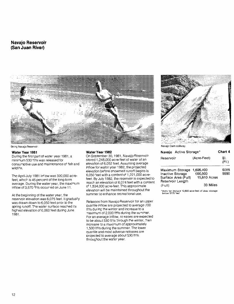
Skiing Navajo Reservoir. Navajo Dam spillway.
Water Year 1981During the first part of water year 1981, aminimum 530 fP/s was released forconsumptive use and maintenance of fish andwildlife.
The April-July 1981 inflow was 320,000 acrefeet, which is 45 percent of the long-termaverage. During the water year, the maximuminflow of 3,670 fP/s occurred on June 11.
At the beginning of the water year, thereservoir elevation was 6,075 feet. It graduallywas drawn down to 6,050 feet prior to thespring runoff. The water surface reached itshighest elevation of 6,060 feet du ring June1981.
12
Water Year 1982On September 30, 1981, Navajo Reservoirstored 1,248,000 acre-feet of water at anelevation of 6,052 feet. Assuming averageinflow for water year 1982, the projectedelevation before snowmelt runoff begins is6,050 feet with a content of 1,221,000 acrefeet. By July 1982, the reservoir is expected toreach an elevation of 6,074 feet with a contentof 1,534,000 acre-feet. This approximateelevation will be maintained throughout thesummer to enhance recreational use.
Releases from Navajo Reservoir for an upperquartile inflow are projected to average 700fP/s during the winter and increase to amaximum of 2,000 fP/s during the summer.For an average inflow, releases are expectedto be about 530 fP/s through the winter, thenincrease to a maximum of approximately1,500 fP/s during the summer. The lowerquartile and most adverse releases areprojected to average about 530 fP/sthroughout the water year.
Navajo Active Storage*
Reservoir (Acre-Feet)
Maximum Storage 1,696,400Inactive Storage 660,500Surface Area (Full) 15,610 AcresReservoir Length(Full) 33 Miles
*does not include 12,600 acre-feet of dead storagebelow 5775 feet
Chart 4
EI.(Ft.)
60855990

5966
6029
Elevation in Feet (Non-Linear Scale)
, """"jlL,~", __ 5720ASONDJFMAMJJAS
Projected 1982ONDJFMAMJJ
Actual 1981
I---+--+---+-----+-~+---+---+-_+____+____t-+--+--+-_+____+__+-~+_::A__+____+_~~ 6085
6072
Panoramic view of Navajo Reservoir, a popular recreational area of the Southwest.
StorageUsable Content in 1000 Acre-Feet
Average
41---+---+-+---+--+
31---+---+-+---+--+
21---+---+-+---+--+-
1 b,.,.--+---+--+---+-~--4--,.,.,.""':;:;;
Navajo Dam spillway and Pine River Marina.
Outflow Release in 1000 Cubic Feet/Second
Actual Operation 1981541---+--+-+---+--+-1---+---+--+--....-+--+---1
321---+---+-+---+--+-?----+-----+--+---+----+----f
1
Projected Operation 1982Upper Quartile
41---+---+--+---+-----4--+---+-----i1---+----+--+---f
31---+--+-+---+---+-?----+----+--?----+----+-----i
2 I---+--+-+---+---+-I---+----"
1 ~liiiiiiiiiiil.
Lower Quartile
321
I
+I
I
LegendMost ProbableUpper QuartileLower QuartileMost Adverse
Most Adverse
321
I II II II I
ONDJ FMAMJ J AS
13

Lake Powell (Colorado River)
Downstream view of Glen Canyon Dam and Powerplant.
*does not include 1,998,000 acre-feet of deadstorage below 3370 feet
186 Miles
81,021,000 Kilowatts
lake Powell Active Storage*
Reservoir (Acre-Feet)
Chart 5
EI.(Ft.)
25,002,000 37009,428,000 35704,126,000 3490
161,390 Acres
Maximum StorageRated HeadMinimum PowerSurface Area (Full)Reservoir Length(Full)Power Plant
Number of UnitsTotal Capacity
Water Year 1982By the end of September 1981, the elevationof Lake Powell was 3,672 feet with a contentof 20,751 ,000 acre-feet. Under average runoffconditions the elevaion is expected to bedrawn down to about 3,662 feet by the springof 1982, and reach a maximum elevation of3,684 feet by the end of July. At this elevation,the content is 22.4 million acre-feet, 90percent of active capacity, and the surfacearea is approximately 149,500 acres.
Assuming average inflow conditions andminimum releases from Lake Powell, thestorage in Lake Powell will remain less thanthe storage in Lake Mead throughout wateryear 1982. Therefore, the proposed operationplan for average inflow is based on a releasefrom Lake Powell of 8,230,000 acre-feet. Withan upper quartile inflow, releases areprojected to total 9,300,000 acre-feet.
On September 30, 1980, the Lake Powellwater surface elevation was 3,688 feet withan active storage of 23,083,000 acre-feet. TheApril-July 1981 runoff above Lake Powell wasapproximately 41 percent of the long-termaverage. The water surface elevation wasdrawn down to 3,677 feet prior to the springrunoff, and attained a maximum seasonallevel of 3,681 feet by July 1981. Total releasesfrom Lake Powell amounted to 8,295,000acre-feet.
Water Year 1981During water year 1981, Lake Powell, which isimpounded by Glen Canyon Dam, wasoperated as part of the Colorado RiverStorage Project in accordance with governingcontracts and laws to provide river regulation,optimum power production, recreation, andfish and wildlife enhancement.
14

Glen Canyon generators. Rehabilitation at Glen Canyon Powerplant tunnel.
3627
3506
Elevation in Feet (Non-Linear Scale)
5
StorageUsable content in Million Acre-Feet
25 ...---+--+--4---+---+---+--If--+---+---+--+--+---+---+-f--+---+---+--4---+---+---+_--I-------1 3700
15
10
50 1--4----f----+--t---1----f---I---1---f--I--4--........f
40 1---+----+----II---+----I--I---+----+----+-4----+----I
30 .--+--+---+-~-+--_+_----+----if---+--_+_--+----i
20 .---+---+---+-I---+---+-----+----i~~_+_--+----i
10
Inflow - OutflowActual 1981 In 1000 Cubic Feet Second
Projected 1982Upper Quartile50 ...---.---...-__t_-r---....----,---..,.-----,r=-.,.----,---..,.-----.
40 ~--+-_+___+-.J--+-_+___+--I-I--~_+___+---I
30 r--+--+---+-~-+--_+_---hlt----lf---r---;~--+----i
20 I---+---+---+--,.,-+---+----t-~--+---+-~
10
Average
40 1---+--+----+--+--+-----+-+---+--+--+---+---1
30 r---+-_+_-+-r--+----+--+~pE:---f1'lE-_+_--+---I
20 1----+-_+___+-.J--+-_+_~~~-+--~--+-1
10
Lower Quartile
30 1---I---+----4--+--+--+----4--~-+--_+_--+----i
20 ~-4-__I_-+-+--+-__I_-+_I_+__~:_+_-+--;
10 ...
Most Adverse
20 ~-+--4--+-~+--+--+-I__+-__t_--+-1
10
o N D J F M A M J J A S
LegendMost ProbableUpper QuartileLower QuartileMost Adverse
15
Lower Basin ReservoirsLake Mead (Colorado River)
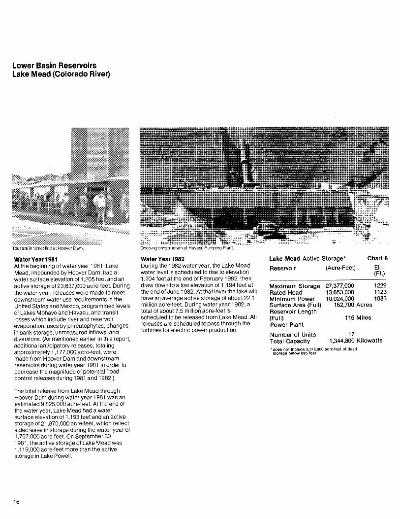
Tourists in ticket line at Hoover Dam. Ongoing construction at Havasu Pumping Plant.
*does not include 2,378,000 acre-feet of deadstorage below 895 feet
115 Miles
171,344,800 Kilowatts
Lake Mead Active Storage*
Reservoir (Acre-Feet)
Chart 6
EI.(Ft.)
27,377,000 122913,653,000 112310,024,000 1083
162,700 Acres
Maximum StorageRated HeadMinimum PowerSurface Area (Full)Reservoir Length(Full)Power Plant
Number of UnitsTotal Capacity
Water Year 1982During the 1982 water year, the Lake Meadwater level is scheduled to rise to elevation1,204 feet at the end of February 1982, thendraw down to a low elevation of 1,194 feet atthe end of June 1982. At that level the lake willhave an average active storage of about 22.1million acre-feet. During water year 1982, atotal of about 7.5 million acre-feet isscheduled to be released from Lake Mead. Allreleases are scheduled to pass through theturbines for electric power production.
Water Year 1981At the beginning of water year 1981, LakeMead, impounded by Hoover Dam, had awater surface elevation of 1,205 feet and anactive storage of 23,637,000 acre-feet. Duringthe water year, releases were made to meetdownstream water use requirements in theUnited States and Mexico, programmed levelsof Lakes Mohave and Havasu, and transitlosses which include river and reservoirevaporation, uses by phreatophytes, changesin bank storage, unmeasured inflows, anddiversions. (As mentioned earlier in this report,additional anticipatory releases, totalingapproximately 1,177,000 acre-feet, weremade from Hoover Dam and downstreamreservoirs during water year 1981 in order todecrease the magnitude of potential floodcontrol releases during 1981 and 1982.)
The total release from Lake Mead throughHoover Dam during water year 1981 was anestimated 9,825,000 acre-feet. At the end ofthe water year, Lake Mead had a watersurface elevation of 1,193 feet and an activestorage of 21 ,870,000 acre-feet, which reflecta decrease in storage during the water year of1,767,000 acre-feet. On September 30,1981, the active storage of Lake Mead was1,119,000 acre-feet more than the activestorage in Lake Powell.
16
Rugged terrain forms backdrop overlooking Davis Dam.··'~m.::·
Trestle crane, left, in operation at Havasu Plant. Twenty-one millionth visitor at Hoover Dam.
Outflow Release in 1000 Cubic Feet/Second
Actual Operation 1981StorageActive Content in Million Acre-Feet Elevation in Feet (Non-Linear Scale)
895
1136
1179
, 1012
'.: .'1083
ASONDJ FMAMJ
Projected 1982ONDJFMAMJJ
Actual 1981
~-+--+----+-~---+~~+--+--+--+--+--+--+-+--+--+--+--+--+---t-t--;-----r---j 1229
5
20
25
10
15
o N D J F M A M J.J A S
Average, Lower Quartile,Most Adverse
Projected Operation 1982Upper Quartile
LegendMost ProbableUpper Quartile
17
lake Mohave (Colorado River)
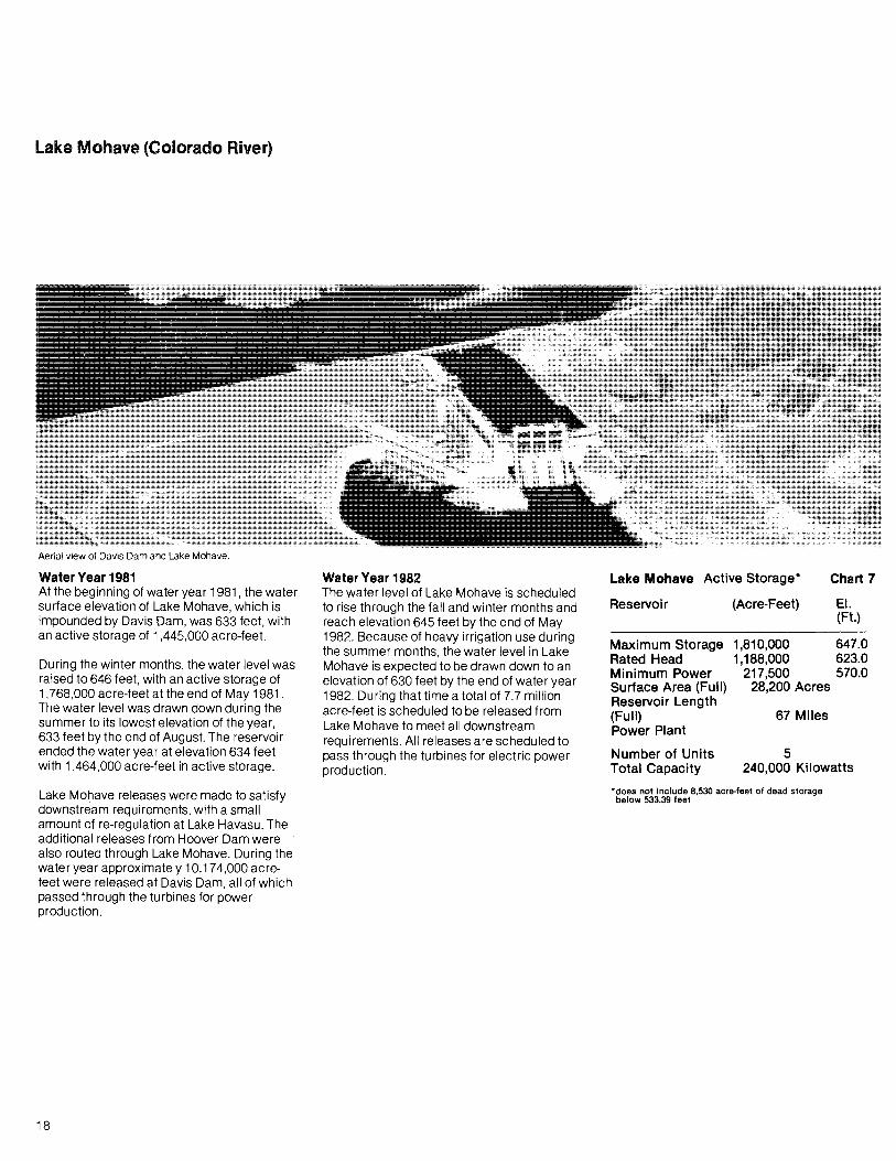
Aerial view of Davis Dam and Lake Mohave.
Maximum Storage 1,810,000 647.0Rated Head 1,188,000 623.0Minimum Power 217,500 570.0Surface Area (Full) 28,200 AcresReservoir Length(Full) 67 MilesPower Plant
Lake Mohave Active Storage*
5240,000 Kilowatts
Water Year 1981At the beginning of water year 1981, the watersurface elevation of Lake Mohave, which isimpounded by Davis Dam, was 633 feet, withan active storage of 1,445,000 acre-feet.
During the winter months, the water level wasraised to 646 feet, with an active storage of1,768,000 acre-feet at the end of May 1981.The water level was drawn down during thesummer to its lowest elevation of the year,633 feet by the end of August. The reservoirended the water year at elevation 634 feetwith 1,464,000 acre-feet in active storage.
Water Year 1982The water level of Lake Mohave is scheduledto rise through the fall and winter months andreach elevation 645 feet by the end of May1982. Because of heavy irrigation use duringthe summer months, the water level in LakeMohave is expected to be drawn down to anelevation of 630 feet by the end of water year1982. During that time a total of 7.7 millionacre-feet is scheduled to be released fromLake Mohave to meet all downstreamrequirements. All releases are scheduled topass through the turbines for electric powerproduction.
Reservoir
Number of UnitsTotal Capacity
(Acre-Feet)
Chart 7
EI.(Ft.)
Lake Mohave releases were made to satisfydownstream requirements, with a smallamount of re-regulation at Lake Havasu. Theadditional releases from Hoover Dam werealso routed through Lake Mohave. During thewater year approximately 10,174,000 acrefeet were released at Davis Dam, all of whichpassed through the turbines for powerproduction.
18
*does not include 8,530 acre-feet of dead storagebelow 533.39 feet

Whitsett Intake Pumping Plant 2 miles upstream from Parker Dam. Tourists view diversion tunnel in Arizona wing of Hoover Dam
58~
61E
A . S 53~
~---+----I63e
Elevation in Feet (Non-Linear Scale
ASONDJ FMAMJJProjected 1982
FMAMJJ0'0 N:O J
Actual 1981
0.5:
1.8 J---+---+-----+--+---+---f-+---+---+--+--+---+--+-+---+--+--+--+---+---+-+---+--+---1647
1.5
Lake Mohave StorageUsable Content in Million Acre-Feet
Release in1000 Cubic Feet / Second
Projected Operation 1982Upper Quartile
Average, Lower Quartile,Most Adverse
Lake Mohave OutflowActual Operation 1981
151---+---+--1---4---+-10..---+---+---+----+-5
15~~--+---t--+--~
10'·5
ONDJFMAMJJAS
1~

Lake Havasu (Colorado River)
4120,000 Kilowatts
35 Miles
Giant pipe sections for Central Arizona Project dwarf car.
Water Year 1981At the beginning of water year 1981, the waterlevel of Lake Havasu, impounded by ParkerDam, was at elevation 447 feet with an activestorage of about 554,000 acre-feet. Thereservoir was drawn down to approximatelyelevation 446 feet, with an active storage ofabout 549,000 acre-feet in February toprovide flood control space for runoff from thedrainage area between Davis and ParkerDams. The water level was then raised to anapproximate elevation of 450 feet by the endof June, with an active storage of about612,000 acre-feet. By the end of the wateryear, Lake Havasu was drawn down to about447 feet with an active storage of 569,000acre-feet.
During the water year, approximately8,653,000 acre-feet were released at ParkerDam, all of which passed through theturbines for power production. That amountincluded the additional releases from LakeMead during the year and flood controlreleases from Alamo Dam on the Bill WilliamsRiver.
Space in the top 10 feet of Lake Havasu(about 180,000 acre-feet) is reserved by theUnited States for control of floods and otheruses, including river regulation. Normally, onlyabout the top 4 feet, or 77,000 acre-feet ofspace, have been used for this pu rpose sinceAlamo Reservoir on the Bill Williams Riverhas been in operation.
20
Water Year 1982Lake Havasu is scheduled at the highestlevels consistent with the requi rements formaintaining flood control space. The yearlylow elevation of approximately 446 feet isscheduled for the October through Februaryhigh flood hazard period. The yearly high of450 feet is scheduled for the low flood hazardmonths of May and June. During water year1982, a total of approximately 6.6 million acrefeet is scheduled to be released from LakeHavasu to meet all downstream requirements.All releases are scheduled to pass through theturbines for electric power production.
Lettuce being loaded for Eastern markets.
Lake Havasu Active Storage*
Reservoi r (Acre-Feet)
Maximum Storage 619,400Rated Head 619,400Minimum Power 439,400Surface Area (Full) 20,400 AcresReservoir Length(Full)Power Plant
Number of UnitsTotal Capacity*does not include 28,600 acre·feet of dead storagebelow 400.0 feet
Chart 8
EI.(Ft.)
450.0450.0440.0

Graceful Parker Dam. CAP water to flow through this pipe from Havasu.
o N D J F M A M J J A S
444
424
438
Elevation in Feet (Non-Linear Scale)
-+----+----i-+---+--+---+----+----+-+---+--+-----i 450WW~~:;ij~~~~~:;;m+--~---l 449
A SON D J F M A MProjected 1982
ONDJFMAMJJActual 1981
300
100
400
200
500
StorageUsable Content in 1000 Acre-Feet
619 ~-+---+--+--+--+--+--+--+--+--+-
600 ....-+--+---+--+--+--+--
Average, Lower Quartile,Most Adverse
Projected Operation 1982Upper Quartile
Outflow Release in 1000 Cubic Feet/Second
Actual Operation 1981
151----+---+---+-+--+--+---+-t--1Ol----+--+---+-r--+-;
5.....11
15k",'~-+----+---+-+---+--+----f---I:::f.;if.!10 ..·5
21

River Regulation
Pipemobile guided in placement of CAP pipe. Helicopter view of Crystal Dam.
The natural virgin runoff reaching the streamsof the Colorado River drainage system aboveGlen Canyon Dam during water year 1981was estimated at about 8.2 million acre-feet.Of this amount, about 3.8 million acre-feetwere consumptively used within the UpperColorado River Basin States.
Adjustments in storage in mainstemreservoirs resulted in an inflow to Lake Powellof 6.3 million acre-feet. The release from GlenCanyon Dam, based on measurements at thegaging station at Lees Ferry, Ariz., was8,295,000 acre-feet. For the 1-year and 10year periods ending September 30, 1981 ,8,310,000 acre-feet and 89,692,000 acre-feet,respectively, passed the compact point atLee Ferry.
22
The projected release from Lake Powellbased on average, or less, runoff conditions is8,230,000 acre-feet.The projected release foran upper quartile runoff condition is 9,300,000acre-feet. When added to the flow of the PariaRiver, this would result in an Upper Basindelivery ranging from 88.6 to 89.7 million acrefeet for the 1O-year period ending September30,1982.
Normally, daily releases are made from thestorage reservoirs in the Lower Basin to meetthe incoming orders of the water useragencies. All water passes through thepowerplant units. The daily releases areregulated on an hourly basis to meet as nearlyas possible the power loads of the electricpower customers. Minimum daily flowobjectives are provided in the river to maintainfishery habitat.
Adjustments to the normal releases are madewhen conditions permit to provide moresatisfactory conditions for water-orientedrecreation activities, to provide transport for
riverborne sediment to desilting facilities, andto assist in controlling water quality. Releasesfrom Lake Powell were at least 1,000 f13/sduring the winter months and were increasedto at least 3,000 f13/s during the summermonths. Minimum daytime releases during thesummer months averaged 8,000 f13/s.
Anticipatory releases and river regulationbelow Hoover Dam resulted in a total deliveryto Mexico of approximately 2,166,000 acrefeet in excess of the treaty quantity (1 ,700,000acre-feet) during water year 1981. Of thatamount 131 ,000 acre-feet of drainage waterswere by-passed for salinity control pursuant toprovisions of Minute No. 242 of theInternational Boundary and Water Commission.
Flood Control
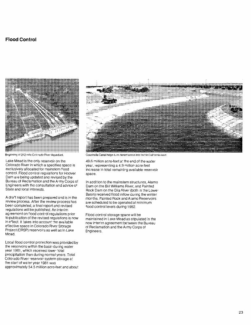
Beginning of 242-mile Colorado River Aqueduct.
Lake Mead is the only reservoir on theColorado River in which a specified space isexclusively allocated for mainstem floodcontrol. Flood control regulations for HooverDam are being updated and revised by theBureau of Reclamation and the Army Corps ofEngineers with the consultation and advice ofState and local interests.
A draft report has been prepared and is in thereview process. After the review process hasbeen completed, a final report and revisedregulations will be published. An interimagreement on flood control regulations priorto publication of the revised regulations is nowin effect. It takes into account the availableeffective space in Colorado River StorageProject (CRSP) reservoirs as well as in LakeMead.
Local flood control protection was provided bythe reservoirs within the basin during wateryear 1981 , which received lower totalprecipitation than during normal years. TotalColorado River reservoir system storage atthe start of water year 1981 wasapproximately 54.5 million acre-feet and about
Coachella Canal helps turn des~rt areas into fertile California land.
49.6 million acre-feet at the end of the wateryear, representing a 4.9 million acre-feetincrease in total remaining available reservoirspace.
In addition to the mainstem structures, AlamoDam on the Bill Williams River, and PaintedRock Dam on the Gila River (both in the LowerBasin) received flood inflow during the wintermonths. Painted Rock and Alamo Reservoirsare scheduled to be operated at minimumflood control levels du ring 1982.
Flood control storage space will bemaintained in Lake Mead as stipulated in thenew interim agreement between the Bureauof Reclamation and the Army Corps ofEngineers.
23

Beneficial Consumptive Uses
Center pivot sprinkler irrigation system.
Upper Basin Uses and LossesThe three largest sources of consumptive usein the Upper Colorado Basin are agriculturaluse within the drainage basin, diversion toadjacent drainage systems, and evaporationlosses. Du ring water year 1981 , the estimateduse for agricultural and municipal andindustrial supply in the Upper Basin was2,441 ,000 acre-feet. Estimated evaporationlosses were 686,000 acre-feet from mainstemreservoirs. Approximately 713,000 acre-feetwere diverted for use in adjacent drainagebasins. Thus, total estimated consumptive useamounted to 3,840,000 acre-feet. Storage inthe Upper Basin mainstem reservoirsdecreased by approximately 3.2 million acrefeet during water year 1981.
Lower Basin Uses and LossesDuring water year 1981, an estimated8,653,000 acre-feet of water were releasedfrom Lake Havasu to meet the requirementsfor water deliveries at Imperial Dam, as wellas those of the Colorado River IndianReservation near Parker, Ariz., the Palo VerdeIrrigation District near Blythe, Calif., othermiscellaneous users along the river; and theanticipatory releases and transit lossesbetween Parker Dam and Imperial Dam.
The major water diversion above Parker Damwas by The Metropolitan Water District(MWD) of Southern California. The MWDpumped approximately 883,000 acre-feetfrom Lake Havasu during water year 1981. Incontrast with previous years, none of this
24
water was utilized for delivery to the City ofTijuana, pursuant to a contract for temporaryemergency delivery of a portion of Mexico'streaty entitlement. During water year 1981,releases of approximately 10,174,000 acrefeet were made from Lake Mohave to providefor releases at Parker Dam; to supplydiversion requirements of The MWD,miscellaneous contractors, and other users;to offset evaporation and other transit lossesbetween Davis and Parker Dams; and tomaintain the scheduled levels of Lake Havasu.
During water year 1981, releases ofapproximately 9,825,000 acre-feet were madefrom Lake Mead at Hoover Dam to regulatethe levels of Lake Mohave and to provide forthe small users and the losses from thisreservoir. In addition, 139,000 acre-feet werediverted from Lake Mead for use by LakeMead National Recreation Area, Boulder City,Basic Management, Inc., and contractors ofthe Division of Colorado River Resources, inNevada. During water year 1981 , the totalreleases and diversions from Lake Mead werean estimated 9,964,000 acre-feet. Thisamount included the anticipatory releasesdiscussed elsewhere in this report.
For water year 1982, a release of 6.6 millionacre-feet from Lake Havasu has beenprojected, including consumptive use
Blythe, Calif., packing shed, Palo Verde Project.
requirements in the United States belowParker Dam, transit losses in the riverbetween Parker Dam and the MexicanBorder, and treaty deliveries to Mexico.
During water year 1982, The MWD isexpected to divert 1,000,000 acre-feet bypumping from Lake Havasu. Consumptiveuses by small users, river losses or gains, andreservoir losses between Davis Dam andParker Dam are projected to be a net loss of162,000 acre-feet.
There are no major users between HooverDam and Davis Dam. During water year 1982,consumptive uses by small users, river lossesor gains, and reservoi r losses betweenHoover Dam and Davis Dam are projected tobe a net gain of 177,000 acre-feet. The netdiversions from Lake Mead are projected at112,000 acre-feet. Evaporation from LakeMead is expected to be about 929,000 acrefeet and net gain between Glen Canyon Damand Lake Mead is expected to be about884,000 acre-feet.

Water Quality Operations
Hydrilla weed is troublesome in canals.
Since water quality aspects of Colorado Riveroperations are extensively described in thebiennial series of reports entitled Quality ofWater, Colorado River Basin, only minimaldiscussion of this aspect of operation ispresented in this report. Report NO.1 0 of thebiennial series was issued in January 1981 .
During water year 1981, the United States bypassed a total of 131 ,000 acre-feet throughthe By-pass Drain. This water was replacedwith a like amount of other water, pursuant toMinute No. 242 of the International Boundaryand Water Commission.
Under the provisions of Minute No. 242, theRepublic of Mexico is entitled to receive atMorelos Dam water of a quality no worse than115 parts per million (p/m) (± 30 p/m) greaterthan that arriving at Imperial Dam. Duringwater year 1981 , the average salinity of theColorado River at Imperial Dam was 786 p/m.During that period the average salinity of thewaters at Morelos Dam was 872 p/m,resulting in a salinity differential of 86p/m, wellwithin the provision of Minute No. 242.
Backfill placement at Yuma, Ariz., Desalting Plant.
No large amount of Gila River infiltration to theWellton-Mohawk Irrigation and DrainageDistrict is expected du ring water year 1982because no flood control releases fromPainted Rock Reservoir are anticipated. Thetotal flows in the By-pass Drain during wateryear 1982 are estimated to be less than180,000 acre-feet. No by-pass waters areexpected to be returned to the Colorado Riverbelow Morelos Dam during water year 1982.
In recognizing the need to manage waterquality of the Colorado River, it has beenrecommended that long term salinityincreases in the river be controlled through awater quality improvement program generallydescribed in the report, Colorado River WaterQuality Improvement Program, datedFebruary 1972, and a status report of thesame title, dated January 1974.
The program calls for a basin-wide approachto salinity control while the Upper Basincontinues to develop its compact-apportionedwaters. The initial step towards improvementof the quality of the river's water wasauthorization by the Congress of the ColoradoRiver Basin Salinity Control Project (PublicLaw 93-320), on June 24,1974.
25

Enhancement of Fishand Wildlife
Spraying to control hydrilla in the Westside Main Canal, Imperial Valley.
Upper BasinIn addition to both cold and warm waterfishing opportunities made available inColorado River Storage Projects (CRSP),Reclamation dams have also created some ofthe finest fishing available in the tailwaterreaches below the reservoirs by providingcontinuous flows which assure suitable fishhabitat. Fontenelle, Flaming Gorge, Navajo,and Glen Canyon tailwater fisheries have allbeen described as blue-ribbon trout streamsby the respective state wildlife agencies whichmanage their use. The Gunnison River belowCrystal Dam also holds great promise forfuture angling opportunities.
The 1981 tailwater trout fishing below FlamingGorge has been described as the best yearever. Angler use and catch has exceededeven earlier impoundment yields due primarilyto the 1978 penstock modification andwarming of downstream flows. Overwinteringfingerling trout, for example, have grown to afoot or more in length by the following springseason. Such growth may preclude the needfor stocking catchable size trout and thusprovide excellent fishing without theincreased hatchery costs.
The Navajo tailwater fishery continues toprovide excellent fishing. A continuous flow ofat least 530 113/s was maintained throughoutthe year immediately below Navajo Dam for
26
fish propagation. The fishery extends some 17miles below the dam and contains brown,cutthroat, and rainbow trout. The upper 2.7miles are regulated under special provision bythe New Mexico Department of Game andFish to insure a quality fishing experience.During the year, representatives from theBureau of Reclamation, Fish and WildlifeService, and various New Mexico Stateagencies met regularly to develop a flowregime which will further enhance the SanJuan River fishery, while meeting the othermultiple-purpose uses of Navajo Reservoirwater.
Recently completed investigations belowFontenelle Dam have led the WyomingDepartment of Game and Fish to initiate aprogram of boulder placement in the GreenRiver below the dam to provide cover andpooling habitat and thereby increase troutproduction. This program was funded underSection 8 of the Colorado River Storage Act,and will be completed in fiscal year 1982. Theoverall effectiveness of the program will beevaluated in 1983.
The Glen Canyon tailwater fishery continuesto be Arizona's "top fishery" due to the clearwater and a continuous flow of at least 1,000f13ls which create a favorable habitat forspecies of fish introduced in the river belowGlen Canyon. The average rainbow troutcaught from Lees Ferry during the 1980-1981fishery season was 18 inches in length andweighed over 3 pounds, or about 6 times the
State average. Brook trout have also beenadded to the stock below the dam where aState record (5 lb. 2 oz.) was caught in April1981.
Due to limited access to the Gunnison Riverand a lack of fishery data, the Crystal Damfishery has not received the attentionexperienced by other CRSP tailwaterfisheries. Preliminary investigations ofinvertebrate production and fish growth belowthe dam, however, point toward a brightfuture. Traveling through the Black Canyon ofthe Gunnison, the cold downstream releaseshave extended the trout fishing to Delta, Colo.A continuous flow of at least 200 f13ls ismaintained in the Gunnison River below theGunnison Tunnel.

Sampling herbicide mobility in Wisteria Canal.
Lower BasinThe fourth year of the 5-year Lake Mead BlackBass Study by Arizona Game and FishDepartment (AGFD) and Nevada Departmentof Wildlife (NOW) was completed during wateryear 1981. The year's efforts againconcentrated on nesting success, survival,cover utilization, and food availability forlargemouth bass. Creel census work revealeda trend towards more angler effort forlargemouth bass rather than striped bass, aswas the case in water year 1980.
Windmill pumps water for wildlife.
This was also the final year for the evaluationof stocking of different sizes of largemouthbass reared on artificial diets in Lake Mead.The fish are reared in the Fish and WildlifeDevelopmental Facility in San Marcus, Tex.Five-inch and eight-inch largemouth weremarked with fluorescent dye and reward tags,respectively, and released into Lake Mead byAGFD and NOW.
The final report and recommendations for allphases of this study will be completedDecember 31 , 1982. The study has beenfunded by the Upper and Lower ColoradoRegions of the Bureau of Reclamation.
Trout habitat study at Flaming Gorge.
27

Preservation of Environment
Coachella Canal divides desert from formerly unproductive areas. Portion of newly-lined Coachella Canal.
Reclamation is conducting a selective stripclearing project in the Cibola Division of theLower Colorado River below Palo Verde, Calif.The study area is a 6.5-mile fringe of riparianvegetation inside the flood control levees.Hydraulic and engineering studies indicatethat a major flood in this area could spilloverthe levees. Selective clearing of vegetationcould decrease the chance of this happening.The study area includes an estimated 700acres of vegetation; the proposed study wouldremove about 180 acres. Vegetation would becleared in 50-, 75-, and 1DO-foot linear stripsparallel to the Colorado River. If the follow-upstudy shows significant impacts to wildlife,mitigation will be developed. The project isbeing planned and coordinated with otherState and Federal agencies.
A temporary cooperative program with theCalifornia Department of Fish and Game(CDFG) to provide water to wildlife hasimproved conditions for deer near theCoachella Canal during the summer of wateryear 1981 . The recently-lined canal is anobstacle and source of significant mortality for
28
deer moving from the Chocolate Mountains towater in the canal itself or in seeps to the west.As part of mitigation agreements with the Fishand Wildlife Service and CDFG, windmillwatering devices are being constructed invegetation pockets frequented by the deer onthe east flank of the Algodones Dunes. By thesummer of 1982, with the windmills inoperation, hopes are that the deer will cometo these wells for water, eliminating the needfor the temporary watering program, as wellas significant canal-related deer losses. Otherstudies of deer are being conducted in theWellton-Mohawk canal area, and in theriparian zone of the Lower Colorado River.

Power Operations
Purchases (for)Parker Davis Firming 0Rio Grande Firming 0CRSP Firming 848,141 ,112Fuel Replac_e_m_e_n_t 84_2....;.,5_1_1-'-0,8_8_8
Subtotal Purchases 1,690,653,000
Transmission for others 222,038,000Power Deliveries from
others (I nte_rc_h_a_ng~e--,-) 99_8....;.,2_2_5-'-o,6_6_4
Total Energy Receipts 7,936,581,964
$46,627,358.00
243,085 kW82,154 kW
$77,784,000
Water Year 1982
22,186,552.79o
2,584,144.272,727,932.97
$74,125,988.03
View of underground Morrow Point Powerplant.
RevenueFirm Energy SalesNonfirm Energy Sales
(Oil Conservation)Parker Davis FirmingWheeling for othersMiscellaneous Income
Total Revenue
kWhEstimated Energy Sales 6,878,668,000 kWhEstimated Purchases 2,000,000,000 kWhEstimated Peaking CapacitySales (kW)
Winter 80-81Summer-81
Estimated Revenue
kWh360,789,000245,511,900314,808,000
57,642,0003,877,310,000
169,604,4005,025,665,300
Water Year 1981
Sources of EnergyNet Generation
Flaming GorgeBlue MesaMorrow PointFontenelleGlen CanyonCrystalSubtotal- Net Generation
Powerhouse interior at Flaming Gorge Dam.
The total revenue from power operations infiscal year 1981 was $74,125,988. For fiscalyear 1982, estimated revenues are$77,784,000.
Upper Basin -Colorado River Storage Project (CRSP)The following table summarizesthe CRSP generation, purchases, disposition,and revenue from power operations for fiscalyear 1981 and presents projections for fiscalyear 1982.
5,625,040,712842,511,888
Disposition of EnergyFirm Energy SalesNon-Firm Energy SalesPower Delivered to others
(Interchange) 987,614,910System Los_s_es 8_4_1...:....,4_1_4...:....,4_5_1
7,936,581,964
29
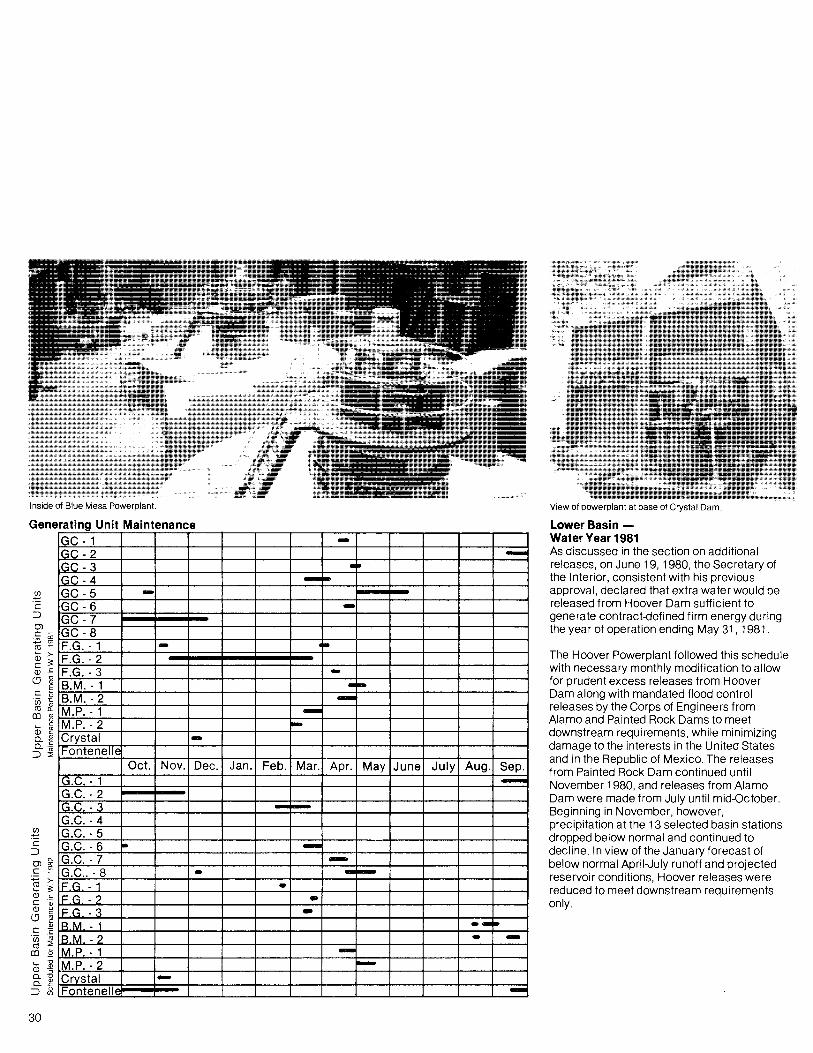
Inside of Blue Mesa Powerplant.
Generating Unit Maintenance
View of powerplant at base of Crystal Dam.
Lower Basin -Water Year 1981As discussed in the section on additionalreleases, on June 19, 1980, the Secretary ofthe Interior, consistent with his previousapproval, declared that extra water would bereleased from Hoover Dam sufficient togenerate contract-defined firm energy duringthe year of operation ending May 31,1981.
The Hoover Powerplant followed this schedulewith necessary monthly modification to allowfor prudent excess releases from HooverDam along with mandated flood controlreleases by the Corps of Engineers fromAlamo and Painted Rock Dams to meetdownstream requirements, while minimizingdamage to the interests in the United Statesand in the Republic of Mexico. The releasesfrom Painted Rock Dam continued untilNovember 1980, and releases from AlamoDam were made from July until mid-October.Beginning in November, however,precipitation at the 13 selected basin stationsdropped below normal and continued todecline. In view of the January forecast ofbelow normal April-July runoff and projectedreservoir conditions, Hoover releases werereduced to meet downstream requirementsonly.
GC -1 -IGC -2 -,GC-3 ••GC-4 - .-GC-5 -GC-6 ..GC-7GC-8F.G. -1 .. t •
F.G. - 2F.G. - 3 -8.M. -1 --8.M. - 2 --M.P. -1 --M.P. - 2 -Crystal -Fontenelle
Oct. Nov. Dec. Jan. Feb. . Mar. Apr. May Junel July . Aug. Sep.G.C. -1 --G.C. -2G.C. -3 -~G.C. -4G.C. -5G.C. -6 .. -G.C. -7 -G.C.. -8 - --F,G -1 •F.G - 2 •F.G - 3 -B M -1 .....B M - 2 • ...M.P. -1 -M.P. - 2 -Crvstal -Fontenell~ -
30
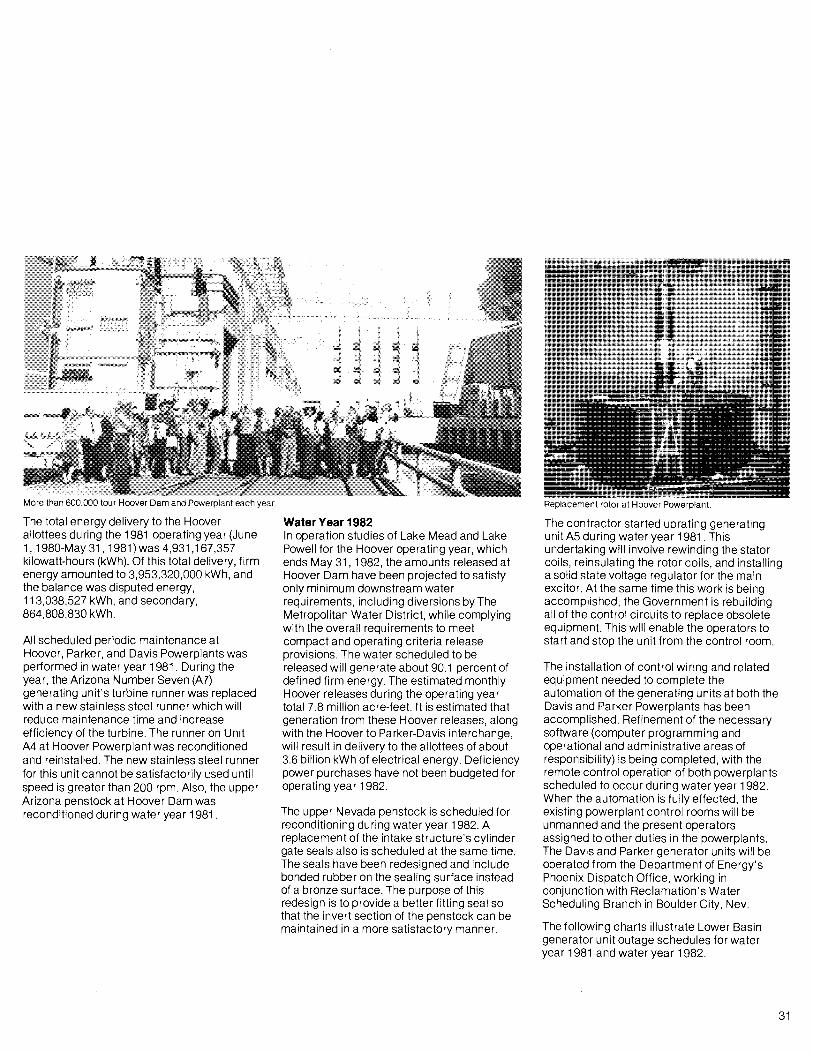
More than 600,000 tour Hoover Dam and Powerplant each year. Replacement rotor at Hoover Powerplant.
The total energy delivery to the Hooverallottees during the 1981 operating year (June1, 1980-May 31,1981) was 4,931,167,357kilowatt-hours (kWh). Of this total delivery, firmenergy amounted to 3,953,320,000 kWh, andthe balance was disputed energy,113,038,527 kWh, and secondary,864,808,830 kWh.
All scheduled periodic maintenance atHoover, Parker, and Davis Powerplants wasperformed in water year 1981. During theyear, the Arizona Number Seven (A7)generating unit's turbine runner was replacedwith a new stainless steel runner which willreduce maintenance time and increaseefficiency of the turbine. The runner on UnitA4 at Hoover Powerplant was reconditionedand reinstalled. The new stainless steel runnerfor this unit cannot be satisfactorily L:sed untilspeed is greater than 200 rpm. Also, the upperArizona penstock at Hoover Dam wasreconditioned during water year 1981.
Water Year 1982In operation studies of Lake Mead and LakePowell for the Hoover operating year, whichends May 31 , 1982, the amounts released atHoover Dam have been projected to satisfyonly minimum downstream waterrequirements, including diversions by TheMetropolitan Water District, while complyingwith the overall requirements to meetcompact and operating criteria releaseprovisions. The water scheduled to bereleased will generate about 90.1 percent ofdefined firm energy. The estimated monthlyHoover releases during the operating yeartotal 7.8 million acre-feet. It is estimated thatgeneration from these Hoover releases, alongwith the Hoover to Parker-Davis interchange,will result in delivery to the allottees of about3.6 billion kWh of electrical energy. Deficiencypower purchases have not been budgeted foroperating year 1982.
The upper Nevada penstock is scheduled forreconditioning during water year 1982. Areplacement of the intake structure's cylindergate seals also is scheduled at the same time.The seals have been redesigned and includebonded rubber on the sealing surface insteadof a bronze surface. The purpose of thisredesign is to provide a better fitting seal sothat the invert section of the penstock can bemaintained in a more satisfactory manner.
The contractor started uprating generatingunit A5 during water year 1981. Thisundertaking will involve rewinding the statorcoils, reinsulating the rotor coils, and installinga solid state voltage regulator for the mainexcitor. At the same time this work is beingaccomplished, the Government is rebuildingall of the control circuits to replace obsoleteequipment. This will enable the operators tostart and stop the unit from the control room.
The installation of control wiring and relatedequipment needed to complete theautomation of the generating units at both theDavis and Parker Powerplants has beenaccomplished. Refinement of the necessarysoftware (computer programming andoperational and administrative areas ofresponsibility) is being completed, with theremote control operation of both powerplantsscheduled to occur during water year 1982.When the automation is fully effected, theexisting powerplant control rooms will beunmanned and the present operatorsassigned to other duties in the powerplants.The Davis and Parker generator units will beoperated from the Department of Energy'sPhoenix Dispatch Office, working inconjunction with Reclamation's WaterScheduling Branch in Boulder City, Nev.
The following charts illustrate Lower Basingenerator unit outage schedules for wateryear 1981 and water year 1982.
31

Tourists at Hoover Dam view generators in Nevada Powerhouse.
Generating Unit Maintenance
Q;~o..J
32
Oct. Nov. Dec. Jan. Feb. Mar. Apr. May June JUly Aug. Sep.
A-1 --.-A-2
A-3
A-4 .-
.A-5
A-6
A-7
A-8
A-9 .-N-1 .....N-2
N-3
N-4
N-5
N-6
N-7
N-8 I
0-1 - --0-2
0-3 .-0-4 ...0-5 -P-1 ..-
P-2 .-P-3 -.-P-4 --
:....Q)
~o..J
Oct. Nov. Dec. Jan. Feb. Mar. Apr. May June July Aug. Sep.
A-1 •A-2 .A-3 ..A-4 --A-5
A-6 -A-7 ..A-8 .-
A-9 .N-1 -N-2
N-3 .-
N-4 - ..-
N-5 .N-6 .-....N-7 .N-8
0-1 ..-
0-2
0-3 -..0-4 -..0-5 ..-.-P-1 .-
P-2 -P-3 ..P-4
GPO 835-34~