
1 · Web viewA key component of this data set is aircraft-sensed atmospheric data and hazards,...
30
DRAFT v.3 15 November 2006 Weather in the Cockpit Concept of Operations 1
Transcript of 1 · Web viewA key component of this data set is aircraft-sensed atmospheric data and hazards,...

DRAFT v.315 November 2006
Weather in the CockpitConcept of Operations
1
FAA Aviation Safety, AVS
Certification and Flight Standards
Table of Contents
1 Introduction 31.1 Definition of Weather in the Cockpit (WIC) 31.2 WIC Concept of Operations 31.3 Purpose and Scope 3
2 User Classes 42.1 Pilots 42.1.1 Low-end General Aviation, Part 91 (no FOC capability) 42.1.2 High-end General Aviation, Part 91/135, USAF
(unscheduled, may, may not have FOC capability) 52.1.3 Part 121 Operators (FOC capability) 52.2 Ground End-users 62.2.1 Traffic Managers/Controllers 62.2.2 Dispatchers, Flight Operations Control (FOC) 62.2.3 Decision Support Services 7
3 Anticipated Weather Products 83.1 Providers 83.2 Products and Operational Integration 83.3 System-level Cockpit Integration 8
4 Operational Environment 94.1 Current Operations—User capabilities 104.1.1 Flight planning 104.1.2 Departure/arrival 104.1.3 En route 104.1.4 Oceanic 114.2 Environment for 2012, Initial Capability (IC) 114.2.1 Flight planning 124.2.2 Departure/arrival 124.2.3 En route 124.2.4 Oceanic 13
2

4.3 Planned Operational Environment for 2025 13
5 Approval and Certification 13
6 International Harmonization 13
Appendix 1. Acronyms 15Appendix 2. Pilot End-user Needs 16Appendix 3. References 21
3

1 Introduction
1.1 Definition of Weather in the Cockpit (WIC) The concept of providing up-to-date weather information to the airborne flight crew has evolved over the years from verbal/textual transmission, to graphical weather depictions from aircraft sensors, to the capability to provide data link transmission of alerts, warnings, and planning weather graphics as required for safely completing a planned flight profile. The following definition comes from “An Operational Systems Vision for Aviation Weather-in-the-Cockpit,” released by FAA AVS-1 in August 2006. “Weather in the Cockpit” means we:
“Employ the aircraft as a node in the National Airspace System’s communications, navigation, and surveillance (CNS) network. Enable flight deck weather information technologies that allow pilots and aircrews to engage in shared situational awareness and shared responsibilities with controllers, dispatchers, Flight Service Station (FSS) specialists, and others, pertaining to preflight, en route, and post flight aviation safety decisions involving weather.”
and this is accomplished through:
“…a system combining and presenting various types of weather information obtained through multiple data-link sources, on-board remote sensors, and in-situ sensors to aid crews with effective flight management”
New concepts—risk management and decision support (either manual or automated)—further increase the power of accessing real-time weather information in the cockpit.
For this document, “cockpit” refers to displays, integrated systems, or any currently undefined function on the flight deck that uses weather information for decision support guidance.
1.2 WIC Concept of OperationsThis concept of operations is a consensus statement of an evolving capability from current operations through an initial capability (IC) envisioned through 2012, resulting in a Next Generation Air Transportation System (NGATS) capability in 2025. It is therefore a living document that provides continual guidance to activities needed to achieve a full weather in the cockpit capability by 2025. What this requires will be described later in this document and will be updated to reflect actual progress and evolving requirements.
1.3 Purpose and ScopeThe scope of this document is “Weather in the Cockpit” and its use by the airborne flight crew for decision support. This document places this capability in the context of the above definition recognizing that the aircraft is indeed a weather node in the total NAS. The intent is to look at the flight crew as part of the notional “triad” of collaborators—dispatch, aircraft, and air traffic control and management—so that a common awareness of the operating environment is attained and properly used. It proposes at a national
4

airspace system (NAS) level how this capability contributes to the objectives set forth by the Joint Planning Development Office (JPDO) for the NGATS in the sense of paving the way for the staged NGATS implementation; however, these connections are not meant to be the stated purpose. This document is living guidance for development and implementation of system-level weather dissemination capability and ultimately some level of automated decision support to the flight crew.
The purpose of this Concept of Operations is to begin a process that ensures weather products are defined, developed, and declared operational for unrestricted use, specifically by the pilot end-user for ground and in-flight decision support. It has been developed and coordinated by members of industry, user groups, the research and development community, and government, to support FAA Flight Standards and Certification efforts to address the issues associated with
Display design and use Weather data base (4-D Weather, the single authoritative NGATS source for
weather information available through network enabled access) plus other approved data sources, to be determined
WIC applications and value-added features for cockpit systems Translation of data to formats needed for data link, or transmission Data link integrity
Respective NGATS IPT Concepts of Operations continue as the system-level source documents for WIC.
2 User ClassesThere are two general user classes to be considered—pilots and ground users, including Flight Operations Centers (FOCs), Air Traffic Managers and Controllers, and Flight Service Stations (FSSs). This is a top-level, functional classification. Actual functional allocation of capabilities is further dependent on the temporal nature of the information (immediate, short-term, and planning), type of operation, and resulting decision support required.
To clarify for this document, FOCs are referred to as dispatchers, airline operations centers, system operations centers, command posts, and are similar in role and function to the FSS. Support functions include shared flight responsibility, weather support, flight planning support, and responsibilities relating to deviations from normal operations.
2.1 PilotsFor WIC, “Pilots” include pilots or aircraft operators, categorized here in terms of operation. The concept of shared situational awareness requires all the operator categories described below to share the same information content with the ground users, later.
2.1.1 Low-end General Aviation, Part 91 (no FOC capability) Low-end general aviation pilots operate small aircraft most often in the low-altitude NAS. These are single-pilot operated aircraft with limited equipage, may be VFR-only,
5

may or may not have air-ground communication and/or data link capability, and most likely do not have integrated flight systems in the cockpit. Many GA pilots carry portable communication systems that have the capability to show weather graphics whenever needed. GA pilots are independent and do not have external flight operations support. Weather flight planning is conducted by the pilot using many common sources and inflight updates are generally sought at the pilot’s discretion (FSS request). Information content, from any source, may vary and may not be the same as that available to air traffic control.
With WIC, the GA pilot can at least access weather information and weather impact variables (WIV) to support inflight, independent decision support for weather avoidance. GA aircraft will need to access and respond to centralized decision support guidance when and if implemented. In any case, WIC will enable access to common weather information for these users in text and graphic formats. Both request-reply (referred to as two-way in this document) and broadcast weather information dissemination will be supported.
2.1.2 High-end General Aviation, Part 91/135, USAF (unscheduled, may or may not have FOC capability)
High-end general aviation includes business aviation, USAF/DoD, and other unscheduled operators. Aircraft are high-end in terms of equipage and performance, and generally do have integrated flight systems. Many operators in this sub-class do have flight operations center support requiring shared situational awareness between pilots and ground flight support. Today, weather information is available in graphical and textual form to FOCs, ATM functions, and may be available to pilots in either or both forms, although information content may vary. WIC implementation will ensure pilots and FOCs share the same weather information content, formats dependent on applications being used.
Helicopter operators, specifically in the Gulf of Mexico and Emergency Medical Services (HEMS), are included in this category. Many of these operators have or are establishing flight operations centers that conform to the Part 121 requirements.
Setting the stage for phased NGATS implementation, WIC gives the pilot the opportunity to react and plan using the same information ground users respond to, and ensures a shared understanding of flight progress. Many of these users are already equipped to receive and process near real-time weather updates.
2.1.3 Part 121 Operators (FOC capability)What differentiates this category of users from other high-end users is the scheduled aspect of their operations. These users operate in a predictable, scheduled environment where flight plans and profiles are determined ahead of time and are available for NAS strategic planning functions. Currently, most aircraft are air-ground and ground-air data link capable so it is expected that an IC will include graphical and textual weather graphics in the cockpit. Most new Part 121 aircraft under development and entering operations are electronic flight bag capable and/or have integrated flight deck systems that can accommodate real-time weather information from the ground. Current and future
6

aircraft also have display systems that can show this weather information, either textually or graphically, to the pilot on request.
Part 121 operations require a ground flight control function (dispatch) which shares operational control and responsibility for the flight with the pilot in command. Shared responsibility requires shared environmental awareness, and FIC is an important component of this need. Most Part 121 operations are in the high-altitude NAS and operate in busy terminals requiring Instrument Flight Rules (IFR) compliance and positive ATC. The shared awareness of the environment extends to ATC as well.
2.2 Ground End-usersDetails of how these users operate in the evolution of NGATS are found in the NGATS, Weather, and SSA Concepts of Operations. This document identifies top-level operations concepts that will emerge as WIC becomes fully capable.
2.2.1 Traffic Managers/ControllersThis category of ground end-users includes the air traffic control, management, and planning functions. At the en route centers, these users have access to a large amount of weather data through the current Weather and Radar Processor (WARP) and Corridor Integrated Weather System (CIWS) systems, with forecasts and briefing support supplied by the Center Weather Service Unit (CWSU). In the terminal area, detailed weather information is available through such systems as the Integrated Terminal Weather System (ITWS) and/or the Terminal Doppler Weather Radar (TDWR). Convective weather can be overlaid on the en route and terminal TRACON (Terminal Radar Approach Control) traffic displays; however, such aircraft situation displays are primarily designed for the air traffic control and separation functions.
As weather information becomes more precise in time and space, the ATM function is “learning” how to use this information in a more proactive way for longer, well-traveled routes and terminal arrival/departure rate determination. Pilots are not involved in the ATM planning process.
WIC by itself will not change weather information content and availability for these users. Data may become available as aircraft become weather sensors in a large scale and access to this data is granted to controllers and managers. What will change is a drastic improvement in the common awareness of why flow and routing decisions are made based on the same knowledge of current and forecast weather conditions. Pilot use of WIC will reduce voice-radio relay of weather information updates by ATC and improve voice communications on negotiating hazardous weather avoidance.
2.2.2 Dispatchers, Flight Operations Control (FOC)The comments above regarding shared awareness of the environment apply for FOC and dispatch functions. This category includes airline dispatch, meteorology, flight operations control (for both airline and unscheduled operations), and DoD Command and Control centers. These users integrate company or agency operations policies, flight plans, flight crew management, aircraft tail number assignment, plus many other data that define their
7

operational concept into the overall system decision support. Weather data and information are available in many formats, from many sources, and generally exist on multiple displays. Dispatchers are trained in meteorology and are more likely to use different, personal strategies for creating a total weather picture for flight support.
WIC, once again, will not change the weather information content available to these users by itself, but it potentially can change the way the FOC function interacts with the flight crew. Decision support can be more collaborative verses directive in nature.
Flight Service Stations are similar to the FOC function in the areas of flight planning, en route flight watch, and weather briefings and inflight updates. Decision support to the pilot is limited to providing aeronautical and weather information as requested. FSSs have access to considerable weather data and information from government sources. A WIC capability would enhance the value of FSS information to the pilot because it would “build” on an already existing level of awareness, and it would also reduce voice-radio relay of weather information updates by FSS.
2.2.3 Decision Support ServicesFundamental to WIC capability is a common, authoritative set of data bases accessible and used by all users of weather information in the NAS. Further, decision support, whether manual as it is now or automated in the future, needs access to the same sets of data. The critical realization is: WIC supports decisions. Therefore, in the interest of increasing the potential for all users to arrive at a similar decision on flight profiles, routes, flows, all users need a common basis for deciding. Looking to the future, the NGATS vision says (borrowed from the Shared Situational Awareness Services ConOps):
“…the primary role of weather information is to enable the identification of where and when aircraft can/cannot fly. Weather information is not just an end product to be viewed in a stand-alone display. Rather, weather information is designed to integrate with and support NGATS decision-oriented automation capabilities and human decision-making processes.”
This means we can expect the end-user may not routinely see “raw” weather information either on the ground or inflight, but instead its impact and resulting alternative courses of action or decisions. This collaborative end user acts as a filter between the weather information and the overall system.
The transition will not happen all at once, but in small steps as the DSS learns the guiding rules and operational concepts. This is why WIC is planning on an initial capability that is operational in nature from the start, but is flexible enough to change as developers and the DSS itself “learns” how the impacts translate into operations.
8
3 Anticipated Weather Products
3.1 ProvidersProviders fall into two categories:
Weather information service providers, including commercial vendors, government providers (National Weather Service, NWS, and Department of Defense, DoD).
Application providers, including value-added services from government and commercial sources, and avionics manufacturers/integrators.
3.2 Products and Operational IntegrationThere are three tiers associated with the term “products”:
Weather information. Information is categorized in terms of aviation impact or hazard: convection, turbulence, inflight and ground icing, volcanic ash, ceiling and visibility, as well as legacy textual products that are advisory or regulatory in nature such as TAFs, SIGMETs, AIRMETs, METARs, and their derived graphical products. A key component of this data set is aircraft-sensed atmospheric data and hazards, including turbulence, icing, relative humidity, pressure, winds and temperature. For the most value to the pilot, WIC must be easily interpreted in terms of level of hazard and relative to the planned 4-D flight profile (including location relative to current aircraft position).
Weather impact variables derived from the above data sets. Decision support (rule-based, “if-this, then-that”) to the end-user. The decision
support result comes from integrated data sets including aeronautical information services (AIS) as well as weather.
Hazard products—turbulence, icing, ceiling and visibility, convection, volcanic ash—are “integrated” products that combine the information content from multiple data sources, including human input, to enhance precision and accuracy. The 4-dimensional grid allows application to 4-dimensional flight profiles for both display applications as well as decision support. They will also have a probability or likelihood of occurrence associated with each grid point that will be used to manage risk for air traffic management. All have been through meteorological verification processes.
3.3 System-level Cockpit IntegrationThe air/ground air traffic communication via data link is and will be two-way. What changes from current operations are the product mix and the operational concept which will become less weather-centric and more decision support-centric. Weather information will be more transparent to the pilot and flight systems, although the pilot will be able to access weather information on request.
Aircraft will also function as enhanced remote and in situ sensors of atmospheric data which will be integrated into the hazard products described above, and be accessible to end-users as raw data if desired. Aircraft data are and will be data linked to the ground; system operation is automatic and generally transparent to the pilot.
9

Uplink of weather information and derived decision support will use broadcast and two-way services. Products can be “pushed” to the aircraft, as in the case of weather alerts that have impact to a particular flight as well as to all flights operating in a particular volume of airspace. They can also be pulled by the aircraft in response to a request by the pilot.
4 Operational EnvironmentThe following are some considerations and challenges facing the national airspace system as more precise weather information is integrated into decision support for air traffic management:
First, weather information is essential for effective ATM decision support. Weather is a constraint on the system.
Weather products should be of high information content and high “glance value.” They should be 4-dimensional (space and time) so that a 4-D flight profile can be related to the weather information.
Even with much improved resolution and precision, the weather information will still have some degree of uncertainty. Therefore, effective ATM will most likely not tolerate deterministic-type decisions (like closing airspace).
To take advantage of the uncertainty characteristic of weather information, consideration should be given to using probabilistic weather forecasts and then basing decisions on expected value (or cost) of a particular course of action. This concept is familiar to us all—risk management as opposed to risk avoidance. Expected value thresholds for decisions such as metering or limiting traffic through hazardous weather areas should be established through experience (prototyping) or customer tolerance to cost. This concept allows for “shades of gray” between binary decision extremes.
Giving consideration for the uncertainty, an operational concept for the use of integrated weather products is essential for both automated and semi-automated decision support (they will be different). This is something that will evolve and cannot be defined without trying out various concepts. This suggests rapid prototyping decision support systems (DSS) to evolve a concept of use.
Consideration should be given to keep the human in the ATM decision loop to take advantage of human judgment. It will be difficult to arrive at a complete set of rules for all situations needed to fully automate ATM functions.
Decision support rules and thresholds for weather will be different for different users and operators as well as for different regions and weather hazards.
These automation decision support capabilities will be directly integrated with weather information so that candidate solutions to weather-related problems can be rapidly developed and presented to decision makers for consideration.
An en route DSS must include consideration for the terminals as well. En route traffic flows will impact terminal input and output. Further, weather decision support for when terminals are impacted by hazardous weather must be included. For example, decision support to enhance arrival capacity improves nothing if there are thunderstorms along the standard terminal arrival and the DSS doesn’t know it.
10

4.1 Current Operations—User capabilitiesMany of these capabilities have been mentioned; this section will summarize and organize these capabilities by phases of flight. Note that very little weather information is provided via “push” to the aircraft by ATC and/or FSS, but rather depends on pilot initiative to seek information to support a particular decision. Also note the lack of automated or other decision support to the direct end-user. Traffic flow management and control is largely manual with some weather information input into the daily route playbook development (e.g., the CCFP and forecaster input).
Electronic flight bags (EFBs) and current/future handheld devices provide access to any weather information available from the Internet, FOC, NWS, and weather information service providers during any phase of flight.
4.1.1 Flight planning Pilots receive official weather briefing, verbal or written format, via FOC, AFSS,
DUAT. Official NWS weather information can be accessed from the Aviation Digital
Data Service (ADDS). Pilots generally take advantage of numerous unofficial weather information
sources—television, newspapers, web sites, graphics and text from cell phones and other portable devices that are generated by weather vendors.
Official NWS products include textual METARs, TAFs, PIREPs, NEXRAD mosaics, satellite imagery, AIRMETs, SIGMETs, area forecast maps. Unofficial information can take the form of either text or graphics. The ADDS application permits viewing graphical weather hazards in both horizontal and vertical cross-section along a planned flight profile (4D). An all-inclusive guide to weather information and official sources is located in the Aeronautical Information Manual (AIM).
4.1.2 Departure/arrival Remote sensing, direct feedback to the pilot as with airborne weather radar,
provides the most up-to-date weather information for flight guidance. Verbal alerts of microburst alerts are provided as a “push” to the aircraft. Air carrier and business aircraft may receive textual weather information via
GATELINK data link. The pilot is required to access digital or verbal Automatic Terminal Information
Service (ATIS), which provides among other things RVR, winds, temperature, significant terminal weather, microburst/wind shear warnings and advisories.
AFSS and FOC interaction with the pilot supplements and updates forecasts received prior and during the flight; FOC is “push” or “pull,” AFSS is “pull” based on pilot request.
4.1.3 En route Remote sensing (airborne radar) is the primary source of weather information for
flight guidance, especially for Part 121 and 135 operations. FOC and AFSS interaction is the same as above.
11

Significant weather alerts are provided by ATC via broadcast alerts; pilot must take action to obtain the information and determine whether the alert applies to the flight planned profile.
En route data link of textual and character graphics is “pushed” from FOC or uplinked in response to pilot request, and displayed or printed on ACARS systems. Non-FOC operations have access to unofficial data link displays that might provide non-standard information content across several vendors. None of this information is referenced to the aircraft’s flight profile except by on-board avionics.
Real-time weather hazard information is passed from aircraft to aircraft via the “party line” with frequent advisories provided by ATC.
4.1.4 Oceanic During flight planning, pilots receive various versions of a pilot information brief
(PIB) as defined by ICAO Annex 15 prior to departure. This package contains both textual and graphical data including broad area forecasts of flight level winds and hazards, and satellite imagery. Flight level winds and temperatures are referenced to the planned flight profile by including them in a company-generated computer flight plan. For other hazards, reference to the flight profile is accomplished by providing horizontal planviews at the planned flight level and a depiction of the route of flight.
En route, updates of hazardous weather along the route of flight and at destination are provided by ATC and/or the FOC. Winds aloft are updated for inclusion into FMS flight plans. Updates are provided via textual ACARS data link.
4.2 Environment for 2012, Initial Capability (IC)Essential to the success of an IC capability is an operational version of the NGATS 4-D Weather, plus other data sets as approved for unrestricted operational use. This will form the common weather data set that all users will access. WIC will draw from data sets representing all weather hazard products ready for unrestricted use in the cockpit, and deemed necessary or desired for common understanding of the environment between the ground and flight deck.
IC thresholds relating to decision support are focused on convective weather, restrictions to visibility (specifically SFO parallel runway operations), and WIC. Objectives for IC add other weather hazards as feasible. IC is a means to stepwise implement an integrated, automated decision support system incorporating weather information and including FOC (dispatch) and ATM (the “triad”). All members of the collaborative triad will access weather with common information content as noted above.
EFBs will continue to expand in use as a means to disseminate and access weather information on the flight deck. Class 3 EFBs will be standard equipment on most if not all new aircraft deliveries, enabling own-ship and flight plan integration with graphical weather displays.
12

4.2.1 Flight planning NGATS weather information content comes from a common data base reflecting
consistent information content for all end-users. Regulated products remain the same; enhanced products (from the above product set), including impact and decision support, will as a minimum include convection and restrictions to visibility for SFO operations. Other weather impact variables will be provided as available.
Flight plans and departure times will be determined for affected flights using convective and restriction to visibility (SFO) impact variables. Impact flight planning will be at a system level.
GATELINK will continue as a source of weather data to support departure and aircraft take-off data preparation.
Actual level of implementation will depend on aircraft equipage; that is, GA and legacy aircraft may not participate in the system-level operation. However, all aircraft able to receive and display weather information and impact will do so.
4.2.2 Departure/arrival D-ATIS will be the primary information source for aerodrome weather, including
RVR, winds, microburst, windshear, temperature. Airborne radar will be used for convective and turbulence hazard awareness.
4.2.3 En route The aircraft will operate as a “weather node” in the NGATS, accepting consistent
weather information, and system impact-derived decision support. Aircraft will also broadcast atmospheric data (winds, temperature, relative humidity, icing, turbulence), allowing its use within the common data base (for product generation and raw data access), and use in other aircraft able to receive the data (that is, crosslink).
Initial focus for system-level decision support is on convection and restrictions to visibility (SFO parallel runway operation).
En route planning horizons are: near-term, 1-20 minutes; planning decisions, greater than 20 minutes to 2 hours or more. A rough guide to this operational concept is: near-term is tactical avoidance through use of airborne radar and reports from other nearby aircraft (“party line”); planning is strategic avoidance, and the IC may implement DSS for ATM, FOC and the flight deck for this domain.
4.2.4 Oceanic Oceanic and remote operations will be similar to the current environment for
weather. ATM will expand use of FANS concepts—automatic dependent surveillance-broadcast (ADS-B), controller-pilot data link communication (CPDLC), RVSM/RHSM (reduced vertical and horizontal separation minima)—through Advanced Technologies and Oceanic Procedures (ATOP) Program implementation.
13
Weather information especially tailored to oceanic and remote regions will be data linked to airborne aircraft, with possible (objective for IC) decision support for flow management within ATOP.
4.3 Planned Operational Environment for 2025In 2025, weather products needed in the cockpit and approved for inflight use will be available to all aircraft. This Concept of Operations will be updated as needed to reflect actual progress and plans for NGATS. WIC may take many forms depending on aircraft equipage/mix, system-level operational concepts, level of automated decision support being implemented, and a number of other factors. WIC may also continue to be presented as actual weather information, weather impact, or a mix of both based on the results of NGATS research and implementation.
The respective IPT Concept of Operations for NGATS, Shared Situational Awareness, AGILE and Weather are the source documents for phased NGATS development and implementation. The WIC Concept of Operations will be updated and coordinated as deemed necessary by the coordinating group responsible for the document.
5 Approval and CertificationCrucial to an effective WIC implementation is user access to common data that reflects consistent information content with other weather users. As the data is translated into products, user interfaces, formats for data link transmission, integrity of the weather content must be maintained. Associated with these requirements are a number of issues that must be addressed to ensure the goal of unrestricted operational approval for cockpit use is met:
Human Factors—functional allocation; display concept; user interface and interaction
Meteorological verification of data base Verification of data link integrity Applications—verification of intended information transfer and use Display guidance and concept
6 International HarmonizationThe scope of this concept of operations does not include the need for international harmonization of WIC capabilities. However, this is a genuine concern so that aircraft flying internationally do not require additional equipage to realize WIC benefits in other parts of the world, and to lessen aircrew training requirements. This harmonization is being addressed in the context of European ATC modernization and the NGATS vision. Both concepts depend on shared situational awareness between the major stakeholders in the airspace system, and include weather information availability to the flight crew. Standards are being sought for data formats, data link commonality, display concepts, and weather information content through the RTCA and EUROCAE Special Committees and Working Groups. These bodies include representatives from government, industry, user groups, and research and development, and operate on the basis of consensus.
14

The documents relating to this effort will be referenced as they are published by the RTCA and EUROCAE.
15

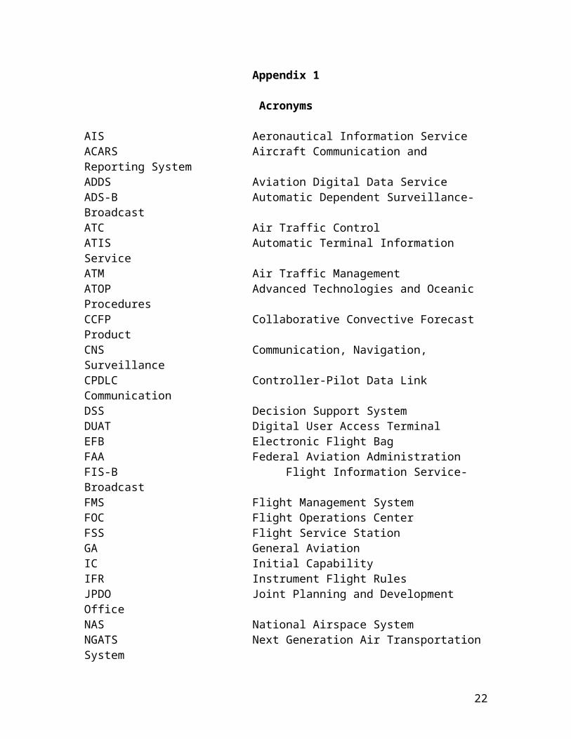
Appendix 1
Acronyms
AIS Aeronautical Information ServiceACARS Aircraft Communication and Reporting SystemADDS Aviation Digital Data ServiceADS-B Automatic Dependent Surveillance-BroadcastATC Air Traffic ControlATIS Automatic Terminal Information ServiceATM Air Traffic ManagementATOP Advanced Technologies and Oceanic ProceduresCCFP Collaborative Convective Forecast ProductCNS Communication, Navigation, Surveillance CPDLC Controller-Pilot Data Link CommunicationDSS Decision Support SystemDUAT Digital User Access TerminalEFB Electronic Flight BagFAA Federal Aviation AdministrationFIS-B Flight Information Service-BroadcastFMS Flight Management SystemFOC Flight Operations CenterFSS Flight Service StationGA General AviationIC Initial CapabilityIFR Instrument Flight RulesJPDO Joint Planning and Development OfficeNAS National Airspace SystemNGATS Next Generation Air Transportation SystemNWIS Net-enabled Weather Information SystemNWS National Weather ServiceRVR Runway Visual RangeRHSM Reduced Horizontal Separation MinimumRTCA Requirements and Technical Concepts for AviationRVSM Reduced Vertical Separation MinimumSFO San Francisco International AirportSSA Shared Situational AwarenessSWIM System Wide Information ManagementVFR Visual Flight RulesWIC Weather in the CockpitWIV Weather Impact Variable
16

Appendix 2
Pilot End-user Needs
The tables below were compiled from the results from a WIC workshop held in Aug 06, and represent a living set of weather needs and desires. There were three breakout sessions—Part 121, High-end GA, and Low-end GA. It is important not to take these needs literally in a future WIC capability, but rather the expressed needs translate into functional applications needed on the flight deck. Also, note that these needs may not be all inclusive, although actual end-users were well represented in the breakout sessions. The user categories in the charts below are identical to those used in the breakout sessions.
The intended goals the users are attempting to satisfy from these needs are: Attain/maintain awareness of the environment, Complete the flight safely, Receive all alerts requiring reactive response, Effective training on information interpretation.
The tables below are raw inputs from the breakout groups. The needs, however, correlate with the above 4 functional applications. Common weather impacts desired for DSS and display in the cockpit are:
Convection, turbulence, inflight icing, restrictions to visibility, and volcanic ash are the hazards that need to be addressed.
High temporal and spatial resolution and 4-D graphics, or 4-D guidance to DSS, are needed. Reactive response hazard alerts are needed.
Enhanced remote and in situ sensing, and timely downlink to ground data bases, is needed.
17

Low-end General Aviation
Decisions-problem ID
Weather info needed
Update rate Spatial coverage
Obstacles & unmet needs
Unrestricted operational
Encounter unexpected CONVECTION
Convective Graphics: Current condition, plus ---nowcast/forecast. - NEXRAD- Lightning- Hailshafts
Convection: 5 min
- HEMS: across 2X mission domain - Need wx in agl frame of reference - Domain size is dynamic according to mission profile and aircraft speed/duration- Longer-range (reroute) support can accept lower spatial res.
- Bandwidth-limited resolution and domain size. - Training requirements-interpretation of Wx data, trending, etc. Training is equipment-specific.
Need data transmission to sfc or low-level flt.
Encounter unexpected IMC (deviation)
Ceiling & Vis Graphics- Metars &
TAFs- Metar
‘AreaCast’- Precip and
precip type
- Fog and cloud coverage.
C&V: 5 min - Limitations of observing systems and system algorithms restrict utility of obs.- No products to support pilot slant range visibility problems. - Discussed incomplete leveraging of existing obs systems. NEED UNAVAILABLE METAR OBS, eg. AWOS and up to 1 min ASOS/AWOS. - No Wx-cams in poorly observed sites. Uplink of sfc image data under variable resolution seems doable. - Lack of TAMDAR-like a/c obs. - Need fog product.
Need data transmission to sfc or low-level flt. Need use of wx products as primary rather than supplementary.
31 Oct 07 desired vendor release date for operational C&V analysis product.
Encounter unexpected IMC or CONVECTION (re-route)
Convective Graphics:- NEXRAD- Lightning- HailshaftsCeiling & Vis Graphics- Metars & TAFs- Metar- ‘AreaCast’
Encounter unexpected PRECIP
Precip and precip type NEXRAD- Precip type info
HEMS: across 2X mission domain
Inflight Icing Needed, TBD
18

High-end General Aviation, USAF (unscheduled)
Decisions-problem ID
Weather info needed
Update Rate (Info Age)
Spatial Obstacles (FAA) Unrestricted operational
Pre-departure briefing
Take-off planning
(Airport Wx)TempWind spd/dir/gustCeiling/VisT/O AlternatesAlt SettingConv. Wx IcingTurbulenceDensity AltPrecip Type
Situation-dependent Situation-dependent Culture Workload Training Op procedure Tech MaturityData coverage Comm. coverage ResourcesBandwidthMarketing Bus. case/ op. benefits
Departure/arrival
Climb: -climb profile -vertical/ lateral deviations - contingency plan - FL selection
Adverse wx avoidance on arrival
- Non-convective turbulence metric scaled to a/c
***- Icing severity level & SLD
***- Convective weather
- 1hour(20 min)
***- 5 min
***- 5 min
Few km 2,000 ft
***Few km1,000 ft
***km1,000 ft
Culture Workload Training
- Op procedure
- Tech Maturity
Data coverage Comm. coverage ResourcesBandwidthMarketing Bus. case/ op. benefits
2007
***Dec 2006
***Approved
Enroute
Strategic (20min<T<2 hr) adverse weather avoidance
- Convective weather
- Icing
- Volc ash/smoke
- Turbulence
- 5 min “nowcast”- Convect f/c
- 15 min n/c - hourly f/c
- 5 min n/c - hourly f/c - 15 min n/c - hourly f/c
- 1km- 1,000 ft
- Few km- 2,000 ft
- 5km- few kft
- Few km - 2,000 ft
Culture Workload Training Op procedure Tech MaturityData coverage Comm. coverage ResourcesBandwidthMarketing Bus. case/ op. benefits
- NCWF approved to supplemental- CIWS, ITWS, CCFP
Near-term (1min<T<20min) adverse weather avoidance
- Convective weather
- Icing
- Volc ash/smoke
- Turbulence
- 5 min “nowcast”
- 5 min “nowcast”
- 5 min “nowcast”
- 5 min “nowcast”
- 1km- 1,000 ft
- 1km- 1,000 ft
- 5 km- few kft
- 1km- 1,000 ft
19

Decisions-problem ID
Weather info needed
Update Rate (Info Age)
Spatial Obstacles (FAA) Unrestricted operational
Enroute
Long-range (>2 hours) adverse weather awareness
- Conv wx obs- Conv wx f/c - Turb f/c- Icing f/c - Volcanic ash/smoke f/c
Forecast applicable +/-few hours from time along trajectory
2D
Endurance / Fuel mngt /Route optimise
- Temperature- Wind
- Hourly- Delta>10kts
- 1-2,000 ft- 20km
Arrival planning/Diversion(20 min. vs. 3hrs)
(Terminal Wx)- Ceiling/Vis- Convect wx- Adv / x-wind- Winter wx- Density alt- Icing
- hourly or c&v < min. criteria- 5 min. for icing- severity > aircraft capability
- 1,000 ft?- few miles- other- 1km radar- 1,000 ft and 5 nm for icing
Awareness of conditions beyond aircraft capability
- Terminal Wx- Enroute Wx
few min as conditions develop- Forecast applicable +/- minutes of relevant times along 4D trajectory
Escape from adverse weather
- IcingTurbulence
- Convective Wx
- 5 min 1,000 ft- 5km
InFlight re-planning /ETOPs/ Emergency management
- Terminal wx- Enroute wx
Space wx impact assessment (comm/nav)More TBD
- EMI- Solar flares- Scintillation
Target planning (mil)More TBD
- Winds- Ceiling/vis
20

Part 121 Operators
Decisions-problem ID
Weather info needed
Update rate Spatial Obstacles Other Comments
Wx re-routes (>100 miles, 4000’ altitude change, ETA>15 minutes)
Current FL Convective WX with 60 min now-cast, winds, turbulence, volcanic ash, cloud tops, (Same info as dispatcher)
Most recent information at decision pt, ie 5 min NEXRAD
“Regional picture”, terrain data, TFR’s, other restricted airspace
Training, band width, ops approval, cockpit workload, consistent user interface (conventions, nomenclature, & displays), common triad data base
Location, Altitude, Movement, Intensity, Size, Predicted location
Route deviations Current FL Convective WX with 60 min now-cast, winds, turbulence, cloud tops, or other data necessary
Most recent info at decision pt, ie 5 mins NEXRAD
Variable, as required Training, band width, ops approval, cockpit workload, consistent user interface (conventions, nomenclature, & displays)
Example: turbulence avoidance and/or mitigation. Data is a subset of requirements for re-route
All decisions and/or problems
Ground products versus In-flight products for decision displays. Bandwidth constraints, request/reply vs. broadcast
Need confidence rating or quality rating of information. Certification needs to balance incremental safety improvements with hazard levels
Turbulence mitigation Location, Altitude, Movement, Intensity, Size, Predicted location
1 minute warning – minimum; (5 minute forecast update rate)
Flight plan Route – 100 miles either side of track, and altitudes 4000 ft above and below
How to fuse observed versus forecast data
21
Appendix 3
References
NGATS Concept of OperationsShared Situational Awareness Integrated Product Team Concept of OperationsWeather Integrated Product Team Concept of OperationsPlus others…
22