


Languages
Pages
Legal

1/9/2014
1
EXPLORATION
Louisiana and the West
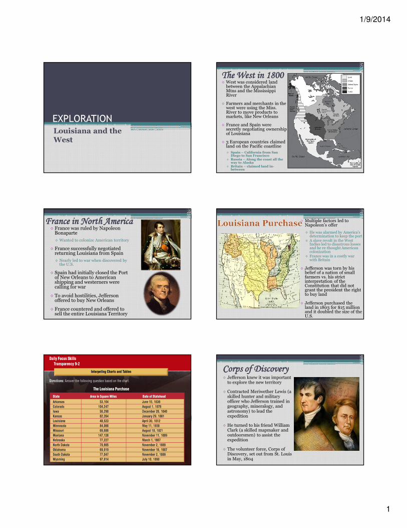
The West in 1800The West in 1800The West in 1800The West in 1800◊ West was considered land between the Appalachian Mtns and the Mississippi River
◊ Farmers and merchants in the west were using the Miss. River to move products to markets, like New Orleans
◊ France and Spain were secretly negotiating ownership of Louisiana
◊ 3 European countries claimed land on the Pacific coastline
◊ Spain – California from San Diego to San Francisco
◊ Russia – Along the coast all the way to Alaska
◊ Britain – claimed land in-between
◊ France was ruled by Napoleon Bonaparte
◊ Wanted to colonize American territory
◊ France successfully negotiated returning Louisiana from Spain
◊ Nearly led to war when discovered by the U.S.
◊ Spain had initially closed the Port of New Orleans to American shipping and westerners were calling for war
◊ To avoid hostilities, Jefferson offered to buy New Orleans
◊ France countered and offered to sell the entire Louisiana Territory
France in North AmericaFrance in North AmericaFrance in North AmericaFrance in North America ◊ Multiple factors led to Napoleon’s offer
◊ He was alarmed by America’s determination to keep the port
◊ A slave revolt in the West Indies led to disastrous losses and he re-thought American colonization
◊ France was in a costly war with Britain
◊ Jefferson was torn by his belief of a nation of small farmers vs. his strict interpretation of the Constitution that did not grant the president the right to buy land
◊ Jefferson purchased the land in 1803 for $15 million and it doubled the size of the U.S.
Corps of DiscoveryCorps of DiscoveryCorps of DiscoveryCorps of Discovery◊ Jefferson knew it was important to explore the new territory
◊ Contracted Meriwether Lewis (a skilled hunter and military officer who Jefferson trained in geography, mineralogy, and astronomy) to lead the expedition
◊ He turned to his friend William Clark (a skilled mapmaker and outdoorsmen) to assist the expedition
◊ The volunteer force, Corps of Discovery, set out from St. Louis in May, 1804

1/9/2014
2
Lewis & Clark Lewis & Clark Lewis & Clark Lewis & Clark
ExpeditionExpeditionExpeditionExpedition◊ They were ordered to establish good relations with the Natives, describe the landscape, plants, and animals
◊ The explorers used the Missouri River as their main route
◊ At the first winter they stopped and built a small fort
◊ While there they met many British & French-Canadian trappers
◊ Sacagawea, with her French husband and their new child guided them, using her language and knowledge of geography
◊ In Nov. 1805, they reached the Pacific and stayed the winter there to review, track, and map their findings
◊ Their journey brought back a wealth of scientific and geographic information
Pike’s ExpeditionPike’s ExpeditionPike’s ExpeditionPike’s Expedition◊ Lewis and Clark explored the northern Louisiana Territory while Zebulon Pike left from St. Louis and explored the south
◊ Spotted the Rocky Mtns from the Red River (the peak he saw would later bear his name)
◊ Spain felt threatened by his expedition and arrested his group at the Rio Grande River
◊ He and his men brought back valuable descriptions of the Great Plains and Rio Grande Valley
Effects of ExplorationEffects of ExplorationEffects of ExplorationEffects of Exploration◊ Explorers of the West brought back tales of adventure as well as new scientific and geographic information
◊ Lewis & Clark produced the first good and accurate maps of the Louisiana Territory
◊ Exploration boosted interest in the fur trade
◊ Pike inaccurately described the treeless Great Plains as a desert, which led Americans to believe it was useless to farming
Top Related