


Languages
Pages
Legal

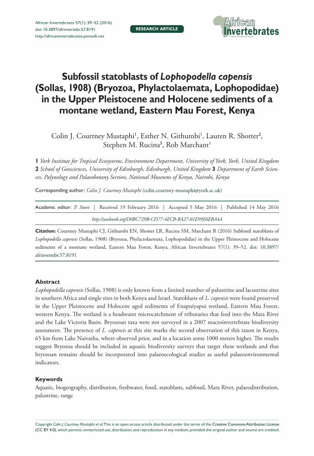
Subfossil statoblasts of Lophopodella capensis (Sollas, 1908)... 39
Subfossil statoblasts of Lophopodella capensis (Sollas, 1908) (Bryozoa, Phylactolaemata, Lophopodidae)
in the Upper Pleistocene and Holocene sediments of a montane wetland, Eastern Mau Forest, Kenya
Colin J. Courtney Mustaphi1, Esther N. Githumbi1, Lauren R. Shotter2, Stephen M. Rucina3, Rob Marchant1
1 York Institute for Tropical Ecosystems, Environment Department, University of York, York, United Kingdom 2 School of Geosciences, University of Edinburgh, Edinburgh, United Kingdom 3 Department of Earth Scien-ces, Palynology and Palaeobotany Section, National Museums of Kenya, Nairobi, Kenya
Corresponding author: Colin J. Courtney Mustaphi ([email protected])
Academic editor: P. Stoev | Received 19 February 2016 | Accepted 5 May 2016 | Published 14 May 2016
http://zoobank.org/D0BC729B-CD77-4ECB-BA27-01E99E6EBA4A
Citation: Courtney Mustaphi CJ, Githumbi EN, Shotter LR, Rucina SM, Marchant R (2016) Subfossil statoblasts of Lophopodella capensis (Sollas, 1908) (Bryozoa, Phylactolaemata, Lophopodidae) in the Upper Pleistocene and Holocene sediments of a montane wetland, Eastern Mau Forest, Kenya. African Invertebrates 57(1): 39–52. doi: 10.3897/afrinvertebr.57.8191
AbstractLophopodella capensis (Sollas, 1908) is only known from a limited number of palustrine and lacustrine sites in southern Africa and single sites in both Kenya and Israel. Statoblasts of L. capensis were found preserved in the Upper Pleistocene and Holocene aged sediments of Enapuiyapui wetland, Eastern Mau Forest, western Kenya. The wetland is a headwater microcatchment of tributaries that feed into the Mara River and the Lake Victoria Basin. Bryozoan taxa were not surveyed in a 2007 macroinvertebrate biodiversity assessment. The presence of L. capensis at this site marks the second observation of this taxon in Kenya, 65 km from Lake Naivasha, where observed prior, and in a location some 1000 meters higher. The results suggest Bryozoa should be included in aquatic biodiversity surveys that target these wetlands and that bryozoan remains should be incorporated into palaeoecological studies as useful palaeoenvironmental indicators.
KeywordsAquatic, biogeography, distribution, freshwater, fossil, statoblasts, subfossil, Mara River, palaeodistribution, palustrine, range
African Invertebrates 57(1): 39–52 (2016)
doi: 10.3897/afrinvertebr.57.8191
http://africaninvertebrates.pensoft.net
Copyright Colin J. Courtney Mustaphi et al. This is an open access article distributed under the terms of the Creative Commons Attribution License (CC BY 4.0), which permits unrestricted use, distribution, and reproduction in any medium, provided the original author and source are credited.
RESEARCH ARTICLE

Colin J. Courtney Mustaphi et al. / African Invertebrates 57(1): 39–52 (2016)40
Introduction
Lophopodella capensis (Sollas, 1908) (Bryozoa: Phylactolaemata: Lophopodidae) is a small Bryozoan that is epiphytic on stems and leaves and epilithic and occurs in fresh-water to brackish waters, up to 9.4 pH in a temperature range of 18–25 °C (Lacourt 1968). It has been observed at water depths from littoral to 18 m depth (Lacourt 1967). L. capensis specimens were originally described from Vlei, Cape town, South Africa, in 1908 (collected in October 1907), and has since then been documented at other locations including Namibia in 1911 (Kraepelin 1914), multiple sites in the Transvaal since 1928 (Hastings 1929), Lake Naivasha, Kenya (Jenkin 1936), and more recently in the Golan Heights, Israel in 1967 (Massard and Geimer 1991). Additional reports of specimens from sites in Japan and UK, but, these have not been confirmed with certainty. The chitinous asexual buds (statoblasts) of Phylactolaemata preserve well within the geologic record of the Upper Quaternary and have potential for interpreting palaeoenvironmental conditions and examining the natural history of identifiable taxa (Francis 2001). Here we present a second occurrence of L. capensis in Kenya from subfossil statoblasts observed in the Upper Pleistocene and Holocene aged sediments of a small, montane wetland located in the Eastern Mau Forest.
Study region
Kiptunga Forest Block is located in the Eastern Mau Forest Block, Mau Narok County, Kenya, and is managed by a local Kenya Forest Service (KFS) station (Figure 1). The Eastern Mau Forest is the smallest of the Mau Forest blocks and has been identified as the most susceptible to negative impacts caused by anthropogenic land use, land cover, and global climatic changes, yet, has high potential for ecological restoration and re-covery (Kinyanjui 2011). The region is situated upon the Mau Escarpment that forms part of the western face of the Great Rift Valley. The geology consists of undifferentiated Tertiary volcanic rocks overlain by Tertiary eutaxitic welded tuffs, which are evident in streambeds and occasional outcrops. The surficial geology consists of an extensive, thick mantle of Upper Pleistocene Mau ashes with basal tuffs (Jennings 1971, Wil-liams 1991), possibly sourced from Londiani and/or Kilombe. Soils consist of relatively young and productive Udands (Andisols) due to the humid orographic climate modify-ing the abundant volcanic tephra. The mantling and subsequent aeolian and hydrologi-cal reworking of the tephra deposit may have formed much of the topographic relief of the ridge including the shallow basin where the wetland subsequently developed.
The indigenous forest is diverse with abundant Afromontane taxa including Croton, Dombeya, Ficus, Juniperus, Olea spp., Podocarpus, Polyscias, Prunus and Schefflera, of which, remnant scattered minor pockets remain. Most of the indigenous forest has been cut and converted to agroforests by the 1930s (Troup 1932) and the forest vegetation is currently partitioned into plantations with cyclic harvesting (Okeyo-Owuor 2007, San-ya 2008). Plantation taxa include indigenous Juniperus procera and, increasingly, exotic

Subfossil statoblasts of Lophopodella capensis (Sollas, 1908)... 41
Figure 1. Location of the study site in Africa (A) and within Kenya (B). The location of the coring site (black circle) within Enapuiyapui (C). The red line represents a fire break cutline.
taxa are planted, which include Pinus patula, Cupressus lusitanica, Corymbia maculata (syn. Eucalyptus maculate; Sanya 2008, Courtney Mustaphi et al. 2014). Stresses on the plantation forests include pests, such as insects, rodents, monkeys that may damage the apical buds of Pinus and Cupressus, and fires during dry periods. Kiptunga Forest hosts wildlife populations of birds, antelopes, gazelles, hyrax, small reptiles, small primates and hyenas (Okeyo-Owuor 2007). A survey of macroinvertebrate taxa conducted in April 2007 found 606 families but did not observe any Phylactolaemata (Okeyo-Owuor 2007). The region is inhabited by the Ogiek community who are traditionally practiced hunter-gatherer livelihoods but current local populations are increasingly practicing pastoralism, dominantly cattle, goats and sheep, and much of the lower elevations have been converted to sedentary agriculture (Spruyt 2011).
Materials and methods
Sampling site
The site is 65 km and just over 1000 m above Lake Naivasha, the nearest documented observation of L. capensis. Enapuiyapui (0°26'11.28"S, 35°47'58.74"E; 2920 m asl,

Colin J. Courtney Mustaphi et al. / African Invertebrates 57(1): 39–52 (2016)42
Figures 1–2) is a high elevation wetland that is an important headwater of Nyabui-yabui, a stream that is an upper tributary of the Mara River, which flows through a landscape characterised byagroforestry patches, productive agricultural areas and the Maasai Mara National Reserve and Serengeti National Park before flowing into Lake Victoria. Enapuiyapui is hydrologically important, being one of the ‘water towers’ of orographic precipitation in Eastern Africa, which is undergoing rapid changes in water levels due to land use and land cover change and the interaction with regional climate change (Okeyo-Owuor 2007). The swamp is located along the broad ridge of the Kiptunga Forest Block and is highly sensitive to hydroclimatic changes and anthro-pogenic modifications; expanding and contracting in response to local hydroclimatic conditions. During periods of heavy rainfall there are minor ephemeral inflows and under wetland high stands a single outflow to the southwest; forming a tributary of the Amala and Mara Rivers. The wetland supports a floating vegetation mat during wetter periods. The greater wetland covers an area of 122 ha although the current ‘wet swamp’ area is about 6 ha. Logging access roads have been constructed to the north, west and south sides of the wetland and includes a bridge over the outlet. The swamp is shallow with most water depths well below 50 cm during March-April 2014 and was lower still (<20 cm) during April 2015. The water level has been decreasing and some locals anecdotally mentioned that there was open water within the swamp and a channel to the road bridge prior to 1972. Interview studies suggest that water levels are certainly lower than 30 years prior with minor degradation of water quality (Okeyo-Owuor 2007). There is some evidence of recent human modifications of the wetland including the bridge construction over an outlet channel, a cut line running along the west margin to keep grass fires from threatening the forests, an abandoned, pumping station built by the colonial government immediately to the east of the bridge that used to supply water to the Kiptunga Forest Station. Cattle graze along the dry margin and further impact the hummocky ground and morphology of the Poaceae and Juncaceae-dominated tussocks.
The swamp is continuously covered by Cyperaceae-Poaceae dominated vegetation with patches of Juncaceae (Figures 2–3). Some tussocks of Cyperaceae, Poaceae and/or Juncaceae provide microhabitat for small forbs and ferns. It is surrounded by Cy-peraceae-Poaceae within the dry edges within the basin and there are small patches of indigenous forest and monoculture tree plots above the basin. Surrounding plantation stands are of variable ages with planting dates from 1935–2006 with the majority of stands dating from the 1960s (Sanya 2008, Courtney Mustaphi et al. 2014). Planta-tions of Cupressus lusitanica dominate the area surrounding the wetland.
Sample collection
On the 10–12 April, 2014, surface sediment samples were collected from 19 locations within the wet area of the swamp and the immediate surrounding region that has been ephemerally wet over the past century. To locate the thickest sediment accumulation

Subfossil statoblasts of Lophopodella capensis (Sollas, 1908)... 43
Figures 2–3. An wide angle aerial oblique photograph of Enapuiyapui wetland from the northwest facing southeast (2). Coring the center of the Cyperaceae-Poaceae wetland, April 2014 (3).
area of the swamp to target for coring the complete stratigraphy, the wetland was first probed using fiberglass rods with multiple 1-m-long rod extensions. A 537 cm stra-tigraphy was collected near the swamp center using a hand pushed Russian D-shaped corer in 50 cm drives with approximately 10 cm overlapped sections (Figure 3). Cores

Colin J. Courtney Mustaphi et al. / African Invertebrates 57(1): 39–52 (2016)44
were wrapped in plastic wrap and aluminum foil, shipped to the University of York, UK, and refrigerated at 4 °C. At the Department of Geography and Earth Sciences, Aberystwyth University, UK. The core sections from 484 cm deep to the top where optically imaged with a RGB camera and volume magnetic susceptibility was simulta-neously measured with a Bartington MS2E sensor at continuous 1 cm intervals and air corrected between measurements.
Subsamples of 1 cm3 were extracted at 1-cm intervals from 537 cm to the top and extracted from the wet core. Subsamples were put in a labelled beaker and soaked with a sodium hexametaphosphate solution (Na6P6O18) and drop of hydrogen perox-ide (H2O2) to disaggregate the samples and aid in the separation of the organic mate-rial and the clay particles (Bamber 1982). Samples were wet sieved through a 125 μm mesh and the retained organic and sediment material was visually inspected under a Zeiss Axio Zoom V16 microscope at 10–40× magnifications. Observations of macro-scopic remains of taxa represent presence data only.
The chronology of the stratigraphy was developed through radiocarbon dating, development of an age-depth model to assign ages to the sediment core depths, and stratigraphic zonation of the magnetic susceptibility data showed periods of significant change in the sediments. Nine samples of organic sediments and organic detritus were accelerator mass spectrometry (AMS) radiocarbon dated and an age-depth model was produced and parameterization is described in the caption of Figure 4. Stratigraphic zones were delineated in the magnetic susceptibility data using a regime shift index sequential algorithm (RSI, Rodionov 2004). Magnetic susceptibility values reflect changes in the erosion patterns and deposition of the sediments of the catchment into the basin (Dearing 1999). The difference between weighted means of the magnetic sus-ceptibility temporal regimes, with a minimum cut-off length of 50 cm, were tested for significance with a Student’s two-tailed t-test with unequal variance (Huber’s weight function parameter = 5) at P < 0.01.
Data resources
The data reported in this paper have been deposited to the Harvard Dataverse repository (Courtney Mustaphi et al. 2016) at http://dx.doi.org/10.7910/DVN/ONKLLL.
Results
Sediment stratigraphy
The basal date for the sediment stratigraphy was 16600 yr BP and represented the on-set of organic sediment accumulation that has continued to present (Figure 4). Three radiocarbon dates were excluded from the age-depth model because they may have con-tained organic matter that was not representative of the stratigraphy (Figure 4, Table 1).

Subfossil statoblasts of Lophopodella capensis (Sollas, 1908)... 45
Fig
ure
4. B
ACO
N v
ersio
n 2.
2 R
pro
gram
lang
uage
scr
ipt a
ge-d
epth
mod
el fo
r th
e En
apui
yapu
i str
atig
raph
y us
ing
MC
MC
ran
dom
wal
ks (
grey
scal
e sh
adin
g)
thro
ugh
the
prob
able
radi
ocar
bon
date
s (1σ
age
pro
babi
lity
distr
ibut
ions
repr
esen
ted
in b
lue)
that
wer
e ca
libra
ted
usin
g th
e In
tCal
13 c
urve
(Tab
le 1
; Bla
auw
and
C
hrist
enso
n 20
11; R
eim
er e
t al.
2013
; R D
evel
opm
ent C
ore
Tea
m 2
015)
. The
final
mod
el u
sed
the
wei
ghte
d av
erag
e of
the
rand
om w
alk
dens
ities
(red
line
) and
95
% C
I (do
tted
grey
line
s) an
d pa
ram
eter
setti
ngs a
re sh
own
at th
e top
righ
t (re
d fo
nt).
Ages
repo
rted
as ca
libra
ted
year
BP
(bef
ore p
rese
nt, 1
950
CE)
. IT
RAX
opt
i-ca
l cor
e fac
e pho
togr
aphs
and
mag
netic
susc
eptib
ility
pro
file (
grey
line
) at b
otto
m le
ft th
at sh
ows t
he 4
84–0
cm se
ctio
n of
the 5
37 cm
core
. Zon
es w
ere d
efine
d us
ing
a re
gim
e sh
ift in
dex
of th
e m
agne
tic su
scep
tibili
ty v
alue
s (R
odio
nov
2004
). Lo
phop
odell
a ca
pens
is pr
esen
ce d
ata
are
repr
esen
ted
by re
d ‘+
’ sym
bols
on th
e m
agne
tic
susc
eptib
ility
pro
file.
Abb
revi
atio
ns a
re A
HP:
Afri
can
Hum
id P
erio
d, H
: Hol
ocen
e, P
s: Pl
eisto
cene
.

Colin J. Courtney Mustaphi et al. / African Invertebrates 57(1): 39–52 (2016)46
Alternative models were considered but did not impact the probable age ranges of the presence of the L. capensis subfossil remains. The sediments were uniform, massive de-posits composed of highly organic sediments with silt and few sand-sized clastic material derived from the tuff deposits surrounding the basin. The magnetic susceptibility values ranged from –4 to 70 ×10-5 SI and averaged 2.8. The variability in the magnetic profile was divided into three zones (Fig. 4): 1) 537–254 cm (16600–11700 yr BP), 2) 253–85 cm (11700–3000 yr BP), 3) 84–0 cm (3000 yr BP to present). These zones broadly reflect regional hydroclimatic changes related to solar variation driven influences on the African Monsoon pattern (Shanahan et al. 2015).
Lophopodella capensis remains
The examination of 19 surface sediment samples collected in April 2014 did not yield any Phylactolaemata remains from any location within the wetland (Table 2). The chitinous remains of fully developed statoblasts of Lophopodella capensis were observed in 13 of the 537 samples (2.4%) of the sediment stratigraphy levels from the center of the wetland (Figure 4, Table 3). When individual intact statoblasts were present, the concentrations ranged between 1 and 6 statoblasts per cm3 of wet sediment. These were found in three clusters in the stratigraphy: between 482–465 cm, representing 15700–15400 yr BP and again during the Upper Pleistocene at 345–331 cm 13300–13000 yr BP. The most recent presence was between 42–16 cm, during the recent upper Holocene sediments aged 710–120 yr BP. All of the elliptical statoblasts encountered had polar spines that were split between the two layers, a common circumstance in contemporary-aged specimens and described by Sollas (1908) and Lacourt (1968).
Table 1. Age determinations for the 537 cm Enapuiyapui Swamp stratigraphy. *1σ error. pMC, percent modern carbon, defined as 1950 common era by 14C activity standard. ** Dates that were excluded from the age-depth modelling.
Depth (cm) Age (14C years)* pMC* δ13CVPDB (±0.1 ‰) Material Laboratory ID
0 –64 Top of core
30–31 201 ± 23 97.53 ± 0.28 –27.3 Picked organics D-AMS-009664
50–51 2449 ± 35 73.72 ± 0.32 –23.5 Bulk sieved <63μm SUERC-57340**
74–76 1865 ± 37 17.58 ± 0.13 >63μm charcoal UBA-27553
100–101 10721 ± 47 26.33 ± 0.15 Bulk sediment UBA-26117**
128–129 7616 ± 33 38.75 ± 0.16 –24.5 Picked organics D-AMS-009663
230–231 9837 ± 42 29.39 ± 0.15 Bulk sediment UBA-26118
315–316 13963 ± 60 17.58 ± 0.13 Bulk sediment UBA-27554**
537 13692 ± 83 18.19 ± 0.19 Bulk sediment UBA-26116 (Base)

Subfossil statoblasts of Lophopodella capensis (Sollas, 1908)... 47
Table 2. Surface sediment sampling locations and volume of wet sediment analysed for L. capensis remains.
ID Latitude Longitude Volume (cm3)NB 1 -0°26.226' 35°47.870' 1NB 2 -0°26.196' 35°47.892' 1NB 3 -0°26.242' 35°47.891' 1NB 4 -0°26.232' 35°47.954' 1NB 5 -0°26.235' 35°47.995' 1NB 6 -0°26.231' 35°48.025' 1NB 7 -0°26.224' 35°48.044' 1NB 8 -0°26.221' 35°47.888' 1NB 9 -0°26.190' 35°47.959' 1NB 10 -0°26.197' 35°47.940' 1NB 11 -0°26.218' 35°47.922' 1NB 12 -0°26.199' 35°47.903' 1NB 13 -0°26.178' 35°47.889' 1NB 14 -0°26.175' 35°47.906' 1NB 15 -0°26.176' 35°47.923' 1NB 16 -0°26.177' 35°47.935' 1NB 17 -0°26.163' 35°47.947' 1NB 18 -0°26.133' 35°47.919' 1NB 19 -0°26.121' 35°47.908' 1
Table 3. Depth intervals and modeled ages of presence of L. capensis remains presented as concentrations of statoblasts per volume of wet sediment.
Depth interval (cm) Age interval (yr BP) L. capensis statoblasts per cm3
16–17 117.6–129.7 220–21 166.1–177.1 121–22 177.1–188.5 122–23 188.5–199.8 123–24 199.8–210.9 325–26 221.9–233.8 126–27 233.8–245.7 241–42 670–711.6 1
331–332 13058.4–13075.3 1344–345 13285–13302.3 1465–466 15392.7–15410.4 1480–481 15655.3–15671.8 6481–482 15671.8–15688.3 4

Colin J. Courtney Mustaphi et al. / African Invertebrates 57(1): 39–52 (2016)48
Discussion and conclusions
Neither Lophopodella capensis nor other Phylactolaemata taxa were encountered in a macroinvertebrate survey conducted across the swamp in April 2007 (Okeyo-Owuor 2007). Although, the survey does not explicitly state whether bryozoans were target taxa for surveying, nor are there details if they were observed or known to be absent. No macroscopic (>125 μm) bryozoan remains were observed in subsamples from the 19 surface sediment samples collected across the wetland. L. capensis were present in three clusters in the stratigraphy and suggest that L. capensis was present in the wet-land since at least 15600 yr BP and was certainly present until recently, around 120 yr BP (Figure 4). Preservation was variable and suggests that degradation of chitinous material has varied throughout the ontogeny of the wetland (Figures 5–8). Presence data represent local presence of the taxa; yet, absence cannot be conclusively inter-preted as absence of the taxa in the palaeoenvironment nor present. The historical presence of L. capensis at Enapuiyapui, a montane headwater wetland, suggests range and biogeography may be influenced by animal dispersal. Although not observed related to L. capensis, birds have been shown to be associated with the distributions of some freshwater bryozoans (Freeland et al. 2000; Figuerola et al. 2005). Possible pathways include feather and skin attachment and ingestion and subsequent excre-tion after traveling (Brochet et al. 2010). Since waterborne dispersal is possible by lophopodid taxa (Wood 2009), the ecological range may include parts of the Lake Victoria Basin and ultimately the Nile, at least during certain intervals of the Late Pleistocene and Holocene. Similar to other lophopodid, L. capensis may be adapted to seasonal drought or possibly extended, multi-year dry periods (Wood 2009). Un-like most other phylac species, the free statoblast of a related taxa, L. carteri, is ini-tially non-buoyant and sinks through the water column, is deposited at the bottom of the basin, to be covered by sediments. During drought conditions, the water dries up and the statoblasts are protected from direct sunlight. As the statoblast dries the water in the large annulus is replaced by air, making the entire structure very buoy-ant once water returns. Once refloated to the water surface it can germinate within a few days. If a lake does not dry up the statoblast will still eventually germinate if the water-sediment interface temperature is sufficiently warm (Wood and Marsh 1996). This strategy could also be present in L. capensis but has yet to be confirmed. Observational or experimental work could further refine the ecological knowledge of this taxa and be beneficial for palaeoenviornmental intepretations of hydrological conditions. Like most phylactolaemates, living L. capensis colonies tolerate a water temperature range of 18–25 °C (Lacourt 1968), yet, dormant statoblasts can survive much wider extremes, which likely occur at this high elevation site.The relatively cool water at this high elevation, equatorial location suggests persistence at water tem-peratures below 18 °C. The inventory of tropical and African phylactolaemata fauna requires further investigation to understand distributions and the natural history of these taxa (Wood 2002).

Subfossil statoblasts of Lophopodella capensis (Sollas, 1908)... 49
Figures 5–8. Lophopodella capensis statoblasts and organic detritus, including charcoal at right, from the sieved sediment subsample from25–26 cm stratigraphic depth, dated to 220–230 yr BP (5). A well pre-served statoblast observed at 41–42 cm, dated to 670–711 (6). Pleistocene-aged statoblast from 480–481 cm, dated to 15600–15700 (7). Same specimen as Fig 6 showing the split layers of the polar spine and recurved hooks (8).
Additional radiocarbon dates of the sediment stratigraphy could further constrain the presence data of this taxon. We suggest that presence data of bryozoan macrore-mains, including the resistant chitinous statoblasts and floatoblasts be examined in other sedimentological studies in East Africa (Francis 2001) as they remain an infre-quently used indicator of aquatic palaeoenvironments and the potential of this proxy is not being realised. In addition these results contribute to our knowledge of African Phylactolaemata natural history. The results of such palaeodistributions can be submit-ted and archived in palaeoecological databases such as Neotoma (Goring et al. 2015). The new finding also suggests that Phylactolaemata should be considered more cen-trally in biodiversity surveys of macroinvertebrates of Kenyan wetlands. New studies of African phylactolaemata are necessary to understand biodiversity loss, local indicators of water quality fluctuations, changes to ecosystem function and as part of developing and incorporating nature-based solutions into local-level land management plans.

Colin J. Courtney Mustaphi et al. / African Invertebrates 57(1): 39–52 (2016)50
Acknowledgements
We thank County Forest Coordinator Samuel Mukundi, forester Dennis K. Mbogo (retired), and KFS askari for permission and help accessing the wetland. We also thank three local men and volunteers from TimSales Ltd. for coring aid and Rebecca M. Muthoni for field work. We thank the British Institute in Eastern Africa (Nairobi) and the late Joseph Mutua for logistical support and acknowledge Denis Odera (NACOS-TI) and Margaret Omoto (NMK) for help with research and export permits. Roland Gehrels graciously permitted use of microscope equipment and Henry Lamb aided with ITRAX, RGB, and magnetic susceptibility scanning. Maria Gehrels prepared the digital microscopy photographs. We thank Timothy S. Wood for his encouragement and guidance on the identification and distributions of L. capensis and for comment-ing on manuscript drafts. We also thank Professor Beth Okamura for her constructive review of this manuscript, which improved the clarity of the paper and advanced the discussion section. This research was funded by Resilience in East African Landscapes (REAL), a European Commission Marie Curie Initial Training Network grant to RM (FP7-PEOPLE-2013-ITN project number 606879).
References
Bamber RN (1982) Sodium hexametaphosphate as an aid in benthic sample sorting. Marine Environmental Research 7(4): 251–255. doi: 10.1016/0141-1136(82)90017-4
Blaauw M, Christen JA (2011) Flexible paleoclimate age-depth models using an autoregressive gamma process. Bayesian Analysis 6: 457–474. doi: 10.1214/ba/1339616472
Brochet AL, Gauthier-Clerc M, Guillemain M, Fritz H, Waterkeyn A, Baltanás Á, Green AJ (2010) Field evidence of dispersal of branchiopods, ostracods and bryozoans by teal (Anas crecca) in the Camargue (southern France). Hydrobiologia 637: 255–261. doi: 10.1007/s10750-009-9975-6
Courtney Mustaphi CJ, Githumbi EN, Mutua J, Muthoni R, Rucina SM, Marchant R (2014) Ongoing sedimentological and palaeoecological investigations at Nyabuiyabui wetland, Kiptunga Forest Block, Eastern Mau Forest, Nakuru District, Kenya. A report to the Mau Forest Conservation Office, Kenya Forest Service, and the National Museums of Kenya Palaeobotany and Palynology Section, Kenya, 1–29.
Courtney Mustaphi CJ, Githumbi EN, Shotter LR, Rucina SM, Marchant R (2016) Radio-carbon dates, magnetic susceptibility and subfossil remains of Lophopodella capensis (Sollas, 1908) data from a sediment core collected from Enapuiyapui wetland, Eastern Mau Forest, Kenya. Harvard Dataverse, V1. doi: 10.7910/DVN/ONKLLL
Dearing JA (1999) Magnetic susceptibility. In: Walden J, Oldfield F, Smith J (Eds) Environ-mental Magnetism: a Practical Guide. Technical Guide No. 6. Quaternary Research As-sociation, London, 35–62.

Subfossil statoblasts of Lophopodella capensis (Sollas, 1908)... 51
Figuerola J, Green AJ, Michot TC (2005) Invertebrate eggs can fly: evidence of waterfowl‐me-diated gene flow in aquatic invertebrates. The American Naturalist 165: 274–280. doi: 10.1086/427092
Francis DR (2001) Bryozoan statoblasts. In: Smol JP, Birks HJB, Last WM (Eds) Tracking Environ-mental Change Using Lake Sediments. Developments in Paleoenvironmental Research Volume 4: Zoological Indicators. Kluwer, Dordrecht, 105–123. doi: 10.1007/0-306-47671-1_6
Freeland JR, Noble LR, Okamura B (2000) Genetic consequences of the metapopulation biol-ogy of a facultatively sexual freshwater invertebrate. Journal of Evolutionary Biology 13: 383–395. doi: 10.1046/j.1420-9101.2000.00192.x
Goring S, Dawson A, Simpson GL, Ram K, Graham RW, Grimm EC, Williams JW (2015) neotoma: A Programmatic Interface to the Neotoma Paleoecological Database. Open Quaternary 1(2): 1–17. doi: 10.5334/oq.ab
Hastings AB (1929) Phylactolaematous Polyzoa from the “Pans” of the Tranvaal. Annals and magazine of natural history 10(3): 129–137. doi: 10.1080/00222932908672945
Jenkin PM (1936) Summary of the ecological results, with special reference to the alkaline lakes. Reports on the Percy Sladen Expedition to some Rift Valley lakes in Kenya. VII. Annals and magazine of natural history 18(10): 133–181. doi: 10.1080/00222933608655181
Jennings DJ (1971) Geology of the Molo area. Report No. 86. Geological Survey of Kenya, Ministry of Natural Resources, Nairobi.
Kinjanjui JM, Karachi M, Ondimu KN (2013) Natural regeneration and ecological recovery in Mau Forest complex, Kenya. Open Journal of Ecology 3(6): 417–422. doi: 10.4236/oje.2013.36047
Kraepelin K (1914) Bryozoa. In: Michaelsen W (Ed.) Beträge zur Kenntnis der Land- und Süsswasserfauna Deutsch-Südwestafrikas. L. Friederichsen & Co, Hamburg, 55–69. doi: 10.5962/bhl.title.7352
Lacourt AW (1968) A monograph of the freshwater bryozoan – Phylactolaemata. Zoologische Verhandelingen 93: 1–155.
R Development Core Team (2015) R: A language and environment for statistical computing. The R Foundation for Statistical Computing, Vienna.
Rodionov SN (2004) A sequential algorithm for testing climate regime shifts. Geophysical Research Letters 31: L09204. doi: 10.1029/2004gl019448
Sanya SM (2008) Forest Plantation Map Eastern Mau Sheet No. 12. 1990, amended, Jan 2008. Photomap (k) Ltd, Nairobi.
Shanahan TM, Mckay NP, Hughen KA, Overpeck JT, Otto-Bliesner B, Heil CW, King J, Scholz CA, Peck J (2015) The time-transgressive termination of the African Humid Period. Nature Geoscience 8: 140–144. doi: 10.1038/ngeo2329
Sollas IBJ (1908) A new fresh-water Polyzoon from S. Africa. Annals and magazine of natural history 8(2): 264–273. doi: 10.1080/00222930808692483
Spruyt C (2011) Changing concepts of nature and conservation regarding Eastern Mau Forest. A case study of the Mariashoni Ogiek. Masters Thesis, Universiteit Gent.
Troup RS (1932) Exotic forest trees in the British Empire. Clarendon Press, Oxford, 259 pp.

Colin J. Courtney Mustaphi et al. / African Invertebrates 57(1): 39–52 (2016)52
Massard J, Geimer G (1991) Note on the freshwater Bryozoa of Israel (Ectoprocta, Phylactol-aemata) In: Bigey FP (Ed.) Memoires HS 1. Bulletin de la Société des Sciences Naturelles de l'Ouest de la France, 243–253.
Okeyo-Owuor JB (2007) Survey of Biodiversity Values of Enapuiyapui Swamp, Kiptunga Forest, Upper Mara River Basin, Nakuru/Molo District, Kenya. WWF-eastern Africa programme office (EARPO) Mara River basin management initiative final report.
Williams LAJ (1991) Geology of the Mau area. Report no. 96. Ministry Of Environment and Natural Resources Mines and Geological Department, Nairobi.
Wood TS (2002) Freshwater bryozoans: a zoogeographical reassessment. In: Jackson PN, But-tler CJ, Spencer Jones M (Eds) Bryozoan Studies 2001: Proceedings of the 12th Interna-tional Bryozoology Association. Rotterdam & Brookfield, Balkema, 339–345.
Wood TS (2009) Bryozoans. In: Thorp JH, Covich AP (Eds) Ecology and classification of North American freshwater invertebrates. Academic press, 505–525.
Wood TS, Marsh TG (1996) The sinking floatoblasts of Lophopodella carteri (Bryozoa: Phy-lactolaemata). In: Gordon DP, Smith AM, Grant-Mackie JA (Eds) Bryozoans in space and time: Proceedings of the 10th International Bryozoology Conference, Victoria University of Wellington, Wellington, New Zealand, 1995. NIWA, 383–389.
Top Related