


Languages
Pages
Legal


U.S. Department of the InteriorU.S. Geological Survey
Fact Sheet 2012–3112August 2012
Slope-Area Computation Program Graphical User Interface 1.0—A Preprocessing and Postprocessing Tool for Estimating Peak Flood Discharge Using the Slope-Area Method
IntroductionThe slope-area method is a technique for estimating the
-
an “indirect measurement” because it relies on evidence left
estimates of channel roughness, and a mathematical model -
tions. This is in contrast to a “direct” measurement of discharge
a current meter or acoustic equipment is used to measure the .
reasons, an indirect measurement of a peak discharge is useful
1994) is an implementation of the slope-area method that com-
Slope-Area Computation Program Graphical User Interface Description
-
-
options. This menu also includes options to save the plot as a
-
Data Entry and Reach Characterization

A),
-
B
must include columns of sequence number, easting, northing,
Figure 1. Screen shots of the New Indirect Wizard showing selected steps in the preparation of the Slope-Area Computation program input data [(A) Project Info screen, (B) Survey Data Input screen, (C) Plan View Plot screen, (D) High Water Marks Profile screen, and (E) Cross Section screen].
A B
C D
E
-
ongoing benchmark and reference mark numbers established at
-
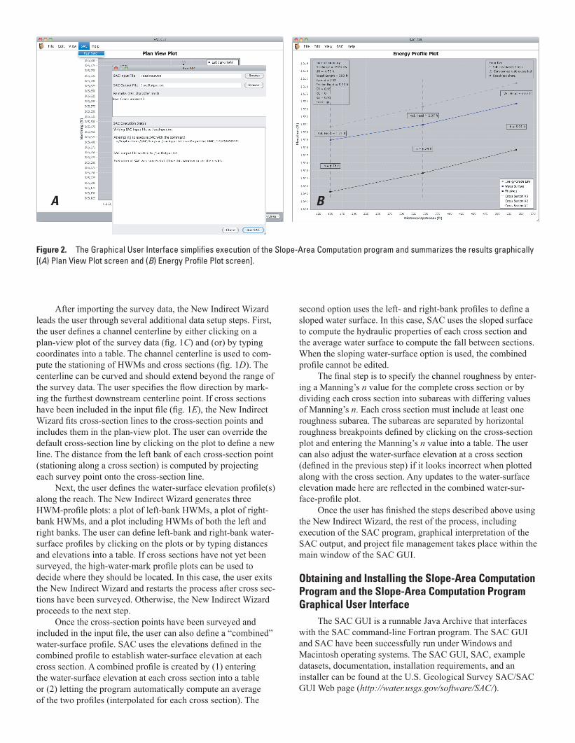
Figure 2. The Graphical User Interface simplifies execution of the Slope-Area Computation program and summarizes the results graphically [(A) Plan View Plot screen and (B) Energy Profile Plot screen].
A B
Ccoordinates into a table. The channel centerline is used to com-
D). The
-
E
line. The distance from the left bank of each cross-section point
-
-n
n
n value into a table. The user
-
Obtaining and Installing the Slope-Area Computation Program and the Slope-Area Computation Program Graphical User Interface
datasets, documentation, installation requirements, and an
http://water.usgs.gov/software/SAC/).

References Cited
Berenbrock, Charles, 1996, A procedure to generate slope-area
at http://pubs.usgs.gov/of/1996/0204/.)
--
http://pubs.usgs.gov/twri/twri3-a2/.)
-
available at http://water.usgs.gov/software/SAC/code/doc/sacman.pdf.)
http://pubs.er.usgs.gov/publication/fs20043028.
Table 1. Input data file fields.
Field Description Data type Required?Sequence number
Yes
of some datum
Number Yes
of some datum
Number Yes
to some datum
Number Yes
A combination of characters and digits
the point
Alpha-numeric characters
Yes
Comments about the point
numeric characters
No
Table 2. Supported point identifier and high-water-mark quality codes.
Point identifiers
Code Description
Benchmark
Stream gage
High water mark quality codes
Code Description
For more information about the SAC GUI, please contact [email protected].
By D. Nathan Bradley
Top Related