


Languages
Pages
Legal

AERONAUTICAL RULES AND FACILITIES
References: FTGU 29th Pages 89-119, AIM AGA & RAC, Pilot’s Handbook of
Aeronautical, Knowledge Chapter 12, CARs Part VI

Topics to be covered
Aerodromes Traffic procedures Documentation Classifications of airspace Rules of the air VFR minima Transportation of dangerous goods

Why learn this stuff?
Just like with every other aspect of life, rules must be followed
If everyone knows and follows the rules, it makes for a safer flying environment

Aerodrome vs. Airport
Aerodrome: Any area of land or water designed for the arrival, departure, movement and servicing of aircraft and includes buildings, installations and equipment situated there
Airport: an aerodrome in which a Canadian Aviation document (certificate) is in force

Manoeuvring area: parts of airport designed for taking off, landing and movement of aircraft (runways and taxiways)
Apron: area intended for loading and unloading of passengers and cargo, refuelling, servicing, maintenance and parking
Movement area: any surface used for aircraft movement including manoeuvring area and apron

Take off: for an aircraft other than a dirigible balloon, the act of leaving the surface, including the take-off roll and the operations immediately preceding and following this act
Landing: in the case of an aircraft other than a dirigible balloon, the act of touching down on a surface, including the operations which immediately precede and follow this act.

Air Traffic: All aircraft in flight and aircraft operating on the maneuvering area of an aerodrome
Airport Traffic: All traffic on the maneuvering area of an airport and all aircraft flying in the vicinity of an airport

Important Abbreviations
AAE: Above Aerodrome Elevation AGL: Above Ground Level ASL: Above Sea (mean) Level AIP: Aeronautical Information Publication AIM: Aeronautical information manual FSS: Flight Service Station ICAO: International Civil Aviation
Organization VMC: Visual meteorological conditions ATC: Air Traffic Controller ATS: Air Traffic Services

Runway Numbering
Numbered according to the direction it’s pointing (called “bearing”)
The number is rounded to the nearest 10° and the last number is dropped (ex. A bearing of 186° would be numbered runway 19)
In Northern Domestic Airspace (NDA), bearings are true, in Southern Domestic Airspace (SDA), bearings are magnetic

Runway Markings

Paved Runways
NORMAL RUNWAY DISPLACED THRESHOLDS
Stopway

Taxiway Markings
Centre line is used for lining up the aircraft on the taxiway
Aircraft must stop at the hold short lines unless otherwise cleared by ATC
Hold short linesTaxiway centre line
Runway hold short lights (amber)

Airside Guidance Signs
Location Sign Direction Sign
No Entry Sign

Aerodrome Markings
Any runway or taxiway that is unserviceable will be marked by large white or yellow X’s
Snow covered areas may be marked with yellow dye
Other unserviceable areas may be marked with red flags, marker boards or cones

Wind Indicators
The runway to be used is usually determined by a wind indicator
3 main types of indicators: Wind sock or cone, tetrahedron and the wind tee


Determining Wind Speed
Wind speed on a wind sock is determined by how many degrees the wind sock hangs below the horizon
A dry Transport Canada standard “Wind Direction Indicator” (wind sock) has the following properties:
Wind speed Wind indicator angle
15 KT or above Horizontal
10 KT 5° below horizontal
6 KT 30° below horizontal

Review
1. How are runways numbered?
2. If you were flying over an airport and saw big white X’s on the runway, what would that mean?
3. If you see a dry windsock hanging 5 degrees below the horizon, how strong is the wind?

Aerodrome Lighting
Runway edge lights – white
Taxiways edge lights – blue
Threshold lighting – green for approach side, red for departure side
Displaced threshold – red on edge, blue on either side
Clearance bars – yellow
Aerodrome traffic procedures

Traffic Circuit
Upwind side – Area opposite from the downwind leg
Crosswind – Links the upwind side to the downwind leg
Downwind – Flight path parallel and opposite to the landing direction
Base – Links the downwind and the final leg
Final – Flight path in the direction of landing

Air Traffic Control Unit: (ATC) An area control centre established to provide
air traffic control service to Instrument Flight Rules (IFR) flights and Controlled Visual Flight Rules (CVFR) flights;
A terminal control unit established to provide air traffic control service to IFR flights and controlled VFR flights operating within a terminal control area; or
An airport control tower unit established to provide air traffic control service to airport traffic; as the circumstances require.

Uncontrolled Airports
Approach circuit from upwind side and enter crosswind at circuit height or straight in downwind leg
MF: Mandatory Frequency Must establish communication to advise
position, intentions and obtain traffic information
ATF: Aerodrome Traffic Frequency

Controlled Airports
Must establish communication with the control tower
May join circuit from any direction if directed by tower
Wait for clearance to land or go around

NORDO and RONLY
NORDO RONLY
Aircraft has no radio Must receive visual
signals if operating at a controlled airport
Aircraft can only receive radio transmissions, cannot transmit
Must acknowledge transmissions through a visual signal (flashing of a landing/taxi light, rocking wings)

Light Signals
Red pyrotechnical flare: Do not land for time being
Flashing runway lights: Advises vehicles and pedestrians to vacate runways immediately
Review
1. If you were at an airport at night and were looking for a taxiway, what colour lights would you be looking for?
2. What are the legs of the circuit?
3. If you were on final approach to land and you saw a red light from the tower, what would you do?
The Canadian Airspace System

Domestic Airspace
Canadian Domestic Airspace:All airspace over the Canadian land mass, Canadian Arctic, Canadian Archipelago and areas of the high seas
Split into two areas:Northern Domestic Airspace (NDA)Southern Domestic Airspace (SDA)
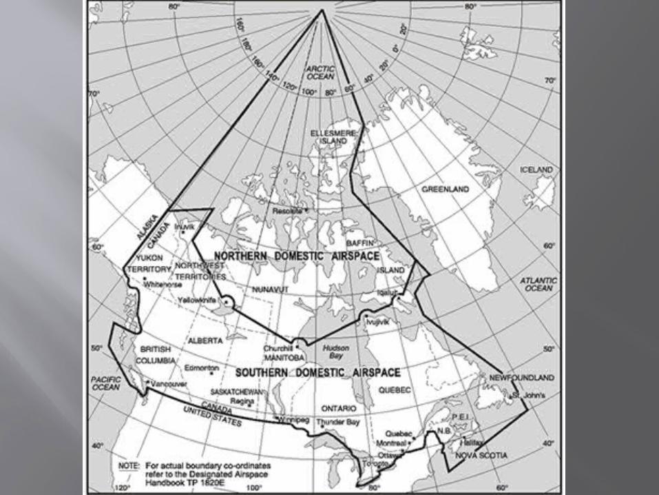

Canadian Domestic Airspace
NORTHERN DOMESTIC AIRSPACE
SOUTHERN DOMESTIC AIRSPACE
The magnetic north pole is located within the NDA
Magnetic compass heading are erratic
Runway headings and cruising altitudes use TRUE tracks
Most of the Canadian land mass is located within this region
Magnetic compass heading are fairly reliable
Runway headings and cruising altitudes use MAGNETIC tracks

Altimeter Regions

Altimeter Setting
ALTIMETER SETTING REGION
STANDARD PRESSURE REGION
Airspace of defined dimensions below 18,000’ ASL
Prior to take off, PIC sets altimeter to current altimeter setting, or field elevation
During flight sets it to the nearest station
While approaching an airport, sets it to the current altimeter setting of that airport
All high level airspace over Canada (18,000’+) and all low level airspace not in the altimeter setting region
The altimeter is generally set to 29.92 “Hg
Prior to take off, the pilot sets it to the current altimeter setting or field elevation
Set to current airport altimeter setting before descending for landing


Uncontrolled airspace: Monitor 126.7 MHz
Controlled airspace: Air Traffic Control service provided Divided into High Level Airspace and Low
Level Airspace High Level Airspace is any airspace above
18,000 feet ASL
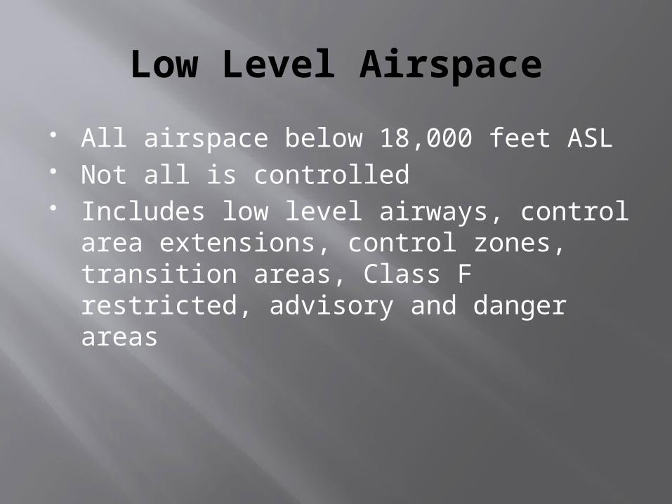
Low Level Airspace
All airspace below 18,000 feet ASL Not all is controlled Includes low level airways, control area
extensions, control zones, transition areas, Class F restricted, advisory and danger areas

Low Level Airways: routes between radio navigation aids
Control Area Extensions: additional controlled airspace surrounding a control zone
Control Zone: designated areas around certain aerodromes
Transition Area: 700 feet AGL to base of controlled airspace
Terminal Control Area: Provide area for IFR control service

Classification of Canadian Airspace

Classifications of Airspace
Canadian Domestic Airspace is divided into 7 classes – A, B, C, D, E, F and G
Flight within each region is governed by specified rules and operating procedures
Controlled airspace: A-F Uncontrolled airspace: G

Classifications of Airspace
CLASS A AIRSPACE CLASS B AIRSPACE
18,000 feet ASL to FL600
IFR only ATC clearance
required ATC separation is
provided to all aircraft All aircraft must have
a Mode C transponder (altimeter reporting)
12,500’ ASL to 17,999’ ASL Any CZ/TCA can be made
into class B if necessary VFR or IFR ATC clearance required ATC separation is provided
to all aircraft Two-way radio Radio navigation
equipment Mode C transponder

Classifications of Airspace
CLASS C AIRSPACE CLASS D AIRSPACE
IFR and VFR VFR requires a
clearance Separation is
provided for IFR traffic, and VFR conflict resolution if the workload permits
Two way radio Mode C transponder
IFR and VFR VFR traffic must make
two-way communication before entering
Separation is provided for IFR traffic, and VFR conflict resolution if the workload permits
Two way radio If in transponder airspace,
a Mode C transponder
Classifications of Airspace
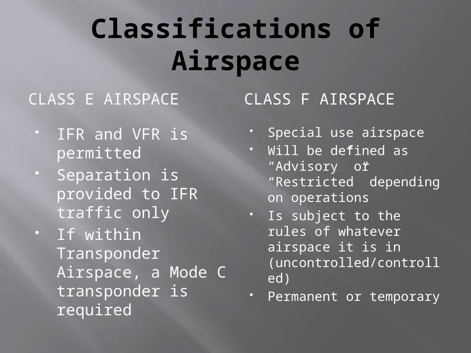
CLASS E AIRSPACE CLASS F AIRSPACE
IFR and VFR is permitted
Separation is provided to IFR traffic only
If within Transponder Airspace, a Mode C transponder is required
Special use airspace Will be defined as
“Advisory” or “Restricted” depending on operations
Is subject to the rules of whatever airspace it is in (uncontrolled/controlled)
Permanent or temporary

More on Class F Airspace
ADVISORY AIRSPACE RESTRICTED AIRSPACE
Areas where non-participating aircraft should be aware of operations
Pilots are allowed to enter at their own discretion
Activities include:TrainingParachutingHang glidingMilitary operations
No person may conduct aerial operations in restricted airspace unless permission has been given

More on Class F Airspace
DANGER AREA
Over international water where Canadian ATC has authority
Activities may cause danger to the aircraft

How do you know what’s Class F
Class F airspace will be indicated on all applicable charts
With the boundaries, a code will be givenExample: CYA113(A)
CY – Indicates Canada A – Indicates advisory 113 – Number inside BC (A) – Indicates aerobatics

Airspace Classification
CLASS G AIRSPACE
Any airspace that hasn’t been classified as A, B, C, D, E or F
ATC does not have any authority or responsibility
Consists of all uncontrolled domestic airspace
Airway: established between specified radio-navigation aides. Air traffic control services are always provided
Air Route: routes are established between specified radio-navigation aides. Air traffic control service is not provided

Review
1. What are the two types of domestic airspace in Canada, and what are the differences?
2. What would you set your altimeter to in the Altimeter setting region?
3. What does CYA123(M) mean?

Air Rules and procedures

Aircraft Documents
The following documents must be on board the aircraft:
Certificate of Airworthiness Certificate of Registration Radio licence Pilot Operating handbook (Aircraft Flight Manual) Weight and balance Journey log Insurance Crew Licences Intercept orders (if not familiar with orders)

Right of Way
Pilot’s responsibility to avoid collision
An aircraft that has the right of way shall take action to avoid collision if necessary
An aircraft that has right of way will give way to another aircraft that appears to be in an emergency situation

Right of Way continued...
When two aircraft are approaching head on, each shall alter their headings to the right
An aircraft that is being overtaken has the right of way and the overtaking aircraft shall alter its heading to the right (pass on the right)
Aircraft on the surface shall give way to landing aircraft
An aircraft approaching an airport to land shall give way to lower aircraft
An aircraft shall not cut in front of an aircraft that is in the final stages of an approach to land
No person shall take off if they will collide with anything

Right of Way
When two aircraft are converging at the same altitude, the aircraft that has the other on its right shall give way, except:
- A power driven heavier-than-air aircraft shall give way to gliders, airships and balloons- An airship shall give way to gliders and balloons- A glider shall give way to balloons- A power driven aircraft shall give way to other aircraft towing gliders or any other load

Night Requirements
Any period of time during which the centre of the sun is more than 6° below the horizon
The period between the end of evening civil twilight and the beginning of morning civil twilight

Night Equipment
Airspeed indicator Sensitive pressure altimeter Direct reading magnetic compass
Non-magnetic direction indicator in NDA Turn and bank indicator Instrument illuminator Time piece and flashlight per crew
member Two way radio in controlled airspace
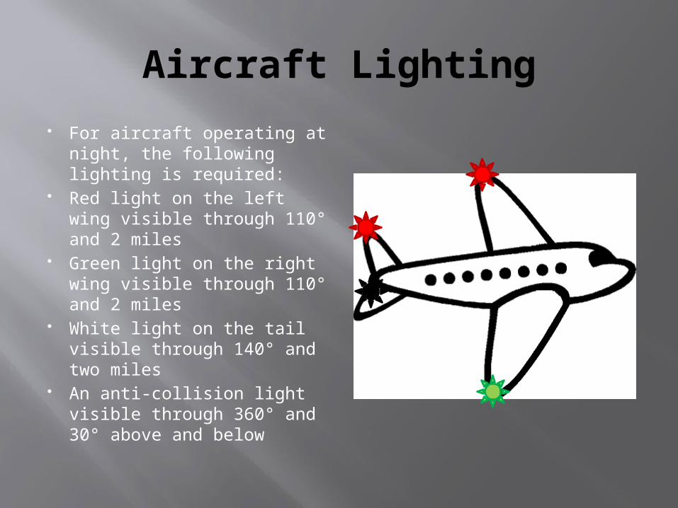
Aircraft Lighting
For aircraft operating at night, the following lighting is required:
Red light on the left wing visible through 110° and 2 miles
Green light on the right wing visible through 110° and 2 miles
White light on the tail visible through 140° and two miles
An anti-collision light visible through 360° and 30° above and below

Rules of the Air
No person shall operate an aircraft unless in accordance with VFR or IFR procedures or in accordance with special regulations set forth by the Minister.
No person shall create a hazard to persons or property on the surface by dropping an object from an aircraft in flight. (CAR 602.23)
It is forbidden to carry dangerous goods except in accordance with the Law on the Transport of Dangerous Materials.

Transportation of Dangerous Goods
Anything that has been identified in section 2 of the Transportation of Dangerous Goods Act, 1992 must be transported in accordance with the regulations in the act
Essentially, proper containers and labelling must be used.

No person shall operate an aircraft in such a reckless or negligent manner as to endanger or be likely to endanger the life or property of any person. (CAR 602.01)
No person shall operate an aircraft that is towing an object unless the aircraft is equipped with a tow hook and release control system that meet the applicable standards of airworthiness. (CAR 602.22)

Air traffic rules and procedures

Clearances and Instructions
Clearance: authorization from an ATC unit for aircraft to proceed in controlled airspace under specific conditions
Instruction: directive issued by ATC unit for air traffic control purposes. You are required to comply and acknowledge receipt unless safety of aircraft is jeopardized.

Flight Rules
Visual flight rules (VFR): Rules which apply when flying with visual
reference to the ground Instrument flight rules (IFR)
Rules which apply when flying with reference to cockpit instruments
Flight Plans and Itineraries
A flight plan or itinerary outlines what type of aircraft is being flown, what equipment is on board, who’s flying it and what route it’s taking
Allow authorities to determine with precision where you are going, ETE, passengers, etc. in an emergency
All aircraft will file a flight plan or itinerary beyond 25 NM of departure aerodrome
Flight Plans vs. Itineraries
FLIGHT PLAN FLIGHT ITINERARY
Must be filed with an ATS unit
Must be closed with an ATS unit upon arrival (arrival report)
If not closed within 1 hour (or time specified in flight plan) search and rescue will be activated
Can be filed with a “responsible person”
Must be closed with that responsible person within the time specified on the flight itinerary (default 24 hours)
Cannot be used for international flights

Cruising altitudes
To increase safety, pilots fly at specific altitudes depending on their direction of travel
For altitudes below 18,000’ ASL, altitudes are stated in thousands
Above 18,000’ ASL, they are called flight levels (i.e. 20,000’ would be called FL200)
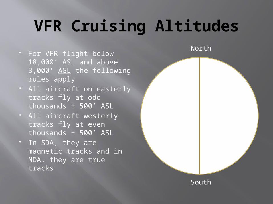
VFR Cruising Altitudes
For VFR flight below 18,000’ ASL and above 3,000’ AGL the following rules apply
All aircraft on easterly tracks fly at odd thousands + 500’ ASL
All aircraft westerly tracks fly at even thousands + 500’ ASL
In SDA, they are magnetic tracks and in NDA, they are true tracks
000-179° :Odd thousands + 500’
180-359° :Even thousands + 500’
North
South

VFR Minima
To fly under Visual Flight Rules (VFR) certain weather criteria have to be met
These weather requirements should allow a pilot to navigate with visual reference to the ground

Review
1. When two aircraft are converging at the same altitude, which one must give way?
2. When two aircraft are approaching head on, what should they do?
3. When do you not have to file a flight plan/itinerary?

VFR Weather MinimaAIRSPACE FLIGHT
VISBILITYDISTANCE FROM CLOUD
DISTANCE AGL
Control Zones 3 SM Horizontally: 1 SMVertically: 500’
500’
Other Controlled Airspace
3 SM Horizontally: 1 SMVertically: 500’
Uncontrolled Airspace
≥ 1000’ AGL 1 SM (Day)3 SM (Night)
Horizontally: 2000’Vertically: 500’
< 1000’ AGL – Fixed wing
2 SM (Day)3 SM (Night)
Clear of cloud

Special VFR
VFR aircraft may flying into control zones that are below VFR weather minima if the following conditions apply:
Clearance from ATC has been given If operating at night, clearance will only be given
for the purpose of landing
FLIGHT VISIBILITY
DISTANCE FROM CLOUD
Aircraft other than Helicopter
1 SM Clear of cloud
Helicopter ½ SM Clear of cloud

Minimum VFR Altitudes
Except for the purposes of taking off or landing:
Built up areas: Minimum 1000’ above highest obstacle within
2000’ of aircraft Non-built up areas:
Minimum 500’ above highest obstacle within 500’ of aircraft

Identification Zones
Air Defence Identification Zones (ADIZ) To enter or fly within an ADIZ, PIC is
required to file IFR flight plan, Defence VFR flight plan or a flight itinerary with ATC or flight service station
No deviation permitted without authorization
Two-way radio required

Review
1. An aircraft is flying VFR from Toronto to Ottawa at 6,500’ ASL, is he doing anything wrong?
2. You are flying and you hear ATC call you up and say “SCV turn right heading 230” – Is this a clearance or instruction? Can you refuse to do this?
3. What are the VFR weather minima for controlled airspace?

Summary
In this class we have covered: Aerodromes Traffic procedures Documentation Classifications of airspace Rules of the air VFR minima Transportation of dangerous goods
The next class will be on theory of flight
Top Related