


Languages
Pages
Legal


Harvey Thorleifson
Chair, Association of American State Geologists
Mapping Committee
Member, National Geospatial
Advisory Committee
Director, Minnesota
Geological Survey
Progress on the US
geological mapping
strategic plan
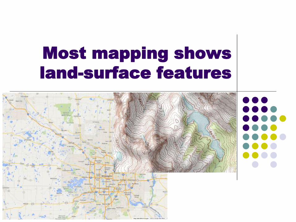
Most mapping shows
land-surface features
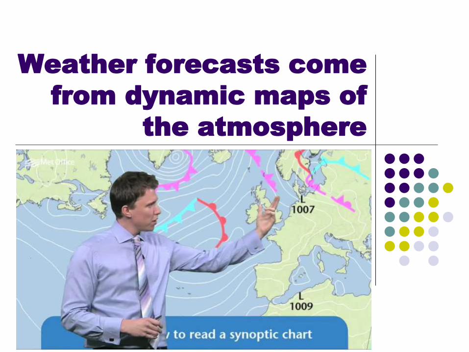
Weather forecasts come
from dynamic maps of
the atmosphere
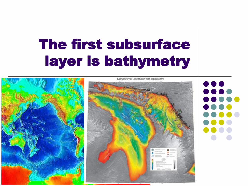
The first subsurface
layer is bathymetry

Next, soil mapping by
agricultural agencies
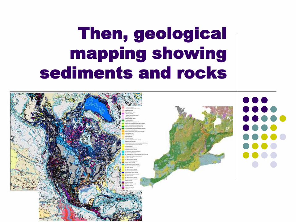
Then, geological
mapping showing
sediments and rocks

Geological mapping is
needed for:
Energy
Minerals
Water
Hazards
Environment
Waste
Engineering
Research

Geological mapping saves
money
lives saved
resources discovered
costs avoided
increased efficiency
fundamental
understanding

Benefits
Very favorable benefits
relative to costs have
been quantitatively
demonstrated

Future geological mapping
needs to be
Regularly updated
Zoomable
Queryable
Complete
Seamless
3D
Onshore to offshore
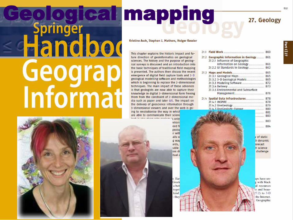
Geological mapping

Geological
mapping in the
2010s
(Asch et al., 2012)
• Asch et al. (2012) highlight the shedding of
constraints through digital capture of field data,
application of geoinformatics, and 3D methods,
thus allowing greater contributions to science and
planning, largely through modeling made possible
by improved 3D mapping that is well-coordinated
with spatial data infrastructure, and well-supported
by global initiatives designed to avert duplication of
effort on standards, arrangements, policies, and
dissemination tools

2D geological mapping

3D geological mapping
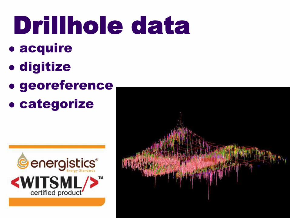
Drillhole data
acquire
digitize
georeference
categorize
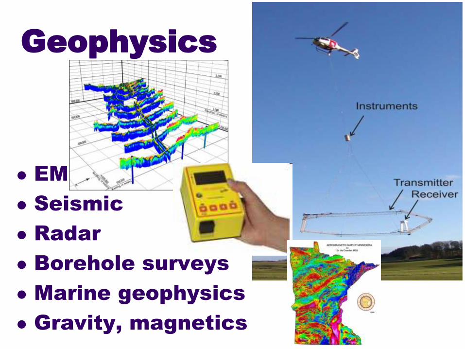
Geophysics
EM
Seismic
Radar
Borehole surveys
Marine geophysics
Gravity, magnetics

Drilling
Stratigraphic benchmarks

History of geological
mapping
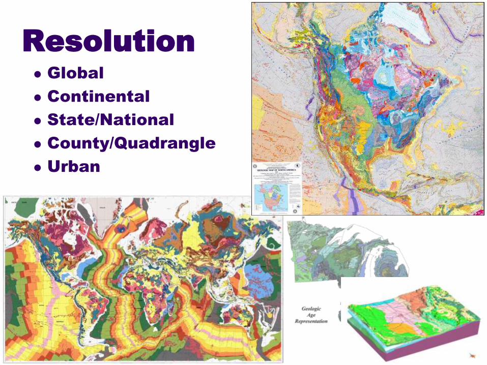
Resolution
Global
Continental
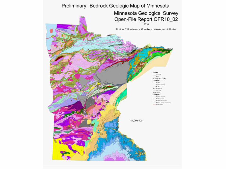
State/National
County/Quadrangle
Urban

Resolution
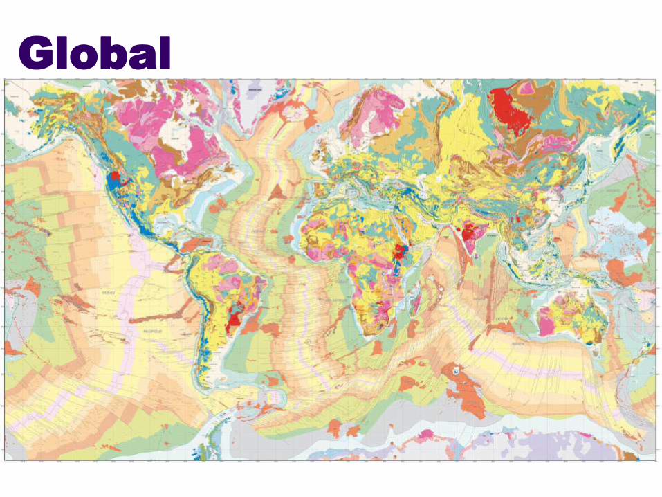
Global
Geological mapping of
the world is coordinated
by the Commission for
the Geological Map of
the World (CGMW)
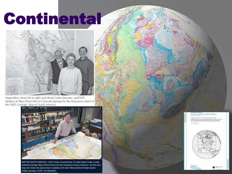
Continental

Availability of
coordinated ~1:0.5M
geological mapping in the
US is coordinated by the
USGS Mineral Resources
Program
State/National
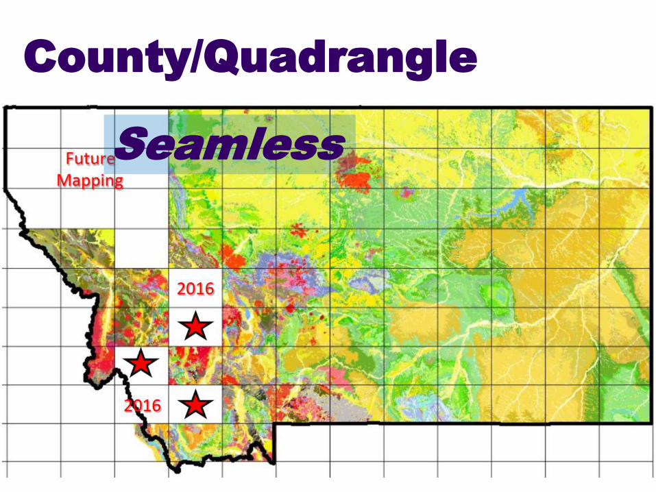
County/Quadrangle
Seamless

The current approach to
geological mapping in
the USA was outlined in
the 1980s by USGS,
AASG, and advisory
committees, starting
with a meeting in Illinois
in 1982
1980s
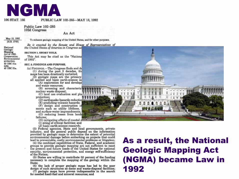
As a result, the National
Geologic Mapping Act
(NGMA) became Law in
1992
NGMA
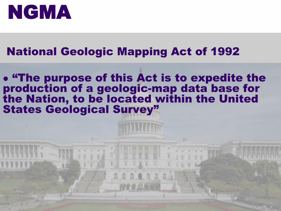
National Geologic Mapping Act of 1992
“The purpose of this Act is to expedite the
production of a geologic-map data base for
the Nation, to be located within the United
States Geological Survey”
NGMA
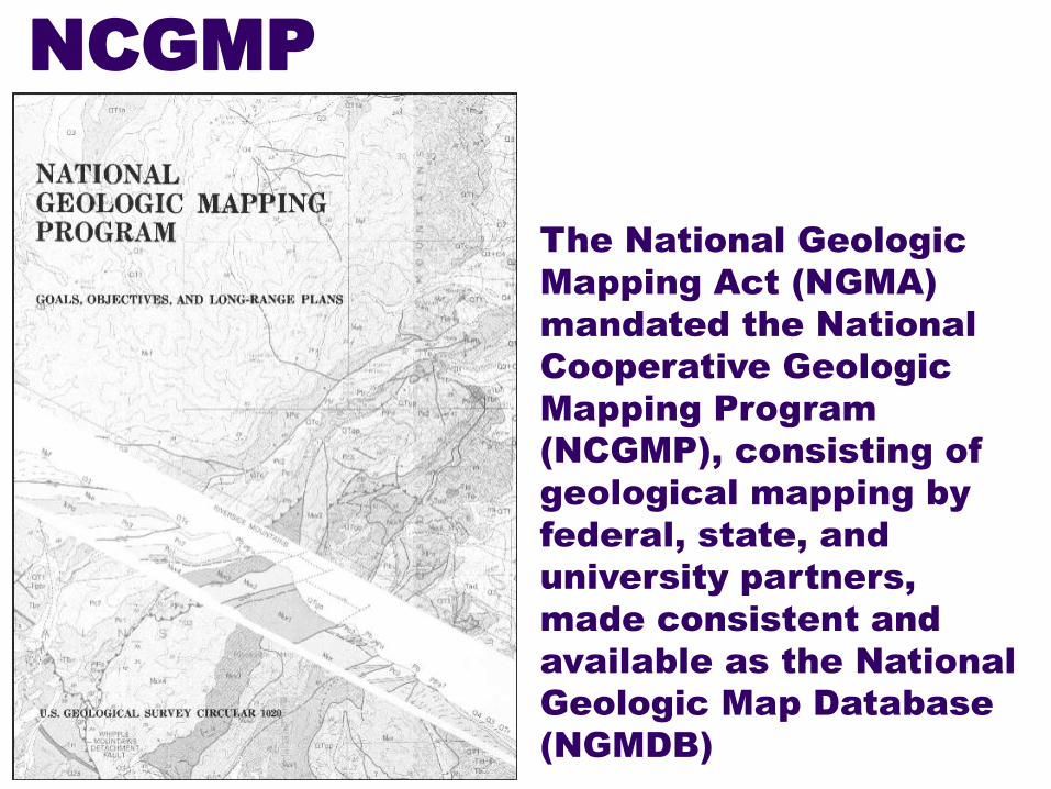
The National Geologic
Mapping Act (NGMA)
mandated the National
Cooperative Geologic
Mapping Program
(NCGMP), consisting of
geological mapping by
federal, state, and
university partners,
made consistent and
available as the National
Geologic Map Database
(NGMDB)
NCGMP
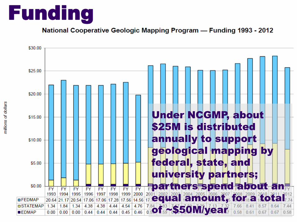
Under NCGMP, about
$25M is distributed
annually to support
geological mapping by
federal, state, and
university partners;
partners spend about an
equal amount, for a total
of ~$50M/year
Funding
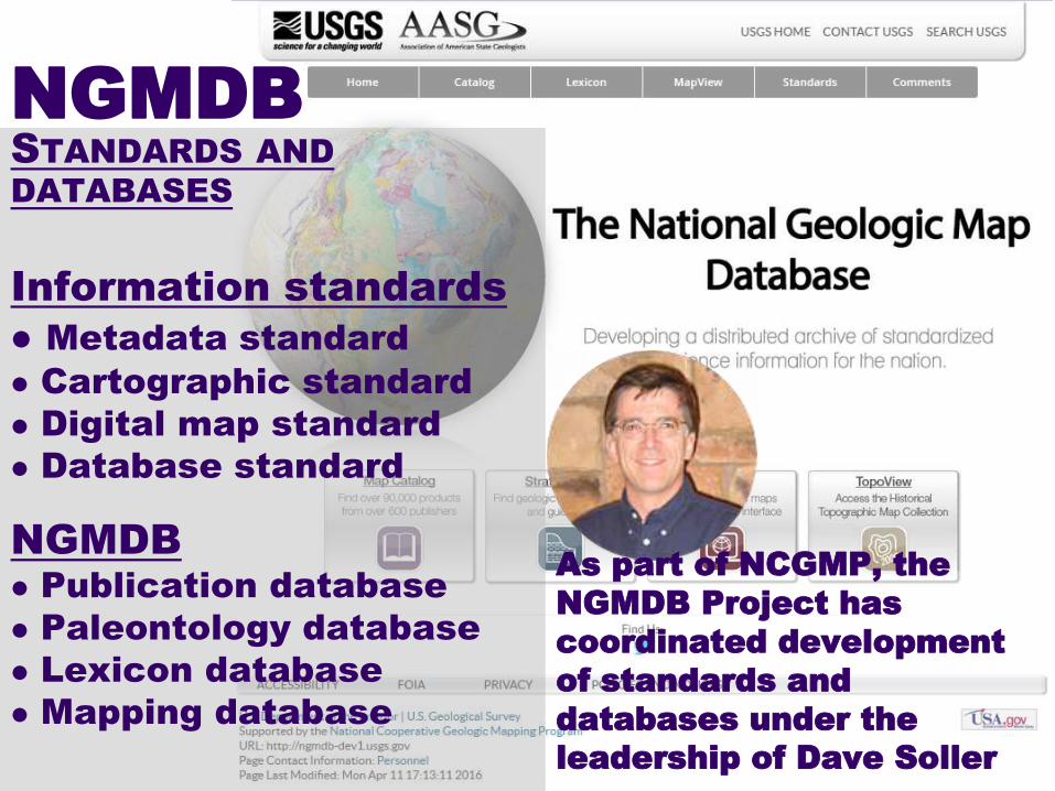
NGMDB
STANDARDS AND
DATABASES
Information standards
Metadata standard
Cartographic standard
Digital map standard
Database standard
NGMDB
Publication database
Paleontology database
Lexicon database
Mapping database
As part of NCGMP, the
NGMDB Project has
coordinated development
of standards and
databases under the
leadership of Dave Soller

Our principal forum for the
development of geologic
map standards in the US is
the annual DMT workshop,
which will be held in
Minneapolis this year
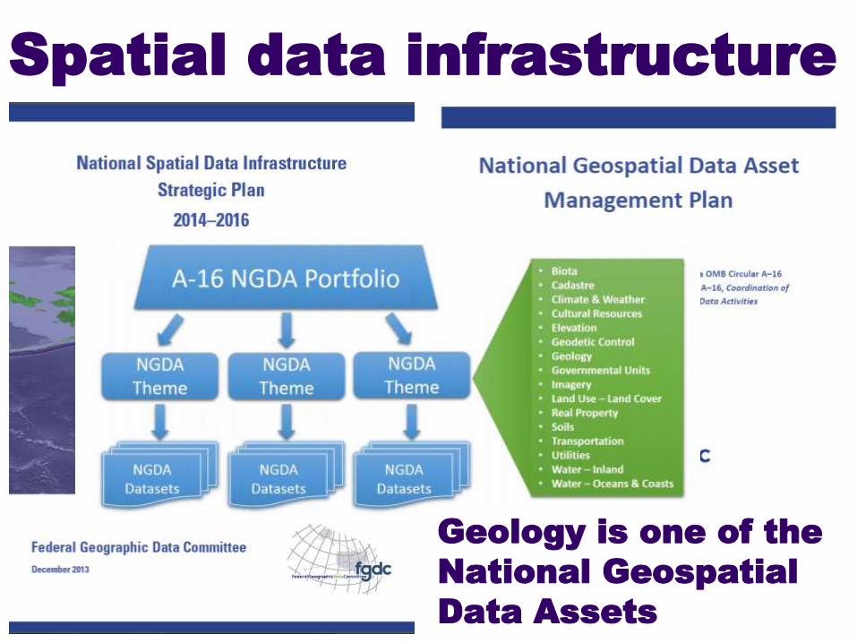
Spatial data infrastructure
Geology is one of the
National Geospatial
Data Assets

1998: The 2000-2010
plan for USGS
geology cited the
need for basin-scale,
nationally consistent
maps showing the
3D distribution of
hydrogeologic
properties
Planning

2011: The 2010-2020
plan for USGS geology
called for development
of the interpretations,
protocols, and standards
needed to provide
seamless geological
maps, while foreseeing
that 3D geologic maps of
continental and offshore
areas will become the
standard
Planning

2013: The most recent
USGS planning called for
collaboration leading to 1)
seamless nationwide
geological maps, 2) 3D
maps that will for
example improve
understanding of
sedimentary basin
processes, and 3) 4D
modeling that will
elucidate the operation of
processes through time
Planning
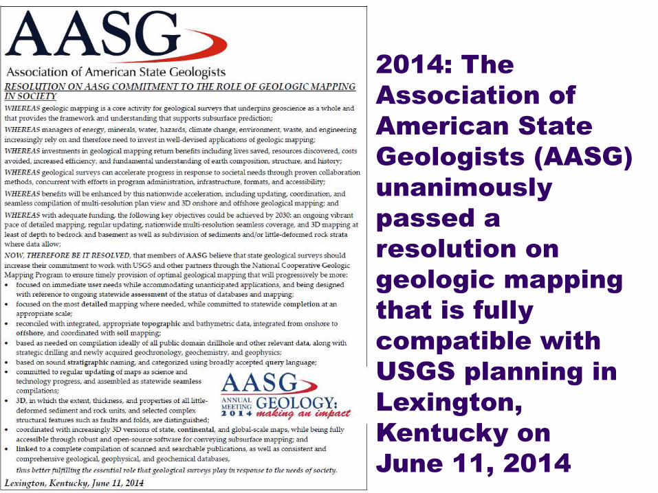
2014: The
Association of
American State
Geologists (AASG)
unanimously
passed a
resolution on
geologic mapping
that is fully
compatible with
USGS planning in
Lexington,
Kentucky on
June 11, 2014
Planning
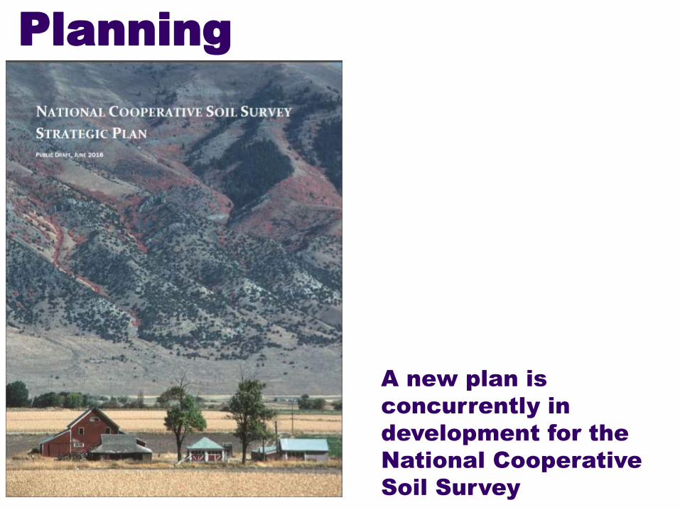
A new plan is
concurrently in
development for the
National Cooperative
Soil Survey
Planning
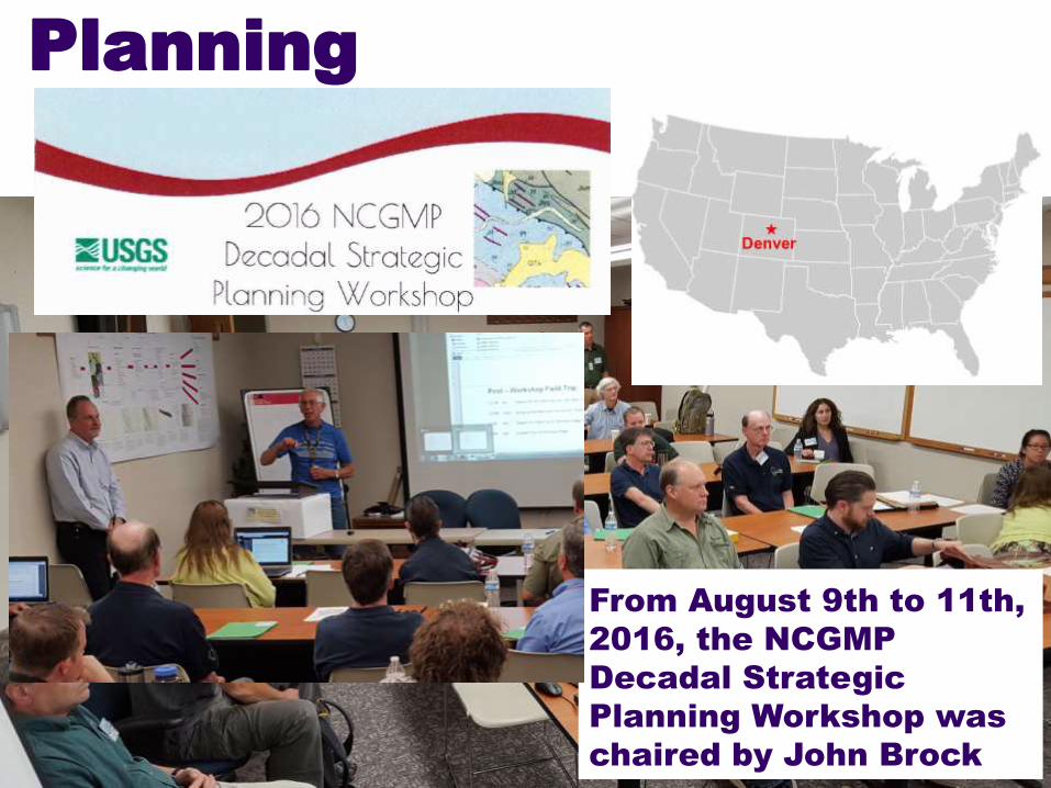
From August 9th to 11th,
2016, the NCGMP
Decadal Strategic
Planning Workshop was
chaired by John Brock
Planning
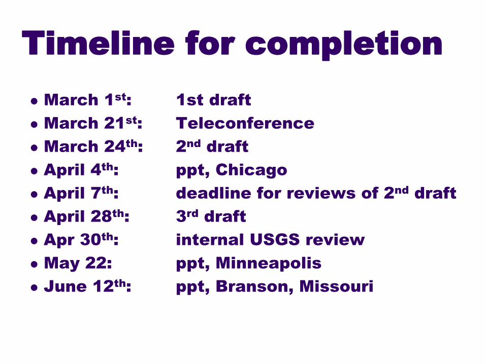
Timeline for completion
March 1st
: 1st draft
March 21st
: Teleconference
March 24th
: 2nd
draft
April 4th
: ppt, Chicago
April 7th
: deadline for reviews of 2nd
draft
April 28th
: 3rd
draft
Apr 30th
: internal USGS review
May 22: ppt, Minneapolis
June 12th
: ppt, Branson, Missouri

Harvey Thorleifson
Chair, Association of American State Geologists
Mapping Committee
Member, National Geospatial
Advisory Committee
Director, Minnesota
Geological Survey
Progress on the US
geological mapping
strategic plan
Top Related