


Languages
Pages
Legal


Coordinator
Training
Version 8
December 2016
Post-Disaster Safety
Assessment Program
(SAP)
Student Manual

California Governor’s Office of Emergency Services December 2016
Safety Assessment Program Coordinator Training
1
State of California
Safety Assessment Program
Coordinator Student Manual
December 2016
Version 8
For current SAP information, please visit our website at www.caloes.ca.gov, and do a Search
for Safety Assessment.

California Governor’s Office of Emergency Services December 2016
Safety Assessment Program Coordinator Training
2
Acknowledgements
The California Governor’s Office of Emergency Services (Cal OES) gratefully acknowledges the
assistance provided by representatives of the Structural Engineers Association of California, the
American Institute of Architects, the American Society of Civil Engineers, the American
Construction Inspectors Association, the California Building Officials, and the State of
California Division of the State Architect, Department of Transportation, the Department of
Water Resources, the Office of Statewide Health Planning and Development, and the Alfred E.
Alquist Seismic Safety Commission for their time and consideration in reviewing and
commenting on this document.
A special thanks goes to the New Zealand Society of Earthquake Engineering, the New Zealand
Department of Building and Housing, the Institute of Professional Engineers in New Zealand,
the Christchurch City Council, the (NZ) Canterbury Earthquake Recovery Authority, and the
(US) Applied Technology Council in assisting with important information and experience used
in the preparation of this manual
Cal OES wishes to acknowledge the many organizations and individuals who contributed or
permitted use of their photos for use in this instruction manual. Photo credits are found beneath
each individual photo, when known. Cal OES also acknowledges the assistance of the Applied
Technology Council in allowing the reproduction and use of their photographs and diagrams
used in this manual as well.
- Jim C. Barnes, P.E.
Statewide SAP Coordinator
California Governor’s Office of Emergency Services

California Governor’s Office of Emergency Services December 2016
Safety Assessment Program Coordinator Training
3
Table of Contents
Unit 1 Emergency Management Overview 7
1.1 Incident Command System (ICS) 7
1.1.1 ICS Features 7
1.1.2 ICS Functions 8
1.2 Standardized Emergency Management System (SEMS) 9
1.2.1 Purpose and Scope of the SEMS Law 9
1.3 Need for SEMS Training 10
1.4 SEMS Components and Features 10
1.4.1 Four Components of SEMS 10
1.4.2 Organization or Response Levels and Activation Requirements 12
1.4.3 SEMS Concept of Teamwork, Coordination and Effectiveness 13
1.4.4 SEMS Implementation 13
1.5 Emergency Management Assistance Compact (EMAC) 14
1.6 Federal Agency Resources 14
1.7 National Incident Management System (NIMS) 15
1.7.1 NIMS After Action/Corrective Action Reports 15
1.7.2 NIMS Resource Typing 15
1.7.3 NIMS Training Requirements 16
1.7.4 NIMSCAST 16
Unit 2 Safety Assessment Operations 19
2.1 Introduction 19
2.1.1 Coordinator Training and Background 19
2.2 Planning Before an Event 20
2.2.1 Designating Key Personnel 20
2.2.2 Placard Adoption 20
2.2.3 Assemble Resources 21
2.2.4 Travel Costs 22
2.2.5 Identify Department Operations Centers (DOCs) 23
2.2.6 Identify and Locate Essential Facilities 23
2.2.7 Identify Buildings at Risk 24
2.2.8 Identify Potential Monitor Buildings 26
2.2.9 Planning for Use of Strike Teams 27
2.2.10 Planning for Shelter In Place 29
2.2.11 Planning for Securing Possessions from Unsafe Buildings 31
2.2.12 SAP and the Media 32
2.2.13 Planning for Catastrophic Events 33
2.2.14 Arrange for Ongoing Training and Exercise 35
2.3 Responding to Disaster 36
2.3.1 Key Personnel and SEMS 36
2.3.2 Needs Assessment 36
2.3.3 Requesting SAP Resources 40
2.3.4 SAP Evaluator Intake 42
2.3.5 SAP Evaluator Coordination 44

California Governor’s Office of Emergency Services December 2016
Safety Assessment Program Coordinator Training
4
Table of Contents (continued)
2.3.6 Record Keeping 48
2.3.7 Call Center and Public Input 49
2.3.8 Demobilization and Handoff 49
2.4 Building Safety Related Issues 50
2.4.1 Collapse Zones 50
2.4.2 Barricades 53
2.4.3 Cordoning Unsafe Structures 56
2.4.4 Shoring 58
2.4.5 Repair versus Demolition and Replacement 61
2.4.6 Engineering Evaluation 61
2.5 Conclusion 62
Appendix
SAP Coordinator and Evaluator Forms 64
CALBO Sample Placard Adoption Ordinance 69
Sample “Notice to Building Owner” Form and Useful Information 75
SAP Coordinator Job Aid 81
SAP Memorandum of Understanding (MOU) 85
California Governor’s Office of Emergency Services December 2016
Safety Assessment Program Coordinator Training
5
UNIT 1: EMERGENCY MANAGEMENT OVERVIEW

California Governor’s Office of Emergency Services December 2016
Safety Assessment Program Coordinator Training
6
Unit 1 Training Guidance
Overview
This section is a basic overview of the Incident Command System (ICS), the California
Standardized Emergency Management System (SEMS), and a review of the National Incident
Management System (NIMS).
Training Goal
This course will provide participants with a basic understanding of ICS, SEMS, and NIMS, as
well as their descriptions and use.
Objectives
At the end of this unit, participants will be able to:
Explain the features of ICS.
Understand how the Safety Assessment Program fits within the ICS functions.
Be aware of the use of ICS within SEMS.
Understand the features and components of SEMS.
Understand the five levels of government within SEMS.
Relate the additional requirements of NIMS over SEMS.
Identify the measure for NIMS compliance in California.

California Governor’s Office of Emergency Services December 2016
Safety Assessment Program Coordinator Training
7
1.0 Emergency Management Overview
1.1 Incident Command System
The Incident Command System (ICS) was developed for emergency management as a part of the
FIRESCOPE (Firefighting Resources of California Organized for Potential Emergencies)
program during the 1970s. Fire conflagrations in Southern California caused property losses that
ran into the millions of dollars, with much loss of life. These losses prompted a case study that
revealed that inadequate emergency management was the single largest contributor to response
problems, requiring an effective solution.
Weaknesses in incident management at the time included:
Lack of accountability
Poor communication
Lack of a planning process
Overwhelmed Incident Commanders
No useful method to integrate inter-agency requirements
The massive mutual aid responses needed for major disasters often require the combined efforts
of scores of responding agencies. However, at the time, local emergency response agencies
often had unique methods that impaired or prevented integration with other agencies under
mutual aid response.
As a result, ICS was developed to provide an integrated and consistent framework for disaster
response. ICS eventually became one of the foundation elements of the Standardized Emergency
Management System (SEMS) in California, and is now at the heart of the National Incident
Management System (NIMS). ICS is recognized worldwide as the preferred approach for
managing incidents and disasters.
1.1.1 ICS Features
ICS allows for a consistent approach for responding agencies to work together to attack the
incident or disaster. The primary features of ICS are:
1. Five Functions: ICS divides the workload into five functions, these being:
management/command; operations; logistics; planning/intelligence; and
finance/administration. This allows each of the workload items to be handled by persons
who are experienced in these fields.
2. Span of Control: ICS also defines an effective “span of control” by restricting the
number of staff under an incident commander or a manager to a maximum ratio of one to
seven, and an ideal ratio of one to five.

California Governor’s Office of Emergency Services December 2016
Safety Assessment Program Coordinator Training
8
3. Chain of Command: ICS establishes that there will be a single authority who is
completely responsible for the outcome of the incident management. This can either be a
Single Command, where one agency is involved, or a Unified Command, which unites
multiple jurisdictions. In a Unified Command, a single coordinated Action Plan will
direct all activities.
4. Unity of Command: In ICS, a staff member reports to only one supervisor or
commander. This eliminates the possibility of conflicting staff direction from multiple
managers.
5. Management by Objective: The Management/Command and Planning/Intelligence
functions are responsible for developing a set of Strategic Objectives in an Action Plan
that will be carried out during the next Operational Period. The Operational Period can
vary in length from an hour to twelve hours or longer, depending on the nature of the
incident. In practice, Operational Periods are most often twelve hours long.
6. Common Terminology: The use of “plain language” terminology is essential for
interagency cooperation. A common set of mutually understandable terms is critical for
disaster communications and team building.
7. Integrated Communications: Communications must occur in such a manner so that
mutual aid agencies can freely speak to one another. This element is also called
“interoperability,” and consists of the necessary hardware for communications, the
planning effort for using all available communication resources, and the networks for
transferring information internally and externally.
8. Comprehensive Resource Management: ICS requires the tracking and accounting of all
assets and personnel during an incident response, from mobilization to demobilization.
1.1.2 ICS Functions
The following provides a brief summary of the titles and definitions of the activities
associated with ICS functions. The Safety Assessment Program fits under the “Construction
and Engineering Branch” of the Operations function.
ICS Function Field Response Level EOC Level Command/Management Command is responsible for the
directing, ordering, and/or controlling
of resources.
Management is responsible for overall
emergency coordination and policies.
Operations The coordinated tactical response of all
field operations as per the Incident
Action Plan.
The coordination of all jurisdictional
operations in support of the emergency
response as per the EOC Action Plan.
Planning/Intelligence The collection, evaluation,
documentation and use of information
related to the incident.
Collecting, evaluating, disseminating,
and documenting information related
to all jurisdiction response activities.
Logistics Providing personnel, equipment,
services, materials, and facilities in
support of the incident.
Providing personnel, equipment,
services, materials, and facilities in
support of jurisdictional response
activities as required.
Finance/Administration Financial and cost analysis, and
administrative aspects not handled by
the other functions.
Broad fiscal and recovery
responsibility, and overall fiscal
accountability.

California Governor’s Office of Emergency Services December 2016
Safety Assessment Program Coordinator Training
9
1.2 Standardized Emergency Management System (SEMS)
As a result of the 1991 East Bay Hills Fire in Oakland, California, State Senate Bill 1841 was
passed by the California legislature and made effective January 1, 1993. The law is found in
Section 8607 of the California Government Code. The intent of this law is to improve the
coordination of state and local emergency response in California.
The statute directed the California Governor’s Office of Emergency Services (Cal OES), in
coordination with other state agencies and interested local emergency management agencies,
to establish by regulation the Standardized Emergency Management System (SEMS). The
SEMS regulations took effect in September of 1994.
1.2.1 Purpose and Scope of the SEMS Law
The basic framework of SEMS includes the following:
The Incident Command System (ICS).
Interagency coordination.
The State’s Master Mutual Aid Agreement (established in 1950) and mutual aid
program.
The Operational Area structure.
A five-level emergency management response organizational structure, activated as
needed.
More information on each of these is found later in this discussion.
The use of SEMS includes the following:
The flow of emergency information and resources within and between involved
agencies at all SEMS organizational levels.
The process of coordination between responding agencies.
The rapid mobilization, deployment, use, and tracking of resources.
SEMS is designed to be flexible and adaptable to the various sorts of emergencies that can
occur in California, and to meet the emergency management needs of all responders. SEMS
is therefore an all-hazards approach to managing emergencies.
By law, State agencies must use SEMS when responding to emergencies involving multiple
jurisdictions or agencies.
Local governments are strongly encouraged to use SEMS; they must use SEMS to be eligible
for state funding of eligible response-related personnel costs. While local governments are
not required to take the SEMS Approved Course of Instruction (ACI), they are required to

California Governor’s Office of Emergency Services December 2016
Safety Assessment Program Coordinator Training
10
ensure that responders can successfully implement SEMS when necessary through their
training.
SEMS is a management system based on a proven approach that has been in use for nearly
twenty years. SEMS provides an organizational framework and guidance for operations at
each level of the State’s emergency management system. It provides the umbrella under
which all response agencies may function in an integrated fashion.
1.3 Need for SEMS Training
Training is essential for the effective use of SEMS at all levels. The State of California has
developed and provided an Approved Course of Instruction (ACI) for SEMS. Agencies may
use the ACI developed by the State, or use an internal training program to meet training
requirements and obtained necessary competencies. Training competencies are described in
the State’s training curriculum as performance objectives. This training is available through
the training arm of Cal OES, the California Specialized Training Institute (CSTI). More
information on this is available at the Cal OES website, www.caloes.ca.gov, under the “Cal
OES Divisions” header, then the “CSTI” link.
There are four courses within the SEMS Approved Course of Instruction:
Introductory Course – A self-study or instructor-based course.
Field Level Course – Seventeen modules of instruction on the Incident Command
System are available for the Field Response Level course.
Emergency Operations Center (EOC) Course – This course consists of three chapters
that can be adapted for use by all agencies or organizations utilizing emergency
operations centers.
Executive Course – An executive overview of SEMS, provided as a self-study or
instructor-based course.
The Approved Course of Instruction includes participant reference materials, instructor
guidelines, visual materials, and tests and exercises.
1.4 SEMS Components and Features
1.4.1 Four Components of SEMS
SEMS integrates several of the State’s primary emergency response programs. The primary
components of SEMS are:
Incident Command System (ICS) – As stated earlier, this was developed as a part of the
FIRESCOPE program during the 1970s by an interagency working group representing local,
state, and federal fire services in California.

California Governor’s Office of Emergency Services December 2016
Safety Assessment Program Coordinator Training
11
After field tests, ICS was adopted by the fire services in California as the standard all-hazards
response system. ICS was also adopted nationally by federal land management agencies as
the standard for response to all wild land fires.
A national generic version of ICS was developed by a multi-discipline working group which
is used in the SEMS Field Response Level course. Modules on Mutual Aid that address
coordination between the field and other SEMS levels have been added to that curriculum.
Interagency Coordination – As it applies to SEMS, this means the participation of various
agencies and disciplines involved at any level of the SEMS organization working together in
a coordinated effort to facilitate decisions for overall emergency response activities,
including the sharing of critical resources and the prioritization of incidents for management.
The cooperative and collaborative working relationship between police, fire, public works,
and parks departments in an EOC is an example of the interagency coordination intended
under SEMS. Another such example would the collaborative operational coordination that
might occur between municipal police, county sheriff, California Highway Patrol, and
National Guard elements that are involved in the same response.
Master Mutual Aid Agreement – This was originally signed in 1950. Under this agreement,
the State of California joined together with all of its cities and counties to provide for a
comprehensive program of voluntarily providing services, resources, personnel, and facilities
to jurisdictions when local resources prove to be inadequate to cope with a disaster or
situation.
Written mutual aid plans and operating procedures were developed for several discipline-
specific mutual aid systems that function on a statewide basis within the Master Mutual Aid
Agreement, including fire response and law enforcement.
The current and planned mutual aid systems form essential links within SEMS. A
comprehensive discussion of mutual aid is contained in the SEMS Guidelines, and Module
16 of the Field Level Course of Instruction is devoted to Mutual Aid.
Operational Areas – This constitutes one of the five organizational levels in SEMS. An
Operational Area consists of a county government with its resources, and all the political
subdivisions within the county’s borders and their resources. The governing bodies of each
county and of the political subdivisions in the county organize and structure their Operational
Area; the county will be the lead agency for the Operational Area unless another arrangement
is established by agreement.
The lead agency in the Operational Area is responsible for:
Coordinating information, resources, and priorities among the local governments
within the Operational Area.
California Governor’s Office of Emergency Services December 2016
Safety Assessment Program Coordinator Training
12
Coordinating information, resources, and priorities between the regional level and the
local government level.
Using interagency coordination to facilitate decisions for overall Operational Area
level emergency response activities.
Overall responsibility for the formation of the Operational Area rests with the Chairman of
the Board of Supervisors for each county.
The Operational Area is used:
For coordination of emergency activities within the geographic area of the county.
To serve as a link in the system of coordination between the Cal OES Regional EOC
(REOC), and the EOCs of the political subdivisions within the Operational Area.
1.4.2 Organizational or Response Levels and Activation Requirements
SEMS regulations describe five organizational response levels, with ICS used at each level.
The levels are:
Field or incident
Local government where the incident is occurring
Operational Area of that local government
Region of that operational area
State
The following is a brief description of each level.
Field or Incident Response Level – This is the level where emergency response personnel and
resources are used to carry out tactical decisions under the command of an appropriate
authority in direct response to an incident or threat. SEMS regulations require the use of ICS
at the field response level of an incident. The Field Response level is described in the SEMS
Guidelines, and in the Field Level Approved Course of Instruction.
Local Government Level – Includes counties, cities, and special districts. Local governments
manage and coordinate the overall emergency response and recovery activities within their
jurisdiction. In SEMS, the local government emergency management organization, and its
relationship and connections to the Field Response level, may vary depending on factors
related to the local government’s geographical size, population, function, or complexity. The
Local Government level is described further in the SEMS guidelines.
Operational Area Level – This is the intermediate level of the State of California’s
emergency management organization. The Operational Area encompasses the particular
county involved and all of its cities and special districts located within that county. The
Operational Area manages and/or coordinates information, resources, and priorities among

California Governor’s Office of Emergency Services December 2016
Safety Assessment Program Coordinator Training
13
local governments within the Operational Area, and serves as the coordination and
communication link between the local government level and the Cal OES Region level.
It is important to note that the Operational Area concept does not mean that the county
government itself is managing and coordinating the response and recovery activities within
the county, even though the Operational Area encompasses the entire county area. In most
cases, the county EOC will function as both the Operational Area EOC and the EOC for the
county organization.
Regional Level – The State of California has been divided into six mutual aid regions. The
purpose of a mutual aid region is to provide for the more effective application and
coordination of mutual aid and other emergency-related activities. Cal OES provides
administrative oversight over the mutual aid regions through three Administrative Regional
Offices (Coastal, Inland, and Southern). In SEMS, the Regional Level manages and
coordinates information and resources among Operational Areas within the mutual aid
region, and also between the Operational Areas and the State level. The Regional Level also
coordinates overall state agency support for emergency response activities within the region.
The Regional Level is described further in the SEMS Guidelines.
State Level – This is managed at the State Operations Center (SOC) at Cal OES Headquarters
in Mather, CA, near Sacramento. Cal OES is responsible for oversight of the SOC per the
California Emergency Services Act (California Government Code Sections 8585 through
8589.7, notably Section 8587), as well as the SEMS Regulations. Cal OES is responsible for
coordinating resource requests and resolving priority issues that might arise in at the
Regional Level, or between the three Cal OES Administrative Regions. The SOC is also
responsible for coordinating with FEMA and other federal agencies involved in the
implementation of the Federal Response Plan (FRA) in California. The State Level is
described further in the SEMS Guidelines.
1.4.3 SEMS Concept of Teamwork, Coordination and Effectiveness
SEMS as an emergency management system provides for a fully integrated and coordinated
response to emergencies involving multiple agencies and jurisdictions at all SEMS levels.
1.4.4 SEMS Implementation
The SEMS Statute requires all state agencies to implement and use SEMS when responding
to emergencies involving multiple agencies and jurisdictions at all SEMS levels.
Local governments are encouraged to use SEMS when responding to emergencies, but are
not required to. They are encouraged to use SEMS in order to obtain state reimbursement for
eligible response-related personnel costs. Nevertheless, SEMS has enjoyed widespread
acceptance and use in California by local governments.

California Governor’s Office of Emergency Services December 2016
Safety Assessment Program Coordinator Training
14
The following material was developed by an interagency working group to assist state and
local agencies in implementing and maintaining SEMS.
SEMS Statute: California Government Code Section 8607.
SEMS Regulations: California Code of Regulations Title 19, Division 2, Chapter 1,
Sections 2400 – 2450.
SEMS Guidelines (in three parts).
SEMS Approved Course of Instruction:
o Introductory Course
o Field Course
o Emergency Operations Center Course
o Executive Course
1.5 Emergency Management Assistance Compact (EMAC)
If California’s resources are overwhelmed in an emergency and assistance is needed from
other states, Cal OES can request aid through the Emergency Management Assistance
Compact (EMAC). EMAC is a direct state-to-state mutual aid arrangement. Cal OES can
also send aid to other states through EMAC.
Immunity from liability and workers compensation, both features of the California Safety
Assessment Program (SAP), go with SAP personnel who are sent to other states under
EMAC. Also, professional licenses and certifications recognized in California are also
accepted in receiving states under Article 5 of EMAC, and vice versa, which is why the
California Safety Assessment Program accepts professional licenses from states other than
California.
There are currently over a thousand persons trained in the California Safety Assessment
Program who reside outside California, along with numerous SAP-certified trainers. The
State of California sent many resources under EMAC to Louisiana and Mississippi in 2005
under EMAC to help with the aftermath of Hurricane Katrina, including 86 SAP personnel.
1.6 Federal Agency Resources
Cal OES must request Federal resources on behalf of the State through the Federal
Emergency Management Agency (FEMA). Federal resources would include personnel and
equipment from the Department of Defense (including the U.S. Army Corps of Engineers),
U.S. Forest Service, Centers for Disease Control, and other federal agencies. A FEMA liaison
is often present at the SOC during emergencies involving State agency response.
There are a number of SAP-certified instructors who train military personnel in the Safety
Assessment Program. It is therefore likely that properly trained SAP evaluators would be

California Governor’s Office of Emergency Services December 2016
Safety Assessment Program Coordinator Training
15
available from federal resources in the event they are needed, although most of these persons
are not currently reported to Cal OES.
1.7 National Incident Management System (NIMS)
NIMS (released in 2004) is a federal arrangement that seeks to implement ICS into the
emergency management structures of all fifty states, all U.S. territories, and all U.S. tribal
governments. It also seeks to unify these systems into a single approach to emergency
management.
Because NIMS was modeled after California’s ICS structure, the integration of NIMS into
SEMS has not required any vast or profound adjustments of SEMS. The changes so far were
in the form of add-ons or simple adjustments to the SEMS processes. These have mostly
occurred with regards to:
After Action/Corrective Action Reports
Resource management (equipment and personnel typing)
Training
1.7.1 NIMS After Action/Corrective Action Reports
California’s SEMS Statute requires that Cal OES prepare a statewide After Action Report
after each declared disaster within 120 days of the incident. The After Action Report
compiles the efforts of state agencies and local governments with respects to the response and
recovery efforts of declared disasters, identifying as well the corrective actions that should be
carried out to improve efforts for the future.
NIMS requires accountability for corrective actions. Agencies and local governments must
agree to carry out corrective actions, and must report the date that the corrective action was
completed.
1.7.2 NIMS Resource Typing
NIMS requires that resources such as personnel, equipment, and teams are identified and
accounted for. There are 120 resource types identified in NIMS. FEMA has a free inventory
database called the Incident Resource Inventory System (IRIS), which allows state and local
governments to identify their available resources in such a way that these will be shared
nationally and housed locally. The Tier 1 Resource Typing definitions are broken into the
following categories:
Animal Health Emergency
Emergency Medical Services
Fire and Hazardous Materials
Incident Management

California Governor’s Office of Emergency Services December 2016
Safety Assessment Program Coordinator Training
16
Law Enforcement
Mass Care
Medical and Public Health
Pathfinder Task Forces
Public Works
Search and Rescue
More information on this can be found at www.fema.gov/emergency/nims.
1.7.3 NIMS Training Requirements
Agencies and local governments seeking NIMS compliance must have their employees
trained appropriately. Please refer to the Five-Year NIMS Training Plan to determine the
level of training necessary for particular individuals (again, at the FEMA NIMS website
shown above). The following NIMS courses are available, both through FEMA’s Emergency
Management Institute in Emmitsburg, MD, and with CSTI in California:
FEMA ICS-100, Introduction to the Incident Command System
FEMA ICS-200, ICS for Single Resources and Initial Action Incidents
FEMA ICS-300, Intermediate ICS
FEMA ICS-400, Advanced ICS
FEMA IS-700, National Incident Management System (NIMS), An Introduction
FEMA IS-800, National Response Framework (NRF), An Introduction
As stated earlier, this training is available through the training arm of Cal OES, the California
Specialized Training Institute (CSTI). More information on this is available at the Cal OES
website, www.caloes.ca.gov, under the “Cal OES Divisions” header, then the “CSTI” link.
1.7.4 NIMSCAST
The NIMS Compliance Assistance Support Tool (NIMSCAST) is a web-based system for
measuring compliance with NIMS and overall emergency readiness. The NIMS Integration
Center, or NIC, has arranged a series of questions, or “metrics,” to measure these.
In California, NIMS compliance is being measured by the 58 counties completing this
process, as well as a select group of state agencies. Cities and special districts in California
are not being required to complete the NIMSCAST metrics; however, any government entity
receiving preparedness grants must be NIMS compliant, so there is a strong incentive for
cities and special districts to examine their own compliance status by completing
NIMSCAST.

California Governor’s Office of Emergency Services December 2016
Safety Assessment Program Coordinator Training
17
UNIT 2 SAFETY ASSESSMENT OPERATIONS

California Governor’s Office of Emergency Services December 2016
Safety Assessment Program Coordinator Training
18
Unit 2 Training Guidance
Overview
This section provides guidance on planning for and performing a successful Safety Assessment
Program (SAP) response operation based on best practices in California, U.S.A., and New
Zealand. Certain building safety related issues such as cordoning and shoring will also be
discussed.
Training Goal
This course will provide participants with a basic understanding of how to prepare for and
conduct a successful SAP response operation.
Objectives
At the end of this unit, participants will be able to:
Identify key personnel for the operation.
Assemble resources in preparation for the event.
Identify locations to set up the SAP operations in.
Identify facilities essential to managing the disaster and buildings most at risk.
Pre-determine monitor buildings to watch for aftershock damage.
Set up specialized strike teams to focus on sectors of building stock.
Prepare for community sheltering in place and securing possessions from unsafe
buildings.
Prepare press releases for SAP and for public media.
Explain steps needed in times of catastrophic disaster.
Prepare a needs assessment for number and type of SAP evaluators.
Perform intake and assignment of SAP evaluators.
Perform documentation of results and manage call center.
Demobilize teams and hand off role to next SAP Coordinator.
Understand issues related to cordoning, barricades, shoring, repair vs. demolition, and
engineering evaluation by building owner’s engineers or architects.

California Governor’s Office of Emergency Services December 2016
Safety Assessment Program Coordinator Training
19
2.0 Safety Assessment Operations
2.1 Introduction
This section of the SAP Coordinator manual is the result of much research into how safety
assessment operations are conducted around the world. An examination was made into how
ATC-20 is used in Europe, Japan, and New Zealand in order to arrive at the best practices
contained herein. The purpose of this chapter is to convey these best practices in such a way that
local building departments can use them in a flexible manner to best adapt to the needs of the
local disaster response.
In Italy and Japan, a very detail-oriented approach is used to evaluate potentially damaged
buildings for post-disaster use. These methods require a degree of care and explanation of
damage that would most certainly be best managed by large numbers of experienced structural
engineers. These approaches are also time-consuming. For these reasons, although the depth of
information obtained is laudable, the swift clearing of usable building stock using these methods
is not as rapidly obtained as either the public in the U.S. would expect, or as the current methods
found in ATC-20 would allow.
In regards to this, it is interesting to note that the ATC-20 program in Greece once was detail-
oriented as Italy’s program is. However, in 1996, Greek authorities decided to change their
ATC-20 based program to a more streamlined version. Greece historically experiences about
half of all of Europe’s earthquakes.
The island nation of New Zealand suffered catastrophic damage in Christchurch on the South
Island in a series of earthquakes that began in September of 2010, culminated in the deadly
February 22, 2011 M6.3 earthquake. New Zealand authorities launched their ATC-20 based
program with little time for preparation or training, and courageously dealt with a very difficult
state of emergency. In the process, they developed a number of innovations that are captured as
best practices in this publication.
As a clarification, the terms “local government” and “jurisdiction” are used synonymously in this
manual.
2.1.1 Coordinator Training and Background
A SAP Coordinator must be already trained in the SAP Evaluator course material. This is
essential, otherwise many of the subjects and issues covered in this chapter will not be
understood.
It is important that the SAP Coordinator already be in a building official or lead building
inspector role in their jurisdiction. The Coordinator may also be someone who is in an

California Governor’s Office of Emergency Services December 2016
Safety Assessment Program Coordinator Training
20
emergency management role in the jurisdiction, who will be standing in for the building official
for this particular purpose.
2.2 Planning Before an Event
2.2.1 Designating Key Personnel
As stated above, the SAP Coordinator should be the building official, or an emergency manager
acting in replacement. There should be at least two persons trained as SAP Coordinators for
every local government. This provides a backup arrangement in case one person is absent. More
trained personnel is better than less, since that would also provide a depth of field to cover the
position to allow for replacements as the disaster response continues, especially in the case of
catastrophic disasters.
Emergency managers who could be trained as SAP Coordinators could include, but not be
restricted to, the city manager, fire chief, emergency services coordinator, or public works
director. In addition, staff should be identified to take care of data entry and call center activity.
School districts usually do not have building department or engineering staff. Nevertheless,
school districts can have trained SAP Coordinators on staff, who can then request SAP
Evaluators from the Operational Area as any jurisdiction can. School districts can also enter into
a Memorandum of Understanding (MOU) with adjacent local governments for SAP evaluators,
or can sign contracts with engineering or architectural firms to have SAP evaluation services
performed after a disaster.
It is good practice to include these roles as part of the continuation of operations/continuation of
government (COOP/COG) plan for the jurisdiction. Moreover, all those who are identified as
part of the SAP coordination effort should practice their roles with exercises on a regular basis.
2.2.2 Placard Adoption
Jurisdictions may consider formally adopting official ATC-20 based placards with appropriate
penalties for unlawful removal or violation. The placards available at the SAP website (under
“SAP Forms”) are in both pdf and jpg formats. The jpg forms can be downloaded and altered
with image manipulation software to create placards with local government seals and legal
citations, so the jurisdiction can use these official placards in their adoption process.
Without formally adopted placards, jurisdictions are not in a position to enforce compliance with
“Unsafe” or “Restricted Use” placards, since unofficial placards, such as the pdf versions found
at the SAP website, are otherwise only recommendations (however strongly worded!) and have
no force of law in themselves. Historically, the public tends to respect these placards, but local
governments may rather choose to be able to enforce the placard restrictions in the interests of
public safety.

California Governor’s Office of Emergency Services December 2016
Safety Assessment Program Coordinator Training
21
Jurisdictions may also choose to adopt placards in other languages besides English. Some
communities have large populations who speak Spanish, Chinese, or other languages, and it may
be in the interests of public safety to have official placards that are multi-lingual. Some cities
have simply made a placard that reads in the second language after the English lines; others have
made a placard that is double in size, with the second language placard after the English one.
Placards must be attached to buildings, on windows, walls, or doors. It is common to use clear
packing tape or even duct tape to do this. Some have used staple guns to attach them to wooden
walls. Another idea is to buy placards on peel-and-stick paper, which will stick very well to most
surfaces. As a comment, stucco walls may prove to be difficult to attach anything to, and the
window or door may be the only reliable location for the placard.
Sample placard adoption language offered by the California Building Officials organization
(CALBO) for possible use by local governments can be found on the SAP website, and in the
appendix of this publication.
2.2.3 Assemble Resources
Jurisdictions will need to assemble the materials used by SAP evaluators in the field, and have
these positioned in a location where they will be accessible once disaster strikes. One suggestion
is to store these supplies in a small outbuilding that can be accessed after an earthquake. Another
suggestion is to store them in the official vehicles of building inspectors. What should be
avoided is storing them inside a public building that may end up being tagged “Unsafe,” and the
supplies are not accessible precisely when they are most needed.
One interesting idea is to organize the supplies into sets for backpacks or duffel bags, so that
there are enough supplies in the backpack for a team of two to work for five days, a standard
deployment period. This list assumes a standard distribution pattern for the placard types, and 26
inspections per team per day, which is historically verified. The backpacks or duffel bags could
be identified with a number, and teams be issued the set of supplies as an equipment check-out
for the duration of their deployment period. The teams individually may find that their placard
needs are somewhat different from what is in the set, and can obtain needed placards on the
second day, and so on. Then the supply sets are checked back in at the end of the team’s
deployment, and the set of supplies restocked for the next deployment. Below is a suggested list
of the supplies in one backpack:
90 “Inspected” green placards
20 “Restricted Use” yellow placards
20 “Unsafe” red placards
130 Rapid Evaluation forms
1 1000 ft. roll Caution tape
3 500 ft. rolls clear package tape (preferred) or duct tape (keep either in sealed bags)
2 Clip boards

California Governor’s Office of Emergency Services December 2016
Safety Assessment Program Coordinator Training
22
2 Chisel point or fine point permanent ink felt markers (for marking placards)
2 Ultra fine point permanent ink markers (for completing evaluation forms)
1 Tape measure
1 Flashlight with batteries
2 Reflective safety vests
1 Staple gun w/staples (for when tape runs out, or is ineffective)
1 Small first aid kit
Be certain that only permanent ink markers are used on placards. If ball point pens are used, the
ink will fade in a short period of time, and the writing on the placard will disappear!
With the advent of ‘smart phones,’ applications are available that can be used to input the Rapid
Evaluation form data in the field, couple this with a photo of the building, and send electronically
to a computer at the Disaster Operations Center. If cell towers are not operational or available,
the ‘smart phone’ can be downloaded once the team returns to the Disaster Operations Center.
This advanced methodology removes much of the need for paper Rapid Evaluation forms and
data entry, with its inherent and sometimes unavoidable mistakes. It also can allow the local
government to have a moment-by-moment status read on the current SAP response effort.
Some of these applications are free, while others are not.
2.2.4 SAP MOU and Reimbursable Expenses
The experiences from the 2014 Napa Earthquake made clear the need to solidify the mutual aid
agreements regarding safety assessment so all parties are aware of their responsibilities, and so
eligible reimbursements from state and federal disaster programs for SAP expenses can proceed.
Therefore, Cal OES created a Safety Assessment Program Memorandum of Understanding
(MOU) that spells out the terms of mutual aid for the Safety Assessment Program, and that also
supplies some operational framework for implementing this mutual aid. A copy of the SAP
MOU can be found in the Appendix.
Cal OES strongly recommends that local governments have a SAP MOU in place before an
emergency happens that requires safety assessment assistance! If no signed agreement is in
place when a request for SAP assistance is made, Cal OES will attempt to have the document
signed by the Receiving Agency before dispatching SAP personnel.
With many jurisdictions, SAP evaluators pay for the travel, room and board expenses up front,
and complete a travel expense claim form with receipts to get reimbursed. This tracks the costs
in such a way that they are easily reimbursed through the above cited process. Cal OES urges
local governments to reimburse these claims as soon as possible.
Some local governments set up arrangements with hotels and restaurants so that all the SAP
evaluators have to do is show their SAP ID cards to the hotel front desk or the restaurant, who
writes down the SAP ID number on the bill, and then the hotel or restaurant bills the jurisdiction
California Governor’s Office of Emergency Services December 2016
Safety Assessment Program Coordinator Training
23
directly. This is a very simple way to manage the expenses, and relieves the SAP evaluator of a
lot of the personal out-of-pocket expenses that would otherwise be faced.
2.2.5 Identify Department Operations Centers (DOCs)
The SAP coordination activity is a very intensive effort that could interfere with the operations in
either an Emergency Operations Center (EOC) or a building department office. Therefore, this
effort is best conducted in an entirely separate location. So, a Department Operations Center
(DOC) must be identified that is neither in the EOC nor at the building department.
The ideal DOC would be in a building likely to survive the earthquake or other event, where
there is backup power and a large room where the SAP activity could take place. In case the
primary location is not usable, a backup site should be selected. The backup site could be as
simple as a large tent, erected in a park or a parking lot.
The DOC should have power for computers, lighting, and presenting the SAP refresher video to
the SAP evaluators. There should also be room for an information board, tables and phones, and
chairs for daily briefings.
2.2.6 Identify and Locate Essential Facilities
‘Essential facilities’ often means buildings that have essential government roles, such as police
and fire stations. While the use of the term in this instance does include those buildings,
‘essential facilities’ in safety assessment coordination means any building or facility that is
essential for the management of the disaster. This definition would include the following:
Emergency services (police and fire stations, Emergency Operations Center)
Key administrative buildings (City Hall, county government or district office, building
department)
Shelters
Pharmacies, grocery stores, hardware stores
Water and wastewater treatment plants
The first two bullets above seem obvious, but it is not uncommon for these urgently needed
facilities to be badly damaged by the event, and yet continue unwittingly to be used. If the SAP
evaluators find that these buildings have been rendered Unsafe, the operations that are normally
managed from them will need to be relocated elsewhere.
Many school districts may have an MOU with the Red Cross for use of their gymnasium or other
facility as a shelter. These buildings need to be cleared for use before they can be reasonably
opened as a public shelter. The same holds true for other public buildings that are planned for
shelter use. Effective planning would capture the location of these facilities for early clearance.

California Governor’s Office of Emergency Services December 2016
Safety Assessment Program Coordinator Training
24
Obtaining basic supplies such as water, food, diapers, first aid supplies, medicine, plywood, and
nails may be extremely difficult after a disaster. A simple way to overcome this is to have
pharmacies, grocery stores, and hardware stores cleared early for use if they can be. Again, a list
of such stores in the community can be used to send out targeted SAP teams to conduct safety
assessments of them on a priority basis.
Hospitals will generally be assessed for use by the California Office of Statewide Health
Planning and Development (OSHPD), or through Building Occupancy Resumption Programs
(BORPs) that are established between owners and private structural engineering firms.
Water and wastewater treatment plants are essential in order to keep potable water available and
to reduce the risk of cholera and other water-borne illnesses. These need to be reviewed for
usability as soon as possible after an event so necessary repairs can commence at once, or so
alternative resources can be established.
2.2.7 Identify Buildings at Risk
It is very useful for the jurisdiction to pre-identify those buildings that are most at risk from a
given event. This can provide an awareness of the degree of risk in the community, and help with
targeting certain areas for review for cordoning or barricading, if warranted. It can also help
with identifying prospects for mitigation.
For flood events, those buildings that are sited in flood plains would be at high risk. Buildings
in tsunami inundation zones or dam inundation zones would face peril from those events. For
earthquake events, the following buildings or situations would be considered ‘at risk:’
Unreinforced masonry buildings
Historic buildings
Non-ductile concrete buildings
Concrete tilt-up buildings
Weak story (or ‘soft-story’) buildings
Mobile homes
Buildings containing hazardous materials
Buildings in liquefaction zones
Currently in California, there are thousands of unreinforced masonry buildings (URMs). A good
number of these have had at least some seismic upgrade, by bracing parapet walls and tying the
walls to the roof diaphragms with steel tie rods. Others may have had a more complete seismic
retrofit. These may come through their next earthquake without collapsing. Those URMs
without such mitigations comprise a serious threat to their occupants and neighbors in an
earthquake.

California Governor’s Office of Emergency Services December 2016
Safety Assessment Program Coordinator Training
25
Historic buildings built before 1927 in California were built using craftsman skills and
principles, without the benefit of a uniform building code. Many of these are now very
vulnerable. Some historic buildings have been seismically retrofitted, and so are better prepared
for the next earthquake. Examples of these include Los Angeles City Hall, Oakland City Hall,
and San Francisco City Hall, which all have seismic base isolation as part of their retrofit
scheme.
Concrete buildings built before 1972 are likely non-ductile in design, meaning that they will
perform in a brittle fashion in response to earthquakes rather than in a flexible, or ductile,
fashion. Even among these, the more dangerous buildings are those with weak, thin columns and
strong beams or inadequate walls. Jurisdiction engineering staff can assist with identifying
which buildings in the jurisdiction fit these descriptions. The Concrete Coalition
(www.concretecoalition.org) is a good source of assistance also.
Concrete tilt-up buildings built before 1972 will not have adequate wall to roof connections
(unless they have been retrofitted), and are subject to separation between the wall and the roof
diaphragm. This can lead to collapse of at least the roof, with deadly consequences. Safety
assessments of these structures are not finished until the roof-wall connections have been
examined.
Weak story buildings (also called “soft story buildings”) are subject to collapse at the weak story.
Most of these are the classic first floor garage buildings, and have not been retrofitted to resist
seismic forces.
Mobile homes placed into service before 1995 may not be anchored to the ground with
permanent foundations or with any seismic bracing. A strong earthquake can move these off
their foundations with no difficulty.
The jurisdiction should have a good list of those buildings that contain hazardous materials, and
what those materials are. If there are a large number of these, it may be best to have SAP
evaluator teams identified as strike teams that focus on clearing these buildings and/or
identifying which buildings are safe for cleanup, or which need shoring before cleanup (see
Section 2.2.9).
Buildings sited in liquefaction zones can end up sinking into the soil, tilting badly, or the ground
can subside around them, leaving pile foundation buildings higher than the soil is. Buildings that
are not well constructed can end up destabilized and collapse. The liquefaction itself can lead to
minor flooding and great quantities of sand boiling up, which will need to be cleared away. If
the site faces a body of water, the ground can suffer lateral spreading, leaving cracks in the
ground that run parallel to the shoreline.

California Governor’s Office of Emergency Services December 2016
Safety Assessment Program Coordinator Training
26
Naturally, if any of these have had proper mitigation against the threat, then they are more likely
to hold up better in an event than those buildings without mitigation. For example, it seems to be
the case that some seismic retrofit of vulnerable buildings is better than no such retrofit.
Photo courtesy Jim C. Barnes
Figure 2-1 - Monitor building in Christchurch, New Zealand (note container barricade in
front of the building which protects the roadway from falling hazards).
2.2.8 Identify Potential Monitor Buildings
Aftershocks pose a continuing threat to damaged buildings and the community at large. When a
significant aftershock occurs, it can cause additional damage to already fragile buildings, turning
a building that was formerly usable (tagged “Inspected”) into one with limitations (“Restricted
Use”) or even unusable (“Unsafe”).
In the past, the way aftershocks were handled was that the building official would have all the
buildings that were examined previous to a major aftershock get assessed for safety again. With
repeated strong aftershocks, this can mean a great deal of duplicate work for SAP evaluators,
putting additional strain on an already limited resource.
In New Zealand, officials identified in Christchurch nine monitor buildings. These were
buildings that were selected as examples of common building types that experienced similar
ground motions. The officials would have these buildings examined periodically or after a
strong aftershock, and if significant additional damage was found, all the buildings of that type in
the city would be re-evaluated.

California Governor’s Office of Emergency Services December 2016
Safety Assessment Program Coordinator Training
27
The use of monitor buildings is a fine idea, and can save a great deal of unnecessary work if used
properly. Care should be taken, however, to select buildings that are typical of many of the
buildings in the community, as well as with typical soil conditions. A mid-rise concrete frame
building constructed after 1972 sited on stiff soil can be compared to like structures, but a
different monitor building should be chosen for concrete buildings built earlier, or that are sited
in a liquefaction zone. Monitor buildings are useful when there are many buildings of certain
sorts in the community, but the number of monitor buildings may increase if there are numerous
types of buildings in the building stock, if the impacted region is larger, and/or if there are large
liquefaction zones.
As an example, a building official might select the following buildings as monitor buildings, due
to these being common in the local building stock:
Three story steel frame building built in 1990 on stiff soil.
Four story concrete frame building built in 1984 on stiff soil.
Eight story concrete frame building built in 1994 on stiff soil.
Two story wood frame apartment building built in 1975 on stiff soil.
One story wood frame house built in 1963 with cripple wall on stiff soil.
Two story URM with moderate seismic upgrade built in 1934 on liquefiable soil (old part
of town by the river).
In practice, the SAP Coordinator could designate SAP evaluators to check these particular
buildings on a routine basis, unless there is a strong aftershock, in which case the SAP
Coordinator can direct that these buildings be checked out at once. Ideally, the SAP teams that
assessed these monitor buildings originally would be sent out to examine them later, so
additional damage can be quickly identified.
2.2.9 Planning for Use of Strike Teams
A strike team is a focused team of a single discipline. Fire fighters engaged in combating wild
land fires are often organized into strike teams with many pieces of equipment. The opposite of
this is a task force, which is a multi-disciplinary team assigned to a single task. Urban Search
and Rescue teams are task forces.
In New Zealand, SAP evaluators were organized into strike teams that focused on particular
sectors of the building stock. This opened up usable buildings such as grocery stores and
pharmacies soon after the earthquake, and allowed highly skilled specialists to focus on where
their background could accomplish the most good.
Strike teams in the Safety Assessment Program can be organized according to the following
suggestions; there may be other types of building stock or issues that a SAP Coordinator may
establish strike teams to handle.

California Governor’s Office of Emergency Services December 2016
Safety Assessment Program Coordinator Training
28
SAP strike teams must not be used to estimate costs of repairs, as this activity will render all
their efforts ineligible for federal and state disaster recovery funding. They can supply
information (percentage of damage, type of structure, square footage) which the jurisdiction can
use to estimate these costs.
Typically, the standard team structure (minimum two SAP evaluators, usually a building
inspector and an engineer or architect) used in the Safety Assessment Program can continue for
the strike team format, with the exceptions as noted below.
Essential Facilities Strike Teams – These teams would focus on clearing for use all the
facilities described in Section 2.2.6 above. This activity should take place very early in
the SAP response timetable. Since these facilities are not next door to each other most of
the time, local drivers added to the teams would be very helpful, if it is possible to
arrange this. The teams that are assigned to look at the water treatment and wastewater
treatment plants must include civil engineers who have a background in these types of
facilities. If any of the essential facilities happen to be mid-rise or high rise buildings, the
teams for these must be made up of structural engineers. SAP Coordinators can include
the number of such persons needed when they make their request to the Operational
Area.
Hazardous Materials Buildings Strike Teams – It is very important that buildings which
contain large quantities of hazardous materials be looked at for their viability soon after
an event. These strike teams would focus on clearing these buildings and/or identifying
which buildings are safe for cleanup, or which need shoring before cleanup. An
experienced hazardous materials advisor is recommended to be on these teams as well.
Mid-Rise and High Rise Building Strike Teams – If there are high rise structures in a
jurisdiction’s building stock, this sort of strike team will be very useful. Generally, for
the purpose of this strike team discussion, mid-rise buildings are those structures which
are over three stories and under ten stories high, while high rises exceed ten stories in
height. The strike teams for mid-rise and high rise buildings must be made up of
structural engineers. SAP Coordinators can include the number of such persons needed
when they make their request to the Operational Area. Having the high rise buildings
evaluated as a group can clear those buildings which are useable, which may allow
businesses or large apartments to reopen. This activity may also be useful to identify
serious collapse hazards among these buildings, leading to decisions regarding cordoning.
Again, it may be useful to have local drivers as part of the team.
Low Rise Building Strike Teams – Strike teams to examine buildings three stories high,
such as apartments or office buildings, can be made up of building inspectors, civil
engineers, and/or architects. By having strike teams focus on these buildings, they can be
readily cleared if useable and opened for businesses or residents to return. This can have
a strong effect on shelter demands and businesses if these are found in a useable
condition. Of course, this sort of strike team is needed only if there are large numbers of

California Governor’s Office of Emergency Services December 2016
Safety Assessment Program Coordinator Training
29
such buildings in the community, such as in the Richmond, Sunset, and Marina districts
in San Francisco.
Dwelling Strike Teams – These teams will usually form the largest group, and will be
focused on clearing one and two family residences. Building inspectors, civil or
structural engineers, and architects can make up these teams.
School Strike Teams – For school districts, it is best if the teams are made up of
architects, structural engineers, and CA Division of the State Architect (DSA) Class 1 or
2 inspectors.
Infrastructure Strike Teams – These teams will be made up of civil engineers who are
experienced in the types of infrastructure being examined. Detailed evaluation forms are
available to assist with the review of local roads and bridges, airports, pipelines, pumping
stations, and tank reservoirs.
Geotechnical Strike Teams – These teams will be made up of geotechnical engineers,
geologists, and/or engineering geologists. They are available to examine landslides,
lateral spreading, liquefaction, settlement, differential settlement, expansive soils, and all
other sorts of geologic issues.
Once a group of strike teams, such as the Essential Facilities group, has finished its work, the
teams can be redirected into another strike team group that has not finished. It is possible that
strike teams may complete their first responsibilities and be folded into the “house” strike teams,
since these will have the largest workload in most cases.
2.2.10 Planning for Shelter-in-Place
One of the long-standing issues when emergency managers plan for large-scale disasters is the
subject of having enough shelter capacity to temporarily assist those whose homes are no longer
livable. In many cases, it may be that the homes are not collapse hazards or otherwise
dangerous, but simply lack running water and sanitary sewer utilities, which makes such homes
unlivable per the California Health and Safety Code. So, jurisdictions are usually left with the
prospect of trying to find large amounts of building space in order to manage the hundreds or
more who need a temporary place to stay while they consider their options. These shelters have
to be properly managed with food, medical, and security staff, and the overall effect on the
survivors of staying warehoused in a shelter is rather dehumanizing. They might also not be able
to keep their pets with them, which for some may mean the difference between staying in a
shelter, or trying to survive on the street with their pets.
The SAP Evaluator Student Manual has long pointed to the option of shelter-in-place for local
governments to consider. This works when the major problem with the homes is that they have
fallen on their cripple walls, thus snapping the water and sewer lines; or the home is relatively
unscathed, but the water and sewer system in the street is compromised. In such instances, if the
jurisdiction provided portable toilets, potable water stations, and temporary showers, the affected

California Governor’s Office of Emergency Services December 2016
Safety Assessment Program Coordinator Training
30
populace could remain in their homes. The homes would be tagged “Restricted Use” with
occupancy allowed as long as the temporary utility arrangements remain.
Photo courtesy Jim C. Barnes
Figure 2-2 - Temporary shower facilities (in renovated shipping container). Security guard
shack is to the right. Christchurch, New Zealand.
This arrangement of shelter-in-place was used with great success in Christchurch, NZ after tens
of thousands of homes were left without water or sewer utilities after the February 22, 2010
earthquake struck. Officials placed portable toilets at routine intervals in these neighborhoods,
and placed portable shower facilities in key locations with attendant security. In many cases
when the water mains themselves were somewhat functional, temporary water lines were run in
flexible plastic piping to the homes, so there was water to drink and cook with. Without these
measures, managing the thousands who would have been rendered homeless otherwise would
have been exceedingly difficult.
Shelter-in-place has the added benefits that the survivors can remain in familiar surroundings,
have their clothes and other possessions nearby, can more easily prepare for work, school, and
other responsibilities, take care of their pets, and more easily plan for the repair of their
dwellings.
In order to plan for shelter-in-place, jurisdictions need to consider potential sources of portable
toilets and portable showers. They must also consider using potable water stations, possibly with

California Governor’s Office of Emergency Services December 2016
Safety Assessment Program Coordinator Training
31
delivery using water tenders or similar vehicles, or planning to run temporary water lines from
operational water mains when that is possible in the affected areas.
2.2.11 Planning for Securing Possessions from Unsafe Buildings
SAP evaluators must continue to post buildings, and are not in a position to help residents or
businesses retrieve belongings from unsafe buildings. However, an effective plan would include
identifying those who could help residents or businesses retrieve important belongings from
unsafe buildings, and providing information on how to get this help. It would also be good to
consider the timing of entering such properties in regards to the overall aftershock pattern.
Finally, if there are many unsafe structures in a neighborhood, the jurisdiction may consider
cordoning off the area or otherwise providing security so as to reduce the risk of looting (see
Section 2.4.2).
SAP evaluators could be given a small stack of flyers to hand off or post at buildings that
receive “Unsafe” placards. The flyers could be small, just large enough to state where help can
be obtained, with phone numbers and addresses to contact for assistance.
The jurisdiction should decide who will be helping residents and businesses with this task. Local
police or fire personnel can supervise persons who enter unsafe structures to make sure that they
spend only a brief amount of time inside. If local first responders are too busy with more
pressing duties, then mutual aid can be requested to provide assistance. CALBO has offered to
bring in mutual aid building inspectors who are not working in the Safety Assessment Program
to help with this. Another option is using law enforcement or fire mutual aid to bring in first
responders to help.
The jurisdiction must also decide exactly how this should be done. Some local governments
decide upon a set amount of time, such as ten or fifteen minutes, to allow for possession retrieval
from unsafe buildings. Another issue to be settled is the arrangements and the timing. Some
jurisdictions set up a schedule for persons to enter unsafe buildings, so a neighborhood can be
worked all at once. The timing after the main earthquake is also important, as strong aftershocks
are most likely in the first few days of the main shock, and the likelihood of such usually
diminishes with time. ATC-20-1 offers guidance on this in its Appendix D. The SAP
coordinator can also check with the California Geological Survey at their website
(www.consrv.ca.gov/cgs) for post-event aftershock expectations.
2.2.12 SAP and the Media

California Governor’s Office of Emergency Services December 2016
Safety Assessment Program Coordinator Training
32
It will be important to communicate to the public information about the Safety Assessment
Program as it affects them, and the news media is a fine way to convey that. Information can
also be posted at jurisdictional websites and Facebook pages.
Key points that can be included in these press releases may include the following:
Identification of SAP Evaluators – SAP evaluators always have a photo identification
card that is uniform (of one sort) and is issued only from Cal OES. The press release can
include a picture of what this card looks like on the front. Please refrain from releasing
the back side of the SAP ID card; if miscreants decide to duplicate this ID card for their
own aims, they will not be aware of the second side, at least from the press release, and
the resulting counterfeit ID card will be easier to spot. Persons bearing ID cards of a
different sort than these, or who don’t have any ID card, and who assert that they are
doing safety assessment are likely committing fraud, and need to be introduced to law
enforcement. Their aim may be to scope out the property for theft later, or for some other
purpose.
Free Service – The work of SAP evaluators is always free to the public. If someone
approaches a resident or business owner and wants to charge a fee for evaluating the
building, they are committing fraud, and a phone call to law enforcement would be
appropriate.
Meaning and purpose of the placards – This can be released with pictures of what the
official jurisdiction placards look like, and a simple explanation of what they mean.
o Unsafe (red) placard – This building is unsafe to enter or use, severe injury or
death could result. Building is a collapse hazard, may be crushed by an adjacent
building, or has a hazardous condition such as a toxic chemical release. The
Unsafe placard is not a demolition order. Permission to enter can only be
obtained from the Building Official. Building may or may not be repairable,
consult with a licensed engineer or architect to determine next steps.
o Restricted Use (yellow) placard – Building can be used per the noted restrictions.
Parts of the building may be usable, or the building can be entered briefly to
obtain important possessions. Parts of the building might be hazardous and use of
these sections may not be allowed. The building might also be usable in its
entirety if certain restrictions are observed.
o Inspected (green) placard – The building has had a visual assessment by a
building professional and appears to be usable as of the date and time of the
assessment. Minor repairs may still be necessary.
Note that the Inspected placard does not say “safe,” only that the building was “inspected.”
Building safety is the responsibility of the building owner, who must make the building as safe
as he or she can afford by retrofitting the structure to current code (the life safety minimum), or
better yet, by upgrading the building beyond code standards so the building is entirely usable
California Governor’s Office of Emergency Services December 2016
Safety Assessment Program Coordinator Training
33
after an event, rather than being something to be evacuated from. There are also buildings which
may survive one earthquake just fine, but that may not do well at all in the next one. The
Inspected placard is not a guarantee of performance, only a statement that the building seems to
be usable as of the time the assessment was done.
The same would hold true of those sections of usable building where the yellow “Restricted Use”
placard has been posted on the building. Just as the Inspected placard is not a guarantee of future
performance against earthquakes, likewise the usable portions of the Restricted Use placard are
not immune to future damage from events.
Social media has grown in importance in recent years, and it would make good sense to plan to
use it to gain informal information on damages in the community. The jurisdiction could create
a link at its website for individual citizens to send Twitter reports on damages or issues they see
in the community. ‘Smart phone’ use by these persons could include camera phone images,
which the SAP coordinator could use to help with coordination efforts. The website should also
carry a warning for lay citizens not to endanger themselves in taking these photos, but to keep
safe and let professionals examine the sites in greater detail when they arrive.
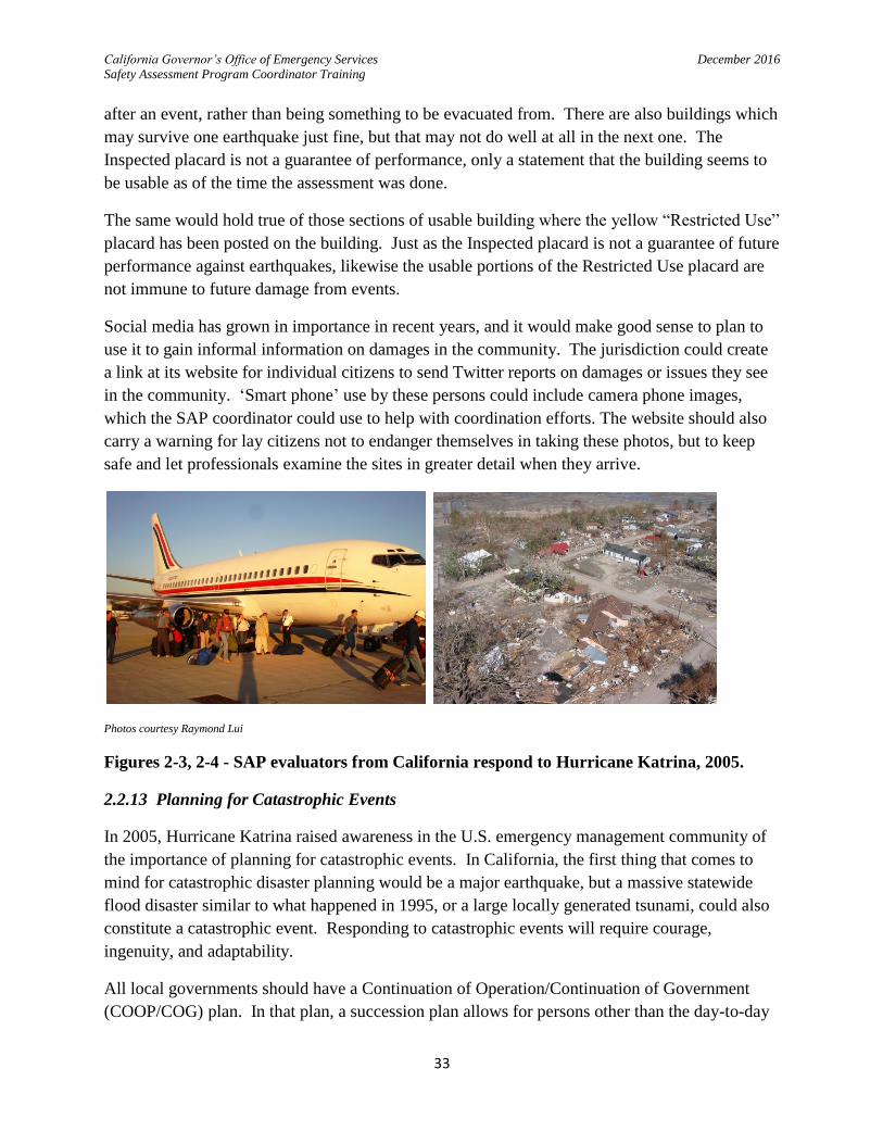
Photos courtesy Raymond Lui
Figures 2-3, 2-4 - SAP evaluators from California respond to Hurricane Katrina, 2005.
2.2.13 Planning for Catastrophic Events
In 2005, Hurricane Katrina raised awareness in the U.S. emergency management community of
the importance of planning for catastrophic events. In California, the first thing that comes to
mind for catastrophic disaster planning would be a major earthquake, but a massive statewide
flood disaster similar to what happened in 1995, or a large locally generated tsunami, could also
constitute a catastrophic event. Responding to catastrophic events will require courage,
ingenuity, and adaptability.
All local governments should have a Continuation of Operation/Continuation of Government
(COOP/COG) plan. In that plan, a succession plan allows for persons other than the day-to-day

California Governor’s Office of Emergency Services December 2016
Safety Assessment Program Coordinator Training
34
primary person to take over in the event that the primary (or immediate successors) are
unavailable for whatever reason. In the very unlikely event that a local government becomes
non-responsive as a whole due to widespread and intense damage, the Operational Area could be
asked by Cal OES to temporarily assist by coordination of safety assessment and other
emergency functions in that affected jurisdiction until the local government stands up again.
As will be discussed later, the number of SAP evaluators that can come to a given jurisdiction
can be limited by the available facilities needed to care for food, shelter, etc. In a catastrophic
event, all the affected communities will be requesting SAP evaluators to one extent or another,
and the number of SAP evaluators actually available may initially be less than what the affected
communities are requesting. In such cases, it becomes necessary to stretch out the assistance
over time. Evaluators would be sent in by Cal OES in waves, on a one-week rotation so the
individuals don’t become exhausted and can make good decisions. More SAP Coordinators can
also be sent in to help manage the SAP evaluators, and the coordinator schedules would overlap
so the previous coordinator could brief the next coordinator on logistics and other important
details.
The local government SAP coordinator may find that the community is best served immediately
by sending out available SAP evaluators in essential facility strike teams only, then moving on to
high rise strike teams, low rise strike teams, and finally the one and two family dwelling strike
teams. This triage might be necessary in order to accomplish the most good in the shortest
period of time with the limited resources available.
Photo courtesy Raymond Lui
Figure 2-5 - SAP evaluators obtain supplies for Katrina response in Baton Rouge. 2005.

California Governor’s Office of Emergency Services December 2016
Safety Assessment Program Coordinator Training
35
It may be necessary early in the emergency to see if supplies can be obtained from nearby
locations, or if the SAP coordinator must send staff outside of the area in order to get supplies.
This was the case in the SAP response to Hurricane Katrina, when SAP evaluators had to get
supplies from Baton Rouge, well outside the area affected by Hurricane Katrina.
Hotels in the area may be nonexistent or in short supply, so the local government may have to
make some unusual or extraordinary arrangements to house and feed the SAP evaluators. In
such cases, SAP evaluators may be asked to bring their own sleeping bags! Buildings that might
otherwise serve as shelters could be used to house them. In response to Hurricane Katrina, some
SAP evaluators were housed in a large bivouac tent, and some were housed and fed in a cruise
ship. When arrangements are not in view, a SAP coordinator might spend most of his or her
time seeking to line up where the evaluators are going to spend the night, and how they will eat!
It can get difficult.
Photos courtesy Raymond Lui
Figures 2-6, 2-7 - Various sleeping arrangements used in the 2005 Hurricane Katrina SAP
response.
Catastrophic disasters often bring out very willing but untrained individuals who want to help.
Cal OES may be able to arrange for on-site SAP evaluator training of building inspectors,
engineers and architects so they could go out the following day after their training to assist. Cal
OES would coordinate these efforts with the Operational Area and with the affected local
governments.
2.2.14 Arrange for Ongoing Training and Exercises
A local government needs to have as many of its building inspectors, licensed civil engineers and
architects trained in safety assessment as possible. Therefore, part of the planning and
preparation for future disasters must include getting staff trained in the Safety Assessment
Program.

California Governor’s Office of Emergency Services December 2016
Safety Assessment Program Coordinator Training
36
Local governments are strongly urged to train their building professional staff, and to open up
such training to licensed civil engineers and architects in the community when possible. Local
governments may also train their own non-credentialed employees, solely for deployment within
their own jurisdiction. However, it is in the jurisdiction’s best interests to keep this use of non-
credentialed staff to a minimum, and only to use those with considerable experience and training
in construction. Non-credentialed staff will not be used in the statewide cadre in California.
It would be good to arrange periodically for a jurisdiction’s SAP evaluators to participate in an
exercise where deployment, reporting, and field evaluation can be done. This could be arranged
with other local jurisdictions and with the Operational Area with good effect.
2.3 Responding to Disaster
2.3.1 Key Personnel and SEMS
As stated earlier, the Building Official or his/her designee must be the SAP coordinator for the
jurisdiction. They report under SEMS to the EOC Construction & Engineering Branch Chief
(who is also over debris management and other technical issues), who reports to the Operations
Chief. The SAP coordinator can provide useful information to the EOC as to the situation status
on the safety assessment response and other particulars within the jurisdiction.
If the EOC is also for the Operational Area, the SAP coordinator may also be acting on behalf of
the Operational Area. Requests from cities and districts within the Operational Area may be
coming in and would be fielded by the Operational Area SAP coordinator, who in turn can
request SAP evaluators from cities and districts within the Operational Area. Once these
resources are exhausted, the Operational Area SAP coordinator would make a request for
additional resources from the Cal OES Regional EOC, who would forward this request to the
statewide SAP coordinator at the State Operations Center for completion.
2.3.2 Needs Assessment
The local government SAP coordinator must conduct a ‘needs assessment’ as soon as possible.
This initial damage review will result in the number of heavily damaged and destroyed buildings,
which can be used to estimate the number of SAP evaluators needed in the field.
This initial damage review is done by means of a ‘windshield survey.’ At least two local
government employees are involved in this, one to drive the vehicle, and the other to write down
simple descriptions of the damage. A city or county will usually need several teams out doing
these, as long as their work is organized and does not overlap. If forms are used, they should be
simple and not require a lot of detail.
The Northridge Earthquake provides historical information that leads to how to estimate the
number of persons needed to respond to a jurisdiction, depending on the number of red and
yellow tagged buildings, and the number of days needed to complete the work.

California Governor’s Office of Emergency Services December 2016
Safety Assessment Program Coordinator Training
37
Jurisdiction January 1994 Days Per City
Total Assigned
Resources by City
Average # of
Resources Assigned Per Day
18 19 20 21 22 23 24 25 26 27 28 29
City of Fillmore 4 14 14 10 8 5 50 10.0
City of Santa Monica
12 12 12 10 10 10 10 10 10 9 96 10.7
City of Santa Clarita
10 10 10 20 20 20 20 20 8 130 16.3
City of Los Angeles
50 50 70 70 160 177 177 177 246 286 296 353 12 2112 176.0
Total Resources Assigned By Day
76 86 106 80 160 177 207 207 284 316 326 363 2388 213
Table 2-1 – Assigned Resources in the Northridge Earthquake
Jurisdiction Red Placards Yellow Placards Green Placards Total Placards % of Red +Yellow Placards
By City
City of Fillmore 198 319 1,532 2,049 25.23
City of Santa Monica
131 382 1,835 2,348 21.85
City of Santa Clarita
15 66 674 755 10.73
City of Los Angeles
1,690 5,715 17,742 25,147 29.45
City of Culver City 30 124 484 638 24.14
TOTALS 2,064 6,606 22,267 30,937 28.02
Table 2-2 – Placard Distribution, Northridge Earthquake
Jurisdiction Days Per City (Column 2)
Assessments Per City
(Column 3)
Assessments Per City Per
Day (Column 4)
(Col. 3/Col. 2)
Number of Assessment
Days (Column 5)
(Col. 3/Col. 4)
Average # of Resources
Assigned Per Day
(Column 6)
Assessments Per Person
Per Day (Column 7)
(Col. 4/Col. 6)
City of Fillmore 5 2,049 410 10.0
City of Santa Monica
9 2,348 261 10.7
City of Santa Clarita
8 755 94 16.3
City of Los Angeles
12 25,147 2,096 176.0
Total 30,299 2861 11 213 13.4
Table 2-3 – Assessments per Day, Northridge Earthquake
When doing the windshield survey, identify damaged buildings that will most likely receive
an Unsafe or Restricted Use placard. Northridge historical records show that the total of
these placards came to about 30 percent of the total number of inspections performed.

California Governor’s Office of Emergency Services December 2016
Safety Assessment Program Coordinator Training
38
Based on the available data, approximately 13 inspections per person per day were
accomplished. Inspections are only done during daylight hours, no night shifts!
The last item that is needed is an estimate of the number of days the inspections will take.
This is a reasonable number that makes sense based upon the scale of the disaster. The
Northridge earthquake took a total of 12 days for SAP evaluators to do their work, although
the number of assessment days came to 11 by calculation due to most jurisdictions not
working part of that period.
The two factors of ‘number of SAP evaluators’ and ‘number of days for inspections’ have an
inverse relationship in the estimate calculations. If not enough inspectors are available, the
‘number of days for inspections’ increases. If more inspectors are available, the ‘number of
days for inspections’ decreases.
The estimate calculations are:
‘Estimated number of Unsafe + Restricted Use placards’ divided by 0.30 = ‘number of
inspections needed.’
(0.30 is 30%)
‘Number of inspections needed’ divided by ‘number of days for inspections’ divided by ‘13
inspections per person per day’ = number of SAP evaluators needed.
With a team of two, the number of inspections per team comes to 26. If 20 minutes is
allowed per house (the most common structure), this calculates to 8 hours 40 minutes of
inspection time. It is not uncommon for teams to be in the field for ten hours a day, which
gives time for lunch and breaks.
Example:
The City of Rosebud, CA has finished its windshield survey and found that there were 1,200
damaged buildings that would probably receive an Unsafe or Restricted Use placard. They
have decided to have the work completed in 14 days. Calculating:
1,200 ‘red and yellow tags’ / 0.30 = 4,000 inspections needed.
4,000 inspections needed / 14 days for inspections / 13 inspections per person per day = 21.9,
use 22 SAP evaluators needed.
Always round up to the nearest even number, so there are teams of two allocated for the
work.
Example:

California Governor’s Office of Emergency Services December 2016
Safety Assessment Program Coordinator Training
39
The City of Alta Vida, CA also has 1,200 damaged buildings worthy of an Unsafe or
Restricted Use placard, but they want to get the work done in 10 days, if there are enough
SAP evaluators to go around.
1,200 ‘red and yellow tags’ / 0.30 = 4,000 inspections needed
4,000 inspections needed / 10 days for inspections / 13 inspections per person per day = 30.8,
use 32 SAP evaluators needed.
Example:
The City of Mount Gabriella, CA, which is closer to the epicenter, has counted 3,756
damaged buildings that would probably get tagged Unsafe or Restricted Use. They would
like to get the work done in 14 days. Calculating:
3,756 ‘red and yellow tags’ / 0.30 = 12,520 inspections needed
12,520 inspections needed / 14 days for inspections / 13 inspections per person per day =
68.8, use 70 SAP evaluators needed.
Example:
The City of Timberlane, CA has 2,350 damaged buildings that could receive an Unsafe or
Restricted Use placard, but needs to be limited to only 30 SAP evaluators because of
available city vehicles. They need to calculate how long it will take to complete the work.
Calculating:
2,350 ‘red and yellow tags’ / 0.30 = 7,833 inspections needed.
Solving for ‘days for inspections:’
7,833 inspections needed / (13 inspections per person per day x 30 SAP evaluators) = 21.75,
or 22 days.
Example:
The City of Resolute has only 850 damaged buildings that might get tagged Unsafe or
Restricted Use, but has the means to provide for only 12 SAP evaluators for rooms and food.
They need to calculate how long it will take to complete the work in their community.
Calculating:
850 ‘red and yellow tags’ / 0.30 = 2,833 inspections needed
Solving for ‘days for inspections:’

California Governor’s Office of Emergency Services December 2016
Safety Assessment Program Coordinator Training
40
2,833 inspections needed / (13 inspections per person per day x 12 SAP evaluators) = 18.16,
or 19 days.
The above examples apply when a jurisdiction is going to perform all Rapid Assessments in
its community, which is by far the most common approach. There may be a need for some
Detailed Assessments of buildings, but these efforts can usually be absorbed using the SAP
evaluator forces at hand. The actual time may take longer as well, due to time spent on the
first day with intake activities, and if aftershocks cause more damage to buildings, requiring
re-assessments.
If a jurisdiction has had minimal damage to structures and wants to have only Detailed
Assessments done, then the calculation for estimating forces would change. Assuming no
other changes, the Detailed Assessment can take three to five times longer than the Rapid
Assessment does. One might use a constant of 3 detailed inspections per person per day
instead of 13, if all Detailed Assessments will be done. Naturally, in such a case there will
be less damage to structures, so there will be fewer inspections required.
2.3.3 Requesting SAP Resources
After roughing out an estimate of the total number of SAP evaluators needed, the makeup of
the strike teams needs to be looked at. After determining the number and type of strike teams
proportioned among the total number of SAP evaluators needed, the SAP coordinator can
arrive at the makeup of the request. Then the request is forwarded to the Operational Area for
handling, as all other requests are under SEMS.
Example:
The SAP coordinator for the City of Timberlane, from the above example, has decided to
have strike teams as follows:
2 – Essential Services strike teams (civil engineers)
1 – High-rise strike team (structural engineers)
2 – Low-rise strike teams (civil engineers, architects or building inspectors)
10 – Dwelling strike teams (civil engineers, architects, or building inspectors)
This makes for a total of 15 teams made up of 2 persons each, total of 30 persons, working a
single day shift each day. No night shifts! Not only is it not feasible to observe all the
building conditions well at night, working at night in a neighborhood affected by disaster is
not safe. There may be dangers caused by the disaster that are hard to see, and the authorities
may have a curfew in place after dark due to looting or other problems.

California Governor’s Office of Emergency Services December 2016
Safety Assessment Program Coordinator Training
41
So, a request for the City of Timberlane will need a minimum of four civil engineers, two
structural engineers, and the 24 others can be mixed. The SAP coordinator has decided it
needs six civil engineers, two structural engineers, four architects, and 18 building inspectors.
Four of the 18 building inspectors come from the City’s own building department, so the
request to the Operational Area will be for 14 building inspectors. The architects will help
round out the request, as they can provide assistance in some of the more historic
neighborhoods in the city, as well as similar technical expertise to what the civil and
structural engineers can bring.
The City of Timberlane also has two SAP coordinators in-house. The Incident Command
System span of control principle encourages optimum management of 5 teams and maximum
of 7 by a single coordinator. So, managing all 15 teams with two coordinators would exceed
this standard. The SAP coordinator taking the lead will also ask for an additional SAP
coordinator under mutual aid to assist; that will result in three SAP coordinators managing
five teams each.
The City of Timberlane has to also provide a location for the SAP evaluators to arrive at.
The SAP coordinator determined that the Department Operations Center (DOC), at 12253
Hasbro Lane in Timberlane, is usable with minor damage from the earthquake, so the SAP
evaluators can report there.
The SAP coordinator for the City of Timberlane makes the following request to the
Operational Area:
“26 SAP evaluators, made up of six civil engineers, two structural engineers, four architects,
and 14 building inspectors, along with one SAP coordinator, to report to 12253 Hasbro Lane,
Timberlane, CA on the next day or day after, as practical.”
The Operational Area now has the choice to see if these resources are available through
mutual aid within the county, the cities, and the special districts of the Operational Area. If
these can be found and dispatched to the City of Timberlane, then the request process is
complete.
However, if the earthquake has damaged cities throughout the Operational Area, and mutual
aid resources are already fully utilized, the Operational Area finds that no mutual aid SAP
evaluators are available within its borders, and forwards the City of Timberlane’s request to
the Cal OES Regional Emergency Operations Center (REOC). The REOC then acts as a
pass-through to forward the request to the Cal OES State Operations Center (SOC).
The statewide SAP coordinator activates the call-down procedure to fill the requests of the
City of Timberlane and the requests of other jurisdictions. He or she hears back from the
partner organizations responsible for the call-downs, and reports back, through the REOC

California Governor’s Office of Emergency Services December 2016
Safety Assessment Program Coordinator Training
42
through the Operational Area to the City of Timberlane, that 26 SAP evaluators and one SAP
coordinator are on their way.
2.3.4 SAP Evaluator Intake
The SAP evaluators are to arrive at the Department Operations Center (DOC) and sign in
with their name, SAP ID number, cell phone number, and date and time of arrival. A form
for this purpose is in the Appendix of this manual.
Photo courtesy David Karina
Figure 2-8 - Deputizing of SAP evaluators, 2010 Baja Earthquake.
The SAP evaluators need to be deputized so they can post official placards of the jurisdiction
and otherwise represent the jurisdiction. This can be done by a jurisdictional clerk; in some
jurisdictions, the Building Official can administer the oath. A SAP coordinator can verify
who can do this by asking the jurisdiction’s legal counsel, if there are questions.
There must be a morning briefing each day. The briefing on the first day of the work will be
different from the others in several ways: the SAP evaluators will be assigned into strike
teams, they will all receive a briefing packet, hear an overview of the situation status by the
SAP coordinator, and watch the SAP refresher video. Then they will be assigned their
equipment and given their field assignments.

California Governor’s Office of Emergency Services December 2016
Safety Assessment Program Coordinator Training
43
Photo courtesy Raymond Lui
Figure 2-9 - Team ‘grounding,’ 2005 Hurricane Katrina response.
It is recommended on the first day that the coordinator also takes the entire group out to a
nearby damaged building and go over how the building could be evaluated, so all can hear
the same information. This method, called ‘grounding,’ was used with success in the
response to Hurricane Katrina.
The briefing packets will have critical phone numbers for the Building Official, law
enforcement, fire, hazardous materials response, utilities, and animal control. (If anyone’s
phone number should be on the placards, it would be the Building Official’s office number.)
The SAP coordinator’s desk and cell phone numbers will also be in the packet, if the
coordinator is someone different from the Building Official. The briefing packet will also
contain any necessary travel expense claim forms, and a map of the area.
The SAP refresher video is a DVD that can be shown on a flat screen TV, by means of an
LCD projector, or on a computer screen, if necessary. It serves to remind the SAP evaluators
of their responsibilities in the field, and also of what they should be careful to avoid. SAP
coordinators are issued these at the time of their training. They are available from Cal OES
upon request.
The DOC should have a seating arrangement so all can be seated during briefings. There
should be an information board, as well as a ‘white board’ or chalk board so assignments can
be shown. The information board can be where the progress map can be displayed, or that
can be set up separately, such as on a tripod or another wall in the room.

California Governor’s Office of Emergency Services December 2016
Safety Assessment Program Coordinator Training
44
2.3.5 SAP Evaluator Coordination
The SAP coordinator must make assignments for the various strike teams. If damage in the
jurisdiction is widespread, then the Dwelling strike teams can be given a series of city or
community blocks or roads to work. If damage is scattered, then Dwelling strike teams can
be given lists of addresses reporting damage, along with a local driver. If any of the teams
has a working GPS device with them, a local driver may not be necessary.
The SAP coordinator must make sure that the teams all have enough work to do to carry
them through the day.
Before sending the teams out, they must be assigned a package of equipment, including
placards, assessment forms, caution tape, etc. A suggested list of this equipment can be
found in Section 2.2.3 of this manual. The equipment needs to be tracked so the individual
sets can be received back after the activation and restocked.
If the teams are going into areas where they could be exposed to danger from elements in the
community, or if there have been reports from earlier teams of efforts to bribe or physically
confront SAP evaluators, then it would be a good idea to include a uniformed law
enforcement officer to accompany the strike teams as necessary.
The jurisdiction can arrange for transportation in several ways. Jurisdiction vehicles can lend
proper official presence to the process, and will be especially useful if these are equipped
with communications equipment. The jurisdiction may also use a van to drop off teams in
key locations for the day, if there is a lot of work to be done in the area. Or, the teams can
travel to the affected areas using some of the vehicles they came in.
The teams need to check in with the SAP coordinator every 90 minutes to 2 hours. This is to
confirm that the teams are not in any trouble in the field, and to quickly discuss any problems
that they may be having. If such can be quickly handled over the phone or by text
messaging, it will help speed progress along. These routine call-ins are also an opportunity
to update the SAP coordinator on progress.

California Governor’s Office of Emergency Services December 2016
Safety Assessment Program Coordinator Training
45
Photo courtesy David Karina
Figure 2-10 - Building official conducting daily briefing with SAP evaluators, 2010 Baja
Earthquake.
There needs to be a briefing in the morning every day of the deployment. The morning
briefing will review at least the following:
Accounting for all SAP evaluators.
Safety issues are reviewed.
Situation status of the disaster and the SAP response progress are reviewed, including
status of monitor buildings.
Action plan objectives for the next 24 hour period, with a review of long-term
objectives.
Review of assignments and new assignments.
Brief questions from SAP evaluators.
As discussed previously in Section 2.2.8, the Building Official can identify a number of
buildings as monitor buildings, to observe the effects of aftershocks on common types of
structures in the community. The SAP coordinator needs to arrange for evaluation of these
structures after major aftershocks, and to do routine monitoring during the early periods of
daily lower magnitude aftershocks. Of course, a weather pattern of strong winds after a
major earthquake can do much of the same damage to weakened structures as aftershocks
can, so this can be taken into consideration by the SAP coordinator as needed.
As the safety assessment work progresses, or as repairs commence after the SAP evaluation
work is done, some of the placards may need to be changed out. SAP evaluators are acting

California Governor’s Office of Emergency Services December 2016
Safety Assessment Program Coordinator Training
46
on behalf of the local building department if they are deputized, and these can replace
placards if conditions become either more dangerous or less so. (For an example of the
latter, a building may initially be found with a hazardous materials spill inside, warranting an
Unsafe placard. Then, a few days later, cleanup of the spill has taken place, and the building
otherwise has no other issues, so the placard could be changed to Inspected.) SAP
evaluators, and the local building inspectors who continue their work after the SAP
deployment is done, need to make sure that the old, obsolete placards are removed before the
new ones are put up. Otherwise, the building occupants and the public at large will be
confused as to the intent of the placards. This can lead to a dangerous, dismissive attitude by
the public towards the placards if the intent of the placards is not clear due to two or more
different placards being posted on the same building.
Photo courtesy David Karina
Figure 2-11 - SAP Coordinator conducting daily debriefing, 2010 Baja Earthquake.
The SAP evaluators need to return to the DOC at the end of each day to be debriefed. If
paper Rapid or Detailed Assessment Forms are being used, these need to be handed in, and
the SAP coordinator and/or assistants need to review them with the individual evaluators to
make sure that all the pertinent information is on the forms. If electronic versions such as
those available for ‘smart phones’ are being used, the forms will be either sent to the DOC
throughout the day, or will be downloaded when the SAP evaluators return to the DOC in the
evening. In either case, the electronic forms will still need to be reviewed by the SAP
coordinator, and the SAP evaluator responsible for preparing them must be available in the
evening to answer questions about the forms. This needs to be done each day, while the SAP
evaluator is still able to remember what was done in the field that day. Whatever approach is
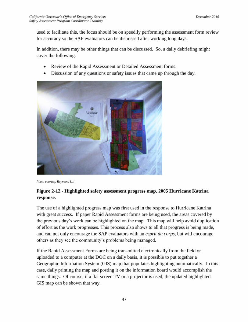
California Governor’s Office of Emergency Services December 2016
Safety Assessment Program Coordinator Training
47
used to facilitate this, the focus should be on speedily performing the assessment form review
for accuracy so the SAP evaluators can be dismissed after working long days.
In addition, there may be other things that can be discussed. So, a daily debriefing might
cover the following:
Review of the Rapid Assessment or Detailed Assessment forms.
Discussion of any questions or safety issues that came up through the day.
Photo courtesy Raymond Lui
Figure 2-12 - Highlighted safety assessment progress map, 2005 Hurricane Katrina
response.
The use of a highlighted progress map was first used in the response to Hurricane Katrina
with great success. If paper Rapid Assessment forms are being used, the areas covered by
the previous day’s work can be highlighted on the map. This map will help avoid duplication
of effort as the work progresses. This process also shows to all that progress is being made,
and can not only encourage the SAP evaluators with an esprit du corps, but will encourage
others as they see the community’s problems being managed.
If the Rapid Assessment Forms are being transmitted electronically from the field or
uploaded to a computer at the DOC on a daily basis, it is possible to put together a
Geographic Information System (GIS) map that populates highlighting automatically. In this
case, daily printing the map and posting it on the information board would accomplish the
same things. Of course, if a flat screen TV or a projector is used, the updated highlighted
GIS map can be shown that way.

California Governor’s Office of Emergency Services December 2016
Safety Assessment Program Coordinator Training
48
The SAP coordinator must be on guard against efforts by well-meaning jurisdictional
executives to shortcut the safety assessment process. One such mistake made on rare
occasions by local government executives is to direct that all remaining buildings that are
ready for use not be placarded with the green Inspected placard.
The primary purpose of the Safety Assessment Program is to help people return to their
usable structures as quickly and safely as possible. If the building is not identified as having
been evaluated and found to be usable, how will the public know if they can use the
building?
Moreover, there have been times, such as in the Nisqually earthquake response in
Washington State, when such a policy was used, and the evaluators there ended up
duplicating efforts by mistakenly evaluating the same buildings several times because there
was no placard on them!
If a SAP coordinator is facing this sort of short-cutting effort in his or her jurisdiction, and is
unsuccessful in persuading the executives there to continue tagging Inspected buildings, a
call or email to the statewide SAP coordinator may be helpful. Contact information is
available at the SAP website.
2.3.6 Record Keeping
All of the assessment forms generated by the SAP evaluators are the property of the
jurisdiction. They are essential for the following reasons:
They constitute a record of what was accomplished in the field to clear buildings for
use and to identify the need for repairs.
They are necessary as a starting point for follow up by the building department to
make sure that required repairs are done before occupancy of Unsafe-posted
buildings, or unsafe parts of Restricted Use-posted buildings, are allowed.
Once paper assessment forms are received at the end of each day, they are entered the
following day into an appropriate database. If no such database is available, a spreadsheet
can be used to capture the information. There is an Excel spreadsheet for that purpose at the
SAP website at the “SAP Forms” link.
The SAP coordinator will need to arrange for local staff to assist with data entry. This
information can also be highlighted on the progress map.
If the forms are being produced electronically, then it is possible that the information might
be set up so it fills into the database automatically as it downloads to the computer at the
DOC. The SAP coordinator can discuss this with jurisdiction IT people to see if this is
feasible. Otherwise, the electronically produced forms will need to be read and entered into
the database like the paper forms are.

California Governor’s Office of Emergency Services December 2016
Safety Assessment Program Coordinator Training
49
The jurisdiction may choose to scan the paper forms into pdf format so they can be kept in an
electronic file for convenient future use.
Once the SAP deployment is over and all the information has been entered into the database,
Cal OES needs to receive a copy of it. This will be used primarily for historical and research
purposes; for example, there are agencies such as the State of California Seismic Safety
Commission that will be interested in seeing how the structures performed in the earthquake
as a whole, which will help with their mandate to improve the seismic safety of structures in
California.
2.3.7 Call Center and Public Input
There will be a need for local government to staff a call center even before the SAP
evaluators are requested. Affected citizens will have many issues, from building damage to
compromised utilities to roaming large dogs. Naturally, these will not be the emergency calls
that should go to 911 and be handled by first responders, but will nevertheless need to be
managed by the jurisdiction in one way or another.
A call center for issues related to building damage and safety assessment can be arranged at
the DOC if it is convenient to do so. (If the DOC does not have the line capacity to have this
operation there, the call center for building department issues will need to be where it best
serves the public need.) The number of people to staff this will depend on the size of the
community and the degree of damage.
The building department call center should receive calls about building safety, requesting
safety evaluations, questions on how to get placards changed, permits for earthquake repair,
and so on. It could be that at least some of the buildings needing safety assessment will be
identified by a phone call from the public, so the call center should work closely with the
SAP coordinator so these can be assigned.
If a link at the local government website allows for social media input by Twitter or other
methods, that will help a good deal with additional input on where there is damage that needs
attention. The call center may be assigned to watch for input from the public in this manner
and relay the information to the SAP coordinator.
2.3.8 Demobilization and Handoff
Once the SAP evaluators have finished their five-day assignment, or if the work is done
before then, the SAP evaluators need to meet back at the DOC to demobilize. At that time,
the SAP coordinator needs to see to it that the following takes place:
Account for all the SAP evaluators.
Obtain all remaining assessment forms, and review them with the appropriate SAP
evaluators.

California Governor’s Office of Emergency Services December 2016
Safety Assessment Program Coordinator Training
50
Retrieve all the equipment sets that were assigned to the SAP teams.
Accept any travel expense claim forms and receipts, if these are available from the
evaluators (otherwise, they will need to mail these to the jurisdiction).
Brief the SAP evaluators on safety issues regarding leaving the jurisdiction.
Thank them all for coming to assist!
In addition to thanking the SAP evaluators for their assistance, the jurisdiction needs to send
a letter to each of them doing the same thing. The jurisdiction also needs to reimburse them
as quickly as possible for their expenses.
If the SAP deployment is necessary for a longer period than five days (which is not unusual),
then another group, or ‘wave,’ of SAP evaluators will come in to replace the ones that just
finished up. There should also be replacement SAP coordinators to come in with the next
group as well. There needs to be an effective handoff of information between the first SAP
coordinator and the next.
In order for this to take place, the first SAP coordinator needs to stay long enough to meet
with the next SAP coordinator to apprise him or her of the situation and other necessary
issues. The following are examples of what should be discussed, though there may be more
subjects than these:
SAP response situation status (including strike team status).
Tasks remaining to be done.
Equipment and supplies status.
Transportation status.
Communication systems in place, including phone lists, computer access, and any
local government radios being used.
DOC facilities.
Arrangements for rooming and food for the next wave of SAP evaluators.
Once all the SAP evaluations are done, then the work is complete and the SAP coordinators
can demobilize.
2.4 Building Safety Related Issues
2.4.1 Collapse Zones
A difficult question that faces building officials is: how far back should a barricade or cordon
be placed around an unstable building? There are good examples to consider for general
public safety which were learned from the fire service.
Fire fighters face grave danger from weakening structures. Structures have often collapsed
while fires are being fought. Incident Safety Officers are trained to watch for signs of

California Governor’s Office of Emergency Services December 2016
Safety Assessment Program Coordinator Training
51
imminent building collapse so as to advise the Incident Commander to fall back to a
defensive posture and establish a collapse zone from which to work. (Defensive fire fighting
means the building is lost, and fire fighters are protecting structures around the burning
structure from being lost as well.)
Buildings may collapse in several ways, but the most common observed by fire fighters is a
90 degree collapse, where the external wall, or even the building, rotates and lays flat.
Incident Commanders know that it is too late to plan for this worst-case scenario once the
structure starts to fall, so the collapse zone is established to protect fire fighters and others on
the scene from certain death or injury.
In 1999, the National Institute for Occupational Safety and Health (NIOSH) published
“Preventing Injuries and Deaths of Fire Fighters due to Structural Collapse.” This publication
said that the collapse zone should be at lease the height of the structure, plus some room for
the debris to scatter.
In considering a collapse zone for World Trade Center Building 7 in 2001, the Incident
Commander established the approximate height of the 47 story building, or 600 feet, as the
radius for the collapse zone.
In observed records starting in 2002, in its Fire Fighter Fatality Investigations, NIOSH began
recommending that Incident Commanders use a standard of 1.5 times the building height to
establish the collapse zone. This radius allows room for the structure to collapse, and the
high velocity debris broken loose by the collapse (such as bricks, parapet pieces, gargoyles)
from hurting others. (The example NIOSH uses is that of a 20 foot high structure needing a
collapse zone of 30 feet.) NIOSH continues to advocate this recommendation to this day.
Fire fighting forces around the U.S. now regard this standard as the definition of a collapse
zone. One example is that of the Los Angeles Fire Department, which at its website posts the
definition of a collapse zone as 1.5 times the height of the building. Other references found
in fire fighting training from around the country consider this to be the standard definition of
a collapse zone.
One reference, Safe and Effective Fireground Operations by Ben Klaene, states that “any
collapse zone that is closer than the building’s height plus an allowance for debris scatter –
usually one and a half times the building’s height – is a calculated risk and the IC [Incident
Commander] must ask whether the expected benefit is worth the risk.” (Mr. Klaene is the
co-author of the book Structural Firefighting: Strategy and Tactics.)
The 2009 NIOSH publication Preventing Deaths and Injuries of Fire Fighters When
Fighting Fires in Unoccupied Structures notes “NIOSH recommends that a collapse zone be
equal to the height of the building plus allowance for scattering debris – usually, at least 1.5
times the height of the building [Fire Fighter’s Handbook 2000].”

California Governor’s Office of Emergency Services December 2016
Safety Assessment Program Coordinator Training
52
It is clear from this history that the NIOSH standard for collapse zones is not new in
California or elsewhere.
It is observed that some buildings weakened by earthquake forces, notably base shear and
overturning forces, have not collapsed immediately, but have failed structurally after several
days of damage from ongoing aftershocks. Communities with earthquake damaged
structures face similar threats to that of fire fighters from collapsing structures.
Building officials are in the position to protect lives from those buildings threatening collapse
by cordoning a collapse zone around them. The California Safety Assessment Program
identifies buildings that are unsafe due to various reasons, including the threat of a building,
landslide or another object falling on them. This approach was used successfully in response
to a damaged water tower in El Centro after the April 4, 2010 Baja Earthquake.
Building officials may choose to follow the proven example of fire fighters in cordoning a
collapse zone that protects the public in the same manner that fire fighters are protected, with
a collapse zone of 1.5 times the height of the building. History has shown that this standard
provides the best protection against injury and death from collapsing structures.
Building officials may also choose themselves to go a different route; after all, Cal OES’s
recommendations are only that. If so, they must seriously examine the question of risk to
human life by doing something less than what NIOSH recommends, as the observation by
Ben Klaene above noted.
Cal OES recommends that the NIOSH standard of a collapse zone and cordoning radius of
1.5 times the building height continues to be used in the Safety Assessment Program with
respects to unsafe buildings in danger of collapse. It may be true that some buildings may
fail in other ways, but this approach provides the best method of securing the safety of the
public at large. This standard is also honored by practical use, as opposed to other methods
proposed by various entities.

California Governor’s Office of Emergency Services December 2016
Safety Assessment Program Coordinator Training
53
Photo courtesy David Karina
Figure 2-13 - Barricades in Calexico after the 2010 Baja Earthquake.
2.4.2 Barricades
Barricades are often installed to keep the public away from localized dangerous conditions,
such as a building overhang or parapet that is in danger of falling. Such barricades may
consist of wooden sawhorse-type barricades with caution tape run between them. Other
barricades may be more formidable, such as those designed to hold back falling rocks or
building debris from public right-of-way.
SAP evaluators can call for barricades on their Rapid Assessment Forms. They can also
barricade off hazards to some degree themselves by using the yellow caution tape provided
by the local government.
Barricades can be installed to define the collapse zones of tall structures that have been
weakened by an earthquake or other event. They may end up being replaced by a cordon
fence if the hazard warrants it. It can be advisable to mark the location of the barricades with
spray paint so the public is discouraged from moving the barricades unsafely.
Cal OES recommends the collapse zone distance described in Section 2.4.1 and
recommended by NIOSH as the distance from a dangerous building to place a barricade.

California Governor’s Office of Emergency Services December 2016
Safety Assessment Program Coordinator Training
54
Photos courtesy Jim C. Barnes
Figures 2-14, 2-15 - Shipping containers used as barricades in parking lot, New
Zealand.
Photo courtesy Jim C. Barnes
Figure 2-16 – Containers used to protect coastal highway from rock falls, New Zealand.
In New Zealand, authorities used steel shipping containers to form sturdy barricades to
prevent rocks from falling into roadways, or to hold back falling debris from buildings. This
is an interesting and useful innovation worth copying, as they were very effective. Several
examples are shown in the photos. The containers lock together at the corners with steel
pins, so the overall construction is very sturdy.

California Governor’s Office of Emergency Services December 2016
Safety Assessment Program Coordinator Training
55
Photo courtesy Jim C. Barnes
Figure 2-17 - Shipping container retrofitted to serve as a debris shed. Christchurch,
New Zealand.
Shipping containers were also used as debris sheds so buildings with damaged masonry
could be entered through them. These particular containers had interior braces installed, and
were topped with bales of hay so as to cushion the blow of the falling masonry. The debris
sheds were then hoisted by crane and placed so someone could walk through them to the
building doorway without the danger of being struck by falling debris.
Each jurisdiction will need to decide what sort of barricade system is best for their
community, how many, and for how long. For example, some communities would prefer to
have reminders of the earthquake removed as quickly as possible, once the safety hazards are
abated. Some barricade systems could become targets of graffiti as well.

California Governor’s Office of Emergency Services December 2016
Safety Assessment Program Coordinator Training
56
Photo courtesy Jim C. Barnes
Figure 2-18 - Cordon fence near collapsed CTV Building, Christchurch, New Zealand.
2.4.3 Cordoning Unsafe Structures
The local government building department is often in the position of advising on when to
cordon off sections of a jurisdiction from the public, so a discussion is relevant in this
manual. Safety assessment decisions often provide information to a Building Official that
lead directly to decisions on cordoning and stabilization.
Powerful earthquakes, tsunamis, and other natural and man-made disasters can render large
sections of building stock dangerous to be around. Those who used these buildings in the
past, and the public at large, need to be protected from the dangerous conditions caused by
debris and unstable structures.
Cordoning was used:
In downtown Santa Cruz after the 1989 Loma Prieta earthquake.
In the Marina district in San Francisco after the 1989 Loma Prieta earthquake.
In Oklahoma City at the Murrah Federal Building after the 1995 terrorist bombing.
In New York at the World Trade Center site after the 2001 terrorist attack.
In downtown Paso Robles after the 2003 San Simeon earthquake.
In Christchurch, New Zealand after the 2010 and 2011 Canterbury earthquakes.
In Santa Cruz Harbor after the 2011 tsunami.
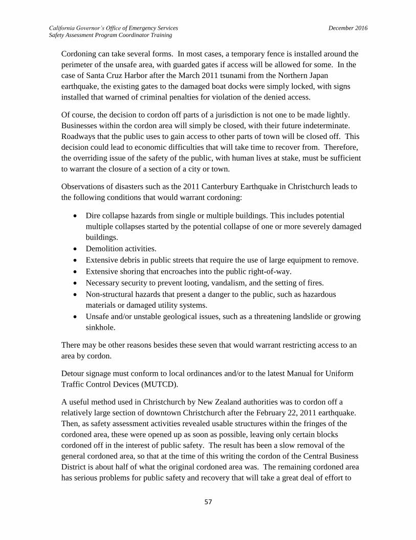
California Governor’s Office of Emergency Services December 2016
Safety Assessment Program Coordinator Training
57
Cordoning can take several forms. In most cases, a temporary fence is installed around the
perimeter of the unsafe area, with guarded gates if access will be allowed for some. In the
case of Santa Cruz Harbor after the March 2011 tsunami from the Northern Japan
earthquake, the existing gates to the damaged boat docks were simply locked, with signs
installed that warned of criminal penalties for violation of the denied access.
Of course, the decision to cordon off parts of a jurisdiction is not one to be made lightly.
Businesses within the cordon area will simply be closed, with their future indeterminate.
Roadways that the public uses to gain access to other parts of town will be closed off. This
decision could lead to economic difficulties that will take time to recover from. Therefore,
the overriding issue of the safety of the public, with human lives at stake, must be sufficient
to warrant the closure of a section of a city or town.
Observations of disasters such as the 2011 Canterbury Earthquake in Christchurch leads to
the following conditions that would warrant cordoning:
Dire collapse hazards from single or multiple buildings. This includes potential
multiple collapses started by the potential collapse of one or more severely damaged
buildings.
Demolition activities.
Extensive debris in public streets that require the use of large equipment to remove.
Extensive shoring that encroaches into the public right-of-way.
Necessary security to prevent looting, vandalism, and the setting of fires.
Non-structural hazards that present a danger to the public, such as hazardous
materials or damaged utility systems.
Unsafe and/or unstable geological issues, such as a threatening landslide or growing
sinkhole.
There may be other reasons besides these seven that would warrant restricting access to an
area by cordon.
Detour signage must conform to local ordinances and/or to the latest Manual for Uniform
Traffic Control Devices (MUTCD).
A useful method used in Christchurch by New Zealand authorities was to cordon off a
relatively large section of downtown Christchurch after the February 22, 2011 earthquake.
Then, as safety assessment activities revealed usable structures within the fringes of the
cordoned area, these were opened up as soon as possible, leaving only certain blocks
cordoned off in the interest of public safety. The result has been a slow removal of the
general cordoned area, so that at the time of this writing the cordon of the Central Business
District is about half of what the original cordoned area was. The remaining cordoned area
has serious problems for public safety and recovery that will take a great deal of effort to
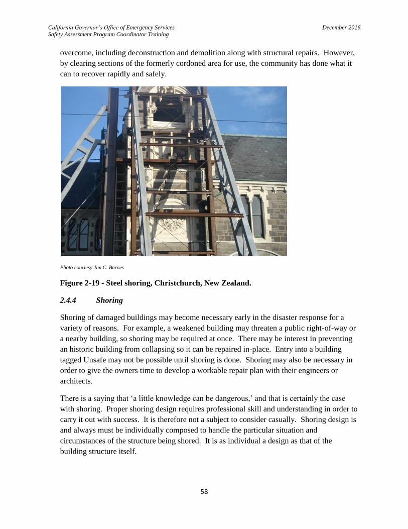
California Governor’s Office of Emergency Services December 2016
Safety Assessment Program Coordinator Training
58
overcome, including deconstruction and demolition along with structural repairs. However,
by clearing sections of the formerly cordoned area for use, the community has done what it
can to recover rapidly and safely.
Photo courtesy Jim C. Barnes
Figure 2-19 - Steel shoring, Christchurch, New Zealand.
2.4.4 Shoring
Shoring of damaged buildings may become necessary early in the disaster response for a
variety of reasons. For example, a weakened building may threaten a public right-of-way or
a nearby building, so shoring may be required at once. There may be interest in preventing
an historic building from collapsing so it can be repaired in-place. Entry into a building
tagged Unsafe may not be possible until shoring is done. Shoring may also be necessary in
order to give the owners time to develop a workable repair plan with their engineers or
architects.
There is a saying that ‘a little knowledge can be dangerous,’ and that is certainly the case
with shoring. Proper shoring design requires professional skill and understanding in order to
carry it out with success. It is therefore not a subject to consider casually. Shoring design is
and always must be individually composed to handle the particular situation and
circumstances of the structure being shored. It is as individual a design as that of the
building structure itself.
California Governor’s Office of Emergency Services December 2016
Safety Assessment Program Coordinator Training
59
Emergency shoring in order to conduct search and rescue operations is generally exempt
from design review; U.S. Urban Search and Rescue teams have a professional engineer as
part of their task force in order to design and oversee such shoring operations. Even the
design parameters for this activity are daunting. The material found at FEMA’s website on
this subject at http://www.fema.gov/pdf/emergency/usr/usr_23_20080205_rog.pdf
emphasizes this. A great deal of expertise is involved regarding estimating the weight of
construction materials being shored, the capacity and configuration of wood and steel
members, beam slenderness ratios of no more than 1 to 25, and bearing capacities of
surfaces. Shoring to resist horizontal forces of 10% gravity is also recommended.
However, the case of the immediate shoring needed to keep rubble from collapsing while a
search for survivors is done is not the same situation as shoring a building to prevent collapse
while being repaired, and a higher standard is needed. The degree of design review required
also depends on if the building will only be occupied by construction workers, or if a wider
use is anticipated that requires a temporary occupancy permit while the repairs are
completed.
When no occupancy is expected while detailed evaluations or engineering evaluations are
being done, the jurisdiction may allow qualified general engineering, shoring contractors, and
building moving contractors to design and construct shoring as they would be permitted in
the staging of a construction project (see CA Business and Professions Code Section 5537.2).
If construction workers will be on site, and when such shoring involves work of 36 feet or
more in height, Cal OSHA requires plans sealed by a licensed California civil engineer and a
Cal OSHA permit before work can commence. Cal OSHA regulations (Title 8, Subchapter
4, Article 29, Section 1717(b)(1)) says that calculations and working drawings shall be
approved and signed by a California civil engineer for all falsework or vertical shoring
installations when any of the following conditions exist:
The height from the sill plate to the soffit of the superstructure exceeds 14 feet.
Individual horizontal spans exceed 16 feet.
Provisions for vehicular traffic through the falsework or vertical shoring are made.
For all falsework and vertical shoring installations not covered by the above provisions, the
falsework or shoring layout shall be approved and signed by one of the following:
A civil engineer currently registered in California.
A (shoring) manufacturer’s authorized representative.
A license contractor’s representative qualified in the usage and erection of falsework
and vertical shoring.
A jurisdiction may handle a request for a temporary occupancy permit of a building with
shoring by viewing the shoring as a temporary structure, therefore subject to Section 108 of

California Governor’s Office of Emergency Services December 2016
Safety Assessment Program Coordinator Training
60
the California Building Code. In that case, a review of the shoring structural design by a
California licensed civil engineer would invariably be a requirement. The repairs would have
to be completed within the 180 days allowed by the temporary structure permit, unless an
extension is granted by the jurisdiction.
In the face of an ongoing emergency response, local governments may find they need to take
on stabilization measures themselves to protect the public and publicly owned structures.
Property owners may also want to take some limited shoring measures themselves to
stabilize threats and minimize additional losses or casualties. Since local governments will
be taxed trying to apply limited resources to the emergency situation, they may opt to oversee
the designs of only those shoring efforts that show the most serious disregard for public
safety, while using their discretion with the rest of the layman efforts.
Jurisdictions may find it expedient to provide permit exemptions by class or dollar value for
disaster related permitting, and retroactive permits and inspections may also be part of a
jurisdiction’s compromise response to a difficult situation.
An interesting use of steel shipping containers in New Zealand was to use them to shore up
the side of a masonry structure. Again, a noteworthy concept that could be used for low-rise
buildings in California with the right situation, such as the room to stack the containers.
There are many fine guides on shoring practice and principles. One public document is
Temporary Shoring & Stabilization of Earthquake Damaged Historic Buildings by Roy W.
Harthorn, from which many of the aforementioned observations are derived.

California Governor’s Office of Emergency Services December 2016
Safety Assessment Program Coordinator Training
61
Photo courtesy Jim C. Barnes
Figure 2-20 - Shipping containers used to shore up masonry building in Christchurch,
New Zealand.
2.4.5 Repair versus Demolition and Replacement
Demolition is a process that normally involves obtaining permission from the building
owner, and various ‘hold harmless’ and other legal documents must be finalized before the
demolition contractor can be turned loose on the project. If a building is threatening to
collapse into a public right-of-way, or is otherwise constituting a threat, and the building
owner is unavailable, the jurisdiction (on advice of legal counsel) may elect to demolish the
building under exigent conditions and bill the building owner for the trouble.
Unless a weakened structure is a clear and present danger to the public, the decision to repair
or demolish a building is largely an economic one. There are usually many ways to repair a
structure, and various cost-effective designs may be considered. However, when it is more
cost-effective to demolish the building, haul the debris away or recycle it, and build a new
building to replace it, demolition of the building becomes attractive.
As a matter of history in California, most buildings that are tagged Unsafe end up being
repaired rather than demolished and replaced.
2.4.6 Engineering Evaluation
ATC-20 lists the Engineering Evaluation as the final kind of evaluation to be done after a
disaster. This effort would be by the building owner’s hired engineer or architect, who
California Governor’s Office of Emergency Services December 2016
Safety Assessment Program Coordinator Training
62
would be responsible for designing a repair scheme for the building. The engineering
evaluation would include opening up wall and ceiling cavities to examine key structural
supports and bracing, and other necessary activities which are outside the scope of the Rapid
or Detailed Evaluations performed by SAP evaluators.
Currently, there is not much guidance from ATC on how this is to be conducted. ATC
intends to eventually produce a formal guide on engineering evaluation which will lend
assistance to these efforts. In the meantime, engineers and architects assigned this task by
their clients will continue to apply the craft of their profession in determining the nature and
extent of building damage and the extent of repair and code upgrades necessary for gaining
formal occupancy of their client’s building from the jurisdiction.
2.5 Conclusion
There is a great deal of information contained in this manual; it is hoped that much of it will
prove to be useful for those who are involved in safety assessment planning and response.
Some of the recommendations will be easier to accomplish in some communities than in
others. Local governments must determine what is most useful and feasible for them to
apply. Nevertheless, this overview of safety assessment coordination practices should be a
useful resource for building officials and emergency managers who have the responsibility to
identify usable or dangerous buildings in their communities.
The following Appendix contains basic forms for managing the SAP coordination. It also has
the CALBO sample placard adoption ordinance, and a suggested ‘notice to homeowners’ that
could be used in a jurisdiction, which are included for reference. There is also the SAP
Coordinator Job Aid, a checklist approach to preparing for, responding to, and demobilizing
from an event. Finally, there is the SAP MOU, and FEMA’s Disaster Assistance Policy
9523.2.

California Governor’s Office of Emergency Services December 2016
Safety Assessment Program Coordinator Training
63
APPENDIX

California Governor’s Office of Emergency Services December 2016
Safety Assessment Program Coordinator Training
64
SAP Evaluator Deployment Tracking Form
Jurisdiction:___________________________________Phone #:__________________
Address:_________________________________________Fax #:__________________
Contact Name_______________________________E-mail:______________________
Name Specialty Organization SAP ID#
Date Time Signed In
Time Signed Out

California Governor’s Office of Emergency Services December 2016
Safety Assessment Program Coordinator Training
65
SAP Field Information Form
Jurisdiction:___________________________________Phone #:__________________
Address:_________________________________________Fax #:__________________
Contact Name_______________________________E-mail:______________________
Type (R=Res,
C=Comm)
Address City or Town
Damage Description Posted Placard (G,Y,R)
Comments % Est. Loss

California Governor’s Office of Emergency Services December 2016
Safety Assessment Program Coordinator Training
66

California Governor’s Office of Emergency Services December 2016
Safety Assessment Program Coordinator Training
67

California Governor’s Office of Emergency Services December 2016
Safety Assessment Program Coordinator Training
68

California Governor’s Office of Emergency Services December 2016
Safety Assessment Program Coordinator Training
69

California Governor’s Office of Emergency Services December 2016
Safety Assessment Program Coordinator Training
70

California Governor’s Office of Emergency Services December 2016
Safety Assessment Program Coordinator Training
71

California Governor’s Office of Emergency Services December 2016
Safety Assessment Program Coordinator Training
72

California Governor’s Office of Emergency Services December 2016
Safety Assessment Program Coordinator Training
73

California Governor’s Office of Emergency Services December 2016
Safety Assessment Program Coordinator Training
74
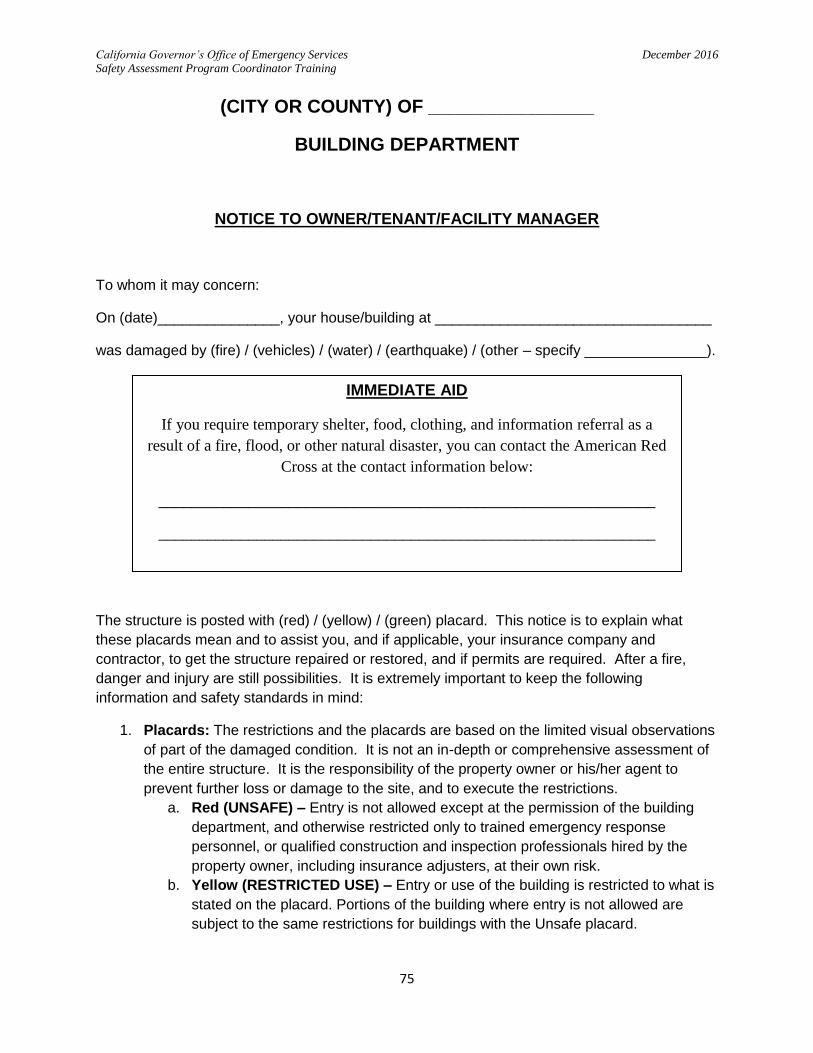
California Governor’s Office of Emergency Services December 2016
Safety Assessment Program Coordinator Training
75
(CITY OR COUNTY) OF ________________
BUILDING DEPARTMENT
NOTICE TO OWNER/TENANT/FACILITY MANAGER
To whom it may concern:
On (date)_______________, your house/building at __________________________________
was damaged by (fire) / (vehicles) / (water) / (earthquake) / (other – specify _______________).
The structure is posted with (red) / (yellow) / (green) placard. This notice is to explain what
these placards mean and to assist you, and if applicable, your insurance company and
contractor, to get the structure repaired or restored, and if permits are required. After a fire,
danger and injury are still possibilities. It is extremely important to keep the following
information and safety standards in mind:
1. Placards: The restrictions and the placards are based on the limited visual observations
of part of the damaged condition. It is not an in-depth or comprehensive assessment of
the entire structure. It is the responsibility of the property owner or his/her agent to
prevent further loss or damage to the site, and to execute the restrictions.
a. Red (UNSAFE) – Entry is not allowed except at the permission of the building
department, and otherwise restricted only to trained emergency response
personnel, or qualified construction and inspection professionals hired by the
property owner, including insurance adjusters, at their own risk.
b. Yellow (RESTRICTED USE) – Entry or use of the building is restricted to what is
stated on the placard. Portions of the building where entry is not allowed are
subject to the same restrictions for buildings with the Unsafe placard.
IMMEDIATE AID
If you require temporary shelter, food, clothing, and information referral as a
result of a fire, flood, or other natural disaster, you can contact the American Red
Cross at the contact information below:
_____________________________________________________________
_____________________________________________________________

California Governor’s Office of Emergency Services December 2016
Safety Assessment Program Coordinator Training
76
c. Green (INSPECTED) – Entry is not limited, building appears usable as of the
date and time when the inspection was made.
d. The owner/agent shall employ a qualified registered professional to provide an
in-depth evaluation of the damage and submit a report to the Building
Department to request a different placard and/or use of building if desired.
2. Repair or reconstruction will require building permits in accordance with the current
edition of the California Building Code as amended and adopted by this jurisdiction, and
any other local ordinances as applicable.
3. Utilities may be disconnected at the request of this jurisdiction for safety reasons. Do
not attempt to reconnect any utilities yourself!
4. For more information contact the Building Department at the following:
______________________________________________________________________
______________________________________________________________________
______________________________________________________________________
______________________________________________________________________
I, __________________________________(print name), am the property owner / agent
_________________________________________________(company name if agent), and
I acknowledge the receipt of this notice.
Cell number _________________________ email _________________________________
California Governor’s Office of Emergency Services December 2016
Safety Assessment Program Coordinator Training
77

California Governor’s Office of Emergency Services December 2016
Safety Assessment Program Coordinator Training
78
California Governor’s Office of Emergency Services December 2016
Safety Assessment Program Coordinator Training
79

California Governor’s Office of Emergency Services December 2016
Safety Assessment Program Coordinator Training
80
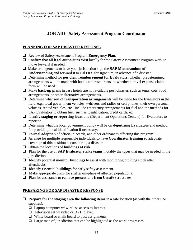
California Governor’s Office of Emergency Services December 2016
Safety Assessment Program Coordinator Training
81
JOB AID - Safety Assessment Program Coordinator
PLANNING FOR SAP DISASTER RESPONSE
Review of Safety Assessment Program Emergency Plan.
Confirm that all legal authorities exist locally for the Safety Assessment Program work to
move forward if needed.
Make arrangements to have your jurisdiction sign the SAP Memorandum of
Understanding and forward it to Cal OES for signature, in advance of a disaster.
Determine method for per diem reimbursement for Evaluators, whether predetermined
arrangements will be made with hotels and restaurants, or whether a travel expense claim
form will be used.
Make back-up plans in case hotels are not available post-disaster, such as tents, cots, food
arrangements, or other alternative arrangements.
Determine what sort of transportation arrangements will be made for the Evaluators in the
field, e.g., local government vehicles w/drivers and radios or cell phones, their own personal
vehicles, rented vehicles, etc. Include emergency arrangements for fuel and the methods for
SAP Evaluators to obtain fuel, such as identification, credit cards, etc.
Identify staging or reporting locations (Department Operations Centers) for Evaluators to
report to.
Determine what the local government policy will be on deputizing Evaluators and method
for providing local identification if necessary.
Formal adoption of official placards, and other ordinances affecting this program.
Arrange for multiple responsible individuals to have Coordinator training so adequate
coverage of this position occurs during a disaster.
Obtain the locations of buildings at risk.
Plan for the use of SAP Evaluator strike teams, notably the types that may be needed in the
jurisdiction.
Identify potential monitor buildings to assist with monitoring building stock after
aftershocks.
Identify essential buildings for early safety assessment.
Make appropriate plans for shelter-in-place of affected populations.
Plan for assistance to remove possessions from Unsafe structures.
PREPARING FOR SAP DISASTER RESPONSE
Prepare for the staging area the following items in a safe location (as with the other SAP
supplies):
Laptop computer w/ wireless access to Internet.
Television set w/ video or DVD player.
White board or chalk board to post assignments.
Large map of jurisdiction that can be highlighted as the work progresses.

California Governor’s Office of Emergency Services December 2016
Safety Assessment Program Coordinator Training
82
Prepare mapped sections on cards of your jurisdiction (map cards) to send Evaluator teams
into, preferably with addresses, such as from the Assessor’s office or from GIS overlays. Try
to keep the number of buildings to 100 or less per map card.
Place in multiple locations the official placards, forms, and supplies (such as inspector’s
vehicles, and/or outbuilding storage, away from potentially collapsing buildings; or remote
digital storage of placards and forms, with an arrangement for remote printing in the event of
disaster.) Break these down into back packs or small bags for use in the field per the list in
the Coordinator manual.
Prepare a suitable number of Evaluator briefing packets, to include the following:
Phone numbers, either a single contact (e.g, EOC), or a list of departments that deal with
hazardous materials, media inquiries, road closures, local law enforcement, fire
department, hazardous material response, animal control, and the Building Official or
other local authority in charge of Safety Assessment.
Travel expense claim reimbursement forms and instructions, if these are to be used
instead of direct billing.
General map of local jurisdiction.
Stockpiling of adequate Evaluator field supplies:
Official green, yellow, and red placards (approx. 70:15:15 ratio for earthquakes, 15:70:15
for inundation flooding; plan per the most likely disaster in your community). Consider
acquiring placards printed on peel and stick paper.
Rapid and Detailed Assessment forms (80:20 ratio).
Rolls of caution tape.
Duct tape and/or staple guns w/staples to attach placards to buildings, if peel and stick
placards are not used.
DURING DISASTER RESPONSE
Start daily written log of events.
Perform windshield survey of jurisdiction as soon as safely possible, counting the total
number of buildings obviously likely to be damaged.
Estimate number of SAP Evaluators needed based on windshield survey, see current
Coordinator Manual.
Make sure the SAP Memorandum of Understanding is completed prior to requesting SAP
Evaluators.
Request SAP Evaluators from Cal OES through the Operational Area (County)
Emergency Operations Center, identifying the staging area they are to report to.
Concurrent with request to Cal OES for assistance through SEMS, begin using local
inspectors to evaluate your essential facilities (those facilities needed most to respond to
and recover from the disaster), then the community at large, using the map cards.
Prepare the staging area (Department Operations Center) for the incoming Evaluators. Obtain in response from Cal OES the names of the individuals responding to your request,
their cell phone numbers, and when they will arrive.
Make final arrangements for covering SAP Evaluator room and board expenses, whether by
direct billing or by travel expense claim form.
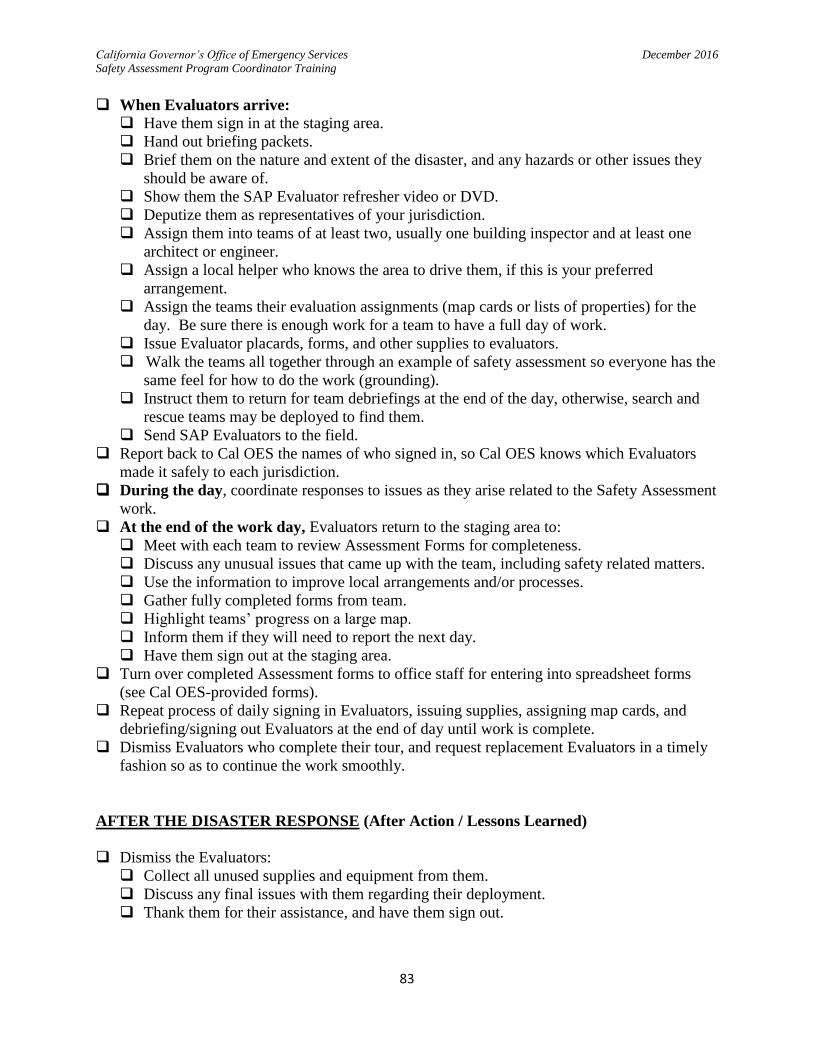
California Governor’s Office of Emergency Services December 2016
Safety Assessment Program Coordinator Training
83
When Evaluators arrive: Have them sign in at the staging area.
Hand out briefing packets.
Brief them on the nature and extent of the disaster, and any hazards or other issues they
should be aware of.
Show them the SAP Evaluator refresher video or DVD.
Deputize them as representatives of your jurisdiction.
Assign them into teams of at least two, usually one building inspector and at least one
architect or engineer.
Assign a local helper who knows the area to drive them, if this is your preferred
arrangement.
Assign the teams their evaluation assignments (map cards or lists of properties) for the
day. Be sure there is enough work for a team to have a full day of work.
Issue Evaluator placards, forms, and other supplies to evaluators.
Walk the teams all together through an example of safety assessment so everyone has the
same feel for how to do the work (grounding).
Instruct them to return for team debriefings at the end of the day, otherwise, search and
rescue teams may be deployed to find them.
Send SAP Evaluators to the field.
Report back to Cal OES the names of who signed in, so Cal OES knows which Evaluators
made it safely to each jurisdiction.
During the day, coordinate responses to issues as they arise related to the Safety Assessment
work.
At the end of the work day, Evaluators return to the staging area to:
Meet with each team to review Assessment Forms for completeness.
Discuss any unusual issues that came up with the team, including safety related matters.
Use the information to improve local arrangements and/or processes.
Gather fully completed forms from team.
Highlight teams’ progress on a large map.
Inform them if they will need to report the next day.
Have them sign out at the staging area.
Turn over completed Assessment forms to office staff for entering into spreadsheet forms
(see Cal OES-provided forms).
Repeat process of daily signing in Evaluators, issuing supplies, assigning map cards, and
debriefing/signing out Evaluators at the end of day until work is complete.
Dismiss Evaluators who complete their tour, and request replacement Evaluators in a timely
fashion so as to continue the work smoothly.
AFTER THE DISASTER RESPONSE (After Action / Lessons Learned)
Dismiss the Evaluators:
Collect all unused supplies and equipment from them.
Discuss any final issues with them regarding their deployment.
Thank them for their assistance, and have them sign out.

California Governor’s Office of Emergency Services December 2016
Safety Assessment Program Coordinator Training
84
Have the office staff update the SAP Information spreadsheet with final set of Assessment
Forms.
Forward the completed SAP Information spreadsheet to the Cal OES SAP Coordinator via
email.
Fax or email the completed Evaluator daily sign-in sheets to the Cal OES SAP Coordinator.
Receive bills for mutual aid Evaluator work from assisting local governments:
Pay these, and retain the records for potential compensation through Cal OES via the
Project Worksheet or Damage Survey Report process.
Receive travel expense claims from Evaluators:
Review them for compliance with your local travel expense rules.
Pay at once the eligible travel expenses of the Evaluators.
Retain records of these payments for reimbursement through Cal OES via the Project
Worksheet or Damage Survey Report process.
Participate in After Action Report preparation using notes from daily written log. Discuss
with Cal OES SAP Coordinator any unusual issues that came up in the Safety Assessment
requiring a response, or any success stories or innovations that arose out of the local effort or
that you became aware of.
Restock Evaluator placards, forms, and supplies in preparation for next disaster.

California Governor’s Office of Emergency Services December 2016
Safety Assessment Program Coordinator Training
85

California Governor’s Office of Emergency Services December 2016
Safety Assessment Program Coordinator Training
86

California Governor’s Office of Emergency Services December 2016
Safety Assessment Program Coordinator Training
87
Top Related