


Languages
Pages
Legal


State of affairs- Institutions in capacity building
Institutes Professional Courses Technology(short courses)
Applications(short courses)Diploma UG PG Research
Space OrganizationsIIRS/NRSC/SAC/RRSSCs
CSSTEAP (UN)
Education Institutions(IITs, ISM etc.)
2 2
University 2 2
Mapping Organizations 1 2
NGOs 21Recently started2Partial emphasis – summer/winter schools, workshops

State of affairs- Institutions, their course curriculum and facets of geospatial education
Institutes Productionof data
Valueaddition
Communicationof data
Utilizationof data
Space OrganizationsIIRS/NRSC/SAC/RRSSCs
CSSTEAP (UN)
Education Institutions(IITs, ISM etc.)
1 1
University 1 1
Mapping Organizations
NGOs 1Recent trends
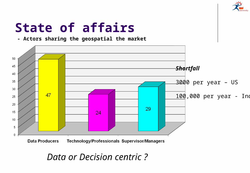
State of affairs- Actors sharing the geospatial the market
Shortfall
3000 per year – US
100,000 per year - India
Data or Decision centric ?

Challenges
Exposure to students Availability of datasets Standardization of curriculum A common ground National sustainable business plan Young Geo-professionals
- Faced by educational institutes/universities
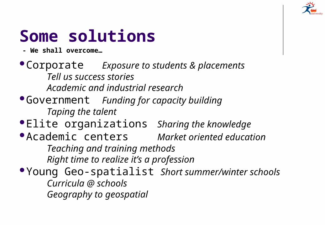
Some solutions
Corporate Exposure to students & placementsTell us success storiesAcademic and industrial research
Government Funding for capacity buildingTaping the talent
Elite organizations Sharing the knowledgeAcademic centers Market oriented education
Teaching and training methodsRight time to realize it’s a profession
Young Geo-spatialist Short summer/winter schoolsCurricula @ schoolsGeography to geospatial
- We shall overcome…
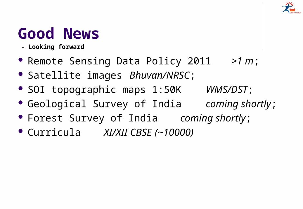
Good News
Remote Sensing Data Policy 2011 >1 m; Satellite images Bhuvan/NRSC; SOI topographic maps 1:50K WMS/DST; Geological Survey of India coming shortly; Forest Survey of India coming shortly; Curricula XI/XII CBSE
(~10000)
- Looking forward

- @ TERI University
MSc (Environmental Studies and Resource Management, Climate Science & Policy, Sustainable Development Practices) – Principles (CORE) and Advance courses (ELECTIVE);
MBA (Infrastructure, Business Sustainability, Urban Management) – Introductory modules;
MTech (Renewable Energy Engg. & Mgmt) - Applications;
Other programs - Lectures;
www.teriuniversity.ac.in
- courses on Geoinformatics
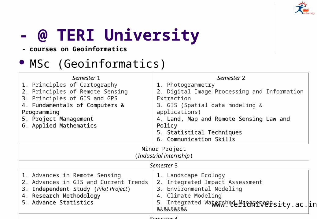
- @ TERI University
MSc (Geoinformatics)
- courses on Geoinformatics
Semester 11. Principles of Cartography2. Principles of Remote Sensing3. Principles of GIS and GPS4. Fundamentals of Computers & ProgrammingFundamentals of Computers & Programming5. Project ManagementProject Management6. Applied MathematicsApplied Mathematics
Semester 21. Photogrammetry2. Digital Image Processing and Information Extraction3. GIS (Spatial data modeling & applications)4. Land, Map and Remote Sensing Law and PolicyLand, Map and Remote Sensing Law and Policy5. Statistical TechniquesStatistical Techniques6. Communication SkillsCommunication Skills
Minor Project(Industrial internship)
Semester 3
1. Advances in Remote Sensing2. Advances in GIS and Current Trends3. Independent Study (Independent Study (Pilot Project))4. Research MethodologyResearch Methodology5. Advance StatisticsAdvance Statistics
1. Landscape Ecology2. Integrated Impact Assessment3. Environmental Modeling4. Climate Modeling5. Integrated Watershed Management….. &&&&&&&&&
Semester 4Major Project
(MSc Dissertation) www.teriuniversity.ac.in

- @ TERI University
MoU with
MoU with
Advanced Diploma in Geoinformatics
- Geoinformatics
www.teriuniversity.ac.in
India Today Aspire Education Summit (2012) Award for most innovative curriculum to TERI University - incorporating elements in education that are the need of the hour by understanding and adapting to change.

Be the change you want to see in the world
Top Related