


Languages
Pages
Legal

New Bedford Harbor Superfund SiteUpdate
November 2019 Kelsey Dumville ZaNetta Purnell David Lederer,
David Dickerson Natalie McClaine
US EPA New Bedford Harbor Superfund Site

Not Complete
- Oredging Complete
No Remediation Required
CJ currently Proposed sediment Cover/Capping Areas
~ -Completed AerovoK Interim Sediment Cap N Intertidal Remediation Completed ! Intertidal Remediation lo be Completed
EPA CAO Cell ~ Riverwalk (Proposed)
Status August 2019 Mflal PtiofographyMASSGIS 201'
JACOBS. New Bedford Harbor
Overview
New Bedford Harbor Super1und Site
Figure 1
Project Status: November 2019
Subtidal Dredging:
Lower Harbor: Substantially Complete
Upper Harbor: Dredging about 91% complete by areal extent
Intertidal:
Approximately 45% complete by volume.
0
200000
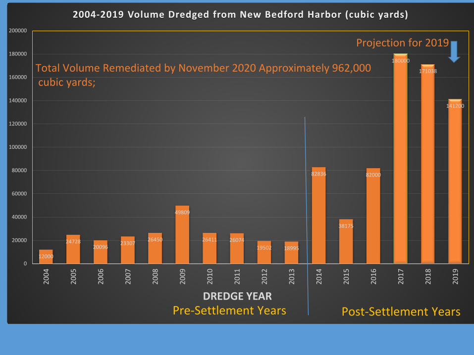
2004-2019 Volume Dredged from New Bedford Harbor (cubic yards)
12000
24728 20096 23307 26450
49809
26411 26074 19502 18995
82836
38175
82000
180000
171038
141200
2004
2005
2006
2007
2008
2009
2010
2011
2012
2013
2014
2015
2016
2017
2018
2019
Total Volume Remediated by November 2020 Approximately 962,000 cubic yards;
180000
160000
140000
120000
100000
80000
60000
40000
20000
Projection for 2019
DREDGE YEAR Pre-Settlement Years Post-Settlement Years
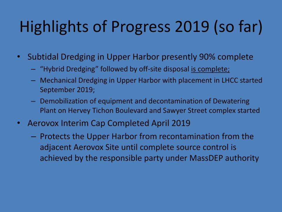
Highlights of Progress 2019 (so far)
• Subtidal Dredging in Upper Harbor presently 90% complete – “Hybrid Dredging” followed by off-site disposal is complete; – Mechanical Dredging in Upper Harbor with placement in LHCC started
September 2019; – Demobilization of equipment and decontamination of Dewatering
Plant on Hervey Tichon Boulevard and Sawyer Street complex started
• Aerovox Interim Cap Completed April 2019 – Protects the Upper Harbor from recontamination from the
adjacent Aerovox Site until complete source control is achieved by the responsible party under MassDEP authority
Subtidal Dredging Upper Harbor
l P:>n CAO C<:11 Orc<l;J 1""J Not Cr.rriplr,k,, -Finll Pu, I lybrid Dnedgi"!I C-ompl,~ - D C11rrN1: ly PfflJ1<>•Ar1S .. rt1m...,, Cowrie applll!l A~a,;.
N
300 600 i ~~--•ml Upper Harbor
Remediation Status
Figure 2
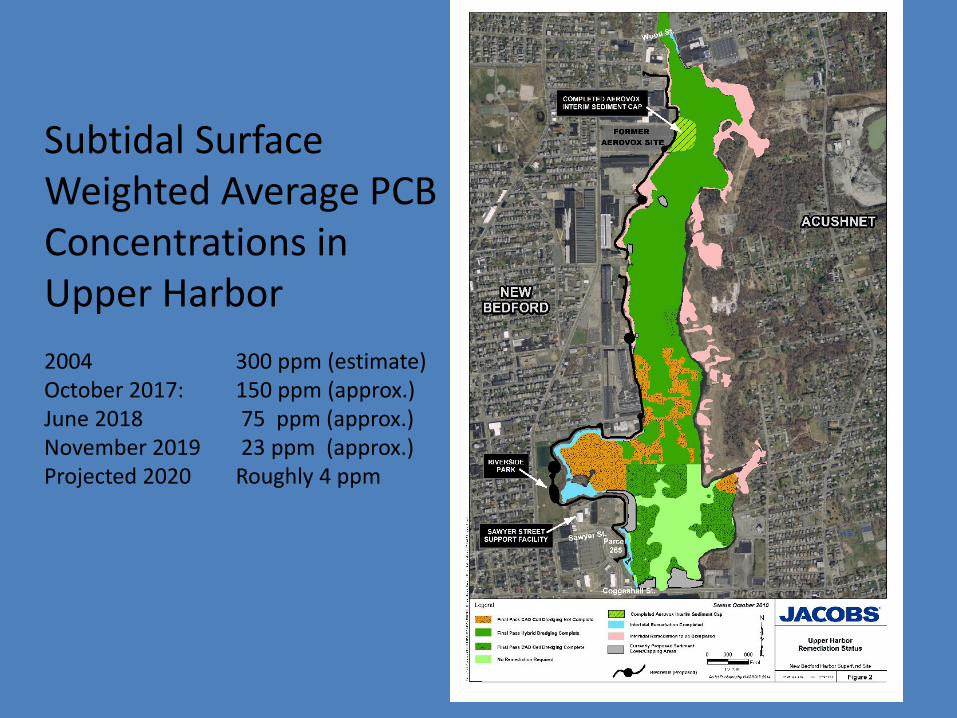
Subtidal Surface Weighted Average PCB Concentrations in Upper Harbor 2004 300 ppm (estimate) October 2017: 150 ppm (approx.) June 2018 75 ppm (approx.) November 2019 23 ppm (approx.) Projected 2020 Roughly 4 ppm
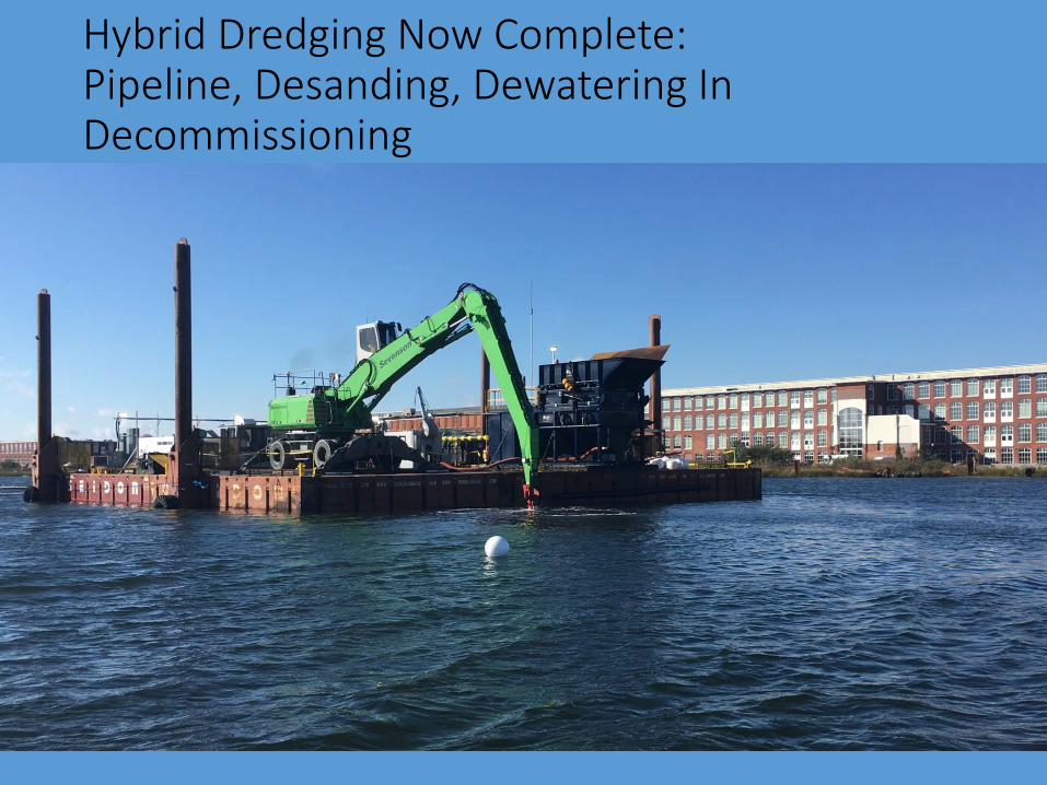
Hybrid Dredging Now Complete: Pipeline, Desanding, Dewatering In Decommissioning
The picture can't be displayed.
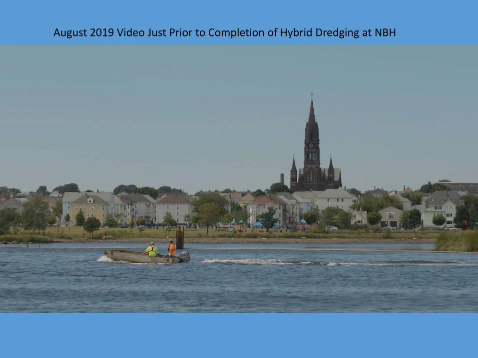
August 2019 Video Just Prior to Completion of Hybrid Dredging at NBH
,ww.flickr.com/photos/usepagov/30488603407/in/album-72157625453872678/I ightbox/ ta * 6 e ))CAT Project (View) ml lnsideEPA ~ t The New York Times [j SEMS Document Ma [j Region 1Self Service
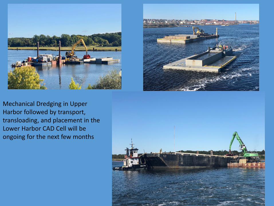
Mechanical Dredging in Upper Harbor followed by transport, transloading, and placement in the Lower Harbor CAD Cell will be ongoing for the next few months
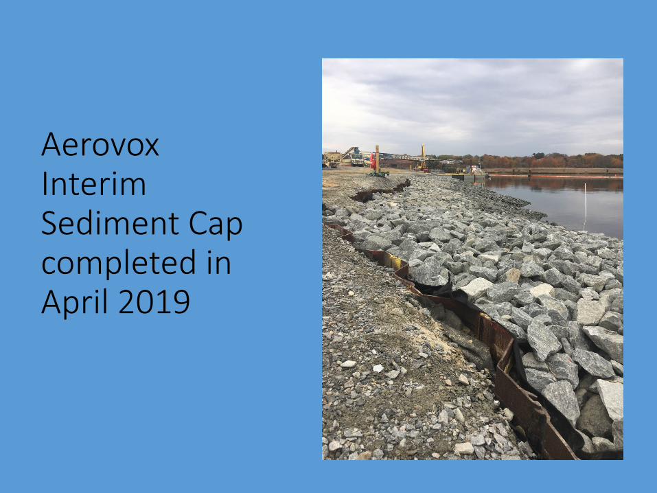
Aerovox Interim Sediment Cap completed in April 2019

Decontamination and Demobilization of Hybrid Dredging Equipment
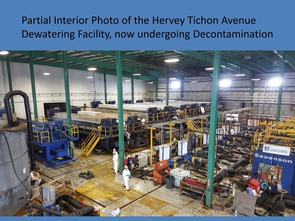
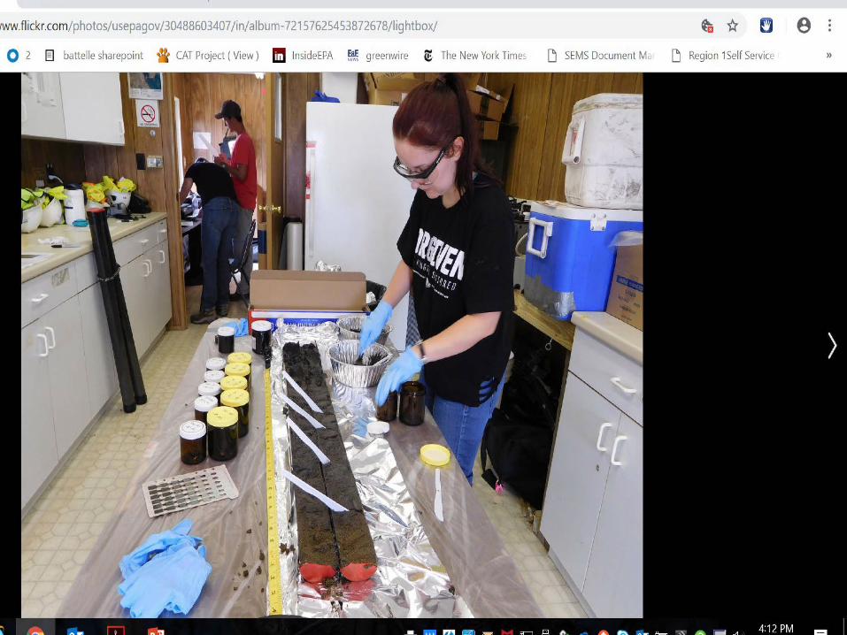
Partial Interior Photo of the Hervey Tichon Avenue Dewatering Facility, now undergoing Decontamination

, ,Cleanups: C,ommunitie,s ar,ou Be,dford, H,arbor
Air monitoring
• Ongoing monitoring during remedial activities
• Data posted to NBH website at epa.gov/nbh/
• Revised Ambient Air Monitoring Plan dated April 2018
• Revisions to Plan Coming in 2020
U.S. Environmental Protection Agency

David Dickerson US EPA
Interidal (Shoreline) Cleanup Subaqueous Capping
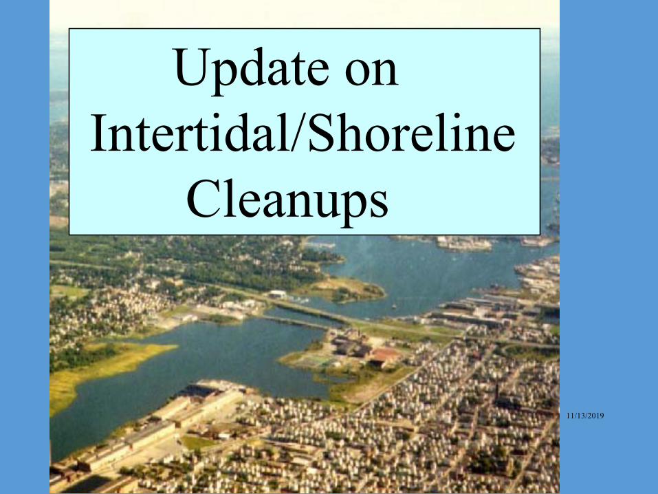
Update on Intertidal/Shoreline
Cleanups
11/13/2019
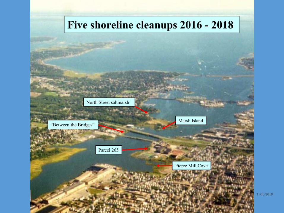
Five shoreline cleanups 2016 - 2018
North Street saltmarsh
Marsh Island “Between the Bridges”
Parcel 265
Pierce Mill Cove
11/13/2019
I I
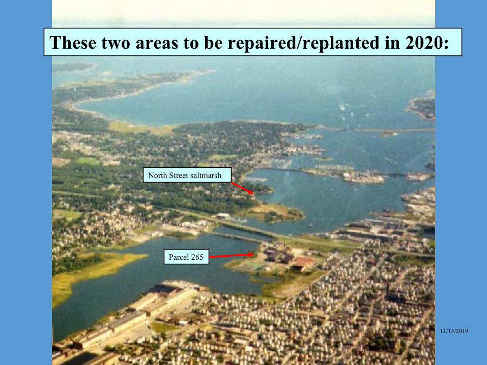
These two areas to be repaired/replanted in 2020:
Parcel 265
North Street saltmarsh
11/13/2019
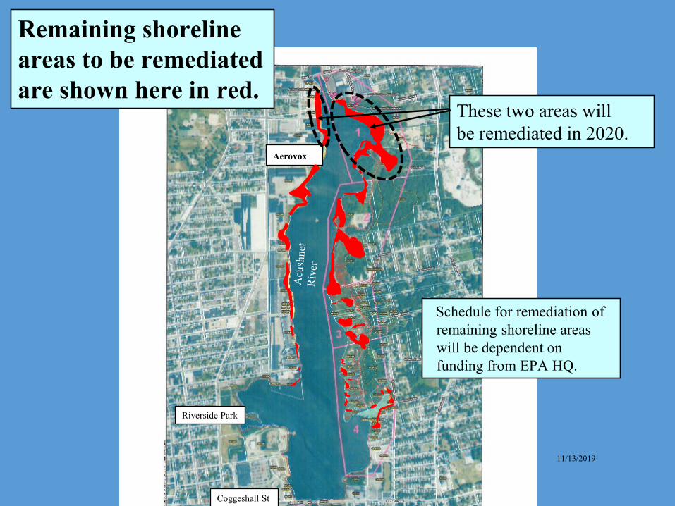
Remaining shoreline areas to be remediated are shown here in red.
Aerovox
These two areas will be remediated in 2020.
Schedule for remediation of remaining shoreline areas will be dependent on funding from EPA HQ.
Riverside Park
11/13/2019
Coggeshall St
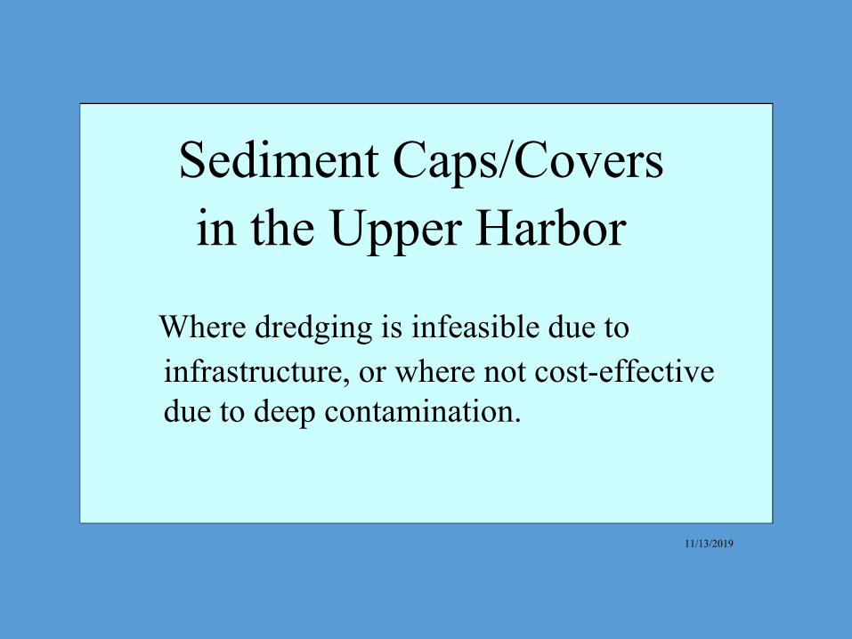
Sediment Caps/Covers in the Upper Harbor
Where dredging is infeasible due to infrastructure, or where not cost-effective due to deep contamination.
11/13/2019

- :• U r,fl,TI )\.1 rr ~ t.1 ""'""' • ~- : to-. m . .. i--, .. ,.,-t .:~ ;."1 frffl (L1 iL"(\.•r,J., ■ o.11.
:. 1 Wff" ;(~I "'tC~ r.Glc"111l bl!
• ~ wn: ;-:--1 t'l: C ■¢4 °,'lffl ■ rll ■ :r r~ in,~ Anlda .Ul
~ ~ ~•I rm11 .■.p:1 :•,Jma l• ;,~ 1 « i::: : ■ c ■-rr i-&.
Pr-1,-._.1 ""'"Yf'~P• ,.,.,~r-,t,,Jlo.!ti:,1
Pn~ o!.i )IJ5Pl' t;1 Kt,.._~ . HcSt-n ri , 1,.,.
□ ~~hr• lrt.1irt il,hl C·•Jn':t..n r~ n1
DRAFT f},-,;
=--1 . ,.,, ....
Exre·,I cf PCE!o O- ... \ ·~ li 1rtt:t_ li1IJ:i~
l,pper H9fMl" lnterti~~l l Me
Fi; w::-1 1
Aerovox
Locations of sediment caps/covers shown in red.
Riverside Park
Coggeshall Street
11/13/2019
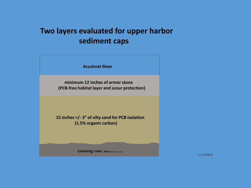
Two layers evaluated for upper harbor sediment caps
Acushnet River
minimum 12 inches of armor stone (PCB-free habitat layer and scour protection)
15 inches +/- 3” of silty sand for PCB isolation (1.5% organic carbon)
Existing river sediment 11/13/2019
ZaNetta Purnell, Kelsey Dumville
Cooperative agreement with the City of New Bedford
Fourth Year of the Outreach Coordinator Program
CEDC – Community Economic Development Center
Bilingual/trilingual outreach Goal: gain knowledge of fishing community in
New Bedford Harbor
OUTREACH COORDINATOR UPDATE
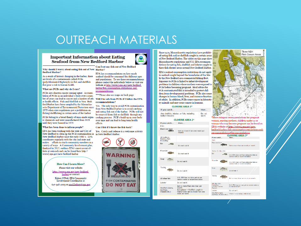
Important Information about Eating Seafood from New Bedford Harbor
Wlly should I worry about eating fish out of Ne'ff Harbor? Bedford Harbor?
As a result of historic dumping in the harbor, there are levels of a contaminants called PCBs (polychlorinated Biphenyls) in fish and shellfish that pose a risk to hwnan health.
Wbat are PCBs and why do I care?
PCBs are a k:no\\on cancer causing agent. Accumulation of PCBs in an individual ' s body over a number of years can lead to cancer and a number of other health effects. Fish and Shellfish in New Bedford Harbor have been sampled by the Massaclrnsens Depanment of Environmental Protection since 1979 when state regulations put a prohibition on fishinglsheilfishing in certain areas of the harbor.
PCBs belong to a broad family of man-made organic chemicals and were manufacnued from 1929 until they were banned in 1979.
Wbat has been done to info1m people?
EPA has been , .. .-orking ,vith the state and City of New Bedford to clean up the PCB contamination in New Bedford Harbor since the early 1980' s. EPA coordinates regularly with the city and state and makes effons to reach conunw1ity members in a variety of ways. A Comnmn.ity Involvement pbn, fin.."llized in 20 15, outlines EPA's most recent efforts at outreach and can be found here http:// www2.epa.gov/new-bedford-harbor
How Can I Learn More?
Please visit our website
http: //w"w2.epa.gov/new-bedford.ha1:h21: or contact
Kelsey O'Neil, EPA Community Involvement Coordinator at
EPA has recommendations on how much seafood should be consumed for different ages and populations. To see those recommendations please contact the individuals belon· or v isit our website at http://\\r"\VW2.epa..gov/new-bedfordha:rbor/fish-consumption-regulations-andrecommendations
***Please also see maps on back page.
Will I bosafe from PCBs if ! follow the EPA l'erommendatioll'i?
Yes. The only way to avoid PCB contamination from New Bedford harbor is to avoid catching and eating fish out of the harbor. PCBs will not be removed from fish or shellfish through any cooking process. PCB' s build up in your body over time and can lead to long tenn health effects.
Can I fish if I throw the fish bark?
Yes. Catch and release is a welcome activity in New Bedford Harbor.
FISH CONTAMINATED
DO NOT EAT
Since 19791 :Massachusetts regulations have prohibit- ~; ed eating fish and/ or shellfish caught in certain areas := ~ of New Bedford Harbor. The tables on this page show =-:a
Massachusetts regulations and U.S. EPA recommen- ==..
dations for eating fish, shellfish and lobster caught in ~ three fish closure areas around New Bedford Harbor. ~
'-· EP A's seafood consumption restrictions do not apply - · to seafood caught beyond the boundaries of the Site by the New Bedford area commercial fishing fleet. Exposure to PCBs is linked to infant development problems in children vIDose mothers were exposed to PCBs before becoming pregnant. Meal advice for PCB-contaminated fish is intended to protect children from developmental problems. PCBs also cause changes in human blood, liver, and immune function of adults. In addition, PCBs cause cancer in laboratory animals and may cause cancer in hwnans.
CLOSURE AREA 1 * If you catch ... then ...
Any shellfish, lobster, or fish, including Do not bottom feeders eat it
If y Qu c atc h ..
Fish:
Black sea bass ..... CLOSURE AREA 2 •
t h e n ...
Elll r'IO ~ t h.tin onl! mttil pe,r month
woman1 nursing mothers, children under 12 or woman ,vho may become pregnant can be found on EPA's ,.,_,·ebsite at h ttp:/{\vw\v2.epa.gov/newbedford-harbor/fish--consw11ption-regulations-and-
Allbottomfeedlog fish induding:
Eel --=::.
Flou~r
Scup
Tautog • A.llotherf15,h
Lobster
Sheltftsh {dams, quahogs, mussels@tc.)
Oo n<>t eat It
Do n<>t eat It
Do not eat It
Do not eat it
U.S. EPA has no data ','et so we C!lnnot makf! a tl!COml"nll!!ndatian
Do net eat it
Eat no morfl than onfl mHI Pfll" ITIOl'l l h . Exception - Shellfish caught m Oarks Cove : eat oo more than one meal per week
rernmmendations#Bemromendations CLOSURE AREA 3 *
lryO(l c;a1c h
Fish :
Battcm-k.,dingl, lh:
ES ..C>
'""
All ofJlcl fish, indo,dinq allllherborumt,,,,." loos<a
Eat norroorelhanoo.i
U.S . EPAdoi-s nothil-N i1dt-Q11<1tedat:1 so unl"IO(makeil rE<ooiffiffldation
U. S. EPlldo,,s not ha,,-;; ad;equ;;tt,diitil ui
cannot make ii r««nmendilll<n
!:.'II no more Ola11 on<? meal per Month
OUTREACH MATERIALS
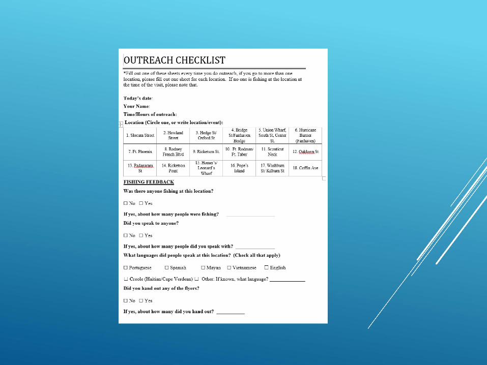
!OUTREACH CHECKLIST •Fill out one of these sheets every time you do outreach, if you go to more than one location, please fill out one sheet for each location. Ifno one is fishing at the location at the time of the visit, please note that.
Location (Circle one, or write location/event):
I. Slocum Street 2.Howland
Street 3. Hedge Stl Oxford St
4. Bridge St/Fa.imaven
Bridge
5. Union Wharf, South St, Center
St.
6. Hurricane Barrier
(Fairhaven)
7. Ft. Phoenix 8. Rodney
French Blvd 9. Ricketson St.
10. Ft Rodman/ Ft. Taber
I I. Sconticut Neck
13. ~ St
14. Ricketson Point
15. Homer's/ Leonard' s
Wharf
16. Pope's Island
17. Washburn St/ Kilburn St
18. Coff"m Ave
Was there anyone fishing at this location?
Ifyes, about how many people were fishing?
Did you speak to anyone?
Ifyes, about how many people did you speak with ? ________
What languages did people speak at this location? (Check all that apply)
D Spanish D Mayan D Vietnamese D English
D Creole (Haitian/Cape Verdean) D Other: Ifknown, what language? ______
Did you hand out any of the flyers?
Ifyes, about how many did you hand ont?
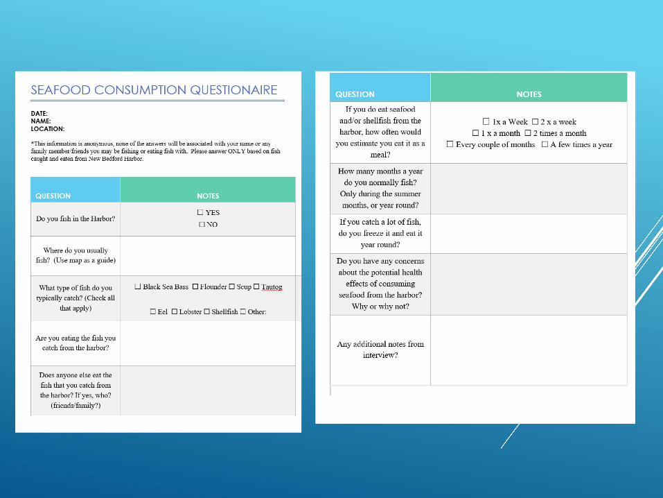
SEAFOOD CONSUMPTION QUESTIONAIRE NOTES
DATE: NAME: LOCATION:
*This information is anonymous, none of the answers will be associated with your name or any family member/friends you may be fishing or eating fish with. Please answer ONLY based on fish caught and eaten from New Bedford Harbor.
NOTES
Do you fish in the Harbor? □ YES
□ NO
Where do you usually
fi sh? (Use map as a guide)
What type of fish do you
typically catch? (Check all
that apply)
D Black Sea Bass □ Flounder □ Scup □ Tautog
□ Eel □ Lobster □ Shellfish □ Other:
Are you eating the fi sh you
catch from the harbor?
Does anyone else eat the
fish that you catch from
the harbor? If yes, who?
(friends/family?)
and/or shellfish from the
harbor, how often would
you estimate you eat it as a
meal?
D lxaWeek □ 2xaweek
D 1 x a month D 2 times a month
D Every couple ofmonths D A few times a year
How many months a year
do you normally fish?
Only during the summer
months, or year round?
Ifyou catch a lot of fish,
do you freeze it and eat it
year round?
Do you have any concerns
about the potential health
effects of consuming
seafood from the harbor?
Why or why not?
Any additional notes from inte1view?
Looking Ahead…
Dave Lederer, USEPA
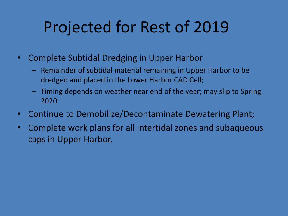
Projected for Rest of 2019
• Complete Subtidal Dredging in Upper Harbor – Remainder of subtidal material remaining in Upper Harbor to be
dredged and placed in the Lower Harbor CAD Cell; – Timing depends on weather near end of the year; may slip to Spring
2020
• Continue to Demobilize/Decontaminate Dewatering Plant; • Complete work plans for all intertidal zones and subaqueous
caps in Upper Harbor.
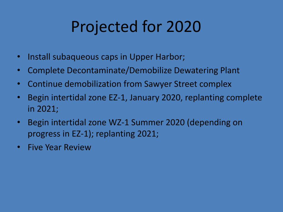
Projected for 2020
• Install subaqueous caps in Upper Harbor; • Complete Decontaminate/Demobilize Dewatering Plant • Continue demobilization from Sawyer Street complex • Begin intertidal zone EZ-1, January 2020, replanting complete
in 2021; • Begin intertidal zone WZ-1 Summer 2020 (depending on
progress in EZ-1); replanting 2021; • Five Year Review
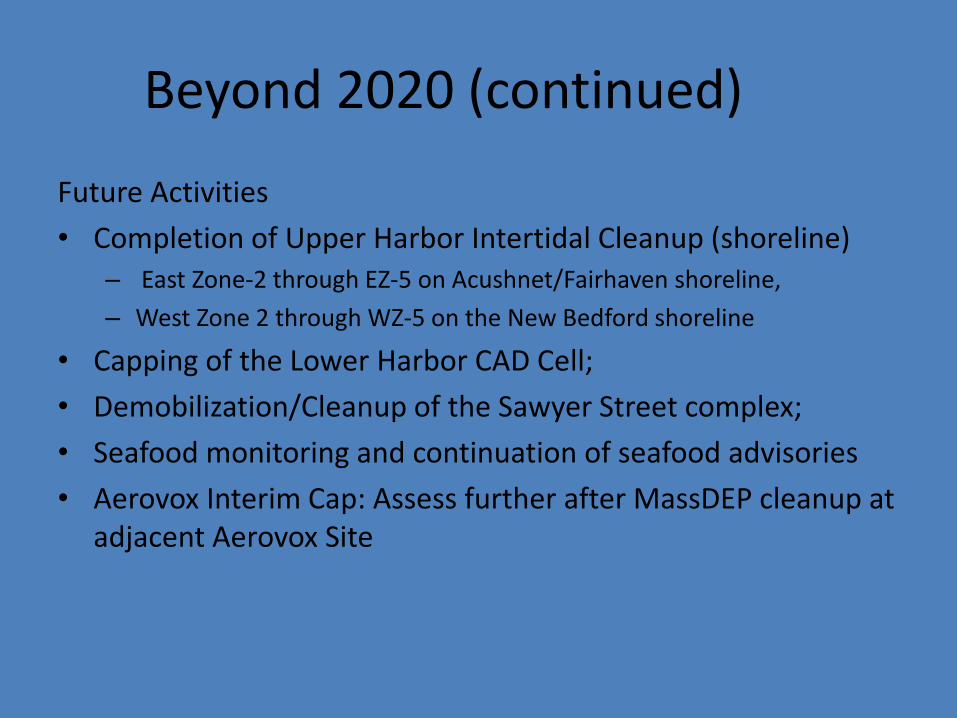
Beyond 2020 (continued)
Future Activities • Completion of Upper Harbor Intertidal Cleanup (shoreline)
– East Zone-2 through EZ-5 on Acushnet/Fairhaven shoreline, – West Zone 2 through WZ-5 on the New Bedford shoreline
• Capping of the Lower Harbor CAD Cell; • Demobilization/Cleanup of the Sawyer Street complex; • Seafood monitoring and continuation of seafood advisories • Aerovox Interim Cap: Assess further after MassDEP cleanup at
adjacent Aerovox Site

Beyond 2020 (continued)
• By the end of 2020, we are projected to have completed over 90% of the total volume to be addressed by the project
• Timing of remaining cleanup work beyond 2020 will be dependent on funding levels available to the project year by year from EPA’s Superfund program.

Questions?
Top Related