


Languages
Pages
Legal

1
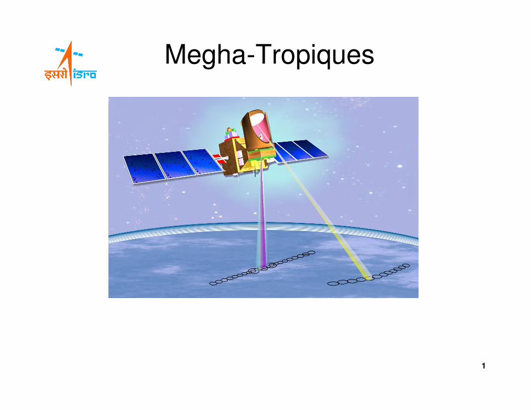
Megha-Tropiques
MEGHA - TROPIQUES PROJECT
•• MEGHA MEGHA IN SANSKRIT MEANS CLOUDS
•• TROPIQUESTROPIQUESIN FRENCH IS TROPICS
2
3
MEGHA - TROPIQUES MISSION
• Indo - French collaboration ( ISRO - CNES )• Climate / atmosphere research and applications satellite for
studies over the tropics• Inclined orbit of 20 degrees for high repetitivity• IRS bus –1500 kg class (Megha-Tropiques: 1000 kg)• Shared responsibility of payloads• Launched by ISRO's PSLV–C18 on 12 October 2011• Spacecraft control and data reception from ISTRAC,
Bangalore• Science data reception from ISTRAC, Bangalore and CNES
GS at Kourou / HBK (Africa)• Level-0 and Level-1 Data Products by ISRO
4
MISSION OBJECTIVES
1. To collect a long-term set of measurements with a
good sampling and coverage over Tropical latitudes to
understand better the processes related to tropical
convective systems and their life cycle.
2. To improve the determination of atmospheric energy
and water budget in the tropical area at various time and
space scales.
3. To study tropical climatic events and their
predictability: droughts, monsoon variability, floods and
tropical cyclones.
5
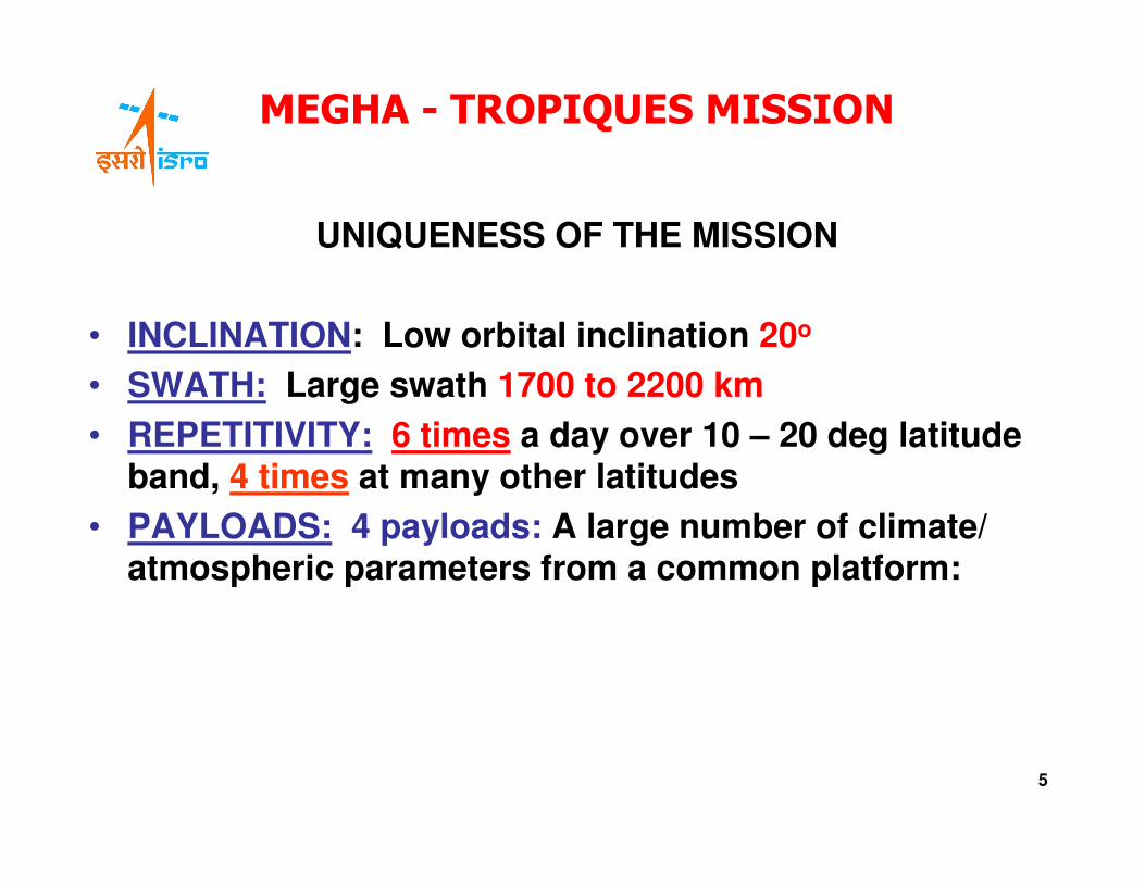
MEGHA - TROPIQUES MISSION
UNIQUENESS OF THE MISSION
• INCLINATION: Low orbital inclination 20o
• SWATH: Large swath 1700 to 2200 km
• REPETITIVITY: 6 times a day over 10 – 20 deg latitude band, 4 times at many other latitudes
• PAYLOADS: 4 payloads: A large number of climate/ atmospheric parameters from a common platform:
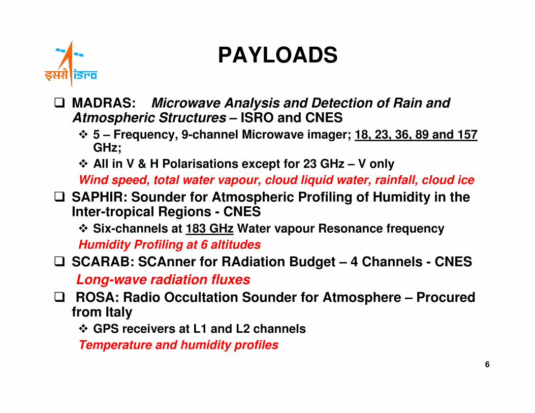
PAYLOADS
� MADRAS: Microwave Analysis and Detection of Rain and Atmospheric Structures – ISRO and CNES
� 5 – Frequency, 9-channel Microwave imager; 18, 23, 36, 89 and 157GHz;
� All in V & H Polarisations except for 23 GHz – V only
Wind speed, total water vapour, cloud liquid water, rainfall, cloud ice
� SAPHIR: Sounder for Atmospheric Profiling of Humidity in the Inter-tropical Regions - CNES
� Six-channels at 183 GHz Water vapour Resonance frequency
Humidity Profiling at 6 altitudes
� SCARAB: SCAnner for RAdiation Budget – 4 Channels - CNES
Long-wave radiation fluxes
� ROSA: Radio Occultation Sounder for Atmosphere – Procured from Italy� GPS receivers at L1 and L2 channels
Temperature and humidity profiles
6
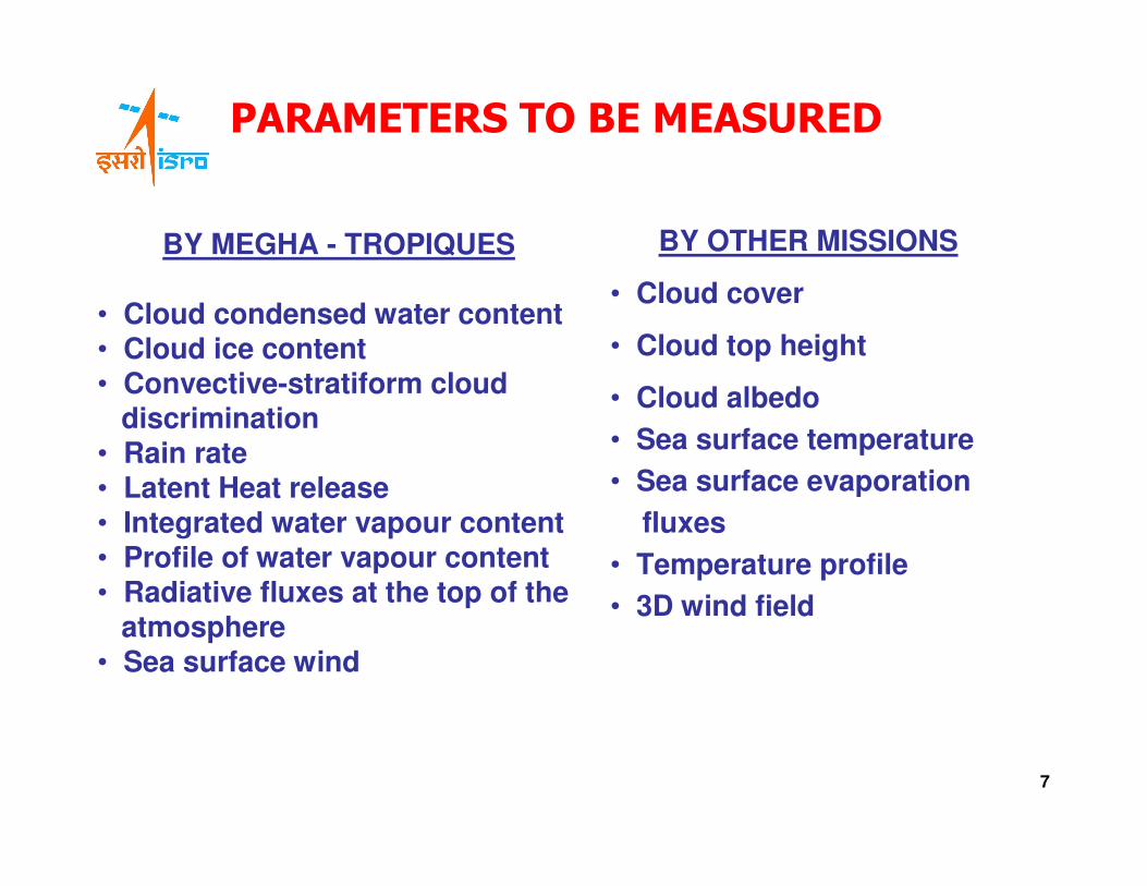
PARAMETERS TO BE MEASURED
BY MEGHA - TROPIQUES
• Cloud condensed water content• Cloud ice content• Convective-stratiform cloud
discrimination• Rain rate• Latent Heat release• Integrated water vapour content• Profile of water vapour content• Radiative fluxes at the top of the
atmosphere• Sea surface wind
BY OTHER MISSIONS
• Cloud cover
• Cloud top height
• Cloud albedo
• Sea surface temperature
• Sea surface evaporation
fluxes
• Temperature profile
• 3D wind field
7
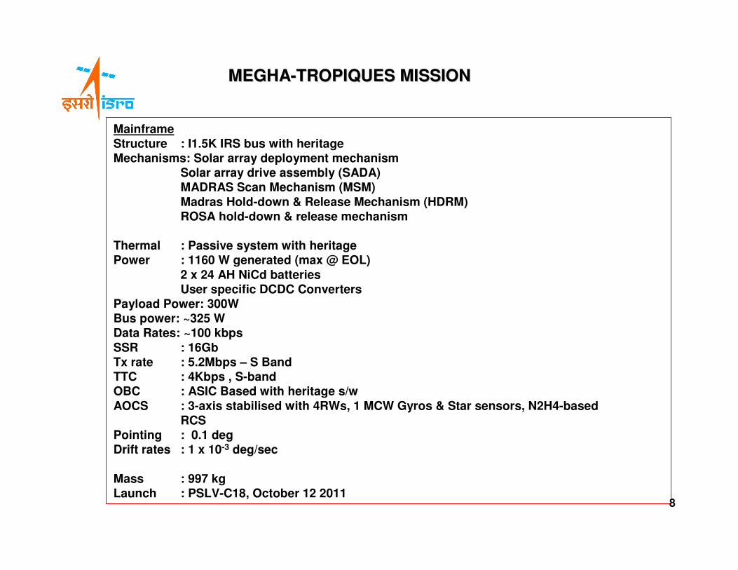
MainframeStructure : I1.5K IRS bus with heritageMechanisms: Solar array deployment mechanism
Solar array drive assembly (SADA) MADRAS Scan Mechanism (MSM)
Madras Hold-down & Release Mechanism (HDRM)ROSA hold-down & release mechanism
Thermal : Passive system with heritagePower : 1160 W generated (max @ EOL)
2 x 24 AH NiCd batteriesUser specific DCDC Converters
Payload Power: 300WBus power: ~325 WData Rates: ~100 kbps
SSR : 16GbTx rate : 5.2Mbps – S BandTTC : 4Kbps , S-bandOBC : ASIC Based with heritage s/w
AOCS : 3-axis stabilised with 4RWs, 1 MCW Gyros & Star sensors, N2H4-based RCS
Pointing : 0.1 deg Drift rates : 1 x 10⁻³ deg/sec
Mass : 997 kgLaunch : PSLV-C18, October 12 2011
MEGHAMEGHA--TROPIQUES MISSION TROPIQUES MISSION
8
9
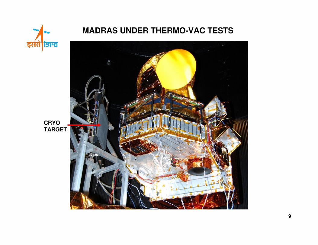
MADRAS UNDER THERMO-VAC TESTS
CRYO TARGET
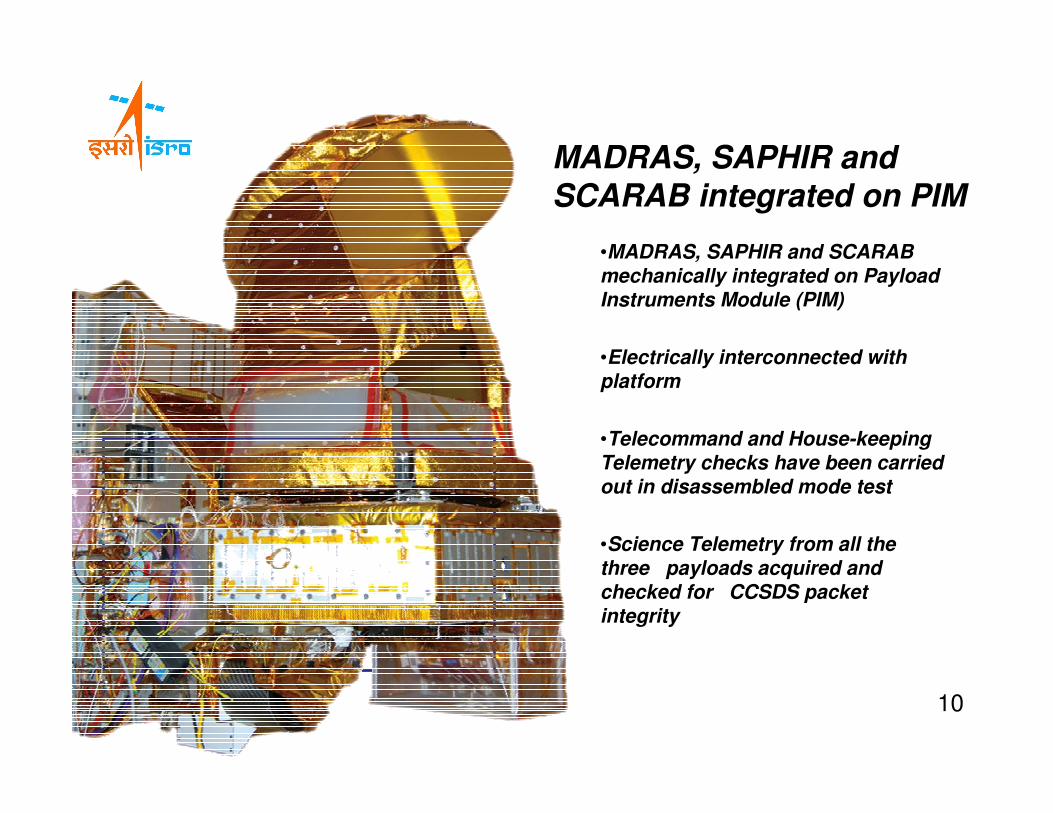
•MADRAS, SAPHIR and SCARAB mechanically integrated on Payload Instruments Module (PIM)
•Electrically interconnected with platform
•Telecommand and House-keeping Telemetry checks have been carried out in disassembled mode test
•Science Telemetry from all the three payloads acquired and checked for CCSDS packet integrity
MADRAS, SAPHIR and SCARAB integrated on PIM
10
11
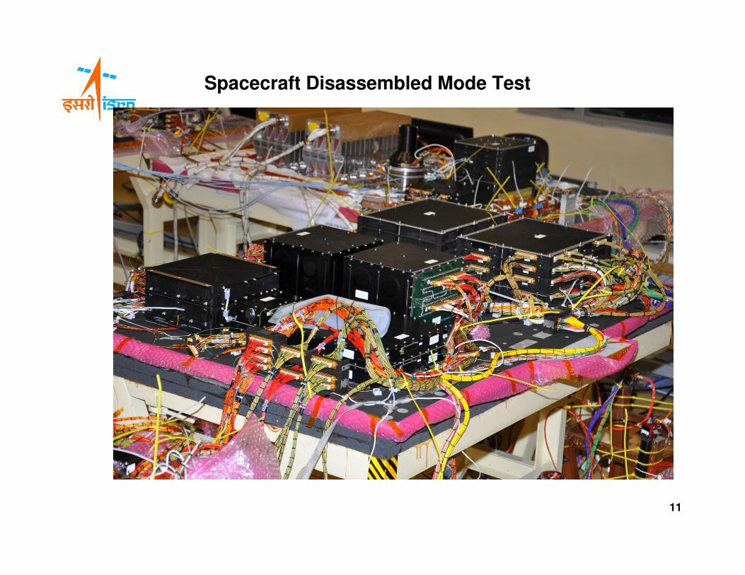
Spacecraft Disassembled Mode Test
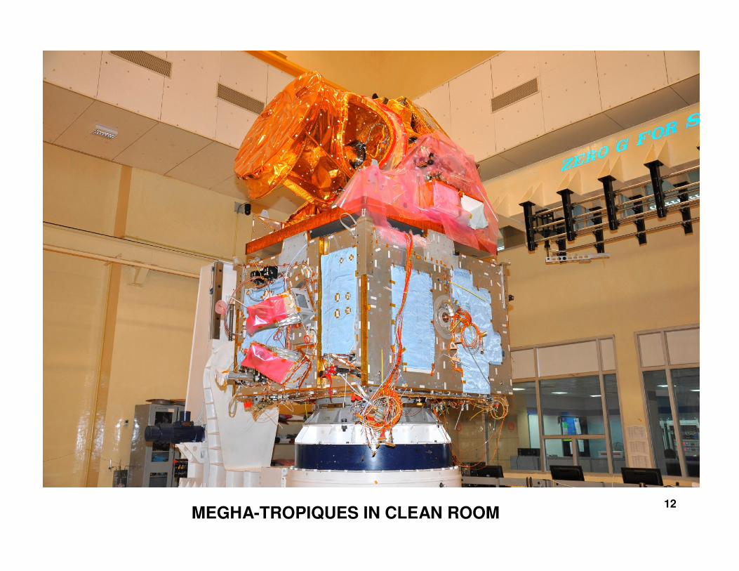
MEGHA-TROPIQUES IN CLEAN ROOM12
13
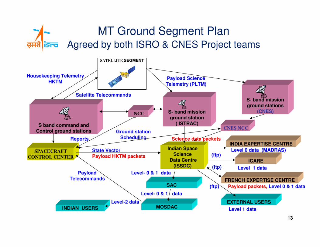
S band command andControl ground stations
Indian SpaceScience
Data Centre(ISSDC)
SPACECRAFT
CONTROL CENTER
FRENCH EXPERTISE CENTRE
INDIAN USERS
SATELLITE SEGMENT
Payload Science Telemetry (PLTM)
Housekeeping TelemetryHKTM
Level-2 data
Payload packets, Level 0 & 1 data
Satellite Telecommands
Reports
Ground station Scheduling
Payload Telecommands
State VectorPayload HKTM packets
MOSDAC
Level- 0 & 1 data
NCC
EXTERNAL USERS
Level 1 data
INDIA EXPERTISE CENTRE
Level 0 data (MADRAS)
(ftp)
(ftp)
(ftp)
S- band mission ground stations
(CNES)
SAC
Level- 0 & 1 data
MT Ground Segment PlanAgreed by both ISRO & CNES Project teams
ICARE
S- band mission ground station
( ISTRAC)
Level 1 data
CNES NCC
Science data packets
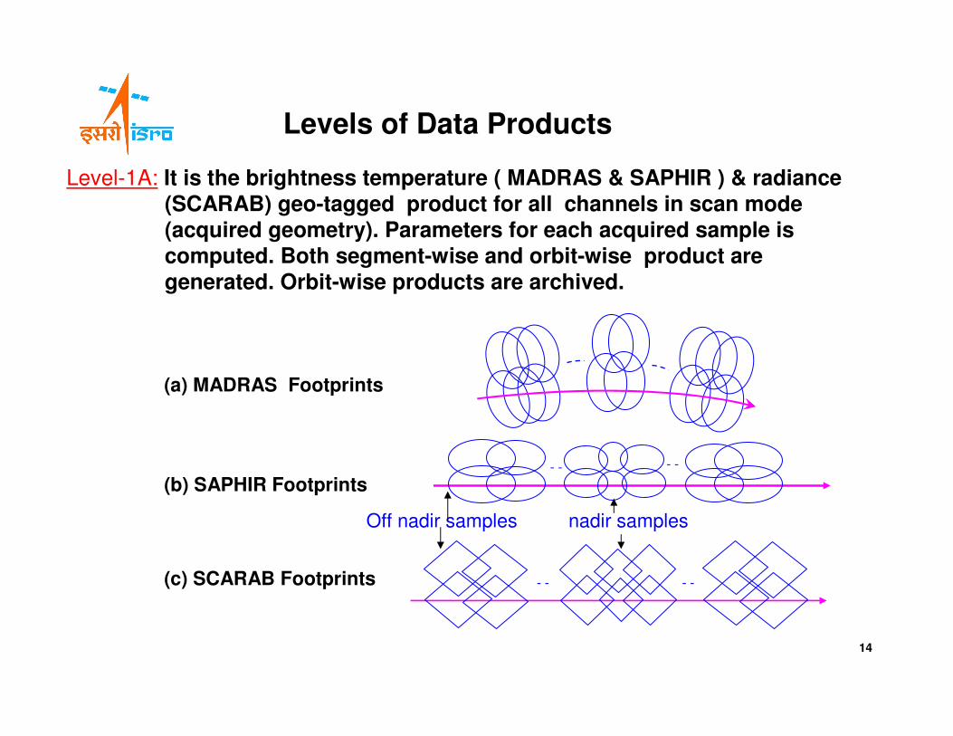
Levels of Data Products
Level-1A: It is the brightness temperature ( MADRAS & SAPHIR ) & radiance (SCARAB) geo-tagged product for all channels in scan mode (acquired geometry). Parameters for each acquired sample is computed. Both segment-wise and orbit-wise product are generated. Orbit-wise products are archived.
(b) SAPHIR Footprints
(a) MADRAS Footprints
- - - -
- - - -
(c) SCARAB Footprints
nadir samplesOff nadir samples
14
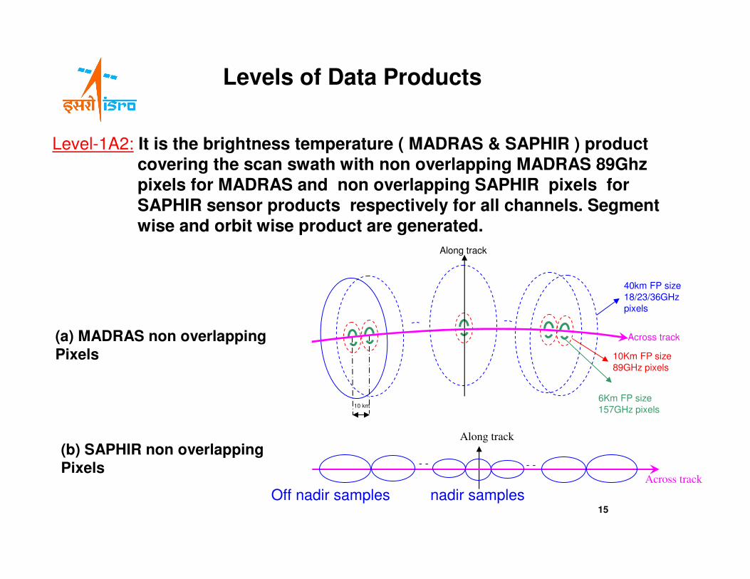
Levels of Data Products
Level-1A2: It is the brightness temperature ( MADRAS & SAPHIR ) product covering the scan swath with non overlapping MADRAS 89Ghz pixels for MADRAS and non overlapping SAPHIR pixels for
SAPHIR sensor products respectively for all channels. Segment wise and orbit wise product are generated.
(b) SAPHIR non overlapping
Pixels
(a) MADRAS non overlapping
Pixels
nadir samplesOff nadir samples
Across track
10 km
40km FP size
18/23/36GHz
pixels
10Km FP size
89GHz pixels
6Km FP size
157GHz pixels
Along track
Along track
- - - -
Across track
15
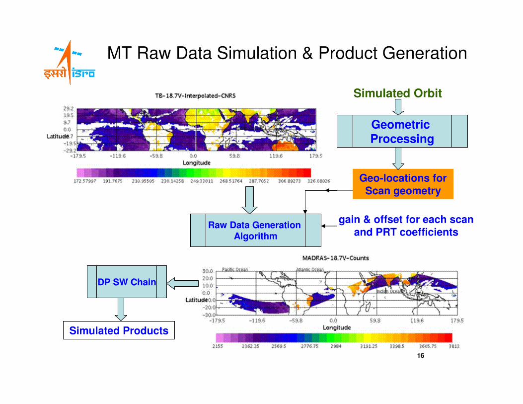
MT Raw Data Simulation & Product Generation
Simulated Orbit
gain & offset for each scan and PRT coefficients
Geo-locations for Scan geometry
Geometric Processing
Simulated Products
Raw Data Generation Algorithm
DP SW Chain
16
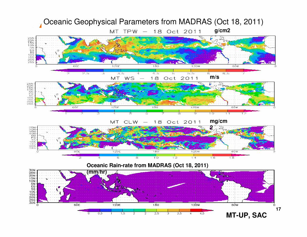
Oceanic Geophysical Parameters from MADRAS (Oct 18, 2011)
Oceanic Rain-rate from MADRAS (Oct 18, 2011) (mm/hr)
m/s
mg/cm2
g/cm2
MT-UP, SAC17
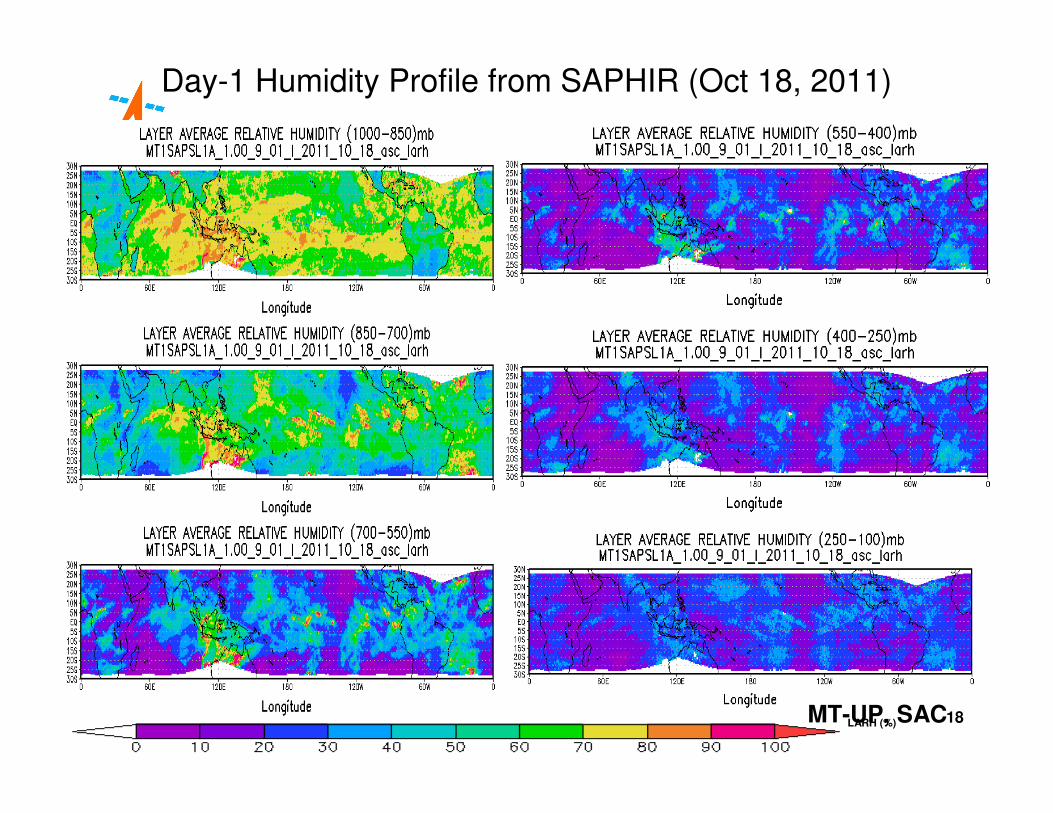
LARH (%)
Day-1 Humidity Profile from SAPHIR (Oct 18, 2011)
MT-UP, SAC18
19
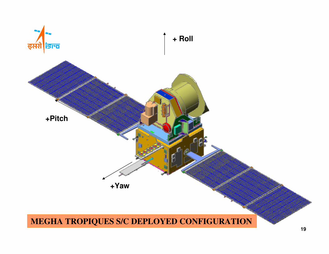
+ Roll
+Pitch
+Yaw
MEGHA TROPIQUES S/C DEPLOYED CONFIGURATION19

THANK YOU
20
Top Related