


Languages
Pages
Legal


CARTOGRAPHICAL DATA TREATMENT ANALYSISFOR REAL TIME THREE-DIMENSIONAL
TERRAIN VISUALIZATION
Flávio Luis de Mello & Luiz Felipe Coutinho Ferreira da Silva
Divisão de Tecnologia da Informação - DTI & Seção de Engenharia Cartográfica - SE6Centro Tecnológico do Exército - CTEx & Instituto Militar de Engenharia - IME

11
Summary
1. Introduction
2. Real Time Systems
3. The Terrain Mesh
4. The Cone Vision
5. The Triangulation Construction Study Case
6. Results
7. Conclusion

Introduction
• Alternative solution for the triangulation problem of altimetric data of cartographic features
• Main goal: allow data management obtain real time 3D terrain visualization from 2D topographic charts
• Application is supposed to be executed on low performance computers embedded on military tanks, vehicles and soldiers combat equipment
• The methodology is constrained by this obsolete hardware (upper bound: Pentium 300 MHz) 22

33
Real Time Systems
• Application metric: scene refresh rate
ExecutionTime
industrial and electrical plants,intensive therapy units
elastic timeresponse
maritime traffic control,cosmic probes navigation snapsho
tresponse definition is not associated to the elapsed
time, but to an opportune problem treatment
• Real time animation: over 12 fps

44
The Terrain Mesh
• Impossible to know exactly the heights of all points on a surface
• Attribute the same height to all neighboring points near a sample height
• Each point is connected using straight line segments in order to compose a triangle set, and each triangle vertex is raised until its corresponding height
• Each triangle vertex corresponds to a point measure on the object surface
Delaunay triangulation

55
The Cone Vision
• Scene vision composed by several layers
• Complex scenes
• If it is possible to determine the invisible geometries before being drawn, it would be possible simply to ignore them, thus preventing the unnecessary data processing

66
Spatial Indexing

77
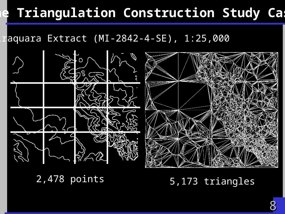
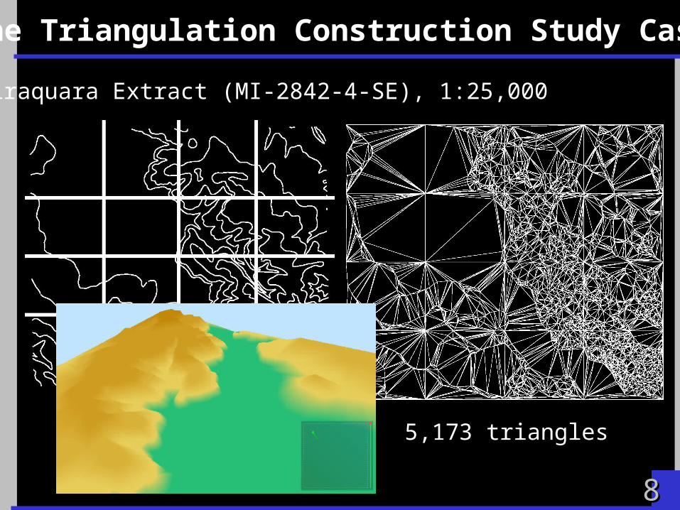
The Triangulation Construction Study Case
Piraquara Extract (MI-2842-4-SE), 1:25,000
2,478 points
88
The Triangulation Construction Study Case
2,478 points 5,173 triangles
Piraquara Extract (MI-2842-4-SE), 1:25,000
88
The Triangulation Construction Study Case
2,478 points 5,173 triangles
Piraquara Extract (MI-2842-4-SE), 1:25,000

99
Results
• The time spent by the graphical device to draw the scene over the monitor screen is inversely influenced by the quantity of geometrical primitives
Frustum culling algorithmDouglas-Peucker generalization
contributes for reducing the number of geometries necessary for the exhibition
• Altimetry data represents about 76% of all the map data (average)

1010
Results
61.181 points 135.504 triangles
Piraquara (MI-2842-4-SE), 1:25,000
Test = <processor, video board, grid>
1 GHz233 MHz
GeForce2 64MB PCIGeForce2 64MB AGPS3Virge 1MB PCI
1x1,2x2,4x4,8x8,16x16,32x32,64x64,128x128

1111
Results

1212
Results

1313
Conclusion
• It was possible to improve the application performance to higher values than the lower limits defined by classic animation literature
• The results analysis suggests that it is possible to create a real time 3D terrain visualization application based on the current available cartographic data and obsolete hardware
• Future work includes: remaining data layers, cartographic symbology, texture rendering, database transaction.
1414
Questions
_________ ________________ ___ ____________ ______ ____________
___ ______________ _______________
____________ ___________ ___
Top Related