


Languages
Pages
Legal


August 2020 Climate Summary for Denver
Hot and Dry … Tied Warmest August on Record
A strong upper level ridge of high pressure dominated the Rocky Mountain Region for much
of the month. This resulted in a hot and dry August across Denver and the Front Range
Urban Corridor. Smoke from large forest fires over the high country produced smoky and
hazy skies across much of the region through month.
65
A strong ridge of high pressure dominated the Rocky Mountain Region for much of the
month, resulting in a hot and dry August across Denver and the Front Range Urban
Corridor. Smoke from large forest fires in Colorado and the western U.S. produced smoky
and hazy skies across much of the region throughout the month.
August 2020 Climate Summary for Denver
Hot and Dry and Smoky

TEMPERATURES:
The average temperature at Denver International Airport for August 2020 was 77.0
degrees F, which is 4.5 degrees above the normal of 72.5 degrees. This tied August
2011 as the Warmest August in Denver Weather History. During the month, 26 days had
temperatures that equaled or exceeded 90 degrees and 6 days in which record
temperatures were tied. The warmest temperature of the month was 100 degrees on the
18th.
ELEVEN WARMEST AUGUST AVERAGE TEMPERATURES IN DENVER WEATHER HISTORY
SINCE 1872: DEGREES F
77.0 – 2020, 2011
76.8 - 1937
75.4 - 2019, 2007
75.3 - 1995
75.0 – 2012, 1994
74.7 - 1938
74.6 - 2013, 1878
TEN COLDEST AUGUST AVERAGE TEMPERATURES IN DENVER WEATHER HISTORY
SINCE 1872: DEGREES F
66.5 - 1915
66.6 - 1927
67.7 - 1920
67.8 - 1884
68.0 - 1888
68.1 - 1968
68.2 - 2004, 1967
68.4 - 1992, 1917


PRECIPITATION:
Denver Received 0.35 inches of precipitation in August 2020 which is 1.34 inches
below the normal of 1.69 inches. There were only 5 days with measurable
precipitation during the month, with the highest daily amount of 0.15 on the 26th.
TEN WETTEST AUGUST PRECIPITATION TOTALS IN DENVER WEATHER HISTORY
SINCE 1872: INCHES
5.85 - 1979
4.47 - 1951
4.03 - 2008
3.87 - 1923
3.69 - 1991
3.52 - 1997
3.49 - 1921
3.37 - 1999
3.22 - 1936
3.20 - 1984
TEN DRIEST AUGUST PRECIPITATION TOTALS IN DENVER WEATHER HISTORY SINCE
1872: INCHES
0.02 - 1924
0.05 - 1917, 1900
0.06 - 1960
0.11 - 2012
0.16 - 1974
0.19 - 1948
0.22 - 2016
0.23 - 1907
0.25 - 1959

August, 2020 Monthly Percent of Normal Precipitation
Most
Most of north central and northeast Colorado saw below normal precipitation during the month of August. The exception to this would be the plains, mainly south of I-76 and portions of Weld and Larimer Counties. Metro Denver had the biggest deficit of rainfall. One example of this would be the Wheatridge Cooperative Weather Station which measured 0.10 inches of precipitation during the month which is only 5% of normal

September 1st 2020
The hot and dry weather worsened drought conditions across North central and Northeastern Colorado.

.
A deep upper level trough of low pressure dominated the central and eastern U.S from the 8th
through the 11th with a large upper level ridge of high pressure centered over the western states.
Colorado was inbetween these two systems under the influence of a northwesterly flow afoft. This
pattern allowed a series of cold front to move across northeastern Colorado resulting in below
normal temperatures. Dry weather prevailed through this period with the exception of some
precipitation on the 11th. Typical weather returned on May 12th and continued through the 17th with
temperatures in the 70s along with the daily round of afternoon and evening showers and storms.
Strong thunderstorms moving across portions of Northeastern Colorado on the afternoon of the 15th
Photo Courtesy of the Rocky Mountain Area Incident Management Team.
Cameron Peak Fire
The hot and dry weather resulted in several fires in the north central mountains of Colorado. The largest, the Pine GulchFire north of Grand Junction, burned over 138000 acres and is the largest in Colorado history. The Cameron Peak Fire north of Rocky Mountain Park is the fourth largest. Other notable fires in Colorado are the Williams Fork and Grizzly Creek Fires. Smoke from these fires as well as other fires across western states produced hazy and Smoky skies across the region throughout much of the month.
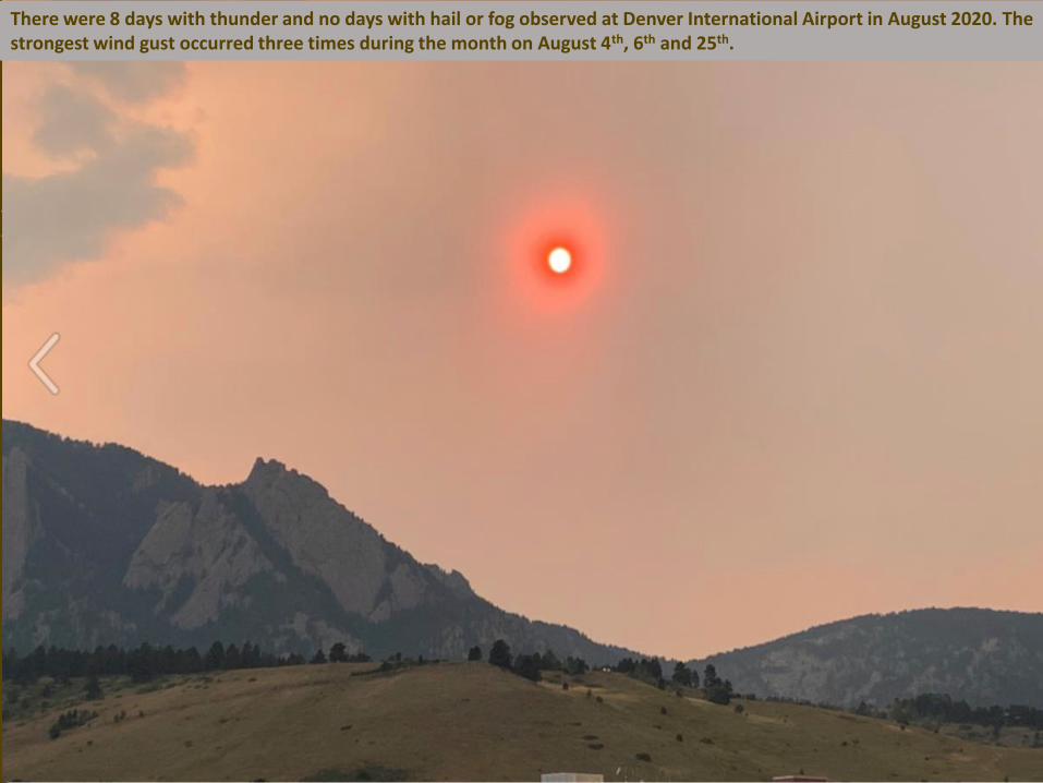
There were 8 days with thunder and no days with hail or fog observed at Denver International Airport in August 2020. The strongest wind gust occurred three times during the month on August 4th, 6th and 25th.
There were 8 days with thunder and no days with hail or fog observed at Denver International Airport in August 2020. The strongest wind gust occurred three times during the month on August 4th, 6th and 25th.
Top Related