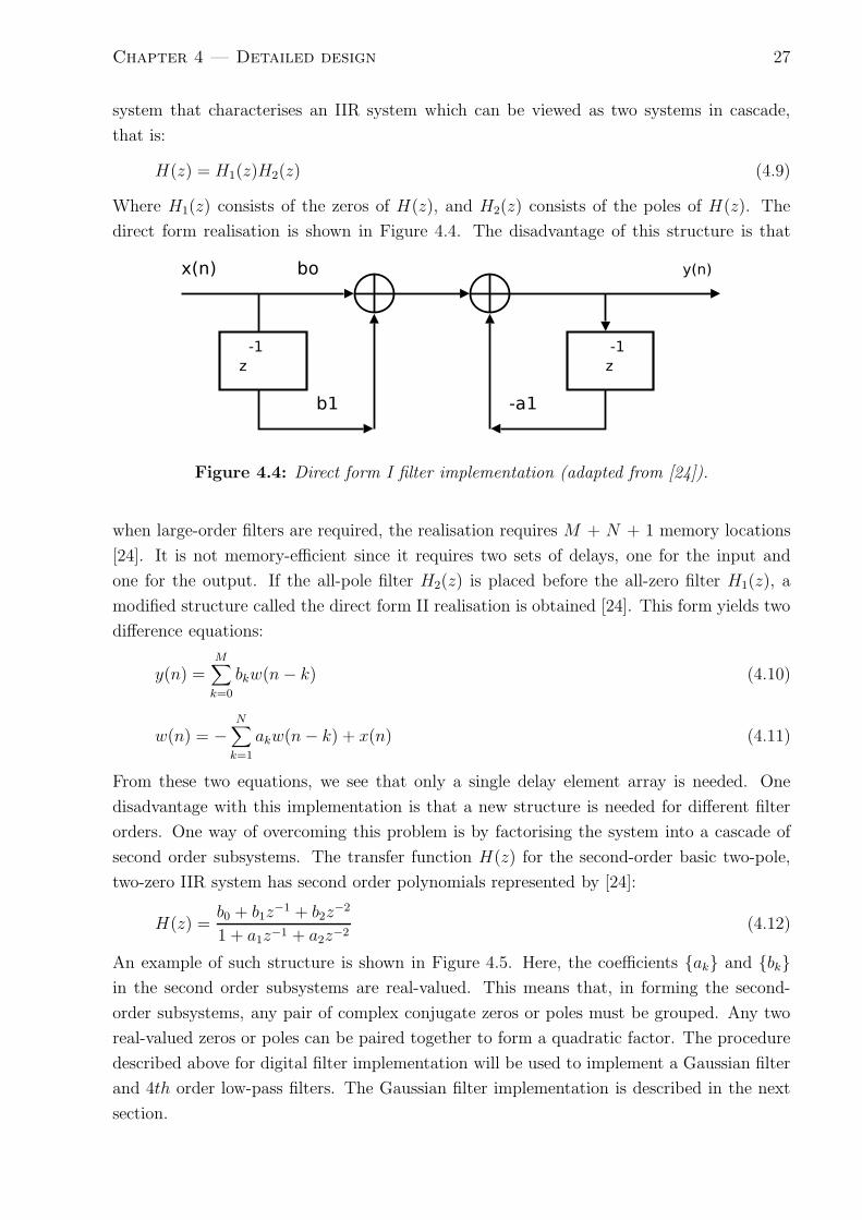
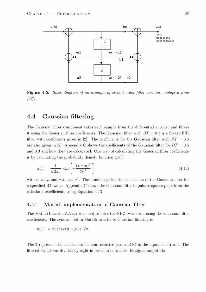
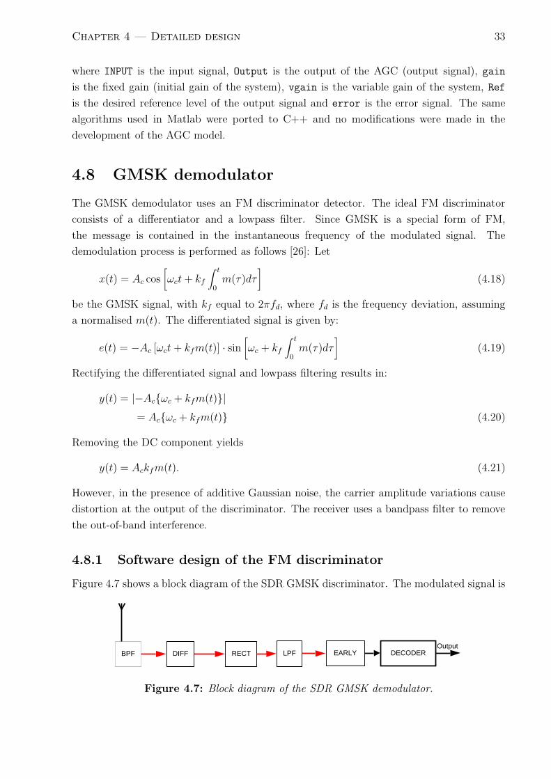
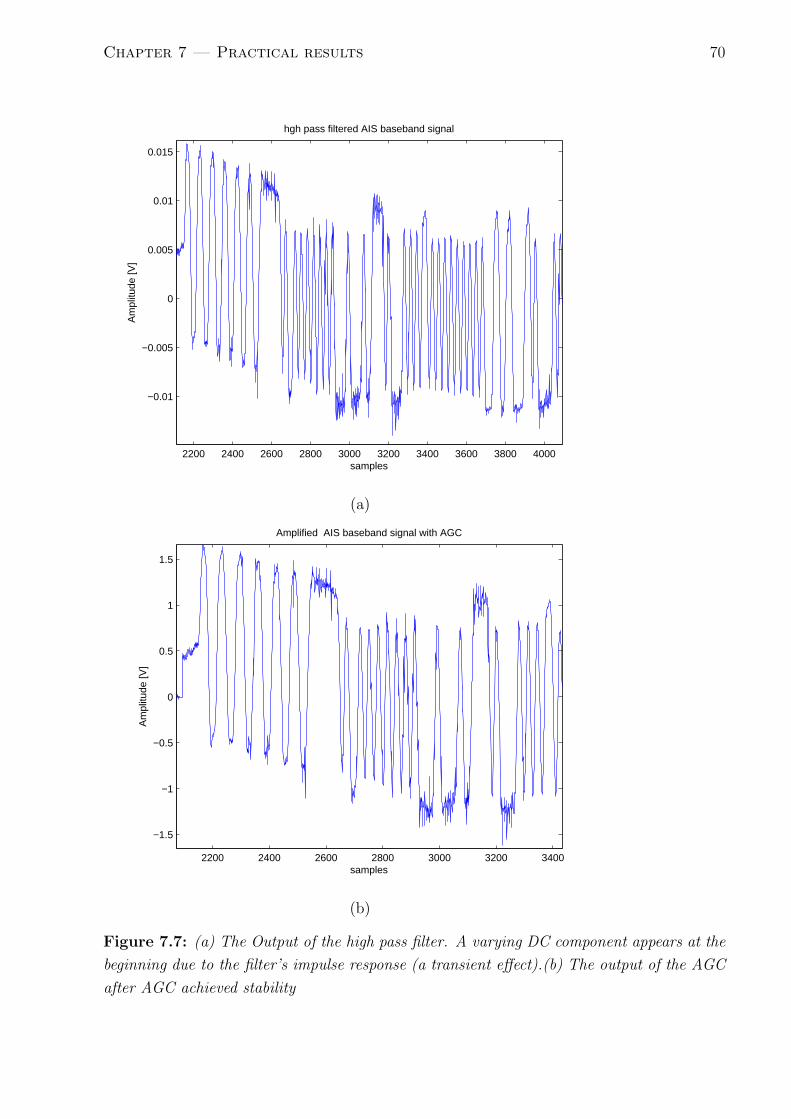
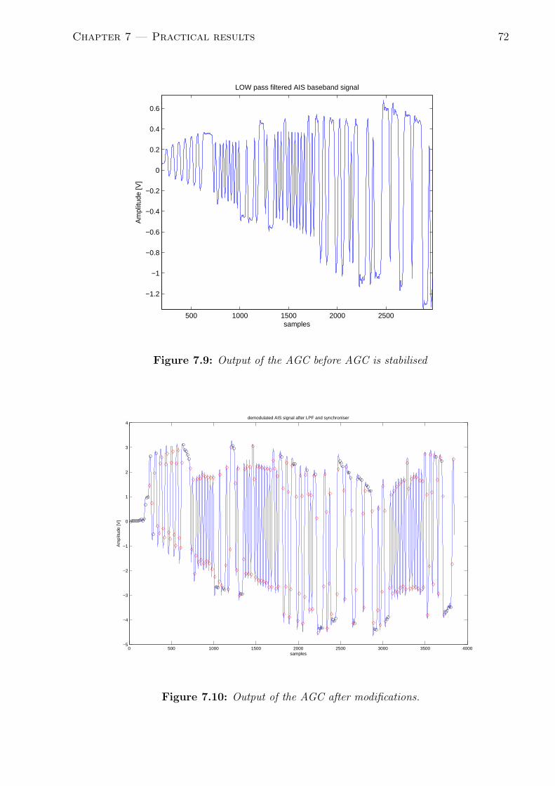
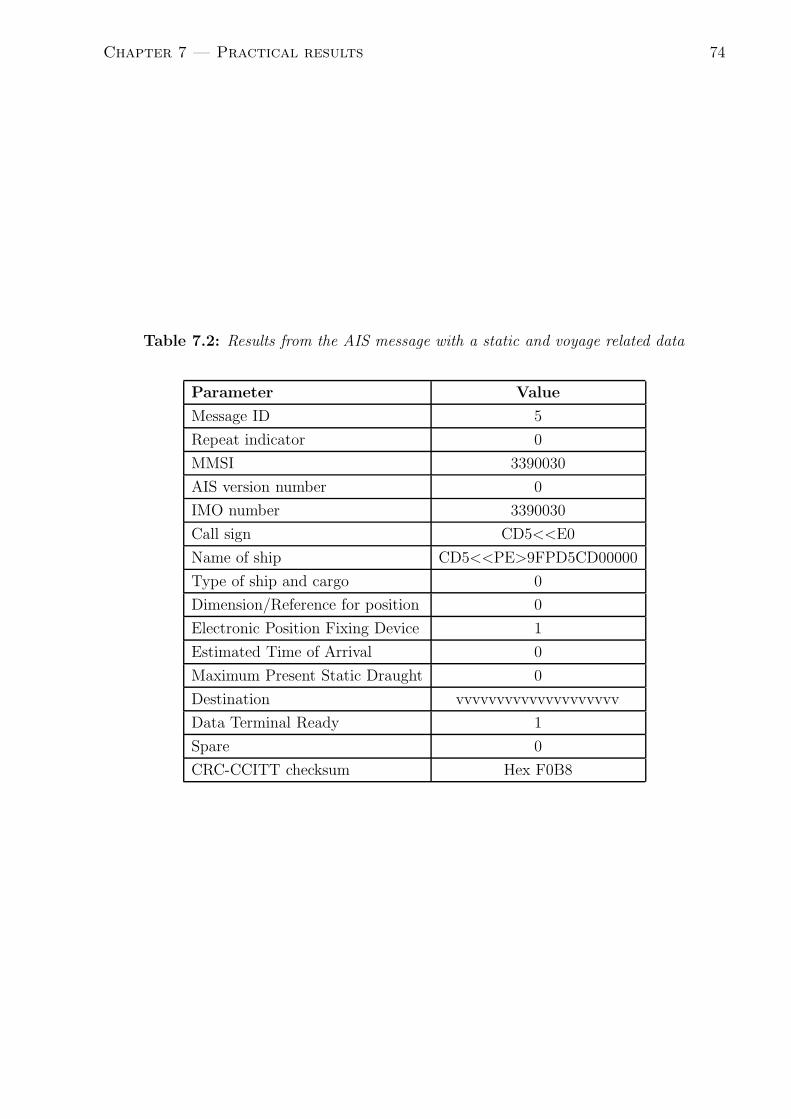
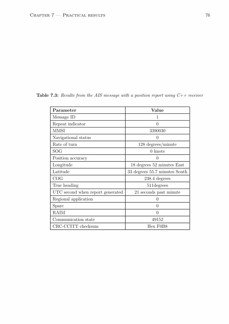
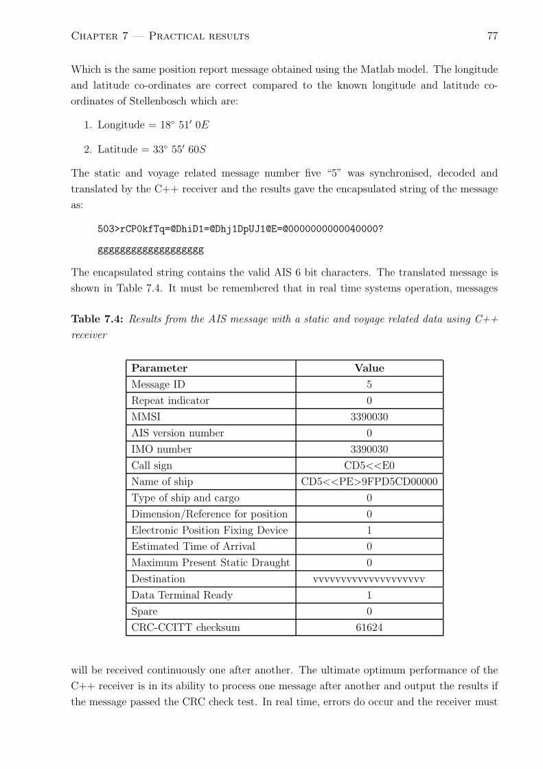
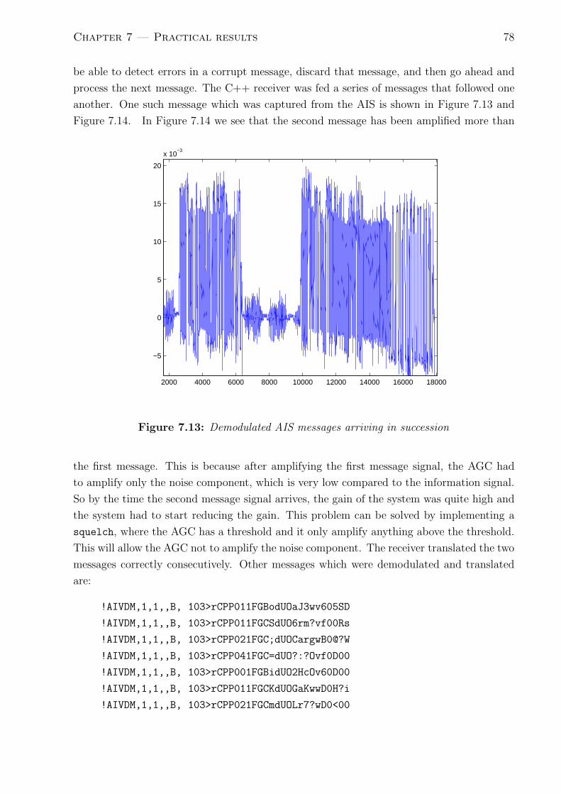
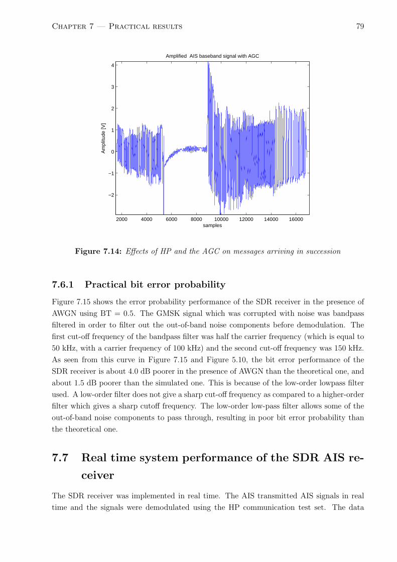
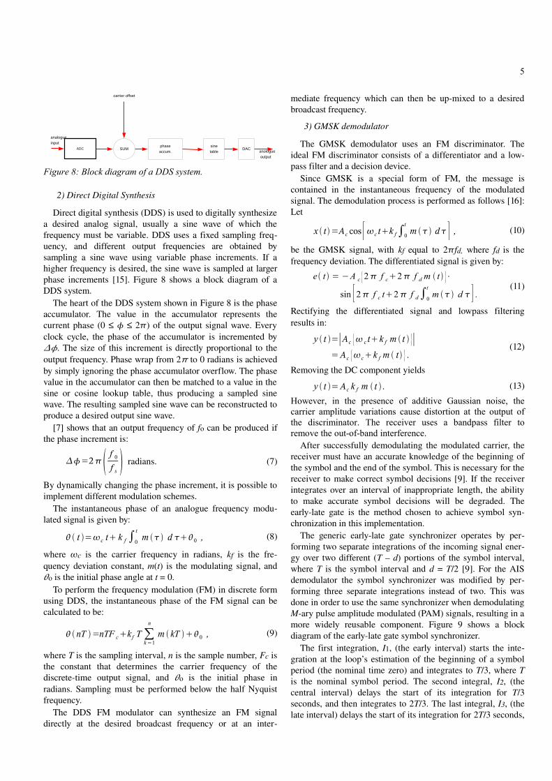
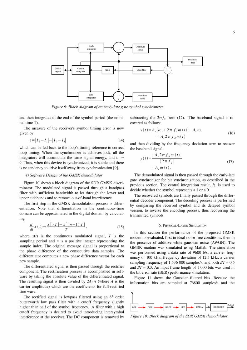
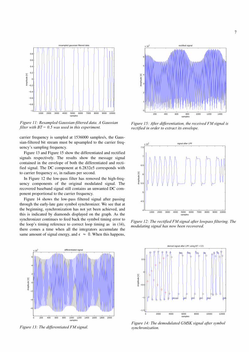
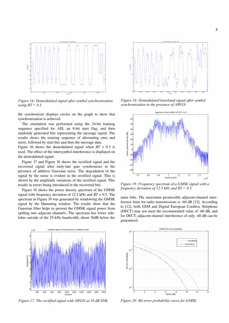
Top Related
Geospatial Big Data Analytics Heatmap AIS main maritime ... · 07/06/2016 · AIS – main maritime routes per shiptype . 07 June 2016 ©e-GEOS2017 – 2 ... Geospatial Big Data
Automatic Identification System: AIS-A Reception of AIS-B ... · Automatic Identification System: AIS-A Reception of AIS-B, 2008 Study . Sandra Tavener and Tristan Cooper . Maritime
New Rules for Maritime Traffic Safety - mlit.go.jp of the maritime traffic including the dissemination of Automatic Identification System (AIS), the Act on Partial Revision of the
A case study using Space AIS for Maritime Surveillance: …web1.see.asso.fr/ocoss2010/Session_2/20100607093158_DeSaintVincent... · A case study using Space AIS for Maritime Surveillance:
TACSAT-2 Target Indicator Experiment (TIE) AIS …...AIS Payload Overview 2007 Maritime Domain Awareness Forum 29 October 2007 Christopher Huffine Technical Staff, Code 8120 Naval
Advancing maritime intelligence with real time satellite AIS · Advancing maritime intelligence with real time satellite AIS A snapshot of global shipping displayed in the exactEarth
Automatic Identification System (AIS) · PDF fileAutomatic Identification System (AIS) Introduction. AIS forms part of the Global Maritime Distress and Safety System (GMDSS) and is
Maritime Safety and Security Information Exchange … Documents/AIS EWG 21-2010... · Maritime Safety and Security Information Exchange System – new possibilities based on modern