Zine El Abidine El Morjani, Steeve Ebener, John Boos, Eman Abdel Ghaffar and Altaf Musani
20
Regional Conference on “Disaster: Relief and Management: International Cooperation & Role of ICT”, Alexandria, Egypt, 14 - 17 April 2007 1 | Modelling the Spatial Distribution of Five Natural Hazards in the Context of the WHO/EMRO Atlas of Disaster Risks as a Step Towards the Reduction of the Health Impact Related to Disasters
description
Modelling the Spatial Distribution of Five Natural Hazards in the Context of the WHO/EMRO Atlas of Disaster Risks as a Step Towards the Reduction of the Health Impact Related to Disasters. Zine El Abidine El Morjani, Steeve Ebener, John Boos, Eman Abdel Ghaffar and Altaf Musani. - PowerPoint PPT Presentation
Transcript of Zine El Abidine El Morjani, Steeve Ebener, John Boos, Eman Abdel Ghaffar and Altaf Musani
Regional Conference on “Disaster: Relief and Management: International Cooperation & Role of ICT”, Alexandria, Egypt, 14 - 17 April 20071 |
Modelling the Spatial Distribution of Five Natural Hazards in the Context of the WHO/EMRO Atlas of Disaster Risks as a Step Towards the Reduction of the Health Impact Related to Disasters

Regional Conference on “Disaster: Relief and Management: International Cooperation & Role of ICT”, Alexandria, Egypt, 14 - 17 April 20072 |
Zine El Abidine El Morjani, Steeve Ebener, John Boos, Eman Abdel Ghaffar and Altaf Musani
http://www.ij-healthgeographics.com/content/6/1/8
Launch of the WHO/EMRO Atlas of Disaster Risk: Volume 1 – Exposure to Natural Hazards
Musani A., Ebener S., El Morjani Z., Boos J., Thomsen I.
http://unstats.un.org/unsd/geoinfo/17thunrccapIP9.pdf

Regional Conference on “Disaster: Relief and Management: International Cooperation & Role of ICT”, Alexandria, Egypt, 14 - 17 April 20073 |
Outline of the presentationOutline of the presentation The context The e-Atlas of Disaster Risk for the Eastern Mediterranean Region Volume 1
Content Space based technology Geographic Information System (GIS)
Future steps Conclusion
Regional Conference on “Disaster: Relief and Management: International Cooperation & Role of ICT”, Alexandria, Egypt, 14 - 17 April 20074 |
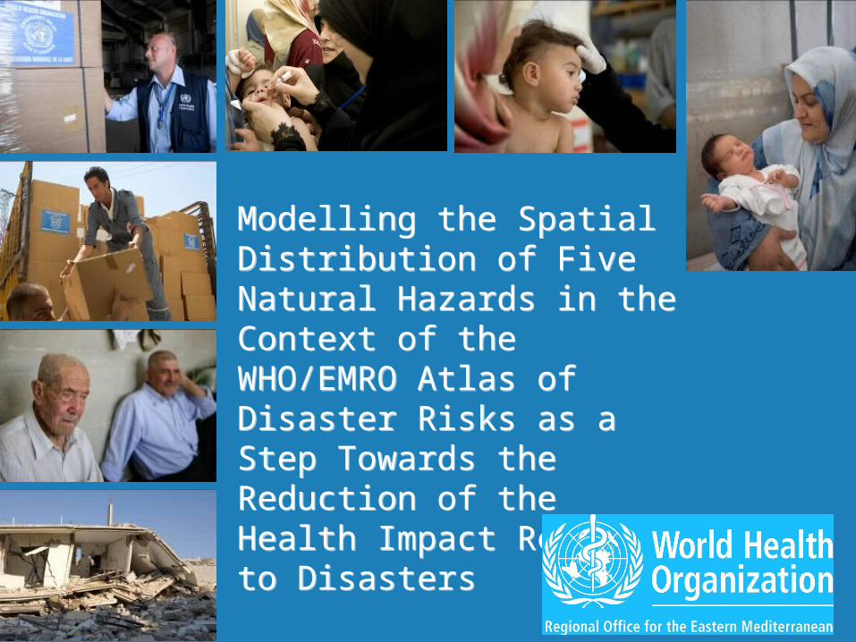
Eastern Mediterranean Region
Afghanistan Bahrain Djibouti Egypt Iran Iraq Jordan Kuwait Lebanon Libya Morocco Pakistan
Qatar Oman Saudi Arabia Somalia Sudan Syria Tunisia United Arab Emirates West Bank and Gaza
Strip Yemen

Regional Conference on “Disaster: Relief and Management: International Cooperation & Role of ICT”, Alexandria, Egypt, 14 - 17 April 20075 |
Complex emergencies: Afghanistan, Lebanon, Iraq, Sudan, Opt, Somalia
The Diversity of Crisis
Natural disasters: Iran, Pakistan,Natural disasters: Iran, Pakistan, Djibouti, Yemen, Morocco…Djibouti, Yemen, Morocco…

Regional Conference on “Disaster: Relief and Management: International Cooperation & Role of ICT”, Alexandria, Egypt, 14 - 17 April 20076 |
Recent trends in EMR Region
Four Major Emergencies over last 5 years:• Lebanon Crisis :$5+ million, 900,000 people affected • Pakistan Earthquake: $15+ million, 3.2 million people
affected
• Darfur Crisis: $20+ million, 4 million people affected• Iraq Crisis: $100+ million, 25 million people affected
And others: Horn of Africa Drought, Bam earthquake, etc
Regional Conference on “Disaster: Relief and Management: International Cooperation & Role of ICT”, Alexandria, Egypt, 14 - 17 April 20077 |
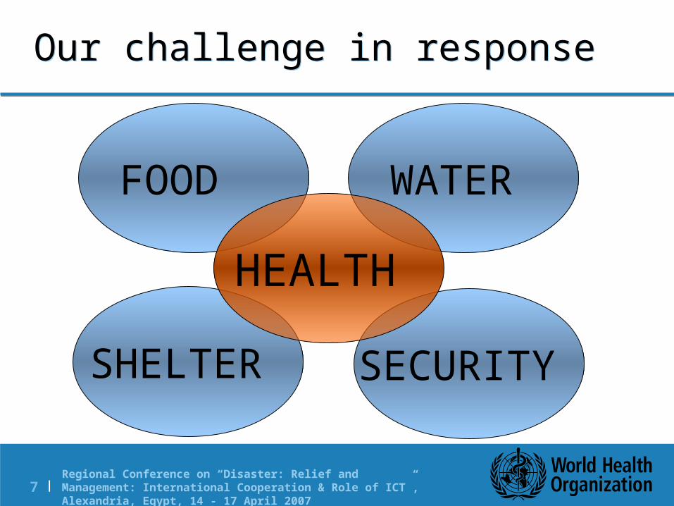
SHELTER
FOOD WATER
SECURITY
HEALTH
Our challenge in response

Regional Conference on “Disaster: Relief and Management: International Cooperation & Role of ICT”, Alexandria, Egypt, 14 - 17 April 20078 |
Strategic framework provided by the World Health Assembly in 2005
“Urging all Member States to build up the national capacity for emergency preparedness and disaster reduction/mitigation and response, in order to reduce avoidable mortality and disability”
Preparedness
Mitigation
Response
Recovery
Regional Conference on “Disaster: Relief and Management: International Cooperation & Role of ICT”, Alexandria, Egypt, 14 - 17 April 20079 |
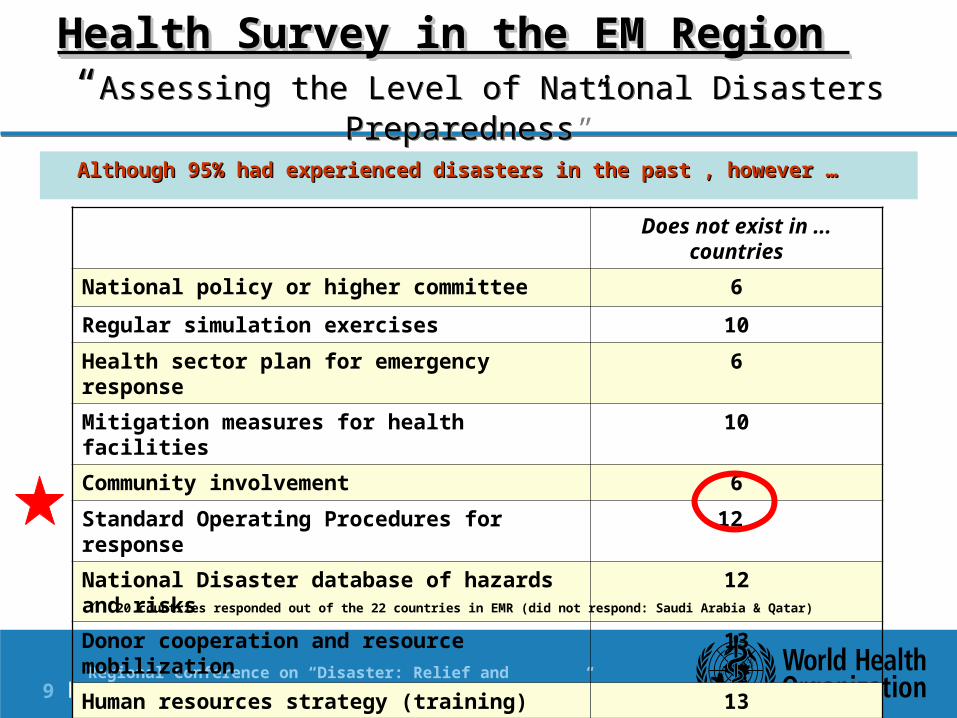
Health Survey in the EM Region Health Survey in the EM Region “Assessing the Level of National Disasters Preparedness”
Although 95% had experienced disasters in the past , however … Although 95% had experienced disasters in the past , however …
Does not exist in ... countries
National policy or higher committee 6
Regular simulation exercises 10Health sector plan for emergency response 6Mitigation measures for health facilities 10Community involvement 6Standard Operating Procedures for response 12 National Disaster database of hazards and risks 12
Donor cooperation and resource mobilization 13Human resources strategy (training) 13 20 countries responded out of the 22 countries in EMR (did not respond: Saudi Arabia & Qatar)
Regional Conference on “Disaster: Relief and Management: International Cooperation & Role of ICT”, Alexandria, Egypt, 14 - 17 April 200710 |
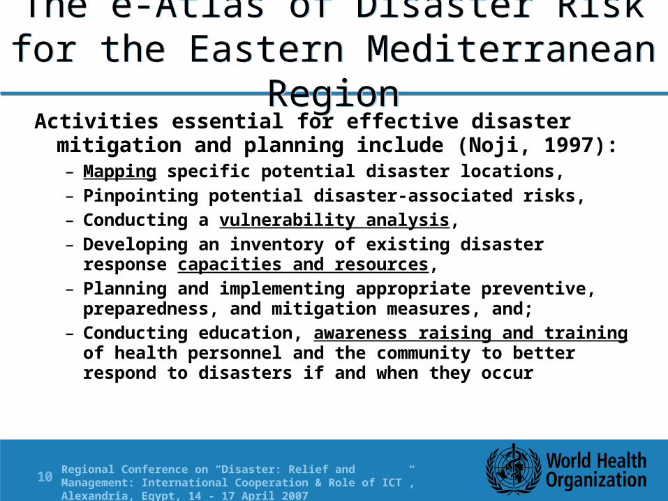
The e-Atlas of Disaster Risk for the Eastern Mediterranean Region
Activities essential for effective disaster mitigation and planning include (Noji, 1997): – Mapping specific potential disaster locations,– Pinpointing potential disaster-associated risks,– Conducting a vulnerability analysis,– Developing an inventory of existing disaster response
capacities and resources,– Planning and implementing appropriate preventive,
preparedness, and mitigation measures, and;– Conducting education, awareness raising and training of
health personnel and the community to better respond to disasters if and when they occur

Regional Conference on “Disaster: Relief and Management: International Cooperation & Role of ICT”, Alexandria, Egypt, 14 - 17 April 200711 |
Obtains the spatial distribution of the risks for five natural hazards (floods, heat, earthquakes, wind speed and landslides) with the objective to better understand the health impact and this in 3 phases:
– Exposure to natural hazards (Volume 1) – Vulnerability (Volume 2)– Risk reduction (Volume 3)
The e-Atlas of Disaster Risk for the Eastern Mediterranean Region
Risk = Hazard x Element at Risk x Vulnerability
Elements at Risk = population and health infrastructures

Regional Conference on “Disaster: Relief and Management: International Cooperation & Role of ICT”, Alexandria, Egypt, 14 - 17 April 200712 |
Volume 1 - ContentThe first volume of the Atlas to be released soon (CD)
will contain: the data (when redistributable) and protocols that
have been used in order to generate the spatial distribution of the five selected natural hazards,
the resulting maps in pdf (country level) and GIS (regional level) format;
regional and country level summary tables presenting the total and percentage of the population exposed to each hazard
other information of interest regarding natural disaster risk assessment (glossary, web sites, reports, publications,…)
Regional Conference on “Disaster: Relief and Management: International Cooperation & Role of ICT”, Alexandria, Egypt, 14 - 17 April 200713 |
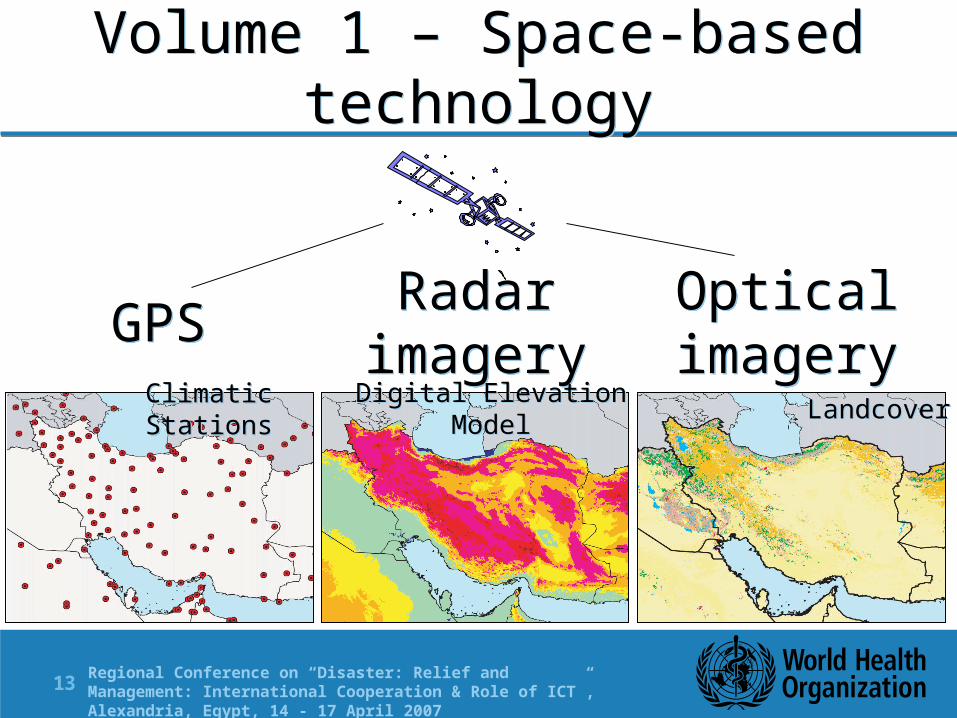
Volume 1 – Space-based technology
Radar imagery
OpticalimageryGPS
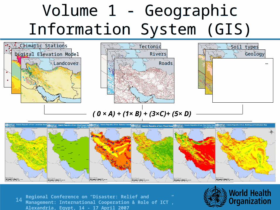
Climatic Stations Digital Elevation Model Landcover
Regional Conference on “Disaster: Relief and Management: International Cooperation & Role of ICT”, Alexandria, Egypt, 14 - 17 April 200714 |
Climatic Stations
Digital Elevation Model
Landcover
TectonicRivers
Soil typesGeology
Roads
( 0 × A) + (1× B) + (3×C)+ (5× D)
…
Volume 1 - Geographic Information System (GIS)

Regional Conference on “Disaster: Relief and Management: International Cooperation & Role of ICT”, Alexandria, Egypt, 14 - 17 April 200715 |
PopulationDistributio
n
Volume 1 - Geographic Information System (GIS)
Regional Conference on “Disaster: Relief and Management: International Cooperation & Role of ICT”, Alexandria, Egypt, 14 - 17 April 200716 |
Future steps Finalize Volume 1 and insure its distribution Improve the method used for modelling the spatial
distribution of the heat hazard (look at heat waves) Add new hazard in the list (drought and maybe cyclones) in
collaboration with other partners; Apply the methods on national data to test their quality at
that level; Allow for the estimation of population exposure at the sub
national level (SALB) In collaboration with partners, compile and/or develop the
content and methods for the 2nd volume of the Atlas that will look at population and health infrastructure vulnerability
Regional Conference on “Disaster: Relief and Management: International Cooperation & Role of ICT”, Alexandria, Egypt, 14 - 17 April 200717 |
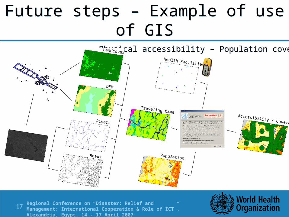
Physical accessibility – Population coverage
DEM
Landcover
Health Facilities
Population
Traveling timeAccessibility / Coverage
Roads
Rivers
Future steps – Example of use of GIS

Regional Conference on “Disaster: Relief and Management: International Cooperation & Role of ICT”, Alexandria, Egypt, 14 - 17 April 200718 |
Future steps - Connection with Telemedicine / Telecommunication
Planning
Regional Conference on “Disaster: Relief and Management: International Cooperation & Role of ICT”, Alexandria, Egypt, 14 - 17 April 200719 |
Conclusion • The maps that are produced in the context of the first
volume can already be used by decision makers for disaster mitigation and planning thus demonstrating the possible use of GIS in this regards
• The methods that have been presented could be applied in other part of the world
• This type of application could be used to support the development of National Spatial Data Infrastructure (NSDI) as it requires the inputs and data from many sectors
• Work remains to be done and data to be found in order to develop the vulnerability layer.

Regional Conference on “Disaster: Relief and Management: International Cooperation & Role of ICT”, Alexandria, Egypt, 14 - 17 April 200720 |
Thank you for your attention
Mr Altaf Musani, Regional Advisor Emergency Preparedness and Humanitarian
ActionRegional Office for the Eastern Mediterranean
World Health Organization www.emro.who.int/eha
AccessMod: http://www.who.int/kms/initiatives/accessmod/en/index.html
SALB: http://www3.who.int/whosis/gis/salb/salb_home.htm
Dr Steeve Ebener, Project ManagerEvidence, Information and Research (EIR)/ Knowledge Management and Sharing (KMS)/
eHealth (EHL)World Health Organization
Head Quarter, [email protected]