Your City, Your Thoughts: Using Maps and Mobile Phones to Discuss Urban Places
22
Crisis Mapping, Time and Community Development Ana Brandusescu, Renée Sieber, Sylvie Jochems Spatial Knowledge and Information 1
-
Upload
ana-brandusescu -
Category
Education
-
view
207 -
download
0
Transcript of Your City, Your Thoughts: Using Maps and Mobile Phones to Discuss Urban Places
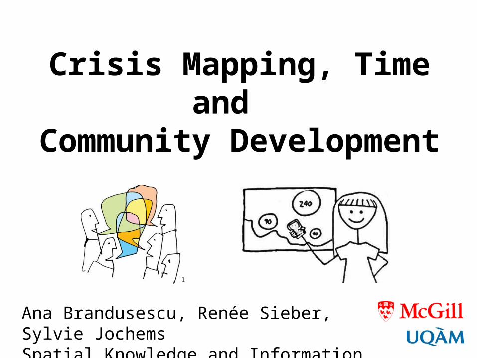
Crisis Mapping, Time and
Community Development
Ana Brandusescu, Renée Sieber, Sylvie JochemsSpatial Knowledge and Information Canada, 2014
1

Overview
• Background: Crisis mapping & mobile technology• Relevance: Connections between crisis mapping & community development • Data & Methods: Montreal & Vancouver• Results: 3 communities, 4 applications• Limitations: Temporality

Background and Relevance
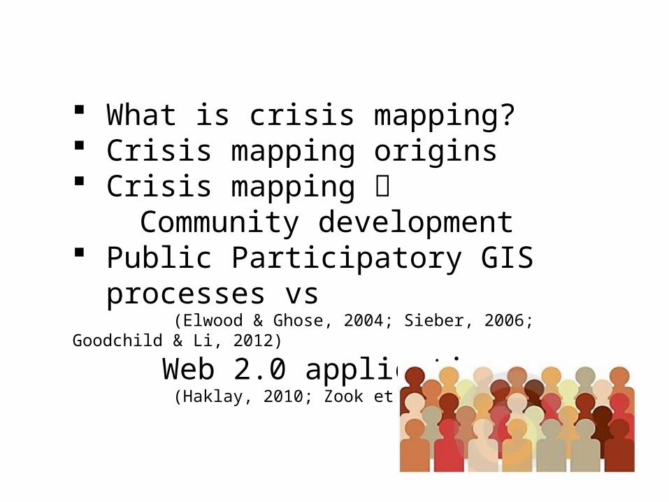
What is crisis mapping? Crisis mapping origins Crisis mapping
Community development Public Participatory GIS processes vs (Elwood & Ghose, 2004; Sieber, 2006; Goodchild & Li, 2012)
Web 2.0 applications (Haklay, 2010; Zook et al., 2010)
2

Haiti Earthquake
3

Mobile technology in the developing world & progressive outcomes (Abraham, 2007; Patnaik et al., 2009; Aker & Mbiti, 2010)
Communication, networking and social structures for communities (Horst & Miller, 2006; Hardey, 2007; Donner, 2008; Yzer & Southwell, 2008; Katz, 2011)
Challenges: Gender, income & digital divides ICTs do not guarantee community support (Girard & O Siochru, 2006)

Data and Methods
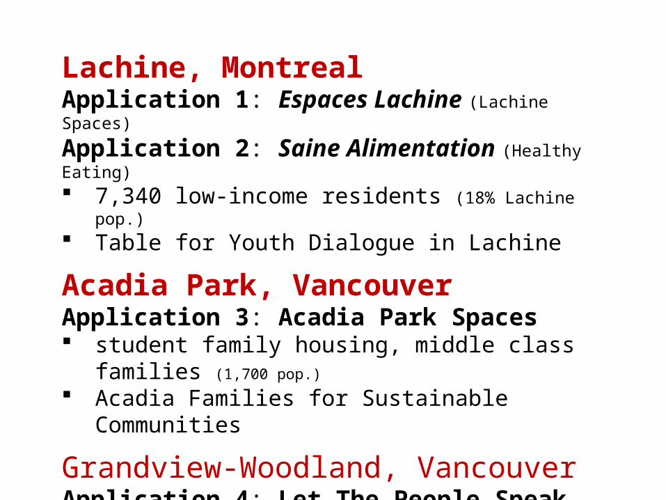
Lachine, MontrealApplication 1: Espaces Lachine (Lachine Spaces)
Application 2: Saine Alimentation (Healthy Eating) 7,340 low-income residents (18% Lachine pop.) Table for Youth Dialogue in Lachine
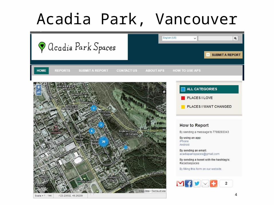
Acadia Park, Vancouver Application 3: Acadia Park Spaces student family housing, middle class families (1,700 pop.)
Acadia Families for Sustainable Communities
Grandview-Woodland, VancouverApplication 4: Let The People Speak Mixed low & middle income population, multiple
ethnicities, renters (66% pop.)


Results
4
Acadia Park, Vancouver

4
4
4

Can we use a crisis mapping platform for
community development?
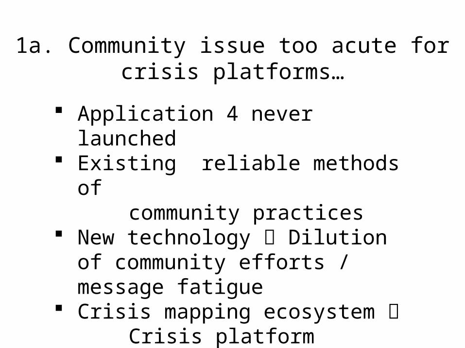
1a. Community issue too acute for crisis platforms…
Application 4 never launched Existing reliable methods of community practices New technology Dilution of
community efforts / message fatigue Crisis mapping ecosystem Crisis platform functionality No such ecosystem for technology in community development
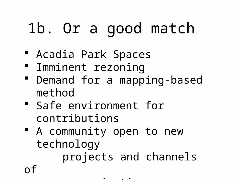
1b. Or a good match
Acadia Park Spaces Imminent rezoning Demand for a mapping-based method Safe environment for contributions A community open to new technology projects and channels of communication
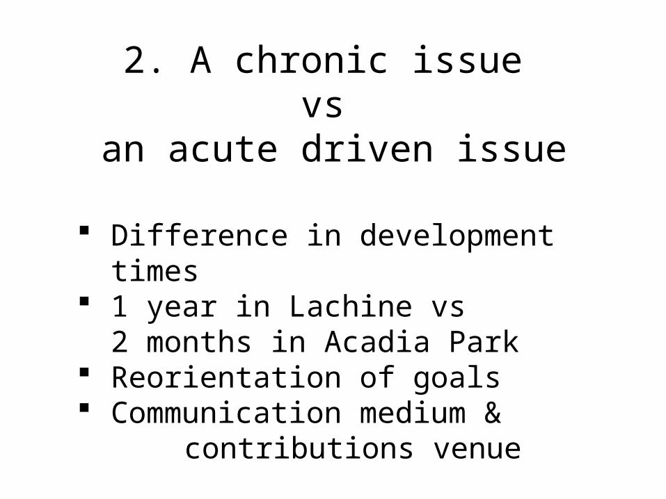
2. A chronic issue vs
an acute driven issue
Difference in development times 1 year in Lachine vs
2 months in Acadia Park Reorientation of goals Communication medium & contributions venue
3. Participant motivations Motivations vary amongst users (Budhathoki, 2010)
Self expression, altruism, pride of place (Coleman et al., 2009) future community aspirations Urgency and clarity of goals is unclear In Lachine: No identifiable causal links In Acadia Park: Urgency linked to motivations

4. Unclear connection between contribution and action
Ex: Playground safety in Lachine A sense of response immediacy No guarantee of an immediacy of action Crisis mapping presumes action = reporting

Conclusions
Mixed results Platform adoption varied Development times and goal reorientation drives platform use Motivations & participation depend
on urgency of issues Immediacy of action is not
guaranteed

ReferencesAbraham, R. (2007). Mobile phones and economic development. Aker, J., & Mbiti, I. (2010). Mobile phones and economic development in Africa. Budhathoki, N.R. (2010). Participants ‘motivations to contribute geographic information in an online community. Coleman, D.J., Georgiadou, Y., & Labonte, J. (2009). VGI: the nature and motivation of
produsers. Donner, J. (2008). Research approaches to mobile use in the developing world.Elwood, S., & Ghose, R. (2004). PPGIS in community development planning.Girard, B., & O Siochru, S. (2006). (Eds.). Communicating in the information society. Goodchild, M. F., & Li, L. (2012). Assuring the quality of VGI. Haklay, M. (2010). How good is volunteered geographical information? Hardey, M. (2007). The city in the age of web 2.0 a new synergistic relationship
between place and people. Horst, H., & Miller, D. (2006). The cell phone: an anthropology of communication. Katz, J.E. (2011). Mobile communication: dimensions of social policy. Patnaik, S., Brunskill, E., & Thies, W. (2009, April). Evaluating the accuracy of data
collection on mobile phones: a study of forms, SMS, and voice. Sieber, R.E. (2006). Public Participation Geographic Information Systems.Yzer, M.C., & Southwell, B.G. (2008). New communication technologies, old questions.Zook, M, Graham, M., Shelton, T., & Gorman, S. (2010). VGI and crowdsourcing
disaster relief.
[1] http://www.conferencecenterblog.com/wpcontent/uploads/2011/09/ social_media_clutter1.jpg[2] Crowdsourcing logo. http://blog.hbs.edu/hbsinov8/?p=1652[3] Ushahidi Haiti Project. [4] Acadia Park Spaces logo designed by Lisa Chen-Wing. https://acadiaparkspaces.crowdmap.com
Image References