Wilshire heights-na hike-bike-trail-presentation-10-25-2016
44
DATA CURRENT OF OCTOBER 1 2016 DALLAS HIKE AND BIKE NETWORK PARK AND RECREATION DEPARTMENT WILSHIRE HEIGHTS NEIGHBORHOOD ASSOCIATION OCTOBER 25, 2016 DATA CURRENT OF OCTOBER 1 2016
-
Upload
chris-davidson -
Category
Government & Nonprofit
-
view
43 -
download
1
Transcript of Wilshire heights-na hike-bike-trail-presentation-10-25-2016

DA
TA C
UR
REN
T O
F O
CTO
BER
1 2
016
DALLAS HIKE AND BIKE
NETWORK PARK AND RECREATION DEPARTMENT
WILSHIRE HEIGHTS NEIGHBORHOOD ASSOCIATION OCTOBER 25, 2016
DA
TA C
UR
REN
T O
F O
CTO
BER
1 2
016

2
DA
TA C
UR
REN
T O
F O
CTO
BER
1 2
016
• History of Dallas Hike and Bike Network
• Existing Trails
• Trails In Design or Under Construction
• Proposed Trails
PURPOSE

3
DA
TA C
UR
REN
T O
F O
CTO
BER
1 2
016
HISTORY: DALLAS MORNING NEWS JANUARY 12, 1969
4
DA
TA C
UR
REN
T O
F O
CTO
BER
1 2
016
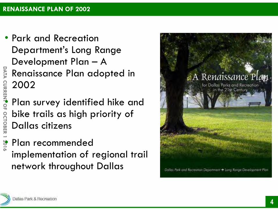
• Park and Recreation Department’s Long Range Development Plan – A Renaissance Plan adopted in 2002
• Plan survey identified hike and bike trails as high priority of Dallas citizens
• Plan recommended implementation of regional trail network throughout Dallas
RENAISSANCE PLAN OF 2002

5
DA
TA C
UR
REN
T O
F O
CTO
BER
1 2
016
• The Dallas Trail Network Master Plan was adopted in 2005, revised in 2008
• Linear trails – 28.8 miles
• Loop trails – 33.9 miles
• Natural trails – 22.8 miles
• 86 Miles
• As of October 1, 2016
• Linear trails – 64.3 miles
• Loop trails – 54.9 miles
• Natural trails – 33.8 miles
• 153 Miles
TRAIL MASTER PLANS

6
DA
TA C
UR
REN
T O
F O
CTO
BER
1 2
016
2003 AND 2006 FUNDING LEVERAGING
• The 2003 and 2006 Bond Program leveraged an additional $29.5M through various grant and partnership programs

7
DA
TA C
UR
REN
T O
F O
CTO
BER
1 2
016
• Significant funding and project design support since 1997
• Priority of the Commissioners Court
• Coordinates funding through TxDOT and NCTCOG
• 2003 Open Space Plan
• Funding for new trails throughout Dallas County •Trinity Forest Spine Trail
•Kleberg Trail
•Trinity Skyline Trail
PARTNERS: DALLAS COUNTY
8
DA
TA C
UR
REN
T O
F O
CTO
BER
1 2
016
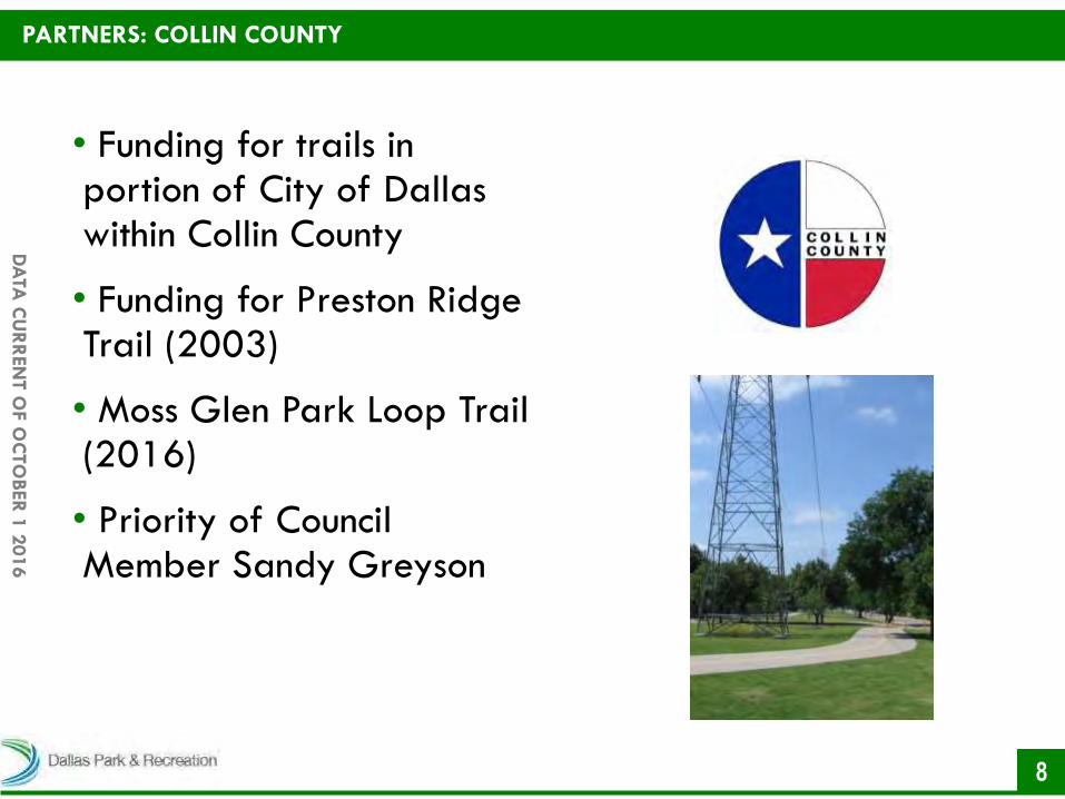
• Funding for trails in portion of City of Dallas within Collin County
• Funding for Preston Ridge Trail (2003)
• Moss Glen Park Loop Trail (2016)
• Priority of Council Member Sandy Greyson
PARTNERS: COLLIN COUNTY

9
DA
TA C
UR
REN
T O
F O
CTO
BER
1 2
016
• Approved by City Council on April 13, 2011
• Established agreement to be used on 60.7 miles (22.4%) of built-out system
• Key provisions of Oncor License Agreement
•Perpetual
•No up-front cost considerations
•City of Dallas maintains full width of corridor
PARTNERS: ONCOR

10
DA
TA C
UR
REN
T O
F O
CTO
BER
1 2
016
• Approved by DART and City Council on November 23, 2015
• A non-exclusive perpetual easement for trails
• Allows for trail improvements on trail, including benches, trash bins, drainage improvements, and water fountains
• All landscaping and improvements must be reviewed and approved by DART and maintained by the City of Dallas
PARTNERS: DART

DA
TA C
UR
REN
T O
F O
CTO
BER
1 2
016
EXISTING TRAILS

12
DA
TA C
UR
REN
T O
F O
CTO
BER
1 2
016
• 153 miles of existing trails
EXISTING TRAILS

13
DA
TA C
UR
REN
T O
F O
CTO
BER
1 2
016
• White Rock Creek Trail established in 1977
• 9.3 mile trail
• Improvements since 2003:
• Portion of trail renovated and widened (2003 and 2006 Bond Program) from Valley View Park to Forest Lane
• Trail extended from Valley View Park to Hillcrest Park (2006 Bond Program)
WHITE ROCK CREEK TRAIL

14
DA
TA C
UR
REN
T O
F O
CTO
BER
1 2
016
• Completed in 1976
• 9.3 mile loop trail
• Improvements since 2000 • East Lawther Trail Improvements (2000 to 2002) from Garland Road to Sunset Bay
•West Lawther Trail Improvements Phase 1 (2003 to 2004) from Pump House to Lily Pad Bay
•Mockingbird Pedestrian Bridge (2005 to 2007)
WHITE ROCK LAKE TRAIL

15
DA
TA C
UR
REN
T O
F O
CTO
BER
1 2
016
• Improvements since 2006:
• West Lawther Trail Improvements Phase 2 (2007 to 2009) from Pad Bay to Mockingbird Pedestrian Bridge
• East Lawther Trail Improvements (2014 to 2015) from Mockingbird Bridge to Bath House Cultural Center
WHITE ROCK LAKE TRAIL
16
DA
TA C
UR
REN
T O
F O
CTO
BER
1 2
016
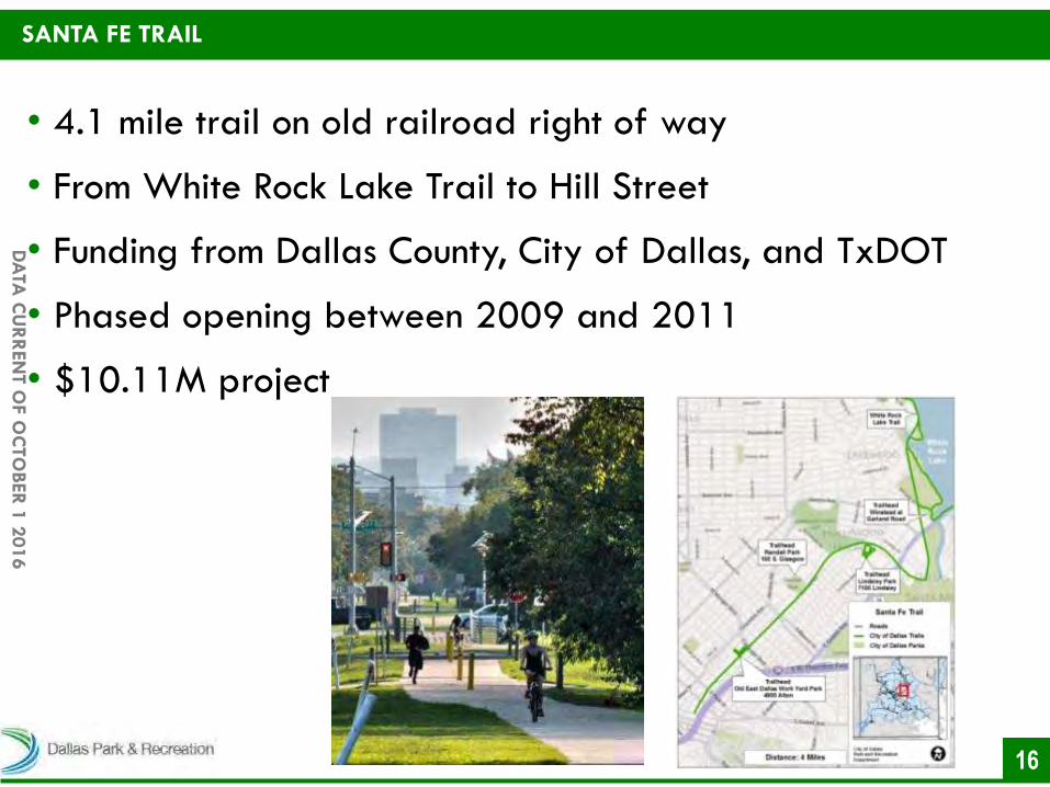
• 4.1 mile trail on old railroad right of way
• From White Rock Lake Trail to Hill Street
• Funding from Dallas County, City of Dallas, and TxDOT
• Phased opening between 2009 and 2011
• $10.11M project
SANTA FE TRAIL

17
DA
TA C
UR
REN
T O
F O
CTO
BER
1 2
016
• 1.5 mile trail
• SoPAC terminus at Northwest Highway to Goforth Road (Doran Point)
• Opened in May 2015
• Connects to the White Rock Creek Trail
• Remaining portion of the trail from Goforth Road to Muchert Service Facility is in design
FLAG POLE HILL TRAIL

18
DA
TA C
UR
REN
T O
F O
CTO
BER
1 2
016
• 1.2 mile trail
• Lake Highlands High School to Ferndale Drive
• Open in October 2014
• Oncor easement
• Eventually connects to White Rock Creek Trail
LAKE HIGHLANDS PHASE I

19
DA
TA C
UR
REN
T O
F O
CTO
BER
1 2
016
• 1.7 mile trail
• Between Skillman St and Fisher Road opened May 2016
• Portion of Ridgewood Trail between Glencoe Park and Skillman Street remains under construction
• Mockingbird Pedestrian Bridge
• Some great views
RIDGEWOOD TRAIL
20
DA
TA C
UR
REN
T O
F O
CTO
BER
1 2
016
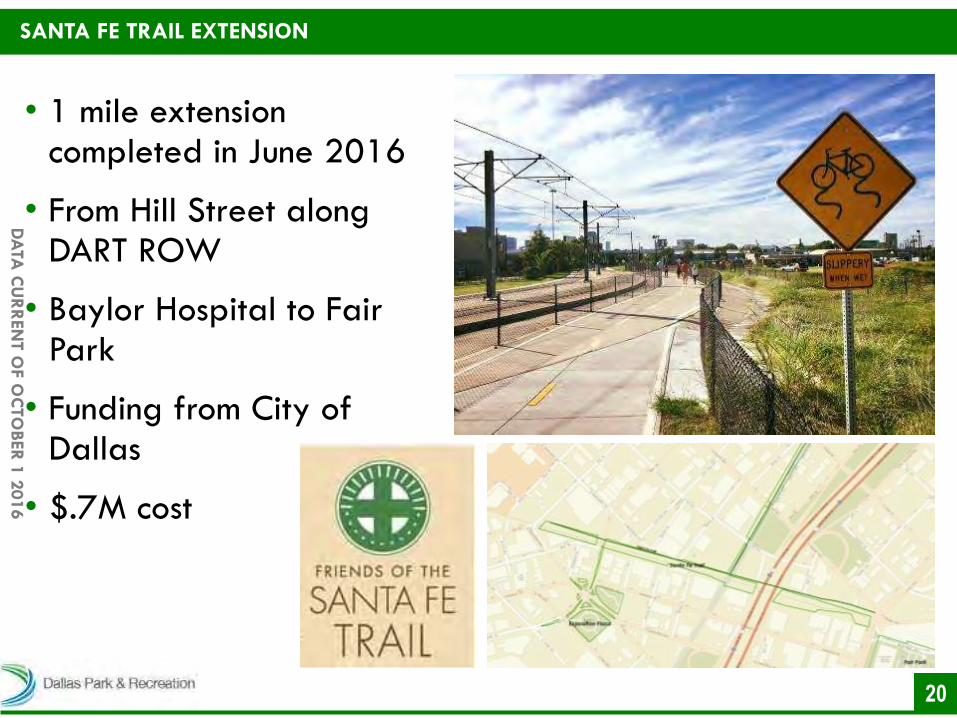
• 1 mile extension completed in June 2016
• From Hill Street along DART ROW
• Baylor Hospital to Fair Park
• Funding from City of Dallas
• $.7M cost
SANTA FE TRAIL EXTENSION
21
DA
TA C
UR
REN
T O
F O
CTO
BER
1 2
016
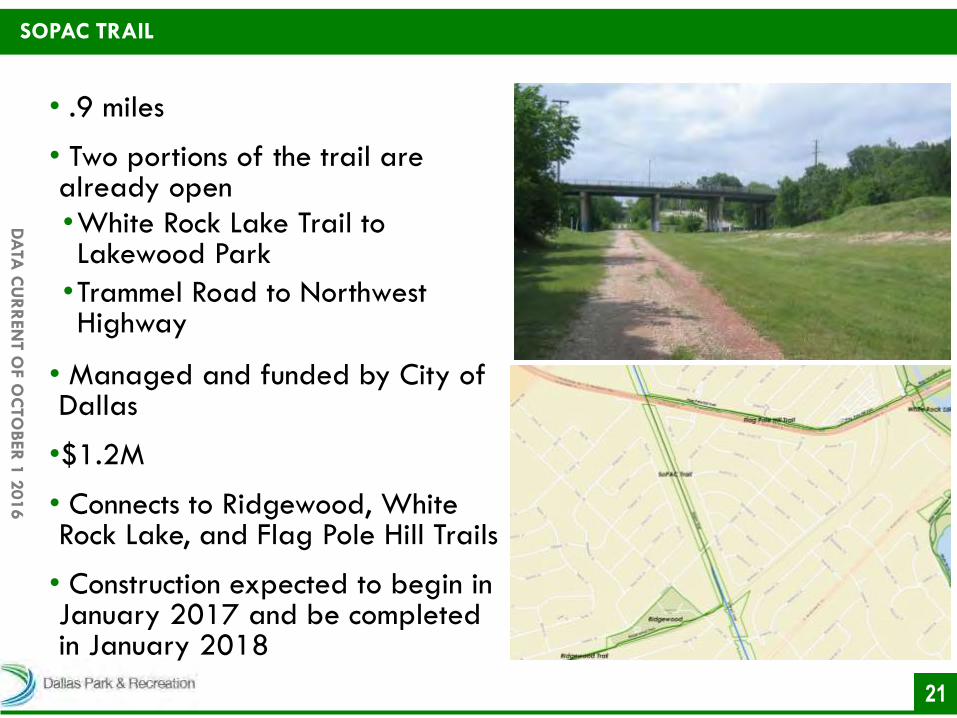
SOPAC TRAIL
• .9 miles
• Two portions of the trail are already open
•White Rock Lake Trail to Lakewood Park
•Trammel Road to Northwest Highway
• Managed and funded by City of Dallas
•$1.2M
• Connects to Ridgewood, White Rock Lake, and Flag Pole Hill Trails
• Construction expected to begin in January 2017 and be completed in January 2018
DA
TA C
UR
REN
T O
F O
CTO
BER
1 2
016
TRAILS IN DESIGN OR UNDER
CONSTRUCTION

23
DA
TA C
UR
REN
T O
F O
CTO
BER
1 2
016
• 50 miles in design or under construction
• 4.6 miles under construction
• Five Mile Creek Trail
• Ridgewood Trail
• Runyon Creek Trail
• 44.9 miles in design
• 25.8 miles expected to begin construction in 2017
TRAILS IN DESIGN OR UNDER CONSTRUCTION

DA
TA C
UR
REN
T O
F O
CTO
BER
1 2
016
TRAILS UNDER CONSTRUCTION

25
DA
TA C
UR
REN
T O
F O
CTO
BER
1 2
016
• 1.2 mile trail
• Portion of Ridgewood Trail between Fisher Road and Skillman St already open
• Segment includes
•Mockingbird Pedestrian Bridge
•One smaller bridge at Twin Sixties Dr
• $17M cost for segment
• Expected to open in Spring 2017
RIDGEWOOD TRAIL
DA
TA C
UR
REN
T O
F O
CTO
BER
1 2
016
TRAILS IN
DESIGN

27
DA
TA C
UR
REN
T O
F O
CTO
BER
1 2
016
SOPAC TRAIL PHASE III
• 1.8 miles
• From Lakewood Park to Trammel Road
• Managed by Dallas County, funding from City of Dallas and NCTOG
• $3.9M
• Connects to White Rock Lake Trail and Santa Fe Trail
• Construction expected to begin in January 2017 and be completed in January 2018

28
DA
TA C
UR
REN
T O
F O
CTO
BER
1 2
016
SOPAC TRAIL PHASE IVA
• 2.5 miles
• From Northwest Highway to Greenville Avenue
• Managed by Dallas County, funding from City of Dallas and NCTOG
• $8.3M
• Connects to •Ridgwood Trail •Flag Pole Hill Trail
• Construction expected to begin in January 2017 and be completed in January 2018

29
DA
TA C
UR
REN
T O
F O
CTO
BER
1 2
016
• 1.2 mile trail
• Harry Moss Park to Arbor Park
•Sidewalk/street connection to Lake Highlands Trail Phase I
• Trail in final design
•Public meeting tonight with CM McGough to determine alignment options
• Needs $2.6M for constructing trail
LAKE HIGHLANDS TRAIL PHASE II/WEST

30
DA
TA C
UR
REN
T O
F O
CTO
BER
1 2
016
• .6 mile trail
• White Rock Creek Trail to Lake Higlands Trail Phase I •Watercrest Park to Olive Schapiro Park
• Trailhead proposed for new Alamo Drafthouse at Skillman St and Abrams Rd
• Trail in conceptual design •Public meeting tonight with CM McGough to determine alignment options
• Construction is funded •Design to begin in January 2017
LAKE HIGHLANDS TRAIL SOUTH

31
DA
TA C
UR
REN
T O
F O
CTO
BER
1 2
016
• .7 mile trail
• Portion of Flag Pole Hill Trail from SoPAC Trail to Goforth Road open
• Through Flag Pole Hill Park to Muchert Service Facility
• Trail design finished
• Project being put out to bid in November 2016
• Construction expected to begin in January 2017
•Completion in October 2017
FLAG POLE HILL TRAIL

DA
TA C
UR
REN
T O
F O
CTO
BER
1 2
016
PROPOSED TRAILS

33
DA
TA C
UR
REN
T O
F O
CTO
BER
1 2
016
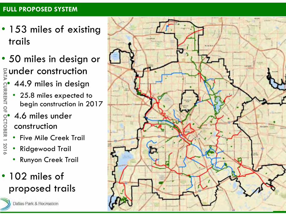
• 102 miles of proposed trails
• Estimated cost of total system buildout $200M
• Reconstruction of 35 miles of loop and linear trails ($36M)
• Building new trails ($164M)
FULL PROPOSED SYSTEM
34
DA
TA C
UR
REN
T O
F O
CTO
BER
1 2
016
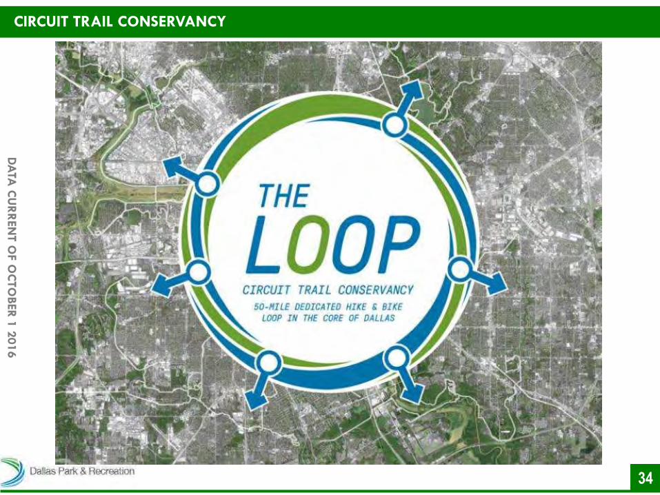
CIRCUIT TRAIL CONSERVANCY
35
DA
TA C
UR
REN
T O
F O
CTO
BER
1 2
016
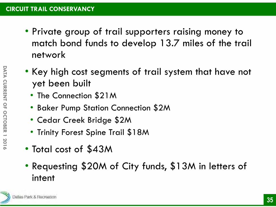
CIRCUIT TRAIL CONSERVANCY
• Private group of trail supporters raising money to match bond funds to develop 13.7 miles of the trail network
• Key high cost segments of trail system that have not yet been built
• The Connection $21M
• Baker Pump Station Connection $2M
• Cedar Creek Bridge $2M
• Trinity Forest Spine Trail $18M
• Total cost of $43M
• Requesting $20M of City funds, $13M in letters of intent
36
DA
TA C
UR
REN
T O
F O
CTO
BER
1 2
016
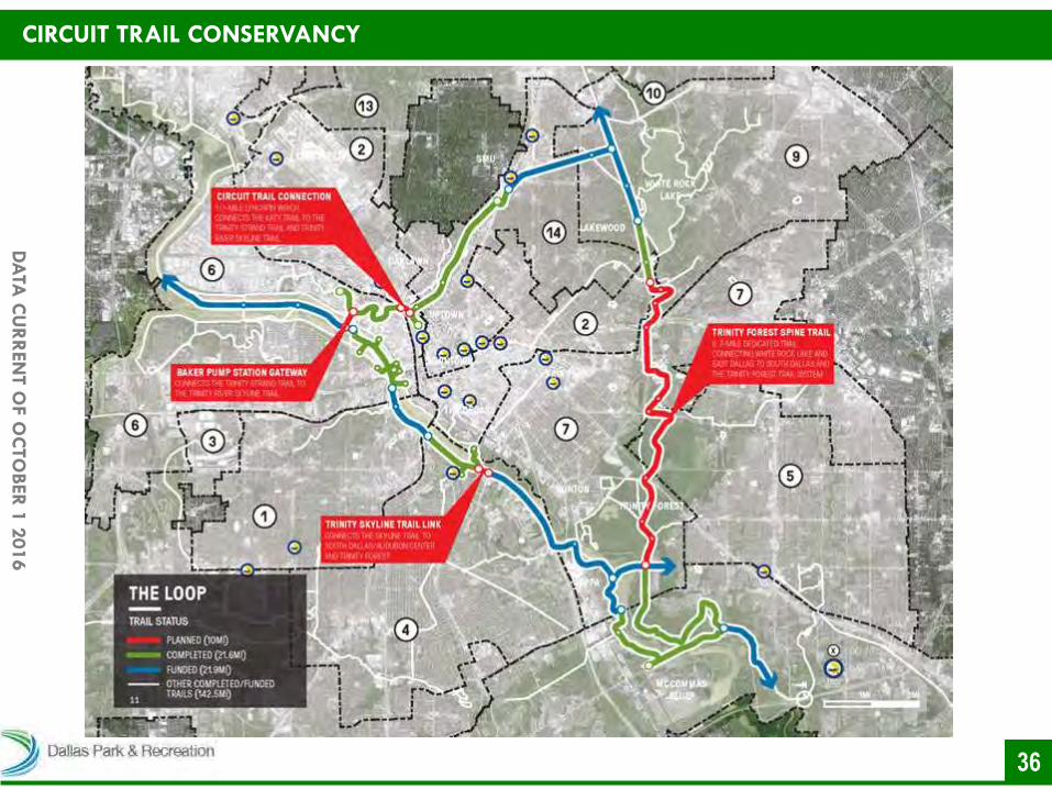
CIRCUIT TRAIL CONSERVANCY

37
DA
TA C
UR
REN
T O
F O
CTO
BER
1 2
016
CIRCUIT TRAIL CONSERVANCY

38
DA
TA C
UR
REN
T O
F O
CTO
BER
1 2
016
CIRCUIT TRAIL CONSERVANCY

39
DA
TA C
UR
REN
T O
F O
CTO
BER
1 2
016
CIRCUIT TRAIL CONSERVANCY
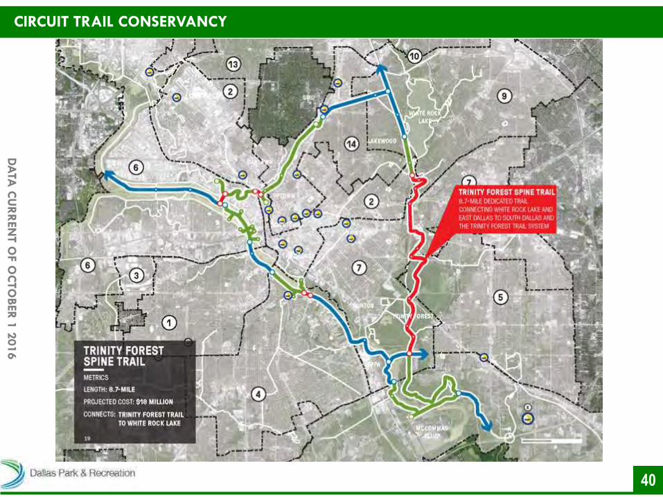
40
DA
TA C
UR
REN
T O
F O
CTO
BER
1 2
016
CIRCUIT TRAIL CONSERVANCY

41
DA
TA C
UR
REN
T O
F O
CTO
BER
1 2
016
CIRCUIT TRAIL CONSERVANCY
42
DA
TA C
UR
REN
T O
F O
CTO
BER
1 2
016
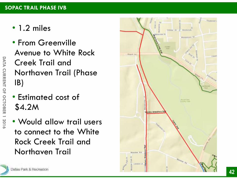
SOPAC TRAIL PHASE IVB
• 1.2 miles
• From Greenville Avenue to White Rock Creek Trail and Northaven Trail (Phase IB)
• Estimated cost of $4.2M
• Would allow trail users to connect to the White Rock Creek Trail and Northaven Trail
43
DA
TA C
UR
REN
T O
F O
CTO
BER
1 2
016
• 153 miles of existing trails
• 50 miles in design or under construction
• 44.9 miles in design
• 25.8 miles expected to begin construction in 2017
• 4.6 miles under construction
• Five Mile Creek Trail
• Ridgewood Trail
• Runyon Creek Trail
• 102 miles of proposed trails
FULL PROPOSED SYSTEM
DA
TA C
UR
REN
T O
F O
CTO
BER
1 2
016
DALLAS HIKE AND BIKE
NETWORK PARK AND RECREATION DEPARTMENT
WILSHIRE HEIGHTS NEIGHBORHOOD ASSOCIATION OCTOBER 25, 2016
DA
TA C
UR
REN
T O
F O
CTO
BER
1 2
016